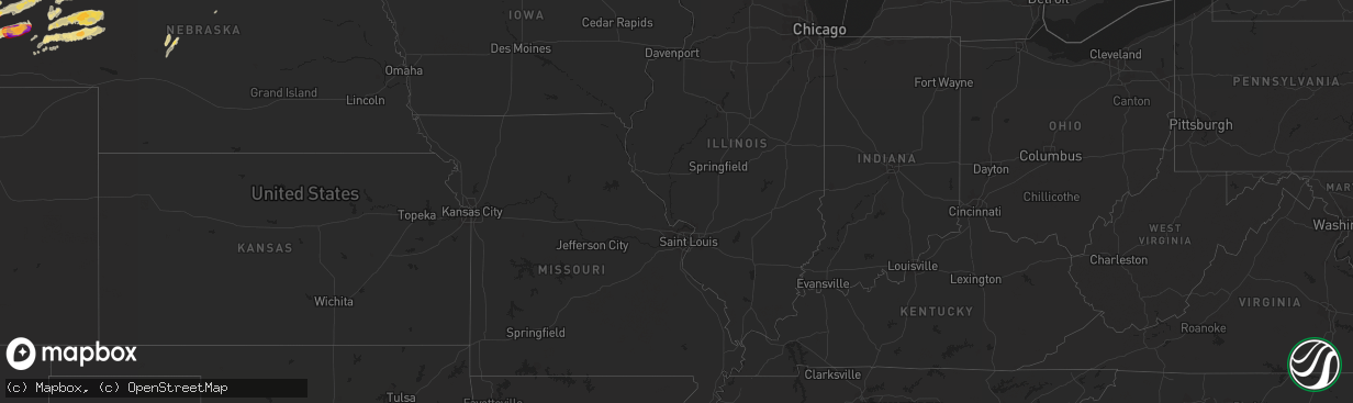
Hail Map in Minnesota on June 19, 2012
The weather event in Minnesota on June 19, 2012 includes Hail map. 11 states and 298 cities were impacted and suffered possible damage. The total estimated number of properties impacted is 14,449.
Want more than just the map?
Turn this storm into a full workflow.
- Owner + property data so you know who to knock
- OnDemand branded weather history reports to win the "did we even have hail?" argument
- RoofTrace estimate so reps stop guessing numbers at the door
Bought this map? Upgrade within 7 days and we'll credit the $230. (10-15 min setup call)
Hail
14,449
Estimated number of impacted properties by a 1.00" hail or larger7,958
Estimated number of impacted properties by a 1.75" hail or larger7,795
Estimated number of impacted properties by a 2.50" hail or largerStorm reports in Minnesota
Minnesota
| Date | Description |
|---|---|
| 06/19/20125:58 PM CDT | A local report indicates 2.00 inch wind near SILVER BAY |
| 06/19/20124:10 PM CDT | A local report indicates 1.00 inch wind near 2 E TWO INLETS |
| 06/19/20123:41 PM CDT | Golf ball hail for 5 to 10 minutes at pickeral lake relayed via wday-tv. |
| 06/19/20123:36 PM CDT | Golf ball hail in rochert via facebook. |
| 06/19/20123:30 PM CDT | Golf ball hail for 5 to 10 minutes at pickeral lake relayed via wday-tv. |
| 06/19/20123:30 PM CDT | Golf ball hail for 5 to 10 minutes at pickeral lake relayed via wday-tv. |
| 06/19/20123:25 PM CDT | Reported at long lake |
| 06/19/20123:25 PM CDT | Reported at long lake |
| 06/19/20123:25 PM CDT | 1.5 inch hail measured at detroit lakes aiport by des moines tv meteorologist. |
| 06/19/20123:25 PM CDT | 1.5 inch hail measured at detroit lakes aiport by broadcast meteorologist. |
| 06/19/20123:24 PM CDT | Golf ball hail in detroit lakes via facebook. |
| 06/19/20123:19 PM CDT | Quarter hail with a few slightly larger stones. |
| 06/19/20123:15 PM CDT | Very strong winds accompanied the hail and tore a few shingles off the roof of a house. |
| 06/19/20122:20 PM CDT | Several trees down. |
| 06/19/20122:20 PM CDT | 12 inch diameter tree down. |
| 06/19/20121:36 PM CDT | A local report indicates 1.00 inch wind near 3 W EMILY |
| 06/19/20121:30 PM CDT | A few large trees down along west shore rd. |
| 06/19/20127:56 AM CDT | Four inch diameter tree downed on knox st between 82nd and american blvd. |
| 06/19/20127:10 AM CDT | Several trees toppled and leaning in different directions on burnsville parkway at 35w. |
| 06/18/20128:18 PM CDT | 8 inch diameter tree uprooted and 6 inch diameter tree snapped 3 feet above ground. |
| 06/18/20127:59 PM CDT | 8-10 inch diameter tree uprooted and fallen on power line. |
All States Impacted by Hail Map on June 19, 2012
Cities Impacted by Hail Map on June 19, 2012
- Ellsworth, NE
- Emily, MN
- Floodwood, MN
- Suring, WI
- Lena, WI
- Gillett, WI
- Little Falls, MN
- Kimball, SD
- Swanville, MN
- Sauk Centre, MN
- Grey Eagle, MN
- Melrose, MN
- Burtrum, MN
- Brooten, MN
- Freeport, MN
- Glenwood, MN
- Bridgeport, NE
- Hay Springs, NE
- Elk Point, SD
- Bowlus, MN
- Holdingford, MN
- Upsala, MN
- Alliance, NE
- Gregory, SD
- Oacoma, SD
- Kettle River, MN
- Mission, SD
- Detroit Lakes, MN
- Callaway, MN
- Lyman, NE
- Bingham, NE
- Westfield, IA
- Duluth, MN
- Cass Lake, MN
- Garfield, MN
- Miltona, MN
- Alexandria, MN
- Brandon, MN
- Onamia, MN
- Hillman, MN
- Alpena, SD
- Lingle, WY
- Torrington, WY
- Saint Francis, SD
- Corsicana, TX
- Milbank, SD
- Big Stone City, SD
- Stockholm, SD
- Strandburg, SD
- Sturgeon Bay, WI
- Wessington Springs, SD
- White Lake, SD
- Gann Valley, SD
- Pukwana, SD
- Dent, MN
- Vergas, MN
- Benson, MN
- Rushville, NE
- Wagner, SD
- Avon, SD
- Dante, SD
- Audubon, MN
- Winner, SD
- Laporte, MN
- Lake George, MN
- Murdock, MN
- Merriman, NE
- Browerville, MN
- Long Prairie, MN
- Rochert, MN
- Cotton, MN
- Canyon, MN
- Gering, NE
- Minatare, NE
- Scottsbluff, NE
- Mitchell, NE
- Woonsocket, SD
- Watertown, SD
- Hemingford, NE
- Belgrade, MN
- New York Mills, MN
- Menahga, MN
- Kilgore, NE
- Lake Park, MN
- Hawk Springs, WY
- Yoder, WY
- Morrill, NE
- Chamberlain, SD
- Dalton, MN
- Oconto, WI
- Oconto Falls, WI
- Abrams, WI
- Thedford, NE
- Wrenshall, MN
- Carlton, MN
- Bellingham, MN
- Sebeka, MN
- Wadena, MN
- Bluffton, MN
- Makinen, MN
- Aitkin, MN
- Brainerd, MN
- Pound, WI
- Silver Bay, MN
- Bayfield, WI
- Herbster, WI
- Two Harbors, MN
- Ortonville, MN
- Correll, MN
- Madison, MN
- Odessa, MN
- Cody, NE
- Tuthill, SD
- Hamill, SD
- Willow Lake, SD
- Hazel, SD
- Park Rapids, MN
- Hawley, MN
- Ideal, SD
- Fort Ripley, MN
- Keshena, WI
- Frazee, MN
- Perham, MN
- Osage, MN
- Angora, NE
- Oshkosh, NE
- Ashby, NE
- Lakeside, NE
- Barnum, MN
- Dumont, MN
- Beardsley, MN
- Pierz, MN
- Maple City, MI
- Cedar, MI
- Harrison, NE
- Cushing, MN
- Randall, MN
- Deer Creek, MN
- Henning, MN
- Royalton, MN
- Rice, MN
- Avon, MN
- Saint Joseph, MN
- Albany, MN
- Lisco, NE
- Broadwater, NE
- Jay Em, WY
- De Smet, SD
- Erwin, SD
- Bryant, SD
- Vienna, SD
- Ponsford, MN
- Pelican Rapids, MN
- Fergus Falls, MN
- Backus, MN
- Merrifield, MN
- Pequot Lakes, MN
- Mcgregor, MN
- Longville, MN
- Fifty Lakes, MN
- Pine River, MN
- Crosby, MN
- Palisade, MN
- Crosslake, MN
- Jacobson, MN
- Swatara, MN
- Outing, MN
- Hill City, MN
- Montevideo, MN
- Watson, MN
- Garrison, MN
- Iroquois, SD
- Parkers Prairie, MN
- Stapleton, NE
- Porterfield, WI
- Crivitz, WI
- Nunda, SD
- Sinai, SD
- Ramona, SD
- Arlington, SD
- Volga, SD
- Martin, SD
- Veteran, WY
- Hayti, SD
- Carpenter, SD
- Yale, SD
- Morris, MN
- Isle, MN
- Marquez, TX
- Franklin, TX
- Teague, TX
- Mexia, TX
- Groesbeck, TX
- Thornton, TX
- Jewett, TX
- Buckholts, TX
- Mountain, WI
- Coleman, WI
- Osakis, MN
- Nevis, MN
- Elbow Lake, MN
- Wendell, MN
- Wheaton, MN
- Herman, MN
- Marietta, MN
- Reliance, SD
- McGrath, MN
- Tintah, MN
- Clarissa, MN
- Staples, MN
- Platte, SD
- Huron, SD
- Allen, SD
- Barnesville, MN
- Felton, MN
- Borup, MN
- Finland, MN
- Lidgerwood, ND
- Hewitt, MN
- Nisswa, MN
- Chokio, MN
- Ogema, MN
- Brookston, MN
- Eagle Bend, MN
- Motley, MN
- Bertha, MN
- Brimson, MN
- Cavour, SD
- Barrett, MN
- Ellison Bay, WI
- Labolt, SD
- South Shore, SD
- Goodwin, SD
- Twin Brooks, SD
- Tamarack, MN
- Edenton, NC
- Ashby, MN
- Battle Lake, MN
- Deerwood, MN
- Hancock, MN
- Parmelee, SD
- Bayard, NE
- Ironton, MN
- Holloway, MN
- Appleton, MN
- Waubun, MN
- Browns Valley, MN
- Donnelly, MN
- Clitherall, MN
- Vining, MN
- Hoffman, MN
- Evansville, MN
- North Zulch, TX
- Normangee, TX
- Remer, MN
- Corona, SD
- Clinton, MN
- Wahpeton, ND
- Fargo, ND
- White Lake, WI
- Brussels, WI
- Cecil, WI
- Aldrich, MN
- Verndale, MN
- Parkston, SD
- Suttons Bay, MI
- Lake Leelanau, MI
- Rogers, TX
- Coushatta, LA
- Nelson, MN
- Marinette, WI
- Peshtigo, WI
- Moose Lake, MN
- Esko, MN
- Ainsworth, NE
- Wood, SD
- Okreek, SD
- Presque Isle, MI
- Posen, MI
- Sunburg, MN
- Flensburg, MN
- New London, MN
- Starbuck, MN
- Ponca, NE
- Akron, IA
- Lake Norden, SD
- Gordon, NE
- Cromwell, MN
- Wahkon, MN
- Farwell, MN
- Kensington, MN
- Graceville, MN
- Pillager, MN
- Saint Paul, MN
- Hudson, WI
- Stillwater, MN
- Houlton, WI
- Lake Elmo, MN


