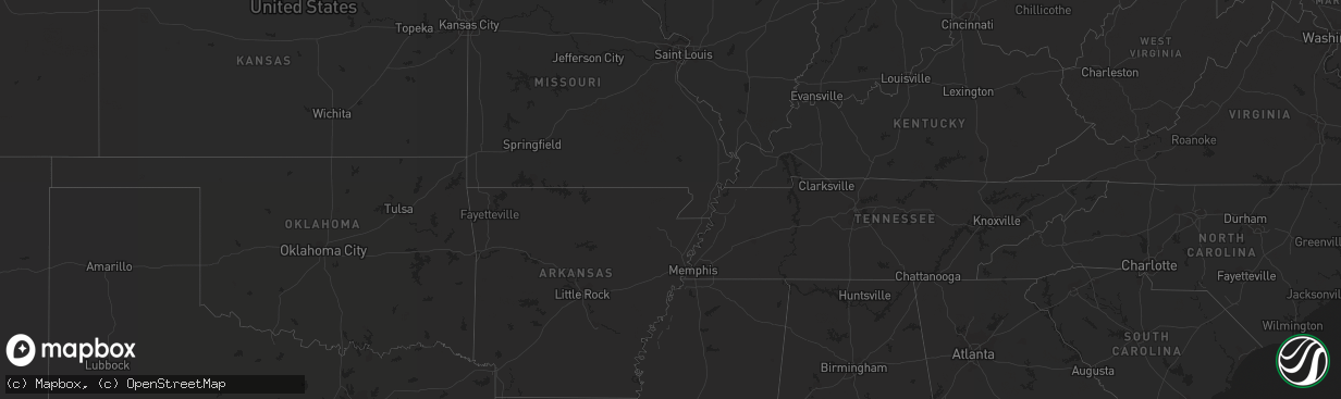
Hail Map on June 19, 2012
The weather event on June 19, 2012 includes Hail map. 11 states and 298 cities were impacted and suffered possible damage. The total estimated number of properties impacted is 15,159.
Want more than just the map?
Turn this storm into a full workflow.
- Owner + property data so you know who to knock
- OnDemand branded weather history reports to win the "did we even have hail?" argument
- RoofTrace estimate so reps stop guessing numbers at the door
Bought this map? Upgrade within 7 days and we'll credit the $230. (10-15 min setup call)
Hail
15,159
Estimated number of impacted properties by a 1.00" hail or larger42,132
Estimated number of impacted properties by a 1.75" hail or larger7,795
Estimated number of impacted properties by a 2.50" hail or largerStates Impacted by Hail Map on June 19, 2012
Storm reports
Virginia
| Date | Description |
|---|---|
| 06/19/20123:55 PM CDT | Tree down on route 60 |
Michigan
| Date | Description |
|---|---|
| 06/19/201211:18 AM CDT | Several large tree branches down in spotters neighborhood. The largest one was estimated as 5 inches in diameter. Time est from radar. |
| 06/19/201211:07 AM CDT | Power lines down |
| 06/19/201210:36 AM CDT | Two large healthy trees down along i 75 near mile marker 336. Each downed tree about a half mile apart. Diameter approx 9 inches. Time est from radar. |
| 06/19/20128:40 AM CDT | 2 large trees down 1 mile west of cedar river on road g12. |
| 06/19/20128:21 AM CDT | Branches down with strong wind. Unknown size of branches. |
South Dakota
| Date | Description |
|---|---|
| 06/19/20121:30 AM CDT | Knocked out electricity |
| 06/19/20121:18 AM CDT | Pea size hail and 1.5 inches of rain |
| 06/19/201212:30 AM CDT | Knocked out electricity |
| 06/18/201211:10 PM CDT | Estimated 50 mph winds and rain amounts 1.80-2 inches |
| 06/18/201211:00 PM CDT | Knocked out electricity |
Nebraska
| Date | Description |
|---|---|
| 06/19/20121:45 AM CDT | A local report indicates 1.00 inch wind near 7 E CODY |
| 06/19/20121:45 AM CDT | A local report indicates 60 MPH wind near 2 N ASHBY |
| 06/19/20121:30 AM CDT | A local report indicates 1.00 inch wind near 6 W CODY |
| 06/19/20121:05 AM CDT | A local report indicates 1.50 inch wind near 4 N BRIDGEPORT |
| 06/19/201212:45 AM CDT | A local report indicates 1.00 inch wind near 16 SW MERRIMAN |
| 06/19/201212:43 AM CDT | A local report indicates 1.00 inch wind near ALLIANCE |
| 06/19/201212:35 AM CDT | Numerous reports of golf ball to hen egg sized hail. Scotts bluff asos reported 62 mph gust at 1135 pm. Widespread reports of windows broken in scottsbluff and gering |
| 06/19/201212:32 AM CDT | Quarters to golf balls. Damage to windows of spotters house. |
| 06/19/201212:31 AM CDT | A local report indicates 1.50 inch wind near SCOTTSBLUFF |
| 06/19/201212:28 AM CDT | A local report indicates 1.50 inch wind near GERING |
| 06/19/201212:27 AM CDT | A local report indicates 1.75 inch wind near GERING |
| 06/19/201212:25 AM CDT | A local report indicates 1.75 inch wind near GERING |
Minnesota
| Date | Description |
|---|---|
| 06/19/20125:58 PM CDT | A local report indicates 2.00 inch wind near SILVER BAY |
| 06/19/20124:10 PM CDT | A local report indicates 1.00 inch wind near 2 E TWO INLETS |
| 06/19/20123:41 PM CDT | Golf ball hail for 5 to 10 minutes at pickeral lake relayed via wday-tv. |
| 06/19/20123:36 PM CDT | Golf ball hail in rochert via facebook. |
| 06/19/20123:30 PM CDT | Golf ball hail for 5 to 10 minutes at pickeral lake relayed via wday-tv. |
| 06/19/20123:30 PM CDT | Golf ball hail for 5 to 10 minutes at pickeral lake relayed via wday-tv. |
| 06/19/20123:25 PM CDT | 1.5 inch hail measured at detroit lakes aiport by des moines tv meteorologist. |
| 06/19/20123:25 PM CDT | Reported at long lake |
| 06/19/20123:25 PM CDT | 1.5 inch hail measured at detroit lakes aiport by broadcast meteorologist. |
| 06/19/20123:25 PM CDT | Reported at long lake |
| 06/19/20123:24 PM CDT | Golf ball hail in detroit lakes via facebook. |
| 06/19/20123:19 PM CDT | Quarter hail with a few slightly larger stones. |
| 06/19/20123:15 PM CDT | Very strong winds accompanied the hail and tore a few shingles off the roof of a house. |
| 06/19/20122:20 PM CDT | 12 inch diameter tree down. |
| 06/19/20122:20 PM CDT | Several trees down. |
| 06/19/20121:36 PM CDT | A local report indicates 1.00 inch wind near 3 W EMILY |
| 06/19/20121:30 PM CDT | A few large trees down along west shore rd. |
| 06/19/20127:56 AM CDT | Four inch diameter tree downed on knox st between 82nd and american blvd. |
| 06/19/20127:10 AM CDT | Several trees toppled and leaning in different directions on burnsville parkway at 35w. |
| 06/18/20128:18 PM CDT | 8 inch diameter tree uprooted and 6 inch diameter tree snapped 3 feet above ground. |
| 06/18/20127:59 PM CDT | 8-10 inch diameter tree uprooted and fallen on power line. |
Wisconsin
| Date | Description |
|---|---|
| 06/19/20128:43 AM CDT | 4 areas of trees down throughout the island. |
| 06/19/20128:03 AM CDT | A local report indicates 1.00 inch wind near OCONTO |
| 06/19/20127:30 AM CDT | A local report indicates 1.50 inch wind near SURING |
| 06/19/20127:24 AM CDT | Also wind gusts estimated at 50-60 mph |
Wyoming
| Date | Description |
|---|---|
| 06/18/201211:48 PM CDT | A local report indicates 1.50 inch wind near TORRINGTON |
| 06/18/201211:40 PM CDT | A local report indicates 1.00 inch wind near TORRINGTON |
| 06/18/201211:30 PM CDT | A local report indicates 58 MPH wind near TORRINGTON |
Cities Impacted by Hail Map on June 19, 2012
- Ellsworth, NE
- Emily, MN
- Floodwood, MN
- Suring, WI
- Lena, WI
- Gillett, WI
- Little Falls, MN
- Kimball, SD
- Swanville, MN
- Sauk Centre, MN
- Grey Eagle, MN
- Melrose, MN
- Burtrum, MN
- Brooten, MN
- Freeport, MN
- Glenwood, MN
- Bridgeport, NE
- Hay Springs, NE
- Elk Point, SD
- Bowlus, MN
- Holdingford, MN
- Upsala, MN
- Alliance, NE
- Gregory, SD
- Oacoma, SD
- Kettle River, MN
- Mission, SD
- Detroit Lakes, MN
- Callaway, MN
- Lyman, NE
- Bingham, NE
- Westfield, IA
- Duluth, MN
- Cass Lake, MN
- Garfield, MN
- Miltona, MN
- Alexandria, MN
- Brandon, MN
- Onamia, MN
- Hillman, MN
- Alpena, SD
- Lingle, WY
- Torrington, WY
- Saint Francis, SD
- Corsicana, TX
- Milbank, SD
- Big Stone City, SD
- Stockholm, SD
- Strandburg, SD
- Sturgeon Bay, WI
- Wessington Springs, SD
- White Lake, SD
- Gann Valley, SD
- Pukwana, SD
- Dent, MN
- Vergas, MN
- Benson, MN
- Rushville, NE
- Wagner, SD
- Avon, SD
- Dante, SD
- Audubon, MN
- Winner, SD
- Laporte, MN
- Lake George, MN
- Murdock, MN
- Merriman, NE
- Browerville, MN
- Long Prairie, MN
- Rochert, MN
- Cotton, MN
- Canyon, MN
- Gering, NE
- Minatare, NE
- Scottsbluff, NE
- Mitchell, NE
- Woonsocket, SD
- Watertown, SD
- Hemingford, NE
- Belgrade, MN
- New York Mills, MN
- Menahga, MN
- Kilgore, NE
- Lake Park, MN
- Hawk Springs, WY
- Yoder, WY
- Morrill, NE
- Chamberlain, SD
- Dalton, MN
- Oconto, WI
- Oconto Falls, WI
- Abrams, WI
- Thedford, NE
- Wrenshall, MN
- Carlton, MN
- Bellingham, MN
- Sebeka, MN
- Wadena, MN
- Bluffton, MN
- Makinen, MN
- Aitkin, MN
- Brainerd, MN
- Pound, WI
- Silver Bay, MN
- Bayfield, WI
- Herbster, WI
- Two Harbors, MN
- Ortonville, MN
- Correll, MN
- Madison, MN
- Odessa, MN
- Cody, NE
- Tuthill, SD
- Hamill, SD
- Willow Lake, SD
- Hazel, SD
- Park Rapids, MN
- Hawley, MN
- Ideal, SD
- Fort Ripley, MN
- Keshena, WI
- Frazee, MN
- Perham, MN
- Osage, MN
- Angora, NE
- Oshkosh, NE
- Ashby, NE
- Lakeside, NE
- Barnum, MN
- Dumont, MN
- Beardsley, MN
- Pierz, MN
- Maple City, MI
- Cedar, MI
- Harrison, NE
- Cushing, MN
- Randall, MN
- Deer Creek, MN
- Henning, MN
- Royalton, MN
- Rice, MN
- Avon, MN
- Saint Joseph, MN
- Albany, MN
- Lisco, NE
- Broadwater, NE
- Jay Em, WY
- De Smet, SD
- Erwin, SD
- Bryant, SD
- Vienna, SD
- Ponsford, MN
- Pelican Rapids, MN
- Fergus Falls, MN
- Backus, MN
- Merrifield, MN
- Pequot Lakes, MN
- Mcgregor, MN
- Longville, MN
- Fifty Lakes, MN
- Pine River, MN
- Crosby, MN
- Palisade, MN
- Crosslake, MN
- Jacobson, MN
- Swatara, MN
- Outing, MN
- Hill City, MN
- Montevideo, MN
- Watson, MN
- Garrison, MN
- Iroquois, SD
- Parkers Prairie, MN
- Stapleton, NE
- Porterfield, WI
- Crivitz, WI
- Nunda, SD
- Sinai, SD
- Ramona, SD
- Arlington, SD
- Volga, SD
- Martin, SD
- Veteran, WY
- Hayti, SD
- Carpenter, SD
- Yale, SD
- Morris, MN
- Isle, MN
- Marquez, TX
- Franklin, TX
- Teague, TX
- Mexia, TX
- Groesbeck, TX
- Thornton, TX
- Jewett, TX
- Buckholts, TX
- Mountain, WI
- Coleman, WI
- Osakis, MN
- Nevis, MN
- Elbow Lake, MN
- Wendell, MN
- Wheaton, MN
- Herman, MN
- Marietta, MN
- Reliance, SD
- McGrath, MN
- Tintah, MN
- Clarissa, MN
- Staples, MN
- Platte, SD
- Huron, SD
- Allen, SD
- Barnesville, MN
- Felton, MN
- Borup, MN
- Finland, MN
- Lidgerwood, ND
- Hewitt, MN
- Nisswa, MN
- Chokio, MN
- Ogema, MN
- Brookston, MN
- Eagle Bend, MN
- Motley, MN
- Bertha, MN
- Brimson, MN
- Cavour, SD
- Barrett, MN
- Ellison Bay, WI
- Labolt, SD
- South Shore, SD
- Goodwin, SD
- Twin Brooks, SD
- Tamarack, MN
- Edenton, NC
- Ashby, MN
- Battle Lake, MN
- Deerwood, MN
- Hancock, MN
- Parmelee, SD
- Bayard, NE
- Ironton, MN
- Holloway, MN
- Appleton, MN
- Waubun, MN
- Browns Valley, MN
- Donnelly, MN
- Clitherall, MN
- Vining, MN
- Hoffman, MN
- Evansville, MN
- North Zulch, TX
- Normangee, TX
- Remer, MN
- Corona, SD
- Clinton, MN
- Wahpeton, ND
- Fargo, ND
- White Lake, WI
- Brussels, WI
- Cecil, WI
- Aldrich, MN
- Verndale, MN
- Parkston, SD
- Suttons Bay, MI
- Lake Leelanau, MI
- Rogers, TX
- Coushatta, LA
- Nelson, MN
- Marinette, WI
- Peshtigo, WI
- Moose Lake, MN
- Esko, MN
- Ainsworth, NE
- Wood, SD
- Okreek, SD
- Presque Isle, MI
- Posen, MI
- Sunburg, MN
- Flensburg, MN
- New London, MN
- Starbuck, MN
- Ponca, NE
- Akron, IA
- Lake Norden, SD
- Gordon, NE
- Cromwell, MN
- Wahkon, MN
- Farwell, MN
- Kensington, MN
- Graceville, MN
- Pillager, MN
- Saint Paul, MN
- Hudson, WI
- Stillwater, MN
- Houlton, WI
- Lake Elmo, MN