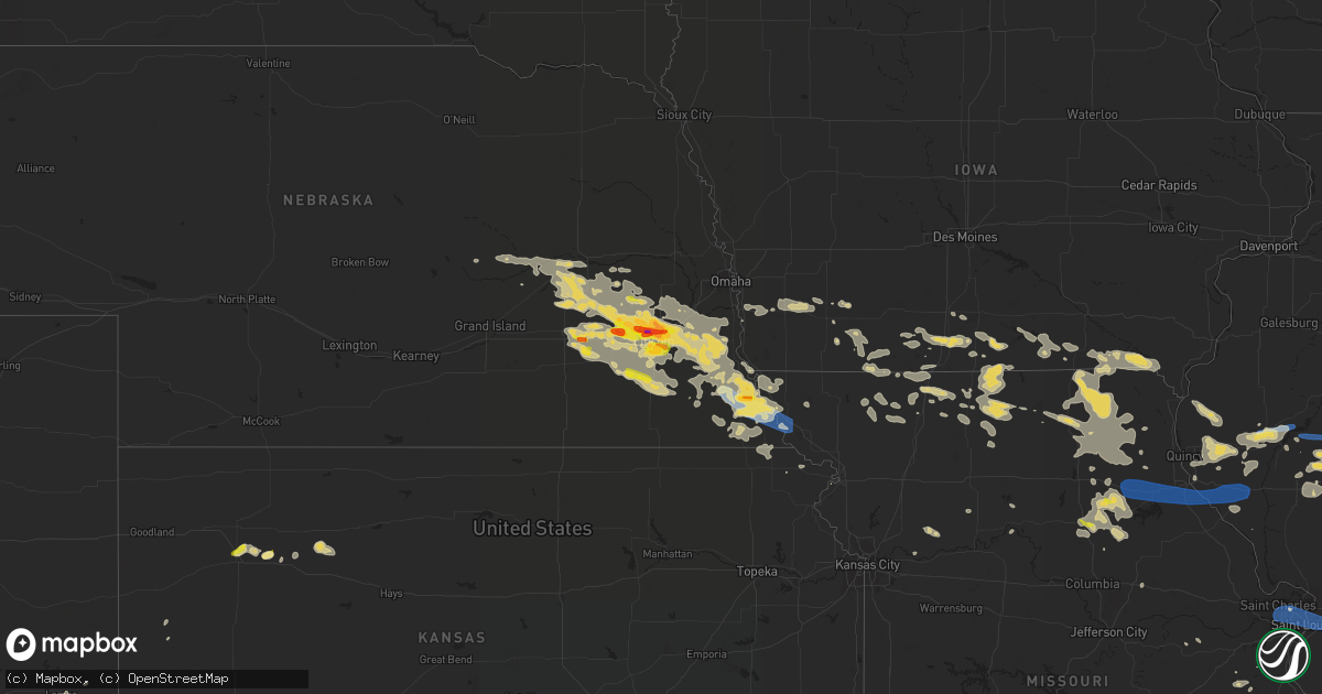
Hail Map on June 16, 2022
Get this storm
June 16 map
$229
one time, instant access
Download today. No call, no setup
Keep the $229
Bought the map and want the full workflow? Apply the entire $229 to a subscription within 7 days. None of it is wasted.
Every map, not just this one
This buys you this map. Subscription and you get every map we run, in the markets you choose from a few cities to whole states to nationwide. Plus real-time alerts the moment a storm fires.
Contact data
Name, contact info, occupancy, even credit band for addresses in the footprint. You go from where it hit to who to call.
Become the source they trust
Unlimited branding weather history reports on demand. You already have the documented answer ready for the property owner, and you are the one who showed up with it.
Property data and RoofTrace estimates
Pull up any address you have got, its value and the exact code rules for that jurisdiction, straight from One Click Code. Then RoofTrace estimates the squares, pitch, and roof value, priced the way you price.
States Impacted by Hail Map on June 16, 2022
Storm reports
Missouri
| Date | Description |
|---|---|
| 06/16/20225:15 PM CDT | A local report indicates 1.00 inch wind near ALLENDALE |
| 06/16/20225:31 AM CDT | At 1031 PM CDT, a severe thunderstorm was located near Hamburg, or 7 miles southeast of Nebraska City, moving southeast at 30 mph. HAZARD...60 mph wind gusts and nickel size hail. SOURCE...Radar indicated. IMPACT...Expect damage to roofs, siding, and trees. Locations impacted include... Tarkio, Rock Port, Watson and Phelps City. This includes Interstate 29 between mile markers 105 and 123. |
| 06/16/20225:20 AM CDT | Large branch down blocking street near lake st. Clair in st. Clair... Mo. |
| 06/16/20225:20 AM CDT | Large tree limbs down blocking road via facebook. |
| 06/16/20225:20 AM CDT | Damage to a large tent via facebook. |
| 06/16/20225:20 AM CDT | Large tree snapped in oakville. Report via facebook. |
| 06/16/20225:16 AM CDT | Large limb down on a fence in cedar hill. Report via facebook. |
| 06/16/20225:12 AM CDT | Large tree down over roadway in lemay. Report via facebook. |
| 06/16/20225:10 AM CDT | Large limb down. Report via facebook. |
| 06/16/20225:10 AM CDT | Large tree limb down via facebook. |
| 06/16/20225:10 AM CDT | Large tree down in south st. Louis city near grand and eichelberger. Time estimated from radar. |
| 06/16/20225:09 AM CDT | At 1008 PM CDT, a severe thunderstorm was located over Maud, moving northeast at 10 mph. HAZARD...60 mph wind gusts and quarter size hail. SOURCE...Radar indicated. IMPACT...Hail damage to vehicles is expected. Expect wind damage to roofs, siding, and trees. This severe thunderstorm will be near... Granville around 1020 PM CDT.Other locations in the path of this severe thunderstorm includeShelbina. |
| 06/16/20225:07 AM CDT | Tree limbs down. |
| 06/16/20225:03 AM CDT | Tree limb estimated to be about 8 inches in diameter fallen from tree. |
| 06/16/20225:01 AM CDT | Large branches down in kirkwood. Report via facebook. |
| 06/16/20225:00 AM CDT | Large branches down in glendale. |
| 06/16/20225:00 AM CDT | 1-4 inch diameter limbs were taken off trees on this property se of labadie. |
| 06/16/20225:00 AM CDT | Multiple tree branches down... Some up to 6 inches in diameter. |
| 06/16/20225:00 AM CDT | 1.5 to 2 foot diameter limb taken off a large oak tree at a height of 20-30 feet off the ground. The branch did not appear to be rotted. |
| 06/16/20224:57 AM CDT | Large tree limb down on car via facebook. |
| 06/16/20224:55 AM CDT | Tree snapped. Report via facebook. |
| 06/16/20224:55 AM CDT | Trees snapped off at golf club of florissant. One large tree down... Blocking estates drive in florissant in both directions. |
| 06/16/20224:53 AM CDT | At kset... St. Charles smartt field. |
| 06/16/20224:51 AM CDT | Large branch down and patio furniture blown all into the yard. Report via facebook. |
| 06/16/20224:50 AM CDT | Large tree topped in st. Charles via facebook. |
| 06/16/20224:50 AM CDT | A few large tree limbs down and one tree uprooted in glen allen estates subdivision. |
| 06/16/20224:50 AM CDT | Large tree limb down via facebook. |
| 06/16/20224:45 AM CDT | Tree down on a house in harvester. Report via facebook. |
| 06/16/20224:45 AM CDT | Medium sized tree down in wentzville via facebook. |
| 06/16/20224:44 AM CDT | Large tree limb down in weldon spring. Report via facebook. |
| 06/16/20224:44 AM CDT | Large limb on a pool in st. Peters. Report via facebook. |
| 06/16/20224:42 AM CDT | Large tree down in st. Peters via twitter. |
| 06/16/20224:42 AM CDT | Via facebook with picture included: large tree fell onto house. |
| 06/16/20224:40 AM CDT | Large tree limb down via facebook. |
| 06/16/20224:40 AM CDT | Small shed damaged via facebook. |
| 06/16/20224:40 AM CDT | Large wooden fence blown over in ofallon il. Report via facebook. |
| 06/16/20224:35 AM CDT | Tree uprooted. Report via facebook. |
| 06/16/20224:30 AM CDT | Several large limbs down. Report via facebook. |
| 06/16/20224:30 AM CDT | Several large limbs down. Report via facebook. Il 3856 9009 large trees down near lady of the snow shrine. Report via facebook. |
| 06/16/20224:30 AM CDT | Small barn sustained roof damage. Report via facebook. |
| 06/16/20224:30 AM CDT | Via twitter with picture included: thin tree snapped and damaged fence. |
| 06/16/20224:20 AM CDT | Trees down on highway kk north of troy via facebook. |
| 06/16/20224:14 AM CDT | Large limbs down in high hill. Report via facebook. |
| 06/16/20224:10 AM CDT | Large tree branch down on home via facebook. |
| 06/16/20224:05 AM CDT | Down tree blocking road via facebook. |
| 06/16/20224:05 AM CDT | Via facebook: large tree took down power line... More tree damage reported. |
| 06/16/20224:01 AM CDT | Large tree branch down in louisiana. Report via facebook. |
| 06/16/20223:45 AM CDT | Mature tree with foliage uprooted and fell into house. No considerable structural damage reported. |
| 06/16/20223:45 AM CDT | Report of utility lines and signs down around town. |
| 06/16/20223:43 AM CDT | Tree down on house in center. Tree down on highway hh north of new london and multiple reports of power out in hannibal. |
| 06/16/20223:40 AM CDT | Tree blocking both lanes of kk. |
| 06/16/20223:40 AM CDT | 1900 without power in mexico... Rural areas surrounding mexico without power as well. Trees down across town. |
| 06/16/20223:40 AM CDT | Power line reported down on east liberty street and minor house damage due to downed trees in mexico.. |
| 06/16/20223:37 AM CDT | Large tree down on a house in new london. Report via facebook. |
| 06/16/20223:34 AM CDT | Large limbs down on a house. Report via facebook. |
| 06/16/20223:21 AM CDT | Missouri mesonet. |
| 06/16/20223:06 AM CDT | Large limbs down and a tree uprooted. Report via facebook. |
| 06/16/20223:04 AM CDT | Large limb snapped. Report via twitter. |
| 06/16/20222:50 AM CDT | Large cottonwood tree down. |
| 06/16/20222:34 AM CDT | Damage to fire department. Several garage doors blown in. |
| 06/16/20221:35 AM CDT | Delayed report. Light pole snapped. Time estimated from radar. |
| 06/16/20221:33 AM CDT | Delayed report. Half a large tree blown down. Time estimated from radar. |
| 06/16/202212:36 AM CDT | A local report indicates 58 MPH wind near SAINT JOSEPH AIRPORT |
| 06/16/202212:22 AM CDT | A local report indicates 59 MPH wind near SAINT JOSEPH AIRPORT |
| 06/15/202211:55 PM CDT | A local report indicates 1.00 inch wind near FAIRFAX |
| 06/15/202211:29 PM CDT | Public weather station reported 59.9 mph. |
| 06/15/202210:10 PM CDT | Largest hail was one inch. Most hail was much smaller. Winds gusting up to 20 mph. |
| 06/15/20228:20 PM CDT | A local report indicates 1.00 inch wind near MOBERLY |
Alabama
| Date | Description |
|---|---|
| 06/16/20224:17 AM CDT | At 916 PM CDT, a severe thunderstorm was located over Elba, moving northwest at 15 mph. HAZARD...60 mph wind gusts and penny size hail. SOURCE...Radar indicated. IMPACT...Expect damage to roofs, siding, and trees. Locations impacted include... Elba, Lee, Pine Level, New Haven, Curtis, Carl Folsom A/p, Basin, Danleys Crossroads, Woodland Grove Church and Camp Humming Hills. |
| 06/16/20222:58 AM CDT | At 758 PM CDT, a severe thunderstorm was located 8 miles southwest of Enterprise, moving west at 15 mph. HAZARD...60 mph wind gusts and penny size hail. SOURCE...Radar indicated. IMPACT...Expect damage to roofs, siding, and trees. Locations impacted include... Elba, Enterprise, Samson, Kinston, Coffee Springs, Chancellor, Perry Store, Lucile, Ino, Turner Crossroads, Central City, Goodman, Basin, Enterprise Municipal A/P, Spears, Pera, Alberton, Weeks, Sellersville and Highfalls. |
| 06/16/20221:29 AM CDT | Report from mping: quarter |
| 06/16/20221:23 AM CDT | At 623 PM CDT, a severe thunderstorm was located over Headland, moving west at 10 mph. HAZARD...60 mph wind gusts and penny size hail. SOURCE...Radar indicated. IMPACT...Expect damage to roofs, siding, and trees. Locations impacted include... Headland, Dothan, Ozark, Midland City, Kinsey, Newton, Webb, Pinckard, Grimes, Newville, Napier Field, Hollis Dairy Road, Kirkland Crossroads, Mabson, Ewell, Headland Municipal A/P, Sylvan Grove, Blackwood, Bagwells Crossroads and Kelly Springs. |
| 06/16/202212:53 AM CDT | Hail fell for over 15 minutes. |
| 06/16/202212:27 AM CDT | Reports of large hail around rockford. |
| 06/16/202212:12 AM CDT | Trees down on hwy 9 north of hwy 22. |
| 06/15/20229:40 PM CDT | Tree down on county road 353. |
| 06/15/20229:25 PM CDT | Two trees down on highway 189. |
| 06/15/20228:00 PM CDT | Tree down on highway 85 south of bellwood at county road 99. |
| 06/15/20227:03 PM CDT | Power pole snapped on cr 112 at old town road. |
Colorado
| Date | Description |
|---|---|
| 06/16/20223:57 AM CDT | At 857 PM MDT, a severe thunderstorm was located 4 miles south of Milton Reservoir, or 17 miles south of Greeley, moving northeast at 15 mph. HAZARD...60 mph wind gusts and quarter size hail. SOURCE...Radar indicated. IMPACT...Expect damage to roofs, siding, and trees. Hail damage to vehicles is expected. This severe thunderstorm will be near... Milton Reservoir around 915 PM MDT. |
| 06/16/20223:08 AM CDT | At 807 PM MDT, a severe thunderstorm was located near Fort Lupton, or 20 miles south of Greeley, moving northeast at 10 mph. HAZARD...60 mph wind gusts and half dollar size hail. SOURCE...Radar indicated. IMPACT...Expect damage to roofs, siding, and trees. Hail damage to vehicles is expected. Locations impacted include... Platteville, Gilcrest and Milton Reservoir. |
| 06/16/202212:01 AM CDT | At 501 PM MDT, a severe thunderstorm was located near Lamar, moving north at 30 mph. HAZARD...60 mph wind gusts and quarter size hail. SOURCE...Radar indicated. IMPACT...Hail damage to vehicles is expected. Expect wind damage to roofs, siding, and trees. Locations impacted include... Lamar and Wiley. |
| 06/15/202210:46 PM CDT | A local report indicates 1.00 inch wind near LYONS |
| 06/15/202210:35 PM CDT | A local report indicates 1.00 inch wind near 1 N CAMPION |
| 06/15/202210:13 PM CDT | A local report indicates 1.50 inch wind near 1 N HUDSON |
| 06/15/202210:13 PM CDT | A local report indicates 1.50 inch wind near 1 N HUDSON |
| 06/15/20229:48 PM CDT | A local report indicates 1.00 inch wind near 3 NNE FORT LUPTON |
| 06/15/20229:48 PM CDT | Corrects previous hail report from 3 nne fort lupton. |
| 06/15/20229:34 PM CDT | A local report indicates 1.25 inch wind near 3 NE FORT LUPTON |
Vermont
| Date | Description |
|---|---|
| 06/16/20226:00 PM CDT | Cars dented. |
| 06/16/20222:11 AM CDT | At 711 PM EDT, a severe thunderstorm was located over South Franklin, moving east at 45 mph. HAZARD...60 mph wind gusts and quarter size hail. SOURCE...Radar indicated. IMPACT...Minor hail damage to vehicles is possible. Expect wind damage to trees and powerlines. Locations impacted include... Newport City, Enosburg Falls, Orleans, Derby Center, Franklin, Jay, Newport Town, Jay In Franklin County, Bakersfield, Orleans Village, Berkshire, Montgomery Center, Brownington, Albany, Montgomery, Coventry, Barton, Troy, Sheldon and Belvidere Center. |
| 06/16/20221:29 AM CDT | At 628 PM EDT, a severe thunderstorm was located over Cannon Corners, moving east at 30 mph. HAZARD...60 mph wind gusts and quarter size hail. SOURCE...Radar indicated. IMPACT...Minor hail damage to vehicles is possible. Expect wind damage to trees and powerlines. Locations impacted include... Chazy, Mooers, Altona, Alburgh Village, Ellenburg Depot, Champlain, St. Albans City, Swanton, St. Albans Town, South Alburgh, Alburgh, Alburgh Dunes State Park, North Hero, Swanton Village, Highgate Falls, Isle La Motte, Rouses Point, Highgate, Fairfield and Sheldon. |
Pennsylvania
| Date | Description |
|---|---|
| 06/16/20226:38 PM CDT | Report from mping: 3-inch tree limbs broken; power poles broken. |
| 06/16/20226:14 PM CDT | Trees down across route 144 in centre hall. |
| 06/16/20225:18 PM CDT | Powerlines down on hartline road. |
| 06/16/20224:42 PM CDT | Tree and wires down via county dispatch |
| 06/16/20224:35 PM CDT | Trees down on wires along route 555. |
| 06/16/20224:20 PM CDT | Widespread trees and wires down along route 255 north of weedville. |
| 06/16/20224:19 PM CDT | Trees down |
| 06/16/20224:16 PM CDT | Widespread trees and wires down in st. Marys. Tree down through house window on grant street. |
| 06/16/20224:12 PM CDT | Trees snapped or uprooted |
| 06/16/20224:03 PM CDT | A number of trees uprooted along sample road. |
| 06/16/20224:00 PM CDT | Trees down on wires on 241 spruce street. Ridgway borough. |
| 06/16/20223:59 PM CDT | Widespread trees down on wires throughout ridgway. |
| 06/16/20223:55 PM CDT | Trees snapped or uprooted |
| 06/16/20223:36 PM CDT | Trees down |
| 06/16/20223:32 PM CDT | Extensive tree damage reported along mckees rd. Reported no damage to structures. |
| 06/16/20223:31 PM CDT | Multiple trees down |
| 06/16/20223:31 PM CDT | Multiple trees down ny 4467 7453 multiple trees and powerlines down. |
| 06/16/20223:23 PM CDT | Multiple trees down in howe township |
| 06/16/20223:20 PM CDT | Two trees reported down in west hickory. The time was estimated by radar. |
| 06/16/20223:15 PM CDT | Trees and wires down across sheffield. |
| 06/16/20223:15 PM CDT | Multiple trees down throughout clintonville |
| 06/16/20223:15 PM CDT | A local report indicates 1.25 inch wind near 1 NE NECTARINE |
| 06/16/20223:15 PM CDT | Power lines down |
| 06/16/20223:00 PM CDT | A local report indicates 1.00 inch wind near TRANSFER |
| 06/16/20222:58 PM CDT | Widespread trees down across tidioute. |
| 06/16/20222:55 PM CDT | Numerous trees down in cochranton. |
| 06/16/20222:53 PM CDT | A local report indicates 1.75 inch wind near FREDONIA |
| 06/16/20222:53 PM CDT | Picture provided. |
| 06/16/20222:48 PM CDT | A local report indicates 1.75 inch wind near 2 W CLARK |
| 06/16/20222:46 PM CDT | A local report indicates 1.50 inch wind near 1 SE TRANSFER |
| 06/16/20222:46 PM CDT | Numerous trees down on wires around grand valley. |
| 06/16/20222:42 PM CDT | Roof blown off house. |
| 06/16/20222:42 PM CDT | Picture provided. |
| 06/16/20222:40 PM CDT | A local report indicates 1.75 inch wind near TRANSFER |
| 06/16/20222:30 PM CDT | Tree down on clay furnace rd just east of clark |
| 06/16/20222:30 PM CDT | Trees snapped or uprooted |
| 06/16/20222:28 PM CDT | A local report indicates 1.50 inch wind near TRANSFER |
| 06/16/20222:15 PM CDT | Extensive tree damage in union city. Large trees broken and uprooted all over seen on social media. Time estimated from radar. |
| 06/16/20224:59 AM CDT | At 959 PM EDT, a severe thunderstorm was located over Wormleysburg, moving southeast at 20 mph. HAZARD...60 mph wind gusts and quarter size hail. SOURCE...Radar indicated. IMPACT...Hail damage to vehicles is expected. Expect wind damage to roofs, siding, and trees. Locations impacted include... Harrisburg, York, Lower Allen, Weigelstown, Progress, Mechanicsburg, Middletown, Camp Hill, New Cumberland, Enola, Steelton and Lemoyne.This includes the following Interstates... The Pennsylvania Turnpike from mile markers 236 to 249. Interstate 81 from mile markers 64 to 68. Interstate 83 from mile markers 22 to 47. Interstate 283 from mile markers 0 to 2. |
| 06/16/20224:04 AM CDT | At 904 AM EDT, a severe thunderstorm was located over Strasburg, moving southeast at 35 mph. HAZARD...60 mph wind gusts and penny size hail. SOURCE...Radar indicated. IMPACT...Expect damage to roofs, siding, and trees. This severe thunderstorm will be near... Gap around 910 AM EDT.Other locations impacted by this severe thunderstorm includeChristiana, Buck, Gordonville, Bird-In-Hand and Refton. |
| 06/16/20223:59 AM CDT | At 858 PM EDT, a severe thunderstorm was located over Duncannon, moving southeast at 25 mph. HAZARD...60 mph wind gusts and half dollar size hail. SOURCE...Radar indicated. IMPACT...Hail damage to vehicles is expected. Expect wind damage to roofs, siding, and trees. Locations impacted include... Harrisburg, Carlisle, Lower Allen, Colonial Park, Progress, Mechanicsburg, Middletown, Camp Hill, New Cumberland, Enola, Steelton and Lemoyne.This includes the following Interstates... The Pennsylvania Turnpike between mile markers 224 and 239...andfrom mile markers 247 to 253. Interstate 81 from mile markers 48 to 68. Interstate 83 from mile markers 40 to 48. Interstate 283 from mile markers 0 to 2. |
| 06/16/20223:17 AM CDT | At 817 PM EDT, a severe thunderstorm was located over Mexico, moving southeast at 30 mph. HAZARD...Two inch hail and 60 mph wind gusts. SOURCE...Radar indicated. IMPACT...People and animals outdoors will be injured. Expect hail damage to roofs, siding, windows, and vehicles. Expect wind damage to roofs, siding, and trees. Locations impacted include... Marysville, Newport, Duncannon, New Bloomfield, Spruce Hill, Mexico, Loysville, Ickesburg, Walnut, Shermansdale, Rockville and Mifflintown. |
| 06/16/20222:26 AM CDT | At 726 PM EDT, a severe thunderstorm was located over Potters Mills, moving southeast at 30 mph. HAZARD...60 mph wind gusts and quarter size hail. SOURCE...Radar indicated. IMPACT...Hail damage to vehicles is expected. Expect wind damage to roofs, siding, and trees. Locations impacted include... Lewistown, Boalsburg, Pleasant Gap, Lemont, Burnham, Houserville, Milroy, Highland Park, Centre Hall, Yeagertown, McClure and Reedsville. |
| 06/16/20221:42 AM CDT | At 642 PM EDT, severe thunderstorms were located along a line extending from Bald Eagle State Park to Julian, moving southeast at 25 mph. HAZARD...60 mph wind gusts and penny size hail. SOURCE...Radar indicated. IMPACT...Expect damage to roofs, siding, and trees. Locations impacted include... Bellefonte, Woodward, Pleasant Gap, Lamar, Zion, Centre Hall, Milesburg, Millheim, Aaronsburg, Rebersburg, Spring Mills and Coburn.For those driving on Interstate 80, this includes areas between theMilesburg and Lamar exits, specifically from mile markers 158 to 171.This includes Interstate 99 from mile markers 77 to 85. |
| 06/16/20221:17 AM CDT | At 617 PM EDT, a severe thunderstorm was located over Snow Shoe, moving southeast at 40 mph. THIS IS A DESTRUCTIVE STORM FOR NORTHERN CENTRE COUNTY. HAZARD...80 mph wind gusts and quarter size hail. SOURCE...Radar indicated. IMPACT...Flying debris will be dangerous to those caught without shelter. Mobile homes will be heavily damaged. Expect considerable damage to roofs, windows, and vehicles. Extensive tree damage and power outages are likely. Locations impacted include... Bellefonte, Zion, Milesburg, Snow Shoe, Clarence, Moshannon, Julian and Unionville.For those driving on Interstate 80, this includes areas between theKylertown and Lamar exits, specifically from mile markers 143 to 163.This includes Interstate 99 from mile markers 83 to 85. |
| 06/16/20221:11 AM CDT | At 611 PM EDT, a severe thunderstorm was located over Cameron, or 12 miles southeast of Moundsville, moving southeast at 40 mph. HAZARD...60 mph wind gusts and quarter size hail. SOURCE...Radar indicated. IMPACT...Minor hail damage to vehicles is possible. Expect wind damage to trees and power lines, resulting in some power outages. Locations impacted include... Mannington, Cameron, Fairview, Hundred, Cassville, Rogersville, Grant Town, Farmington, Aleppo, Blacksville, Spraggs, and Mount Morris. |
| 06/16/20221:00 AM CDT | At 559 PM EDT, a severe thunderstorm was located near Keating, moving east at 40 mph. HAZARD...70 mph wind gusts and half dollar size hail. SOURCE...Radar indicated. IMPACT...Hail damage to vehicles is expected. Expect considerable tree damage. Wind damage is also likely to mobile homes, roofs, and outbuildings. Locations impacted include... Lock Haven, Keating, Lamar, Mill Hall, Dunnstown, Flemington, Castanea, Blanchard, Clarence, Pine Glen, Monument and Bald Eagle State Park.For those driving on Interstate 80, this includes areas between theBellefonte and Loganton exits, specifically from mile markers 163 to182.This includes the following highways... Route 220 from west of Lamar on I-80 to Lock Haven. State Road 120 from north of Lock Haven to Lock Haven. |
| 06/16/202212:54 AM CDT | At 553 PM EDT, a severe thunderstorm was located over Glen Union or about 10 miles east of Renovo, moving east at 40 mph. HAZARD...60 mph wind gusts and half dollar size hail. SOURCE...Radar indicated. IMPACT...Hail damage to vehicles is expected. Expect wind damage to roofs, siding, and trees. This severe thunderstorm will be near... Avis, McElhattan and Waterville around 610 PM EDT. Jersey Shore around 620 PM EDT.Other locations impacted by this severe thunderstorm includeSalladasburg.This includes the following highways... Route 220 from Avis to Jersey Shore. State Road 120 near Hyner View State Park. |
| 06/16/202212:39 AM CDT | At 538 PM EDT, a severe thunderstorm produccing widespread wind damage was located near Hicks Run, moving east at 40 mph. HAZARD...70 mph wind gusts and half dollar size hail. SOURCE...Radar indicated. IMPACT...Hail damage to vehicles is expected. Expect considerable tree damage. Wind damage is also likely to mobile homes, roofs, and outbuildings. Locations impacted include... Keating, Karthaus and Pine Glen. |
| 06/16/202212:17 AM CDT | At 517 PM EDT, a severe thunderstorm was located 9 miles west of Brockway, or 9 miles northeast of Brookville, moving east at 45 mph. HAZARD...60 mph wind gusts and quarter size hail. SOURCE...Radar indicated. IMPACT...Minor hail damage to vehicles is possible. Expect wind damage to trees and power lines, resulting in some power outages. Locations impacted include... Brockway. |
| 06/16/202212:08 AM CDT | At 508 PM EDT, a severe thunderstorm was located near New Bethlehem, or 7 miles east of Rimersburg, moving east at 40 mph. HAZARD...Ping pong ball size hail and 60 mph wind gusts. SOURCE...Radar indicated. IMPACT...People and animals outdoors will be injured. Expect hail damage to roofs, siding, windows, and vehicles. Expect wind damage to trees and power lines, resulting in some power outages. Locations impacted include... Punxsutawney, Brookville, Rimersburg, Reynoldsville, New Bethlehem, Sykesville, Falls Creek, Sligo, Big Run, Dayton, Summerville, and Rossiter. |
| 06/15/202211:56 PM CDT | At 456 PM EDT, a severe thunderstorm was located 8 miles southwest of Marienville, moving east at 45 mph. HAZARD...60 mph wind gusts and half dollar size hail. SOURCE...Radar indicated. IMPACT...Minor hail damage to vehicles is possible. Expect wind damage to trees and power lines, resulting in some power outages. Locations impacted include... Sigel, Fisher, Leeper, Clarington, Clear Creek State Park, and Cook Forest State Park. |
| 06/15/202211:53 PM CDT | At 453 PM EDT, a severe thunderstorm was located 8 miles east of Cadiz, moving southeast at 40 mph. HAZARD...Ping pong ball size hail and 60 mph wind gusts. SOURCE...Radar indicated. IMPACT...People and animals outdoors will be injured. Expect hail damage to roofs, siding, windows, and vehicles. Expect wind damage to trees and power lines, resulting in some power outages. Locations impacted include... Wheeling, Weirton, Steubenville, Martins Ferry, Cadiz, Warwood, Wellsburg, West Liberty, Triadelphia, Avella, Clearview, and Valley Grove. |
| 06/15/202211:27 PM CDT | At 427 PM EDT, a severe thunderstorm was located 14 miles northeast of Slippery Rock, or 14 miles east of Grove City, moving southeast at 45 mph. HAZARD...Ping pong ball size hail and 60 mph wind gusts. SOURCE...Radar indicated. IMPACT...People and animals outdoors will be injured. Expect hail damage to roofs, siding, windows, and vehicles. Expect wind damage to trees and power lines, resulting in some power outages. Locations impacted include... Clarion, Knox, Rimersburg, New Bethlehem, East Brady, Parker, Sligo, Emlenton, Strattanville, Bruin, Clintonville, and Limestone. |
| 06/15/202211:25 PM CDT | At 424 PM EDT, a severe thunderstorm was located over James City, moving east at 50 mph. HAZARD...70 mph wind gusts and half dollar size hail. SOURCE...Radar indicated. IMPACT...Hail damage to vehicles is expected. Expect considerable tree damage. Wind damage is also likely to mobile homes, roofs, and outbuildings. This severe thunderstorm will be near... James City around 430 PM EDT. Johnsonburg and Wilcox around 440 PM EDT. East Branch Dam around 450 PM EDT. Truman and Elk River around 500 PM EDT. Emporium around 510 PM EDT.Other locations impacted by this severe thunderstorm includeWeedville and Kersey.This includes the following highways... Route 219 from Brockport to north of Wilcox. State Road 66 from Russell City to James City. State Road 120 from Ridgway to Emporium. State Road 255 from north of Penfield to Johnsonburg. |
| 06/15/202211:18 PM CDT | At 417 PM EDT, a severe thunderstorm was located near Orwell, or 17 miles north of Warren, moving east at 45 mph. HAZARD...Golf ball size hail and 60 mph wind gusts. SOURCE...Radar indicated. IMPACT...People and animals outdoors will be injured. Expect hail damage to roofs, siding, windows, and vehicles. Expect damage to trees and power lines. Locations impacted include... Kinsman, Andover, Linesville, Harmonsburg, Adamsville, Pymatuning North, Pymatuning Central, Atlantic, Mecca, Johnston, Cherry Valley, Conneaut Lake, Jamestown, Conneaut Lakeshore, Geneva and Hartstown. |
| 06/15/202211:15 PM CDT | At 415 AM EDT, a severe thunderstorm was located near Hortonville, or 13 miles west of Liberty, moving east at 25 mph. HAZARD...60 mph wind gusts and quarter size hail. SOURCE...Radar indicated. IMPACT...Hail damage to vehicles is expected. Expect wind damage to roofs, siding, and trees. Locations impacted include... Fallsburg, Liberty, Neversink, South Fallsburg, Callicoon, Fremont, Woodridge, Jeffersonville, Parksville and Swan Lake. |
| 06/15/202210:57 PM CDT | At 357 PM EDT, a severe thunderstorm was located 10 miles northwest of Grove City, moving east at 45 mph. HAZARD...Two inch hail and 60 mph wind gusts. SOURCE...Radar indicated. IMPACT...People and animals outdoors will be injured. Expect hail damage to roofs, siding, windows, and vehicles. Expect wind damage to trees and power lines, resulting in some power outages. Locations impacted include... Franklin, Knox, Mercer, Stoneboro, Seneca, Polk, Sandy Lake, Emlenton, Clintonville, Fredonia, St. Petersburg, and Eau Claire. |
| 06/15/202210:55 PM CDT | At 355 PM EDT, a severe thunderstorm was located 10 miles northwest of Franklin, moving east at 45 mph. HAZARD...60 mph wind gusts and quarter size hail. SOURCE...Radar indicated. IMPACT...Minor hail damage to vehicles is possible. Expect wind damage to trees and power lines, resulting in some power outages. Locations impacted include... Oil City, Franklin, Marienville, Sugarcreek, Tionesta, Hasson Heights, Seneca, Rouseville, Cooperstown, Woodland Heights, Pleasantville, and Utica. |
| 06/15/202210:47 PM CDT | At 347 PM EDT, a severe thunderstorm was located over Grand Valley, moving east at 45 mph. HAZARD...70 mph wind gusts and quarter size hail. SOURCE...Radar indicated. IMPACT...Hail damage to vehicles is expected. Expect considerable tree damage. Wind damage is also likely to mobile homes, roofs, and outbuildings. Locations impacted include... Sheffield, Grand Valley, Chapman State Park, Tidioute and Clarendon. |
| 06/15/202210:36 PM CDT | At 335 PM EDT, severe thunderstorms were located along a line extending from Arcade to near Falconer, moving east at 45 mph. HAZARD...60 mph wind gusts and quarter size hail. SOURCE...Radar indicated. IMPACT...Minor damage to vehicles is possible. Expect wind damage to trees and power lines. Locations impacted include... Jamestown, Olean, Salamanca, Letchworth State Park, Allegany State Park, Springville, Perry, Mount Morris, Falconer and Ashford.This includes the following highways... Interstate 390 near exit 6. Interstate 86 between exits 8 and 31. |
| 06/15/202210:24 PM CDT | At 324 PM EDT, a severe thunderstorm was located near Claylick, or near Greencastle, moving southeast at 25 mph. HAZARD...60 mph wind gusts and quarter size hail. SOURCE...Radar indicated. IMPACT...Damaging winds will cause some trees and large branches to fall. This could injure those outdoors, as well as damage homes and vehicles. Roadways may become blocked by downed trees. Localized power outages are possible. Unsecured light objects may become projectiles. Locations impacted include... Hagerstown, Municipal Stadium, Robinwood, Fountainhead-Orchard Hills, Smithsburg, Paramount-Long Meadow, Wilson-Conococheague, Mount Aetna, Mount Lena, San Mar, Long Meadow, Wolfsville, Halfway, Maugansville, Myersville, Cavetown, Funkstown, Leitersburg, Sabillasville and Fort Ritchie. |
| 06/15/202210:14 PM CDT | At 314 PM EDT, a severe thunderstorm was located over Harmonsburg, or 9 miles west of Meadville, moving east at 45 mph. HAZARD...Ping pong ball size hail and 60 mph wind gusts. SOURCE...Radar indicated. IMPACT...People and animals outdoors will be injured. Expect hail damage to roofs, siding, windows, and vehicles. Expect damage to trees and power lines. Locations impacted include... Meadville, Titusville, Linesville, Adamsville, Pymatuning Central, Riceville, Harmonsburg, Lincolnville, Guys Mills, Pymatuning North, Atlantic, Canadohta Lake, Cochranton, Saegertown, Conneautville, Conneaut Lake, Jamestown, Hydetown, Blooming Valley and Townville. |
| 06/15/20229:46 PM CDT | At 246 PM EDT, severe thunderstorms were located along the I-90 ridge line northwest of Warren County, moving to the east at 35 mph. HAZARD...60 mph wind gusts. SOURCE...Radar indicated. IMPACT...Expect damage to roofs, siding, and trees. Locations impacted include... Columbus, Youngsville, Russell, Spring Creek, Lottsville, Enterprise, Garland, Grand Valley, Sugar Grove, Starbrick and Bear Lake.This includes the following highways... Route 6 from Columbus to Starbrick. Route 62 between south of Irvine and Starbrick...and from Warren tothe New York border. |
| 06/15/20229:25 PM CDT | A local report indicates 1.00 inch wind near 2 WSW MAYTOWN |
| 06/15/20229:15 PM CDT | A local report indicates 1.00 inch wind near 2 NNW VALLEY GREEN |
| 06/15/20229:10 PM CDT | At 209 PM EDT, a severe thunderstorm was located over Fort Littleton, moving east at 20 mph. HAZARD...60 mph wind gusts and quarter size hail. SOURCE...Radar indicated. IMPACT...Hail damage to vehicles is expected. Expect wind damage to roofs, siding, and trees. This severe thunderstorm will be near... Fort Loudon around 210 PM EDT. Fannettsburg and St. Thomas around 230 PM EDT. Willow Hill around 240 PM EDT. Upper Strasburg around 250 PM EDT. Chambersburg, Shippensburg and Roxbury around 300 PM EDT.Other locations impacted by this severe thunderstorm includeOrrstown.This includes the following Interstates... The Pennsylvania Turnpike between mile markers 175 and 184...betweenmile markers 187 and 194...and from mile markers 198 to 201. Interstate 81 from mile markers 14 to 24. |
| 06/15/20228:55 PM CDT | Wires down. |
| 06/15/20228:10 PM CDT | Tree down on bloomfield rd. |
| 06/15/20228:00 PM CDT | Tree down on municipal building road. |
| 06/15/20228:00 PM CDT | Trees down at buttonwood campground. |
| 06/15/20227:40 PM CDT | Damage on gill hill rd. Time based on radar. |
| 06/15/20227:25 PM CDT | Via twitter. |
| 06/15/20227:21 PM CDT | Considerable damage to church. Time based on radar. |
| 06/15/20227:19 PM CDT | Via twitter. |
| 06/15/20227:00 PM CDT | Old fort road |
New Mexico
| Date | Description |
|---|---|
| 06/16/202212:35 AM CDT | Awos station kskx taos muni airport. Downburst winds from shower activity. |
| 06/15/20229:38 PM CDT | Mesonet station dprn5 old horse springs 19 sse |
New York
| Date | Description |
|---|---|
| 06/16/20225:14 PM CDT | Tree down. |
| 06/16/20225:02 PM CDT | Tree down. |
| 06/16/20225:01 PM CDT | Two reports of trees down on ridge road in cazenovia. Time estimated from radar. |
| 06/16/20225:01 PM CDT | Trees down on rathbun road. Time estimated from radar. |
| 06/16/20224:59 PM CDT | Trees down blocking pompey hollow road. Time estimated from radar. |
| 06/16/20224:46 PM CDT | Tree down across fountain street in constable... New york. |
| 06/16/20224:46 PM CDT | Trees and wires down |
| 06/16/20224:40 PM CDT | Multiple trees and powerlines down. |
| 06/16/20224:28 PM CDT | Tree down on a house. Information from a tree service company. Time estimated from radar. |
| 06/16/20224:17 PM CDT | Widespread trees and powerlines down across saint lawrence county. |
| 06/16/20224:12 PM CDT | Wires down on peterman road and ovid street. Time estimated from radar. |
| 06/16/20224:10 PM CDT | Powerlines down along route 68 between pike road and morrill road near canton... Ny. |
| 06/16/20224:03 PM CDT | A local report indicates 1.25 inch wind near 4 SSE FULTON |
| 06/16/20223:59 PM CDT | Multiple trees down of which did damaged to a deck attached to a house in granby... Ny. |
| 06/16/20223:52 PM CDT | A local report indicates 1.75 inch wind near 4 E VICTOR |
| 06/16/20223:50 PM CDT | Numerous holes reported in siding of house from golf ball sized hail. |
| 06/16/20223:50 PM CDT | Large tree down and power pole. |
| 06/16/20223:48 PM CDT | Corrects previous hail report from 2 sse fairport. |
| 06/16/20223:48 PM CDT | A local report indicates 1.25 inch wind near 2 SSE FAIRPORT |
| 06/16/20223:48 PM CDT | Multiple reports of quarter to golf ball size hail. |
| 06/16/20223:47 PM CDT | Multiple trees down and report of structural damage to a building. |
| 06/16/20223:46 PM CDT | Trees and powerlines down near hammond... Ny. |
| 06/16/20223:40 PM CDT | Trees and powerlines down on cornell avenue. |
| 06/16/20223:36 PM CDT | A local report indicates 1.00 inch wind near CATO |
| 06/16/20223:35 PM CDT | Trees and powerlines down along willard road. |
| 06/16/20223:35 PM CDT | Multiple trees down. |
| 06/16/20223:24 PM CDT | Tree down on a house. |
| 06/16/20223:24 PM CDT | Part of the livonia school roof damaged. |
| 06/16/20223:20 PM CDT | Large tree down on sunset campground. Tree barely missed 2 rvs and fell between the two campsites. |
| 06/16/20223:17 PM CDT | Several trees down in lakeville area. |
| 06/16/20223:17 PM CDT | Several trees down in lakeville area. Ny 4332 7658 tree down. |
| 06/16/20223:15 PM CDT | Several trees blown down along/near rt 20a in geneseo. |
| 06/16/20223:12 PM CDT | Tree down. |
| 06/16/20223:12 PM CDT | Two large trees down. |
| 06/16/20223:08 PM CDT | Trees and wires down in conquest. |
| 06/16/20223:04 PM CDT | A local report indicates 1.00 inch wind near PERRY |
| 06/16/20223:00 PM CDT | A local report indicates 1.00 inch wind near 4 SSW RED CREEK |
| 06/16/20223:00 PM CDT | A local report indicates 2.50 inch wind near 4 WNW CATO |
| 06/16/20223:00 PM CDT | Trees and wires down in victory. |
| 06/16/20222:58 PM CDT | Tree took down wires on hewes rd. |
| 06/16/20222:50 PM CDT | *** 1 inj *** damage to mobile homes... Including two completely destroyed. 1 minor injury reported. |
| 06/16/20222:42 PM CDT | Tree down. |
| 06/16/20222:38 PM CDT | A local report indicates 1.00 inch wind near SARDINIA |
| 06/16/20222:37 PM CDT | A local report indicates 1.50 inch wind near SARDINIA |
| 06/16/20222:30 PM CDT | Tree down. |
| 06/16/20221:58 PM CDT | Corrects previous tstm wnd dmg report from 4 sw chautauqua. Tree took down wires on hewes rd. |
| 06/16/20227:18 AM CDT | At 1218 AM EDT, a severe thunderstorm was located over Warsaw, or 12 miles northwest of Letchworth State Park, moving east at 30 mph. HAZARD...60 mph wind gusts and quarter size hail. SOURCE...Radar indicated. IMPACT...Minor damage to vehicles is possible. Expect wind damage to trees and power lines. Locations impacted include... Geneseo, Letchworth State Park, Perry, Warsaw, Mount Morris, Conesus, Groveland, Livonia, Covington and Castile.This includes Interstate 390 between exits 5 and 8. |
| 06/16/20221:31 AM CDT | At 630 PM EDT, a severe thunderstorm was located near Clinton, or 8 miles southwest of New Hartford, moving east at 30 mph. HAZARD...60 mph wind gusts and penny size hail. SOURCE...Radar indicated. IMPACT...Expect damage to roofs, siding, and trees. Locations impacted include... Utica, Kirkland, Westmoreland, Paris, Deerfield, Whitesboro, New York Mills, Sherrill, Yorkville and Augusta. |
| 06/16/202212:58 AM CDT | At 556 PM EDT, a severe thunderstorm was located near Fair Haven Beach State Park, moving northeast at 40 mph. HAZARD...Ping pong ball size hail and 60 mph wind gusts. SOURCE...Radar indicated. IMPACT...People and animals outdoors will be injured. Expect hail damage to roofs, siding, windows, and vehicles. Expect wind damage to trees and power lines. Locations impacted include... Oswego, Fulton, Sandy Island Beach State Park, Fair Haven Beach State Park, Pulaski, Central Square, Adams, Redfield, Cato and Selkirk Shores State Park.This includes Interstate 81 between exits 32 and 42. |
| 06/16/202212:41 AM CDT | At 538 PM EDT, severe thunderstorms were located along a line extending from Nicholville to near Lake Ozonia to near Horseshoe Lake, moving east at 50 mph. HAZARD...70 mph wind gusts and quarter size hail. SOURCE...Law enforcement and utilities report numerous powerlines down in southern and central Saint Lawrence County. IMPACT...Minor hail damage to vehicles is possible. Expect considerable tree damage. Wind damage is also likely to mobile homes, roofs, and outbuildings. Locations impacted include... Tupper Lake, Adirondack Regional Airport, Saranac Lake, Lake Placid, Saranac, Parishville, Wilmington, Keene, Piercefield, Bryants Mill, Wawbeek, Lyon Mountain, Merrill, Clayburg, Carry Falls Reservoir, Keene Valley, Cranberry Lake, Lawrenceville, Au Sable Forks and Debar Mountain. |
| 06/16/202212:26 AM CDT | At 526 PM EDT, severe thunderstorms were located along a line extending from Bridgeport to near Levanna, moving southeast at 30 mph. HAZARD...60 mph wind gusts and quarter size hail. SOURCE...Radar indicated. IMPACT...Hail damage to vehicles is expected. Expect wind damage to roofs, siding, and trees. Locations impacted include... Onondaga, Syracuse, Auburn, De Witt, Sullivan, Oneida, Lenox, Pompey, North Syracuse and Solvay. |
| 06/16/202212:25 AM CDT | At 524 PM EDT, a severe thunderstorm was located over Westville Center, moving east at 30 mph. HAZARD...60 mph wind gusts and quarter size hail. SOURCE...Radar indicated. IMPACT...Minor hail damage to vehicles is possible. Expect wind damage to trees and powerlines. Locations impacted include... Moira, Bangor, Fort Covington, Bombay, Malone, Churubusco, Ellenburg Depot, Chateaugay, Helena, Burke, St. Regis, Brushton, Ellenburg, Constable, Earlville, Fort Covington Center, West Bangor, South Bombay, Cannon Corners and Ironton. |
| 06/16/202212:10 AM CDT | At 510 PM EDT, a severe thunderstorm was located over Plainville, or near Baldwinsville, moving northeast at 55 mph. HAZARD...60 mph wind gusts and quarter size hail. SOURCE...Radar indicated. IMPACT...Hail damage to vehicles is expected. Expect wind damage to roofs, siding, and trees. Locations impacted include... Clay, Cicero, Lysander, Van Buren, Baldwinsville, Jordan, Elbridge, Brewerton, Plainville and Bayberry. |
| 06/16/202212:04 AM CDT | At 504 PM EDT, severe thunderstorms were located along a line extending from Plainville to near Clifton Springs, moving east at 40 mph. HAZARD...60 mph wind gusts and quarter size hail. SOURCE...Radar indicated. IMPACT...Minor damage to vehicles is possible. Expect wind damage to trees and power lines. Locations impacted include... Geneva, Fulton, Canandaigua, Newark, Lyons, Palmyra, Victor, Clifton Springs, Clyde and Phelps.This includes the following highways... Interstate 90 between exits 45 and 40. Interstate 81 between exits 32 and 34. |
| 06/15/202211:50 PM CDT | At 450 PM EDT, a severe thunderstorm was located near West Carthage, or 12 miles southeast of Fort Drum, moving east at 30 mph. HAZARD...60 mph wind gusts and quarter size hail. SOURCE...Radar indicated. IMPACT...Minor damage to vehicles is possible. Expect wind damage to trees and power lines. Locations impacted include... Carthage, West Carthage, Herrings, Barnes Corners, Denmark, New Bremen, Copenhagen, Harrisville, Croghan and Castorland. |
| 06/15/202211:50 PM CDT | At 450 PM EDT, severe thunderstorms were located along a line extending from near Waterloo to near Liverpool, moving east at 15 mph. HAZARD...60 mph wind gusts and quarter size hail. SOURCE...Radar indicated. IMPACT...Hail damage to vehicles is expected. Expect wind damage to roofs, siding, and trees. Locations impacted include... Onondaga, Syracuse, Auburn, De Witt, Van Buren, North Syracuse, Seneca Falls, Solvay, Waterloo and Chittenango. |
| 06/15/202211:43 PM CDT | At 443 PM EDT, a severe thunderstorm was located near Hammond, moving east at 50 mph. HAZARD...60 mph wind gusts and quarter size hail. SOURCE...Radar indicated. IMPACT...Minor hail damage to vehicles is possible. Expect wind damage to trees and powerlines. Locations impacted include... Potsdam, Tupper Lake, Gouverneur, Ogdensburg, Canton, Oswegatchie, Lisbon, De Kalb, Bangor, Fowler, Parishville, Colton, Piercefield, Morley, Degrasse, Carry Falls Reservoir, Richville, Hammond, Cranberry Lake and Lawrenceville. |
| 06/15/202211:23 PM CDT | At 423 PM EDT, a severe thunderstorm was located over Coles Creek State Park, moving east at 15 mph. HAZARD...60 mph wind gusts and quarter size hail. SOURCE...Radar indicated. IMPACT...Minor hail damage to vehicles is possible. Expect wind damage to trees and powerlines. Locations impacted include... Massena, Norfolk, Louisville, Moira, Waddington, St. Regis, Massena International Airport - Richards Field, Madrid, Helena, Chipman, Brasher Falls, Norwood, North Stockholm, Eisenhower Lock, Brasher Center, Hogansburg, St. Lawrence State Park, Ironton, Rooseveltown and Coles Creek State Park. |
| 06/15/202211:20 PM CDT | At 420 PM EDT, a severe thunderstorm was located near Cato, or 11 miles south of Fair Haven Beach State Park, moving east at 60 mph. HAZARD...60 mph wind gusts and half dollar size hail. SOURCE...Radar indicated. IMPACT...Minor damage to vehicles is possible. Expect wind damage to trees and power lines. Locations impacted include... Clyde, Sodus, Weedsport, Cato, Rose, Ira, Huron, Conquest, Savannah and Wolcott.This includes Interstate 90 near exit 40. |
| 06/15/202211:14 PM CDT | At 414 PM EDT, a severe thunderstorm was located near Oswego, moving northeast at 40 mph. HAZARD...Ping pong ball size hail and 60 mph wind gusts. SOURCE...Radar indicated. IMPACT...People and animals outdoors will be injured. Expect hail damage to roofs, siding, windows, and vehicles. Expect wind damage to trees and power lines. Locations impacted include... Oswego, Fulton, Sandy Island Beach State Park, Pulaski, Central Square, Adams, Redfield, Selkirk Shores State Park, Mexico Point State Park and Adams Center.This includes Interstate 81 between exits 32 and 42. |
| 06/15/202211:10 PM CDT | At 409 PM EDT, a severe thunderstorm was located over Mount Morris, or near Letchworth State Park, moving east at 50 mph. HAZARD...60 mph wind gusts and quarter size hail. SOURCE...Radar indicated. IMPACT...Minor damage to vehicles is possible. Expect wind damage to trees and power lines. Locations impacted include... Geneva, Canandaigua, Geneseo, Dansville, Letchworth State Park, Newark, Williamson, Marion, Perry and Lyons.This includes the following highways... Interstate 390 between exits 4 and 10. Interstate 90 between exits 45 and 42. |
| 06/15/202211:07 PM CDT | At 407 PM EDT, a severe thunderstorm was located over Albion, moving east at 55 mph. HAZARD...60 mph wind gusts and half dollar size hail. SOURCE...Radar indicated. IMPACT...Minor damage to vehicles is possible. Expect wind damage to trees and power lines. Locations impacted include... Rochester, Greece, Irondequoit, Chili, Brockport, East Rochester, Albion, Hilton, Webster and Fairport.This includes the following highways... Interstate 390 near exit 12. Interstate 90 near exit 46. |
| 06/15/202211:01 PM CDT | At 359 PM EDT, a severe thunderstorm was located near Cato, or 13 miles south of Fair Haven Beach State Park, moving east at 40 mph. HAZARD...Golf ball size hail and 60 mph wind gusts. SOURCE...Radar indicated. IMPACT...People and animals outdoors will be injured. Expect hail damage to roofs, siding, windows, and vehicles. Expect wind damage to roofs, siding, and trees. Locations impacted include... Syracuse, Clay, Cicero, Lysander, Van Buren, Baldwinsville, North Syracuse, Solvay, Fayetteville and Minoa. |
| 06/15/202210:57 PM CDT | At 357 PM EDT, a severe thunderstorm was located near Cato, or 11 miles south of Fair Haven Beach State Park, moving east at 25 mph. HAZARD...Ping pong ball size hail and 60 mph wind gusts. SOURCE...Radar indicated. IMPACT...People and animals outdoors will be injured. Expect hail damage to roofs, siding, windows, and vehicles. Expect wind damage to trees and power lines. Locations impacted include... Weedsport, Cato, Phoenix, Conquest, Savannah, Port Byron, Meridian, Sand Ridge and South Butler.This includes Interstate 90 near exit 40. |
| 06/15/202210:44 PM CDT | At 344 PM EDT, a severe thunderstorm was located over Canadohta Lake, or 21 miles northeast of Meadville, moving east at 50 mph. HAZARD...Ping pong ball size hail and 60 mph wind gusts. SOURCE...Radar indicated. IMPACT...People and animals outdoors will be injured. Expect hail damage to roofs, siding, windows, and vehicles. Expect damage to trees and power lines. Locations impacted include... Corry, Union City, Waterford, Canadohta Lake, Lincolnville, Mill Village, Spartansburg and Elgin. |
| 06/15/202210:29 PM CDT | At 328 AM EDT, a severe thunderstorm was located over Equinunk, or 16 miles southeast of Deposit, moving southeast at 20 mph. HAZARD...60 mph wind gusts and quarter size hail. SOURCE...Radar indicated. IMPACT...Hail damage to vehicles is expected. Expect wind damage to roofs, siding, and trees. Locations impacted include... Damascus, Callicoon, Cochecton, Fremont, Starlight, Stalker, Hortonville, Equinunk, Hankins and Lake Como. |
| 06/15/202210:20 PM CDT | At 319 PM EDT, a severe thunderstorm was located near Sodus, or 18 miles southwest of Fair Haven Beach State Park, moving northeast at 30 mph. HAZARD...60 mph wind gusts and quarter size hail. SOURCE...Radar indicated. IMPACT...Minor damage to vehicles is possible. Expect wind damage to trees and power lines. Locations impacted include... Oswego, Fulton, Fair Haven Beach State Park, Lyons, Sodus, Chimney Bluffs State Park, Nine Mile Point, Battle Island State Park, Scriba and Volney. |
| 06/15/202210:16 PM CDT | At 315 PM EDT, a severe thunderstorm was located over Youngstown, or 8 miles north of Niagara Falls, moving east at 45 mph. HAZARD...60 mph wind gusts and half dollar size hail. SOURCE...Radar indicated. IMPACT...Minor damage to vehicles is possible. Expect wind damage to trees and power lines. Locations impacted include... Lockport, Medina, Albion, Newfane, Pendleton, Lewiston, Youngstown, Middleport, Oakfield and Waterport. |
| 06/15/20229:47 PM CDT | At 247 AM EDT, a severe thunderstorm was located near Harford, or near Marathon, moving southeast at 45 mph. HAZARD...60 mph wind gusts. SOURCE...Radar indicated. IMPACT...Expect damage to roofs, siding, and trees. Locations impacted include... Virgil, Coventry, Greene, Oxford, Willet, Whitney Point, Harford, Marathon, Lapeer and German. |
| 06/15/20229:38 PM CDT | At 237 AM EDT, a severe thunderstorm was located over Greater Binghamton Airport, moving east at 25 mph. HAZARD...60 mph wind gusts and quarter size hail. SOURCE...Radar indicated. IMPACT...Hail damage to vehicles is expected. Expect wind damage to roofs, siding, and trees. Locations impacted include... Maine, Port Dickinson, Greater Binghamton Airport, Sanitaria Springs, Chenango Forks, Chenango Bridge, Castle Creek, Chenango Valley State Park and Port Crane. |
| 06/15/20229:35 PM CDT | At 234 PM EDT, severe thunderstorms were located along a line extending from near Findley Lake to Cranesville, Pennsylvania, moving east at 40 mph. HAZARD...60 mph wind gusts and quarter size hail. SOURCE...Radar indicated. IMPACT...Minor damage to vehicles is possible. Expect wind damage to trees and power lines. Locations impacted include... Jamestown, Dunkirk, Fredonia, Westfield, Lakewood, Gowanda, Silver Creek, Falconer, Ashford and Mayville.This includes the following highways... Interstate 90 between exits 61 and 58. Interstate 86 between exits 4 and 16. |
| 06/15/20229:17 PM CDT | At 217 AM EDT, a severe thunderstorm was located over Alpine, or near Odessa, moving east at 30 mph. HAZARD...60 mph wind gusts and quarter size hail. SOURCE...Radar indicated. IMPACT...Hail damage to vehicles is expected. Expect wind damage to roofs, siding, and trees. Locations impacted include... Ithaca, Newfield, Cayuga Heights, Lansing, Enfield, Danby, Caroline, Dryden, Catharine and Odessa. |
| 06/15/20229:06 PM CDT | At 206 AM EDT, a severe thunderstorm was located over Ledyard, or 14 miles southeast of Seneca Falls, moving east at 50 mph. HAZARD...60 mph wind gusts and quarter size hail. SOURCE...Radar indicated. IMPACT...Hail damage to vehicles is expected. Expect wind damage to roofs, siding, and trees. Locations impacted include... Cortland, Homer, Groton, Locke, Genoa, Ledyard, Preble, Moravia, Scott and Sempronius. |
| 06/15/20228:13 PM CDT | At 112 AM EDT, a severe thunderstorm was located over Romulus, or 9 miles south of Waterloo, moving east at 35 mph. HAZARD...60 mph wind gusts and quarter size hail. SOURCE...Radar indicated. IMPACT...Hail damage to vehicles is expected. Expect wind damage to roofs, siding, and trees. Locations impacted include... Romulus, Fayette, Fleming, Genoa, Ledyard, Union Springs, Aurora, Kendaia, Levanna and Venice Center. |
Maryland
| Date | Description |
|---|---|
| 06/15/202211:32 PM CDT | At 431 PM EDT, a severe thunderstorm was located over Ashburn, or over Broadlands, moving east at 30 mph. HAZARD...60 mph wind gusts. SOURCE...Radar indicated. IMPACT...Damaging winds will cause some trees and large branches to fall. This could injure those outdoors, as well as damage homes and vehicles. Roadways may become blocked by downed trees. Localized power outages are possible. Unsecured light objects may become projectiles. Locations impacted include... Rockville, Reston, Leesburg, South Riding, Herndon, Fairfax, Vienna, Broadlands, Lansdowne, Lowes Island, Brambleton, Mantua, Poolesville, Dulles International Airport, Potomac, North Bethesda, Ashburn, Oakton, Sterling and North Potomac. |
| 06/15/202210:28 PM CDT | At 327 PM EDT, a severe thunderstorm was located near Inwood, or 9 miles southeast of Greenwood, moving east at 30 mph. HAZARD...60 mph wind gusts and quarter size hail. SOURCE...Radar indicated. IMPACT...Damaging winds will cause some trees and large branches to fall. This could injure those outdoors, as well as damage homes and vehicles. Roadways may become blocked by downed trees. Localized power outages are possible. Unsecured light objects may become projectiles. Locations impacted include... Martinsburg, Charles Town, Shepherdstown, Ranson, Inwood, Williamsport, Kearneysville, Corporation Of Ranson, Saint James, Berkeley, Falling Waters, Sharpsburg, Shenandoah Junction, Fairplay, Middleway, Hedgesville, Winebrenners Cross, Tomahawk, Johnsontown and Cedar Grove. |
| 06/15/202210:04 PM CDT | At 303 PM EDT, a severe thunderstorm was located over Mercersburg, moving east at 35 mph. HAZARD...60 mph wind gusts and quarter size hail. SOURCE...Radar indicated. IMPACT...Hail damage to vehicles is expected. Expect wind damage to roofs, siding, and trees. This severe thunderstorm will be near... Greencastle and Marion around 320 PM EDT. Waynesboro, Wayne Heights and Rouzerville around 340 PM EDT.Other locations impacted by this severe thunderstorm includeWilliamson, Upton, State Line, Quincy and Penn State Mont Alto.This includes Interstate 81 from mile markers 0 to 10. |
| 06/15/20228:53 PM CDT | At 152 PM EDT, a severe thunderstorm was located over Big Cove Tannery, moving east at 25 mph. HAZARD...60 mph wind gusts and quarter size hail. SOURCE...Radar indicated. IMPACT...Hail damage to vehicles is expected. Expect wind damage to roofs, siding, and trees. Locations impacted include... Mercersburg, Claylick and Whitetail Ski Area. |
Virginia
| Date | Description |
|---|---|
| 06/16/20226:55 PM CDT | 2 trees downed onto a structure. |
| 06/16/20226:47 PM CDT | Preliminary survey shows widespread uprooted and snapped trees on rock castle and old stage roads. 16 homes were damaged. Widespread power outages. Estimated width was |
| 06/16/20226:02 PM CDT | Baseball stands and fencing significantly damaged. |
| 06/16/20225:55 PM CDT | Trees down mt airy rd. |
| 06/16/20225:45 PM CDT | A local report indicates 1.00 inch wind near 6 SE ORANGE |
| 06/16/20225:35 PM CDT | Trees down kennen rd. |
| 06/16/20225:35 PM CDT | Elizabeth trice walton park. |
| 06/16/20225:25 PM CDT | A local report indicates 1.25 inch wind near ORANGE |
| 06/16/20225:25 PM CDT | Multiple reports of trees down in the city of orange. |
| 06/16/20225:12 PM CDT | Tree down in the 2000 block of celt rd. |
| 06/16/20225:11 PM CDT | Tree down at the intersection of tatums school rd. And locust grove church rd. |
| 06/16/20225:11 PM CDT | Tree down in the 900 block of locust grove church rd. |
| 06/16/20225:11 PM CDT | Tree down along wrights ln. |
| 06/16/20225:10 PM CDT | Trees down ellisville dr. |
| 06/16/20225:06 PM CDT | Tree blew down on plank road near constitution highway. |
| 06/16/20224:54 PM CDT | Numerous trees blew down along the corridor of james madison hwy... Zachary taylor hwy and rapidan rd. |
| 06/16/20224:43 PM CDT | A tree blew down near the 11200 block of st paul's rd. |
| 06/16/20224:38 PM CDT | A tree blew down onto power lines near opal rd and south pines rd. |
| 06/16/20224:19 PM CDT | A local report indicates 1.00 inch wind near 2 NNE REVA |
| 06/16/20224:18 PM CDT | A local report indicates 1.00 inch wind near 2 E SLATE MILLS |
| 06/16/20223:53 PM CDT | Tree down on moody creek rd. |
| 06/16/20223:49 PM CDT | Tree down on barnesville highway. |
| 06/16/20223:47 PM CDT | Tree down on jackson vaughn rd. Richmond nc 3501 7975 numerous trees and power lines down throughout richmond county. |
| 06/16/20223:47 PM CDT | Tree down on jackson vaughn rd. |
| 06/16/20223:43 PM CDT | Tree down on va 92... Kings highway. |
| 06/16/20223:43 PM CDT | Tree down on colemans ferry rd. |
| 06/16/20223:41 PM CDT | Tree down on george washington highway. |
| 06/16/20223:40 PM CDT | Numerous trees down across the county. |
| 06/16/20223:38 PM CDT | Tree down on edgewood lane. |
| 06/16/20223:31 PM CDT | A tree blew down near frogtown rd and providence ln. |
| 06/16/20223:31 PM CDT | A tree blew down near frogtown rd and providence ln. |
| 06/16/20223:28 PM CDT | Multiple branches down and a tree uprooted on corro place. |
| 06/16/20223:28 PM CDT | Multiple large tree branches down off of fairhunt drive. |
| 06/16/20223:27 PM CDT | Several large branches down on sycolin road near the sycolin creek. |
| 06/16/20223:25 PM CDT | A tree blew down near blue ridge mountain rd and john mosby hwy. |
| 06/16/20223:20 PM CDT | Trees blew down in loudon county on northbound va-651 gap road near us-15 james monroe highway. |
| 06/16/20223:20 PM CDT | Tree uprooted on bellevue rd. |
| 06/16/20223:02 PM CDT | Tree down. Time estimated from radar. |
| 06/16/20223:02 PM CDT | Tree down. Time estimated from radar. |
| 06/16/20222:54 PM CDT | A local report indicates 1.75 inch wind near CHESTER GAP |
| 06/16/20222:52 PM CDT | A local report indicates 1.50 inch wind near 2 SE CHESTER GAP |
| 06/16/20222:50 PM CDT | Tree down near hummingbird lane. |
| 06/16/20222:38 PM CDT | Tree on powerline in the 2900 block of south boston hwy. |
| 06/16/20222:38 PM CDT | Tree down on rocksprings road. |
| 06/16/20222:36 PM CDT | Tree down. Time estimated from radar. |
| 06/16/20222:32 PM CDT | Tree on power line. Time estimated from radar. |
| 06/16/20222:30 PM CDT | Tree down on lime plant road. |
| 06/16/20222:28 PM CDT | Tree on power line. |
| 06/16/20222:28 PM CDT | Tree and power line down. Time estimated from radar. |
| 06/16/20222:26 PM CDT | Tree and power lines down. Time estimated from radar. |
| 06/16/20222:25 PM CDT | Tree on house. Time estimated from radar. |
| 06/16/20222:24 PM CDT | From picture relayed by wdbj7. Time estimated from radar. |
| 06/16/20222:24 PM CDT | Corrects previous hail report from 1 ene keeling. From picture relayed by wdbj7. Time estimated from radar. |
| 06/16/20222:22 PM CDT | Trees and power lines down in the 3300 block of old richmond rd. |
| 06/16/20222:20 PM CDT | Tree on vehicle. Time estimated from radar. |
| 06/16/20222:20 PM CDT | Tree on vehicle. Time estimated from radar. |
| 06/16/20222:15 PM CDT | Hail to the size of quarters for up to 15 minutes. |
| 06/16/20222:10 PM CDT | Tree down on mount view rd near blairs va. |
| 06/16/20222:04 PM CDT | Tree on powerline on hickory forest rd. |
| 06/16/20221:20 PM CDT | A business on coleman lane reported at least one large tree blown down by thunderstorm winds and several large branches down. |
| 06/16/20221:20 PM CDT | Thunderstorm winds blew down a tree near the intersection of carver road and creekside drive. |
| 06/16/20221:16 PM CDT | Tree down in the 100 block of naff road. Time estimated from radar. |
| 06/16/20221:13 PM CDT | Tree down in the road... Blocking one lane on appalachian drive. Also tree on powerline. Before fieldale bridge... Near intersection of brandon rd and daniels creek rd. |
| 06/16/20221:00 PM CDT | Thunderstorm winds blew a tree down on pioneer trail. |
| 06/16/202212:47 PM CDT | Tree down blocking one lane of road. Near intersection of fair oaks drive and henry street in stanleytown va. |
| 06/16/20226:36 AM CDT | At 1136 PM EDT, a severe thunderstorm was located near Oriskany, moving southeast at 25 mph. HAZARD...60 mph wind gusts. SOURCE...Radar indicated. IMPACT...Expect damage to roofs, siding, and trees. Locations impacted include... Alleghany... Covington... Clifton Forge... Buchanan... Glasgow... Troutville... and New Castle. |
| 06/16/20226:30 AM CDT | At 1129 PM EDT, a severe thunderstorm was located over South Boston, moving southeast at 15 mph. Another strong storm was located near Alton. HAZARD...60 mph wind gusts and quarter size hail. SOURCE...Radar indicated. IMPACT...Hail damage to vehicles is expected. Expect wind damage to roofs, siding, and trees. Locations impacted include... South Boston... Halifax... Scottsburg... Hitesburg... Cluster Springs... Staunton River State Park... and Dryburg. |
| 06/16/20226:24 AM CDT | At 1124 PM EDT, a severe thunderstorm was located near Rainelle, moving southeast at 35 mph. HAZARD...60 mph wind gusts. SOURCE...Radar indicated. IMPACT...Expect damage to roofs, siding, and trees. Locations impacted include... Lewisburg... Hinton... White Sulphur Springs... Ronceverte... Rainelle... Alderson... and Rupert.This includes The following Location The West Virginia StateFairgrounds. |
| 06/16/20225:40 AM CDT | At 1040 PM EDT, severe thunderstorms were located along a line extending from near Greenbank to 6 miles southwest of Snowshoe to 7 miles east of Camden-On-gauley, moving south at 40 mph. HAZARD...Ping pong ball size hail and 60 mph wind gusts. SOURCE...Radar indicated. IMPACT...People and animals outdoors will be injured. Expect hail damage to roofs, siding, windows, and vehicles. Expect wind damage to roofs, siding, and trees. Locations impacted include... Marlinton, Cass Scenic Railroad, Greenbank, Webster Springs, Addison (Webster Springs), Snowshoe, Mingo, Cowen, Durbin, Hillsboro, Dunmore, Monterville, Arbovale, Bartow, Cranberry Mountain Nature Center, Slaty Fork, Minnehaha Springs, Upper Glade, Frost and Boyer. |
| 06/16/20225:13 AM CDT | At 1013 PM EDT, severe thunderstorms were located along a line extending from near Mill Creek to 8 miles southeast of Sutton, moving south at 45 mph. HAZARD...60 mph wind gusts and quarter size hail. SOURCE...Radar indicated. IMPACT...Hail damage to vehicles is expected. Expect wind damage to roofs, siding, and trees. Locations impacted include... Marlinton, Cass Scenic Railroad, Greenbank, Webster Springs, Addison (Webster Springs), Mill Creek, Snowshoe, Holly River State Park, Mingo, Cowen, Durbin, Hillsboro, Huttonsville, Arbovale, Cheat Bridge, Minnehaha Springs, Upper Glade, Helvetia, Pickens and Waneta. |
| 06/16/20224:22 AM CDT | At 922 PM EDT, a severe thunderstorm was located near Pilot, moving southeast at 30 mph. HAZARD...60 mph wind gusts. SOURCE...Radar indicated. IMPACT...Expect damage to roofs, siding, and trees. Locations impacted include... Christiansburg... Rocky Mount... Floyd... Pilot... Ferrum... Terrys Fork... and Endicott. |
| 06/16/20223:14 AM CDT | At 812 PM EDT, a severe thunderstorm was located near Sabot, or 7 miles northeast of Powhatan, moving southeast at 45 mph. HAZARD...60 mph wind gusts and half dollar size hail. SOURCE...Radar indicated. IMPACT...Minor damage to vehicles is possible. Expect wind damage to trees and powerlines. This severe thunderstorm will be near... Moseley around 825 PM EDT.Other locations impacted by this severe thunderstorm include GoodwinsStore, Flat Rock, Crozier, Winterpock, Jefferson, Midlothian,Subletts, Skinquarter, Fine Creek Mills and Holly Hills. |
| 06/16/20222:42 AM CDT | At 742 PM EDT, a severe thunderstorm was located near Stanardsville, or 7 miles southwest of Madison, moving east at 20 mph. HAZARD...60 mph wind gusts and quarter size hail. SOURCE...Radar indicated. IMPACT...Damaging winds will cause some trees and large branches to fall. This could injure those outdoors, as well as damage homes and vehicles. Roadways may become blocked by downed trees. Localized power outages are possible. Unsecured light objects may become projectiles. Locations impacted include... Orange, Stanardsville, Gordonsville, Ruckersville, Quinque, Eheart, Lydia, Barboursville, Montpelier Station, Newtown, Nasons, Madison Mills, Montford, Old Somerset, Amicus, Somerset, Hood, Locust Dale, Mcmullen and Rapidan. |
| 06/16/20222:19 AM CDT | At 719 PM EDT, a severe thunderstorm was located over Montebello, or 14 miles north of Forks Of Buffalo, moving east at 25 mph. HAZARD...Quarter size hail. SOURCE...Radar indicated. IMPACT...Some hail damage to agriculture is expected. Locations impacted include... Shipman, Montebello, Lovingston, Bryant, Jonesboro, Elma, Tyro, Rockfish, Faber and Massies Mill. |
| 06/16/20222:11 AM CDT | At 711 PM EDT, a severe thunderstorm was located near Boswells Tavern, or 12 miles east of Charlottesville, moving southeast at 20 mph. HAZARD...Ping pong ball size hail and 60 mph wind gusts. SOURCE...Radar indicated. IMPACT...Damaging winds will cause some trees and large branches to fall. This could injure those outdoors, as well as damage homes and vehicles. Roadways may become blocked by downed trees. Localized power outages are possible. Unsecured light objects may become projectiles. Locations impacted include... Campbell, Cobham and Cismont. |
| 06/16/20221:40 AM CDT | At 640 PM EDT, a severe thunderstorm was located near Troy, or 8 miles north of Palmyra, moving southeast at 20 mph. HAZARD...60 mph wind gusts and half dollar size hail. SOURCE...Radar indicated. IMPACT...Minor damage to vehicles is possible. Expect wind damage to trees and powerlines. This severe thunderstorm will be near... Ferncliff around 655 PM EDT. Kents Store around 705 PM EDT. Hadensville around 725 PM EDT.Other locations impacted by this severe thunderstorm include Bybee,Zion Crossroads, Wilmington, Stage Junction, Caledonia and Tabscott. |
| 06/16/20221:37 AM CDT | At 634 PM EDT, a severe thunderstorm was located near Orange, moving southeast at 15 mph. THIS IS A DESTRUCTIVE STORM FOR Somerset, Orange and Montpellier Station. HAZARD...Baseball size hail and 70 mph wind gusts. SOURCE...Radar indicated. IMPACT...Expect wind damage to trees and power lines. Locations impacted include... Orange, Gordonsville, Thornhill, Madison Mills, Montford, Lahore, Old Somerset, Montpelier Station, Madison Run and Somerset. |
| 06/16/20221:28 AM CDT | At 628 PM EDT, a severe thunderstorm was located over Mineral, moving southeast at 20 mph. HAZARD...Ping pong ball size hail and 60 mph wind gusts. SOURCE...Radar indicated. IMPACT...People and animals outdoors will be injured. Expect hail damage to roofs, siding, windows, and vehicles. Expect wind damage to trees and powerlines. This severe thunderstorm will be near... Bumpass around 650 PM EDT.Other locations impacted by this severe thunderstorm includePendleton, Beaverdam, Louisa Airport, Fredericks Hall, WaresCrossroads, Hewlett, Locust Creek, Mabelton, Apple Grove and Cuckoo. |
| 06/16/20221:13 AM CDT | At 613 PM EDT, a severe thunderstorm was located near Orange, moving southeast at 15 mph. HAZARD...Ping pong ball size hail and 60 mph wind gusts. SOURCE...Radar indicated. IMPACT...Damaging winds will cause some trees and large branches to fall. This could injure those outdoors, as well as damage homes and vehicles. Roadways may become blocked by downed trees. Localized power outages are possible. Unsecured light objects may become projectiles. Locations impacted include... Orange, Gordonsville, Mine Run, Verdiersville, Montpelier Station, Thornhill, Nasons, Madison Mills, Montford, Glenora, Old Somerset, Unionville, Somerset, Locust Dale, Rhoadesville, Rapidan, Madison Run, Pratts, Rochelle and Aroda. |
| 06/16/202212:58 AM CDT | At 558 PM EDT, a severe thunderstorm was located near Hume, or 11 miles west of Warrenton, moving southeast at 15 mph. HAZARD...60 mph wind gusts and quarter size hail. SOURCE...Radar indicated. IMPACT...Damaging winds will cause some trees and large branches to fall. This could injure those outdoors, as well as damage homes and vehicles. Roadways may become blocked by downed trees. Localized power outages are possible. Unsecured light objects may become projectiles. Locations impacted include... Warrenton, Bealeton, New Baltimore, Opal, Flint Hill, Turnbull, Auburn, Hackleys Crossroads, Casanova, Jeffersonton, Cresthill and Orlean. |
| 06/16/202212:52 AM CDT | Tree down across pandapas pond rd. |
| 06/16/202212:48 AM CDT | One tree down due to thunderstorm winds along the 1400 block of walker creek valley road. |
| 06/16/202212:48 AM CDT | One tree reported down due to thunderstorm winds along wilderness road. |
| 06/16/202212:45 AM CDT | At 545 PM EDT, a severe thunderstorm was located near Louisa, moving east at 15 mph. HAZARD...60 mph wind gusts and quarter size hail. SOURCE...Radar indicated. IMPACT...Minor damage to vehicles is possible. Expect wind damage to trees and powerlines. This severe thunderstorm will be near... Mineral around 605 PM EDT. Bumpass around 630 PM EDT.Other locations impacted by this severe thunderstorm includePendleton, Louisa Airport, Fredericks Hall, Trevilians, WaresCrossroads, Vawter Corner and Cuckoo. |
| 06/16/202212:45 AM CDT | At 545 PM EDT, a severe thunderstorm was located near Orange, moving east at 15 mph. HAZARD...Golf ball size hail and 60 mph wind gusts. SOURCE...Radar indicated. IMPACT...Expect wind damage to trees and power lines. Hail is large enough to dent and damage vehicles. Some hail damage to roofs, siding, and windows is possible. Locations impacted include... Orange, Mine Run, Rhoadesville, Brokenburg, Parker, Everona, Verdiersville, Burr Hill, Madison Run, Locust Grove, Gold Dale, Thornhill, Nasons, Logan, Lahore, Glenora, Lake Of The Woods, Unionville and Cookstown. |
| 06/16/202212:28 AM CDT | At 528 PM EDT, a severe thunderstorm was located near Orange, moving east at 20 mph. HAZARD...60 mph wind gusts and quarter size hail. SOURCE...Radar indicated. IMPACT...Damaging winds will cause some trees and large branches to fall. This could injure those outdoors, as well as damage homes and vehicles. Roadways may become blocked by downed trees. Localized power outages are possible. Unsecured light objects may become projectiles. Locations impacted include... Culpeper, Orange, Brightwood, Raccoon Ford, Stevensburg, Rapidan, Oakpark, Pratts, Aroda, Winston, Madison Mills, Mitchells, Fordsville, Twymans Mill, Leon and Locust Dale. |
| 06/16/202212:24 AM CDT | At 524 PM EDT, a severe thunderstorm was located near Arcola, or near South Riding, moving southeast at 20 mph. HAZARD...60 mph wind gusts and quarter size hail. SOURCE...Radar indicated. IMPACT...Damaging winds will cause some trees and large branches to fall. This could injure those outdoors, as well as damage homes and vehicles. Roadways may become blocked by downed trees. Localized power outages are possible. Unsecured light objects may become projectiles. Locations impacted include... Centreville, South Riding, Burke, Linton Hall, Chantilly, Bull Run, Haymarket, Manassas, Sudley, Manassas Park, Fairfax Station, Gainesville, Nokesville, Clifton, Catharpin, Woolsey, Aldie, Halfway and Broad Run. |
| 06/16/202212:21 AM CDT | Several trees reported down along hwy 220 from boones mill to grassy hill. |
| 06/16/202212:15 AM CDT | A few trees down in stewartsville... Along route 24 and also goodview road. |
| 06/16/202212:15 AM CDT | A few trees down in stewartsville... Along route 24 and also goodview road. Ff at golf club of florissant. One large tree down... Blocking estates drive in florissant in b |
| 06/16/202212:12 AM CDT | At 512 PM EDT, a severe thunderstorm was located 7 miles southeast of Sperryville, or 10 miles northwest of Culpeper, moving southeast at 15 mph. HAZARD...Golf ball size hail and 70 mph wind gusts. SOURCE...Radar indicated. IMPACT...Expect wind damage to trees and power lines. Hail is large enough to dent and damage vehicles. Some hail damage to roofs, siding, and windows is possible. Locations impacted include... Culpeper, Castleton, Catalpa, Slate Mills, Brandy Station, Woodville, Winston, Cardova, Reva, Rixeyville, Alanthus, Boston and Five Forks. |
| 06/16/202212:11 AM CDT | Tree down. |
| 06/16/202212:00 AM CDT | One tree down on poor farm road. |
| 06/15/202211:59 PM CDT | Tree down. |
| 06/15/202211:57 PM CDT | Tree down at shadwell drive and waterfall drive. |
| 06/15/202211:57 PM CDT | At 456 PM EDT, a severe thunderstorm was located near Hume, or 11 miles west of Warrenton, moving southeast at 20 mph. HAZARD...60 mph wind gusts and quarter size hail. SOURCE...Radar indicated. IMPACT...Damaging winds will cause some trees and large branches to fall. This could injure those outdoors, as well as damage homes and vehicles. Roadways may become blocked by downed trees. Localized power outages are possible. Unsecured light objects may become projectiles. Locations impacted include... Warrenton, Bealeton, Hume, New Baltimore, Opal, Turnbull, Airlie, Auburn, Hackleys Crossroads, Jeffersonton, Cresthill and Orlean. |
| 06/15/202211:30 PM CDT | At 430 PM EDT, a severe thunderstorm was located near Luray, or 18 miles north of Madison, moving east at 20 mph. HAZARD...60 mph wind gusts and quarter size hail. SOURCE...Radar indicated. IMPACT...Damaging winds will cause some trees and large branches to fall. This could injure those outdoors, as well as damage homes and vehicles. Roadways may become blocked by downed trees. Localized power outages are possible. Unsecured light objects may become projectiles. Locations impacted include... Luray, Sperryville, Kimball, Castleton, Ida, Viewtown, Nethers, Woodville, Amissville, Fairview, Five Forks, Panorama, Rock Mills, Cardova, Skyland and Boston. |
| 06/15/202211:23 PM CDT | Tree down. |
| 06/15/202211:22 PM CDT | At 422 PM EDT, a severe thunderstorm was located near Front Royal, moving east at 20 mph. HAZARD...60 mph wind gusts and quarter size hail. SOURCE...Radar indicated. IMPACT...Damaging winds will cause some trees and large branches to fall. This could injure those outdoors, as well as damage homes and vehicles. Roadways may become blocked by downed trees. Localized power outages are possible. Unsecured light objects may become projectiles. Locations impacted include... Front Royal, Hume, Delaplane, Linden, Marshall, Chester Gap, Huntly, Arco, Rectortown, Glen Echo, Meadowville, Markham, Browntown, Ashville, Ada and Riverside. |
| 06/15/202211:12 PM CDT | At 412 PM EDT, a severe thunderstorm was located 7 miles north of Linden, or 9 miles northeast of Front Royal, moving east at 20 mph. HAZARD...60 mph wind gusts and quarter size hail. SOURCE...Radar indicated. IMPACT...Damaging winds will cause some trees and large branches to fall. This could injure those outdoors, as well as damage homes and vehicles. Roadways may become blocked by downed trees. Localized power outages are possible. Unsecured light objects may become projectiles. Locations impacted include... Saint Louis, Blue Mountain, Howellsville, Millwood, White Post, Upperville, Bethel and Paris. |
| 06/15/202211:07 PM CDT | At 407 PM EDT, a severe thunderstorm was located near Mike, or near Red House, moving southeast at 30 mph. HAZARD...60 mph wind gusts and quarter size hail. SOURCE...Radar indicated. IMPACT...Hail damage to vehicles is expected. Expect wind damage to roofs, siding, and trees. Locations impacted include... Appomattox... Keysville... Charlotte Court House... Phenix... Red House... Concord... and Drakes Branch. |
| 06/15/202211:04 PM CDT | One tree reported down due to thunderstorm winds along purgatory mountain road. |
| 06/15/202210:58 PM CDT | At 357 PM EDT, a severe thunderstorm was located over Hodges, or near Altavista, moving southeast at 30 mph. HAZARD...60 mph wind gusts and quarter size hail. SOURCE...Radar indicated. IMPACT...Hail damage to vehicles is expected. Expect wind damage to roofs, siding, and trees. Locations impacted include... South Boston... Altavista... Halifax... Hurt... Brookneal... Charlotte Court House... and Phenix. |
| 06/15/202210:52 PM CDT | Power lines down. |
| 06/15/202210:51 PM CDT | Tree down. |
| 06/15/202210:50 PM CDT | A tree down as well as power lines. |
| 06/15/202210:43 PM CDT | At 343 PM EDT, a severe thunderstorm was located near Front Royal, moving east at 20 mph. HAZARD...60 mph wind gusts and quarter size hail. SOURCE...Radar indicated. IMPACT...Damaging winds will cause some trees and large branches to fall. This could injure those outdoors, as well as damage homes and vehicles. Roadways may become blocked by downed trees. Localized power outages are possible. Unsecured light objects may become projectiles. Locations impacted include... Front Royal, Hume, Delaplane, Linden, Marshall, Chester Gap, Huntly, Arco, Rectortown, Karo, Glen Echo, Meadowville, Markham, Browntown, Ashville, Ada and Riverside. |
| 06/15/202210:30 PM CDT | At 329 PM EDT, a severe thunderstorm was located over Stonewall, or near Concord, moving east at 20 mph. HAZARD...60 mph wind gusts and quarter size hail. SOURCE...Radar indicated. IMPACT...Hail damage to vehicles is expected. Expect wind damage to roofs, siding, and trees. Locations impacted include... Appomattox... Concord... Pamplin City... Appomattox National Historic Park... Riverville... Stonewall... and Hixburg. |
| 06/15/202210:22 PM CDT | Large tree down. |
| 06/15/202210:09 PM CDT | At 308 PM EDT, a severe thunderstorm was located near Bent Creek, moving south at 20 mph. HAZARD...60 mph wind gusts and quarter size hail. SOURCE...Radar indicated. IMPACT...Hail damage to vehicles is expected. Expect wind damage to roofs, siding, and trees. Locations impacted include... Appomattox... Bent Creek... Appomattox National Historic Park... Riverville... New Glasgow... Oakville... and Tower Hill. |
| 06/15/202210:05 PM CDT | At 305 PM EDT, a severe thunderstorm was located over Hurt, moving southeast at 10 mph. HAZARD...60 mph wind gusts and quarter size hail. SOURCE...Radar indicated. IMPACT...Hail damage to vehicles is expected. Expect wind damage to roofs, siding, and trees. Locations impacted include... Altavista... Hurt... Gretna... Ingram... Mt Airy... Leesville... and Java. |
| 06/15/20229:52 PM CDT | At 252 PM EDT, a severe thunderstorm was located over Ayersville, or near Mayodan, moving southeast at 35 mph. HAZARD...60 mph wind gusts and quarter size hail. SOURCE...Radar indicated. IMPACT...Hail damage to vehicles is expected. Expect wind damage to roofs, siding, and trees. Locations impacted include... Eden... Reidsville... Wentworth... Mayodan... Madison... Stoneville... and Camp Springs. |
| 06/15/20229:27 PM CDT | At 227 PM EDT, a severe thunderstorm was located near Boones Mill, moving southeast at 10 mph. HAZARD...60 mph wind gusts and quarter size hail. SOURCE...Radar indicated. IMPACT...Hail damage to vehicles is expected. Expect wind damage to roofs, siding, and trees. Locations impacted include... Rocky Mount... Boones Mill... Penhook... Sydnorsville... Ferrum... Burnt Chimney... and Western Smith Mountain Lake. |
| 06/15/20229:16 PM CDT | At 215 PM EDT, a severe thunderstorm was located over Westfield, or near Pilot Mountain, moving southeast at 25 mph. HAZARD...60 mph wind gusts and quarter size hail. SOURCE...Radar indicated. IMPACT...Hail damage to vehicles is expected. Expect wind damage to roofs, siding, and trees. Locations impacted include... Mount Airy... Fairview... Flat Rock... Yadkinville... Dobson... Pilot Mountain... and Walnut Cove. |
| 06/15/20229:02 PM CDT | At 201 PM EDT, a severe thunderstorm was located over Penns Store, or near Spencer, moving southeast at 10 mph. HAZARD...60 mph wind gusts and half dollar size hail. SOURCE...Radar indicated. IMPACT...Hail damage to vehicles is expected. Expect wind damage to roofs, siding, and trees. Locations impacted include... Mayodan... Madison... Stoneville... Sandy Ridge... Spencer... Penns Store... and Price. |
| 06/15/20228:52 PM CDT | Tree down on owens rd. |
| 06/15/20228:52 PM CDT | One tree down due to thunderstorm winds along union valley road. |
| 06/15/20228:48 PM CDT | Tree down on state park rd near claytor lake. |
| 06/15/20228:48 PM CDT | Multiple trees reported down due to thunderstorm winds along route 8 from riner to floyd. |
| 06/15/20228:48 PM CDT | Several trees down along childress rd. |
| 06/15/20228:46 PM CDT | One tree down due to thunderstorm winds along fairview church road. |
| 06/15/20228:46 PM CDT | One tree down due to thunderstorm winds along fairview church road. |
| 06/15/20228:38 PM CDT | Tree down in dublin on rt 100. |
| 06/15/20227:25 PM CDT | Power outages. |
| 06/15/20227:15 PM CDT | Numerous trees down. |
| 06/15/20227:10 PM CDT | Numerous trees down. |
West Virginia
| Date | Description |
|---|---|
| 06/16/20226:45 PM CDT | Reports of multiple trees down. |
| 06/16/20225:54 PM CDT | A local report indicates 1.50 inch wind near STEELTON |
| 06/16/20224:51 PM CDT | Trees and large branches reported down in grand vue park. Time estimated based on radar. |
| 06/16/20224:47 PM CDT | Powerlines were reported down. |
| 06/16/20223:20 PM CDT | A tree blew down near the 1300 block of johnny cake ln. |
| 06/16/20226:17 AM CDT | At 1116 PM EDT, a severe thunderstorm was located over Mount Hope, or 8 miles south of Fayetteville, moving southeast at 15 mph. HAZARD...60 mph wind gusts and quarter size hail. SOURCE...Radar indicated. IMPACT...Hail damage to vehicles is expected. Expect wind damage to roofs, siding, and trees. Locations impacted include... Fayetteville, Babcock State Park, Oak Hill, Mount Hope, Bradley, Piney View, Stanaford, Prosperity, Meadow Bridge and Thurmond.This includes the following highways... West Virginia Turnpike between mile markers 52 and 53. Interstate 64 in West Virginia between mile markers 127 and 137. Route 19 between mile markers 1 and 22. |
| 06/16/20226:15 AM CDT | At 1115 PM EDT, a severe thunderstorm was located over Mountain Grove, or 8 miles northwest of Hot Springs, moving southeast at 35 mph. HAZARD...60 mph wind gusts. SOURCE...Radar indicated. IMPACT...Expect damage to roofs, siding, and trees. Locations impacted include... Lexington... Buena Vista... Glasgow... Goshen... Warm Springs... Millboro... and Hot Springs.This includes The following Location VMI. |
| 06/16/20224:44 AM CDT | At 944 PM EDT, a severe thunderstorm was located near Rock Cave, or 14 miles south of Buckhannon, moving southeast at 40 mph. HAZARD...60 mph wind gusts and half dollar size hail. SOURCE...Radar indicated. IMPACT...Hail damage to vehicles is expected. Expect wind damage to roofs, siding, and trees. Locations impacted include... Mill Creek, Holly River State Park, Rock Cave, Mingo, Burnsville, Huttonsville, Alexander, Monterville, Cheat Bridge, Eden, Helvetia, Pickens, Cleveland, Waneta, Alton, Walkersville, Hacker Valley, Kanawha Head, Ireland and Tallmansville.This includes Interstate 79 between mile markers 78 and 83. |
| 06/16/20224:29 AM CDT | At 928 PM EDT, a severe thunderstorm was located 8 miles northwest of St. Marys, moving southeast at 35 mph. HAZARD...60 mph wind gusts and quarter size hail. SOURCE...Radar indicated. IMPACT...Hail damage to vehicles is expected. Expect wind damage to roofs, siding, and trees. Locations impacted include... Harrisville, St. Marys, Sistersville, Pennsboro, Belmont, North Bend State Park, Newport, Matamoras, Ellenboro, Friendly, Lower Salem, Alma, Maxwell, Arvilla, Point Lookout, New Matamoras, Wick, Mountain, Hebron and Pike.This includes the following highways... Interstate 77 in Ohio between mile markers 6 and 14. Route 50 in West Virginia between mile markers 31 and 44. |
| 06/16/20224:25 AM CDT | At 924 PM EDT, a severe thunderstorm was located 7 miles southeast of Arnoldsburg, or 14 miles south of Grantsville, moving east at 25 mph. HAZARD...60 mph wind gusts and quarter size hail. SOURCE...Radar indicated. IMPACT...Hail damage to vehicles is expected. Expect wind damage to roofs, siding, and trees. Locations impacted include... Sutton, Gassaway, Flatwoods, Shock, Exchange, Heaters, Frametown, Orma, Wilsie, Rosedale, Nicut and Chloe.This includes the following highways... Interstate 79 between mile markers 55 and 77. Route 19 near mile marker 68. |
| 06/16/20224:14 AM CDT | At 914 PM EDT, a severe thunderstorm was located near Weston, moving southeast at 45 mph. HAZARD...60 mph wind gusts and quarter size hail. SOURCE...Radar indicated. IMPACT...Hail damage to vehicles is expected. Expect wind damage to roofs, siding, and trees. Locations impacted include... Weston, Glenville, Jackson Mill, Stonewall Jackson, Holly River State Park, Rock Cave, Burnsville, Jane Lew, Sand Fork, Alexander, Eden, Helvetia, Pickens, Cleveland, Alum Bridge, Hacker Valley, Kanawha Head, Ireland, French Creek and Diana.This includes the following highways... Interstate 79 between mile markers 73 and 105. Route 33 between mile markers 1 and 7. |
| 06/16/20223:42 AM CDT | At 842 PM EDT, a severe thunderstorm was located near West Union, or 12 miles northeast of Harrisville, moving southeast at 35 mph. HAZARD...60 mph wind gusts and quarter size hail. SOURCE...Radar indicated. IMPACT...Hail damage to vehicles is expected. Expect wind damage to roofs, siding, and trees. Locations impacted include... Salem, Pennsboro, West Union, Camden, Greenwood, Blandville, Avon, Grove, Leopold, New Milton, Smithburg, Mountain and Alum Bridge.This includes Route 50 in West Virginia between mile markers 44 and62. |
| 06/16/20223:31 AM CDT | At 831 PM EDT, a severe thunderstorm was located near Salem, or 18 miles west of Clarksburg, moving southeast at 30 mph. HAZARD...60 mph wind gusts and penny size hail. SOURCE...Radar indicated. IMPACT...Expect damage to roofs, siding, and trees. Locations impacted include... Clarksburg, Stonewood, Nutter Fort, Salem, West Milford, Center Point, Sedalia and Wolf Summit.This includes the following highways... Interstate 79 near mile marker 116. Route 50 in West Virginia between mile markers 59 and 76. |
| 06/16/20223:26 AM CDT | At 825 PM EDT, a severe thunderstorm was located near Beverly, moving southeast at 30 mph. HAZARD...60 mph wind gusts and quarter size hail. SOURCE...Radar indicated. IMPACT...Hail damage to vehicles is expected. Expect wind damage to roofs, siding, and trees. Locations impacted include... Marietta, Lowell, Macksburg, Lower Salem and Devola. This includes Interstate 77 in Ohio between mile markers 1 and 17. |
| 06/16/20223:23 AM CDT | At 823 PM EDT, a severe thunderstorm was located 7 miles northeast of Glenville, moving east at 25 mph. HAZARD...60 mph wind gusts and quarter size hail. SOURCE...Radar indicated. IMPACT...Hail damage to vehicles is expected. Expect wind damage to roofs, siding, and trees. Locations impacted include... Buckhannon, Weston, Stonewall Jackson, Sand Fork, Camden, Baldwin, Lorentz, Stouts Mills, Sand Run, Troy, Walkersville, Alum Bridge, Tallmansville, Overhill, Coxs Mills, Linn, Hodgesville, Horner and French Creek.This includes the following highways... Interstate 79 between mile markers 83 and 104. Route 33 between mile markers 1 and 17. |
| 06/16/20223:01 AM CDT | At 801 PM EDT, a severe thunderstorm was located over Middlebourne, moving southeast at 25 mph. HAZARD...60 mph wind gusts and quarter size hail. SOURCE...Radar indicated. IMPACT...Hail damage to vehicles is expected. Expect wind damage to roofs, siding, and trees. Locations impacted include... Middlebourne, West Union, New Milton, Alma, Smithburg, Lima, Blandville, Center Point, Sedalia and Canton.This includes Route 50 in West Virginia between mile markers 50 and63. |
| 06/16/20222:42 AM CDT | At 742 PM EDT, a severe thunderstorm was located over Sophia, or 8 miles southwest of Beckley, moving east at 20 mph. HAZARD...60 mph wind gusts and quarter size hail. SOURCE...Radar indicated. IMPACT...Hail damage to vehicles is expected. Expect wind damage to roofs, siding, and trees. Locations impacted include... Beckley, Mabscott, Sophia, Crab Orchard, Dry Creek, Macarthur, Coal City, Shady Spring, Beaver, Daniels, Lester, Rhodell, Ghent, Glen Daniel and Josephine.This includes the following highways... West Virginia Turnpike between mile markers 28 and 43. Interstate 64 in West Virginia between mile markers 120 and 137. |
| 06/16/20222:41 AM CDT | At 741 PM EDT, a severe thunderstorm was located near Sistersville, or 11 miles south of Woodsfield, moving southeast at 35 mph. HAZARD...70 mph wind gusts and ping pong ball size hail. SOURCE...Radar indicated. IMPACT...People and animals outdoors will be injured. Expect hail damage to roofs, siding, windows, and vehicles. Trees snapped and uprooted. Power outages can be expected. Locations impacted include... New Martinsville, Woodsfield, Caldwell, Dudley, Sardis, Summerfield, Belle Valley, Lewisville, Sarahsville, Dexter City, Fly, and Antioch. |
| 06/16/20222:33 AM CDT | At 733 PM EDT, a severe thunderstorm was located 8 miles northwest of Sistersville, or 10 miles south of Woodsfield, moving southeast at 30 mph. HAZARD...60 mph wind gusts and half dollar size hail. SOURCE...Radar indicated. IMPACT...Hail damage to vehicles is expected. Expect wind damage to roofs, siding, and trees. Locations impacted include... Middlebourne, Sistersville, Matamoras, Friendly, Arvilla, Alma, Point Lookout, New Matamoras, Wick and Hebron. |
| 06/16/20221:53 AM CDT | At 653 PM EDT, a severe thunderstorm was located near Caldwell, moving southeast at 35 mph. HAZARD...Ping pong ball size hail and 60 mph wind gusts. SOURCE...Radar indicated. IMPACT...People and animals outdoors will be injured. Expect hail damage to roofs, siding, windows, and vehicles. Expect wind damage to trees and power lines, resulting in some power outages. Locations impacted include... Caldwell, Dudley, Summerfield, Belle Valley, Lewisville, Sarahsville, Dexter City, Fly, Antioch, Stafford, Graysville, and Harriettsville. |
| 06/16/20221:24 AM CDT | At 624 PM EDT, a severe thunderstorm was located near Woodsfield, moving southeast at 35 mph. HAZARD...Ping pong ball size hail and 60 mph wind gusts. SOURCE...Radar indicated. IMPACT...People and animals outdoors will be injured. Expect hail damage to roofs, siding, windows, and vehicles. Expect wind damage to trees and power lines, resulting in some power outages. Locations impacted include... New Martinsville, Barnesville, Woodsfield, Powhatan Point, Quaker City, Sardis, Senecaville, Beallsville, Clarington, Lore City, Old Washington, and Lewisville. |
| 06/16/202212:27 AM CDT | Tree down on albemarle street. |
| 06/16/202212:15 AM CDT | Tree down. |
| 06/16/202212:14 AM CDT | At 514 PM EDT, a severe thunderstorm was located over Freeport, moving southeast at 25 mph. THIS IS A DESTRUCTIVE STORM! HAZARD...Baseball size hail and 60 mph wind gusts. SOURCE...Trained weather spotters. IMPACT...People and animals outdoors will be severely injured. Expect shattered windows, extensive damage to roofs, siding, and vehicles. Locations impacted include... Martins Ferry, St. Clairsville, Bellaire, Barnesville, Cadiz, Freeport, Bridgeport, Bethesda, Antrim, Flushing, Adena, and Brookside. |
| 06/15/202211:25 PM CDT | Several trees down in town. |
| 06/15/202211:20 PM CDT | At 420 PM EDT, a severe thunderstorm was located 9 miles south of Carrollton, moving southeast at 30 mph. HAZARD...Golf ball size hail and 60 mph wind gusts. SOURCE...Radar indicated. IMPACT...People and animals outdoors will be injured. Expect hail damage to roofs, siding, windows, and vehicles. Expect wind damage to trees and power lines, resulting in some power outages. Locations impacted include... Weirton, Steubenville, Cadiz, Wellsburg, West Liberty, Clearview, Valley Grove, Toronto, Wintersville, Mingo Junction, Follansbee, and Hooverson Heights. |
| 06/15/202211:15 PM CDT | Large healthy pine tree down rt. 60 in white sulphur just past ingleside avenue heading east. |
| 06/15/202210:58 PM CDT | Several trees down due to thunderstorms winds around the frankford area. |
| 06/15/202210:54 PM CDT | Reports of multiple trees down. |
| 06/15/202210:44 PM CDT | Multiple trees down due to thunderstorms winds across the neola area. |
| 06/15/202210:34 PM CDT | Multiple trees reported down due to thunderstorm winds along sherwood lake road. |
| 06/15/202210:23 PM CDT | Multiple trees reported down due to thunderstorm winds along wv 92 from trainer to the pocahontas county line. |
| 06/15/20229:51 PM CDT | At 251 PM EDT, a severe thunderstorm was located 8 miles northwest of Winchester, moving east at 25 mph. HAZARD...60 mph wind gusts and quarter size hail. SOURCE...Radar indicated. IMPACT...Damaging winds will cause some trees and large branches to fall. This could injure those outdoors, as well as damage homes and vehicles. Roadways may become blocked by downed trees. Localized power outages are possible. Unsecured light objects may become projectiles. Locations impacted include... Winchester, Martinsburg, Inwood, Brucetown, Glengary, Gerrardstown, Gainesboro, Cedar Grove, Clear Brook, Ridgeway, Bunker Hill, Stephenson, Wadesville, Cross Junction, Arden, Cedar Hill, Albin, Gore, Whitacre and Greenwood. |
| 06/15/20228:14 PM CDT | Multiple trees down. Time estimated by radar. |
| 06/15/20228:00 PM CDT | Report of tree down near douglas run. Photo with report on social media. |
| 06/15/20227:54 PM CDT | Multiple trees and powerlines down from weston to glenville. Time estimated by radar. |
| 06/15/20227:50 PM CDT | Reports of multiple trees down. |
| 06/15/20227:45 PM CDT | 1 inch hail reported. Photo included with report on social media. |
| 06/15/20227:40 PM CDT | Reports of multiple trees down. |
| 06/15/20227:28 PM CDT | Report of tree down along route 16. |
| 06/15/20227:24 PM CDT | Quarter size hail. |
| 06/15/20227:15 PM CDT | Corrects previous hail report from middlebourne. 1 inch hail reported. Photo included with report on social media. |
| 06/15/20227:00 PM CDT | Reports of multiple trees down. |
| 06/15/20227:00 PM CDT | Quarter size hail reported. Photo included with social media report. |
| 06/15/20227:00 PM CDT | Reports of multiple trees down. |
Michigan
| Date | Description |
|---|---|
| 06/16/20227:17 AM CDT | Multiple trees down at the walnut creek country club. Time estimated by radar. |
| 06/16/20227:10 AM CDT | Multiple trees down reported across green oak township. Additional trees down reported in hamburg. |
| 06/16/20222:16 AM CDT | At 716 AM EDT, severe thunderstorms were located along a line extending from near Howell to near Gregory to near Grass Lake, moving east at 55 mph. HAZARD...60 mph wind gusts. SOURCE...Radar indicated. IMPACT...Expect damage to roofs, siding, and trees. Severe thunderstorms will be near... Howell and Pinckney around 720 AM EDT. Brighton and Dexter around 725 AM EDT. Hamburg and Whitmore Lake around 730 AM EDT. Ann Arbor and South Lyon around 735 AM EDT. Dixboro around 740 AM EDT. Ypsilanti and Salem around 745 AM EDT.Other locations impacted by these severe thunderstorms includePlainfield, Hudson Mills Metropark, Island Lake State RecreationArea, Delhi Mills, Barton Hills, Pinckney State Recreation Area,Hudson Mills, Parkers Corners, Lakeland and Lyndon Township. |
| 06/15/202211:31 PM CDT | At 431 AM EDT, severe thunderstorms were located along a line extending from 9 miles west of Sebewaing to Quanicassee to near Bridgeport, moving northeast at 65 mph. HAZARD...60 mph wind gusts and penny size hail. SOURCE...Radar indicated. IMPACT...Expect damage to roofs, siding, and trees. Severe thunderstorms will be near... Vassar and Unionville around 440 AM EDT. Sebewaing, Pigeon and Fairgrove around 445 AM EDT. Caro, Caseville, Akron and Owendale around 450 AM EDT. Elkton around 455 AM EDT. Gagetown around 500 AM EDT. Cass City around 505 AM EDT.Other locations impacted by these severe thunderstorms include EastDayton, Tuscola, Colling, Wilmot, Wisner, Ivanhoe, Bay Port,Ellington, Gilford and Richville. |
| 06/15/202210:49 PM CDT | At 349 AM EDT, severe thunderstorms were located along a line extending from near Oil City to near DeWitt, moving east at 55 mph. HAZARD...60 mph wind gusts and quarter size hail. SOURCE...Radar indicated. IMPACT...Hail damage to vehicles is expected. Expect wind damage to roofs, siding, and trees. Severe thunderstorms will be near... Sanford around 400 AM EDT. Midland around 410 AM EDT. Auburn around 415 AM EDT. Kawkawlin around 420 AM EDT. Bay City and Essexville around 425 AM EDT.Other locations impacted by these severe thunderstorms include Brant,Nelson, Carrollton, Garfield, Arthur, Fenmore, Burt, Buena VistaTownship, Gera and Poseyville. |
| 06/15/202210:48 PM CDT | At 348 AM EDT, a severe thunderstorm was located near Pleasant Valley, or 10 miles northeast of Alma, moving east at 50 mph. HAZARD...60 mph wind gusts and quarter size hail. SOURCE...Radar indicated. IMPACT...Hail damage to vehicles is expected. Expect wind damage to roofs, siding, and trees. Locations impacted include... Alma... St. Louis... Shepherd... Breckenridge... Wheeler... Forest Hill... |
| 06/15/20229:18 PM CDT | At 216 AM EDT, a severe thunderstorm was located over Lake St. Helen, or near St. Helen, moving northeast at 50 mph. HAZARD...60 mph wind gusts. SOURCE...Radar indicated. IMPACT...Expect damage to roofs, siding, and trees. This severe thunderstorm will be near... St. Helen around 225 AM EDT. Clear Lake around 235 AM EDT.Other locations in the path of this severe thunderstorm include RoseCity, Rose Township, Mack Lake, Lupton and McKinley. |
Mississippi
| Date | Description |
|---|---|
| 06/16/20226:40 PM CDT | Microburst with estimated 60 mph wind gusts in the providence subdivision with winds carrying smaller limbs and vegetation in the air. |
| 06/16/20226:39 PM CDT | Several trees downed in madison county... Especially in between flora and lake caroline and in the ms hwy 22 area. Some trees downed on power lines. |
| 06/16/20226:04 PM CDT | A tree was downed on power line along conti st in jackson. |
| 06/16/20225:56 PM CDT | Top of a tree snapped in the dinsmor neighborhood. |
| 06/16/20225:48 PM CDT | Tree downed on a power line on pine knoll dr. |
| 06/16/20225:20 PM CDT | Tree downed between tomnolen and stewart. |
| 06/16/20223:18 AM CDT | At 818 PM CDT, a severe thunderstorm was located over Mendenhall, moving northwest at 10 mph. HAZARD...60 mph wind gusts and penny size hail. SOURCE...Radar indicated. IMPACT...Expect damage to roofs, siding, and trees. Locations impacted include... Mendenhall, Pinola, Union, Sanatorium, Martinville, Cato, Johns, Harrisville, Piney Woods, Shivers, D'Lo and Braxton. |
| 06/16/20222:14 AM CDT | At 714 PM CDT, severe thunderstorms were located along a line extending from near Benton to Tinsley to near Phoenix, moving northwest at 35 mph. HAZARD...60 mph wind gusts. SOURCE...Law enforcement. Madison County Sheriffs Office reported numerous trees downed between Flora and Canton. IMPACT...Expect damage to roofs, siding, and trees. Locations impacted include... Yazoo City, Phoenix, Tinsley, Little Yazoo, Holly Bluff and Satartia. |
| 06/16/20221:50 AM CDT | At 650 PM CDT, a severe thunderstorm was located near Flora, or 13 miles west of Canton, moving west at 25 mph. HAZARD...60 mph wind gusts and penny size hail. SOURCE...Radar indicated. IMPACT...Expect damage to roofs, siding, and trees. Locations impacted include... Flora, Little Yazoo and Bentonia. |
| 06/16/20221:12 AM CDT | At 612 PM CDT, a severe thunderstorm was located over Canton, moving southwest at 10 mph. HAZARD...60 mph wind gusts and quarter size hail. SOURCE...Radar indicated. IMPACT...Hail damage to vehicles is expected. Expect wind damage to roofs, siding, and trees. This severe thunderstorm will be near... Canton around 640 PM CDT. Gluckstadt and Annandale around 700 PM CDT. |
| 06/16/202212:43 AM CDT | At 543 PM CDT, a severe thunderstorm was located near Madison, moving west at 15 mph. HAZARD...60 mph wind gusts and quarter size hail. SOURCE...Radar indicated. IMPACT...Hail damage to vehicles is expected. Expect wind damage to roofs, siding, and trees. Locations impacted include... Jackson, Madison and Ridgeland. |
| 06/16/202212:25 AM CDT | At 525 PM CDT, a severe thunderstorm was located near Fannin, or near Brandon, moving southwest at 10 mph. HAZARD...60 mph wind gusts and nickel size hail. SOURCE...Radar indicated. IMPACT...Expect damage to roofs, siding, and trees. Locations impacted include... Jackson, Pearl, Brandon, Flowood, Richland, Monterey and Fannin. |
| 06/15/202210:27 PM CDT | At 326 PM CDT, a severe thunderstorm was located near Crossroads, or 8 miles east of Bogalusa, moving west at 10 mph. HAZARD...60 mph wind gusts and nickel size hail. SOURCE...Radar indicated. IMPACT...Expect damage to roofs, siding, and trees. Locations impacted include... Bogalusa and Crossroads. |
| 06/15/20228:19 PM CDT | Power lines downed off ms hwy 13. |
| 06/15/20227:05 PM CDT | Trees downed on scotland rd. |
Louisiana
| Date | Description |
|---|---|
| 06/16/20224:13 PM CDT | Large tree limbs downed by thunderstorm winds in robert. |
| 06/15/202211:07 PM CDT | At 406 PM CDT, a severe thunderstorm was located near Folsom, or 7 miles northwest of Covington, moving west at 20 mph. HAZARD...60 mph wind gusts and penny size hail. SOURCE...Radar indicated. IMPACT...Expect damage to roofs, siding, and trees. Locations impacted include... Covington, Folsom and Robert. This includes Interstate 12 between mile markers 49 and 61. |
Georgia
| Date | Description |
|---|---|
| 06/16/20221:15 PM CDT | A local report indicates 1.00 inch wind near LAKEMONT |
| 06/16/20226:41 AM CDT | At 1140 PM EDT, a severe thunderstorm was located near New Georgia, or 8 miles southwest of Dallas, moving northwest at 25 mph. HAZARD...60 mph wind gusts and half dollar size hail. SOURCE...Radar indicated. IMPACT...Hail damage to vehicles is expected. Expect wind damage to roofs, siding, and trees. Locations impacted include... Dallas, Buchanan, Villa Rica, Temple, Rockmart, Hiram, Yorkville, Fish Creek, Eubank Lake, Antioch, Van Wert, Draketown, Lake Val-Do-Mar, Felton and New Georgia. |
| 06/16/20226:28 AM CDT | At 1127 PM EDT, a severe thunderstorm was located near New Georgia, or near Douglasville, moving west at 15 mph. HAZARD...60 mph wind gusts and half dollar size hail. SOURCE...Radar indicated. IMPACT...Hail damage to vehicles is expected. Expect wind damage to roofs, siding, and trees. Locations impacted include... Douglasville, Dallas, Villa Rica, Powder Springs, Austell, Temple, Hiram, Lithia Springs, Winston, Lake Val-Do-Mar, Brownsville and New Georgia. |
| 06/16/20225:49 AM CDT | At 1048 PM EDT, a severe thunderstorm was located over Lithia Springs, or near Douglasville, moving west at 10 mph. HAZARD...60 mph wind gusts and quarter size hail. SOURCE...Radar indicated. IMPACT...Hail damage to vehicles is expected. Expect wind damage to roofs, siding, and trees. Locations impacted include... Douglasville, Dallas, Villa Rica, Powder Springs, Austell, Hiram, Lithia Springs, Winston, Lake Val-Do-Mar, Brownsville, New Georgia and Mableton. |
| 06/16/20225:17 AM CDT | At 1017 PM EDT, a severe thunderstorm was located over Six Flags Over Georgia, or 9 miles west of Atlanta, moving southwest at 5 mph. HAZARD...60 mph wind gusts and quarter size hail. SOURCE...Radar indicated. IMPACT...Hail damage to vehicles is expected. Expect wind damage to roofs, siding, and trees. Locations impacted include... Atlanta, Douglasville, Austell, Lithia Springs, Sweetwater Creek State Park, Six Flags Over Georgia, Cascade Heights, Sandtown and Mableton. |
| 06/16/20224:46 AM CDT | At 946 PM EDT, a severe thunderstorm was located over Chastain Memorial Park, or 9 miles southeast of Marietta, moving southwest at 5 mph. HAZARD...60 mph wind gusts and quarter size hail. SOURCE...Radar indicated. IMPACT...Hail damage to vehicles is expected. Expect wind damage to roofs, siding, and trees. Locations impacted include... Atlanta, Marietta, Sandy Springs, Roswell, Smyrna, Dunwoody, Chamblee, Doraville, North Atlanta, North Druid Hills, Tucker, Mount Bethel, Vinings, Bankhead, Brookhaven, Bolton, Atlantic Station, Mableton and Chastain Memorial Park. |
| 06/16/20221:15 AM CDT | Quarter sized hail reported at the intersection of dr. Bramblett and pleasant grove rd |
| 06/15/202211:29 PM CDT | At 428 PM EDT, severe thunderstorms were located along a line extending from 7 miles southeast of Hartwell to 11 miles south of Anderson, moving southeast at 5 mph. HAZARD...60 mph wind gusts and quarter size hail. SOURCE...Radar indicated. IMPACT...Minor hail damage to vehicles is expected. Expect wind damage to trees and power lines. Locations impacted include... Iva, Lake Secession, Starr, Lowndesville, Russell State Park, Antreville, Rock Branch, Nuberg, Ruckersville and Hartwell. |
| 06/15/202210:45 PM CDT | The emergency manager reported two trees down blocking roadways. |
| 06/15/202210:36 PM CDT | The emergency manager reported a downed tree on powerlines. |
| 06/15/202210:35 PM CDT | Multiple trees and 6+ inch limbs down at bethel church rd and hwy 92 |
| 06/15/202210:32 PM CDT | The emergency manager reported multiple trees down in southwest paulding county... Including several blocking roadways... And three causing damage to homes. One tree tr |
| 06/15/202210:32 PM CDT | The emergency manager reported several trees and powerlines down near the area of ga highway 120 in central paulding county... Some blocking roadways. At least one caus |
| 06/15/202210:26 PM CDT | The emergency manager reported multiple trees and powerlines down blocking roadways in south paulding county. At least one tree was reported down on a house. Two separa |
| 06/15/202210:08 PM CDT | Tree and powerlines down on car. |
| 06/15/202210:05 PM CDT | Numerous trees down |
| 06/15/202210:05 PM CDT | *** 1 inj *** 1 tree down on a car |
| 06/15/202210:05 PM CDT | 3 large trees down |
| 06/15/202210:00 PM CDT | Quarter to golf ball size hail |
| 06/15/20229:58 PM CDT | The emergency manager reported multiple trees down on roadways in southeast paulding county. At least one blocked an entrance to a subdivision and another caused an acc |
| 06/15/20229:48 PM CDT | Small tree snapped at fessenden ave and washington st |
| 06/15/20229:44 PM CDT | Tree fell on house. |
| 06/15/20229:13 PM CDT | At 213 PM EDT, severe thunderstorms were located along a line extending from 12 miles north of Clarkesville to 8 miles southeast of Clayton, moving southeast at 10 mph. HAZARD...60 mph wind gusts and quarter size hail. SOURCE...Radar indicated. IMPACT...Minor hail damage to vehicles is expected. Expect wind damage to trees and power lines. Locations impacted include... Tallulah Falls, Lake Rabun, Lake Burton, Lakemont, Tallulah Gorge State Park, Long Creek, Batesville, Seed Lake, Turnerville and Tiger. |
| 06/15/20228:53 PM CDT | Quarter sized hail reported via social media in sandy springs near roswell rd |
| 06/15/20228:38 PM CDT | Walnut sized hail observed at abernathy and glenridge rd |
Nebraska
| Date | Description |
|---|---|
| 06/16/20226:53 AM CDT | At 1153 PM CDT, a severe thunderstorm was located 5 miles southwest of Adams, or 12 miles northeast of Beatrice, moving southeast at 40 mph. HAZARD...60 mph wind gusts and half dollar size hail. SOURCE...Radar indicated. IMPACT...Hail damage to vehicles is expected. Expect wind damage to roofs, siding, and trees. This severe thunderstorm will be near... Filley around 1205 AM CDT. Virginia and Crab Orchard around 1210 AM CDT.Other locations in the path of this severe thunderstorm includeLewiston, Burchard and Elk Creek. |
| 06/16/20226:19 AM CDT | At 1119 PM CDT, a severe thunderstorm was located over Nemaha, or 9 miles east of Auburn, moving east at 45 mph. HAZARD...60 mph wind gusts and nickel size hail. SOURCE...Radar indicated. IMPACT...Expect damage to roofs, siding, and trees. Locations impacted include... Tarkio, Mound City, Rock Port, Fairfax, Burlington Junction, Craig, Quitman, Bigelow, Corning, Indian Cave State Park and Phelps City.This includes Interstate 29 between mile markers 82 and 115. |
| 06/16/20226:16 AM CDT | At 1116 PM CDT, a severe thunderstorm was located over Cortland, or 17 miles north of Beatrice, moving southeast at 40 mph. HAZARD...60 mph wind gusts and quarter size hail. SOURCE...Radar indicated. IMPACT...Hail damage to vehicles is expected. Expect wind damage to roofs, siding, and trees. This severe thunderstorm will be near... Firth around 1125 PM CDT. Adams around 1135 PM CDT.Other locations in the path of this severe thunderstorm includeSterling, Filley, Crab Orchard, Lewiston and Elk Creek. |
| 06/16/20225:13 AM CDT | At 1013 PM CDT, a severe thunderstorm was located near Pleasant Dale, or 10 miles southeast of Seward, moving southeast at 25 mph. HAZARD...60 mph wind gusts and quarter size hail. SOURCE...Radar indicated. IMPACT...Hail damage to vehicles is expected. Expect wind damage to roofs, siding, and trees. This severe thunderstorm will be near... Emerald around 1025 PM CDT.Other locations in the path of this severe thunderstorm includePioneers Park.This includes Interstate 80 in Nebraska between mile markers 382 and397. |
| 06/16/20225:08 AM CDT | A local report indicates 1.50 inch wind near 4 WNW NEMAHA |
| 06/16/20225:00 AM CDT | Delayed report. Four wooden power poles snapped and irrigation pivot flipped from outflow winds. |
| 06/16/20224:54 AM CDT | At 954 PM CDT, a severe thunderstorm was located 4 miles northwest of Roca, or 7 miles south of Lincoln, moving east at 30 mph. HAZARD...60 mph wind gusts and quarter size hail. SOURCE...Radar indicated. IMPACT...Hail damage to vehicles is expected. Expect wind damage to roofs, siding, and trees. This severe thunderstorm will be near... Holmes Lake Park around 1000 PM CDT. Hickman and Roca around 1005 PM CDT.Other locations in the path of this severe thunderstorm includeBennet, Panama, Palmyra and Douglas. |
| 06/16/20224:40 AM CDT | At 939 PM CDT, a severe thunderstorm was located over Waco, or 7 miles east of York, moving east at 25 mph. HAZARD...Half dollar size hail. SOURCE...Radar indicated. IMPACT...Damage to vehicles is expected. Locations impacted include... Waco.This includes Interstate 80 between mile markers 357 and 365. |
| 06/16/20224:28 AM CDT | At 928 PM CDT, a severe thunderstorm was located near Utica, or 11 miles west of Seward, moving east at 35 mph. HAZARD...60 mph wind gusts and half dollar size hail. SOURCE...Radar indicated. IMPACT...Hail damage to vehicles is expected. Expect wind damage to roofs, siding, and trees. This severe thunderstorm will be near... Goehner around 935 PM CDT. Staplehurst around 940 PM CDT.Other locations in the path of this severe thunderstorm includeSeward and Garland.This includes Interstate 80 in Nebraska between mile markers 375 and385. |
| 06/16/20224:21 AM CDT | At 921 PM CDT, a severe thunderstorm was located 3 miles north of Pleasant Dale, or 9 miles southeast of Seward, moving east at 35 mph. HAZARD...Golf ball size hail and 60 mph wind gusts. SOURCE...Radar indicated. IMPACT...People and animals outdoors will be injured. Expect hail damage to roofs, siding, windows, and vehicles. Expect wind damage to roofs, siding, and trees. This severe thunderstorm will be near... Malcolm and Emerald around 930 PM CDT. Lincoln Airport and Pioneers Park around 935 PM CDT.Other locations in the path of this severe thunderstorm includeLincoln, Holmes Lake Park, Walton, Waverly and Eagle.This includes Interstate 80 in Nebraska between mile markers 385 and418. |
| 06/16/20224:18 AM CDT | At 917 PM CDT, a severe thunderstorm was located near Octavia, or 9 miles northeast of David City, moving east at 35 mph. HAZARD...60 mph wind gusts and quarter size hail. SOURCE...Radar indicated. IMPACT...Hail damage to vehicles is expected. Expect wind damage to roofs, siding, and trees. This severe thunderstorm will be near... Prague around 935 PM CDT.Other locations in the path of this severe thunderstorm includeMalmo. |
| 06/16/20224:00 AM CDT | At 900 PM CDT, a severe thunderstorm was located near Emerald, or 7 miles west of Lincoln, moving east at 35 mph. HAZARD...60 mph wind gusts and quarter size hail. SOURCE...Radar indicated. IMPACT...Hail damage to vehicles is expected. Expect wind damage to roofs, siding, and trees. This severe thunderstorm will be near... Lincoln Airport around 905 PM CDT. Lincoln and Holmes Lake Park around 915 PM CDT. Walton around 920 PM CDT.Other locations in the path of this severe thunderstorm includeWaverly.This includes Interstate 80 in Nebraska between mile markers 385 and412. |
| 06/16/20223:40 AM CDT | A local report indicates 61 MPH wind near 9 SE LA GRANGE |
| 06/16/20221:58 AM CDT | Well calibrated personal weather station. |
| 06/16/20221:57 AM CDT | Relayed via broadcast media. |
| 06/16/20221:53 AM CDT | Report from mping: hen egg |
| 06/16/20221:53 AM CDT | Report from mping: quarter |
| 06/16/20221:52 AM CDT | Picture on social media. Time estimated from radar. |
| 06/16/20221:52 AM CDT | Well calibrated personal weather station. |
| 06/16/20221:50 AM CDT | Picture on social media. Time estimated from radar. |
| 06/16/20221:47 AM CDT | Report from mping: half dollar |
| 06/16/20221:44 AM CDT | Picture on social media. Time estimated from radar. |
| 06/16/20221:33 AM CDT | Report from mping: golf ball |
| 06/16/20221:30 AM CDT | Ping pong to golf ball sized hail. Relayed via social media. |
| 06/16/20221:28 AM CDT | A local report indicates 1.00 inch wind near 2 E LINCOLN |
| 06/16/20221:10 AM CDT | A local report indicates 1.00 inch wind near 2 W GARLAND |
| 06/15/202211:53 PM CDT | A few limbs down in town. |
| 06/15/202211:35 PM CDT | Flag pole broken. |
| 06/15/202211:30 PM CDT | A few trees split and limbs down in indian cave state park. |
| 06/15/202211:18 PM CDT | Mostly smaller... But a few quarter size hail stones. |
| 06/15/202211:09 PM CDT | 50 to 60 mph wind gust estimated by deputy in auburn. |
| 06/15/202210:10 PM CDT | Corrects previous non-tstm wnd gst report from 5 nne dunbar. Also nickel size hail. |
| 06/15/20229:40 PM CDT | A local report indicates 1.75 inch wind near 2 S SEWARD |
| 06/15/20229:35 PM CDT | A local report indicates 1.00 inch wind near 6 NW BENNET |
| 06/15/20229:35 PM CDT | Report from mping. |
| 06/15/20229:34 PM CDT | Report from mping. |
| 06/15/20229:33 PM CDT | Report from mping. |
| 06/15/20229:32 PM CDT | A local report indicates 1.50 inch wind near 4 SSE LINCOLN |
| 06/15/20229:21 PM CDT | Report from mping. Same location but continued hail. |
| 06/15/20229:20 PM CDT | A local report indicates 1.25 inch wind near 2 NW LINCOLN |
| 06/15/20229:18 PM CDT | Report from mping. |
| 06/15/20229:10 PM CDT | Photo from social media. |
| 06/15/20229:09 PM CDT | At the airport. |
| 06/15/20229:08 PM CDT | A local report indicates 1.75 inch wind near 6 WNW LINCOLN |
| 06/15/20229:08 PM CDT | Report from mping:. |
| 06/15/20229:08 PM CDT | A local report indicates 1.25 inch wind near 5 ESE MALCOLM |
Texas
| Date | Description |
|---|---|
| 06/15/20227:45 PM CDT | Tree branches down near vinton rd and doniphan dr. |
North Carolina
| Date | Description |
|---|---|
| 06/16/20225:50 PM CDT | Numerous trees and power lines down throughout scotland county. |
| 06/16/20225:30 PM CDT | Numerous trees and power lines down throughout richmond county. |
| 06/16/20225:18 PM CDT | Tree down on nc highway 211 near the moore/montgomery county line. |
| 06/16/20225:14 PM CDT | Tree blocking road at cole rd and brewer rd. |
| 06/16/20225:11 PM CDT | Tree on road at w ewing st and w main st in candor. |
| 06/16/20225:08 PM CDT | Tree on road at ballpark rd and us highway 220 alt s. |
| 06/16/20225:08 PM CDT | Tree and power pole down at cabin creek rd and post office rd. |
| 06/16/20225:08 PM CDT | Tree down blocking road at cabin creek rd and coy rd. |
| 06/16/20225:05 PM CDT | Tree on road at sedberry rd and cedar creek rd. |
| 06/16/20225:05 PM CDT | Power pole on tree... Resulting in an electrical fire. |
| 06/16/20225:05 PM CDT | Tree down at mccaskill rd. |
| 06/16/20225:01 PM CDT | Several reports of trees down near the city of wadesboro. Time estimated by radar. |
| 06/16/20225:00 PM CDT | Tree on road at sedberry rd and cedar creek rd. |
| 06/16/20225:00 PM CDT | Power pole on tree... Resulting in an electrical fire. |
| 06/16/20224:52 PM CDT | Tree down at cross link rd and hadley rd. |
| 06/16/20224:52 PM CDT | Tree down at the 700 block of belmont dr in raleigh. |
| 06/16/20224:52 PM CDT | Tree down at s state st and i-40. |
| 06/16/20224:50 PM CDT | Power line down at the 2000 block of poole rd. |
| 06/16/20224:48 PM CDT | Tree down at the 1000 block of s person st in downtown raleigh. |
| 06/16/20224:48 PM CDT | Tree down at renfrow rd and parkland rd. |
| 06/16/20224:48 PM CDT | Tree down at lake wheeler rd and s saunders st in raleigh. |
| 06/16/20224:29 PM CDT | Report of a tree down in the city of ansonville blocking the roadway. Time estimated by radar. |
| 06/16/20224:28 PM CDT | Trees down county wide. |
| 06/16/20224:25 PM CDT | Tree down at spence farm rd and olde mckenzie dr in holly springs. |
| 06/16/20224:21 PM CDT | Several report349) 0000 w 7 wnw holly hill orangeburg sc 3336 8053 sc highway patrol reported trees down on i95 at mile marker 88sb. Time estimat |
| 06/16/20224:21 PM CDT | Several reports of downed trees around the city of polkton. Time estimated by radar. |
| 06/16/20224:13 PM CDT | Several reports of trees down around the city of peachland. Time estimated by radar. |
| 06/16/20224:12 PM CDT | Trees down county wide. |
| 06/16/20224:03 PM CDT | Tree across lincoln street in cramerton. |
| 06/16/20223:59 PM CDT | A tree fell on a car |
| 06/16/20223:59 PM CDT | A tree fell on montgomery nc 3531 7976 tree on road at ballpark rd and us highway 220 alt s. |
| 06/16/20223:53 PM CDT | Fallen trees caused power outages in downtown pittsboro as well as to the north and west. |
| 06/16/20223:53 PM CDT | Corrects previous tstm wnd dmg report from 1 se oakboro. Several trees down in the area of oakboro. Time estimated by radar. |
| 06/16/20223:49 PM CDT | Tree down on cedar forest rd. |
| 06/16/20223:45 PM CDT | Quarter size hail in cotswold area. |
| 06/16/20223:41 PM CDT | Multiple trees down on the southside of yadkinville nc. |
| 06/16/20223:37 PM CDT | Tree down near intersection of fishing creek rd and lw anderson rd. |
| 06/16/20223:37 PM CDT | Tree down on fishing creek rd. |
| 06/16/20223:36 PM CDT | Fallen trees causing power outages on randolph church rd and holder farm rd. |
| 06/16/20223:30 PM CDT | Tree down on old 60 hwy near ronda nc. |
| 06/16/20223:30 PM CDT | Fallen trees causing power outages on piney grove church rd. |
| 06/16/20223:14 PM CDT | Large tree down on house along hwy 16 south of newton. |
| 06/16/20223:04 PM CDT | Fallen trees caused power outages at robertson rd and rolling creek dr. A car in the jordan lake area. |
| 06/16/20223:04 PM CDT | Fallen trees caused power outages at robertson rd and rolling creek dr. |
| 06/16/20223:01 PM CDT | Emergency management confirmed trees and powerlines down county-wide. Some areas include mcleansville... Greensboro... Pleasant garden... And forest oaks. |
| 06/16/20222:55 PM CDT | Fallen trees causing power outages in downtown greensboro. |
| 06/16/20222:54 PM CDT | Tree down on nc hwy 86 near the caswell farmers market. |
| 06/16/20222:49 PM CDT | A local report indicates 1.00 inch wind near 1 SE KANNAPOLIS |
| 06/16/20222:48 PM CDT | Trees down. |
| 06/16/20222:44 PM CDT | Trees and power lines down. Widespread tree damage across southern rowan... Northern cabarrus... And central cabarrus counties. |
| 06/16/20222:43 PM CDT | One tree down due to thunderstorm winds near the intersection of spearmen road and cunningham mill road. |
| 06/16/20222:42 PM CDT | Multiple trees down reported throughout providence... Nc. |
| 06/16/20222:40 PM CDT | One tree down due to thunderstorm winds along church street extension. |
| 06/16/20222:40 PM CDT | One tree down due to thunderstorm winds along meadow branch road. |
| 06/16/20222:39 PM CDT | Multiple trees down due to thunderstorm winds along sandy cross road. |
| 06/16/20222:38 PM CDT | One tree down due to thunderstorm winds along the 100 block of woolen store road. |
| 06/16/20222:35 PM CDT | One tree down due to thunderstorm winds along wendy oak road. |
| 06/16/20222:34 PM CDT | Quarter sized hail near the intersection of nc hwy 268 and route 601. |
| 06/16/20222:30 PM CDT | Numerous reports of trees and power lines down throughout the county. Reports still coming in as of 4:15 pm. |
| 06/16/20222:28 PM CDT | One tree down due to thunderstorm winds at the intersection of new lebanon church road and nc highway 65. |
| 06/16/20222:26 PM CDT | One tree down due to thunderstorm winds along mccollum road. |
| 06/16/20222:20 PM CDT | Trees down in spencer and in east spencer. |
| 06/16/20222:19 PM CDT | A tree down blocking the road near the intersection of windswept drive and crossing ridge drive. Time estimated by radar. |
| 06/16/20222:14 PM CDT | One tree down due to thunderstorm winds along cheney loop road. |
| 06/16/20222:09 PM CDT | Partially rotten large oak tree blown down. |
| 06/16/20222:09 PM CDT | One tree down due to the thunderstorm winds along the 1700 block of ayersville road. |
| 06/16/20221:49 PM CDT | Tree down on nc hwy 770. Time estimated from radar. |
| 06/16/20221:47 PM CDT | Trees down from millspring to rutherford county line. |
| 06/16/20221:42 PM CDT | Multiple trees down in statesville... From photographs sent to office. |
| 06/16/20221:34 PM CDT | Tree down on king road. |
| 06/16/20221:30 PM CDT | Tree down on hwy 704. Time estimated from radar. |
| 06/16/20221:30 PM CDT | Thunderstorm winds blew down a tree which took down powerlines on rockford road. |
| 06/16/20221:26 PM CDT | 2 trees down. Time estimated from radar. |
| 06/16/20221:26 PM CDT | 5 trees down. |
| 06/16/202212:38 PM CDT | Trees down in pleasant gardens area. |
| 06/16/202212:38 PM CDT | Pleasant gardens area. |
| 06/16/202212:18 PM CDT | Reported on nix creek rd. In sugar hill area. |
| 06/16/20227:46 AM CDT | At 1246 PM EDT, a severe thunderstorm was located near Fremont, or 17 miles north of Goldsboro, moving southeast at 15 mph. HAZARD...60 mph wind gusts and quarter size hail. SOURCE...Radar indicated. IMPACT...Hail damage to vehicles is expected. Expect wind damage to roofs, siding, and trees. Locations impacted include... Wilson, Fremont, Lucama, Stantonsburg, Black Creek, Pikeville, Saratoga, Eureka and Nahunta. |
| 06/16/20227:46 AM CDT | At 1246 PM EDT, a severe thunderstorm was located 8 miles north of Brevard, or 5 miles northwest of Etowah, and is nearly stationary. HAZARD...60 mph wind gusts and quarter size hail. SOURCE...Radar indicated. IMPACT...Minor hail damage to vehicles is expected. Expect wind damage to trees and power lines. Locations impacted include... Mills River, Etowah, Forge Mountain, Horse Shoe, North Transylvania, Penrose and Looking Glass. |
| 06/16/20222:32 AM CDT | At 732 PM EDT, severe thunderstorms were located along a line extending from Fairmont to near Floydale, moving southeast at 15 mph. HAZARD...60 mph wind gusts and quarter size hail. SOURCE...Radar indicated. IMPACT...Minor hail damage to vehicles is possible. Expect wind damage to trees and power lines. Locations impacted include... Dillon, Pembroke, Fairmont, Latta, Rowland, Lake View, Clio, Sellers, Fork, Zion, Hamer, South Of The Border, Minturn, Elrod, Raemon, Barnesville, Floydale, Smithboro, Kemper and Purvis. |
| 06/16/20221:43 AM CDT | At 641 PM EDT, a severe thunderstorm was located near Hoffman, or 12 miles north of Laurinburg, moving south at 20 mph. HAZARD...60 mph wind gusts and nickel size hail. SOURCE...Radar indicated. IMPACT...Expect damage to roofs, siding, and trees. Locations impacted include... Laurinburg, Aberdeen, Maxton, Hoffman, Pinebluff, Wagram, East Laurinburg, Laurel Hill, Bowmore and Camp Mackall. |
| 06/16/20221:03 AM CDT | At 603 PM EDT, a severe thunderstorm was located over Biscoe, or near Troy, moving south at 15 mph. HAZARD...60 mph wind gusts and quarter size hail. SOURCE...Radar indicated. IMPACT...Hail damage to vehicles is expected. Expect wind damage to roofs, siding, and trees. Locations impacted include... Troy, Biscoe, Foxfire, Star, Candor, Norman, Seven Lakes and Eagle Springs. |
| 06/16/202212:44 AM CDT | At 544 PM EDT, a severe thunderstorm was located near Raleigh, moving southeast at 25 mph. HAZARD...60 mph wind gusts and penny size hail. SOURCE...Radar indicated. IMPACT...Expect damage to roofs, siding, and trees. Locations impacted include... Raleigh, Cary, Garner, Clayton, RDU International, Knightdale, Wendell, William B Umstead State Park, Flowers and Lake Benson. |
| 06/16/202212:39 AM CDT | At 539 PM EDT, a severe thunderstorm was located near Biscoe, or 12 miles east of Troy, and is nearly stationary. HAZARD...60 mph wind gusts and quarter size hail. SOURCE...Radar indicated. IMPACT...Hail damage to vehicles is expected. Expect wind damage to roofs, siding, and trees. Locations impacted include... Biscoe, Robbins, Star, Candor, Steeds, Highfalls, Eagle Springs and Seven Lakes. |
| 06/16/202212:33 AM CDT | At 533 PM EDT, a severe thunderstorm was located near Windy Gap, or 8 miles south of Ronda, moving southeast at 25 mph. HAZARD...60 mph wind gusts and quarter size hail. SOURCE...Radar indicated. IMPACT...Hail damage to vehicles is expected. Expect wind damage to roofs, siding, and trees. Locations impacted include... Windy Gap... Buck Shoals... Lone Hickory... and Brooks Crossroads. |
| 06/16/202212:08 AM CDT | At 507 PM EDT, a severe thunderstorm was located 10 miles north of Marshville, or 16 miles northeast of Monroe, moving south at 15 mph. HAZARD...60 mph wind gusts and nickel size hail. SOURCE...Radar indicated. IMPACT...Expect damage to roofs, siding, and trees. Locations impacted include... Wadesboro, Ansonville, Polkton, Norwood, Peachland, White Store and Lake Tillery. |
| 06/15/202211:54 PM CDT | At 454 PM EDT, a severe thunderstorm was located 11 miles southwest of Yadkinville, or near Harmony, moving southeast at 25 mph. HAZARD...60 mph wind gusts and quarter size hail. SOURCE...Radar indicated. IMPACT...Minor hail damage to vehicles is expected. Expect wind damage to trees and power lines. Locations impacted include... Mocksville, Bermuda Run, Harmony, Love Valley, Turnersburg, Olin, Cool Springs, Sheffield, Union Grove and Farmington. |
| 06/15/202211:50 PM CDT | At 450 PM EDT, a severe thunderstorm was located near Gastonia, moving east at 15 mph. HAZARD...60 mph wind gusts and quarter size hail. SOURCE...Radar indicated. IMPACT...Minor hail damage to vehicles is expected. Expect wind damage to trees and power lines. Locations impacted include... Gastonia, Mt Holly, Belmont, South Gastonia, Dallas, Stanley, Cramerton, Lowell, Ranlo and Mcadenville. |
| 06/15/202211:46 PM CDT | At 446 PM EDT, severe thunderstorms were located along a line extending from near Drakes Branch to Redoak to near Virgilina, moving southeast at 30 mph. HAZARD...60 mph wind gusts and quarter size hail. SOURCE...Radar indicated. IMPACT...Minor damage to vehicles is possible. Expect wind damage to trees and powerlines. Severe thunderstorms will be near... Clarksville, Kells Corner and Rehoboth around 505 PM EDT. Chase City around 510 PM EDT. Boydton around 515 PM EDT.Other locations impacted by these severe thunderstorms includeNelson, Wilburn, Spanish Grove, Beechwood, John H Kerr Dam, NorthView, Finchley, Finneywood, Skipwith and Fairview. |
| 06/15/202211:43 PM CDT | At 441 PM EDT, severe thunderstorms were located along a line extending from near Hillsborough to near Siler City to Asheboro, moving southeast at 25 mph. HAZARD...60 mph wind gusts and nickel size hail. SOURCE...Radar indicated. IMPACT...Expect damage to roofs, siding, and trees. Locations impacted include... Raleigh, Durham, Cary, Chapel Hill, Asheboro, Hillsborough, Randleman, Pittsboro, Siler City and North Carolina Zoo. |
| 06/15/202211:37 PM CDT | At 436 PM EDT, a severe thunderstorm was located over Wylliesburg, or near Redoak, moving east at 35 mph. HAZARD...60 mph wind gusts and quarter size hail. SOURCE...Radar indicated. IMPACT...Hail damage to vehicles is expected. Expect wind damage to roofs, siding, and trees. Locations impacted include... South Boston... Keysville... Charlotte Court House... Phenix... Virgilina... Redoak... and Red House. |
| 06/15/202211:27 PM CDT | At 425 PM EDT, a severe thunderstorm was located near Plyler, or near Albemarle, and is nearly stationary. A second severe thunderstorm was located northeast of Locust. HAZARD...60 mph wind gusts and nickel size hail. SOURCE...Radar indicated. IMPACT...Expect damage to roofs, siding, and trees. Locations impacted include... Albemarle, Plyler, Locust, Oakboro, Stanfield, Richfield, New London and Finger. |
| 06/15/202211:26 PM CDT | At 426 PM EDT, a severe thunderstorm was located near Swancreek, or near Ronda, moving southeast at 15 mph. HAZARD...60 mph wind gusts and quarter size hail. SOURCE...Radar indicated. IMPACT...Hail damage to vehicles is expected. Expect wind damage to roofs, siding, and trees. Locations impacted include... North Wilkesboro... Wilkesboro... Yadkinville... Jonesville... Ronda... Boomer... and Windy Gap. |
| 06/15/202211:21 PM CDT | At 421 PM EDT, a severe thunderstorm was located 9 miles west of Lincolnton, or 4 miles north of Cherryville, moving east at 15 mph. HAZARD...60 mph wind gusts and quarter size hail. SOURCE...Radar indicated. IMPACT...Minor hail damage to vehicles is expected. Expect wind damage to trees and power lines. Locations impacted include... Lincolnton, Cherryville, High Shoals, Waco, Boger City, Iron Station, Crouse, Fallston, Stanley and Belwood. |
| 06/15/202211:18 PM CDT | At 417 PM EDT, severe thunderstorms were located along a line extending from near Baynes to 9 miles south of McLeansville to near High Point, moving southeast at 20 mph. HAZARD...70 mph wind gusts and nickel size hail. SOURCE...Radar indicated. IMPACT...Expect considerable tree damage. Damage is likely to mobile homes, roofs, and outbuildings. Locations impacted include... High Point, Burlington, Asheboro, Graham, Randleman, Siler City, Mebane, Elon, Archdale and Trinity. |
| 06/15/202211:03 PM CDT | At 403 PM EDT, a severe thunderstorm was located over Hightowers, or near Jericho, moving southeast at 35 mph. HAZARD...60 mph wind gusts and quarter size hail. SOURCE...Radar indicated. IMPACT...Hail damage to vehicles is expected. Expect wind damage to roofs, siding, and trees. Locations impacted include... Reidsville... Yanceyville... Jericho... Prospect Hill... Camp Springs... Milton... and Quick. |
| 06/15/202210:55 PM CDT | At 354 PM EDT, severe thunderstorms were located along a line extending from near Elmo to near Camp Springs, moving southeast at 30 mph. HAZARD...60 mph wind gusts and penny size hail. SOURCE...Radar indicated. IMPACT...Expect damage to roofs, siding, and trees. Locations impacted include... Roxboro, Hillsborough, Mebane, Rougemont, Concord, Carr, Efland, Mayo Reservoir, Schley and Bethel Hill. |
| 06/15/202210:55 PM CDT | At 355 PM EDT, severe thunderstorms were located along a line extending from 8 miles north of Gaffney to 11 miles southeast of Spartanburg, moving southeast at 20 mph. HAZARD...60 mph wind gusts and nickel size hail. SOURCE...Radar indicated. IMPACT...Expect damage to trees and power lines. Locations impacted include... Gaffney, Union, Pacolet, Monarch Mill, Blacksburg, Buffalo, Jonesville, Pacolet Mills, Grover and Patterson Springs. |
| 06/15/202210:54 PM CDT | At 354 PM EDT, a severe thunderstorm was located 5 miles west of Downtown Concord, or near West Concord, moving southeast at 5 mph. HAZARD...60 mph wind gusts and quarter size hail. SOURCE...Radar indicated. IMPACT...Minor hail damage to vehicles is expected. Expect wind damage to trees and power lines. Locations impacted include... Downtown Concord, Northeast Charlotte, West Concord, Harrisburg, University City, Reedy Creek Park, Coddle Creek Reservoir, Charlotte Motor Speedway, Croft and Mint Hill. |
| 06/15/202210:45 PM CDT | At 344 PM EDT, a severe thunderstorm was located near Hickory, moving southeast at 15 mph. HAZARD...60 mph wind gusts and quarter size hail. SOURCE...Radar indicated. IMPACT...Minor hail damage to vehicles is expected. Expect wind damage to trees and power lines. Locations impacted include... Hickory, Statesville, St. Stephens, Conover, Claremont, Catawba, Lookout Shoals Lake, Bandys, Millersville and Scotts. |
| 06/15/202210:40 PM CDT | At 340 PM EDT, severe thunderstorms were located along a line extending from Yanceyville to near High Point, moving southeast at 20 mph. HAZARD...60 mph wind gusts and nickel size hail. SOURCE...Radar indicated. IMPACT...Expect damage to roofs, siding, and trees. Locations impacted include... Greensboro, High Point, Burlington, Graham, Mebane, Elon, McLeansville, Gibsonville, Pleasant Garden and Jamestown. |
| 06/15/202210:34 PM CDT | At 334 PM EDT, a severe thunderstorm was located over Crutchfield, or over Fairview, moving east at 20 mph. HAZARD...60 mph wind gusts and quarter size hail. SOURCE...Radar indicated. IMPACT...Hail damage to vehicles is expected. Expect wind damage to roofs, siding, and trees. Locations impacted include... Elkin... Fairview... Jonesville... Dobson... Pilot Mountain... Boonville... and East Bend. |
| 06/15/202210:32 PM CDT | At 332 PM EDT, a severe thunderstorm was located 5 miles southwest of Hickory, or near Mountain View, moving southeast at 20 mph. HAZARD...60 mph wind gusts and quarter size hail. SOURCE...Radar indicated. IMPACT...Minor hail damage to vehicles is expected. Expect wind damage to trees and power lines. Locations impacted include... Newton, Lincolnton, Maiden, Mountain View, Startown, Propst, Vale, Longview, Cooksville and Hickory. |
| 06/15/202210:27 PM CDT | At 327 PM EDT, a severe thunderstorm was located near Kannapolis, moving southeast at 5 mph. HAZARD...60 mph wind gusts and quarter size hail. SOURCE...Radar indicated. IMPACT...Minor hail damage to vehicles is expected. Expect wind damage to trees and power lines. Locations impacted include... Kannapolis, Downtown Concord, China Grove, Landis, Enochville, Mt Pleasant, West Concord and Coddle Creek Reservoir. |
| 06/15/202210:22 PM CDT | At 322 PM EDT, a severe thunderstorm was located 8 miles southeast of Lincolnton, or near Stanley, moving southeast at 15 mph. HAZARD...60 mph wind gusts and quarter size hail. SOURCE...Radar indicated. IMPACT...Minor hail damage to vehicles is expected. Expect wind damage to trees and power lines. Locations impacted include... Gastonia, Huntersville, Mt Holly, Belmont, Dallas, Stanley, Cramerton, Lowell, Ranlo and High Shoals. |
| 06/15/202210:21 PM CDT | At 321 PM EDT, a severe thunderstorm was located near Pine Hall, or near Walnut Cove, moving east at 10 mph. HAZARD...60 mph wind gusts and quarter size hail. SOURCE...Radar indicated. IMPACT...Hail damage to vehicles is expected. Expect wind damage to roofs, siding, and trees. Locations impacted include... Greensboro, Summerfield, Stokesdale, Colfax, Belews Creek and Belews Lake. |
| 06/15/202210:14 PM CDT | At 314 PM EDT, a severe thunderstorm was located 5 miles east of Salisbury, or near Spencer, and is nearly stationary. HAZARD...60 mph wind gusts and quarter size hail. SOURCE...Radar indicated. IMPACT...Minor hail damage to vehicles is expected. Expect wind damage to trees and power lines. Locations impacted include... Salisbury, Spencer, Granite Quarry, Rockwell, Faith, High Rock Lake, Gold Hill and High Rock. |
| 06/15/202210:13 PM CDT | At 313 PM EDT, severe thunderstorms were located along a line extending from 4 miles south of Rutherfordton to 13 miles west of Spartanburg, moving east at 20 mph. HAZARD...60 mph wind gusts and quarter size hail. SOURCE...Radar indicated. IMPACT...Minor hail damage to vehicles is expected. Expect wind damage to trees and power lines. Locations impacted include... Spartanburg, Forest City, Rutherfordton, Columbus, Boiling Springs SC, Spindale, Duncan, Lyman, Landrum and Cowpens. |
| 06/15/202210:00 PM CDT | At 300 PM EDT, a severe thunderstorm was located over Westover Hills, or near Danville, moving southeast at 65 mph. HAZARD...60 mph wind gusts and quarter size hail. SOURCE...Radar indicated. IMPACT...Hail damage to vehicles is expected. Expect wind damage to roofs, siding, and trees. Locations impacted include... Danville... Eden... Reidsville... Martinsville... Yanceyville... Bethel... and Chatham.This includes The following Location Danville Airport. |
| 06/15/20229:59 PM CDT | At 259 PM EDT, severe thunderstorms were located along a line extending from near Abbottsburg to near Rowan, moving south at 25 mph. HAZARD...Quarter size hail. SOURCE...Radar indicated. IMPACT...Minor damage to vehicles is possible. Locations impacted include... Whiteville, Elizabethtown, Rowan, Bladenboro, Lake Waccamaw, Sandyfield, Hallsboro, Redbug, Council, Riegelwood, Carvers, Abbottsburg, Lisbon, Lagoon, Elkton, Emerson, Kelly, Freeman, Delco and Brunswick. |
| 06/15/20229:45 PM CDT | At 244 PM EDT, a severe thunderstorm was located 7 miles southwest of Rutherfordton, moving south at 20 mph. HAZARD...60 mph wind gusts and half dollar size hail. SOURCE...Radar indicated. IMPACT...Minor hail damage to vehicles is expected. Expect wind damage to trees and power lines. The strongest winds moving ahead of the rain, so do not wait for the rain to begin to take shelter. Locations impacted include... Rutherfordton, Columbus, Tryon, Green Hill, Mill Spring, Green Creek, Lake Adger, Spindale and Lake Lure. |
| 06/15/20229:35 PM CDT | At 235 PM EDT, severe thunderstorms were located along a line extending from near Elizabethtown to near Harrells, moving south at 15 mph. HAZARD...Quarter size hail. SOURCE...Radar indicated. IMPACT...Minor damage to vehicles is possible. Locations impacted include... Elizabethtown, Lagoon, Lisbon, White Lake and Bladen County Hospital. |
| 06/15/20229:32 PM CDT | At 232 PM EDT, a severe thunderstorm was located near Statesville, moving southeast at 15 mph. HAZARD...60 mph wind gusts and quarter size hail. SOURCE...Radar indicated. IMPACT...Minor hail damage to vehicles is expected. Expect wind damage to trees and power lines. Locations impacted include... Statesville, Troutman, Stony Point, Hiddenite, Turnersburg, Olin, Scotts, Cool Springs, Cleveland and Cooleemee. |
| 06/15/20229:30 PM CDT | At 229 PM EDT, severe thunderstorms were located along a line extending from near Brevard to 20 miles southeast of Sylva, and are nearly stationary. Another storm was located along the Haywood Transylvania County border, drifting southeast near 5 mph. HAZARD...60 mph wind gusts and quarter size hail. SOURCE...Radar indicated. IMPACT...Minor hail damage to vehicles is expected. Expect wind damage to trees and power lines. Locations impacted include... Brevard, Rosman, Lake Toxaway, Graveyard Fields, Looking Glass, B.R. Parkway-Black Balsam To Mount Pisgah, Mount Pisgah, B.R. Parkway-Balsam Gap To Black Balsam Area, Black Balsam Area and Balsam Grove. |
| 06/15/20229:28 PM CDT | At 228 PM EDT, a severe thunderstorm was located near Lincolnton, moving southeast at 20 mph. HAZARD...60 mph wind gusts and quarter size hail. SOURCE...Radar indicated. IMPACT...Minor hail damage to vehicles is expected. Expect wind damage to trees and power lines. Locations impacted include... Lincolnton, Maiden, Westport, High Shoals, Boger City, Iron Station, Denver, Crouse, Dallas and Cherryville. |
| 06/15/20229:18 PM CDT | At 218 PM EDT, a severe thunderstorm was located over Callands, moving southeast at 40 mph. HAZARD...60 mph wind gusts and quarter size hail. SOURCE...Radar indicated. IMPACT...Hail damage to vehicles is expected. Expect wind damage to roofs, siding, and trees. Locations impacted include... Danville... Chatham... Blairs... Callands... Axton... Snow Creek... and Leatherwood.This includes The following Location Danville Airport. |
| 06/15/20229:06 PM CDT | At 206 PM EDT, a severe thunderstorm was located 10 miles northwest of Rutherfordton, or 7 miles east of Lake Lure, moving south at 5 mph. HAZARD...60 mph wind gusts and quarter size hail. SOURCE...Radar indicated. IMPACT...Minor hail damage to vehicles is expected. Expect wind damage to trees and power lines. Locations impacted include... Rutherfordton, Lake Lure, Shingle Hollow, Green Hill, Thermal City, Lake Adger, Union Mills, Mill Spring and Chimney Rock State Park. |
| 06/15/20229:01 PM CDT | At 200 PM EDT, severe thunderstorms were located along a line extending from near Bowdens to near Ammon, moving southeast at 20 mph. HAZARD...60 mph wind gusts and quarter size hail. SOURCE...Radar indicated. IMPACT...Hail damage to vehicles is expected. Expect wind damage to roofs, siding, and trees. Locations impacted include... Clinton, Harrells, Garland and Turkey. |
| 06/15/20228:43 PM CDT | At 143 PM EDT, a severe thunderstorm was located over Fairy Stone State Park, or near Bassett, moving southeast at 10 mph. HAZARD...60 mph wind gusts and quarter size hail. SOURCE...Radar indicated. IMPACT...Hail damage to vehicles is expected. Expect wind damage to roofs, siding, and trees. Locations impacted include... Martinsville... Bassett... Ridgeway... Villa Heights... Chatmoss... Collinsville... and Horse Pasture.This includes The following Locations The Martinsville Speedway andMartinsville Airport. |
| 06/15/20228:25 PM CDT | At 125 PM EDT, a severe thunderstorm was located near Brevard, and is nearly stationary. HAZARD...60 mph wind gusts and quarter size hail. SOURCE...Radar indicated. IMPACT...Minor hail damage to vehicles is expected. Expect wind damage to trees and power lines. Locations impacted include... Brevard, Jones Gap State Park, Dupont State Forest, Table Rock State Park, Caesars Head State Park, Pumpkintown, Penrose, Connestee, Crab Creek and Cleveland. |
| 06/15/20228:24 PM CDT | At 124 PM EDT, a severe thunderstorm was located near Critz, or 7 miles northeast of Stuart, moving southeast at 10 mph. HAZARD...60 mph wind gusts and quarter size hail. SOURCE...Radar indicated. IMPACT...Hail damage to vehicles is expected. Expect wind damage to roofs, siding, and trees. Locations impacted include... Stuart... Spencer... Sanville... Penns Store... Critz... Patrick Springs... and Horse Pasture. |
| 06/15/20228:12 PM CDT | At 111 PM EDT, a severe thunderstorm was located near Marion, moving southeast at 15 mph. HAZARD...60 mph wind gusts and quarter size hail. SOURCE...Radar indicated. IMPACT...Minor hail damage to vehicles is expected. Expect wind damage to trees and power lines. Locations impacted include... Marion, Old Fort, Lake James State Park, Lake James, Nebo, Sugar Hill, Pleasant Gardens, Glenwood, Fero and Dysartsville. |
South Carolina
| Date | Description |
|---|---|
| 06/16/20226:59 PM CDT | Tree reported down at the intersection of highway 35 and russellville road. Time estimated by radar. |
| 06/16/20226:35 PM CDT | Sc highway patrol reported trees down at cameron road and mccords ferry road. Time estimated by radar. |
| 06/16/20226:25 PM CDT | Sc highway patrol reported trees down in roadway with all lanes blocked. Time estimated by radar. |
| 06/16/20226:22 PM CDT | Sc highway patrol reported trees down and roadway blocked at wildlife road and wildlife circle. Time estimated. |
| 06/16/20226:18 PM CDT | Dispatch reports trees down along ranchero st at snipes pond rd. |
| 06/16/20226:05 PM CDT | Sc highway patrol reported trees down at lewis road and deejay lane. Time estimated. |
| 06/16/20226:04 PM CDT | The public reported several trees down in olanta and provided video of damage to a large-diameter tree that was split. |
| 06/16/20226:03 PM CDT | Sc highway patrol reported tree in the roadway on live oak rd. Time estimated by radar. |
| 06/16/20226:03 PM CDT | Tree down across north bethel road near the intersection of west camp branch road. |
| 06/16/20226:02 PM CDT | Sc highway patrol reports trees down on megan ct at strawberry ln. |
| 06/16/20226:00 PM CDT | Sc highway patrol reports trees down along i-95 sb at mm132. |
| 06/16/20225:52 PM CDT | Tree down on horrace matthews road near the intersection of poor farm road. |
| 06/16/20225:50 PM CDT | Sc highway patrol reported trees down and roadway blocked at trinity road and mcknight road. Time estimated. |
| 06/16/20225:46 PM CDT | Tree across southborough road near the intersection of century drive. |
| 06/16/20225:34 PM CDT | Tree in roadway on old creek rd and us1. 911 call center. |
| 06/16/20225:30 PM CDT | Tornado confirmed in darlington... Sc... Northeast of lamar. Additional information forthcoming with storm survey results. |
| 06/16/20225:30 PM CDT | Numerous trees and powerlines down across southeast chesterfield co. |
| 06/16/20225:26 PM CDT | County dispatch reported trees down along columbia highway at shiloh church rd. |
| 06/16/20225:26 PM CDT | Sc highway patrol reports trees down along i-77 near ft jackson. |
| 06/16/20225:24 PM CDT | Columbia fire reports multiple collapsed structures along downing st in columbia. |
| 06/16/20225:23 PM CDT | Tree down across us 15 near the railroad avenue cross section. |
| 06/16/20225:22 PM CDT | Corrects previous tstm wnd dmg report from 2 nw red bank. Sc highway patrol reported trees down and roadway blocked at wildlife road and wildlife circle. Time estimated |
| 06/16/20225:18 PM CDT | Sc highway patrol reported trees down along hwy 52 at belton rd. |
| 06/16/20225:16 PM CDT | Sc highway patrol reports trees down on surrey st at magrath st. |
| 06/16/20225:15 PM CDT | Sc highway patrol reported trees down at battleford road and emerald valley road. Time estimated. |
| 06/16/20225:14 PM CDT | Dispatch reports trees down along lakeshore dr. |
| 06/16/20225:10 PM CDT | Sc highway patrol reported tree in the roadway at the intersection of riverhill cir. And broad river rd. Time estimated by radar. |
| 06/16/20225:10 PM CDT | Sc highway patrol reported tree in the roadway at the intersection of williamsburg dr. And coronado dr. Time estimated by radar. |
| 06/16/20225:09 PM CDT | Sc highway patrol reported tree blocking the roadway at the intersection of burning tree dr. And st. Andrews rd. Time estimated by radar. |
| 06/16/20225:09 PM CDT | Sc highway patrol reported tree blocking the roadway at the intersection of browning rd. And zimalcrest dr. Time estimated by radar. |
| 06/16/20225:06 PM CDT | Dispatch reports numerous trees down along hwy 1 in lugoff which took down powerlines. |
| 06/16/20225:00 PM CDT | Sc highway patrol reported trees down at crane church and slab pile road. Time estimated by radar. |
| 06/16/20225:00 PM CDT | Sc highway patrol reported tree in the roadway at the intersection of old creek rd. And us 1. Time estimated by radar. |
| 06/16/20224:59 PM CDT | Dispatch reported numerous trees down along bethune rd near bethune. |
| 06/16/20224:50 PM CDT | Sc highway patrol reports trees down on veterans row and sessions rd. |
| 06/16/20224:40 PM CDT | Tree down on john j richards road at beaver creek. |
| 06/16/20224:33 PM CDT | Sc highway patrol reported tree in roadway at the intersection of craig farm rd. And montgomery rd. Time estimated by radar. |
| 06/16/20224:31 PM CDT | County dispatch reported trees on power lines along baltic circle. |
| 06/16/20224:28 PM CDT | Sc highway patrol reported trees down along cedar grove rd at hwy 1. |
| 06/16/20224:17 PM CDT | Tree down in the city of newberry. |
| 06/16/20224:10 PM CDT | County dispatch reported trees and power lines down at multiple locations in the county with widespread power outages along collins rd due to lines down. |
| 06/16/20224:10 PM CDT | Fairfield county dispatch reported trees down along hwy 200 near i-77. |
| 06/16/20224:10 PM CDT | Fairfield county dispatch reported large uprooted trees at the intersection of patrick and 321 in white oak. Time estimated by radar. |
| 06/16/20224:02 PM CDT | Large tree fell on traveling truck 1.5 miles north of harmony baptist church. |
| 06/16/20223:51 PM CDT | Trees and power lines down county wide. |
| 06/16/20223:50 PM CDT | Newberry county sheriff reported trees down along shingle mill rd at piester rd. |
| 06/16/20223:46 PM CDT | Tree down on piester road |
| 06/16/20223:30 PM CDT | Trees and power lines down county wide. |
| 06/16/20223:19 PM CDT | Trees down city of buffalo. |
| 06/16/20223:14 PM CDT | Trees down in sharon. |
| 06/16/20223:14 PM CDT | Trees down in mcconnells. |
| 06/16/20223:03 PM CDT | Trees down in jonesville. |
| 06/16/20223:03 PM CDT | Trees down county wide... Some on houses. |
| 06/16/20222:45 PM CDT | Trees down. S of downed trees around the city of polkton. Time estimated by |
| 06/16/20222:45 PM CDT | Trees down. |
| 06/16/20222:40 PM CDT | Multiple power lines down along highway 150 in gaffney. |
| 06/16/20222:28 PM CDT | Tree down. |
| 06/16/20222:18 PM CDT | Trees down at this location and 12 other locations around the northeast quadrant of spartanburg county. |
| 06/16/20221:40 PM CDT | Trees uprooted along townsend drive. |
| 06/16/20227:48 AM CDT | At 1248 PM EDT, a severe thunderstorm was located 9 miles northwest of Walhalla, or near Oconee State Park, and is nearly stationary. HAZARD...60 mph wind gusts and quarter size hail. SOURCE...Radar indicated. IMPACT...Minor hail damage to vehicles is expected. Expect wind damage to trees and power lines. Locations impacted include... Oconee State Park, Pine Mountain and Mountain Rest. |
| 06/16/20222:52 AM CDT | At 751 PM EDT, a severe thunderstorm was located near Brookdale, moving south at 25 mph. HAZARD...60 mph wind gusts and penny size hail. SOURCE...Radar indicated. IMPACT...Expect damage to trees and powerlines. Locations impacted include... Orangeburg, Brookdale, St. Matthews, Holly Hill, Branchville, Summerton, Bowman, Elloree, Santee State Park, Santee Cooper Regional Airport, Claflin College, South Carolina State University, Orangeburg County Airport, Edisto Gardens, Santee, Cameron, Eutawville, Rowesville, Vance and Cordova.This includes the following highways... Interstate 26 between mile markers 143 and 169. Interstate 95 between mile markers 85 and 117. |
| 06/16/20222:45 AM CDT | At 744 PM EDT, a severe thunderstorm was located near Holly Hill, moving south at 35 mph. HAZARD...60 mph wind gusts. SOURCE...Radar indicated. IMPACT...Expect damage to trees and powerlines. Locations impacted include: Moncks Corner, Saint George, Dorchester, Ridgeville, Saint Stephen, Harleyville, Bonneau, Reevesville, Smoaks, Cross, Northern Lake Moultrie, Old Santee Canal State Park, Eastern Lake Marion, Canadys and Pinopolis.This warning includes the following interstates: I-26 between mile markers 171 and 194. I-95 in South Carolina between mile markers 68 and 85. |
| 06/16/20222:32 AM CDT | At 732 PM EDT, a severe thunderstorm was located near Summerton, or 15 miles southwest of Manning, moving south at 40 mph. HAZARD...60 mph wind gusts and penny size hail. SOURCE...Radar indicated. IMPACT...Expect damage to trees and powerlines. Locations impacted include... Summerton, Elloree, Santee State Park, Santee Cooper Regional Airport, Santee, Eutawville, Vance, Poplar Creek Landing, Rimini, St. Paul, Stumphole Landing, Rocks Pond Campground and Marina, Eautaw Springs, Indian Bluff Recreation Park, Davis Station, Creston, Blounts Landing, Mill Creek Marina and Campground, Lone Star and Low Falls Landing.This includes the following highways... Interstate 26 between mile markers 161 and 164. Interstate 95 between mile markers 90 and 117. |
| 06/16/20221:59 AM CDT | At 659 PM EDT, a severe thunderstorm was located 7 miles east of Aiken Municipal Airport, or 11 miles northeast of Aiken, moving east at 20 mph. HAZARD...60 mph wind gusts and quarter size hail. SOURCE...Radar indicated. IMPACT...Hail damage to vehicles is expected. Expect wind damage to trees and powerlines. Locations impacted include... Aiken Municipal Airport, Wagener, Perry, Perry Airport, Thor and New Holland.This includes Interstate 20 in South Carolina between mile markers 19and 29. |
| 06/16/20221:56 AM CDT | At 656 PM EDT, a severe thunderstorm was located near Eastover, or 8 miles southwest of Shaw Air Base, moving southeast at 25 mph. HAZARD...60 mph wind gusts and penny size hail. SOURCE...Radar indicated. IMPACT...Expect damage to trees and powerlines. Locations impacted include... Columbia, Sumter, Forest Acres, McEntire Air Base, South Sumter, Shaw Air Base, St. Matthews, Eastover, Congaree National Park, Hopkins, Oakland, Horrel Hill, Mulberry, Sumter County Airport, Gadsden, Millwood, Poinsett State Park, Pinewood, Paxville and Cane Savannah.This includes the following highways... Interstate 26 between mile markers 131 and 137. Interstate 77 between mile markers 7 and 13. Interstate 95 between mile markers 117 and 118. |
| 06/16/20221:43 AM CDT | At 642 PM EDT, a severe thunderstorm was located near Woods Bay State Park, or 13 miles west of Lake City, moving south at 20 mph. HAZARD...60 mph wind gusts and penny size hail. SOURCE...Radar indicated. IMPACT...Expect damage to trees and powerlines. Locations impacted include... Manning, Alcolu, Woods Bay State Park, Elliott, Turbeville, Mayesville, Lynchburg, Brogdon, Foreston, East Sumter, St. Charles, Gable and Shiloh.This includes Interstate 95 between mile markers 118 and 146. |
| 06/16/20221:41 AM CDT | At 641 PM EDT, a severe thunderstorm was located over Timmonsville, or 10 miles southwest of Darlington, moving southeast at 25 mph. HAZARD...60 mph wind gusts and quarter size hail. SOURCE...Radar indicated. IMPACT...Minor hail damage to vehicles is possible. Expect wind damage to trees and power lines. Locations impacted include... Florence, Lake City, Timmonsville, Pamplico, Quinby, Mars Bluff, Cartersville, Florence Darlington Technical College Main Campus, Hebron, New Hope, Sardis, Hyman, Effingham, Francis Marion University, Friendfield, Claussen, Evergreen, Scranton, Coward and Olanta. |
| 06/16/20221:35 AM CDT | At 634 PM EDT, severe thunderstorms were located along a line extending from 6 miles west of Red Bank to Ridge Spring, moving northeast at 10 mph. HAZARD...60 mph wind gusts and penny size hail. SOURCE...Radar indicated. IMPACT...Expect damage to trees and powerlines. Locations impacted include... Gilbert, Summit, Camp Kinard, Steedman, Kneece, Samaria Fire Station and Cedar Pond Campground.This includes Interstate 20 in South Carolina between mile markers 30and 48. |
| 06/16/20221:27 AM CDT | At 627 PM EDT, a severe thunderstorm was located over Five Points, or over Columbia, moving east at 30 mph. HAZARD...60 mph wind gusts and penny size hail. SOURCE...Radar indicated. IMPACT...Expect damage to trees and powerlines. Locations impacted include... Columbia, Lexington, West Columbia, Cayce, Irmo, Forest Acres, Springdale, St. Andrews, Highway 6 at Lake Murray Dam, Red Bank, Dentsville, Oak Grove, South Congaree, Pine Ridge, Gaston, Arcadia Lakes, Columbia International University, Harbison State Forest, Riverbanks Zoo and SC State Farmer's Market.This includes the following highways... Interstate 126 between mile markers 0 and 3. Interstate 20 in South Carolina between mile markers 49 and 73. Interstate 26 between mile markers 100 and 124. Interstate 77 between mile markers 0 and 12, and between milemarkers 19 and 22. |
| 06/16/20221:26 AM CDT | At 625 PM EDT, a severe thunderstorm was located 9 miles south of Biscoe, or 13 miles southeast of Troy, moving south at 15 mph. There is also a north-south oriented line of strong storms from Candor to Diggs also capable of producing severe winds and quarter sized hail. HAZARD...60 mph wind gusts and quarter size hail. SOURCE...Radar indicated. IMPACT...Hail damage to vehicles is expected. Expect wind damage to roofs, siding, and trees. Locations impacted include... Rockingham, Hamlet, Hoffman, Ellerbe, Foxfire, Dobbins Heights, Gibson, Norman, Diggs and Laurel Hill. |
| 06/16/20221:20 AM CDT | At 620 PM EDT, a severe thunderstorm was located over Villages at Sandhill, or 7 miles northeast of Dentsville, moving east at 30 mph. HAZARD...60 mph wind gusts. SOURCE...Radar indicated. IMPACT...Expect damage to trees and powerlines. Locations impacted include... Columbia, Sumter, Forest Acres, Camden, McEntire Air Base, Dentsville, Shaw Air Base, Arcadia Lakes, Lugoff, Hopkins, Oakland, Villages at Sandhill, Elgin, Horrel Hill, Killian, Mulberry, Woodfield, Sesquicentennial State Park, Lake Carolina and Fort Jackson.This includes the following highways... Interstate 20 in South Carolina between mile markers 73 and 120. Interstate 77 between mile markers 7 and 24. |
| 06/16/20221:17 AM CDT | At 617 PM EDT, a severe thunderstorm was located 7 miles east of Carolina Sandhills Wildlife Refuge, or 13 miles north of Hartsville, moving east at 25 mph. HAZARD...60 mph wind gusts and quarter size hail. SOURCE...Radar indicated. IMPACT...Hail damage to vehicles is expected. Expect wind damage to trees and powerlines. Locations impacted include... Carolina Sandhills Wildlife Refuge, Cheraw State Park, Patrick, Cheraw Fish Hatchery, Alligator Fire Station, Middendorf and Bay Springs Fire Station. |
| 06/16/20221:08 AM CDT | At 608 PM EDT, severe thunderstorms were located along a line extending from near Cheraw Municipal Airport to near Cassatt, moving southeast at 20 mph. HAZARD...60 mph wind gusts and quarter size hail. SOURCE...Radar indicated. IMPACT...Minor hail damage to vehicles is possible. Expect wind damage to trees and power lines. Locations impacted include... Bennettsville, Hartsville, Darlington, Mccoll, Lamar, Clio, Mont Clare, Brownsville, Lydia, Darlington Raceway, Swift Creek, Oats, Chavistown, Floyd, Minturn, North Hartsville, Dovesville, Auburn, Wallace and Clyde. |
| 06/16/202212:59 AM CDT | At 559 PM EDT, a severe thunderstorm was located over Red Bank, moving south at 20 mph. HAZARD...60 mph wind gusts and penny size hail. SOURCE...Radar indicated. IMPACT...Expect damage to trees and powerlines. Locations impacted include... Lexington, Irmo, Highway 6 at Lake Murray Dam, Red Bank, Oak Grove, Dreher Island State Park, Pelion, Gilbert, Summit, Lexington County Airport At Pelion, Oswald Park, Shull Island, Bundrick Island, Putnam's Landing, Siesta Cove Marina, Murray, Rocky Point Recreation Area, Peachtree Rock, Edmund and Pine Island.This includes Interstate 20 in South Carolina between mile markers 41and 60. |
| 06/16/202212:55 AM CDT | At 554 PM EDT, severe thunderstorms were located along a line extending from near Westville to near Lugoff, moving southeast at 20 mph. HAZARD...60 mph wind gusts and quarter size hail. SOURCE...Radar indicated. IMPACT...Hail damage to vehicles is expected. Expect wind damage to trees and powerlines. Locations impacted include... Camden, Bishopville, Lake Wateree Dam, Lee State Park, Westville, Longtown, Cassatt, Liberty Hill, Goodale State Park, Lake Wateree State Park, Mcbee, Bethune, Lucknow, North Central High School, Dekalb, North Towne Square Shopping Center, Antioch, Midway Elementary School, Pine Grove Fire Station and Woodward Airfield.This includes Interstate 20 in South Carolina between mile markers115 and 126. |
| 06/16/202212:51 AM CDT | At 550 PM EDT, a severe thunderstorm was located near Edgefield County Airport, or 12 miles north of Aiken, moving west at 5 mph. HAZARD...60 mph wind gusts and quarter size hail. SOURCE...Radar indicated. IMPACT...Hail damage to vehicles is expected. Expect wind damage to trees and powerlines. Locations impacted include... Aiken, Edgefield, Johnston, Aiken Municipal Airport, Edgefield County Airport, Trenton, Strom Thurmond High School, Harmony, Vaucluse and Edgefield Federal Correction Institution.This includes Interstate 20 in South Carolina between mile markers 12and 24. |
| 06/16/202212:47 AM CDT | At 547 PM EDT, a severe thunderstorm was located over Oak Grove, moving southeast at 15 mph. HAZARD...60 mph wind gusts and penny size hail. SOURCE...Radar indicated. IMPACT...Expect damage to trees and powerlines. Locations impacted include... Columbia, West Columbia, Cayce, Irmo, Forest Acres, Springdale, St. Andrews, Oak Grove, Dentsville, South Congaree, Pine Ridge, Gaston, Arcadia Lakes, Columbia International University, Riverbanks Zoo, SC State Farmer's Market, Columbia Metro Airport, SC State Fair Grounds, West Columbia Riverwalk and Sandy Run.This includes the following highways... Interstate 126 between mile markers 0 and 3. Interstate 20 in South Carolina between mile markers 60 and 72. Interstate 26 between mile markers 103 and 125. Interstate 77 between mile markers 0 and 7. |
| 06/16/202212:36 AM CDT | At 535 PM EDT, a severe thunderstorm was located over Elgin, or 10 miles northeast of Dentsville, moving southeast at 15 mph. HAZARD...60 mph wind gusts and quarter size hail. SOURCE...Radar indicated. IMPACT...Hail damage to vehicles is expected. Expect wind damage to trees and powerlines. Locations impacted include... Camden, Lugoff, Lake Carolina, Elgin, Villages at Sandhill, Pine Grove Fire Station and North Towne Square Shopping Center.This includes Interstate 20 in South Carolina between mile markers 82and 99. |
| 06/16/202212:32 AM CDT | At 532 PM EDT, severe thunderstorms were located along a line extending from near Mineral Springs to near Liberty Hill, moving east at 35 mph. HAZARD...60 mph wind gusts and penny size hail. SOURCE...Radar indicated. IMPACT...Expect damage to trees and powerlines. Locations impacted include... Lancaster, Pageland, Kershaw, Chesterfield, Elgin, Heath Springs, USC Lancaster, Irwin, Carolina Sandhills Wildlife Refuge, Mt Pisgah, Buford, Jefferson, Ruby, Mount Croghan, Chesterfield Ruby Middle School, Arrowood Estates, Middendorf, Faith Christian School, Bear Creek Park and Central High School. |
| 06/16/202212:29 AM CDT | At 529 PM EDT, a severe thunderstorm was located 7 miles east of Batesburg-Leesville, moving south at 20 mph. HAZARD...60 mph wind gusts. SOURCE...Radar indicated. IMPACT...Expect damage to trees and powerlines. Locations impacted include... Lexington, Batesburg-Leesville, Highway 6 at Lake Murray Dam, Red Bank, Oak Grove, Gilbert, Summit, Cedar Grove Fire Station, South Shore Marina, Oswald Park, Fredonia, Shull Island, Bundrick Island, Siesta Cove Marina, Murray, Peachtree Rock, Edmund, Camp Kinard, Hollow Creek Public Park and Barr Lake.This includes Interstate 20 in South Carolina between mile markers 39and 59. |
| 06/16/202212:28 AM CDT | At 527 PM EDT, a severe thunderstorm was located over Monticello, or near VC Summer Nuclear Station, moving south at 20 mph. HAZARD...60 mph wind gusts and penny size hail. SOURCE...Radar indicated. IMPACT...Expect damage to trees and powerlines. Locations impacted include... Columbia, Irmo, Winnsboro, VC Summer Nuclear Station, Fairfield County Airport, Monticello, Ballentine, Killian, Blackstock, Harbison State Forest, Blythewood, Ridgeway, Lebanon Fire Station, Lake Murray Marina, Fairfield County Detention Center, Upper Richland Fire Station, Rion, Winnsboro Mills, Fairfield Elementary School and Smallwood.This includes the following highways... Interstate 26 between mile markers 95 and 102. Interstate 77 between mile markers 21 and 51. |
| 06/16/202212:20 AM CDT | At 519 PM EDT, a severe thunderstorm was located near Great Falls, or 12 miles south of Lancaster, moving east at 30 mph. HAZARD...60 mph wind gusts and quarter size hail. SOURCE...Radar indicated. IMPACT...Hail damage to vehicles is expected. Expect wind damage to trees and powerlines. Locations impacted include... Camden, Lake Wateree Dam, Westville, Liberty Hill, Lake Wateree State Park, Longtown, Ridgeway, Dekalb, North Towne Square Shopping Center, Woodward Airfield, Mitford and Lake Wateree near Highway 97. |
| 06/16/202212:13 AM CDT | At 513 PM EDT, a severe thunderstorm was located 7 miles southwest of Blair, or 8 miles northeast of Newberry, moving southeast at 15 mph. HAZARD...60 mph wind gusts and penny size hail. SOURCE...Radar indicated. IMPACT...Expect damage to trees and powerlines. Locations impacted include... Newberry, VC Summer Nuclear Station, Whitmire, Newberry County Airport, Blair, Newberry County Detention Center, US-176 and SC- 34 Crossroads, Henderson Island, Belfast Wildlife Management Area, Maybington Fire Station, Feasterville Fire Station, Bush River Fire Station and Enoree Ranger District Office.This includes Interstate 26 between mile markers 62 and 76. |
| 06/16/202212:08 AM CDT | At 507 PM EDT, a severe thunderstorm was located 5 miles south of Indian Land, or 4 miles north of Van Wyck, moving east at 20 mph. HAZARD...60 mph wind gusts and quarter size hail. SOURCE...Radar indicated. IMPACT...Minor hail damage to vehicles is expected. Expect wind damage to trees and power lines. Locations impacted include... Marshville, Sturdivants, Jaars and Trinity. |
| 06/16/202212:03 AM CDT | At 502 PM EDT, a severe thunderstorm was located over Newberry, moving southeast at 15 mph. HAZARD...60 mph wind gusts and quarter size hail. SOURCE...Radar indicated. IMPACT...Hail damage to vehicles is expected. Expect wind damage to trees and powerlines. Locations impacted include... Newberry, Prosperity, Jenkinsville, Newberry College, Dreher Island State Park, Chapin, Little Mountain, Pomaria, Silverstreet, Peak, Putnam's Landing, White Rock, Rocky Point Recreation Area, Hollywood Elementary School, Chappells Fire Station, Melvin Park, Lighthouse Marina, Stoney Hill, Newberry County Detention Center and Fairview Fire Station.This includes Interstate 26 between mile markers 76 and 95. |
| 06/15/202211:47 PM CDT | At 446 PM EDT, a severe thunderstorm was located near Blackstock, or 10 miles south of Chester, moving south at 20 mph. HAZARD...60 mph wind gusts. SOURCE...Radar indicated. IMPACT...Expect damage to trees and powerlines. Locations impacted include... Winnsboro, VC Summer Nuclear Station, Fairfield County Airport, Monticello, Blackstock, Ridgeway, Rion, Winnsboro Mills, Fairfield Elementary School, Lebanon Fire Station, White Oak and Fairfield County Detention Center.This includes Interstate 77 between mile markers 33 and 50. |
| 06/15/202211:45 PM CDT | At 445 PM EDT, a severe thunderstorm was located 7 miles west of Lancaster, or 4 miles north of Fort Lawn, moving east at 30 mph. HAZARD...60 mph wind gusts and quarter size hail. SOURCE...Radar indicated. IMPACT...Minor hail damage to vehicles is expected. Expect wind damage to trees and power lines. Locations impacted include... Rock Hill, Lesslie, Great Falls, Fort Lawn, Mcconnells, Richburg, Lowrys, Catawba, Blackstock and Edgemoor. |
| 06/15/202211:41 PM CDT | At 441 PM EDT, severe thunderstorms were located along a line extending from 7 miles southeast of Downtown Concord to 8 miles southeast of Uptown Charlotte to 8 miles northwest of Indian Land, moving southeast at 20 mph. HAZARD...60 mph wind gusts and quarter size hail. SOURCE...Radar indicated. IMPACT...Minor hail damage to vehicles is expected. Expect wind damage to trees and power lines. Locations impacted include... Monroe, South Charlotte, Southwest Charlotte, East Charlotte, Matthews, Mint Hill, Indian Trail, Weddington, Stallings and Unionville. |
| 06/15/202211:31 PM CDT | At 430 PM EDT, severe thunderstorms were located along a line extending from Southwest Charlotte to near Richburg, moving east at 25 mph. HAZARD...60 mph wind gusts and penny size hail. SOURCE...Radar indicated. IMPACT...Expect damage to trees and powerlines. Locations impacted include... Lancaster, Indian Land, Kershaw, Elgin, Heath Springs, Andrew Jackson State Park, USC Lancaster, Van Wyck, Irwin, Buford, Bell Town Fire Station, Arrowood Estates, Camp Creek Fire Station, Community of Almond Glen, Antioch, Kirk Air Base, Faith Christian School, Pleasant Hill, Unity Fire Station and Lancaster Mill. |
| 06/15/202211:27 PM CDT | At 427 PM EDT, a severe thunderstorm was located 6 miles southeast of Uptown Charlotte, or near Southpark Mall, moving south at 30 mph. HAZARD...60 mph wind gusts and quarter size hail. SOURCE...Radar indicated. IMPACT...Minor hail damage to vehicles is expected. Expect wind damage to trees and power lines. Locations impacted include... Uptown Charlotte, Central Charlotte, South Charlotte, Southwest Charlotte, East Charlotte, Matthews, Mint Hill, Pineville, Freedom Park and The Plaza. |
| 06/15/202211:26 PM CDT | At 426 PM EDT, a severe thunderstorm was located 8 miles southeast of Union, or 5 miles northwest of Carlisle, moving southeast at 10 mph. HAZARD...60 mph wind gusts and quarter size hail. SOURCE...Radar indicated. IMPACT...Minor hail damage to vehicles is expected. Expect wind damage to trees and power lines. Locations impacted include... Chester, Carlisle, Chester State Park, Leeds, Cornwell, Tuckertown and Santuc. |
| 06/15/202211:17 PM CDT | At 417 PM EDT, a severe thunderstorm was located near Whitmire, or 12 miles north of Newberry, moving southeast at 10 mph. HAZARD...60 mph wind gusts and penny size hail. SOURCE...Radar indicated. IMPACT...Expect damage to trees and powerlines. Locations impacted include... Newberry, VC Summer Nuclear Station, Whitmire, Newberry County Airport, Blair, Newberry County Detention Center, US-176 and SC- 34 Crossroads, Henderson Island, Belfast Wildlife Management Area, Maybington Fire Station, Feasterville Fire Station, Bush River Fire Station and Enoree Ranger District Office.This includes Interstate 26 between mile markers 62 and 76. |
| 06/15/202211:08 PM CDT | At 408 PM EDT, a severe thunderstorm was located 8 miles southeast of Gastonia, or near Steele Creek, moving southeast at 15 mph. HAZARD...60 mph wind gusts and quarter size hail. SOURCE...Radar indicated. IMPACT...Minor hail damage to vehicles is expected. Expect wind damage to trees and power lines. Locations impacted include... Southwest Charlotte, Fort Mill, Pineville, Cramerton, Steele Creek, Carowinds, Lake Wylie, Southpark Mall, Freedom Park and Central Charlotte. |
| 06/15/202210:37 PM CDT | At 337 PM EDT, a severe thunderstorm was located 7 miles northeast of Anderson, or near Williamston, moving east at 15 mph. HAZARD...60 mph wind gusts and quarter size hail. SOURCE...Radar indicated. IMPACT...Minor hail damage to vehicles is expected. Expect wind damage to trees and power lines. Locations impacted include... Belton, Williamston, West Pelzer, Fork Shoals, Broadway Lake, Anderson and Piedmont. |
| 06/15/202210:03 PM CDT | At 303 PM EDT, a severe thunderstorm was located near Easley, moving east at 10 mph. HAZARD...60 mph wind gusts and quarter size hail. SOURCE...Radar indicated. IMPACT...Minor hail damage to vehicles is expected. Expect wind damage to trees and power lines. Locations impacted include... Easley, West Greenville, Berea, Welcome, Cherrydale Point, Furman University, Dacusville, Liberty, Paris Mountain State Park and Greenville Downtown. |
| 06/15/20229:58 PM CDT | At 257 PM EDT, a severe thunderstorm was located 5 miles southwest of Easley, or near Liberty, and is nearly stationary. HAZARD...60 mph wind gusts and quarter size hail. SOURCE...Radar indicated. IMPACT...Minor hail damage to vehicles is expected. Expect wind damage to trees and power lines. Locations impacted include... Easley, Powdersville, Piedmont, Liberty and Norris. |
| 06/15/20229:22 PM CDT | At 222 PM EDT, a severe thunderstorm was located near Pickens, and is nearly stationary. HAZARD...60 mph wind gusts and quarter size hail. SOURCE...Radar indicated. IMPACT...Minor hail damage to vehicles is expected. Expect wind damage to trees and power lines. Locations impacted include... Pickens, Table Rock State Park, Jocassee Gorges, Sunset, Pumpkintown, Dacusville, Nine Times, Liberty and Easley. |
| 06/15/20229:01 PM CDT | At 200 PM EDT, a severe thunderstorm was located 9 miles southwest of Columbus, or 5 miles northeast of Tigerville, moving southeast at 10 mph. HAZARD...60 mph wind gusts and quarter size hail. SOURCE...Radar indicated. IMPACT...Minor hail damage to vehicles is expected. Expect wind damage to trees and power lines. Locations impacted include... Taylors, Landrum, Campobello, Tigerville, Lake Bowen, Lake Robinson, Pleasant Ridge State Park, North Saluda Reservoir, Glassy Mountain and Gowensville. |
| 06/15/20228:15 PM CDT | At 115 PM EDT, a severe thunderstorm was located 11 miles east of Clayton, or 7 miles northwest of Oconee State Park, and is nearly stationary. HAZARD...60 mph wind gusts and quarter size hail. SOURCE...Radar indicated. IMPACT...Minor hail damage to vehicles is expected. Expect wind damage to trees and power lines. Locations impacted include... Highlands, Mountain City, Dillard, Sky Valley, Oconee State Park, Black Rock Mountain State Park, Mountain Rest, Scaly Mountain, Pine Mountain and Clayton. |
| 06/15/20228:15 PM CDT | Tree in roadway at river road and trucklands road. Time estimated from radar. |
| 06/15/20228:08 PM CDT | Tree down in road at treeland drive and loblolly. |
| 06/15/20228:05 PM CDT | Schp reported tree down at bohicket rd and shadow pond rd. Likely due to thunderstorm outflow. Time estimated by radar. |
| 06/15/20227:53 PM CDT | Schp reported a tree down at penny creek dr and rogers ln. Likely due to thunderstorm outflow. Time estimated from radar. |
| 06/15/20227:48 PM CDT | Tree reported down on bates branch road at brewer road. Time estimated from radar. |
| 06/15/20227:46 PM CDT | Tree down at 401 n. Live oak road. |
| 06/15/20227:45 PM CDT | Tree down on powerlines at gravel hill road and harristown road. |
| 06/15/20227:32 PM CDT | Tree down at 401 n. Live oak road. |
| 06/15/20227:31 PM CDT | Sc highway patrol reports a tree down at the intersection of augusta highway and jefferies highway. Time estimated by radar. Damage due to thunderstorm outflow. |
| 06/15/20227:20 PM CDT | Tree down on powerlines at gravel hill road and harristown road. |
| 06/15/20227:19 PM CDT | Sc highway patrol reported a tree on homestead rd. Before the bowman town limit. Time estimated by radar. |
| 06/15/20227:00 PM CDT | Sc highway patrol reported tree down on i95 at mile marker 87sb. Time estimated. |
| 06/15/20227:00 PM CDT | Sc highway patrol reported trees down on i95 at mile marker 88sb. Time estimated. |
Kansas
| Date | Description |
|---|---|
| 06/16/20226:57 AM CDT | At 1156 PM CDT, severe thunderstorms were located along a line extending from 6 miles north of Tarkio to Craig to Salem, moving southeast at 30 mph. HAZARD...60 mph wind gusts and penny size hail. SOURCE...Radar indicated. IMPACT...Expect damage to roofs, siding, and trees. Locations impacted include... Maryville, Mound City, Highland, Oregon, Burlington Junction, Hopkins, Maitland, Skidmore, Forest City, Craig, Fillmore, White Cloud, Barnard, Bolckow, Graham, Clearmont, Elmo, Pickering, Big Lake and Rosendale.This includes Interstate 29 between mile markers 66 and 94. |
| 06/16/20226:09 AM CDT | At 1109 PM CDT, a severe thunderstorm was located 4 miles south of Auburn, moving southeast at 40 mph. HAZARD...60 mph wind gusts. SOURCE...Radar indicated. IMPACT...Expect damage to roofs, siding, and trees. This severe thunderstorm will be near... Stella and Nemaha around 1120 PM CDT. Shubert around 1125 PM CDT.Other locations in the path of this severe thunderstorm includeVerdon, Falls City and Rulo. |
| 06/16/20224:08 AM CDT | At 908 PM CDT, a severe thunderstorm was located 4 miles north of Oakley, moving east at 15 mph. HAZARD...Half dollar size hail. SOURCE...Radar indicated. IMPACT...Damage to vehicles is expected. This severe thunderstorm will remain over mainly rural areas of southeastern Thomas and southwestern Sheridan Counties, including the following locations... Angelus.This includes Interstate 70 in Kansas between mile markers 66 and 74. |
| 06/15/20228:07 PM CDT | Pea-quarter sized hail via social media message. |
Illinois
| Date | Description |
|---|---|
| 06/16/20226:55 AM CDT | A local report indicates 58 MPH wind near OLNEY NOBLE AIRPORT |
| 06/16/20226:55 AM CDT | Large tree branch broken. Time estimated from radar. |
| 06/16/20226:55 AM CDT | Trees down. Report relayed by broadcast media. Time estimated by radar. |
| 06/16/20226:50 AM CDT | Report from mping: 1-inch tree limbs broken and/or shingles blown off. |
| 06/16/20226:45 AM CDT | Some damage to grain bins from high winds. |
| 06/16/20226:45 AM CDT | Two homes with major damage due wind damage and/or trees falling on them. One home with a large tree limb through. Late report. |
| 06/16/20226:45 AM CDT | Numerous reports of power outages in jefferson county. Numerous tree branches and limbs down near mt. Vernon. Shingles off roofs. |
| 06/16/20226:45 AM CDT | Tree on home. |
| 06/16/20226:45 AM CDT | Numero |
| 06/16/20226:44 AM CDT | 1 inch tree limbs broken... Shingles blown off home. |
| 06/16/20226:41 AM CDT | Power lines and trees are down. |
| 06/16/20226:40 AM CDT | From facebook. Tree branches blown down porch chairs blown throughout yard. Time estimated from radar. |
| 06/16/20226:40 AM CDT | A local report indicates 60 MPH wind near 1 NE VALIER |
| 06/16/20226:40 AM CDT | Trees and power lines down. |
| 06/16/20226:38 AM CDT | Large branches and power lines down on east deer farm lane. |
| 06/16/20226:36 AM CDT | Trees down. Report relayed by broadcast media. Time estimated by radar. |
| 06/16/20226:35 AM CDT | Power poles blown down on route 45 near the clay and wayne county line. Corn flattened from wind driven heavy rains. |
| 06/16/20226:35 AM CDT | Corrects previous tstm wnd dmg report from 5 nne tamaroa. Tree on home. |
| 06/16/20226:34 AM CDT | Trees and powerlines down in coffeen... Il. |
| 06/16/20226:34 AM CDT | Around 5 power poles and lines down across us highway 45 in flora. |
| 06/16/20226:30 AM CDT | Tree blown down... Was half dead. Time approximate. |
| 06/16/20226:30 AM CDT | Tree damage. Report relayed by broadcast media. Time estimated by radar. |
| 06/16/20226:30 AM CDT | Large trees down. |
| 06/16/20226:30 AM CDT | Several trees and power lines down just north of clay city on the outskirts of town. Several roads blocked by trees. Time estimated by radar. |
| 06/16/20226:25 AM CDT | Damage to old sheriff's office square in louisville. |
| 06/16/20226:25 AM CDT | Severe roof damage to zinks building center on highway 45. |
| 06/16/20226:25 AM CDT | Damage to old sheriffs office square in louisville. |
| 06/16/20226:23 AM CDT | Major damage to blair's processing plant building. |
| 06/16/20226:23 AM CDT | Power poles blown down on xenia and iola road. |
| 06/16/20226:23 AM CDT | Major damage to blairs processing plant building. |
| 06/16/20226:22 AM CDT | Damage to a shed from strong winds. |
| 06/16/20226:20 AM CDT | Tree limbs and power lines down. Report relayed by broadcast media. Time estimated by radar. |
| 06/16/20226:15 AM CDT | Trees and powerlines blown down. Some roof damage from fallen tree branches. |
| 06/16/20226:15 AM CDT | From facebook. Tree and power line down. Also... Wind blew swing set over. Time estimated. |
| 06/16/20226:10 AM CDT | Via twitter: large tree down on road in town. |
| 06/16/20226:10 AM CDT | From facebook. Part of a tree down. Time estimated from radar. |
| 06/16/20226:09 AM CDT | Shed completely destroyed and scattered across road. |
| 06/16/20226:07 AM CDT | Via twitter with picture: small tree snapped and estimated wind speeds of 50 to 60 mph. |
| 06/16/20226:07 AM CDT | Large trees down in salem... Il. Report via twitter. |
| 06/16/20226:05 AM CDT | Lots of tree damage in and around cowden. Whole trees and branches snapped at base. |
| 06/16/20226:05 AM CDT | Large branches down via facebook. |
| 06/16/20226:03 AM CDT | Multiple trees and power lines down. Half the town without power via facebook. |
| 06/16/20226:00 AM CDT | Large trees blown down along with several large branches throughout altamont. Powerlines down with power outages this morning and some damage to parked vehicles. Garage |
| 06/16/20226:00 AM CDT | Tree split in two and damaged power lines. Time estimated by radar. |
| 06/16/20226:00 AM CDT | Large tree limbs on lines in evansville. Report via facebook. |
| 06/16/20226:00 AM CDT | Multiple trees and power lines down on residences. |
| 06/16/20225:55 AM CDT | Power lines down. Time estimated by radar. |
| 06/16/20225:51 AM CDT | Extensive tree damage reported along the shelby/fayette county line in herrick. |
| 06/16/20225:51 AM CDT | Large tree snapped. Report via facebook. |
| 06/16/20225:46 AM CDT | Large tree uprooted. Report via facebook. |
| 06/16/20225:45 AM CDT | Several large branches down via facebook. |
| 06/16/20225:42 AM CDT | Large tree branch down across driveway via facebook. |
| 06/16/20225:41 AM CDT | Via twitter with pictures included: tree damage and limbs down. Tweet estimated wind gusts of 70 mph. |
| 06/16/20225:40 AM CDT | Damage to a large shed in greenville. Report via facebook. |
| 06/16/20225:31 AM CDT | Spotter estimated 60 mph winds. |
| 06/16/20225:30 AM CDT | Large tree branch down via facebook. |
| 06/16/20225:30 AM CDT | Large limbs down across town. Report via facebook. |
| 06/16/20225:30 AM CDT | Trees down throughout the town of witt. |
| 06/16/20225:30 AM CDT | Large branches blocking street in farmersville via facebook. |
| 06/16/20225:30 AM CDT | Large trees blocking street via facebook. |
| 06/16/20225:30 AM CDT | Large branch on top of home via facebook. |
| 06/16/20225:30 AM CDT | Garage door blown in. Report via facebook. |
| 06/16/20225:30 AM CDT | Trees down in town. |
| 06/16/20225:28 AM CDT | Large tree down. Report via facebook. |
| 06/16/20225:23 AM CDT | Shingle damage to the roof of a home. Report via facebook. |
| 06/16/20225:20 AM CDT | Trees reported down near belleville via facebook. |
| 06/16/20225:19 AM CDT | Two large trees down in rural edwardsville. Report via facebook. |
| 06/16/20225:17 AM CDT | Large trees down near lady of the snow shrine. Report via facebook. |
| 06/16/20225:16 AM CDT | Large tree on car. Report via facebook. |
| 06/16/20225:15 AM CDT | At kcps... St. Louis downtown airport. |
| 06/16/20225:15 AM CDT | Large trees down via facebook. |
| 06/16/20225:12 AM CDT | Via twitter with picture: siding peeling off side of building in town. |
| 06/16/20225:12 AM CDT | 12 inch tree uprooted and damaged fence. |
| 06/16/20225:11 AM CDT | Trees and powerlines down in litchfield... Il. |
| 06/16/20225:10 AM CDT | From facebook. Power lines and trees down. |
| 06/16/20225:10 AM CDT | Siding damage to business on east ferguson street. |
| 06/16/20225:10 AM CDT | Large branch on house via facebook. |
| 06/16/20225:10 AM CDT | Tree blocking road. Report via facebook. |
| 06/16/20225:10 AM CDT | Estimated 50 to 60 mph wind gusts that flattened corn plants in fields. |
| 06/16/20225:10 AM CDT | At k3lf... Litchfield airport. |
| 06/16/20225:10 AM CDT | At kaln... St. Louis regional airport. |
| 06/16/20225:07 AM CDT | Large tree fell on to a house and damaged it. Report via facebook. |
| 06/16/20225:05 AM CDT | Large tree down on a car in granite city... Il. Report via facebook. |
| 06/16/20225:05 AM CDT | Large tree split near base via facebook. Time estimated based on radar. |
| 06/16/20225:01 AM CDT | Large tree snapped. Report via facebook. |
| 06/16/20225:00 AM CDT | Large branch down via facebook. |
| 06/16/20225:00 AM CDT | Widespread tree damage with numerous large trees down. Report relayed by broadcast media and time estimated by radar. |
| 06/16/20225:00 AM CDT | Two power poles snapped. Report via twitter. |
| 06/16/20224:58 AM CDT | Large trees down in meadowbrook. Report via facebook. |
| 06/16/20224:55 AM CDT | Via facebook: part of a tree down... No power.... |
| 06/16/20224:50 AM CDT | Damage to house soffit. Report via twitter. |
| 06/16/20224:50 AM CDT | Large tree limbs blown down from high winds. |
| 06/16/20224:49 AM CDT | Via facebook with pictures: 4x4 corner post down... Limbs down... And mailboxes blown off their posts. |
| 06/16/20224:45 AM CDT | Shingles blown off house roof and 2 inch diameter tree limbs blown down. |
| 06/16/20224:45 AM CDT | Large tree down over roadway. Report via facebook. |
| 06/16/20224:44 AM CDT | Large tree snapped in greenfield. Report via facebook. |
| 06/16/20224:40 AM CDT | Power lines down near lanphier high school and in the northgate subdivision. Time estimated from radar. |
| 06/16/20224:40 AM CDT | Trees blown down from high winds. |
| 06/16/20224:38 AM CDT | Large trees snapped in carrollton. Report via facebook. |
| 06/16/20224:37 AM CDT | Large tree knocked down... Crushing a fence. |
| 06/16/20224:35 AM CDT | Numerous trees down all over scott county. A stationary semi truck was blown over by the winds. Time estimated by radar. |
| 06/16/20224:35 AM CDT | Tree damage in winchester. Report relayed by broadcast media. Time estimated by radar. |
| 06/16/20224:35 AM CDT | Corn flattened. Estimated 55 to 60 mph wind gusts with heavy rains. |
| 06/16/20224:35 AM CDT | Tree limbs down. Report relayed by broadcast media. Time estimated by radar. |
| 06/16/20224:35 AM CDT | Multiple trees broken in half. Report relayed by broadcast media. Time estimated by radar. |
| 06/16/20224:33 AM CDT | Large limbs down on power poles. Report via facebook. |
| 06/16/20224:10 AM CDT | Numerous trees down across the southern half of sangamon county... Mainly south of i-72. Location approximate... Time estimated by radar. |
| 06/16/20224:00 AM CDT | Report from mping: 1-inch tree limbs broken and/or shingles blown off. Time estimated by radar. |
| 06/16/20224:00 AM CDT | Report from mping: 1-inch tree limbs broken and/or shingles blown off. Time adjusted based on radar. |
| 06/16/20223:55 AM CDT | Large tree on a house. Report via facebook. |
| 06/16/20223:47 AM CDT | A local report indicates 1.00 inch wind near RUSHVILLE |
| 06/16/20223:45 AM CDT | Several large trees down on il route 100. Time estimated by radar. |
| 06/16/20223:35 AM CDT | 3 to 4 inch diameter tree branches blown down with pea size hail. |
| 06/16/20223:35 AM CDT | Several power poles down in rushville. Time estimated by radar. |
| 06/16/20223:35 AM CDT | House sustained damage from large downed tree limb. Time estimated by radar. |
| 06/16/20223:34 AM CDT | Couple trees blown down along with branches at turtle lake. |
| 06/15/202210:16 PM CDT | At 316 AM CDT, a severe thunderstorm was located over Flanagan, or 7 miles west of Pontiac, moving east at 40 mph. HAZARD...60 mph wind gusts and quarter size hail. SOURCE...Radar indicated. IMPACT...Hail damage to vehicles is expected. Expect wind damage to roofs, siding, and trees. Locations impacted include... Pontiac, Cullom, Saunemin and Emington. Including the following interstate... I-55 between mile markers 192 and 207. |
| 06/15/20229:18 PM CDT | At 218 AM CDT, a severe thunderstorm was located over Bay View Gardens, or near Peoria, moving east at 40 mph. HAZARD...60 mph wind gusts and quarter size hail. SOURCE...Radar indicated. IMPACT...Hail damage to vehicles is expected. Expect wind damage to roofs, siding, and trees. This severe thunderstorm will be near... Metamora around 230 AM CDT.Other locations in the path of this severe thunderstorm includeRoanoke, Washburn and Minonk.This includes the following highways... Interstate 39 between mile markers 17 and 37. Interstate 474 between mile markers 0 and 2. Interstate 74 between mile markers 86 and 90. |
Florida
| Date | Description |
|---|---|
| 06/16/20226:48 PM CDT | Trees and powerlines down on 3rd street south of bristol. |
| 06/16/20226:36 PM CDT | Tree down on a powerline on magnolia church road. |
| 06/16/20226:49 AM CDT | At 1149 PM CDT, a severe thunderstorm was located near Stonemill Creek, or 16 miles southwest of Blountstown, moving northwest at 45 mph. HAZARD...60 mph wind gusts and penny size hail. SOURCE...Radar indicated. IMPACT...Expect damage to roofs, siding, and trees. Locations impacted include... Stonemill Creek, Wewahitchka, Southport, Fountain, Chipola Cutoff, Singer Road, Bayou George, Camp Flowers, Gainer Spring, Scotts Ferry, Bennett, Youngstown, Kinard, Porter Lake, Chipola Park, Vicksburg, Majette, Nixon, Betts and Bayhead. |
| 06/16/20222:49 AM CDT | At 748 PM CDT, a severe thunderstorm was located over Bonifay, moving west at 20 mph. HAZARD...60 mph wind gusts and penny size hail. SOURCE...Radar indicated. IMPACT...Expect damage to roofs, siding, and trees. Locations impacted include... Vernon, Chipley, Graceville, Bonifay, Marianna, Bradford, Union, Live Oak, Malone, Cottondale, Grand Ridge, Greenwood, Ponce De Leon, Alford, Caryville, Wausau, Esto, Westville, Campbellton and Noma. |
| 06/16/20222:38 AM CDT | At 737 PM EDT/637 PM CDT/, a severe thunderstorm was located near Blountstown, moving southwest at 10 mph. HAZARD...60 mph wind gusts and penny size hail. SOURCE...Radar indicated. IMPACT...Expect damage to roofs, siding, and trees. Locations impacted include... Blountstown, Orange, Bristol, Abe Springs, Sharpstown, Red Hill, Marysville, Scotts Ferry, Kennys Mill, Estiffanulga, Lewis, Woods and Hugh Creek. |
| 06/16/20222:15 AM CDT | At 714 PM CDT, Doppler radar indicated a severe thunderstorm capable of producing damaging winds in excess of 60 mph. This storm was located 8 miles southwest of Marianna, and moving west at 15 mph. Penny size hail may also accompany the damaging winds. Locations impacted include... Chipley, Marianna, Bonifay, Bradford, Sneads, Cottondale, Grand Ridge, Alford, Wausau, Richter Crossroads, Blue Spring, Union City, Star, Jacobs, Alliance, Smyrna, Bahoma, Compass Lake, Sylvania and Johnson Crossroads. |
| 06/16/20221:20 AM CDT | At 620 PM CDT, a severe thunderstorm was located near Blountstown, moving west at 10 mph. HAZARD...60 mph wind gusts and penny size hail. SOURCE...Radar indicated. IMPACT...Expect damage to roofs, siding, and trees. Locations impacted include... Blountstown, Altha, Moose Pond, Clarksville, Red Oak, Ocheesee, Selman, Chason, Chipola, Henderson Mill, Camps Head, Kennys Mill, Center Lake, Willis, Nettle Ridge, Blountstown Airport, Macedonia, Durham and White Pond. |
| 06/15/20228:12 PM CDT | Trees down across jackson county. |
| 06/15/20227:55 PM CDT | Lines down in graceville. |
| 06/15/20227:45 PM CDT | Around 16 trees reported down across the county. |
| 06/15/20227:25 PM CDT | Powerlines down on unattended vehicle. Report via jackson county fire scanner. |
Ohio
| Date | Description |
|---|---|
| 06/16/20226:38 PM CDT | Tree down. |
| 06/16/20226:32 PM CDT | A local report indicates 1.50 inch wind near 1 SE GRAYSVILLE |
| 06/16/20226:30 PM CDT | Range of sizes from dime to half dollar accompanied by very strong wind |
| 06/16/20226:18 PM CDT | A local report indicates 1.00 inch wind near STAFFORD |
| 06/16/20226:18 PM CDT | Damage to outbuilding observed from thunderstorm wind. |
| 06/16/20225:01 PM CDT | A local report indicates 1.00 inch wind near 1 SSE QUAKER CITY |
| 06/16/20224:55 PM CDT | Trees down on old national road |
| 06/16/20224:45 PM CDT | A local report indicates 1.00 inch wind near BETHESDA |
| 06/16/20224:36 PM CDT | A local report indicates 1.00 inch wind near BARNESVILLE |
| 06/16/20224:27 PM CDT | Report of tree down on old national road. Time estimated based on radar. |
| 06/16/20224:20 PM CDT | Trees down on mt hermon road and beeham run road both near cambridge via county dispatch |
| 06/16/20224:11 PM CDT | A local report indicates 1.00 inch wind near MOOREFIELD |
| 06/16/20224:00 PM CDT | A number of trees down. |
| 06/16/20224:00 PM CDT | A local report indicates 1.00 inch wind near WEST CHESTER |
| 06/16/20223:52 PM CDT | A local report indicates 1.50 inch wind near 3 NW WEST CHESTER |
| 06/16/20223:51 PM CDT | Tree damage along window road reported to ema by residents |
| 06/16/20223:39 PM CDT | Report of multiple trees and power lines down in the area. |
| 06/16/20223:36 PM CDT | A local report indicates 1.25 inch wind near JEWETT |
| 06/16/20223:33 PM CDT | Numerous trees and wires down in the ne portion of trumbull county. Time estimated from radar. |
| 06/16/20223:26 PM CDT | Em passing along report of estimated baseball size hail. |
| 06/16/20223:26 PM CDT | A local report indicates 1.50 inch wind near PORT WASHINGTON |
| 06/16/20223:17 PM CDT | Large tree limbs/branches down |
| 06/16/20223:16 PM CDT | Multiple trees and powerlines down in mesopotamia. Route 534 is closed south of route 87. Time estimated from radar. |
| 06/16/20223:16 PM CDT | Tree down across route 534 about a half mile north of mesopatamia. It also took down power lines. |
| 06/16/20223:12 PM CDT | Report of multiple trees and power lines down in the area. |
| 06/16/20223:04 PM CDT | A local report indicates 1.00 inch wind near SHERRODSVILLE |
| 06/16/20223:00 PM CDT | A local report indicates 1.00 inch wind near DOVER |
| 06/16/20222:53 PM CDT | Numerous trees and powerlines down in mt. Vernon and danville. A transformer was also on fire in mt. Vernon. Time estimated from radar. |
| 06/16/20222:45 PM CDT | Report of multiple trees down around dover. Damage not considered excessive. |
| 06/16/20222:45 PM CDT | Power lines down |
| 06/16/20222:38 PM CDT | One tree snapped in the jeffco lakes part of andover. Time estimated from radar. |
| 06/16/20222:38 PM CDT | One tree snapped in the jeffco lakes part of andover. Time estimated from radar. |
| 06/16/20222:37 PM CDT | Tree down across n. Crater ave. Near e. 7th street |
| 06/16/20222:35 PM CDT | A local report indicates 1.75 inch wind near STRASBURG |
| 06/16/20222:34 PM CDT | A local report indicates 1.25 inch wind near STRASBURG |
| 06/16/20222:33 PM CDT | Delayed report - quarter inch hail. |
| 06/16/20222:26 PM CDT | Report of wind damage to a church. |
| 06/16/20222:24 PM CDT | Numerous trees and powerlines down in the ne part of the county. |
| 06/16/20222:18 PM CDT | Estimated golf ball sized hail. Time estimated via radar. |
| 06/16/20221:55 PM CDT | Several trees and wires down in smithville... New pittsburg... And s of wooster. Time estimated from radar. |
| 06/16/20221:47 PM CDT | A few trees down in the burton area. Time estimated from radar. |
| 06/16/20221:47 PM CDT | Numerous trees and wires down on butternut road in burton. Also a house fire on the burton square possibly related to lightning. Time estimate |
| 06/16/20221:47 PM CDT | Numerous trees and wires down on butternut road in burton. Also a house fire on the burton square possibly related to lightning. Time estimated from radar. |
| 06/16/20221:42 PM CDT | Golf ball sized hail. |
| 06/16/20221:40 PM CDT | Quarter sized hail near aquilla rd and mayfield rd. |
| 06/16/20224:06 AM CDT | At 905 PM EDT, a severe thunderstorm was located near Caldwell, moving southeast at 20 mph. HAZARD...60 mph wind gusts and quarter size hail. SOURCE...Radar indicated. IMPACT...Hail damage to vehicles is expected. Expect wind damage to roofs, siding, and trees. Locations impacted include... Macksburg and Lower Salem. This includes Interstate 77 in Ohio between mile markers 9 and 17. |
| 06/16/20224:03 AM CDT | At 903 PM EDT, a severe thunderstorm was located near Caldwell, moving southeast at 35 mph. HAZARD...60 mph wind gusts and quarter size hail. SOURCE...Radar indicated. IMPACT...Minor hail damage to vehicles is possible. Expect wind damage to trees and power lines, resulting in some power outages. Locations impacted include... Caldwell, Dudley, Dexter City, and Harriettsville. |
| 06/16/20223:33 AM CDT | At 832 PM EDT, a severe thunderstorm was located near New Lexington, moving southeast at 30 mph. HAZARD...60 mph wind gusts and quarter size hail. SOURCE...Radar indicated. IMPACT...Hail damage to vehicles is expected. Expect wind damage to roofs, siding, and trees. Locations impacted include... New Lexington, Glouster, McConnelsville, Shawnee, Chesterhill, New Straitsville, Malta, Corning, Jacksonville, Trimble, Hemlock, Amesville, Rendville and Burr Oak State Park. |
| 06/16/20223:20 AM CDT | At 820 PM EDT, a severe thunderstorm was located over St. Marys, moving southeast at 35 mph. HAZARD...60 mph wind gusts and quarter size hail. SOURCE...Radar indicated. IMPACT...Hail damage to vehicles is expected. Expect wind damage to roofs, siding, and trees. Locations impacted include... Harrisville, St. Marys, Pennsboro, Belmont, North Bend State Park, Newport, Matamoras, Ellenboro, Cairo, Pullman, Friendly, Greenwood, Smithville, Maxwell, Schultz, Arvilla, Point Lookout, New Matamoras, Wick and Mountain.This includes Route 50 in West Virginia between mile markers 28 and51. |
| 06/16/20223:04 AM CDT | At 804 PM EDT, a severe thunderstorm was located near Bremen, or 7 miles west of Somerset, moving southeast at 35 mph. HAZARD...60 mph wind gusts and quarter size hail. SOURCE...Radar indicated. IMPACT...Hail damage to vehicles is expected. Expect wind damage to roofs, siding, and trees. Locations impacted include... New Lexington, Somerset, Shawnee, Perry State Forest, Crooksville, Junction City, Corning, Hemlock and Rendville. |
| 06/16/20223:01 AM CDT | At 801 PM EDT, a severe thunderstorm was located near Pleasantville, moving east at 45 mph. HAZARD...60 mph wind gusts and penny size hail. SOURCE...Radar indicated. IMPACT...Expect damage to trees and power lines. Locations impacted include... Lancaster, Bremen, Pleasantville, Rushville, West Rushville and North Berne. |
| 06/16/20222:43 AM CDT | At 742 PM EDT, severe thunderstorms were located along a line extending from near Caldwell to 8 miles northwest of McConnelsville, moving southeast at 25 mph. HAZARD...60 mph wind gusts and half dollar size hail. SOURCE...Radar indicated. IMPACT...Hail damage to vehicles is expected. Expect wind damage to roofs, siding, and trees. Locations impacted include... McConnelsville, Beverly, Malta, Stockport, Bristol, Macksburg, Lower Salem, Eagleport and Hackney.This includes Interstate 77 in Ohio between mile markers 11 and 17. |
| 06/16/20222:19 AM CDT | At 719 PM EDT, severe thunderstorms were located along a line extending from 10 miles southwest of Byesville to 7 miles east of Perry State Forest, moving east-southeast at 40 mph. HAZARD...60 mph wind gusts and quarter size hail. SOURCE...Radar indicated. IMPACT...Hail damage to vehicles is expected. Expect wind damage to roofs, siding, and trees. Locations impacted include... Bristol and Eagleport. |
| 06/16/20222:10 AM CDT | At 710 PM EDT, a severe thunderstorm was located near Woodsfield, moving southeast at 30 mph. HAZARD...60 mph wind gusts and half dollar size hail. SOURCE...Radar indicated. IMPACT...Minor hail damage to vehicles is possible. Expect wind damage to trees and power lines, resulting in some power outages. Locations impacted include... New Martinsville, Woodsfield, Pine Grove, Sardis, Beallsville, Clarington, Cameron, Wileyville, Proctor, Reader, Porters Falls, and Hannibal. |
| 06/16/20221:52 AM CDT | At 652 PM EDT, severe thunderstorms were located along a line extending from near South Zanesville to near Pleasantville, moving east at 25 mph. HAZARD...60 mph wind gusts and quarter size hail. SOURCE...Radar indicated. IMPACT...Hail damage to vehicles is expected. Expect wind damage to roofs, siding, and trees. Locations impacted include... Somerset, Perry State Forest, Crooksville, Junction City and Glenford. |
| 06/16/20221:33 AM CDT | At 632 PM EDT, a severe thunderstorm was located near Byesville, or near Cambridge, moving southeast at 40 mph. HAZARD...60 mph wind gusts and quarter size hail. SOURCE...Radar indicated. IMPACT...Minor hail damage to vehicles is possible. Expect wind damage to trees and power lines, resulting in some power outages. Locations impacted include... Cambridge, Caldwell, New Concord, Byesville, Pleasant City, Cumberland, Summerfield, Belle Valley, Sarahsville, Norwich, Wolf Run State Park, and Salt Fork State Park. |
| 06/16/202212:45 AM CDT | At 545 PM EDT, a severe thunderstorm was located near Barnesville, moving southeast at 35 mph. HAZARD...60 mph wind gusts and half dollar size hail. SOURCE...Radar indicated. IMPACT...Minor hail damage to vehicles is possible. Expect wind damage to trees and power lines, resulting in some power outages. Locations impacted include... Wheeling, Moundsville, Martins Ferry, St. Clairsville, Bellaire, Barnesville, Bethlehem, Triadelphia, Shadyside, McMechen, Powhatan Point, and Glen Dale. |
| 06/16/202212:43 AM CDT | At 542 PM EDT, a severe thunderstorm was located near Byesville, or near Cambridge, moving southeast at 35 mph. HAZARD...60 mph wind gusts and quarter size hail. SOURCE...Radar indicated. IMPACT...Minor hail damage to vehicles is possible. Expect wind damage to trees and power lines, resulting in some power outages. Locations impacted include... Cambridge, Barnesville, Woodsfield, Byesville, Quaker City, Senecaville, Beallsville, Lore City, Old Washington, Lewisville, Jerusalem, and Salesville. |
| 06/15/202211:58 PM CDT | At 458 PM EDT, a severe thunderstorm was located near Dresden, or 8 miles southwest of Coshocton, moving east at 30 mph. HAZARD...60 mph wind gusts and half dollar size hail. SOURCE...Radar indicated. IMPACT...Minor hail damage to vehicles is possible. Expect wind damage to trees and power lines, resulting in some power outages. Locations impacted include... Coshocton, Cambridge, New Concord, Byesville, Dresden, Antrim, Senecaville, Conesville, Lore City, Old Washington, Plainfield, and Otsego. |
| 06/15/202211:42 PM CDT | At 442 PM EDT, a severe thunderstorm was located near West Lafayette, or near Coshocton, moving east at 45 mph. HAZARD...60 mph wind gusts and quarter size hail. SOURCE...Radar indicated. IMPACT...Minor hail damage to vehicles is possible. Expect wind damage to trees and power lines, resulting in some power outages. Locations impacted include... Coshocton, Newcomerstown, West Lafayette, Dresden, Frazeysburg, Baltic, Port Washington, Conesville, Stone Creek, Plainfield, Otsego, and Chili. |
| 06/15/202211:34 PM CDT | At 433 PM EDT, a severe thunderstorm was located near Newcomerstown, or 9 miles southwest of Uhrichsville, moving southeast at 30 mph. HAZARD...Golf ball size hail and 60 mph wind gusts. SOURCE...Radar indicated. IMPACT...People and animals outdoors will be injured. Expect hail damage to roofs, siding, windows, and vehicles. Expect wind damage to trees and power lines, resulting in some power outages. Locations impacted include... Uhrichsville, Barnesville, Cadiz, Freeport, Newcomerstown, Dennison, Gnadenhutten, Bethesda, Antrim, Tuscarawas, Flushing, and Adena. |
| 06/15/202211:05 PM CDT | At 404 PM EDT, severe thunderstorms were located along a line extending from near Farmerstown to near Gambier, moving east at 40 mph. HAZARD...60 mph wind gusts and half dollar size hail. SOURCE...Radar indicated. IMPACT...Minor hail damage to vehicles is possible. Expect wind damage to trees and power lines, resulting in some power outages. Locations impacted include... Coshocton, Uhrichsville, Newcomerstown, West Lafayette, Dresden, Frazeysburg, Gnadenhutten, Tuscarawas, Baltic, Warsaw, Port Washington, and Conesville. |
| 06/15/202210:58 PM CDT | At 358 PM EDT, a severe thunderstorm was located near Middlefield, or 10 miles southeast of Chardon, moving east at 40 mph. HAZARD...Ping pong ball size hail and 60 mph wind gusts. SOURCE...Radar indicated. IMPACT...People and animals outdoors will be injured. Expect hail damage to roofs, siding, windows, and vehicles. Expect damage to trees and power lines. Locations impacted include... Cortland, Middlefield, North Bloomfield, Orwell, Burton, West Farmington, Bristolville, Huntsburg, Claridon, Mecca, Roaming Shores and Aquilla. |
| 06/15/202210:50 PM CDT | At 350 PM EDT, a severe thunderstorm was located over Centerburg, moving east at 40 mph. HAZARD...60 mph wind gusts and nickel size hail. SOURCE...Radar indicated. IMPACT...Expect damage to trees and power lines. Locations impacted include... Newark, Utica, Hanover, Hartford, St. Louisville, Fredonia, US Route 62 at State Route 661, Fallsburg and Purity. |
| 06/15/202210:46 PM CDT | At 346 PM EDT, a severe thunderstorm was located over Dover, moving east at 30 mph. HAZARD...Two inch hail and 60 mph wind gusts. SOURCE...Radar indicated. IMPACT...People and animals outdoors will be injured. Expect hail damage to roofs, siding, windows, and vehicles. Expect wind damage to trees and power lines, resulting in some power outages. Locations impacted include... New Philadelphia, Dover, Uhrichsville, Cadiz, Carrollton, Dennison, Bolivar, Scio, Midvale, Mineral City, Jewett, and Bergholz. |
| 06/15/202210:34 PM CDT | At 334 PM EDT, a severe thunderstorm was located over Glenmont, or 10 miles west of Millersburg, moving east at 25 mph. HAZARD...60 mph wind gusts and half dollar size hail. SOURCE...Radar indicated. IMPACT...Minor hail damage to vehicles is possible. Expect wind damage to trees and power lines, resulting in some power outages. Locations impacted include... New Philadelphia, Dover, Newcomerstown, West Lafayette, Sugarcreek, Baltic, Warsaw, Port Washington, Stone Creek, Nellie, Chili, and Walhonding. |
| 06/15/202210:19 PM CDT | At 319 PM EDT, a severe thunderstorm was located near Cortland, or 9 miles northwest of Sharpsville, moving east at 35 mph. HAZARD...Ping pong ball size hail and 60 mph wind gusts. SOURCE...Radar indicated. IMPACT...People and animals outdoors will be injured. Expect hail damage to roofs, siding, windows, and vehicles. Expect damage to trees and power lines. Locations impacted include... Cortland, Vienna Center, Girard, Vienna, Yankee Lake, Brookfield Center and West Hill. |
| 06/15/202210:18 PM CDT | At 318 PM EDT, a severe thunderstorm was located near Kinsman, or 17 miles north of Warren, moving east at 40 mph. HAZARD...60 mph wind gusts and quarter size hail. SOURCE...Radar indicated. IMPACT...Minor hail damage to vehicles is possible. Expect wind damage to trees and power lines, resulting in some power outages. Locations impacted include... Hermitage, Sharon, Grove City, Sharpsville, Greenville, Mercer, Stoneboro, Sandy Lake, Clark, Jamestown, Fredonia, and Jackson Center. |
| 06/15/202210:16 PM CDT | At 315 PM EDT, severe thunderstorms were located along a line extending from Nashville to near Waldo, moving east-southeast at 30 mph. HAZARD...60 mph wind gusts and quarter size hail. SOURCE...Radar indicated. IMPACT...Minor damage to vehicles is possible. Expect damage to trees and power lines. Locations impacted include... Mount Vernon, Millersburg, Berlin, Walnut Creek, Loudonville, Fredericktown, Gambier, Sugarcreek, Cardington, Centerburg, Ashley, Prospect, Danville, Killbuck, Waldo, Glenmont, Chesterville, Nashville, Sparta and Farmerstown. |
| 06/15/202210:07 PM CDT | At 307 PM EDT, a severe thunderstorm was located near Mount Eaton, or 10 miles southeast of Wooster, moving east at 40 mph. HAZARD...60 mph wind gusts and quarter size hail. SOURCE...Radar indicated. IMPACT...Minor hail damage to vehicles is possible. Expect wind damage to trees and power lines, resulting in some power outages. Locations impacted include... New Philadelphia, Dover, Strasburg, Malvern, Bolivar, Mineral City, Dellroy, Sherrodsville, Parral, Zoar, Atwood Lake, and Leesville Lake Park. |
| 06/15/202210:02 PM CDT | At 302 PM EDT, a severe thunderstorm was located near Holmesville, or 8 miles north of Millersburg, moving east at 45 mph. HAZARD...60 mph wind gusts and half dollar size hail. SOURCE...Radar indicated. IMPACT...People and animals outdoors will be injured. Expect hail damage to roofs, siding, windows, and vehicles. Expect damage to trees and power lines. Locations impacted include... Wooster, Massillon, Minerva, Brewster, Navarre, Shreve, Waynesburg, East Sparta, Holmesville, Wilmot, Mount Eaton, Winesburg, Apple Creek, Beach City, Fredericksburg, Robertsville and Mount Hope. |
| 06/15/20229:50 PM CDT | At 250 PM EDT, a severe thunderstorm was located near Middlefield, or 11 miles east of Chardon, moving east at 45 mph. HAZARD...Ping pong ball size hail and 60 mph wind gusts. SOURCE...Radar indicated. IMPACT...People and animals outdoors will be injured. Expect hail damage to roofs, siding, windows, and vehicles. Expect damage to trees and power lines. Locations impacted include... Cortland, Kinsman, North Bloomfield, Orwell, Andover, West Farmington, Mecca, Johnston, Hartsgrove, Roaming Shores, Pierpont, Cherry Valley, Rock Creek and Orangeville. |
| 06/15/20229:32 PM CDT | At 231 PM EDT, a severe thunderstorm was located near Chardon, moving east at 40 mph. HAZARD...60 mph wind gusts and quarter size hail. SOURCE...Radar indicated. IMPACT...Minor damage to vehicles is possible. Expect damage to trees and power lines. Locations impacted include... Chardon, Middlefield, Burton, Chesterland, Mayfield Heights, Willoughby Hills, Highland Heights, Kirtland, Pepper Pike, Huntsburg, Mayfield, Claridon, Gates Mills, Montville, Hunting Valley, Thompson, Kirtland Hills, Waite Hill and Aquilla. |
| 06/15/20229:29 PM CDT | At 229 PM EDT, a severe thunderstorm was located over Hayesville, or near Ashland, moving east at 40 mph. HAZARD...60 mph wind gusts and half dollar size hail. SOURCE...Radar indicated. IMPACT...People and animals outdoors will be injured. Expect hail damage to roofs, siding, windows, and vehicles. Expect damage to trees and power lines. Locations impacted include... Wooster, Ashland, Orrville, Rittman, Doylestown, Dalton, Shreve, Hayesville, Mount Eaton, Smithville, Apple Creek, Marshallville, Jeromesville, Fredericksburg, Congress, Mifflin, Rowsburg, Mohicanville and Reedsburg. |
| 06/15/20229:15 PM CDT | Multiple trees down across the area. |
| 06/15/20229:10 PM CDT | At 210 PM EDT, a severe thunderstorm was located near Conneaut, moving east at 45 mph. HAZARD...60 mph wind gusts and quarter size hail. SOURCE...Radar indicated. IMPACT...Minor damage to vehicles is possible. Expect damage to trees and power lines. Locations impacted include... Erie, Conneaut, Corry, Edinboro, North East, Union City, Girard, North Kingsville, Cambridge Springs, Waterford, Albion, Wattsburg, Canadohta Lake, Riceville, Northwest Harborcreek, Lincolnville, Pymatuning North, Harborcreek, Lawrence Park and Wesleyville. |
| 06/15/20228:54 PM CDT | At 154 PM EDT, a severe thunderstorm was located near Crestline, or 8 miles northwest of Mansfield, moving east at 45 mph. HAZARD...60 mph wind gusts and quarter size hail. SOURCE...Radar indicated. IMPACT...Minor damage to vehicles is possible. Expect damage to trees and power lines. Locations impacted include... Mansfield, Ashland, Galion, Shelby, Ontario, Crestline, Hayesville, Polk, Jeromesville, Bailey Lakes, North Robinson, Mifflin, Rowsburg, Nankin, Shenandoah, Olivesburg and Mohicanville. |
| 06/15/20228:50 PM CDT | Corrects previous tstm wnd dmg report from lower salem. Multiple trees down across the area. |
| 06/15/20227:01 PM CDT | Some trees down near thurston. Measured 43 mph wind with a hand-held anemometer. |
| 06/15/20227:01 PM CDT | Some trees down near thurston. Measured 43 mph wind with a hand-held anemometer. |
Iowa
| Date | Description |
|---|---|
| 06/16/20225:37 AM CDT | At 1037 PM CDT, a severe thunderstorm was located near Ashland, or 12 miles southwest of Gretna, moving east at 40 mph. HAZARD...60 mph wind gusts and quarter size hail. SOURCE...Radar indicated. IMPACT...Hail damage to vehicles is expected. Expect wind damage to roofs, siding, and trees. This severe thunderstorm will be near... Murdock around 1045 PM CDT. Louisville around 1055 PM CDT.Other locations in the path of this severe thunderstorm includeWeeping Water, Cedar Creek, Nehawka, Plattsmouth, Murray, Union andBeaver Lake.This includes Interstate 80 in Nebraska between mile markers 418 and430. |
| 06/16/20225:27 AM CDT | At 1027 PM CDT, severe thunderstorms were located along a line extending from 2 miles south of Riverton to 5 miles north of Peru to 2 miles southwest of Talmage, moving southeast at 45 mph. HAZARD...60 mph wind gusts and nickel size hail. SOURCE...Radar indicated. IMPACT...Expect damage to roofs, siding, and trees. Severe thunderstorms will be near... Hamburg and Riverton around 1035 PM CDT.Other locations in the path of these severe thunderstorms includeBrownville and Nemaha.This includes Interstate 29 between mile markers 1 and 4. |
| 06/16/20224:51 AM CDT | At 950 PM CDT, severe thunderstorms were located along a line extending from 3 miles south of Tabor to 5 miles southwest of Union to 2 miles west of Unadilla, moving southeast at 35 mph. HAZARD...60 mph wind gusts and nickel size hail. SOURCE...Radar indicated. IMPACT...Expect damage to roofs, siding, and trees. Severe thunderstorms will be near... Sidney around 1000 PM CDT. Nebraska City around 1005 PM CDT.Other locations in the path of these severe thunderstorms includeLorton, Hamburg, Talmage, Riverton and Julian.This includes Interstate 29 between mile markers 1 and 20. |
| 06/16/20224:24 AM CDT | At 924 PM CDT, a severe thunderstorm was located near Weeping Water, or 17 miles south of Gretna, moving east at 60 mph. HAZARD...60 mph wind gusts and half dollar size hail. SOURCE...Radar indicated. IMPACT...Hail damage to vehicles is expected. Expect wind damage to roofs, siding, and trees. This severe thunderstorm will be near... Nehawka around 935 PM CDT. Plattsmouth, Murray, Union and Beaver Lake around 940 PM CDT.Other locations in the path of this severe thunderstorm includePacific Junction, Glenwood, Tabor, Malvern and Randolph.This includes Interstate 29 between mile markers 24 and 37. |
Cities Impacted by Hail Map on June 16, 2022
- Fort Covington, NY
- Brushton, NY
- Oswego, NY
- Hannibal, NY
- Fine, NY
- Fulton, NY
- Clay, NY
- Brewerton, NY
- Trenton, MO
- Spickard, MO
- North Bend, PA
- Lock Haven, PA
- Chaumont, NY
- Bellwood, NE
- David City, NE
- Bethany, MO
- Ridgeway, MO
- Martinsville, MO
- Ransomville, NY
- Wilson, NY
- Canandaigua, NY
- Stanley, NY
- Bloomfield, IA
- Moulton, IA
- Verdon, NE
- Salem, NE
- Humboldt, NE
- Falls City, NE
- Dawson, NE
- Lacona, NY
- Sandy Creek, NY
- Pulaski, NY
- Chaffee, NY
- West Valley, NY
- East Concord, NY
- Bliss, NY
- Sardinia, NY
- Springville, NY
- Arcade, NY
- Delevan, NY
- Yorkshire, NY
- Saegertown, PA
- Cambridge Springs, PA
- Hastings, IA
- Johnstown, OH
- Massena, NY
- Gouverneur, NY
- Theresa, NY
- Antwerp, NY
- Fort Drum, NY
- Philadelphia, NY
- Watertown, NY
- Rodman, NY
- La Fargeville, NY
- Abie, NE
- Bruno, NE
- Linwood, NE
- Honeoye Falls, NY
- Victor, NY
- Frederick, IL
- Mount Sterling, IL
- Rushville, IL
- Browning, IL
- Timewell, IL
- Elkhart, IL
- Garden Grove, IA
- Allerton, IA
- Princeton, MO
- Waterford, PA
- Edinboro, PA
- Wattsburg, PA
- Conneaut, OH
- McKean, PA
- Albion, PA
- Girard, PA
- Cranesville, PA
- Union City, PA
- Kingsville, OH
- Erie, PA
- Springboro, PA
- Shortsville, NY
- Palmyra, NY
- Farmington, NY
- Wolbach, NE
- Corning, IA
- Hermon, NY
- Eagleville, MO
- Hatfield, MO
- Cape Vincent, NY
- Clayton, NY
- Pennellville, NY
- Memphis, NY
- Clyde, NY
- Central Square, NY
- Cato, NY
- Jordan, NY
- Red Creek, NY
- Martville, NY
- Savannah, NY
- Wolcott, NY
- Sterling, NY
- Phoenix, NY
- Weedsport, NY
- Port Byron, NY
- Lyons, NY
- Sodus, NY
- North Rose, NY
- Baldwinsville, NY
- Brewster, OH
- Navarre, OH
- Geneseo, NY
- Clifton Springs, NY
- Leicester, NY
- Manchester, NY
- Phelps, NY
- Conesus, NY
- Bloomfield, NY
- Honeoye, NY
- Silver Springs, NY
- Gainesville, NY
- Silver Lake, NY
- Mount Morris, NY
- Perry, NY
- Hemlock, NY
- Castile, NY
- Lima, NY
- Livonia, NY
- Hammond, NY
- De Peyster, NY
- Cattaraugus, NY
- East Otto, NY
- Snow Shoe, PA
- Moshannon, PA
- Drakesville, IA
- Syracuse, NY
- Liverpool, NY
- Conneautville, PA
- Greenville, PA
- Kinsman, OH
- Fowler, OH
- Burghill, OH
- Farmdale, OH
- Howard, OH
- Gambier, OH
- Gilman City, MO
- Kellerton, IA
- Lamoni, IA
- Landisburg, PA
- Sherman, NY
- Findley Lake, NY
- Clymer, NY
- Newark, NY
- Jamesville, NY
- Auburn, NY
- Copenhagen, NY
- Clarence, PA
- Pottersdale, PA
- James City, PA
- Weedville, PA
- Clarendon, PA
- Kersey, PA
- Bellefonte, PA
- Benezett, PA
- Tidioute, PA
- Centerville, PA
- Spartansburg, PA
- Driftwood, PA
- Grand Valley, PA
- Titusville, PA
- Sheffield, PA
- Saint Marys, PA
- Howard, PA
- Pittsfield, PA
- Ridgway, PA
- Johnsonburg, PA
- Sinnamahoning, PA
- Marienville, PA
- Kane, PA
- Tionesta, PA
- Karthaus, PA
- Kersey, CO
- Greeley, CO
- La Salle, CO
- Geneva, NY
- Fremont, IN
- Angola, IN
- Edon, OH
- Warren, OH
- Vienna, OH
- Emlenton, PA
- Masury, OH
- Jackson Center, PA
- Transfer, PA
- Petrolia, PA
- Stoneboro, PA
- Parker, PA
- Mercer, PA
- Eau Claire, PA
- Harrisville, PA
- Rimersburg, PA
- Hermitage, PA
- Fredonia, PA
- Fairmount City, PA
- Clintonville, PA
- Cortland, OH
- Hilliards, PA
- Clark, PA
- West Sunbury, PA
- Karns City, PA
- New Bethlehem, PA
- Boyers, PA
- Grove City, PA
- Sligo, PA
- Sharpsville, PA
- Polk, PA
- Bruin, PA
- Kennerdell, PA
- North Bloomfield, OH
- Chardon, OH
- Huntsburg, OH
- Middlefield, OH
- Novelty, OH
- Chesterland, OH
- Orwell, OH
- Newbury, OH
- Burton, OH
- Windsor, OH
- Gates Mills, OH
- Russell, NY
- Medina, NY
- Middleport, NY
- Richville, NY
- De Kalb Junction, NY
- Redwood, NY
- Grand River, IA
- Albany, MO
- New Hampton, MO
- McFall, MO
- Tingley, IA
- Ellston, IA
- Browning, MO
- Laredo, MO
- Chula, MO
- Humphreys, MO
- Franklin, PA
- Cooperstown, PA
- Eagle Rock, VA
- Clifton Forge, VA
- Mulberry Grove, IL
- Bingham, IL
- Ramsey, IL
- Fillmore, IL
- Coffeen, IL
- Galt, MO
- Renovo, PA
- Statesville, NC
- Glenwood, IA
- Malvern, IA
- Pacific Junction, IA
- Tecumseh, NE
- Rockport, IL
- Pittsfield, IL
- Pleasant Hill, IL
- Benton, IA
- Clearfield, IA
- Bedford, IA
- Blockton, IA
- Rutherfordton, NC
- Chesnee, SC
- Clarence, MO
- Lentner, MO
- Powersville, MO
- Seymour, IA
- Lucerne, MO
- Newtown, MO
- Lineville, IA
- Pollock, MO
- Harris, MO
- Mercer, MO
- Unionville, MO
- Milan, MO
- Corydon, IA
- Clinton, NC
- Richwoods, MO
- Lonedell, MO
- Sullivan, MO
- Hoxie, KS
- Bland, VA
- Alpharetta, GA
- Morrisonville, IL
- Nokomis, IL
- Clover, SC
- Belmont, NC
- Gastonia, NC
- Darlington, SC
- Long Island, VA
- Greencastle, PA
- Clear Spring, MD
- Hagerstown, MD
- Mercersburg, PA
- Pisgah Forest, NC
- High Point, NC
- Jamestown, NC
- Ashland, IL
- Liberty, IL
- Mendenhall, MS
- Salem, WV
- Vesuvius, VA
- Lincolnton, NC
- Maybeury, WV
- Pocahontas, VA
- Bluefield, VA
- Welch, WV
- Bramwell, WV
- Luray, MO
- Queen City, MO
- Gibbs, MO
- Kirksville, MO
- Shelbyville, MO
- Brashear, MO
- Milton, IA
- La Plata, MO
- Cantril, IA
- Baring, MO
- Memphis, MO
- Atlanta, MO
- Hurdland, MO
- Bethel, MO
- Knox City, MO
- Rutledge, MO
- Novinger, MO
- Greentop, MO
- Farmington, IA
- Keosauqua, IA
- Mount Sterling, IA
- Bonaparte, IA
- Novelty, MO
- Kahoka, MO
- Pulaski, IA
- Downing, MO
- Edina, MO
- Arbela, MO
- La Belle, MO
- Lancaster, MO
- Newark, MO
- Green Castle, MO
- Leonard, MO
- Roanoke, VA
- Salem, VA
- Mifflin, PA
- McAlisterville, PA
- McClure, PA
- Millerstown, PA
- Mifflintown, PA
- Shermans Dale, PA
- Port Royal, PA
- Newport, PA
- Oakland Mills, PA
- New Bloomfield, PA
- Duncannon, PA
- Lewistown, PA
- Thompsontown, PA
- Marianna, FL
- Grand Ridge, FL
- Oconee, IL
- Pana, IL
- Six Mile, SC
- Central, SC
- Aldie, VA
- Leesburg, VA
- Gretna, VA
- Chatham, VA
- Java, VA
- West Union, WV
- Bluford, IL
- Dix, IL
- Irvington, IL
- Centralia, IL
- Johnsonville, IL
- Keenes, IL
- Walnut Hill, IL
- Texico, IL
- Kell, IL
- Mount Vernon, IL
- Iuka, IL
- Pelham, NC
- Ruffin, NC
- Reidsville, NC
- Tarkio, MO
- Watson, MO
- Rock Port, MO
- Westboro, MO
- Winston, GA
- Whitesburg, GA
- Clio, SC
- Blenheim, SC
- Bennettsville, SC
- Bentonia, MS
- Benton, MS
- Rapidan, VA
- Reva, VA
- Boston, VA
- Culpeper, VA
- Mitchells, VA
- West, MS
- Sallis, MS
- Elba, AL
- Kinston, AL
- Samson, AL
- Quincy, FL
- Montpelier, VA
- Rockville, VA
- Northport, AL
- Purcellville, VA
- Scarbro, WV
- Mount Hope, WV
- Fayetteville, WV
- Kincaid, WV
- Maidens, VA
- Powhatan, VA
- Palmyra, VA
- Goochland, VA
- Crozier, VA
- Pratts, VA
- Louisa, VA
- Madison, VA
- Columbia, VA
- Barboursville, VA
- Sandy Hook, VA
- Keswick, VA
- Somerset, VA
- Rochelle, VA
- Aroda, VA
- Unionville, VA
- Troy, VA
- Gum Spring, VA
- Radiant, VA
- Ruckersville, VA
- Gordonsville, VA
- Mineral, VA
- Kents Store, VA
- Stanardsville, VA
- State Farm, VA
- Orange, VA
- Bumpass, VA
- Tiger, GA
- Lakemont, GA
- Hardy, VA
- Bessemer City, NC
- Fort Lupton, CO
- Hudson, CO
- Sylacauga, AL
- Talladega, AL
- Goodwater, AL
- Stockport, OH
- Waterford, OH
- Newport, VA
- Union Mills, NC
- Lake Lure, NC
- Tryon, NC
- Mill Spring, NC
- Thomasville, NC
- Winston Salem, NC
- Northfork, WV
- Kimball, WV
- Brookneal, VA
- Nathalie, VA
- Gladys, VA
- Ellerbe, NC
- Emerson, IA
- Red Oak, IA
- Old Fort, NC
- Marion, NC
- Macon, NC
- Warrenton, NC
- Campobello, SC
- Greer, SC
- Landrum, SC
- McBee, SC
- Bethune, SC
- Jefferson, SC
- Dwight, NE
- Browns Summit, NC
- Nashville, NC
- Chattahoochee, FL
- Bainbridge, GA
- Sneads, FL
- Coatsburg, IL
- Camp Point, IL
- Paloma, IL
- Quincy, IL
- Clayton, IL
- Fowler, IL
- Quinton, AL
- Dora, AL
- Cordova, AL
- Marion, SC
- Norwood, LA
- Kershaw, SC
- Covington, VA
- Marble Hill, MO
- Vinton, LA
- Greensboro, NC
- Summerfield, NC
- McLeansville, NC
- Eastover, SC
- Dalzell, SC
- Rembert, SC
- Weeping Water, NE
- Carlisle, SC
- Whitmire, SC
- Newberry, SC
- Union, SC
- Tuskegee, AL
- Camillus, NY
- Warners, NY
- Joanna, SC
- Kinards, SC
- Silverstreet, SC
- Hopkins, SC
- Randolph, AL
- Jemison, AL
- Brierfield, AL
- Norfolk, NY
- Chase Mills, NY
- Friend, NE
- Cordova, NE
- York, NE
- Waco, NE
- McCool Junction, NE
- Exeter, NE
- Beaver Crossing, NE
- Glenmont, OH
- Danville, OH
- Lewistown, MO
- Chesterhill, OH
- Marine, IL
- Alhambra, IL
- Rushville, OH
- Somerset, OH
- Thornville, OH
- Penokee, KS
- Hill City, KS
- Morland, KS
- Baylis, IL
- Versailles, IL
- Griggsville, IL
- Chambersburg, IL
- Orrick, MO
- Lamar, CO
- Gainesville, VA
- Haymarket, VA
- Jonesville, NC
- Hamptonville, NC
- Lerona, WV
- Peterstown, WV
- Pipestem, WV
- Halifax, VA
- Crystal Hill, VA
- Wilson, NC
- Lucama, NC
- McConnells, SC
- Chester, SC
- Trinity, NC
- New Castle, VA
- Elizabethtown, NC
- Garland, NC
- Pinewood, SC
- Summerton, SC
- Bishopville, SC
- Camden, SC
- Cassatt, SC
- Saluda, SC
- Ward, SC
- Picayune, MS
- Troy, AL
- Louisville, AL
- Clayton, AL
- Perkinston, MS
- Smithdale, MS
- Liberty, MS
- Orangeburg, SC
- Cordova, SC
- Warsaw, IL
- Basco, IL
- Golden, IL
- West Point, IL
- Bowen, IL
- Lewisberry, PA
- Etters, PA
- New Cumberland, PA
- Bremen, OH
- Ronceverte, WV
- Sinks Grove, WV
- Alderson, WV
- Estes Park, CO
- Heath, OH
- Granville, OH
- Newark, OH
- Camp Hill, PA
- Summerdale, PA
- Enola, PA
- Marysville, PA
- Mechanicsburg, PA
- Elliottsburg, PA
- Harrisburg, PA
- York Haven, PA
- Lemoyne, PA
- Nashport, OH
- Butler, OH
- Wheeler, IL
- Loveland, CO
- Berthoud, CO
- Webster Springs, WV
- Eskdale, WV
- Gallagher, WV
- Montgomery, WV
- Martinsburg, WV
- Hedgesville, WV
- Hamilton, VA
- Clay City, IL
- Flora, IL
- Hillsboro, IL
- Donnellson, IL
- Philadelphia, MO
- Monroe City, MO
- Crawley, WV
- Smoot, WV
- Rainelle, WV
- Highland, IL
- Pocahontas, IL
- Greenville, IL
- Carlyle, IL
- Breese, IL
- White Sulphur Springs, WV
- Ballard, WV
- Union, WV
- Greenville, WV
- Ripplemead, VA
- Lindside, WV
- Pembroke, VA
- Narrows, VA
- Martinsville, VA
- Patrick Springs, VA
- Bassett, VA
- Fieldale, VA
- Clinton, SC
- Laurens, SC
- Morganton, NC
- Mayesville, SC
- Gable, SC
- Hamer, SC
- Gibson, NC
- Hamlet, NC
- Laurinburg, NC
- Little Rock, SC
- Maxton, NC
- Rowland, NC
- Laurel Hill, NC
- Rockingham, NC
- McColl, SC
- Dillon, SC
- Monroe, NC
- Liberty Hill, SC
- Ridgeway, SC
- Heath Springs, SC
- Blackstock, SC
- Great Falls, SC
- Winnsboro, SC
- Maysville, GA
- Lamar, SC
- Timmonsville, SC
- Lawrenceville, GA
- Suwanee, GA
- Saint Francisville, LA
- Carriere, MS
- Mulga, AL
- Brundidge, AL
- Banks, AL
- Oakdale, LA
- Glenmora, LA
- Quaker City, OH
- Salesville, OH
- Milroy, PA
- Cook, NE
- Fredericktown, OH
- Cleveland, SC
- Marietta, SC
- Pickens, SC
- Evans, CO
- Villisca, IA
- Elliott, IA
- Green City, MO
- Rosebud, MO
- Owensville, MO
- Windsor, IL
- Strasburg, IL
- Neoga, IL
- Raleigh, NC
- Alexander, IL
- Jacksonville, IL
- Lemont, PA
- Huntingdon, PA
- Julian, PA
- Spring Mills, PA
- Centre Hall, PA
- University Park, PA
- State College, PA
- Boalsburg, PA
- Milesburg, PA
- Port Matilda, PA
- Humeston, IA
- Weldon, IA
- Decatur, IA
- Van Wert, IA
- Leon, IA
- Millersport, OH
- Pleasantville, OH
- Thurston, OH
- Baltimore, OH
- Lenox, IA
- Sharpsburg, IA
- Gravity, IA
- Lawndale, NC
- Cherryville, NC
- Udell, IA
- Unionville, IA
- Moravia, IA
- Centerville, IA
- Anabel, MO
- Pinnacle, NC
- Highland, KS
- Reedsville, PA
- Pilot Mountain, NC
- South Boston, VA
- Tribune, KS
- Ararat, NC
- Beardstown, IL
- Harrisburg, NC
- Landis, NC
- Concord, NC
- Charlotte, NC
- Kannapolis, NC
- China Grove, NC
- Matthews, NC
- Pennsboro, WV
- Perryville, MO
- Winchester, VA
- Hull, IL
- Sunset, SC
- Candor, NC
- Jackson Springs, NC
- Robbins, NC
- Seagrove, NC
- Eagle Springs, NC
- Star, NC
- Biscoe, NC
- Lashmeet, WV
- Matoaka, WV
- Beeson, WV
- Rock, WV
- Berkeley Springs, WV
- Lancaster, SC
- Mode, IL
- Stewardson, IL
- Shelbyville, IL
- Girard, IL
- Waggoner, IL
- Farmersville, IL
- Lugoff, SC
- Blythewood, SC
- Columbia, SC
- Elgin, SC
- Danielsville, GA
- Carnesville, GA
- Royston, GA
- Commerce, GA
- Harmony, NC
- Union Grove, NC
- Heflin, AL
- Munford, AL
- Oxford, AL
- Delta, AL
- Anniston, AL
- Alcolu, SC
- Dorchester, NE
- Crete, NE
- Columbus, NC
- Table Rock, NE
- The Plains, VA
- Middleburg, VA
- Rocky Gap, VA
- Bluefield, WV
- Princeton, WV
- Kennesaw, GA
- Marietta, GA
- Jane Lew, WV
- Glenville, WV
- Crawford, WV
- Orlando, WV
- French Creek, WV
- Camden, WV
- Tallmansville, WV
- Buckhannon, WV
- Rock Cave, WV
- Helvetia, WV
- Walkersville, WV
- Adrian, WV
- Horner, WV
- Weston, WV
- New Milton, WV
- Burnsville, WV
- Copen, WV
- Sand Fork, WV
- Linn, WV
- Alum Bridge, WV
- Pickens, WV
- Wytheville, VA
- Ceres, VA
- Ferrum, VA
- Valparaiso, NE
- Brainard, NE
- Ashland, NE
- Cottondale, FL
- Campbellton, FL
- Chipley, FL
- Graceville, FL
- Alford, FL
- Bonifay, FL
- Sebree, KY
- Slaughters, KY
- Calhoun, KY
- New Douglas, IL
- Livingston, IL
- Staunton, IL
- North Tazewell, VA
- Falls Mills, VA
- Bastian, VA
- Alvo, NE
- Murdock, NE
- Greenwood, NE
- Hosford, FL
- Daleville, VA
- Vinton, VA
- Troutville, VA
- Catawba, VA
- Cloverdale, VA
- Travelers Rest, SC
- Benwood, WV
- Mcmechen, WV
- Cameron, WV
- Glen Dale, WV
- Wheeling, WV
- Jacobsburg, OH
- Moundsville, WV
- Bellaire, OH
- Glen Easton, WV
- Shadyside, OH
- Marshville, NC
- Wingate, NC
- Hartsville, SC
- Hurt, VA
- Altavista, VA
- Lynch Station, VA
- Friedheim, MO
- Oak Ridge, MO
- Daisy, MO
- Elon, NC
- Gibsonville, NC
- Newton, NC
- Lyman, SC
- Inman, SC
- Atlanta, GA
- Birmingham, AL
- Docena, AL
- Adamsville, AL
- Vale, NC
- Hickory, NC
- Bristol, FL
- Vernon Hill, VA
- Greenwood, FL
- Brevard, NC
- Belton, SC
- Williamston, SC
- Chancellor, AL
- Stokesdale, NC
- Belews Creek, NC
- Coffee Springs, AL
- Panacea, FL
- Cowpens, SC
- Spartanburg, SC
- Boiling Springs, SC
- Chesterville, OH
- Cardington, OH
- Mount Gilead, OH
- Catawba, SC
- Fort Mill, SC
- Rock Hill, SC
- Edgemoor, SC
- Roebuck, SC
- Pauline, SC
- Gainesville, GA
- Sumter, SC
- Cleveland, GA
- Dallas, GA
- Hiram, GA
- Austell, GA
- Douglasville, GA
- Smyrna, GA
- Temple, GA
- Mableton, GA
- Lithia Springs, GA
- Villa Rica, GA
- Bremen, GA
- Powder Springs, GA
- Blountstown, FL
- Altha, FL
- Mount Vernon, OH
- Utica, OH
- Blacklick, OH
- Pataskala, OH
- Reynoldsburg, OH
- Ponce De Leon, FL
- Middlebourne, WV
- Hacker Valley, WV
- Diana, WV
- Moberly, MO
- Jacksonville, MO
- Holliday, MO
- Centralia, MO
- Madison, MO
- Clark, MO
- Cairo, MO
- Thompson, MO
- Paris, MO
- Shelbina, MO
- Sorento, IL
- Worden, IL
- Huntly, VA
- Front Royal, VA
- Bentonville, VA
- Flint Hill, VA
- Amissville, VA
- Jeffersonton, VA
- Hume, VA
- Marshall, VA
- Chester Gap, VA
- Linden, VA
- Yadkinville, NC
- Boonville, NC
- Frohna, MO
- Santee, SC
- Elloree, SC
- Asheboro, NC
- Claremont, NC
- Stony Point, NC
- Taylorsville, NC
- Faison, NC
- Flowery Branch, GA
- Ruby, SC
- Mount Croghan, SC
- Cumming, GA
- Cloudcroft, NM
- Kellyton, AL
- Alexander City, AL
- Weogufka, AL
- Equality, AL
- Rockford, AL
- Roanoke, LA
- Marksville, LA
- Conover, NC
- Dexter, NY
- Brownville, NY
- Seneca Falls, NY
- Cayuga, NY
- Waterloo, NY
- Cammal, PA
- Oakley, KS
- Boyce, VA
- Brownstown, IL
- Noble, IL
- Abingdon, VA
- Pittsville, VA
- Sandy Level, VA
- Wilkesboro, NC
- Blair, SC
- Lynchburg, SC
- Rosman, NC
- Buford, GA
- Selma, AL
- Tallahassee, FL
- Sopchoppy, FL
- Carrabelle, FL
- Brock, NE
- Talmage, NE
- Belmont, OH
- Sardis, OH
- Cambridge, OH
- Gnadenhutten, OH
- Summerfield, OH
- Powhatan Point, OH
- Adamsville, OH
- New Concord, OH
- Norwich, OH
- Beallsville, OH
- Cadiz, OH
- Barnesville, OH
- Tippecanoe, OH
- Blue Rock, OH
- Conesville, OH
- White Cottage, OH
- Roseville, OH
- Freeport, OH
- Mount Perry, OH
- Hebron, OH
- Wingett Run, OH
- Fresno, OH
- Zanesville, OH
- Coshocton, OH
- Flushing, OH
- Chandlersville, OH
- Warsaw, OH
- Hopewell, OH
- Byesville, OH
- Duncan Falls, OH
- Crooksville, OH
- Kimbolton, OH
- Piedmont, OH
- Newcomerstown, OH
- West Lafayette, OH
- Jerusalem, OH
- Bethesda, OH
- Caldwell, OH
- New Matamoras, OH
- Woodsfield, OH
- Mcconnelsville, OH
- Lore City, OH
- Jacksontown, OH
- Frazeysburg, OH
- Dresden, OH
- Trinway, OH
- Sarahsville, OH
- Philo, OH
- Lewisville, OH
- Lower Salem, OH
- Belle Valley, OH
- Glenford, OH
- Graysville, OH
- Senecaville, OH
- Sistersville, WV
- Cumberland, OH
- Stone Creek, OH
- Dexter City, OH
- Uhrichsville, OH
- Alledonia, OH
- Pleasant City, OH
- Kipling, OH
- Port Washington, OH
- Hiwassee, VA
- Osceola, IA
- Platteville, CO
- Williamsfield, OH
- Andover, OH
- Hartstown, PA
- Jamestown, PA
- Cochranton, PA
- Adamsville, PA
- Atlantic, PA
- Hadley, PA
- Stanberry, MO
- Ravenwood, MO
- Worth, MO
- Gentry, MO
- Herrick, IL
- Chilhowie, VA
- Denver, NC
- Woodburn, IA
- Petersburg, IL
- Mystic, IA
- Melrose, IA
- Philipsburg, PA
- Herndon, WV
- Benton, IL
- Whittington, IL
- Penhook, VA
- Callands, VA
- Uniontown, MO
- Luray, VA
- Woodville, VA
- Sperryville, VA
- Etlan, VA
- Syria, VA
- Wallace, SC
- New Berlin, IL
- Waverly, IL
- Thayer, IL
- Loami, IL
- Auburn, IL
- Glenarm, IL
- Modesto, IL
- Virden, IL
- Chatham, IL
- Pawnee, IL
- Divernon, IL
- Macon, MO
- Crouse, NC
- Batesburg, SC
- Cayce, SC
- West Columbia, SC
- Gilbert, SC
- Leesville, SC
- Pelion, SC
- Lexington, SC
- Jackson, NC
- Alton, VA
- Saint Joseph, MO
- Gold Hill, NC
- Salisbury, NC
- Ingraham, IL
- Louisville, IL
- Farina, IL
- Mason, IL
- Newton, IL
- Edgewood, IL
- Xenia, IL
- Dieterich, IL
- Rinard, IL
- Sandstone, WV
- Hinton, WV
- Pence Springs, WV
- Gore, VA
- Madison, NC
- Poplarville, MS
- Havana, FL
- Blairs, VA
- Sutherlin, VA
- Keeling, VA
- Banco, VA
- Cainsville, MO
- Blythedale, MO
- Williamsburg, WV
- Asbury, WV
- Renick, WV
- Frankford, WV
- Maxwelton, WV
- Lewisburg, WV
- Albemarle, NC
- New London, NC
- Saxe, VA
- Randolph, VA
- Phenix, VA
- Scottsburg, VA
- Clover, VA
- Mocksville, NC
- Durant, MS
- Max Meadows, VA
- Flowood, MS
- Madison, MS
- Brandon, MS
- Ridgeland, MS
- Canton, MS
- Stuart, VA
- Meadows Of Dan, VA
- Woolwine, VA
- Floyd, VA
- Lyons, CO
- Elliston, VA
- Fairmont, NC
- Hayesville, NC
- Bedford, VA
- Thaxton, VA
- Montvale, VA
- Roseboro, NC
- Lebanon, VA
- Kings Mountain, NC
- Altamont, IL
- Effingham, IL
- Shumway, IL
- Beecher City, IL
- Watson, IL
- Teutopolis, IL
- Bessemer, AL
- Dallas, WV
- Triadelphia, WV
- Gerald, MO
- New Haven, MO
- Council, NC
- Kelly, NC
- Whiteville, NC
- Clarkton, NC
- Rocky Mount, VA
- Boones Mill, VA
- Callaway, VA
- Bladenboro, NC
- Land O'Lakes, FL
- Vidor, TX
- Johnston, SC
- Ridge Spring, SC
- Trenton, SC
- Aiken, SC
- Clio, AL
- Brookhaven, MS
- Fair Bluff, NC
- Mize, MS
- Mount Olive, MS
- Highland Home, AL
- Pickrell, NE
- Hallam, NE
- Cortland, NE
- Wilber, NE
- Adams, NE
- Firth, NE
- Clatonia, NE
- Letohatchee, AL
- Roaring River, NC
- Ronda, NC
- North Wilkesboro, NC
- Dobson, NC
- Elkin, NC
- Jennings, LA
- Climax, NC
- Franklinville, NC
- Randleman, NC
- Magnolia, MS
- Summit, MS
- Mayodan, NC
- Pearl River, LA
- Auburn, NE
- Johnson, NE
- Sophia, NC
- Enoree, SC
- Wedgefield, SC
- Liberty, SC
- Easley, SC
- Pendleton, SC
- Salley, SC
- Wagener, SC
- Wilson, LA
- Jackson, LA
- Ethel, LA
- Ashland, OH
- Wooster, OH
- Jeromesville, OH
- Perrysville, OH
- Shreve, OH
- Dundee, OH
- Dover, OH
- Fredericksburg, OH
- Apple Creek, OH
- Leesville, OH
- Carrollton, OH
- Jewett, OH
- Beach City, OH
- Wilmot, OH
- Scio, OH
- Dillonvale, OH
- Bowerston, OH
- Sherrodsville, OH
- Dennison, OH
- Mineral City, OH
- Bolivar, OH
- Hopedale, OH
- Strasburg, OH
- Somerdale, OH
- New Philadelphia, OH
- Bloomingdale, OH
- Mendon, IL
- Payson, IL
- Rosamond, IL
- Pleasant Plains, IL
- Springfield, IL
- Mount Pulaski, IL
- Sigel, IL
- Bunker Hill, IL
- Check, VA
- Shawsville, VA
- Hillsville, VA
- Critz, VA
- Spencer, VA
- Pearisburg, VA
- Christiansburg, VA
- Radford, VA
- Pilot, VA
- Dublin, VA
- Claudville, VA
- Laurel Fork, VA
- Indian Valley, VA
- Dugspur, VA
- Pulaski, VA
- Sandy Ridge, NC
- Willis, VA
- Eggleston, VA
- Copper Hill, VA
- Riner, VA
- Westfield, NC
- Ararat, VA
- Lawsonville, NC
- Blacksburg, VA
- Pleasant Garden, NC
- Julian, NC
- Peachland, NC
- Polkton, NC
- Norwood, NC
- Oakboro, NC
- Locust, NC
- Sautee Nacoochee, GA
- Bowdon, GA
- Spring Hill, FL
- Centreville, MS
- Promise City, IA
- Millersburg, OH
- Killbuck, OH
- Grant City, MO
- New Market, IA
- Loraine, IL
- Tower Hill, IL
- Meadow Creek, WV
- Beaver, WV
- Meadow Bridge, WV
- Shady Spring, WV
- Huntsville, MO
- Higbee, MO
- Richmond, MO
- Rayville, MO
- Hardin, MO
- Hot Springs, VA
- Warm Springs, VA
- Bacova, VA
- Woodson, IL
- Murrayville, IL
- Franklin, IL
- Saint Marys, WV
- Miami, MO
- Dittmer, MO
- Wayne City, IL
- Durham, NC
- Robinson, KS
- Kernersville, NC
- Colfax, NC
- Sherrills Ford, NC
- Catawba, NC
- Burlington, NC
- Chesterfield, SC
- Danville, VA
- Dry Fork, VA
- Latta, SC
- Sellers, SC
- Ringgold, VA
- McConnellsburg, PA
- Norlina, NC
- Nodaway, IA
- Braxton, MS
- Mount Erie, IL
- Fletcher, MO
- Blackwell, MO
- Manning, SC
- Martell, NE
- Sprague, NE
- Roca, NE
- Lincoln, NE
- Denton, NE
- Virginia, IL
- Tallula, IL
- Camp Creek, WV
- Spanishburg, WV
- Flat Top, WV
- New Zion, SC
- Kingstree, SC
- Greensburg, LA
- West Blocton, AL
- Centreville, AL
- Spout Spring, VA
- Pamplin, VA
- Cullen, VA
- Red House, VA
- Charlotte Court House, VA
- Appomattox, VA
- Concord, VA
- Abita Springs, LA
- Bush, LA
- Covington, LA
- Louisburg, NC
- Castalia, NC
- Helen, GA
- Mount Airy, NC
- Gladstone, VA
- Waxhaw, NC
- Rockmart, GA
- Monetta, SC
- Kosciusko, MS
- Wesson, MS
- Nehawka, NE
- Avoca, NE
- Henderson, IA
- Stanton, IA
- Newport, OH
- Neffs, OH
- Reader, WV
- Marietta, OH
- Cameron, OH
- Saint Clairsville, OH
- Friendly, WV
- Beverly, OH
- Reno, OH
- Whipple, OH
- Macksburg, OH
- Clarington, OH
- Littleton, WV
- Plainfield, OH
- New Martinsville, WV
- Malta, OH
- Lowell, OH
- Buckeye Lake, OH
- Alma, WV
- New Lexington, OH
- Baltic, OH
- Coal Run, OH
- Proctor, WV
- Auxvasse, MO
- Kingdom City, MO
- Slatyfork, WV
- Valley Head, WV
- Monterville, WV
- Dallas, NC
- Iron Station, NC
- Stanley, NC
- Goodview, VA
- Moneta, VA
- Dewy Rose, GA
- Hartwell, GA
- Iva, SC
- Elberton, GA
- Cottonwood, AL
- Slocomb, AL
- Dothan, AL
- Mansfield, OH
- Hiawatha, KS
- Morrill, KS
- Mount Ayr, IA
- Craig, MO
- Rulo, NE
- Walhonding, OH
- Redding, IA
- Sheridan, MO
- Dawson, IL
- Buffalo, IL
- Williamsville, IL
- Sherman, IL
- Riverton, IL
- Cass, WV
- Marlinton, WV
- Oak Hill, WV
- Skipwith, VA
- Red Oak, VA
- Clarksville, VA
- Charles Town, WV
- Fairfax, MO
- Skidmore, MO
- Groveport, OH
- Carroll, OH
- Canal Winchester, OH
- Pickerington, OH
- Columbus, OH
- Grove City, OH
- Madison Heights, VA
- Lynchburg, VA
- Maben, WV
- Slab Fork, WV
- Flat Rock, IL
- Robinson, IL
- Sumner, IL
- Oblong, IL
- Ireland, WV
- Cameron, SC
- Saint Matthews, SC
- Bridgeton, MO
- Saint Louis, MO
- Saint Ann, MO
- Pageland, SC
- Marion, VA
- Sugar Grove, VA
- Attapulgus, GA
- Cedar Mountain, NC
- Zirconia, NC
- Harrells, NC
- Nebraska City, NE
- Hamburg, IA
- Goodman, MS
- Lake Toxaway, NC
- Green Sulphur Springs, WV
- Beckley, WV
- Goshen, AL
- Fairfield, VA
- Raphine, VA
- Ulysses, NE
- Surprise, NE
- Shubert, NE
- Milford, NE
- Clarks, NE
- Syracuse, NE
- Sterling, NE
- Davey, NE
- Columbus, NE
- Peru, NE
- Springfield, NE
- Manley, NE
- Brownville, NE
- Belgrade, NE
- Murray, NE
- Benedict, NE
- Garland, NE
- Wahoo, NE
- Burr, NE
- Eagle, NE
- Lorton, NE
- Stromsburg, NE
- Weston, NE
- Louisville, NE
- Plattsmouth, NE
- Nemaha, NE
- Palmyra, NE
- Elmwood, NE
- Julian, NE
- Goehner, NE
- Ceresco, NE
- Duncan, NE
- Fullerton, NE
- Raymond, NE
- Osceola, NE
- Stella, NE
- Utica, NE
- Pleasant Dale, NE
- Waverly, NE
- Ithaca, NE
- Shelby, NE
- Otoe, NE
- Polk, NE
- Seward, NE
- Rising City, NE
- Hickman, NE
- Dunbar, NE
- Genoa, NE
- Staplehurst, NE
- Walton, NE
- Monroe, NE
- Unadilla, NE
- Silver Creek, NE
- Gresham, NE
- Malcolm, NE
- Bennet, NE
- Bee, NE
- Junction City, OH
- Bogard, MO
- Troutman, NC
- Donalsonville, GA
- Spencer, NC
- Headland, AL
- Midland City, AL
- Newville, AL
- Clayton, GA
- Mountain Rest, SC
- Mooresboro, NC
- Lancaster, OH
- Ewing, MO
- Mendon, MO
- Olin, NC
- Hayesville, OH
- Loudonville, OH
- Holmesville, OH
- Rayland, OH
- Dellroy, OH
- Sugarcreek, OH
- Adena, OH
- Rochester, IL
- Craigsville, WV
- Fenwick, WV
- Nettie, WV
- Wolfcreek, WV
- Wayside, WV
- Virgilina, VA
- Briggsdale, CO
- Indian Trail, NC
- Fort Lawn, SC
- Lincoln, AL
- Eastaboga, AL
- Folsom, LA
- Tuckasegee, NC
- Lutz, FL
- Grand Chenier, LA
- Machias, NY
- Zoar, OH
- Layland, WV
- Mannsville, NY
- Gaffney, SC
- Wathena, KS
- Easton, MO
- Mound City, MO
- Fillmore, MO
- Forest City, MO
- Amazonia, MO
- Oregon, MO
- Troy, KS
- Savannah, MO
- Graham, NC
- Haw River, NC
- Efland, NC
- Chapel Hill, NC
- Mebane, NC
- Liberty, NC
- Whitsett, NC
- Palmyra, MO
- New London, MO
- Kinderhook, IL
- Emden, MO
- Hannibal, MO
- Hunnewell, MO
- Frankford, MO
- Barry, IL
- New Salem, IL
- Center, MO
- New Canton, IL
- Bath, IL
- Oakford, IL
- Chandlerville, IL
- East Saint Louis, IL
- Chesterfield, MO
- Caseyville, IL
- Fairview Heights, IL
- Lovejoy, IL
- Maryland Heights, MO
- Venice, IL
- Earth City, MO
- Granite City, IL
- Hazelwood, MO
- Belleville, IL
- O'Fallon, IL
- Collinsville, IL
- Madison, IL
- Taylor Springs, IL
- Butler, IL
- Saint Elmo, IL
- Litchfield, IL
- Irving, IL
- Parkersburg, IL
- West Salem, IL
- Kinmundy, IL
- Sailor Springs, IL
- Olney, IL
- Dundas, IL
- Sims, IL
- Geff, IL
- Ellery, IL
- Cisne, IL
- Golden Gate, IL
- Albion, IL
- Fairfield, IL
- Boydton, VA
- Buffalo Junction, VA
- Chase City, VA
- Wylliesburg, VA
- Smithfield, OH
- Locust Dale, VA
- Longmont, CO