Hail Map in Michigan on June 16, 2012
Get this storm
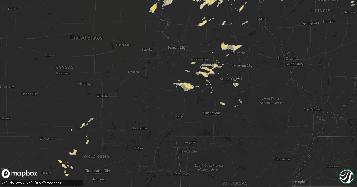
June 16 map
$229
one time, instant access
Download today. No call, no setup
Keep the $229
Bought the map and want the full workflow? Apply the entire $229 to a subscription within 7 days. None of it is wasted.
Every map, not just this one
This buys you this map. Subscription and you get every map we run, in the markets you choose from a few cities to whole states to nationwide. Plus real-time alerts the moment a storm fires.
Contact data
Name, contact info, occupancy, even credit band for addresses in the footprint. You go from where it hit to who to call.
Become the source they trust
Unlimited branding weather history reports on demand. You already have the documented answer ready for the property owner, and you are the one who showed up with it.
Property data and RoofTrace estimates
Pull up any address you have got, its value and the exact code rules for that jurisdiction, straight from One Click Code. Then RoofTrace estimates the squares, pitch, and roof value, priced the way you price.
Storm reports in Michigan
Michigan
| Date | Description |
|---|---|
| 06/16/20124:57 PM CDT | A couple trees are down in the area. Unknown health/size. |
| 06/16/20124:40 PM CDT | Tree came down in north park and took down some wires with it. Report courtesy of woodtv. |
| 06/16/20124:40 PM CDT | At least two trees down in the westgate area of comstock park and a couple trees down at the maranantha church campground area in comstock park. Time approximate. |
| 06/16/20124:38 PM CDT | A large tree came down and power lines are down as well. |
| 06/16/20124:30 PM CDT | Two trees came down near walker city hall. Report relayed by woodtv. |
| 06/16/20124:30 PM CDT | Power lines down in kent city. |
| 06/16/20124:30 PM CDT | The top of a four foot diameter tree down near seventh street and covell. The top of a three foot diameter tree down near seventh street and oakhurst. Both trees appear |
| 06/16/20124:20 PM CDT | Large healthy tree branch 15 inches in diameter down on a house. Numerous other branches down in area. |
| 06/16/20124:09 PM CDT | Multiple healthy 6 inch to 12 inch diameter trees down near zeeland. |
| 06/16/20124:03 PM CDT | Wind gust at holland asos. |
| 06/16/20123:55 PM CDT | Tree damage. Healthy 2 foot diameter branch and 18 inch diameter trunk snapped off. Weather station anemometer registered 98 mph wind. No structural damage noted. High |
| 06/16/20123:55 PM CDT | A local report indicates 1.25 inch wind near NEW BUFFALO |
| 06/16/20123:55 PM CDT | Tree down on 126th ave south of saugatuck. Health unknown. Report relayed by woodtv. |
All States Impacted by Hail Map on June 16, 2012
Cities Impacted by Hail Map on June 16, 2012
- Electra, TX
- Davidson, OK
- Oklaunion, TX
- Harrold, TX
- Lincoln, MO
- Cole Camp, MO
- Merrillville, IN
- Crown Point, IN
- Fayette, MO
- Abingdon, IL
- Gilson, IL
- Knoxville, IL
- London Mills, IL
- Maquon, IL
- Saint Augustine, IL
- Saunemin, IL
- Altona, IL
- Thomas, OK
- Weatherford, OK
- Lowell, IN
- Henryville, IN
- Memphis, IN
- Galesburg, IL
- Bucklin, MO
- New Cambria, MO
- Harrisburg, MO
- Hallsville, MO
- Columbia, MO
- Sturgeon, MO
- Metamora, IL
- Lowpoint, IL
- New Buffalo, MI
- Wetmore, CO
- Smithton, MO
- Stockport, IA
- Milton, IA
- Memphis, MO
- Cantril, IA
- Keosauqua, IA
- Birmingham, IA
- Douds, IA
- Blackstone, IL
- Pritchett, CO
- West Point, IA
- Saint Paul, IA
- East Galesburg, IL
- Hereford, TX
- Fowler, CO
- Avondale, CO
- Mount Ayr, IA
- Redding, IA
- Essex, IL
- Humansville, MO
- Haskell, TX
- Weinert, TX
- Meadow, TX
- Wilson, TX
- Tahoka, TX
- Covington, IN
- Veedersburg, IN
- West Lebanon, IN
- Williamsport, IN
- Attica, IN
- Sugar City, CO
- Bloomfield, IA
- Hamlin, TX
- Caldwell, KS
- Sardinia, OH
- Mount Orab, OH
- Princeton, MO
- Yoder, CO
- Mora, MO
- Sedalia, MO
- Mooresville, MO
- Utica, MO
- Chillicothe, MO
- Okeene, OK
- El Dorado Springs, MO
- Walker, MO
- Schell City, MO
- Harwood, MO
- Rockville, MO
- Richards, MO
- Rich Hill, MO
- Cotopaxi, CO
- Loveland, OK
- Wakita, OK
- Canyon, TX
- Maryville, MO
- Kellerton, IA
- Wilmington, IL
- Reddick, IL
- Bonfield, IL
- Gardner, IL
- Gowen, MI
- Lakeview, MI
- Stanton, MI
- Trufant, MI
- Seymour, TX
- Goree, TX
- Coatsville, MO
- Glenwood, MO
- Moulton, IA
- Gladstone, IL
- Stronghurst, IL
- Kankakee, IL
- Chebanse, IL
- Winchester, OH
- Hurdland, MO
- Baring, MO
- Edina, MO
- Hoopeston, IL
- Dwight, IL
- Milton, IN
- Cambridge City, IN
- Connersville, IN
- Pueblo, CO
- Friona, TX
- Conchas Dam, NM
- Kent City, MI
- Eagleville, MO
- Davis City, IA
- Cainsville, MO
- Blythedale, MO
- Clinton, MO
- Maysville, KY
- Raton, NM
- Colony, OK
- Hydro, OK
- Nash, OK
- Georgetown, OH
- Russellville, OH
- Franklin, MO
- Glasgow, MO
- Cedar Lake, IN
- Albia, IA
- Moravia, IA
- Ambia, IN
- Fowler, IN
- Sand Lake, MI
- Pierson, MI
- Aspermont, TX
- Blakesburg, IA
- Shepherd, TX
- Hebron, IN
- Whitesboro, TX
- Gordonville, TX
- Tucson, AZ
- Grand River, IA
- Van Wert, IA
- Unionville, MO
- Pollock, MO
- Lucerne, MO
- Powersville, MO
- Portales, NM
- Brimfield, IL
- Elmwood, IL
- Williamsfield, IL
- Laura, IL
- Niangua, MO
- Conway, MO
- Oneida, IL
- Enid, OK
- Waukomis, OK
- Benton, IA
- New Franklin, MO
- Gilliam, MO
- Slater, MO
- Rocheport, MO
- Centralia, MO
- Mercer, MO
- Newtown, MO
- Dimmitt, TX
- Paducah, TX
- Old Glory, TX
- Warsaw, MO
- Tuscumbia, MO
- Saint Elizabeth, MO
- O'Brien, TX
- Merkel, TX
- Floyd, NM
- Yates City, IL
- Farmington, IL
- Hermitage, MO
- Pittsburg, MO
- Forrest, IL
- Cullom, IL
- Fairbury, IL
- Custer City, OK
- Ropesville, TX
- Milford, IL
- Cissna Park, IL
- Onarga, IL
- Loda, IL
- Buckley, IL
- Brownfield, TX
- Rensselaer, IN
- Bedford, IA
- Vega, TX
- Floris, IA
- Pulaski, IA
- Moscow, TX
- Blockton, IA
- Pickering, MO
- Parnell, MO
- Hopkins, MO
- Sheridan, MO
- Happy, TX
- Springfield, CO
- Crowell, TX
- Lamoni, IA
- Redkey, IN
- Ridgeville, IN
- Albany, IN
- Parker City, IN
- Downing, WI
- Glenwood City, WI
- Boyceville, WI
- Queen City, MO
- Livonia, MO
- Summerfield, TX
- Cameron, IL
- Avon, IL
- Berwick, IL
- Wataga, IL
- Walters, OK
- Rulo, NE
- Geary, OK
- Mosquero, NM
- Chanute, KS
- Downing, MO
- Windsor, MO
- Green Valley, AZ
- Calhoun, MO
- Rossville, IL
- Tarkio, MO
- Cache, OK
- Peoria, IL
- Dunlap, IL
- Edwards, IL
- Mapleton, IL
- Faxon, OK
- Iberia, MO
- Chattanooga, OK
- Grandfield, OK
- Florence, MO
- Stover, MO
- Versailles, MO
- Leeton, MO
- Green Ridge, MO
- Fortuna, MO
- Colorado City, CO
- Rye, CO
- Beulah, CO
- Garita, NM
- Jamestown, OH
- Port William, OH
- Wilmington, OH
- Ionia, MO
- Deepwater, MO
- Schneider, IN
- Momence, IL
- Grant Park, IL
- Lake Village, IN
- Pembroke Township, IL
- Leon, IA
- Ridgeway, MO
- Falls City, NE
- Fairfax, MO
- Craig, MO
- Kim, CO
- Medaryville, IN
- Francesville, IN
- Hillsboro, OH
- Washburn, IL
- Watonga, OK
- Lomax, IL
- Arlington, CO
- Greentop, MO
- Black River Falls, WI
- Hume, MO
- Prescott, KS
- Fulton, KS
- Nevada, MO
- Agency, IA
- Ottumwa, IA
- Lawton, OK
- Mountain View, OK
- Carnegie, OK
- Apache, OK
- Princeville, IL
- Hoffman Estates, IL
- Streamwood, IL
- Hanover Park, IL
- Schaumburg, IL
- Seymour, IA
- Manito, IL
- Brashear, MO
- Marshfield, MO
- Ludlow, IL
- Paxton, IL
- Fairview, IL
- Bailey, CO
- La Porte, IN
- Michigan City, IN
- Boswell, IN
- Perrysville, IN
- Alvin, IL
- Mountain Grove, MO
- Swan River, MN
- Westcliffe, CO
- Maxwell, NM
- Springer, NM
- Dickens, TX
- Avery, TX
- Peotone, IL
- Manhattan, IL
- Lubbock, TX
- Munday, TX
- Otterville, MO
- Dixon, MO
- Dahinda, IL
- Fairborn, OH
- Yellow Springs, OH
- Mound City, MO
- Rule, TX
- Media, IL
- Carman, IL
- Raritan, IL
- Burlington, IA
- Biggsville, IL
- Medford, OK
- Aroma Park, IL
- Herscher, IL
- Clifton, IL
- Bradley, IL
- Saint Anne, IL
- Bourbonnais, IL
- Sidney, OH
- Rochester, TX
- Groveton, TX
- Kirksville, MO
- Corydon, IA
- Butler, MO
- Skidmore, MO
- Mount Pleasant, IA
- Hillsboro, IA
- New London, IA
- Salem, IA
- Selma, IA
- Ludlow, MO
- Denver City, TX
- Seagraves, TX
- Syracuse, MO
- Vernon, TX
- Hillsboro, IN
- Newtown, IN
- Mellott, IN
- Henning, IL
- Waynetown, IN
- Glenview, IL
- Northbrook, IL
- Monmouth, IL
- Alexis, IL
- Gerlaw, IL
- Trivoli, IL
- Enon, OH
- Bunceton, MO
- Boonville, MO
- Cherokee, OK
- Springfield, OH
- Pecos, TX
- Wallingford, KY
- Flemingsburg, KY
- Harris, MO
- Green City, MO
- Spickard, MO
- Two Buttes, CO
- Milan, MO
- Melrose, NM
- Mcadoo, TX
- Kewanna, IN
- Muleshoe, TX
- Martinsville, OH
- Lynchburg, OH
- New Vienna, OH
- Centerville, IA
- Abilene, TX
- Mount Prospect, IL
- Prospect Heights, IL
- Barnett, MO
- Rocky Mount, MO
- Eldon, MO
- Louisville, NE
- Springfield, NE
- South Bend, NE
- Ashland, NE
- Gretna, NE
- Champaign, IL
- Danville, IA
- Grenville, NM
- Rutledge, MO
- Novelty, MO
- Union Pier, MI
- Dyer, IN
- Crete, IL
- Chicago Heights, IL
- Lineville, IA
- Brumley, MO
- Hartville, MO
- Cedar Springs, MI
- Coral, MI
- Greenville, MI
- Ellston, IA
- Kirkwood, IL
- Centerview, MO
- Holden, MO
- Sahuarita, AZ
- Newburg, MO
- Tulia, TX
- Luray, MO
- Corn, OK
- Osceola, MO
- Shelbyville, MO
- Lentner, MO
- Rolling Meadows, IL
- Arlington Heights, IL
- Wheatland, MO
- Cross Timbers, MO
- Linneus, MO
- Purdin, MO
- Decatur, IA
- Arbela, MO
- Sabina, OH
- Leesburg, OH
- Walsh, CO
- Ocate, NM
- Valparaiso, IN
- Allerton, IA
- Dunkirk, IN
- Farmland, IN
- Hitchcock, OK
- Newkirk, NM
- Monon, IN
- McCaulley, TX
- Sonoita, AZ
- Patagonia, AZ
- Ancona, IL
- South Bend, IN
- Lakeville, IN
- Verdigre, NE
- Buchanan, MI
- Galien, MI
- Tucumcari, NM
- Ashkum, IL
- Amarillo, TX
- Goodland, IN
- Brook, IN
- Trenton, MO
- Green Castle, MO
- Exline, IA
- Maitland, MO
- Gifford, IL
- Rantoul, IL
- Earl Park, IN
- Sheldon, IL
- Rio, IL
- Manteno, IL
- Cabery, IL
- Martinton, IL
- Danforth, IL
- Emington, IL
- Campus, IL
- Buckingham, IL
- Bonaparte, IA
- Hale Center, TX
- Oak Creek, WI
- Racine, WI
- Caledonia, WI
- Bevier, MO
- Macon, MO
- Tioga, TX
- Streator, IL
- Wenona, IL
- Long Point, IL
- Dana, IL
- Mindenmines, MO
- West Liberty, KY
- Donnellson, IA
- Crocker, MO
- Richland, MO
- Canton, OK
- Quincy, OH
- Maplewood, OH
- Unionville, IA
- Murdock, NE
- Glasford, IL
- Hedrick, IA
- Ethel, MO
- Talihina, OK
- Gary, IN
- Plainview, TX
- Conifer, CO
- Chula, MO
- Falcon, MO
- Plato, MO
- Beecher, IL
- Macomb, IL
- Wheeling, MO
- Cincinnati, IA
- Seymour, IN
- Ulman, MO
- Winfield, IA
- Mount Union, IA
- Morning Sun, IA
- Erie, KS
- Galesburg, KS
- Hope, IN
- Medway, OH
- Brookville, IN
- Roseville, IL
- Gorin, MO
- Knox City, TX
- Jet, OK
- Elkland, MO
- Ravenwood, MO
- Burlington Junction, MO
- Montpelier, IA
- Blue Grass, IA
- Muscatine, IA
- Sweet Springs, MO
- Farwell, TX
- Hanna City, IL
- Clearmont, MO
- Midland, OH
- Bolivar, MO
- Polk, MO
- Las Animas, CO
- Varna, IL
- East Peoria, IL
- Lacon, IL
- Blanchester, OH
- Manzanola, CO
- Mayslick, KY
- North Henderson, IL
- Hinton, OK
- Wyoming, IL
- Quincy, MO
- Glencoe, NM
- Ruidoso, NM
- Sylvester, TX
- Breckenridge, MO
- Bainbridge, OH
- Greenfield, OH
- Canon City, CO
- Toluca, IL
- Kremlin, OK
- Mcgregor, MN
- Atoka, OK


