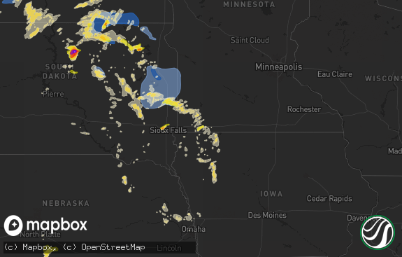
Hail Map in Indiana on June 13, 2018
The weather event in Indiana on June 13, 2018 includes Hail map. 24 states and 508 cities were impacted and suffered possible damage. The total estimated number of properties impacted is 0.

Hail
0
Estimated number of impacted properties by a 1.00" hail or larger0
Estimated number of impacted properties by a 1.75" hail or larger0
Estimated number of impacted properties by a 2.50" hail or largerStorm reports in Indiana
Indiana
| Date | Description |
|---|---|
| 06/13/20186:10 PM CDT | A few trees and power lines down in by the fairgrounds. Time roughly estimated from radar. Relayed by wdrb 41 louisville. |
| 06/13/20182:40 PM CDT | Tree fell onto car in kroger parking lot. No injuries. |
| 06/13/20182:26 PM CDT | Several trees and power lines down as well as barn damage east of county road 150 east on county road 900 north. Appears to be straight line wind damage. Relayed from l |
| 06/13/201812:49 AM CDT | At 548 PM EDT, a severe thunderstorm was located near North Vernon, or 15 miles northeast of Seymour, moving southeast at 20 mph. HAZARD...60 mph wind gusts and quarter size hail. SOURCE...Radar indicated. IMPACT...Hail damage to vehicles is expected. Expect wind damage to roofs, siding, and trees. Locations impacted include... Columbus, North Vernon, Elizabethtown, Jonesville, Azalia, Newbern, Country Squire Lakes, Grammer and Taylorsville.This includes Interstate 65 between mile markers 57 and 73. |
| 06/12/201811:36 PM CDT | At 436 PM EDT, a severe thunderstorm was located near Greensburg, or 14 miles southeast of Shelbyville, moving southeast at 25 mph. HAZARD...60 mph wind gusts and penny size hail. SOURCE...Radar indicated. IMPACT...Expect damage to roofs, siding, and trees. Locations impacted include... Greensburg, Adams, Milford, St. Paul, Millhousen, Newpoint, Clarksburg, Burney, Lake Santee and Sandusky.This includes Interstate 74 between mile markers 123 and 144. |
| 06/12/20187:40 PM CDT | State trooper reported trees down in the milltown area. |
| 06/12/20187:00 PM CDT | Report of trees down with several snapped. Time approximated based on radar... As a couple of waves went through... One at 757 pm and a second by 8:14 pm. |
All States Impacted by Hail Map on June 13, 2018
Cities Impacted by Hail Map on June 13, 2018
- Albert City, IA
- Emmetsburg, IA
- Graettinger, IA
- Fenton, IA
- Cylinder, IA
- Ringsted, IA
- Burke, SD
- Ola, AR
- Eads, CO
- Vernon, TX
- Benton, AR
- Peterson, IA
- Brant Lake, NY
- Alexander, AR
- Saint Francis, SD
- Addison, NY
- Woodhull, NY
- Eldorado, OH
- West Manchester, OH
- New Madison, OH
- Arlington, IN
- Rushville, IN
- Jonesville, LA
- Norway, KS
- Cambridge, IA
- Maxwell, IA
- Deming, NM
- El Dorado, AR
- Laurel, IA
- Haverhill, IA
- Marshalltown, IA
- Gilman, IA
- Yuma, CO
- La Luz, NM
- Anguilla, MS
- Dover, AR
- Russellville, AR
- Elmer, OK
- Sanborn, IA
- Saint Cloud, FL
- Ozark, MO
- Mount Ida, AR
- Story, AR
- Machias, NY
- West Valley, NY
- Delevan, NY
- Adrian, MN
- Greenbrier, AR
- Hamburg, AR
- Jones, LA
- Bonita, LA
- Kingfisher, OK
- Little Rock, AR
- Otis, CO
- Fountain Hill, AR
- Wilmar, AR
- Hermitage, AR
- Hope, IN
- Greensburg, IN
- Columbus, IN
- Ramah, CO
- Rush, CO
- Hugo, CO
- Evansville, IN
- Haigler, NE
- Yoder, CO
- Sutherland, IA
- Hollandale, MS
- Eckley, CO
- Dallas, SD
- Winner, SD
- Colome, SD
- Cowansville, PA
- Kittanning, PA
- Manson, IA
- Orleans, IN
- Kirbyville, MO
- Louise, MS
- Valmora, NM
- Pine Bluff, AR
- Haubstadt, IN
- Fort Branch, IN
- Ruthven, IA
- Runnells, IA
- Prairie City, IA
- Ocate, NM
- Mora, NM
- Sheridan, AR
- Clarendon, AR
- Fort Dodge, IA
- Duncombe, IA
- Vincent, IA
- Webster City, IA
- Woolstock, IA
- Webb, IA
- Alamogordo, NM
- Nenzel, NE
- Kilgore, NE
- Urbana, OH
- Springfield, OH
- Saint Paris, OH
- Valley Springs, AR
- Yellville, AR
- Saint Joe, AR
- Pyatt, AR
- Harrison, AR
- Everton, AR
- Saint Paul, IN
- Westport, IN
- Chillicothe, OH
- Londonderry, OH
- Callender, IA
- Moorland, IA
- Logan, OH
- Sugar Grove, OH
- Rockbridge, OH
- Greenville, MS
- Whiteland, IN
- Greenwood, IN
- Harrisburg, IL
- Hartsville, IN
- Moville, IA
- Surrency, GA
- Odum, GA
- Mission, SD
- Scipio, IN
- Grammer, IN
- Elizabethtown, IN
- Hardinsburg, KY
- Pen Argyl, PA
- Bangor, PA
- Bauxite, AR
- Leola, AR
- Hampton, AR
- Calion, AR
- Jolley, IA
- Lake View, IA
- Auburn, IA
- Lytton, IA
- Rockwell City, IA
- Sac City, IA
- Alvord, IA
- Rock Rapids, IA
- Ellsworth, MN
- Simla, CO
- Matheson, CO
- Owensboro, KY
- Reed, KY
- Henderson, KY
- Hatch, NM
- Arrey, NM
- Wiggins, MS
- Brooklyn, MS
- Lexa, AR
- Arkadelphia, AR
- Heltonville, IN
- Norman, IN
- Paron, AR
- Conway, AR
- Kingsley, IA
- Marcus, IA
- Nineveh, IN
- Edinburgh, IN
- Jackson, OH
- Minford, OH
- Beaver, OH
- Peel, AR
- Port Orange, FL
- Franklinville, NY
- Knierim, IA
- Otho, IA
- Somers, IA
- Barnum, IA
- Sheffield, IA
- Burnside, IA
- Lehigh, IA
- Gowrie, IA
- Kimbolton, OH
- Lore City, OH
- Piedmont, OH
- Freeport, OH
- Watonga, OK
- Bigelow, MN
- Worthington, MN
- Altheimer, AR
- Lake Andes, SD
- Pierson, IA
- Silver Bay, NY
- Putnam Station, NY
- Hague, NY
- Grove City, PA
- Kanawha, IA
- Star City, AR
- Sioux Rapids, IA
- Houghton, NY
- Rushford, NY
- Freedom, NY
- Farmersville Station, NY
- Springville, NY
- Cuba, NY
- Caneadea, NY
- Omaha, AR
- Lead Hill, AR
- Paullina, IA
- Cleghorn, IA
- Wood, SD
- Okreek, SD
- Pocahontas, IA
- Pomeroy, IA
- Palmer, IA
- Highlandville, MO
- Poyen, AR
- Malvern, AR
- Churdan, IA
- Atlantic Beach, FL
- Lamar, IN
- Ayrshire, IA
- Flippin, AR
- Chicora, PA
- Karns City, PA
- Rimersburg, PA
- Rural Valley, PA
- Manorville, PA
- Fenelton, PA
- Ford City, PA
- Dayton, PA
- East Brady, PA
- Templeton, PA
- Worthington, PA
- Adrian, PA
- Monroe, IA
- Richland, IN
- Mena, AR
- Rison, AR
- Shaw, MS
- Freetown, IN
- Sibley, IA
- Mellwood, AR
- Larrabee, IA
- Kingston, OH
- Socorro, NM
- Tipton, OK
- Rolling Fork, MS
- Christiansburg, OH
- Casstown, OH
- Fletcher, OH
- Conover, OH
- Monticello, AR
- Milroy, IN
- Bulger, PA
- Burgettstown, PA
- Linn Grove, IA
- Harrold, TX
- Oklaunion, TX
- Vilonia, AR
- Enola, AR
- Trafalgar, IN
- Morgantown, IN
- Nashville, IN
- Jonesville, IN
- Kelley, IA
- Primghar, IA
- Hartley, IA
- Titonka, IA
- Buffalo Center, IA
- Rye, CO
- Madrid, IA
- Warren, AR
- Mount Vernon, IN
- Tichnor, AR
- Snow Lake, AR
- Leland, MS
- Wagon Mound, NM
- Boone, IA
- Bloomingburg, OH
- Laurens, IA
- Havelock, IA
- Fonda, IA
- Altus, OK
- Odell, TX
- Portsmouth, OH
- Wheelersburg, OH
- Bradford, OH
- Covington, OH
- Bristow, IN
- Camden, OH
- French Lick, IN
- Wabbaseka, AR
- Stuttgart, AR
- Granville, IA
- Greenville, IA
- Spencer, IA
- Cherokee, IA
- Archer, IA
- Bronson, IA
- Hornick, IA
- Meriden, IA
- Aurelia, IA
- Royal, IA
- Remsen, IA
- Anthon, IA
- Ashton, IA
- Sheldon, IA
- Correctionville, IA
- Oxford, NJ
- Wray, CO
- Canal Winchester, OH
- Shelbyville, IN
- Frederick, OK
- Theresa, NY
- Duncan, MS
- Alligator, MS
- Clarksdale, MS
- Greenville, OH
- Murdo, SD
- Lucasville, OH
- Franklin Furnace, OH
- Ames, IA
- Carriere, MS
- Lonsdale, AR
- Traskwood, AR
- New Matamoras, OH
- Paducah, TX
- Farnhamville, IA
- Baxter, IA
- Stratford, IA
- Washington, IN
- Calhoun, KY
- Utica, KY
- New Smyrna Beach, FL
- Avondale, CO
- Robertsdale, AL
- Cimarron, NM
- Martinsville, IN
- Brownstown, IN
- Holman, NM
- Chamisal, NM
- Chacon, NM
- Hockley, TX
- Fowler, CO
- Story City, IA
- Mercer, PA
- Franklin, IN
- Damascus, AR
- Tularosa, NM
- Lindsay, NE
- Geddes, SD
- Seymour, IN
- Schnellville, IN
- Celestine, IN
- Birdseye, IN
- Saint Anthony, IN
- Ferdinand, IN
- Bedford, IN
- Little Rock, IA
- George, IA
- Belfast, NY
- Angelica, NY
- Mer Rouge, LA
- Omega, OK
- High Rolls Mountain Park, NM
- Gregory, SD
- Colfax, IA
- Irene, SD
- Altoona, IA
- Badger, IA
- Clare, IA
- Humboldt, IA
- Norris City, IL
- Bancroft, IA
- Lone Rock, IA
- Montrose, AR
- Sims, AR
- Danville, AR
- Curlew, IA
- Elkhart, IA
- Bondurant, IA
- Lancaster, OH
- Carroll, OH
- Eaton, OH
- Kit Carson, CO
- Galva, IA
- Shirley, IN
- New Castle, IN
- Kennard, IN
- Hays, KS
- Santa Rosa, NM
- Bonita Springs, FL
- Lismore, MN
- Chandler, MN
- Edgerton, MN
- Doon, IA
- Flat Rock, IN
- Indianapolis, IN
- Griffithville, AR
- Ogden, IA
- Mount Bethel, PA
- Saylorsburg, PA
- Brodheadsville, PA
- Saint Augustine, FL
- Huxley, IA
- Polk City, IA
- Bouton, IA
- Grimes, IA
- Granger, IA
- Dallas Center, IA
- Luther, IA
- Slater, IA
- Woodward, IA
- Harris, IA
- Mitchellville, IA
- Commiskey, IN
- Hollister, MO
- Waldron, AR
- Des Arc, AR
- Pueblo, CO
- Medora, IN
- Marion, LA
- Vicksburg, MS
- Conyers, GA
- Minburn, IA
- Collins, IA
- Abbeville, LA
- Lehigh Acres, FL
- North Vernon, IN
- Morganfield, KY
- Norman, AR
- South Charleston, OH
- South Solon, OH
- Magnolia, TX
- White River, SD
- Fort Myers, FL
- Rome, IN
- Cannelton, IN
- Stephensport, KY
- Raleigh, IL
- Eldorado, IL
- Dickens, IA
- Marathon, IA
- Parrish, FL
- Wimauma, FL
- Petersburg, IN
- Uniontown, KY
- Rohwer, AR
- Quanah, TX
- Mallard, IA
- Tunnelton, IN
- Pomeroy, OH
- Albany, OH
- New Paris, OH
- Mitchell, IN
- Lohrville, IA
- Camden, AR
- La Fargeville, NY
- Clayton, NY
- Kiowa, CO
- Elnora, IN
- Okaton, SD
- Cloverport, KY
- Hawesville, KY
- Richfield Springs, NY
- Ribera, NM
- Bradenton, FL
- Ransom, KS
- Huntingburg, IN
- Dale, IN
- Watson, AR
- Florence, VT
- Castleton, VT
- Lewisville, IN
- Knightstown, IN
- Paoli, IN
- Dubois, IN
- Maurice, LA
- Marshall, AR
- Evanston, IN
- Saint Meinrad, IN
- Schaller, IA
- Sherwood, AR
- Rushmore, MN
- Wilmont, MN
- Reading, MN
- Battle Creek, IA
- Tillar, AR
- Prattsville, AR
- Storm Lake, IA
- Rembrandt, IA
- Alta, IA
- Truesdale, IA
- Hillsboro, NM
- Spiceland, IN
- Cleveland, MS
- Boyle, MS
- Plainville, KS
- Stockton, KS
- Colorado City, CO
- Wilkes Barre, PA
- East Concord, NY
- Fillmore, NY
- Allen, SD
- Tuthill, SD
- Martin, SD
- Cody, NE
- Crookston, NE
- Merriman, NE
- Norris, SD
- Long Valley, SD
- Bastrop, LA


