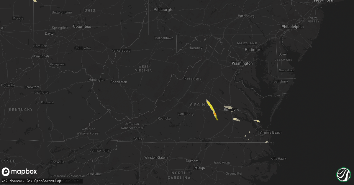
Hail Map in Virginia on June 12, 2022
Get this storm
June 12 map
$229
one time, instant access
Download today. No call, no setup
Keep the $229
Bought the map and want the full workflow? Apply the entire $229 to a subscription within 7 days. None of it is wasted.
Every map, not just this one
This buys you this map. Subscription and you get every map we run, in the markets you choose from a few cities to whole states to nationwide. Plus real-time alerts the moment a storm fires.
Contact data
Name, contact info, occupancy, even credit band for addresses in the footprint. You go from where it hit to who to call.
Become the source they trust
Unlimited branding weather history reports on demand. You already have the documented answer ready for the property owner, and you are the one who showed up with it.
Property data and RoofTrace estimates
Pull up any address you have got, its value and the exact code rules for that jurisdiction, straight from One Click Code. Then RoofTrace estimates the squares, pitch, and roof value, priced the way you price.
Storm reports in Virginia
Virginia
| Date | Description |
|---|---|
| 06/12/20226:50 PM CDT | Multiple reports of trees down near clinton. |
| 06/12/20226:08 PM CDT | Numerous trees down. |
| 06/12/20225:53 PM CDT | Multiple trees down around bremo bluff. |
| 06/12/202211:40 AM CDT | Trees down in the north river area. |
| 06/12/202211:18 AM CDT | Tree down across brockwell road. |
| 06/12/202211:03 AM CDT | Tree down near courthouse rd and prince george drive. |
| 06/12/202210:30 AM CDT | Numerous trees down throughout the county. Time estimated by radar. |
| 06/12/202210:00 AM CDT | Trees down on powerlines on the north side of richmond. |
| 06/12/20229:55 AM CDT | Numerous trees down across the central part of henrico county. |
| 06/12/20229:50 AM CDT | Trees down in the area of three chopt road and cary street. |
| 06/12/20227:46 AM CDT | At 1246 PM EDT, a severe thunderstorm was located 8 miles southeast of Marion Station, or 11 miles southwest of Pocomoke City, moving east at 30 mph. HAZARD...60 mph wind gusts and penny size hail. SOURCE...Radar indicated. IMPACT...Expect damage to trees and powerlines. This severe thunderstorm will remain over mainly rural areas of southeastern Somerset, southern Worcester and northern Accomack Counties, including the following locations... Horntown, Hallwood, Mappsville, Byrdtown, Hopewell, Greenbackville, Rehobeth, Saxis, Wallops Island and Temperanceville. |
| 06/12/20227:30 AM CDT | At 1229 PM EDT, severe thunderstorms were located along a line extending from near Hartfield to near Gloucester Courthouse to Queens Lake, moving east at 30 mph. HAZARD...60 mph wind gusts and penny size hail. SOURCE...Radar indicated. IMPACT...Expect damage to trees and powerlines. Severe thunderstorms will be near... Hayes around 1235 PM EDT. Virginia Institute For Marine Sciences, Gloucester Point, Wicomico and Blakes around 1245 PM EDT. Mathews, Achilles and Mobjack around 1250 PM EDT. Seaford and Gwynn around 1255 PM EDT. Bavon around 100 PM EDT.Other locations impacted by these severe thunderstorms includeLackey, Ruff, Beulah, Moon, Laban, Camp Peary, Glass, Naxera, Harcumand Cash. |
| 06/12/20227:00 AM CDT | At 1200 PM EDT, a severe thunderstorm was located over Prince George, or over Fort Lee, moving southeast at 15 mph. HAZARD...60 mph wind gusts and quarter size hail. SOURCE...Radar indicated. IMPACT...Minor damage to vehicles is possible. Expect wind damage to trees and powerlines. This severe thunderstorm will be near... Garysville around 1220 PM EDT. Disputanta around 1225 PM EDT. Burrowsville around 1235 PM EDT. Waverly and Cabin Point around 1245 PM EDT.Other locations impacted by this severe thunderstorm include TaylorsCorner, Carsley, Birchett Estate, Spring Grove, Brandon, Jordan PointCountry Club, Petersburg National Battlefield, Barham, New Bohemiaand Richard Bland College. |
| 06/12/20226:46 AM CDT | At 1146 AM EDT, severe thunderstorms were located along a line extending from New Kent to near Holdcroft to near Charles City, moving east at 40 mph. HAZARD...60 mph wind gusts and penny size hail. SOURCE...Radar indicated. IMPACT...Expect damage to trees and powerlines. Severe thunderstorms will be near... Holdcroft around 1150 AM EDT. Toano, Rustic and Barhamsville around 1200 PM EDT. Claremont and Norge around 1205 PM EDT. Williamsburg and College Of William And Mary around 1210 PM EDT. Surry, Queens Lake and York Terrace around 1215 PM EDT. Jamestown and Scotland around 1220 PM EDT. Gloucester Courthouse, Kings Point and Carver Gardens around 1225 PM EDT. Gloucester Point, Hayes, Busch Gardens and Grove around 1230 PM EDT.Other locations impacted by these severe thunderstorms includeEltham, Chickahominy Shore, Croaker, Chippokes State Park, CampPeary, Lanexa, Ewell, Poolesville, Warren Mill and Allmondsville. |
| 06/12/20226:10 AM CDT | At 1110 AM EDT, severe thunderstorms were located along a line extending from near Mechanicsville to Bellwood, moving east at 30 mph. HAZARD...60 mph wind gusts and nickel size hail. SOURCE...Radar indicated. IMPACT...Expect damage to trees and powerlines. Severe thunderstorms will be near... Bottoms Bridge around 1125 AM EDT. Tunstall around 1130 AM EDT. Roxbury around 1135 AM EDT. Talleysville and Jordans Point around 1140 AM EDT. Adkins Store and Providence Forge around 1145 AM EDT. New Kent and Charles City around 1150 AM EDT. Ruthville around 1155 AM EDT.Other locations impacted by these severe thunderstorms includeWayside, Richmond Heights, Mountcastle, Elko, Cohoke, Sandston,Glendale, Westwood, Richmond International and Colonial Downs. |
| 06/12/20225:38 AM CDT | At 1038 AM EDT, severe thunderstorms were located along a line extending from near Glen Allen to near Tuckahoe to near Sabot, moving east at 30 mph. HAZARD...60 mph wind gusts. SOURCE...Radar indicated. IMPACT...Expect damage to trees and powerlines. Severe thunderstorms will be near... Ashland, Randolph Macon College, Glen Allen and Laurel around 1045 AM EDT. Richmond and Lakeside around 1050 AM EDT. Hanover around 1055 AM EDT. Bon Air, Mechanicsville and East Highland Park around 1100 AM EDT. University Of Richmond and Studley around 1105 AM EDT. Downtown Richmond around 1110 AM EDT. Virginia Commonwealth University, Virginia Union University and Bensley around 1115 AM EDT. Manquin around 1120 AM EDT.Other locations impacted by these severe thunderstorms includeEnfield, Central Garage, Richmond Heights, Hanover Airport,Midlothian, Elmont, Etna Mills, Short Pump, Montrose and Subletts. |
| 06/12/20223:59 AM CDT | At 858 PM EDT, severe thunderstorms were located along a line extending from near Spainville to 6 miles south of Amelia Courthouse, moving south to southeast at 15 to 20 mph. HAZARD...60 mph wind gusts and quarter size hail. SOURCE...Radar indicated. IMPACT...Minor damage to vehicles is possible. Expect wind damage to trees and powerlines. Severe thunderstorms will be near... Spainville around 915 PM EDT. Blackstone and Wilsons around 925 PM EDT. Fort Pickett around 940 PM EDT.Other locations impacted by these severe thunderstorms includeWellville, North Wellville, Dominy Corner, Hebron, Earls, Clay Store,Blackstone Airport, Denaro, Pattersons Store and Darvills. |
| 06/12/20223:41 AM CDT | At 841 PM EDT, a severe thunderstorm was located 8 miles west of Boswells Tavern, or 8 miles east of Charlottesville, moving southeast at 20 mph. HAZARD...60 mph wind gusts and quarter size hail. SOURCE...Radar indicated. IMPACT...Damaging winds will cause some trees and large branches to fall. This could injure those outdoors, as well as damage homes and vehicles. Roadways may become blocked by downed trees. Localized power outages are possible. Unsecured light objects may become projectiles. Locations impacted include... Campbell, Cobham, Stony Point and Cismont. |
| 06/12/20223:14 AM CDT | At 814 PM EDT, severe thunderstorms were located along a line extending from near Amelia Courthouse to near Morven, moving southeast at 20 mph. HAZARD...60 mph wind gusts and quarter size hail. SOURCE...Radar indicated. IMPACT...Minor damage to vehicles is possible. Expect wind damage to trees and powerlines. Severe thunderstorms will be near... Amelia Courthouse and Chula around 830 PM EDT. Scotts Fork around 840 PM EDT. Mannboro around 855 PM EDT. Blackstone, Spainville and Wilsons around 900 PM EDT.Other locations impacted by these severe thunderstorms includeWellville, North Wellville, Maplewood, Earls, Ammon, Lodore,Truxillo, Clay Store, Giles Mill and Denaro. |
| 06/12/20223:02 AM CDT | At 801 PM EDT, a severe thunderstorm was located near Free Union, or 10 miles north of Charlottesville, moving southeast at 20 mph. HAZARD...60 mph wind gusts and quarter size hail. SOURCE...Radar indicated. IMPACT...Damaging winds will cause some trees and large branches to fall. This could injure those outdoors, as well as damage homes and vehicles. Roadways may become blocked by downed trees. Localized power outages are possible. Unsecured light objects may become projectiles. Locations impacted include... Campbell, Hollymead, Cobham, Cismont, Boyd Tavern, Keswick, Stony Point, Advance Mills, Earlysville, Amicus and Carrsbrook. |
| 06/12/20222:19 AM CDT | At 718 PM EDT, a severe thunderstorm was located near Lakeside Village, or near Cartersville, moving southeast at 20 mph. HAZARD...60 mph wind gusts and quarter size hail. SOURCE...Radar indicated. IMPACT...Minor damage to vehicles is possible. Expect wind damage to trees and powerlines. This severe thunderstorm will be near... Trenholm around 735 PM EDT. Sunnyside around 740 PM EDT. Ballsville and Tobaccoville around 745 PM EDT. Powhatan, Macon and Morven around 755 PM EDT.Other locations impacted by this severe thunderstorm include GoodwinsStore, Hatchers, Ashby, Oak Forest, Rodophil, Giles Mill, Clinton,Tamworth, Paineville and Whiteville. |
| 06/12/20221:46 AM CDT | At 646 PM EDT, a severe thunderstorm was located over Fork Union, moving southeast at 20 mph. HAZARD...60 mph wind gusts and quarter size hail. SOURCE...Radar indicated. IMPACT...Minor damage to vehicles is possible. Expect wind damage to trees and powerlines. This severe thunderstorm will be near... Fork Union around 650 PM EDT. Duncan around 710 PM EDT. Lakeside Village around 720 PM EDT. Cartersville around 725 PM EDT.Other locations impacted by this severe thunderstorm include Dixie,Trents Mill, Cohasset, Whiteville, Shores, Carysbrook, CentralPlains, Bremo Bluff and Trenton Mills. |
| 06/11/20228:35 PM CDT | At 135 PM EDT, a severe thunderstorm was located near Ocean View, moving southeast at 30 mph. HAZARD...60 mph wind gusts. SOURCE...Radar indicated. IMPACT...Expect damage to trees and powerlines. This severe thunderstorm will be near... Kempsville around 145 PM EDT. Virginia Beach around 155 PM EDT.Other locations impacted by this severe thunderstorm include RudeeHeights, Princess Anne Plaza, Sigma, Sandbridge Beach, Oceana NAS,Macons Corner, Pungo, Bayside, Oceana and Wards Corner. |
| 06/11/20228:05 PM CDT | Multiple trees down just north of the intersection of namozine and w creek road. Time estimated. |
| 06/11/20227:43 PM CDT | Multiple trees and power lines down between jettersville and amelia courthouse. |
All States Impacted by Hail Map on June 12, 2022
Cities Impacted by Hail Map on June 12, 2022
- Prairie City, SD
- Hammond, MT
- Ekalaka, MT
- Reva, SD
- Camp Crook, SD
- Buffalo, SD
- Wessington Springs, SD
- Saint James, MN
- Drayton, ND
- Stephen, MN
- Sturgis, SD
- Piedmont, SD
- Thief River Falls, MN
- Mankato, MN
- Woonsocket, SD
- Moorcroft, WY
- Goodridge, MN
- Davenport, NE
- Rock Rapids, IA
- Alvord, IA
- Doon, IA
- Rock Valley, IA
- Franklin, VA
- Torrington, WY
- Canton, SD
- Arvada, WY
- Decker, MT
- Sheridan, WY
- Otter, MT
- Clearmont, WY
- Salyersville, KY
- Pine Bluffs, WY
- Carpenter, WY
- Burns, WY
- Larchwood, IA
- Inwood, IA
- Worthing, SD
- Harrisburg, SD
- Lennox, SD
- Yuma, CO
- Haxtun, CO
- Otis, CO
- Fleming, CO
- Hebron, NE
- Belleville, KS
- Chester, NE
- Odell, NE
- Diller, NE
- Beatrice, NE
- Garden City, KS
- Irwin, ID
- Swan Valley, ID
- Wilson, WY
- Saint Augustine, IL
- Abingdon, IL
- Berwick, IL
- Butterfield, MN
- Odin, MN
- Bridgeport, NE
- Broadwater, NE
- Cameron, IL
- Monmouth, IL
- Warren, MN
- Herman, MN
- Hankinson, ND
- New Effington, SD
- Sisseton, SD
- Norcross, MN
- Rosholt, SD
- Claire City, SD
- Wheaton, MN
- Mountain Lake, MN
- Middle River, MN
- Grygla, MN
- Newfolden, MN
- Strandquist, MN
- Burke, SD
- Gregory, SD
- Humboldt, TN
- Medina, TN
- Fort Thompson, SD
- Gordon, NE
- Gloucester, VA
- Ogallah, KS
- Wakeeney, KS
- Ellis, KS
- Palco, KS
- Plainville, KS
- Colome, SD
- Dallas, SD
- Quinter, KS
- Collyer, KS
- Utica, KS
- Fairmont, NC
- McIntosh, SD
- Kimball, SD
- Cleveland, MN
- Le Center, MN
- Round Lake, MN
- Leon, IA
- Decatur, IA
- Ellsworth, NE
- Alzada, MT
- Broadus, MT
- Milford, IA
- Belle Fourche, SD
- Lemmon, SD
- Lodgepole, SD
- Ormsby, MN
- Elysian, MN
- Madison Lake, MN
- Everly, IA
- Hartley, IA
- Deadwood, SD
- White Owl, SD
- Owanka, SD
- Witten, SD
- Wall, SD
- Hamill, SD
- Winner, SD
- Presho, SD
- Enning, SD
- New Underwood, SD
- Alva, WY
- Beulah, WY
- Pierre, SD
- Philip, SD
- Midland, SD
- Fort Meade, SD
- Okaton, SD
- Saint Onge, SD
- Reliance, SD
- Spearfish, SD
- Nisland, SD
- Whitewood, SD
- White River, SD
- Newell, SD
- Chamberlain, SD
- Quinn, SD
- Upton, WY
- Harrold, SD
- Belvidere, SD
- Rozet, WY
- Union Center, SD
- Wood, SD
- Blunt, SD
- Vale, SD
- Kennebec, SD
- Ideal, SD
- Gillette, WY
- Lead, SD
- Hulett, WY
- Fort Pierre, SD
- Howes, SD
- Draper, SD
- Vivian, SD
- Kadoka, SD
- Milesville, SD
- Lower Brule, SD
- Wasta, SD
- Aladdin, WY
- Sundance, WY
- Long Valley, SD
- Murdo, SD
- Weston, WY
- Lake Park, IA
- Liverpool, IL
- Forest City, IL
- Lewistown, IL
- Havana, IL
- Topeka, IL
- Canton, IL
- Manito, IL
- Spirit Lake, IA
- Okoboji, IA
- Arnolds Park, IA
- Mitchell, NE
- Harrison, NE
- Morrill, NE
- Veteran, WY
- Scottsbluff, NE
- Lyman, NE
- Alliance, NE
- Meadowlands, MN
- Centerville, SD
- Ogallala, NE
- Venango, NE
- Julesburg, CO
- Holyoke, CO
- Ovid, CO
- Amherst, CO
- Irene, SD
- Viborg, SD
- Avon, IL
- Roseville, IL
- Rushville, IL
- Plymouth, IL
- Camden, IL
- Littleton, IL
- White Lake, SD
- Red Oak, IA
- Essex, IA
- Bayard, NE
- Ahoskie, NC
- Concord, IL
- Jacksonville, IL
- Arenzville, IL
- Fedora, SD
- Saint Peter, MN
- Jackson, WY
- Kelly, WY
- Le Sueur, MN
- Industry, IL
- Vermont, IL
- Pawnee City, NE
- Burchard, NE
- Dighton, KS
- Arnold, NE
- Stapleton, NE
- North Platte, NE
- Brady, NE
- Pinetown, NC
- Pantego, NC
- Plymouth, NC
- Mount Vernon, SD
- Frederick, IL
- Hill City, KS
- Hardy, NE
- Superior, NE
- Banner, WY
- Weldon, IA
- Van Wert, IA
- Akron, CO
- Aulander, NC
- Woodland, NC
- Downs, KS
- Portis, KS
- Osborne, KS
- Lake View, SC
- Nichols, SC
- State Line, IN
- Veedersburg, IN
- Alvin, IL
- Potomac, IL
- Danville, IL
- Henning, IL
- Williamsport, IN
- Covington, IN
- Rossville, IL
- Bismarck, IL
- Gann Valley, SD
- Thomasboro, IL
- Dewey, IL
- Mahomet, IL
- Fisher, IL
- Champaign, IL
- Urbana, IL
- Paxton, NE
- Hays, KS
- Sterling, CO
- Versailles, OH
- Russia, OH
- Astoria, IL
- Nemo, SD
- Mapleton, MN
- Janesville, MN
- Pemberton, MN
- Fairmount, IL
- Dana, IN
- Catlin, IL
- Georgetown, IL
- Ridge Farm, IL
- Cayuga, IN
- Westville, IL
- Merriman, NE
- Winnebago, MN
- Granada, MN
- Truman, MN
- Fairmont, MN
- Willshire, OH
- Monroe, IN
- Decatur, IN
- Rockford, OH
- Geneva, NE
- Springview, NE
- Marston, NC
- Hoffman, NC
- Arlington, CO
- Volin, SD
- Suffolk, VA
- Tryon, NE
- Diagonal, IA
- Healy, KS
- Scott City, KS
- Stickney, SD
- Plankinton, SD
- Arthur, NE
- Jackson, TN
- Oakfield, TN
- Lewiston Woodville, NC
- Kelford, NC
- Scotland Neck, NC
- Bethel Springs, TN
- Gilead, NE
- Shickley, NE
- Belvidere, NE
- Friend, NE
- Daykin, NE
- Carleton, NE
- Fairbury, NE
- Strang, NE
- Milligan, NE
- Ohiowa, NE
- Tobias, NE
- Bruning, NE
- Alexandria, NE
- Republic, KS
- Williamsburg, VA
- Seaford, VA
- Yorktown, VA
- Poquoson, VA
- Newport News, VA
- Las Animas, CO
- Pinson, TN
- Beech Bluff, TN
- Henderson, TN
- Finger, TN
- Conway, NC
- Springfield, OH
- Lakefield, MN
- Worthington, MN
- Okabena, MN
- Mud Butte, SD
- Liberty, NE
- Centralia, KS
- Powhattan, KS
- Baileyville, KS
- Horton, KS
- Blue Springs, NE
- Oneida, KS
- Sabetha, KS
- Fairview, KS
- Oketo, KS
- Axtell, KS
- Wymore, NE
- Summerfield, KS
- Wetmore, KS
- Beattie, KS
- Seneca, KS
- Brewster, MN
- Trimont, MN
- Alpha, MN
- Dunnell, MN
- Sherburn, MN
- Welcome, MN
- Estherville, IA
- Jackson, MN
- Palmyra, IL
- Murrayville, IL
- Girard, IL
- Nilwood, IL
- Modesto, IL
- Waggoner, IL
- Woodson, IL
- Franklin, IL
- Carlinville, IL
- Raymond, IL
- Waverly, IL
- Agate, CO
- Gates, NC
- Dover, NC
- Gaylord, KS
- Lebanon, KS
- Seaboard, NC
- Pendleton, NC
- Margarettsville, NC
- Leoti, KS
- Wilkesville, OH
- Albany, OH
- Langsville, OH
- Vinton, OH
- Ray, OH
- McArthur, OH
- Hamden, OH
- Letcher, SD
- Artesian, SD
- Esbon, KS
- Fort Lee, VA
- Hopewell, VA
- Prince George, VA
- Hay Springs, NE
- Ocheyedan, IA
- Harris, IA
- Davis, SD
- Smith Center, KS
- Athol, KS
- Cedar, KS
- Creola, OH
- Williamston, NC
- Robersonville, NC
- Hemingford, NE
- Marshall, IN
- Bloomingdale, IN
- Kingman, IN
- Roper, NC
- Garysburg, NC
- Gaston, NC
- Mills, NE
- Mitchell, SD
- Herrick, SD
- Johnstown, NE
- Ainsworth, NE
- Platte, SD
- Russellville, IN
- Bainbridge, IN
- Greencastle, IN
- Alton, KS
- Richmond, VA
- Henrico, VA
- Bingham, NE
- Rushville, NE
- Hull, IA
- Carthage, IL
- Marysville, KS
- Lancaster, KS
- Everest, KS
- Barneston, NE
- Hiawatha, KS
- Columbia, VA
- Palmyra, VA
- Scottsville, VA
- New Canton, VA
- Jetersville, VA
- Bremo Bluff, VA
- Powhatan, VA
- Fork Union, VA
- Cartersville, VA
- Cumberland, VA
- Amelia Court House, VA
- Belhaven, NC
- Scranton, NC
- Woodburn, IA
- New Virginia, IA
- Osceola, IA
- Lillington, NC
- Saint Joseph, IL
- Muncie, IL
- Ogden, IL
- Fithian, IL
- Oakwood, IL
- Ransom, KS
- Syracuse, KS
- Kendall, KS
- Walshville, IL
- Sorento, IL
- Hillsboro, IL
- Litchfield, IL
- Greenville, IL
- Panama, IL
- Donnellson, IL
- Thayer, IA
- Holly, CO
- Shannon City, IA
- Lorimor, IA
- Tingley, IA
- Grand River, IA
- Murray, IA
- Ellston, IA
- Afton, IA
- Catharine, KS
- Washington, NC
- Manakin Sabot, VA
- Glen Allen, VA
- Jamesville, NC
- Lakin, KS
- Holcomb, KS
- Bridgewater, IA
- Fontanelle, IA
- Creswell, NC
- Courtland, KS
- Webber, KS
- Woodston, KS
- Burr Oak, KS
- Formoso, KS
- Stockton, KS
- Natoma, KS
- Cawker City, KS
- Mankato, KS
- Jewell, KS
- Kirwin, KS
- Windsor, VA
- Zuni, VA
- South Bloomingville, OH
- Bogue, KS
- Cimarron, KS
- Ingalls, KS
- Butler, IL
- Gillespie, IL
- Winchester, IL
- Sugar City, CO
- Crawfordsville, IN
- Alamo, IN
- Waynetown, IN
- Hobgood, NC
- Oak City, NC
- Roachdale, IN
- Rockville, IN
- Deerfield, KS
- Murfreesboro, NC
- Chesapeake, VA
- Virginia Beach, VA
- Beardstown, IL
- Kensington, KS
- Londonderry, OH
- Granada, CO
- Garden Grove, IA
- Kiowa, CO
- Petersburg, VA
- Disputanta, VA
- Elizabeth City, NC
- Homer, IL
- Colerain, NC
- Ludlow, SD
- Backus, MN
- Hackensack, MN
- Berne, IN
- Capitol, MT
- Blackstone, VA
- Devils Tower, WY
- Box Elder, SD
- Jansen, NE
- Plymouth, NE
- Virginia, NE
- Lewiston, NE
- Arlington, SD
- Alpena, SD
- Oacoma, SD
- Carthage, SD
- Oldham, SD
- Ramona, SD
- Pukwana, SD
- Cavour, SD
- Virgil, SD
- Howard, SD
- Iroquois, SD
- Wessington, SD
- Huron, SD
- Wanblee, SD
- Winfred, SD
- Harrison, SD
- Spencer, SD
- Wentworth, SD
- Fulton, SD
- Alexandria, SD
- Canova, SD
- Corsica, SD
- Salem, SD
- Madison, SD
- Recluse, WY
- Smithboro, IL
- Roodhouse, IL
- Keyesport, IL
- Mulberry Grove, IL
- Hillsdale, IN
- Kinston, NC
- Goff, KS
- Netawaka, KS
- Viking, MN
- Sutherland, NE


