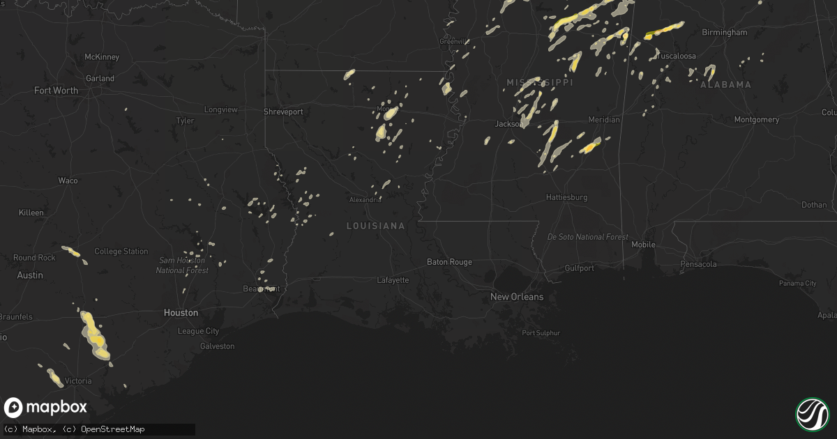
Hail Map in Louisiana on June 9, 2014
Get this storm
June 9 map
$229
one time, instant access
Download today. No call, no setup
Keep the $229
Bought the map and want the full workflow? Apply the entire $229 to a subscription within 7 days. None of it is wasted.
Every map, not just this one
This buys you this map. Subscription and you get every map we run, in the markets you choose from a few cities to whole states to nationwide. Plus real-time alerts the moment a storm fires.
Contact data
Name, contact info, occupancy, even credit band for addresses in the footprint. You go from where it hit to who to call.
Become the source they trust
Unlimited branding weather history reports on demand. You already have the documented answer ready for the property owner, and you are the one who showed up with it.
Property data and RoofTrace estimates
Pull up any address you have got, its value and the exact code rules for that jurisdiction, straight from One Click Code. Then RoofTrace estimates the squares, pitch, and roof value, priced the way you price.
Storm reports in Louisiana
Louisiana
| Date | Description |
|---|---|
| 06/09/20144:05 PM CDT | Trees and power lines down...scattered across the parish |
| 06/09/20143:55 PM CDT | Tractor trailer pulling a mobile home driving down highway 65 was blown off the road. |
| 06/09/20143:55 PM CDT | Numerous trees down across the parish with several vehicles blown off roadways. More specific damage information will be gathered later. |
| 06/09/20143:53 PM CDT | A few trees down in town...on hwy 134 sw of town and others on hwy 65 just n of town. |
| 06/09/20143:50 PM CDT | Trees down along highway 892 and highway 604. |
| 06/09/20143:48 PM CDT | Tree down across the tensas river bridge |
| 06/09/20143:35 PM CDT | Few trees and powerlines down in and near oak grove |
| 06/09/20143:30 PM CDT | Scattered trees down across the north portion of the parish along with a few power lines down. |
| 06/09/20143:30 PM CDT | Several trees and power lines down |
| 06/09/20143:15 PM CDT | Several trees down across the parish |
| 06/09/20143:09 PM CDT | Trees down hwy 849 and also cypress circle |
| 06/09/20143:04 PM CDT | Reports of trees down throughout the parish...including on highway 139s and highway 140n. |
| 06/09/20143:00 PM CDT | Trees down hwy 4 w |
| 06/09/20142:47 PM CDT | Trees down 165n sterlington rd... Several power lines down in city... Traffic lights inop |
| 06/09/20142:40 PM CDT | 2 large main transmission towers down in front of entergy power on 165 south in sterlington |
All States Impacted by Hail Map on June 9, 2014
Cities Impacted by Hail Map on June 9, 2014
- Sardis, TN
- Enville, TN
- Milledgeville, TN
- Morris Chapel, TN
- Seagrove, NC
- Asheboro, NC
- Norway, SC
- Denmark, SC
- Cope, SC
- Mangham, LA
- Turner, MT
- Bowman, SC
- Harleyville, SC
- Dorchester, SC
- Saint George, SC
- Meyersville, TX
- Goliad, TX
- Yorktown, TX
- West Point, MS
- Houston, MS
- Muldoon, TX
- La Grange, TX
- Fayette, AL
- Kennedy, AL
- Thomasville, NC
- Trinity, NC
- Potts Camp, MS
- Abbeville, MS
- Hickory Flat, MS
- Oxford, MS
- Fayetteville, TX
- Eupora, MS
- Chatham, LA
- Fort Lauderdale, FL
- Columbus, MS
- Victoria, TX
- Boligee, AL
- Lena, MS
- Walnut Grove, MS
- Forest, MS
- Schulenburg, TX
- Weimar, TX
- Zavalla, TX
- Denton, NC
- Troy, NC
- Star, NC
- Magee, MS
- Mantee, MS
- Bellefontaine, MS
- Okolona, MS
- Amory, MS
- Aberdeen, MS
- Raleigh, MS
- Lake, MS
- Ocala, FL
- Summerfield, FL
- Indianola, MS
- Greenwood Springs, MS
- Spearsville, LA
- Lillie, LA
- Canton, MS
- Camden, MS
- Houlka, MS
- Smithville, MS
- Fulton, MS
- Tremont, MS
- Deville, LA
- Leesville, LA
- Anacoco, LA
- Shelbyville, TX
- Bay Springs, MS
- Stringer, MS
- Charleston, MS
- Sylacauga, AL
- Childersburg, AL
- Cedarbluff, MS
- Oakland, MS
- Vicksburg, MS
- Kissimmee, FL
- Monroe, LA
- Livingston, AL
- Cleveland, TX
- Ethelsville, AL
- Carrollton, AL
- Chinook, MT
- Hogeland, MT
- Winnfield, LA
- Estero, FL
- Columbia, LA
- West Monroe, LA
- Grayson, LA
- Orangeburg, SC
- Cordova, SC
- Many, LA
- Belmont, LA
- Hallettsville, TX
- Pheba, MS
- Mathiston, MS
- Maben, MS
- Vidor, TX
- Orange, TX
- Benton, MS
- Shuqualak, MS
- Gordo, AL
- Millport, AL
- Reform, AL
- Broaddus, TX
- Clermont, FL
- Edna, TX
- Louise, TX
- Sheridan, TX
- Sublime, TX
- Ganado, TX
- Garwood, TX
- Sallis, MS
- Bunnell, FL
- Taylorsville, MS
- Woodland, MS
- Stewart, MS
- Prairie, MS
- Kilmichael, MS
- Livingston, TX
- Starkville, MS
- Goodman, MS
- Pickens, MS
- Kaufman, TX
- Kemp, TX
- Lake Providence, LA
- Transylvania, LA
- Rolling Fork, MS
- Mayersville, MS
- Fairmont, NC
- Lumberton, NC
- Rowland, NC
- Berry, AL
- Ashville, AL
- Steele, AL
- Mendenhall, MS
- Belleview, FL
- Ackerman, MS
- Weir, MS
- French Camp, MS
- Ethel, MS
- Vaiden, MS
- Oakland, TX
- Benoit, MS
- Corinth, MS
- Burkeville, TX
- Brent, AL
- Centreville, AL
- Duncanville, AL
- Eutaw, AL
- Coldspring, TX
- Shepherd, TX
- Louisville, MS
- Utica, MS
- Brandon, MS
- Pelahatchie, MS
- Sardis, MS
- Batesville, MS
- Dry Creek, LA
- Grant, LA
- Sugartown, LA
- Talladega, AL
- Milam, TX
- Pontotoc, MS
- Henderson, TX
- Whiteville, TN
- Somerville, TN
- Gadsden, AL
- Collins, MS
- Marthaville, LA
- Robeline, LA
- Lufkin, TX
- Diboll, TX
- Noxapater, MS
- McCool, MS
- Aimwell, LA
- Steens, MS
- Waldo, FL
- Beaumont, TX
- Downsville, LA
- Pineville, LA
- Bamberg, SC
- Palacios, TX
- Florien, LA
- Tillatoba, MS
- Cascilla, MS
- Glendora, MS
- Minter City, MS
- Aliceville, AL
- Brooksville, MS
- Crawford, MS
- Artesia, MS
- Vossburg, MS
- Stonewall, MS
- Paulding, MS
- Heidelberg, MS
- Enterprise, MS
- Pachuta, MS
- Quitman, MS
- Bradley, SC
- Florence, MS
- Salley, SC
- Water Valley, MS
- Courtland, MS
- Pope, MS
- Conroe, TX
- Carthage, MS
- Kosciusko, MS
- Brierfield, AL
- Rose Hill, MS
- Fort Payne, AL
- Gore Springs, MS
- Duck Hill, MS
- Bastrop, LA
- Rockdale, TX
- Thorndale, TX
- Morton, MS
- Flowood, MS
- Chatham, MS
- Greenville, MS
- Glen Allan, MS
- Mize, MS
- Louin, MS
- Oak Ridge, LA
- Lexington, TX
- Lawley, AL
- Randolph, AL
- West Blocton, AL
- Onalaska, TX
- Alto, TX
- Philadelphia, MS
- Macon, MS
- Sulligent, AL
- Caledonia, MS
- Hamilton, MS
- Yoakum, TX
- Bernice, LA
- Junction City, AR
- Randolph, MS
- Myrtle, MS
- Mount Olive, MS
- Pulaski, MS
- Calhoun City, MS
- Vardaman, MS
- Marion, AL
- Evans, LA
- New Albany, MS
- Fort Lawn, SC
- Doddsville, MS
- Honea Path, SC
- Donalds, SC
- Kershaw, SC
- Deridder, LA
- Troy, SC
- Manning, SC
- Newellton, LA
- Jones, LA
- Hawthorne, FL
- Sophia, NC
- Pittsboro, MS
- Baskin, LA
- Rayville, LA
- Winnsboro, LA
- Fosters, AL
- Hornbeck, LA
- Dime Box, TX
- Caldwell, TX
- Neeses, SC
- Blackville, SC
- Brookeland, TX
- Wiergate, TX
- Noble, LA
- Winter Garden, FL
- Preston, MS
- Sunflower, MS
- Grenada, MS
- Jasper, TX
- Madison, MS
- Humble, TX
- Spring, TX
- Rowesville, SC
- Banner, MS
- Bruce, MS
- Apple Springs, TX
- Groveton, TX
- Crockett, TX
- Saint Joseph, LA
- Akron, AL
- Moundville, AL
- Pelion, SC
- Gaston, SC
- Leland, MS
- Buna, TX
- Columbus, TX
- New Waverly, TX
- Pollock, LA
- The Villages, FL
- Schlater, MS
- Knoxville, AL
- Ralph, AL
- Jonesville, LA
- Ocklawaha, FL
- Shelby, AL
- Eastover, SC
- Gadsden, SC
- Columbiana, AL
- Pembroke, NC
- Kennard, TX
- Naples, FL
- Parkin, AR
- Wynne, AR
- Pollok, TX
- Wells, TX
- Saratoga, TX
- Kelly, LA
- Olla, LA
- Adamsville, TN
- Saltillo, TN
- Valley Park, MS
- Harrisonburg, LA
- Farmerville, LA
- Etta, MS
- Bronson, TX
- Pineland, TX
- Eros, LA
- Calhoun, LA
- Scobey, MS
- Hollandale, MS
- Center Point, LA


