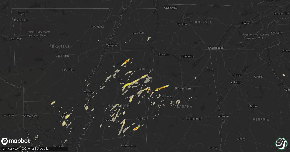
Hail Map on June 9, 2014
Get this storm
June 9 map
$229
one time, instant access
Download today. No call, no setup
Keep the $229
Bought the map and want the full workflow? Apply the entire $229 to a subscription within 7 days. None of it is wasted.
Every map, not just this one
This buys you this map. Subscription and you get every map we run, in the markets you choose from a few cities to whole states to nationwide. Plus real-time alerts the moment a storm fires.
Contact data
Name, contact info, occupancy, even credit band for addresses in the footprint. You go from where it hit to who to call.
Become the source they trust
Unlimited branding weather history reports on demand. You already have the documented answer ready for the property owner, and you are the one who showed up with it.
Property data and RoofTrace estimates
Pull up any address you have got, its value and the exact code rules for that jurisdiction, straight from One Click Code. Then RoofTrace estimates the squares, pitch, and roof value, priced the way you price.
States Impacted by Hail Map on June 9, 2014
Storm reports
North Carolina
| Date | Description |
|---|---|
| 06/09/20144:25 PM CDT | A tree was blown down in the community of millers creek. |
| 06/09/20144:20 PM CDT | Tree down 13000 block hwy 268. Time from radar. |
| 06/09/20144:20 PM CDT | A tree was blown down in the community of roaring river. |
| 06/09/20144:16 PM CDT | Tree down on huffman fork road. Time from radar. |
| 06/09/20144:14 PM CDT | Tree down at boone trail and boiling springs road. Time from radar. |
| 06/09/20144:14 PM CDT | Tree down on red white and blue road. Time from radar. |
| 06/09/20144:10 PM CDT | A set of powerlines was blown down in the community of hays. |
| 06/08/20148:40 PM CDT | Trees blown down...also about 5 sse of seagrove. |
| 06/08/20148:30 PM CDT | Several trees down in the area. |
| 06/08/20148:05 PM CDT | Trees reported down in ramseur... Time estimated by radar |
| 06/08/20148:00 PM CDT | Several reports of trees down in randleman |
| 06/08/20147:59 PM CDT | Trees reported down in staley... Time estimated by radar |
| 06/08/20147:45 PM CDT | Tree blown down onto power-line. |
| 06/08/20147:45 PM CDT | One tree down on old liberty road. |
| 06/08/20147:45 PM CDT | Two trees down in the area on bethany church road and tom brown road. |
| 06/08/20147:45 PM CDT | Large oak trees down on naomi road in randleman... Time estimated by radar |
| 06/08/20147:45 PM CDT | One tree blown down near the intersection of highway 49 and tot hill farm road. |
| 06/08/20147:45 PM CDT | One tree was blown down. |
| 06/08/20147:39 PM CDT | Trees down near climax |
| 06/08/20147:36 PM CDT | Several reports of trees down in randleman... Time estimated by radar |
| 06/08/20147:32 PM CDT | 3 trees down in various parts of salisbury. No reports of hail. |
| 06/08/20147:12 PM CDT | Spotter reported very strong wind gusts west of salisbury... Nc. |
| 06/08/20147:09 PM CDT | Trees down on fairview church road near archdale... Time estimated by radar |
South Carolina
| Date | Description |
|---|---|
| 06/09/20146:51 PM CDT | Public reported several small limbs down and two large limbs down in cope. They also reported dime size hail. Tstm wnd dmg duration 2 minutes |
| 06/09/20146:50 PM CDT | Public reported large limbs down and wind gusts estimated to be from 50 to 60 mph. They also reported pea size hail. Tstm wnd dmg duration 2 minutes |
| 06/09/20146:48 PM CDT | Public reported several limbs down... Some large along binnicker bridge road. They also reported penny size hail. Tstm wnd dmg duration 2 minutes |
| 06/09/20145:01 PM CDT | Public reported nickel to quarter size hail and windy conditions along heritage road. Hail duration 2 minutes |
| 06/09/20144:30 PM CDT | One tree partially blocking mt lebanon church road near the intersection with twin oaks drive. |
| 06/09/20144:22 PM CDT | A few small pine trees fell in the storm at the intersection of neely ferry road and kellett road. |
| 06/09/20144:02 PM CDT | Trees down off old furnance rd and mason rd in boiling springs... Sc. |
| 06/09/20143:50 PM CDT | 1 tree down off hwy 184 west in antreville... Sc. |
| 06/08/201410:09 PM CDT | Dorchester county dispatch reported a tree down on e main street in dorchester sc. |
| 06/08/20149:46 PM CDT | Trained spotter relayed report of 1.5 inch hail. |
| 06/08/20149:28 PM CDT | Sc highway patrol reports trees down on i-26 near mile marker 169. |
| 06/08/20149:22 PM CDT | South carolina highway patrol reported a tree down along interstate 26 eastbound near mile marker 170. |
| 06/08/20149:17 PM CDT | Along ennis lane there was a small tree uprooted...there was damage to a small shed covering a water pump and a portion of a metal roof covering a cattle barn. There wa |
| 06/08/20149:17 PM CDT | An ef0 tornado snapped off a few trees and uprooted a couple of trees along a path from near ditch bank road southeast across old school house road then across ebenezer |
| 06/08/20148:05 PM CDT | Highway patrol reported trees down along cordova road near the chateau heights subdivision. Tstm wnd dmg duration 2 minutes |
| 06/08/20147:39 PM CDT | Sheriff dispatch reported trees down near the intersection of blewer road and dunn road. Tstm wnd dmg duration 2 minutes |
Texas
| Date | Description |
|---|---|
| 06/09/20148:16 AM CDT | Damage at avery schools... Trees down... Roof damage to gym... Power out |
| 06/09/20148:16 AM CDT | An ef0 tornado occurred in avery...beginning along cr 3326. The tornado snapped numerous trees...damaged the roof of the school gym and a dugout at the baseball field.. |
| 06/09/20147:10 AM CDT | A tree was blown down onto a house. The roof of a barn was also blown off. |
| 06/09/20141:21 AM CDT | Trees blown on to power lines causing numerous blackouts. |
| 06/09/20141:20 AM CDT | Trees down south of weimar |
| 06/09/20141:05 AM CDT | Powerlines down |
Georgia
| Date | Description |
|---|---|
| 06/08/201411:45 PM CDT | Floyd county ema relayed a report of 17 trees down across the county as well as numerous power outages. |
Mississippi
| Date | Description |
|---|---|
| 06/09/20146:45 PM CDT | Several trees down in town. |
| 06/09/20146:45 PM CDT | Tree blown down on a house |
| 06/09/20146:40 PM CDT | Pea sized hail rapidly increased to golf ball size on highway 8. |
| 06/09/20146:35 PM CDT | Numerous trees down across roads across winston county. One tree down on a house. |
| 06/09/20146:25 PM CDT | Reports of trees down and power outages on the western portions of the county...including highway 395...county road 123...county road 397 and county road 826. |
| 06/09/20146:18 PM CDT | Trees down all across southern and eastern portions of attala county. |
| 06/09/20146:15 PM CDT | Downed trees scattered across the county |
| 06/09/20146:15 PM CDT | Measured by rooftop anemometer at wcbi tv |
| 06/09/20146:15 PM CDT | Numerous trees down across roads across the county. Report of some campers rolled over by wind in nw part of the county. |
| 06/09/20146:04 PM CDT | Golf ball sized hail near highway 349. |
| 06/09/20145:45 PM CDT | Reports of several trees down throughout the county. |
| 06/09/20145:44 PM CDT | Trees down in crossgates |
| 06/09/20145:44 PM CDT | Trees down along hwy 21 |
| 06/09/20145:38 PM CDT | Multiple trees down all across the county. |
| 06/09/20145:30 PM CDT | Trees down |
| 06/09/20145:30 PM CDT | Reports of several trees down throughout the county. |
| 06/09/20145:30 PM CDT | A few trees down along hwy 12 e |
| 06/09/20145:30 PM CDT | Reports of several trees down throughout the county. |
| 06/09/20145:28 PM CDT | A local report indicates 1.00 inch wind near LUDLOW |
| 06/09/20145:26 PM CDT | Trees downed in byram |
| 06/09/20145:25 PM CDT | Trees down |
| 06/09/20145:25 PM CDT | Trees down along hwy 17 |
| 06/09/20145:24 PM CDT | Report of quarter size hail in bellefontaine. |
| 06/09/20145:15 PM CDT | Tree down on a house. |
| 06/09/20145:15 PM CDT | Trees down |
| 06/09/20145:10 PM CDT | Large tree downed across a road...knocking down power lines |
| 06/09/20145:05 PM CDT | Reports of a powerline down on paul williams road in raymond. |
| 06/09/20144:55 PM CDT | Reports of trees and powerlines down throughout the county. |
| 06/09/20144:40 PM CDT | A few trees and power lines down. |
| 06/09/20144:40 PM CDT | Power lines down |
| 06/09/20144:34 PM CDT | A few trees and power lines down. |
| 06/09/20144:33 PM CDT | Numerous trees down around vicksburg and in the county. |
| 06/09/20144:30 PM CDT | Report of quarter size hail west of mize. |
| 06/09/20144:30 PM CDT | Large tree downed across a road...knocking down power lines |
| 06/09/20144:15 PM CDT | Reports of trees down on old highway 61 and powerlines down on highway 438 in arcola. |
| 06/09/20144:05 PM CDT | Several trees down in mayersville and across the county per sheriffs office. |
| 06/08/20147:50 PM CDT | Several trees down and power lines down...many along and over highway 345. |
| 06/08/20147:47 PM CDT | Trees down on west side of burnsville. |
| 06/08/20147:45 PM CDT | Reports of trees down on highway 513 and powerline down on county road 3541. |
| 06/08/20147:43 PM CDT | A local report indicates 1.00 inch wind near MACON |
| 06/08/20147:38 PM CDT | A local report indicates 1.75 inch wind near NEW HOPE |
| 06/08/20147:26 PM CDT | Trees and power lines down in thrasher. |
| 06/08/20147:20 PM CDT | Trees down near highway 9. Still being cleared from the road. |
| 06/08/20147:15 PM CDT | Measured by rooftop anemometer at wcbi tv |
| 06/08/20147:15 PM CDT | Trees and powerlines down countywide. Trees on a couple of houses in columbus. |
| 06/08/20147:14 PM CDT | A local report indicates 1.00 inch wind near 1 N AMORY |
| 06/08/20147:13 PM CDT | Occurred near the vossburg community |
| 06/08/20147:05 PM CDT | Reports of trees down and power outages throughout the county. |
Nevada
| Date | Description |
|---|---|
| 06/09/20144:50 PM CDT | Dry microburst at austin raws...no lightning... Probably no rain either |
| 06/08/20149:26 PM CDT | Dry microburst at eureka airport asos...no lightning... Probably no rain reached the ground. |
| 06/08/20148:38 PM CDT | Dry microburst at desatoya mountain raws...no lightning... Probably no rain either |
| 06/08/20148:00 PM CDT | Dry microburst occurred between 600 and 630 pm based off trained weather spotter report and radar. Very little...if any...rain or lightning occurred with this storm. Sp |
Louisiana
| Date | Description |
|---|---|
| 06/09/20144:05 PM CDT | Trees and power lines down...scattered across the parish |
| 06/09/20143:55 PM CDT | Numerous trees down across the parish with several vehicles blown off roadways. More specific damage information will be gathered later. |
| 06/09/20143:55 PM CDT | Tractor trailer pulling a mobile home driving down highway 65 was blown off the road. |
| 06/09/20143:53 PM CDT | A few trees down in town...on hwy 134 sw of town and others on hwy 65 just n of town. |
| 06/09/20143:50 PM CDT | Trees down along highway 892 and highway 604. |
| 06/09/20143:48 PM CDT | Tree down across the tensas river bridge |
| 06/09/20143:35 PM CDT | Few trees and powerlines down in and near oak grove |
| 06/09/20143:30 PM CDT | Scattered trees down across the north portion of the parish along with a few power lines down. |
| 06/09/20143:30 PM CDT | Several trees and power lines down |
| 06/09/20143:15 PM CDT | Several trees down across the parish |
| 06/09/20143:09 PM CDT | Trees down hwy 849 and also cypress circle |
| 06/09/20143:04 PM CDT | Reports of trees down throughout the parish...including on highway 139s and highway 140n. |
| 06/09/20143:00 PM CDT | Trees down hwy 4 w |
| 06/09/20142:47 PM CDT | Trees down 165n sterlington rd... Several power lines down in city... Traffic lights inop |
| 06/09/20142:40 PM CDT | 2 large main transmission towers down in front of entergy power on 165 south in sterlington |
Tennessee
| Date | Description |
|---|---|
| 06/09/201410:00 AM CDT | Tree down on harpeth-peytonsville road at lewisburg pike blocking one lane |
| 06/08/201411:20 PM CDT | Tree down along route 27. |
| 06/08/201410:40 PM CDT | A large tree was downed on canton lane in health place subdivision in franklin. |
| 06/08/201410:08 PM CDT | A tree was reported down on carnton lane blocking the roadway near franklin. |
| 06/08/201410:03 PM CDT | Large tree limbs down at residence on goose creek road |
| 06/08/201410:00 PM CDT | Tree down on harpeth-peytonsville road at lewisburg pike blocking one lane |
| 06/08/20149:44 PM CDT | Estimated 60 mph wind gust in extreme southwestern portion of dickson county near interstate 40. |
| 06/08/20149:20 PM CDT | Multiple power lines down and a tree fallen at the intersection of rose road and highway 31s. |
| 06/08/20149:08 PM CDT | Trees were downed just about three miles west of lawrenceburg near the intersection of u.s. Highway 64 and state road 240 near the red hill community. Just southeast of |
| 06/08/20149:08 PM CDT | Large tree was downed on a house on commerce street in loretto. |
| 06/08/20148:53 PM CDT | A tree was reported down in the community of flatwoods along highway 13 south. |
| 06/08/20148:29 PM CDT | Trees were reported down in the city of collinwood along highway 13. |
Kentucky
| Date | Description |
|---|---|
| 06/09/20146:28 AM CDT | Large limbs down. Some trees uprooted and power lines down. |
Alabama
| Date | Description |
|---|---|
| 06/08/201411:30 PM CDT | Tree down on highway. |
| 06/08/201411:13 PM CDT | Tree down on highway. |
| 06/08/201410:04 PM CDT | Trees down along huffman road near 5 mile creek. |
| 06/08/201410:00 PM CDT | A tree was reported down across the road. |
| 06/08/20149:56 PM CDT | A tree was reported down on powerlines. |
| 06/08/20149:55 PM CDT | Trees down along huffman road near 5 mile creek. |
| 06/08/20149:45 PM CDT | Trees were blocking miller lane and james road. |
| 06/08/20149:43 PM CDT | A tree was reported down across the road. |
| 06/08/20149:42 PM CDT | A tree was blown down on olive drive. |
| 06/08/20149:22 PM CDT | A tree was blown down. |
| 06/08/20149:13 PM CDT | Trees were down in cordova. |
| 06/08/20149:10 PM CDT | Thunderstorm winds downed several trees and a transformer was blown near athens. |
| 06/08/20149:10 PM CDT | Thunderstorm winds downed several trees and powerlines. |
| 06/08/20149:10 PM CDT | Trees down and barn destroyed. |
| 06/08/20149:02 PM CDT | A tree was blown down on cr 1069. |
| 06/08/20149:00 PM CDT | Thunderstorm winds downed a few trees. |
| 06/08/20148:53 PM CDT | Trees reported down on highway 101 at state line road with road closed |
| 06/08/20148:49 PM CDT | Tree down blocking highway 140 near the buhl elementary school. |
| 06/08/20148:45 PM CDT | A few trees were downed by thunderstorm winds. |
| 06/08/20148:44 PM CDT | Tree down on car on mormon road near macedonia church. |
| 06/08/20148:37 PM CDT | Trees down along county road 63 south of berry. |
| 06/08/20148:30 PM CDT | Ef-1 with estimated peak wind speed of 105 ph. Path length of 5.9 miles. Maximum path width of 150 yards. |
| 06/08/20148:30 PM CDT | Trees were reported down in nauvoo. |
| 06/08/20148:30 PM CDT | Thunderstorm winds downed a tree. |
| 06/08/20148:30 PM CDT | Trees were reported down on tombigbee street. |
| 06/08/20148:30 PM CDT | Trees were reported down on tombigbee street. |
| 06/08/20148:30 PM CDT | Thunderstorm winds downed numerous trees and extensively damaged a county school bus barn. |
| 06/08/20148:29 PM CDT | Several trees were downed by thunderstorm winds. |
| 06/08/20148:25 PM CDT | Several trees were downed by thunderstorm winds. |
| 06/08/20148:25 PM CDT | Thunderstorm winds downed a tree. |
| 06/08/20148:25 PM CDT | Thunderstorm winds downed a tree. |
| 06/08/20148:20 PM CDT | Thunderstorm winds downed a tree. |
| 06/08/20148:18 PM CDT | Estimated in downtown haleyville. |
| 06/08/20147:54 PM CDT | Mobile home overturned near county road 25 and highway 19 in western marion county. |
| 06/08/20147:54 PM CDT | Partial roof removed from church along highway 119 north near county road 11 in barnesville. |
| 06/08/20147:51 PM CDT | Near highway 171 in far northwest tuscaloosa county. |
| 06/08/20147:47 PM CDT | A local report indicates 1.50 inch wind near 5 E ASHCRAFT CORNER |
| 06/08/20147:46 PM CDT | A local report indicates 1.50 inch wind near 7 NE REFORM |
| 06/08/20147:46 PM CDT | Trees down blocking highway 278 in beaverton. |
| 06/08/20147:45 PM CDT | Trees were blown down in the barnesville community. |
| 06/08/20147:36 PM CDT | Trees were reported down across the northern portion of the county... From the lamar county airport north to the county line. |
| 06/08/20147:35 PM CDT | Measured in downtown vernon. |
Montana
| Date | Description |
|---|---|
| 06/08/20149:50 PM CDT | Public report of microburst which briefly caused power flickers and damaged three makeshift barns on private property. |
Florida
| Date | Description |
|---|---|
| 06/09/20146:10 PM CDT | Wcjb tv-20 relayed a public report of quarter sized hail near little sante fe lake. |
| 06/09/20143:55 PM CDT | A tree and wires were reported down in the summerfield area. Time estimated from radar data. |
Kansas
| Date | Description |
|---|---|
| 06/09/20142:57 PM CDT | Two brief touchdowns in northeast sedgwick county near butler county line. Relayed from butler county emergency management. |
| 06/09/20142:39 PM CDT | Brief touchdown near towne west mall on maple street. Tree down and car windows broken. |
Cities Impacted by Hail Map on June 9, 2014
- Sardis, TN
- Enville, TN
- Milledgeville, TN
- Morris Chapel, TN
- Seagrove, NC
- Asheboro, NC
- Norway, SC
- Denmark, SC
- Cope, SC
- Mangham, LA
- Turner, MT
- Bowman, SC
- Harleyville, SC
- Dorchester, SC
- Saint George, SC
- Meyersville, TX
- Goliad, TX
- Yorktown, TX
- West Point, MS
- Houston, MS
- Muldoon, TX
- La Grange, TX
- Fayette, AL
- Kennedy, AL
- Thomasville, NC
- Trinity, NC
- Potts Camp, MS
- Abbeville, MS
- Hickory Flat, MS
- Oxford, MS
- Fayetteville, TX
- Eupora, MS
- Chatham, LA
- Fort Lauderdale, FL
- Columbus, MS
- Victoria, TX
- Boligee, AL
- Lena, MS
- Walnut Grove, MS
- Forest, MS
- Schulenburg, TX
- Weimar, TX
- Zavalla, TX
- Denton, NC
- Troy, NC
- Star, NC
- Magee, MS
- Mantee, MS
- Bellefontaine, MS
- Okolona, MS
- Amory, MS
- Aberdeen, MS
- Raleigh, MS
- Lake, MS
- Ocala, FL
- Summerfield, FL
- Indianola, MS
- Greenwood Springs, MS
- Spearsville, LA
- Lillie, LA
- Canton, MS
- Camden, MS
- Houlka, MS
- Smithville, MS
- Fulton, MS
- Tremont, MS
- Deville, LA
- Leesville, LA
- Anacoco, LA
- Shelbyville, TX
- Bay Springs, MS
- Stringer, MS
- Charleston, MS
- Sylacauga, AL
- Childersburg, AL
- Cedarbluff, MS
- Oakland, MS
- Vicksburg, MS
- Kissimmee, FL
- Monroe, LA
- Livingston, AL
- Cleveland, TX
- Ethelsville, AL
- Carrollton, AL
- Chinook, MT
- Hogeland, MT
- Winnfield, LA
- Estero, FL
- Columbia, LA
- West Monroe, LA
- Grayson, LA
- Orangeburg, SC
- Cordova, SC
- Many, LA
- Belmont, LA
- Hallettsville, TX
- Pheba, MS
- Mathiston, MS
- Maben, MS
- Vidor, TX
- Orange, TX
- Benton, MS
- Shuqualak, MS
- Gordo, AL
- Millport, AL
- Reform, AL
- Broaddus, TX
- Clermont, FL
- Edna, TX
- Louise, TX
- Sheridan, TX
- Sublime, TX
- Ganado, TX
- Garwood, TX
- Sallis, MS
- Bunnell, FL
- Taylorsville, MS
- Woodland, MS
- Stewart, MS
- Prairie, MS
- Kilmichael, MS
- Livingston, TX
- Starkville, MS
- Goodman, MS
- Pickens, MS
- Kaufman, TX
- Kemp, TX
- Lake Providence, LA
- Transylvania, LA
- Rolling Fork, MS
- Mayersville, MS
- Fairmont, NC
- Lumberton, NC
- Rowland, NC
- Berry, AL
- Ashville, AL
- Steele, AL
- Mendenhall, MS
- Belleview, FL
- Ackerman, MS
- Weir, MS
- French Camp, MS
- Ethel, MS
- Vaiden, MS
- Oakland, TX
- Benoit, MS
- Corinth, MS
- Burkeville, TX
- Brent, AL
- Centreville, AL
- Duncanville, AL
- Eutaw, AL
- Coldspring, TX
- Shepherd, TX
- Louisville, MS
- Utica, MS
- Brandon, MS
- Pelahatchie, MS
- Sardis, MS
- Batesville, MS
- Dry Creek, LA
- Grant, LA
- Sugartown, LA
- Talladega, AL
- Milam, TX
- Pontotoc, MS
- Henderson, TX
- Whiteville, TN
- Somerville, TN
- Gadsden, AL
- Collins, MS
- Marthaville, LA
- Robeline, LA
- Lufkin, TX
- Diboll, TX
- Noxapater, MS
- McCool, MS
- Aimwell, LA
- Steens, MS
- Waldo, FL
- Beaumont, TX
- Downsville, LA
- Pineville, LA
- Bamberg, SC
- Palacios, TX
- Florien, LA
- Tillatoba, MS
- Cascilla, MS
- Glendora, MS
- Minter City, MS
- Aliceville, AL
- Brooksville, MS
- Crawford, MS
- Artesia, MS
- Vossburg, MS
- Stonewall, MS
- Paulding, MS
- Heidelberg, MS
- Enterprise, MS
- Pachuta, MS
- Quitman, MS
- Bradley, SC
- Florence, MS
- Salley, SC
- Water Valley, MS
- Courtland, MS
- Pope, MS
- Conroe, TX
- Carthage, MS
- Kosciusko, MS
- Brierfield, AL
- Rose Hill, MS
- Fort Payne, AL
- Gore Springs, MS
- Duck Hill, MS
- Bastrop, LA
- Rockdale, TX
- Thorndale, TX
- Morton, MS
- Flowood, MS
- Chatham, MS
- Greenville, MS
- Glen Allan, MS
- Mize, MS
- Louin, MS
- Oak Ridge, LA
- Lexington, TX
- Lawley, AL
- Randolph, AL
- West Blocton, AL
- Onalaska, TX
- Alto, TX
- Philadelphia, MS
- Macon, MS
- Sulligent, AL
- Caledonia, MS
- Hamilton, MS
- Yoakum, TX
- Bernice, LA
- Junction City, AR
- Randolph, MS
- Myrtle, MS
- Mount Olive, MS
- Pulaski, MS
- Calhoun City, MS
- Vardaman, MS
- Marion, AL
- Evans, LA
- New Albany, MS
- Fort Lawn, SC
- Doddsville, MS
- Honea Path, SC
- Donalds, SC
- Kershaw, SC
- Deridder, LA
- Troy, SC
- Manning, SC
- Newellton, LA
- Jones, LA
- Hawthorne, FL
- Sophia, NC
- Pittsboro, MS
- Baskin, LA
- Rayville, LA
- Winnsboro, LA
- Fosters, AL
- Hornbeck, LA
- Dime Box, TX
- Caldwell, TX
- Neeses, SC
- Blackville, SC
- Brookeland, TX
- Wiergate, TX
- Noble, LA
- Winter Garden, FL
- Preston, MS
- Sunflower, MS
- Grenada, MS
- Jasper, TX
- Madison, MS
- Humble, TX
- Spring, TX
- Rowesville, SC
- Banner, MS
- Bruce, MS
- Apple Springs, TX
- Groveton, TX
- Crockett, TX
- Saint Joseph, LA
- Akron, AL
- Moundville, AL
- Pelion, SC
- Gaston, SC
- Leland, MS
- Buna, TX
- Columbus, TX
- New Waverly, TX
- Pollock, LA
- The Villages, FL
- Schlater, MS
- Knoxville, AL
- Ralph, AL
- Jonesville, LA
- Ocklawaha, FL
- Shelby, AL
- Eastover, SC
- Gadsden, SC
- Columbiana, AL
- Pembroke, NC
- Kennard, TX
- Naples, FL
- Parkin, AR
- Wynne, AR
- Pollok, TX
- Wells, TX
- Saratoga, TX
- Kelly, LA
- Olla, LA
- Adamsville, TN
- Saltillo, TN
- Valley Park, MS
- Harrisonburg, LA
- Farmerville, LA
- Etta, MS
- Bronson, TX
- Pineland, TX
- Eros, LA
- Calhoun, LA
- Scobey, MS
- Hollandale, MS
- Center Point, LA