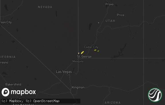
Hail Map in Utah on June 6, 2023
The weather event in Utah on June 6, 2023 includes Hail map. 25 states and 417 cities were impacted and suffered possible damage. The total estimated number of properties impacted is 0.

Hail
0
Estimated number of impacted properties by a 1.00" hail or larger0
Estimated number of impacted properties by a 1.75" hail or larger0
Estimated number of impacted properties by a 2.50" hail or largerStorm reports in Utah
Utah
| Date | Description |
|---|---|
| 06/06/20236:42 PM CDT | Mesonet station rsbu1 rosebud. |
| 06/06/20236:40 PM CDT | Mesonet station ut30 3.1 e collinston |
| 06/06/20235:49 PM CDT | Mesonet station ur308 2.5 nw lucin |
| 06/06/20235:23 PM CDT | Mesonet station ur305 27.0 e lucin |
| 06/06/20235:15 PM CDT | Hat island - 4242 ft |
| 06/06/20235:15 PM CDT | Hat island - 4242 ft. |
| 06/06/20235:10 PM CDT | Wendover port of entry - 4227 ft |
| 06/06/20235:10 PM CDT | Wendover port of entry - 4227 ft. |
| 06/06/20234:45 PM CDT | Bonneville salt flats - 4218 ft |
| 06/06/20234:45 PM CDT | Bonneville salt flats - 4218 ft. |
| 06/06/20234:41 PM CDT | A local report indicates 70 MPH wind near BARRO |
| 06/06/20234:41 PM CDT | A local report indicates 70 MPH wind near BARRO |
| 06/06/20234:40 PM CDT | I-80 at mp 29 - 4223 ft |
| 06/06/20234:40 PM CDT | I-80 at mp 29 - 4223 ft. |
| 06/06/20234:35 PM CDT | Interstate 80 - 4125 ft |
| 06/06/20234:35 PM CDT | Interstate 80 - 4125 ft. |
| 06/06/20234:10 PM CDT | West of wildcat mtn - 4259 ft |
| 06/06/20234:10 PM CDT | West of wildcat mtn - 4259 ft. |
| 06/06/20233:55 PM CDT | Salt flats - 4265 ft |
| 06/06/20233:55 PM CDT | Salt flats - 4265 ft. |
| 06/06/20233:35 PM CDT | Camel back mtn - 5077 ft |
| 06/06/20233:35 PM CDT | Camel back mtn - 5077 ft. |
| 06/06/20233:15 PM CDT | White sage - 4363 ft |
| 06/06/20233:15 PM CDT | White sage - 4363 ft. |
| 06/05/20237:30 PM CDT | Mesonet station pc358 hansel valley. |
All States Impacted by Hail Map on June 6, 2023
Cities Impacted by Hail Map on June 6, 2023
- Saratoga Springs, NY
- Gansevoort, NY
- Fort Lauderdale, FL
- North Miami Beach, FL
- Miami, FL
- Dania, FL
- Hollywood, FL
- Hallandale, FL
- Miami Beach, FL
- Stillwater, NY
- Schuylerville, NY
- Purchase, NY
- Port Chester, NY
- Greenwich, CT
- Rye, NY
- Valley Falls, NY
- Johnsonville, NY
- Troy, NY
- Cropseyville, NY
- West Harrison, NY
- White Plains, NY
- Harrison, NY
- Locust Valley, NY
- Bayville, NY
- Oyster Bay, NY
- Mill Neck, NY
- Cold Spring Harbor, NY
- Syosset, NY
- East Norwich, NY
- Woodbury, NY
- Huntington, NY
- Sturbridge, MA
- Charlton, MA
- Huntington Station, NY
- Mulhall, OK
- Guadalupita, NM
- Ocate, NM
- Guthrie, OK
- Atlanta, KS
- Ozark, AR
- Olive Branch, MS
- Stafford Springs, CT
- Monson, MA
- Stillwater, OK
- Greenfield Center, NY
- Malta, MT
- Dodson, MT
- Loring, MT
- Whitewater, MT
- Hephzibah, GA
- Augusta, GA
- Snow Lake, AR
- Parker, CO
- Sapello, NM
- Las Vegas, NM
- Aurora, CO
- Englewood, CO
- Denver, CO
- Kinderhook, NY
- Stuyvesant, NY
- Stuyvesant Falls, NY
- Hudson, NY
- Ghent, NY
- Idaho Falls, ID
- Commerce City, CO
- Brighton, CO
- Philmont, NY
- Hillsdale, NY
- San Elizario, TX
- El Paso, TX
- Guffey, CO
- Hogeland, MT
- Ballston Spa, NY
- Douglas, OK
- Gallup, NM
- Ganado, AZ
- Ponca City, OK
- Croghan, NY
- Kingfisher, OK
- Dover, OK
- Coweta, OK
- Broken Arrow, OK
- Northville, NY
- Hadley, NY
- Corinth, NY
- Cedar Vale, KS
- Edwards, MS
- Blythe, GA
- Reed Point, MT
- Big Timber, MT
- Capitan, NM
- Rociada, NM
- Victory Mills, NY
- La Junta, CO
- Greenwich, NY
- Bartlesville, OK
- Mahnomen, MN
- Melrose, NY
- Petersburg, NY
- Labelle, FL
- Armonk, NY
- Lamont, OK
- Atlanta, GA
- Marietta, GA
- Smyrna, GA
- Vernon, FL
- Chipley, FL
- Uniontown, AR
- Muldrow, OK
- Van Buren, AR
- Natural Dam, AR
- Cedarville, AR
- Chambers, AZ
- Pawhuska, OK
- Winnie, TX
- Clarksville, IA
- Shell Rock, IA
- Perry, OK
- Morrison, OK
- Glencoe, OK
- North Dartmouth, MA
- South Dartmouth, MA
- New Bedford, MA
- Gloversville, NY
- Johnstown, NY
- Fountain Inn, SC
- Simpsonville, SC
- Shidler, OK
- Watonga, OK
- Ossining, NY
- Bixby, OK
- Seekonk, MA
- Swansea, MA
- Rehoboth, MA
- Attleboro, MA
- Dighton, MA
- Somerset, MA
- Schertz, TX
- Fall River, MA
- Pawtucket, RI
- Princeton, TX
- Farmersville, TX
- Norwood, GA
- Crawfordville, GA
- Tonkawa, OK
- Copan, OK
- Wann, OK
- Gary, MN
- Cushing, OK
- Wayne, PA
- Norristown, PA
- King Of Prussia, PA
- Claremore, OK
- San Antonio, TX
- Converse, TX
- Briarcliff Manor, NY
- Chappaqua, NY
- Valliant, OK
- Franklin, LA
- Jefferson, CO
- Schenectady, NY
- La Veta, CO
- Waynesboro, GA
- Mechanicville, NY
- Schaghticoke, NY
- Pleasanton, TX
- Niotaze, KS
- Valhalla, NY
- Thornwood, NY
- Powell, WY
- Ripley, OK
- Pomfret, CT
- Pomfret Center, CT
- Pawnee, OK
- Okarche, OK
- Westport, MA
- Bluff City, KS
- Ashland, MS
- Newburgh, NY
- Elaine, AR
- Calumet, OK
- Paris, TX
- Brookston, TX
- Aragon, NM
- Datil, NM
- Greenville, SC
- Mauldin, SC
- Hennessey, OK
- Mamaroneck, NY
- Pleasantville, NY
- Blenheim, SC
- Assonet, MA
- Green River, UT
- New Braunfels, TX
- Woodstock, CT
- Potts Camp, MS
- Hernando, MS
- Tunica, MS
- Fence Lake, NM
- Poplar Grove, AR
- Cotopaxi, CO
- Frisco City, AL
- Lilburn, GA
- Snellville, GA
- Brewton, AL
- Inola, OK
- Bozeman, MT
- Scarsdale, NY
- Fairmont, OK
- Lake Luzerne, NY
- Greer, SC
- Blossom, TX
- Southaven, MS
- Prairie Grove, AR
- Crescent, OK
- Phoenixville, PA
- Collegeville, PA
- Yale, OK
- Weed, NM
- Eastford, CT
- Mansfield, TX
- Mooreland, OK
- Jbsa Randolph, TX
- Cibolo, TX
- Universal City, TX
- Follett, TX
- Beaumont, TX
- Marianna, AR
- Lexa, AR
- Iuka, MS
- Wallkill, NY
- Amsterdam, NY
- Mount Hope, AL
- Russellville, AL
- Skiatook, OK
- Lake Cormorant, MS
- Tulsa, OK
- Gage, OK
- El Reno, OK
- Croton On Hudson, NY
- Cortlandt Manor, NY
- Duncanville, TX
- Gray Court, SC
- Woodruff, SC
- Devers, TX
- Monroe, GA
- Loganville, GA
- Fort Bliss, TX
- Hardin, MT
- Crow Agency, MT
- Hollywood, SC
- Rapelje, MT
- Deming, NM
- Beggs, OK
- Fort Lupton, CO
- Fort Hancock, TX
- Waco, TX
- West, TX
- Haskell, OK
- Clayton, OK
- Snow, OK
- Chanute, KS
- Hayfork, CA
- Morris, OK
- Porter Corners, NY
- Campbell, MN
- Foxhome, MN
- Fergus Falls, MN
- Magdalena, NM
- Broadview, MT
- Molt, MT
- Sapulpa, OK
- Jenks, OK
- Las Cruces, NM
- North Charleston, SC
- Kiefer, OK
- Mounds, OK
- Appling, GA
- Harlem, GA
- Grovetown, GA
- Varnville, SC
- Tohatchi, NM
- Boise, ID
- Garden City, ID
- Dearing, GA
- Thomson, GA
- Pecos, NM
- Laramie, WY
- Braman, OK
- Blackwell, OK
- Eagle, ID
- Telephone, TX
- Bokchito, OK
- Ivanhoe, TX
- Soda Springs, CA
- Emigrant Gap, CA
- Tremonton, UT
- Honeyville, UT
- Craryville, NY
- Castle Rock, CO
- Tornillo, TX
- South Haven, KS
- Ribera, NM
- Montezuma, NM
- Crystal Springs, MS
- Hampton, SC
- Huntley, MT
- Ballantine, MT
- Columbus, MT
- Adams Run, SC
- San Jose, NM
- Carrizozo, NM
- Joliet, MT
- Roberts, MT
- Dallas, GA
- Bearcreek, MT
- Summerville, SC
- Charleston, SC
- Johns Island, SC
- Ravenel, SC
- Walsenburg, CO
- Ogden, UT
- Glenpool, OK
- Madison, GA
- Bear River City, UT
- Brigham City, UT
- Kim, CO
- Garland, UT
- Corona, NM
- Crownpoint, NM
- Bluejacket, OK
- Alva, OK
- Glade Park, CO
- Early Branch, SC
- El Dorado, AR
- Estancia, NM
- Goldthwaite, TX
- Loris, SC
- Longs, SC
- Norton, MA
- Zuni, NM
- Olney Springs, CO
- Ordway, CO
- Sandia Park, NM
- Hudson, CO
- Warrenton, GA
- Coldwater, KS
- Castleberry, AL
- Grants, NM
- Model, CO
- Serafina, NM
- Latta, SC
- Truth Or Consequences, NM
- Burbank, OK
- Fairfax, OK
- Jemez Pueblo, NM
- Park City, MT
- Fabens, TX
- Cloudcroft, NM
- Waynoka, OK
- Wellington, KS
- Belden, CA
- Twain, CA
- Ochelata, OK
- Altamont, KS
- Edgewood, NM
- Elk City, KS
- East Moriches, NY
- Center Moriches, NY
- Manorville, NY
- Columbia, SC
- Eastover, SC
- Toxey, AL
- Gilbertown, AL
- Newkirk, OK
- Sierra Blanca, TX
- Social Circle, GA
- Greeley, CO
- Mannford, OK
- Rutledge, GA
- Bennington, OK
- Atmore, AL
- Rattan, OK
- Conyers, GA
- Moncks Corner, SC
- Pinopolis, SC
- Magnolia, MS
- Jemez Springs, NM
- Osyka, MS
- Florence, SC
- Good Hope, GA
- San Rafael, NM
- Timmonsville, SC
- Rembert, SC
- Dalzell, SC
- Sumter, SC
- Cross, SC
- Mayesville, SC
- Wedgefield, SC
- Shaw Afb, SC
- Woodstock Valley, CT
- Union Point, GA
- Reevesville, SC
- Branchville, SC
- Saint George, SC
- Bishopville, SC
- Glen Cove, NY
- Brunson, SC
- Camak, GA
- Estill, SC
- Girard, GA
- Lugoff, SC
- Somers, CT
- Camden, SC
- Pompeys Pillar, MT
- Berkley, MA
- Waucoma, IA


