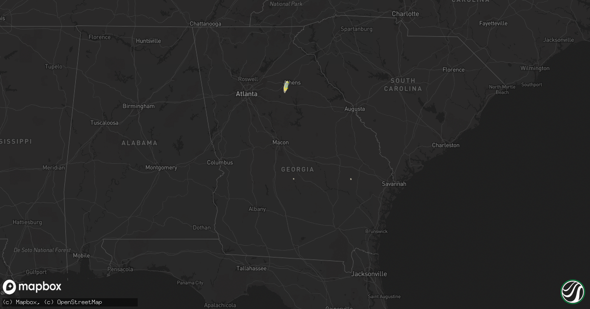
Hail Map in Georgia on June 6, 2021
Get this storm
June 6 map
$229
one time, instant access
Download today. No call, no setup
Keep the $229
Bought the map and want the full workflow? Apply the entire $229 to a subscription within 7 days. None of it is wasted.
Every map, not just this one
This buys you this map. Subscription and you get every map we run, in the markets you choose from a few cities to whole states to nationwide. Plus real-time alerts the moment a storm fires.
Contact data
Name, contact info, occupancy, even credit band for addresses in the footprint. You go from where it hit to who to call.
Become the source they trust
Unlimited branding weather history reports on demand. You already have the documented answer ready for the property owner, and you are the one who showed up with it.
Property data and RoofTrace estimates
Pull up any address you have got, its value and the exact code rules for that jurisdiction, straight from One Click Code. Then RoofTrace estimates the squares, pitch, and roof value, priced the way you price.
Storm reports in Georgia
Georgia
| Date | Description |
|---|---|
| 06/06/20214:30 AM CDT | At 929 PM EDT, a severe thunderstorm was located over North High Shoals, or near Watkinsville, moving north at 25 mph. HAZARD...60 mph wind gusts and quarter size hail. SOURCE...Radar indicated. IMPACT...Hail damage to vehicles is expected. Expect wind damage to roofs, siding, and trees. Locations impacted include... Watkinsville, Bogart, North High Shoals, Bishop, Athens-Clarke County, Beechwood Hills and Eastville. |
| 06/05/20218:45 PM CDT | Report of several trees snappand and uprooted around jennings mill pkwy in athens |
| 06/05/20218:45 PM CDT | Multiple reports of numerous trees were blown down in the huntington park subdivision as well as hail estimated to be half-dollar sized. |
| 06/05/20218:44 PM CDT | Hail the size of pingpong balls were reported between jimmy daniel and huntington rd. |
| 06/05/20218:40 PM CDT | Numerous trees blown down along mars hill rd... With hail just under the size of golf balls on sagefield dr |
| 06/05/20218:40 PM CDT | Gdot weather sensor at us 78 and monroe highway measured a wind gust of 61 mph. |
| 06/05/20218:38 PM CDT | Quarter-sized hail with several trees down reported on crestwood dr in watkinsville. |
| 06/05/20218:33 PM CDT | Several trees were reported down... With a few falling on powerlines... Along rays church rd near the intersection with hwy 53. |
| 06/05/20218:30 PM CDT | Large swath of fallen and snapped trees along and near the intersection of rays church road and maxey rd as a result of estimated 70-80 mph winds. |
All States Impacted by Hail Map on June 6, 2021
Cities Impacted by Hail Map on June 6, 2021
- Kingston, OK
- Madill, OK
- Quitaque, TX
- Turkey, TX
- Clarendon, TX
- Breckenridge, TX
- Graham, TX
- Woodson, TX
- Olton, TX
- Plainview, TX
- Hale Center, TX
- Hart, TX
- Fluvanna, TX
- Tahoka, TX
- Odonnell, TX
- Gail, TX
- Brownfield, TX
- Wichita Falls, TX
- Veteran, WY
- Yoder, WY
- Lingle, WY
- Tipton, OK
- Elmer, OK
- Lamar, CO
- Sand Springs, OK
- Arriba, CO
- Genoa, CO
- Bishop, GA
- Watkinsville, GA
- Bogart, GA
- Athens, GA
- Good Hope, GA
- Throckmorton, TX
- Kress, TX
- Tulia, TX
- Paducah, TX
- Chugwater, WY
- Elgin, OK
- Fletcher, OK
- Apache, OK
- Happy, TX
- Hereford, TX
- Dimmitt, TX
- Collins, GA
- Tribune, KS
- Holly, CO
- Syracuse, KS
- Childress, TX
- Cee Vee, TX
- Lone Wolf, OK
- Roosevelt, OK
- Mountain Park, OK
- Blair, OK
- Snyder, OK
- Frederick, OK
- Hollister, OK
- Silverton, TX
- Floydada, TX
- Petersburg, TX
- Keenesburg, CO
- Anadarko, OK
- Lagrange, ME
- Lamesa, TX
- Bushnell, NE
- Lawton, OK
- Medicine Park, OK
- Hugo, CO
- Matheson, CO
- Afton, TX
- Dickens, TX
- Mcadoo, TX
- Albany, TX
- Briggsdale, CO
- Cheyenne, WY
- Wheatland, WY
- Rush Springs, OK
- Ninnekah, OK
- Welch, TX
- Spur, TX
- Windthorst, TX
- Scotland, TX
- Henrietta, TX
- Limon, CO
- La Salle, CO
- Roggen, CO
- Kersey, CO
- Milo, ME
- Old Town, ME
- Mannford, OK
- Terlton, OK
- Cleveland, OK
- Aspermont, TX
- Electra, TX
- Seymour, TX
- Old Glory, TX
- Olney, TX
- Holliday, TX
- Gotebo, OK
- Cement, OK
- Crosbyton, TX
- Lockney, TX
- Sharon Springs, KS
- Okmulgee, OK
- Atoka, OK
- Wapanucka, OK
- Mcalister, NM
- Bowie, TX
- Montague, TX
- Nocona, TX
- Crowell, TX
- Matador, TX
- Weinert, TX
- Quanah, TX
- Caddo, TX
- Gurdon, AR
- Tyler, TX
- Davidson, OK
- Sentinel, OK
- Granite, OK
- Vernon, TX
- Eldorado, OK
- Caddo, OK
- Caney, OK
- Hobart, OK
- Abernathy, TX
- Rush, CO
- Hasty, CO
- Okarche, OK
- Olustee, OK
- Fieldton, TX
- Goree, TX
- Cheyenne Wells, CO
- McClave, CO
- Springlake, TX
- Roaring Springs, TX
- Littlefield, TX
- Wiley, CO
- Beggs, OK
- Mounds, OK
- Grandfield, OK
- Loveland, OK
- Kingwood, TX
- Porter, TX
- Rule, TX
- Altus, OK
- Newcastle, TX
- Amherst, TX
- Okeene, OK
- Hitchcock, OK
- Kimball, NE
- Dill City, OK
- Camden, AR
- Haskell, TX
- Eastman, GA
- San Augustine, TX
- Chireno, TX
- Nazareth, TX
- Wellington, TX
- Headrick, OK
- Arapahoe, CO
- Conchas Dam, NM
- Trementina, NM
- Iowa Park, TX
- Okemah, OK
- Sunset, TX
- Wiggins, CO
- Isabella, OK
- Earth, TX
- Seagraves, TX
- Henryetta, OK
- Munday, TX
- De Queen, AR
- Lagrange, WY
- Weldona, CO
- Alex, OK
- Torrington, WY


