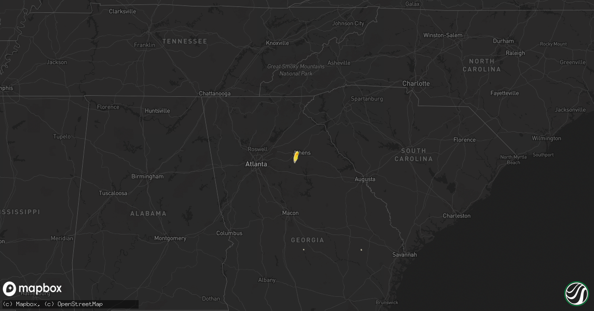
Hail Map on June 6, 2021
Get this storm
June 6 map
$229
one time, instant access
Download today. No call, no setup
Keep the $229
Bought the map and want the full workflow? Apply the entire $229 to a subscription within 7 days. None of it is wasted.
Every map, not just this one
This buys you this map. Subscription and you get every map we run, in the markets you choose from a few cities to whole states to nationwide. Plus real-time alerts the moment a storm fires.
Contact data
Name, contact info, occupancy, even credit band for addresses in the footprint. You go from where it hit to who to call.
Become the source they trust
Unlimited branding weather history reports on demand. You already have the documented answer ready for the property owner, and you are the one who showed up with it.
Property data and RoofTrace estimates
Pull up any address you have got, its value and the exact code rules for that jurisdiction, straight from One Click Code. Then RoofTrace estimates the squares, pitch, and roof value, priced the way you price.
States Impacted by Hail Map on June 6, 2021
Storm reports
Arkansas
| Date | Description |
|---|---|
| 06/06/20214:10 AM CDT | *updated* a tree was blown down over hwy 53 just south of gurdon... And caused an accident involving a log truck rollover. |
| 06/06/20214:10 AM CDT | A tree was blown down over hwy 53 between gurdon and whelen springs and caused an accident. |
Kansas
| Date | Description |
|---|---|
| 06/06/20216:04 AM CDT | At 1104 PM MDT, a severe thunderstorm was located 10 miles southwest of Horace, or 11 miles southwest of Tribune, moving southeast at 5 mph. HAZARD...60 mph wind gusts and quarter size hail. SOURCE...Radar indicated. IMPACT...Hail damage to vehicles is expected. Expect wind damage to roofs, siding, and trees. This severe thunderstorm will remain over mainly rural areas of southwestern Greeley County. |
| 06/06/20215:39 AM CDT | At 1038 PM MDT, a severe thunderstorm was located 8 miles south of Sharon Springs, moving southeast at 5 mph. HAZARD...60 mph wind gusts and quarter size hail. SOURCE...Radar indicated. IMPACT...Hail damage to vehicles is expected. Expect wind damage to roofs, siding, and trees. This severe thunderstorm will remain over mainly rural areas of southwestern Wallace and north central Greeley Counties. |
Nebraska
| Date | Description |
|---|---|
| 06/06/20212:39 AM CDT | At 739 PM MDT, a severe thunderstorm was located near Veteran, or 12 miles west of Torrington, moving northeast at 30 mph. HAZARD...Ping pong ball size hail and 60 mph wind gusts. SOURCE...Radar indicated. IMPACT...People and animals outdoors will be injured. Expect hail damage to roofs, siding, windows, and vehicles. Expect wind damage to roofs, siding, and trees. Locations impacted include... Torrington, Lingle and Veteran. |
| 06/06/20211:16 AM CDT | At 616 PM MDT, a severe thunderstorm was located over Kimball Airport, or near Kimball, moving northeast at 25 mph. HAZARD...60 mph wind gusts and quarter size hail. SOURCE...Radar indicated. IMPACT...Hail damage to vehicles is expected. Expect wind damage to roofs, siding, and trees. Locations impacted include... Kimball, Dix, Oliver Reservoir and Kimball Airport. This includes Interstate 80 in Nebraska between mile markers 11 and34. |
| 06/05/20217:20 PM CDT | A local report indicates 1.00 inch wind near 6 SSW KIMBALL |
Wyoming
| Date | Description |
|---|---|
| 06/06/20211:37 AM CDT | At 637 PM MDT, a severe thunderstorm was located over Chugwater, or 21 miles southeast of Wheatland, moving northeast at 25 mph. HAZARD...60 mph wind gusts and half dollar size hail. SOURCE...Radar indicated. IMPACT...Hail damage to vehicles is expected. Expect wind damage to roofs, siding, and trees. Locations impacted include... Chugwater and Slater. This includes Interstate 25 in Wyoming between mile markers 56 and61. |
| 06/06/20211:11 AM CDT | At 610 PM MDT, a severe thunderstorm was located 11 miles southwest of Chugwater, or 29 miles south of Wheatland, moving northeast at 25 mph. HAZARD...60 mph wind gusts and quarter size hail. SOURCE...Radar indicated. IMPACT...Hail damage to vehicles is expected. Expect wind damage to roofs, siding, and trees. Locations impacted include... Chugwater.This includes Interstate 25 in Wyoming between mile markers 39 and57, and near mile marker 61. |
| 06/06/202112:32 AM CDT | At 531 PM MDT, a severe thunderstorm was located near Iron Mountain, or 28 miles northeast of Laramie, moving northeast at 20 mph. HAZARD...60 mph wind gusts and quarter size hail. SOURCE...Radar indicated. IMPACT...Hail damage to vehicles is expected. Expect wind damage to roofs, siding, and trees. This severe thunderstorm will remain over mainly rural areas of northwestern Laramie and south central Platte Counties.This includes Interstate 25 in Wyoming between mile markers 34 and43. |
| 06/06/202112:21 AM CDT | At 521 PM MDT, a severe thunderstorm was located near Panorama Point, or 22 miles southwest of Kimball, moving east at 15 mph. HAZARD...60 mph wind gusts and half dollar size hail. SOURCE...Radar indicated. IMPACT...Hail damage to vehicles is expected. Expect wind damage to roofs, siding, and trees. Locations impacted include... Pine Bluffs and Panorama Point. This includes the following highways... Interstate 80 in Wyoming between mile markers 397 and 400, and nearmile marker 402. Interstate 80 in Nebraska between mile markers 1 and 8. |
| 06/05/20219:03 PM CDT | A local report indicates 1.00 inch wind near 1 S LINGLE |
| 06/05/20218:58 PM CDT | Pea to quarter size hail. |
| 06/05/20218:38 PM CDT | A local report indicates 1.75 inch wind near 1 NW VETERAN |
| 06/05/20217:40 PM CDT | Delayed report... Nickel to quarter sized hail. |
| 06/05/20217:35 PM CDT | Report relayed from fire chief of heavy hail damage to north bound vehicles around interstate 25 mile marker 57 north of chugwater. |
North Carolina
| Date | Description |
|---|---|
| 06/05/202110:42 PM CDT | At 341 PM EDT, a severe thunderstorm was located 9 miles west of Salisbury, or near Cleveland, moving north at 5 mph. HAZARD...60 mph wind gusts and quarter size hail. SOURCE...Radar indicated. IMPACT...Minor hail damage to vehicles is expected. Expect wind damage to trees and power lines. Locations impacted include... Cooleemee, Cleveland, Mount Ulla, Piedmont Research Station, Woodleaf, Cool Springs and Statesville. |
Colorado
| Date | Description |
|---|---|
| 06/06/20216:46 AM CDT | At 1145 PM MDT, a severe thunderstorm was located 9 miles northeast of Hartman, or 12 miles north of Coolidge, moving south at 10 mph. HAZARD...60 mph wind gusts and half dollar size hail. SOURCE...Radar indicated. IMPACT...Hail damage to vehicles is expected. Expect wind damage to roofs, siding, and trees. Locations impacted include... Hartman. |
| 06/06/20215:30 AM CDT | At 1030 PM MDT, severe thunderstorms were located along a line extending from near McClave to 7 miles southwest of Lamar, moving southwest at 10 mph. HAZARD...Ping pong ball size hail and 60 mph wind gusts. SOURCE...Radar indicated. IMPACT...People and animals outdoors will be injured. Expect hail damage to roofs, siding, windows, and vehicles. Expect wind damage to roofs, siding, and trees. Locations impacted include... Hasty, John Martin Reservoir and Caddoa. |
| 06/06/20214:46 AM CDT | At 946 PM MDT, a severe thunderstorm was located near Wiley, or near Lamar, and is nearly stationary. HAZARD...60 mph wind gusts and quarter size hail. SOURCE...Radar indicated. IMPACT...Hail damage to vehicles is expected. Expect wind damage to roofs, siding, and trees. Locations impacted include... Lamar, Wiley and McClave. |
| 06/05/202111:08 PM CDT | At 408 PM MDT, a severe thunderstorm was located 4 miles northeast of Keenesburg, or 24 miles southeast of Greeley, moving southeast at 5 mph. HAZARD...60 mph wind gusts and quarter size hail. SOURCE...Radar indicated. IMPACT...Expect damage to roofs, siding, and trees. Hail damage to vehicles is expected. Locations impacted include... Keenesburg, Prospect Valley and Roggen. |
| 06/05/202111:02 PM CDT | At 401 PM MDT, a severe thunderstorm was located 7 miles southeast of Keota, or 26 miles northwest of Fort Morgan, moving southeast at 5 mph. HAZARD...60 mph wind gusts and quarter size hail. SOURCE...Radar indicated. IMPACT...Expect damage to roofs, siding, and trees. Hail damage to vehicles is expected. Locations impacted include... New Raymer. |
| 06/05/202110:54 PM CDT | A local report indicates 1.75 inch wind near LAMAR |
| 06/05/20219:19 PM CDT | At 219 PM MDT, a severe thunderstorm was located near Fountain, or 16 miles southeast of Colorado Springs, moving south at 10 mph. HAZARD...60 mph wind gusts and quarter size hail. SOURCE...Radar indicated. IMPACT...Hail damage to vehicles is expected. Expect wind damage to roofs, siding, and trees. Locations impacted include... Fountain and Hanover. |
Alabama
| Date | Description |
|---|---|
| 06/06/202111:53 AM CDT | Trees reported down roughly 1 mile west of ward along cr 10 and cr 16. Time estimated by radar. |
Mississippi
| Date | Description |
|---|---|
| 06/06/20217:20 AM CDT | Reports of several trees down... Sheds damaged... Vehicle/boat damage... And homes damaged in the brushy creek community. |
North Dakota
| Date | Description |
|---|---|
| 06/06/20217:43 AM CDT | At 1242 AM CDT, a severe thunderstorm was located near Deering, or 18 miles northeast of Minot, moving east at 45 mph. HAZARD...60 mph wind gusts and penny size hail. SOURCE...Radar indicated. IMPACT...Expect damage to roofs, siding, and trees. Locations impacted include... Upham. |
| 06/06/20217:39 AM CDT | At 1238 AM CDT/1138 PM MDT/, severe thunderstorms were located along a line extending from 10 miles east of Manning to 8 miles south of Marshall to 4 miles south of Richardton, moving east at 50 mph. HAZARD...60 mph wind gusts and quarter size hail. SOURCE...Radar indicated. IMPACT...Hail damage to vehicles is expected. Expect wind damage to roofs, siding, and trees. Severe thunderstorms will be near... Hebron and Halliday around 1255 AM CDT.Other locations in the path of these severe thunderstorms includeDodge and Golden Valley. |
| 06/06/20217:13 AM CDT | At 1212 AM CDT, severe thunderstorms were located along a line extending from near Max to 10 miles southwest of Hannover, moving east at 45 mph. HAZARD...70 mph wind gusts. SOURCE...Surface observations. IMPACT...Expect considerable tree damage. Damage is likely to mobile homes, roofs, and outbuildings. Locations impacted include... Beulah, Garrison, Washburn, Hazen, Underwood, Wilton, Turtle Lake, Center, Stanton, Max, Riverdale, Pick City, Mercer, Coleharbor, Butte, Benedict, Beulah Bay Recreation Area, Hazen Bay Recreation Area, Lake Sakakawea State Park and Hannover. |
| 06/05/202110:24 PM CDT | At 324 AM CDT, severe thunderstorms were located along a line extending from 7 miles northwest of Maida to near Niagara, moving northeast at 55 mph. HAZARD...60 mph wind gusts. SOURCE...Radar indicated. IMPACT...Expect damage to roofs, siding, and trees. Locations impacted include... Grafton, Langdon, Park River, Cavalier, Walhalla, Hallock and Drayton. |
| 06/05/20219:39 PM CDT | At 238 AM CDT, severe thunderstorms were located along a line extending from Penn to Spirit Lake Nation to 6 miles west of Pingree, moving east at 60 mph. HAZARD...60 mph wind gusts and penny size hail. SOURCE...Radar indicated. IMPACT...Expect damage to roofs, siding, and trees. Locations impacted include... Langdon, Park River, Larimore, Lakota, McVille, Michigan and Aneta. |
| 06/05/20219:17 PM CDT | At 217 AM CDT, severe thunderstorms were located along a line extending from 7 miles northeast of St. John to 6 miles south of Agate, moving east at 35 mph. HAZARD...60 mph wind gusts. SOURCE...Radar indicated. IMPACT...Expect damage to roofs, siding, and trees. Locations impacted include... Bisbee, Rocklake, Clyde, Sarles, Egeland, Calio and Calvin. |
| 06/05/20218:55 PM CDT | At 155 AM CDT, severe thunderstorms were located along a line extending from near Shell Valley to Hurdsfield, moving east at 40 mph. HAZARD...60 mph wind gusts and quarter size hail. SOURCE...Radar indicated. IMPACT...Hail damage to vehicles is expected. Expect wind damage to roofs, siding, and trees. Locations impacted include... Brantford, New Rockford, Devils Lake. |
| 06/05/20218:52 PM CDT | At 152 AM CDT, severe thunderstorms were located along a line extending from 5 miles northwest of Wolford to 10 miles south of Esmond to 9 miles south of Hurdsfield, moving east at 60 mph. HAZARD...60 mph wind gusts and quarter size hail. SOURCE...Surface observations. IMPACT...Hail damage to vehicles is expected. Expect wind damage to roofs, siding, and trees. Locations impacted include... Rugby, Harvey, Fessenden, Drake, Anamoose, Martin, Balta, Wolford, Barton, Berwick, Heimdal, Bremen, Manfred, Balfour, Hamberg, Kief, Krueger Lake, Wellsburg, George Lake, and Sheyenne Lake. |
Maine
| Date | Description |
|---|---|
| 06/06/20214:15 PM CDT | Trees down in lagrange. |
| 06/05/202111:41 PM CDT | At 440 PM EDT, a severe thunderstorm was located near Orneville, or 11 miles west of Howland, moving southeast at 25 mph. HAZARD...60 mph wind gusts and penny size hail. SOURCE...Radar indicated. IMPACT...Expect damage to trees and power lines. Locations impacted include... Old Town, Howland, Milo, Orneville, Milford, Enfield, Greenbush, Bradford, Brownville, Alton, Lagrange, Sebec, Passadumkeag, Lowell, Atkinson, Argyle, Medford, Maxfield, Costigan and Boyd Lake. |
Oklahoma
| Date | Description |
|---|---|
| 06/06/20214:23 PM CDT | A local report indicates 60 MPH wind near 4 NW OKARCHE |
| 06/06/20214:50 AM CDT | Broken tree limbs. |
| 06/06/20214:20 AM CDT | Tipton mesonet |
| 06/06/20214:15 AM CDT | Tipton mesonet |
| 06/06/20214:10 AM CDT | Tipton mesonet |
| 06/06/20213:55 AM CDT | 4 inch diamater tree limbs broken. |
| 06/06/20213:35 AM CDT | Time estimated |
| 06/06/20213:15 AM CDT | Pictures of damage across snyder including downed fences... An old brick store front toppled... And pieces of a grain silo torn off. Winds estimated 65-75 mph. Time rad |
| 06/05/202111:08 PM CDT | At 407 PM CDT, a severe thunderstorm was located near Okarche, and is nearly stationary. HAZARD...60 mph wind gusts and quarter size hail. SOURCE...Radar indicated. IMPACT...Hail damage to vehicles is expected. Expect wind damage to roofs, siding, and trees. Locations impacted include... Okarche. |
| 06/05/202110:55 PM CDT | At 354 PM CDT, a severe thunderstorm was located 4 miles northeast of Okeene, moving northeast at 5 mph. HAZARD...60 mph wind gusts and nickel size hail. SOURCE...Radar indicated. IMPACT...Expect damage to roofs, siding, and trees. Locations impacted include... Okeene, Ringwood, Ames, Isabella, Homestead and Lacey. |
| 06/05/202110:39 PM CDT | At 339 PM CDT, a severe thunderstorm was located 4 miles west of Geary, and is nearly stationary. HAZARD...60 mph wind gusts and quarter size hail. SOURCE...Radar indicated. IMPACT...Hail damage to vehicles is expected. Expect wind damage to roofs, siding, and trees. Locations impacted include... Hinton, Geary, Bridgeport and Greenfield. |
| 06/05/202110:31 PM CDT | At 330 PM CDT, a severe thunderstorm was located near Okeene, moving northeast at 25 mph. HAZARD...60 mph wind gusts and quarter size hail. SOURCE...Radar indicated. IMPACT...Hail damage to vehicles is expected. Expect wind damage to roofs, siding, and trees. Locations impacted include... Fairview, Okeene, Canton, Longdale, Ames, Isabella, southeastern Canton Lake, Homestead and Southard. |
Texas
| Date | Description |
|---|---|
| 06/06/20216:45 AM CDT | At 1144 PM CDT, severe thunderstorms were located along a line extending from 4 miles southwest of Vigo Park to near Hale Center, moving east at 50 mph. HAZARD...60 mph wind gusts and quarter size hail. SOURCE...Radar indicated. IMPACT...Hail damage to vehicles is expected. Expect wind damage to roofs, siding, and trees. Locations impacted include... Plainview, Floydada, Silverton, Caprock Canyon State Park, Lockney, Quitaque, South Plains, Claytonville, Dougherty, Mackenzie Reservoir, Aiken, Valley Schools and Seth Ward. |
| 06/06/20216:23 AM CDT | At 1122 PM CDT, a severe thunderstorm was located over Welch, or 16 miles northwest of Lamesa, moving east at 25 mph. HAZARD...60 mph wind gusts and quarter size hail. SOURCE...Radar indicated. IMPACT...Hail damage to vehicles is expected. Expect wind damage to roofs, siding, and trees. Locations impacted include... Welch, Hancock, Punkin Center and Arvana. |
| 06/06/20216:19 AM CDT | At 1119 PM CDT, a severe thunderstorm was located 8 miles east of Brownfield, moving east at 30 mph. HAZARD...60 mph wind gusts and quarter size hail. SOURCE...Radar indicated. IMPACT...Hail damage to vehicles is expected. Expect wind damage to roofs, siding, and trees. Locations impacted include... Tahoka, O'donnell, Grassland and New Moore. |
| 06/06/20215:59 AM CDT | At 1059 PM CDT, severe thunderstorms were located along a line extending from 10 miles southwest of Happy to near Littlefield, moving north at 5 mph. HAZARD...60 mph wind gusts and quarter size hail. SOURCE...Radar indicated. IMPACT...Hail damage to vehicles is expected. Expect wind damage to roofs, siding, and trees. Locations impacted include... Plainview, Tulia, Abernathy, Hale Center, Olton, Kress, Cotton Center, Spade, Halfway, Seth Ward and Edmonson. |
| 06/06/20215:21 AM CDT | At 1021 PM CDT, severe thunderstorms were located along a line extending from near Hart to near Littlefield, moving northeast at 10 mph. HAZARD...60 mph wind gusts and quarter size hail. SOURCE...Radar indicated. IMPACT...Hail damage to vehicles is expected. Expect wind damage to roofs, siding, and trees. Locations impacted include... Plainview, Littlefield, Hale Center, Olton, Hart, Kress, Cotton Center, Fieldton, Halfway, Spade and Edmonson. |
| 06/06/20215:18 AM CDT | At 1018 PM CDT, a severe thunderstorm was located 14 miles southwest of Happy, or 15 miles east of Dimmitt, moving east at 25 mph. HAZARD...60 mph wind gusts and quarter size hail. SOURCE...Radar indicated. IMPACT...Hail damage to vehicles is expected. Expect wind damage to roofs, siding, and trees. Locations impacted include... Tulia, Happy and Nazareth. |
| 06/06/20214:57 AM CDT | A local report indicates 1.00 inch wind near 4 WSW WICHITA FALLS |
| 06/06/20214:55 AM CDT | Relayed via mping. |
| 06/06/20214:40 AM CDT | At 940 PM CDT, severe thunderstorms were located along a line extending from near Wildorado to 7 miles southeast of Hereford, moving east at 15 mph. HAZARD...60 mph wind gusts and quarter size hail. SOURCE...Radar indicated. IMPACT...Minor damage to roofs, siding, and trees is possible. Hail damage to vehicles is expected. Locations impacted include... Amarillo, Canyon, Mescalero Park, Bushland, Buffalo Lake, Dawn, Umbarger and Timbercreek Canyon. |
| 06/06/20214:31 AM CDT | At 930 PM CDT, a severe thunderstorm was located over Easter, or 6 miles northwest of Dimmitt, moving east at 30 mph. HAZARD...60 mph wind gusts and quarter size hail. SOURCE...Radar indicated. IMPACT...Hail damage to vehicles is expected. Expect wind damage to roofs, siding, and trees. Locations impacted include... Dimmitt and Easter. |
| 06/06/20214:27 AM CDT | At 927 PM CDT, a severe thunderstorm was located 8 miles north of Earth, moving northeast at 20 mph. HAZARD...60 mph wind gusts and quarter size hail. SOURCE...Radar indicated. IMPACT...Hail damage to vehicles is expected. Expect wind damage to roofs, siding, and trees. Locations impacted include... Olton, Hart, Earth, Nazareth and Springlake. |
| 06/06/20212:54 AM CDT | At 753 PM CDT, a severe thunderstorm was located over Tyler, moving northeast at 10 mph. HAZARD...60 mph wind gusts and quarter size hail. SOURCE...Radar indicated. IMPACT...Hail damage to vehicles is expected. Expect wind damage to roofs, siding, and trees. Locations impacted include... Tyler, Winona and Red Springs. |
| 06/06/20211:36 AM CDT | At 635 PM MDT, severe wind gusts from decaying thunderstorms were located along a line extending from near Broadview to 9 miles southwest of Portales, moving east at 30 mph. HAZARD...60 mph wind gusts. SOURCE...Radar indicated. IMPACT...Expect damage to roofs, siding, and trees. Locations impacted include... Clovis, Portales, Texico, Dora, Floyd, Grady, Causey, Saint Vrain, Ranchvale and Arch.This includes Highway 60 between Mile Markers 371 and 397. |
| 06/05/20217:59 PM CDT | Quarter size hail fell a couple miles south of downtown tyler. |
Georgia
| Date | Description |
|---|---|
| 06/06/20214:30 AM CDT | At 929 PM EDT, a severe thunderstorm was located over North High Shoals, or near Watkinsville, moving north at 25 mph. HAZARD...60 mph wind gusts and quarter size hail. SOURCE...Radar indicated. IMPACT...Hail damage to vehicles is expected. Expect wind damage to roofs, siding, and trees. Locations impacted include... Watkinsville, Bogart, North High Shoals, Bishop, Athens-Clarke County, Beechwood Hills and Eastville. |
| 06/05/20218:45 PM CDT | Multiple reports of numerous trees were blown down in the huntington park subdivision as well as hail estimated to be half-dollar sized. |
| 06/05/20218:45 PM CDT | Report of several trees snappand and uprooted around jennings mill pkwy in athens |
| 06/05/20218:44 PM CDT | Hail the size of pingpong balls were reported between jimmy daniel and huntington rd. |
| 06/05/20218:40 PM CDT | Gdot weather sensor at us 78 and monroe highway measured a wind gust of 61 mph. |
| 06/05/20218:40 PM CDT | Numerous trees blown down along mars hill rd... With hail just under the size of golf balls on sagefield dr |
| 06/05/20218:38 PM CDT | Quarter-sized hail with several trees down reported on crestwood dr in watkinsville. |
| 06/05/20218:33 PM CDT | Several trees were reported down... With a few falling on powerlines... Along rays church rd near the intersection with hwy 53. |
| 06/05/20218:30 PM CDT | Large swath of fallen and snapped trees along and near the intersection of rays church road and maxey rd as a result of estimated 70-80 mph winds. |
Cities Impacted by Hail Map on June 6, 2021
- Kingston, OK
- Madill, OK
- Quitaque, TX
- Turkey, TX
- Clarendon, TX
- Breckenridge, TX
- Graham, TX
- Woodson, TX
- Olton, TX
- Plainview, TX
- Hale Center, TX
- Hart, TX
- Fluvanna, TX
- Tahoka, TX
- Odonnell, TX
- Gail, TX
- Brownfield, TX
- Wichita Falls, TX
- Veteran, WY
- Yoder, WY
- Lingle, WY
- Tipton, OK
- Elmer, OK
- Lamar, CO
- Sand Springs, OK
- Arriba, CO
- Genoa, CO
- Bishop, GA
- Watkinsville, GA
- Bogart, GA
- Athens, GA
- Good Hope, GA
- Throckmorton, TX
- Kress, TX
- Tulia, TX
- Paducah, TX
- Chugwater, WY
- Elgin, OK
- Fletcher, OK
- Apache, OK
- Happy, TX
- Hereford, TX
- Dimmitt, TX
- Collins, GA
- Tribune, KS
- Holly, CO
- Syracuse, KS
- Childress, TX
- Cee Vee, TX
- Lone Wolf, OK
- Roosevelt, OK
- Mountain Park, OK
- Blair, OK
- Snyder, OK
- Frederick, OK
- Hollister, OK
- Silverton, TX
- Floydada, TX
- Petersburg, TX
- Keenesburg, CO
- Anadarko, OK
- Lagrange, ME
- Lamesa, TX
- Bushnell, NE
- Lawton, OK
- Medicine Park, OK
- Hugo, CO
- Matheson, CO
- Afton, TX
- Dickens, TX
- Mcadoo, TX
- Albany, TX
- Briggsdale, CO
- Cheyenne, WY
- Wheatland, WY
- Rush Springs, OK
- Ninnekah, OK
- Welch, TX
- Spur, TX
- Windthorst, TX
- Scotland, TX
- Henrietta, TX
- Limon, CO
- La Salle, CO
- Roggen, CO
- Kersey, CO
- Milo, ME
- Old Town, ME
- Mannford, OK
- Terlton, OK
- Cleveland, OK
- Aspermont, TX
- Electra, TX
- Seymour, TX
- Old Glory, TX
- Olney, TX
- Holliday, TX
- Gotebo, OK
- Cement, OK
- Crosbyton, TX
- Lockney, TX
- Sharon Springs, KS
- Okmulgee, OK
- Atoka, OK
- Wapanucka, OK
- Mcalister, NM
- Bowie, TX
- Montague, TX
- Nocona, TX
- Crowell, TX
- Matador, TX
- Weinert, TX
- Quanah, TX
- Caddo, TX
- Gurdon, AR
- Tyler, TX
- Davidson, OK
- Sentinel, OK
- Granite, OK
- Vernon, TX
- Eldorado, OK
- Caddo, OK
- Caney, OK
- Hobart, OK
- Abernathy, TX
- Rush, CO
- Hasty, CO
- Okarche, OK
- Olustee, OK
- Fieldton, TX
- Goree, TX
- Cheyenne Wells, CO
- McClave, CO
- Springlake, TX
- Roaring Springs, TX
- Littlefield, TX
- Wiley, CO
- Beggs, OK
- Mounds, OK
- Grandfield, OK
- Loveland, OK
- Kingwood, TX
- Porter, TX
- Rule, TX
- Altus, OK
- Newcastle, TX
- Amherst, TX
- Okeene, OK
- Hitchcock, OK
- Kimball, NE
- Dill City, OK
- Camden, AR
- Haskell, TX
- Eastman, GA
- San Augustine, TX
- Chireno, TX
- Nazareth, TX
- Wellington, TX
- Headrick, OK
- Arapahoe, CO
- Conchas Dam, NM
- Trementina, NM
- Iowa Park, TX
- Okemah, OK
- Sunset, TX
- Wiggins, CO
- Isabella, OK
- Earth, TX
- Seagraves, TX
- Henryetta, OK
- Munday, TX
- De Queen, AR
- Lagrange, WY
- Weldona, CO
- Alex, OK
- Torrington, WY