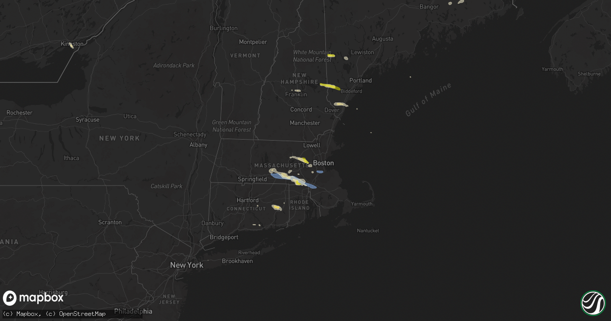
Hail Map on June 6, 2020
Get this storm
June 6 map
$229
one time, instant access
Download today. No call, no setup
Keep the $229
Bought the map and want the full workflow? Apply the entire $229 to a subscription within 7 days. None of it is wasted.
Every map, not just this one
This buys you this map. Subscription and you get every map we run, in the markets you choose from a few cities to whole states to nationwide. Plus real-time alerts the moment a storm fires.
Contact data
Name, contact info, occupancy, even credit band for addresses in the footprint. You go from where it hit to who to call.
Become the source they trust
Unlimited branding weather history reports on demand. You already have the documented answer ready for the property owner, and you are the one who showed up with it.
Property data and RoofTrace estimates
Pull up any address you have got, its value and the exact code rules for that jurisdiction, straight from One Click Code. Then RoofTrace estimates the squares, pitch, and roof value, priced the way you price.
States Impacted by Hail Map on June 6, 2020
Storm reports
Colorado
| Date | Description |
|---|---|
| 06/06/20206:55 PM CDT | Asos station kako akron. |
| 06/06/20206:46 PM CDT | Mesonet station dw6400 castle rock. |
| 06/06/20206:33 PM CDT | Asos station klic limon. |
| 06/06/20206:32 PM CDT | Mesonet station co039 076w067 wiggins bijou creek. |
| 06/06/20206:26 PM CDT | A local report indicates 59 MPH wind near LIMON |
| 06/06/20206:20 PM CDT | Mesonet station ew7966 elizabeth. |
| 06/06/20206:18 PM CDT | Mesonet station cw5040 briggsdale. |
| 06/06/20206:15 PM CDT | Awos station kfmm fort morgan. |
| 06/06/20206:14 PM CDT | A local report indicates 63 MPH wind near 8 WNW CROOK |
| 06/06/20206:13 PM CDT | A local report indicates 62 MPH wind near 5 NE BLENDE |
| 06/06/20206:08 PM CDT | Roof and sides blown off a barn. |
| 06/06/20206:01 PM CDT | Mesonet station ew7240 ramaha. |
| 06/06/20205:59 PM CDT | Trees uprooted or snapped; roof blown off. |
| 06/06/20205:52 PM CDT | Mesonet station co072 070w304 bennett. |
| 06/06/20205:52 PM CDT | Mesonet station co073 surrey ridge. |
| 06/06/20205:45 PM CDT | Delayed report: roof peeled off a trailer home near the epco fairgrounds. Time estimated per doppler radar signatures. Doppler radar estimates 70-75 mph winds. |
| 06/06/20205:42 PM CDT | A local report indicates 72 MPH wind near 2 E CASTLE ROCK |
| 06/06/20205:42 PM CDT | Asos station kcos colorado springs airport. |
| 06/06/20205:42 PM CDT | Mesonet station co072 070w304 bennett. |
| 06/06/20205:42 PM CDT | Mesonet station co039 076w067 wiggins bijou creek. |
| 06/06/20205:40 PM CDT | 3 inch diamter branches down. |
| 06/06/20205:38 PM CDT | Delayed report: large barn and tack house knocked over intersection of hwy 94 and antelope drive. Doppler estimated winds of 60-65 mph. |
| 06/06/20205:36 PM CDT | A local report indicates 62 MPH wind near FORT MORGAN |
| 06/06/20205:35 PM CDT | Awos station k1ow oscar madis. |
| 06/06/20205:34 PM CDT | . |
| 06/06/20205:34 PM CDT | 1-inch tree limbs broken; shingles blown off. |
| 06/06/20205:34 PM CDT | A local report indicates 78 MPH wind near 10 ESE ROCKPORT |
| 06/06/20205:30 PM CDT | Awos station kmnh monument elbert. |
| 06/06/20205:30 PM CDT | A local report indicates 77 MPH wind near 6 NE GREENLAND |
| 06/06/20205:26 PM CDT | A local report indicates 61 MPH wind near 1 SE MONUMENT |
| 06/06/20205:24 PM CDT | A local report indicates 58 MPH wind near 3 ENE MANITOU SPRINGS |
| 06/06/20205:22 PM CDT | Mesonet station co038 076e037 keenesburg. |
| 06/06/20205:21 PM CDT | Mesonet station dw9298 keenesburg. |
| 06/06/20205:19 PM CDT | A local report indicates 64 MPH wind near GALETON |
| 06/06/20205:18 PM CDT | A local report indicates 69 MPH wind near 3 SSW AIR FORCE ACADEMY |
| 06/06/20205:18 PM CDT | A local report indicates 60 MPH wind near 2 NNW AIR FORCE ACADEMY |
| 06/06/20205:15 PM CDT | 1-inch tree limbs broken; shingles blown off. |
| 06/06/20205:12 PM CDT | Trees uprooted or snapped; roof blown off. |
| 06/06/20205:09 PM CDT | A local report indicates 72 MPH wind near 5 ESE HUDSON |
| 06/06/20205:06 PM CDT | Tree damage in town. |
| 06/06/20205:06 PM CDT | Trees uprooted or snapped; roof blown off. |
| 06/06/20205:04 PM CDT | Shallow rooted trees pushed over. Numerous power poles down. |
| 06/06/20205:04 PM CDT | Mesonet station ew9243 commerce city. |
| 06/06/20205:02 PM CDT | 1-inch tree limbs broken; shingles blown off. |
| 06/06/20205:02 PM CDT | Mesonet station co171 nunn. |
| 06/06/20205:01 PM CDT | Asos station kden denver. |
| 06/06/20205:01 PM CDT | Mesonet station fw3105 parker. |
| 06/06/20205:00 PM CDT | Mesonet station co010 025s229 sh7. |
| 06/06/20205:00 PM CDT | 3 inch branches and fences downed. |
| 06/06/20205:00 PM CDT | Awos station kbkf buckley angb den. |
| 06/06/20205:00 PM CDT | Large tree uprooted on downing near alameda. |
| 06/06/20204:59 PM CDT | A local report indicates 69 MPH wind near CROOK |
| 06/06/20204:58 PM CDT | Tree damage... Too. 4-6 inch diameter limbs broken. |
| 06/06/20204:57 PM CDT | Trees uprooted or snapped; roof blown off. |
| 06/06/20204:57 PM CDT | Green houses and gazebo overturned. |
| 06/06/20204:57 PM CDT | Mesonet station ctpc2 carpenter peak. |
| 06/06/20204:56 PM CDT | Mesonet station aenc2 arsenal. |
| 06/06/20204:55 PM CDT | Corrects time from 4 s buckley afb. Trees uprooted or snapped; roof blown off. |
| 06/06/20204:55 PM CDT | Asos station kapa denver arapahoe. |
| 06/06/20204:55 PM CDT | Mesonet station up727 2.7 sw brighton |
| 06/06/20204:55 PM CDT | 3-inch tree limbs broken; power poles broken. |
| 06/06/20204:54 PM CDT | Mesonet station polc2 polhemus. |
| 06/06/20204:54 PM CDT | Awos station kbkf buckley angb den. |
| 06/06/20204:52 PM CDT | Mesonet station co035 076e125 sterling. |
| 06/06/20204:51 PM CDT | 136th and zuni. |
| 06/06/20204:51 PM CDT | 3-inch tree limbs broken; power poles broken. |
| 06/06/20204:50 PM CDT | Asos station kapa denver arapahoe. |
| 06/06/20204:50 PM CDT | 6 to 10 inch tree branches down. Time estimated from radar. |
| 06/06/20204:50 PM CDT | Mesonet station co003 070w276 colo. Blvd. |
| 06/06/20204:49 PM CDT | Mesonet station co178 0.1 mi s of 84th ave. |
| 06/06/20204:49 PM CDT | Mesonet station co156 0.7 mi s of northwest pkwy. |
| 06/06/20204:49 PM CDT | Mesonet station co161 0.2 mi n of i-225. |
| 06/06/20204:49 PM CDT | Mesonet station co149 orchard. |
| 06/06/20204:46 PM CDT | 1-inch tree limbs broken; shingles blown off. |
| 06/06/20204:44 PM CDT | Mesonet station co007 470w014 wadsworth. |
| 06/06/20204:44 PM CDT | 1-inch tree limbs broken; shingles blown off. |
| 06/06/20204:43 PM CDT | 1-inch tree limbs broken; shingles blown off. |
| 06/06/20204:42 PM CDT | 1-inch tree limbs broken; shingles blown off. |
| 06/06/20204:42 PM CDT | 1-inch tree limbs broken; shingles blown off. |
| 06/06/20204:41 PM CDT | Awos station kfnl ft collins lovel. |
| 06/06/20204:41 PM CDT | Mesonet station cw5285 littleton. |
| 06/06/20204:40 PM CDT | Numerous 1 inch diameter tree limbs broken. |
| 06/06/20204:40 PM CDT | A local report indicates 65 MPH wind near LAKEWOOD |
| 06/06/20204:40 PM CDT | Tree down. Time estimated from radar. |
| 06/06/20204:39 PM CDT | 1-inch tree limbs broken; shingles blown off. |
| 06/06/20204:39 PM CDT | Mesonet station co008 470e000 rooney rd. |
| 06/06/20204:39 PM CDT | Mesonet station cw8926 lakewood. |
| 06/06/20204:35 PM CDT | May have been a brief gustnado. |
| 06/06/20204:30 PM CDT | Numerous trees down... Broken branches across canon city. |
| 06/06/20204:26 PM CDT | Asos station kako akron. |
| 06/06/20204:25 PM CDT | Corrects previous non-tstm wnd gst report from 1 ne crisman. Mesonet station ew4338 boulder. |
| 06/06/20204:15 PM CDT | A local report indicates 90 MPH wind near 2 E COPPER MOUNTAIN |
| 06/06/20204:10 PM CDT | Trees down blocking cars at devils thumb trailhead. |
| 06/06/20204:10 PM CDT | Trees down near idlewild. |
| 06/06/20204:10 PM CDT | Tree down blocking lions gate drive. |
| 06/06/20204:02 PM CDT | Mesonet station co110 285s195 jefferson. |
| 06/06/20204:00 PM CDT | Top of winter park ski area. |
| 06/06/20204:00 PM CDT | A local report indicates 66 MPH wind near 2 SSE WINTER PARK |
| 06/06/20203:55 PM CDT | Trees down... Partially blocking highway 40. |
| 06/06/20203:55 PM CDT | A local report indicates 1.00 inch wind near 4 E BLUE MOUNTAIN |
| 06/06/20203:39 PM CDT | Mesonet station co158 2.4 mi e of silverthorne. |
| 06/06/20203:39 PM CDT | Mesonet station co159 2.9 mi w of ejmt - the box. |
| 06/06/20203:34 PM CDT | A local report indicates 71 MPH wind near 8 WNW LAST CHANCE |
| 06/06/20203:14 PM CDT | A local report indicates 85 MPH wind near CEDAR POINT |
| 06/06/20203:12 PM CDT | Awos station k0co berthoud pass. |
| 06/06/20203:09 PM CDT | Tree knocked over by strong winds blocking traffic in both directions on emma road near mile marker 3. |
| 06/06/20203:09 PM CDT | Mesonet station co154 0.6 mi e of co-91 copper mtn. |
| 06/06/20202:57 PM CDT | Mesonet station dhoc2 dead horse... Buford 14ene. |
| 06/06/20202:54 PM CDT | A local report indicates 79 MPH wind near 3 ESE COPPER MOUNTAIN |
| 06/06/20202:54 PM CDT | Awos station kccu red cliff pass. |
| 06/06/20202:49 PM CDT | Report from mping: trees uprooted or snapped; roof blown off. |
| 06/06/20202:46 PM CDT | Mesonet station gdrc2 great divide 2sw. |
| 06/06/20202:28 PM CDT | Mesonet station tt290 rbfmz portable1. |
| 06/06/20202:11 PM CDT | Corrects previous non-tstm wnd gst report from 2 s wolf creek pass. Awos station kcpw wolf creek pass. |
| 06/06/20202:02 PM CDT | Asos station keeo meeker airport. |
| 06/06/20201:48 PM CDT | Asos station kril garfield county rgnl ap. |
| 06/06/20201:45 PM CDT | . |
| 06/06/20201:42 PM CDT | Mesonet station co073 surrey ridge. |
| 06/06/20201:18 PM CDT | Mesonet station drac2 dragon road. |
| 06/06/20201:15 PM CDT | Received small hail. |
| 06/06/20201:15 PM CDT | Small and heavy rain accompanied wind. |
| 06/06/202012:59 PM CDT | Social media reports of several very large trees being broken off / uprooted causing damage to cabins and vehicles; time estimated from radar imagery. |
| 06/06/202012:53 PM CDT | . |
| 06/06/202011:50 AM CDT | A local report indicates 1.00 inch wind near DOLORES 2.5 WNW |
| 06/06/20207:59 AM CDT | At 1258 PM MDT, severe thunderstorms were located along a line extending from 14 miles northwest of Meeker to 21 miles northwest of New Castle to 7 miles southeast of Silt, moving northeast at 75 mph. HAZARD...70 mph wind gusts. SOURCE...Radar indicated. IMPACT...Expect considerable tree damage. Damage is likely to mobile homes, roofs, and outbuildings. Locations impacted include... Glenwood Springs, Craig, Rifle, New Castle, Silt, Meeker, Lay, Loyd, Juniper Springs, Buford, Great Divide, Axial, Maybell and Hamilton.This includes the following highways... Interstate 70 in Colorado between mile markers 90 and 118. U.S. Highway 40 in Colorado between mile markers 58 and 94. Colorado 13 between mile markers 1 and 8, and between mile markers24 and 93. Colorado 64 between mile markers 60 and 73. Colorado 82 near mile marker 1. Colorado 318 near mile marker 60. |
| 06/06/20207:28 AM CDT | At 1228 PM MDT, severe thunderstorms were located along a line extending from 19 miles northwest of Parachute to 6 miles south of Collbran, moving northeast at 80 mph. HAZARD...70 mph wind gusts. SOURCE...Radar indicated. IMPACT...Expect considerable tree damage. Damage is likely to mobile homes, roofs, and outbuildings. Locations impacted include... Rifle, New Castle, Silt, Meeker, Parachute, Collbran, De Beque, Rio Blanco, Battlement Mesa, Plateau City and Molina.This includes the following highways... Interstate 70 in Colorado between mile markers 62 and 104. Colorado 13 between mile markers 1 and 56. Colorado 64 between mile markers 71 and 73. Colorado 65 near mile marker 34. |
| 06/06/20206:59 AM CDT | At 1159 AM MDT, severe thunderstorms were located along a line extending from 9 miles northeast of Fruita to 6 miles northwest of Delta to 13 miles west of Montrose, moving northeast at 70 mph. HAZARD...70 mph wind gusts and penny size hail. SOURCE...Trained weather spotters. IMPACT...Expect considerable tree damage. Damage is likely to mobile homes, roofs, and outbuildings. Locations impacted include... Grand Junction, Montrose, Fruita, Delta, Orchard City, Palisade, Cedaredge, Olathe, Parachute, Hotchkiss, Collbran, De Beque, Crawford, Mesa, Battlement Mesa, Cameo, Molina, Austin, Grand Mesa and Orchard Mesa.This includes the following highways... Interstate 70 in Colorado between mile markers 20 and 89. U.S. Highway 50 in Colorado between mile markers 32 and 91. Colorado 65 between mile markers 1 and 61. Colorado 90 mile marker 82 and near mile marker 88. Colorado 92 between mile markers 1 and 31. Colorado 133 between mile markers 1 and 7. Colorado 141 between mile markers 147 and 162. |
| 06/06/20206:19 AM CDT | At 1119 AM MDT, severe thunderstorms were located along a line extending from 34 miles east of Sunnyside to 37 miles west of Fruita to 18 miles northeast of Castle Valley, moving north at 65 mph. HAZARD...70 mph wind gusts and penny size hail. SOURCE...Radar indicated. IMPACT...Expect considerable tree damage. Damage is likely to mobile homes, roofs, and outbuildings. Locations impacted include... Cisco.This includes the following highways... Interstate 70 in Colorado between mile markers 1 and 5. Interstate 70 in Utah between mile markers 206 and 231. Utah 128 between mile markers 32 and 43. |
| 06/06/20206:13 AM CDT | At 1112 AM MDT, a severe thunderstorm was located 22 miles west of Rico, or 46 miles northwest of Durango, moving northeast at 45 mph. HAZARD...60 mph wind gusts and quarter size hail. SOURCE...Radar indicated. IMPACT...Hail damage to vehicles is expected. Expect wind damage to roofs, siding, and trees. This severe thunderstorm will remain over mainly rural areas of north central Dolores, central San Miguel and northeastern Montezuma Counties. |
| 06/06/20205:53 AM CDT | At 1052 AM MDT, severe thunderstorms were located along a line extending from 7 miles west of La Sal to 8 miles west of Slick Rock to near Dove Creek, moving north at 60 mph. These are very dangerous storms. HAZARD...90 mph wind gusts and golf ball size hail. SOURCE...Law enforcement. IMPACT...You are in a life-threatening situation. Flying debris may be deadly to those caught without shelter. Mobile homes will be heavily damaged or destroyed. Homes and businesses will have substantial roof and window damage. Expect extensive tree damage and power outages. Locations impacted include... La Sal, Nucla, Naturita, Slick Rock, Spanish Valley, Egnar, Paradox, Vancorum, La Sal Junction, Bedrock, Gateway, Summit Point and Uravan.This includes the following highways... U.S. Highway 191 in Utah between mile markers 92 and 107. Colorado 90 between mile markers 1 and 33. Colorado 141 between mile markers 3 and 115. Colorado 145 between mile markers 112 and 116. |
| 06/06/20205:44 AM CDT | At 1043 AM MDT, a severe thunderstorm was located 7 miles west of Dolores, or 43 miles west of Durango, moving north at 55 mph. HAZARD...60 mph wind gusts and quarter size hail. SOURCE...Radar indicated. IMPACT...Hail damage to vehicles is expected. Expect wind damage to roofs, siding, and trees. Locations impacted include... Cortez, Dolores, Lebanon, Arriola, Yellow Jacket and Lewis. This includes the following highways... U.S. Highway 491 in Colorado between mile markers 27 and 43. U.S. Highway 160 in Colorado between mile markers 38 and 42. Colorado 145 between mile markers 1 and 12. |
| 06/06/20201:43 AM CDT | At 642 PM MDT, severe thunderstorms were located along a line extending from 7 miles west of Ellsworth to 9 miles north of Oshkosh to near Julesburg, moving east at 55 mph. HAZARD...70 mph wind gusts. SOURCE...Radar indicated. IMPACT...Expect considerable tree damage. Damage is likely to mobile homes, roofs, and outbuildings. Locations impacted include... Ogallala, Oshkosh, Big Springs, Brule, Lewellen, Kingsley Dam, Ashby, Barton, Lemoyne, Crescent Lake National Wildlife Refuge, Dogtown Flats, Swede Lake, Deer Lake, Britton Lake, Megeath, Mumper, Bourquim Hill, Herman Lake, Adams Flats and Sugar Loaf Hill.This includes the following highways... Highway 2 between mile markers 133 and 143. Highway 61 between mile markers 81 and 122, and between mile markers145 and 146. Highway 92 between mile markers 115 and 138. Interstate 80 in Nebraska between mile markers 92 and 131. |
| 06/06/20201:08 AM CDT | At 605 PM MDT, severe thunderstorms were located along a line extending from 10 miles southwest of Thurman to 13 miles southeast of Truckton, or along a line extending from 21 miles northwest of Flagler to 40 miles northeast of Pueblo, moving northeast at 55 mph. HAZARD...70 mph wind gusts. SOURCE...Radar indicated. IMPACT...Expect considerable tree damage. Damage is likely to mobile homes, roofs, and outbuildings. Locations impacted include... Hugo, Arriba, Genoa, Boyero, Karval, Punkin Center, Kutch, Wild Horse Point and Forder. |
| 06/06/202012:58 AM CDT | At 557 PM MDT, severe thunderstorms were located along a line extending from 3 miles south of Peetz to 8 miles south of Lindon, or along a line extending from 17 miles southwest of Sidney to 28 miles northeast of Limon, moving northeast at 55 mph. HAZARD...70 mph wind gusts. SOURCE...Radar indicated. IMPACT...Expect considerable tree damage. Damage is likely to mobile homes, roofs, and outbuildings. Locations impacted include... Sterling, Akron, Otis, Fleming, Merino, Iliff, Peetz, Crook, Arickaree School, Prewitt Reservoir, Padroni, Atwood, Burdett, Lindon, Midway, Lone Star, Thurman, Cope, Anton and St Petersburg. |
| 06/06/202012:27 AM CDT | At 526 PM MDT, severe thunderstorms were located along a line extending from 6 miles south of Byers to 3 miles north of Simla, or along a line extending from 37 miles east of Denver to 20 miles west of Limon, moving northeast at 60 mph. HAZARD...75 mph wind gusts. SOURCE...Radar indicated. IMPACT...Expect considerable tree damage. Damage is likely to mobile homes, roofs, and outbuildings. Locations impacted include... Limon, Hugo, Arriba, Genoa, Boyero, Matheson, Agate and Kutch. |
| 06/06/202012:18 AM CDT | At 517 PM MDT, severe thunderstorms were located along a line extending from 9 miles south of Kimball Airport to 5 miles northeast of Antelope Springs to near Leader, or along a line extending from 12 miles south of Kimball to 18 miles northeast of Fort Morgan to 48 miles north of Limon, moving northeast at 60 mph. HAZARD...70 mph wind gusts. SOURCE...Radar indicated. IMPACT...Expect considerable tree damage. Damage is likely to mobile homes, roofs, and outbuildings. Locations impacted include... Sterling, Fort Morgan, Akron, Brush, Log Lane Village, Deer Trail, Merino, Iliff, Hillrose, Peetz, Prewitt Reservoir, Shamrock, Leader, Padroni, Atwood, Twelve-Mile Corner, Stoneham, Byers, Westplains and Cottonwood Valley. |
| 06/06/202012:11 AM CDT | At 510 PM MDT, a severe thunderstorm was located 13 miles south of Salt Creek, or 15 miles south of Pueblo, moving northeast at 65 mph. This is a very dangerous storm. HAZARD...80 mph wind gusts and quarter size hail. SOURCE...Radar indicated. IMPACT...Flying debris will be dangerous to those caught without shelter. Mobile homes will be heavily damaged. Expect considerable damage to roofs, windows, and vehicles. Extensive tree damage and power outages are likely. Locations impacted include... Pueblo, Fowler, Calhan, Manzanola, Olney Springs, Boone, Crowley, Ramah, Hanover, Truckton, Yoder, Salt Creek, Ellicott, Pueblo Depot, Pinon, Blende, Avondale, Rush, Pueblo Reservoir and Pueblo West. |
| 06/05/202011:56 PM CDT | At 455 PM MDT, severe thunderstorms were located along a line extending from near Meriden Rest Area to near Grover, moving northeast at 60 mph. HAZARD...70 mph wind gusts. SOURCE...Radar indicated. IMPACT...Expect considerable tree damage. Damage is likely to mobile homes, roofs, and outbuildings. Locations impacted include... Kimball, Pine Bluffs, Morrill, La Grange, Lyman, Burns, Dix, Albin, Oliver Campground, Hillsdale, Stegall, Panorama Point, Hawk Springs, Hawk Springs Campground, Oliver Reservoir, Hubbard Hill, Kimball Airport, Hawk Springs Recreation Area, Harrisburg and Meriden Rest Area.This includes the following highways... Interstate 80 in Wyoming between mile markers 378 and 402. Interstate 80 in Nebraska between mile markers 1 and 35. |
| 06/05/202011:50 PM CDT | At 450 PM MDT, a severe thunderstorm was located 16 miles east of Greenhorn Mountain, or 21 miles south of Pueblo, moving northeast at 55 mph. HAZARD...60 mph wind gusts and nickel size hail. SOURCE...Radar indicated. IMPACT...Expect damage to roofs, siding, and trees. Locations impacted include... Colorado City. |
| 06/05/202011:50 PM CDT | At 449 PM MDT, severe thunderstorms were located along a line extending from 10 miles northeast of Ponderosa Park to 8 miles northwest of Calhan, or along a line extending from 26 miles southeast of Denver to 28 miles northeast of Colorado Springs, moving northeast at 60 mph. These are very dangerous storms. HAZARD...80 mph wind gusts. SOURCE...Radar indicated. IMPACT...Flying debris will be dangerous to those caught without shelter. Mobile homes will be heavily damaged. Expect considerable damage to roofs, windows, and vehicles. Extensive tree damage and power outages are likely. Locations impacted include... Limon, Elbert, Hugo, Kiowa, Simla, Arriba, Genoa, Ramah, Matheson and Agate. |
| 06/05/202011:43 PM CDT | At 443 PM MDT, severe thunderstorms were located along a line extending from near Kiowa to 6 miles north of Ellicott to near Pinon, moving northeast at 60 mph. These are very dangerous storms. HAZARD...80 mph wind gusts and quarter size hail. SOURCE...Radar indicated. IMPACT...Flying debris will be dangerous to those caught without shelter. Mobile homes will be heavily damaged. Expect considerable damage to roofs, windows, and vehicles. Extensive tree damage and power outages are likely. Locations impacted include... Southeastern Colorado Springs, Pueblo, Fountain, Calhan, Boone, Ramah, Hanover, Truckton, Yoder, Peyton, Pinon, Security, Falcon, Security-Widefield, Blende, Avondale, Rush, Pueblo Reservoir, Salt Creek and Ellicott. |
| 06/05/202011:36 PM CDT | At 433 PM MDT, severe thunderstorms were located along a line extending from 4 miles northwest of Briggsdale to near Bennett, or along a line extending from 25 miles northeast of Greeley to 26 miles east of Denver, moving northeast at 60 mph. HAZARD...80 mph wind gusts. SOURCE...Radar indicated. IMPACT...Expect considerable tree damage. Damage is likely to mobile homes, roofs, and outbuildings. Locations impacted include... Southeastern Greeley, Fort Morgan, eastern Aurora, eastern Denver International Airport, Hudson, Bennett, Kersey, Keenesburg, Wiggins, Log Lane Village, Deer Trail, Grover, Purcell, Galeton, Shamrock, Weldona, Leader, Twelve-Mile Corner, Strasburg and Orchard. |
| 06/05/202011:34 PM CDT | At 434 PM MDT, a severe thunderstorm was located 7 miles north of Pueblo West, or 15 miles northwest of Pueblo, moving northeast at 50 mph. HAZARD...60 mph wind gusts. SOURCE...Radar indicated. IMPACT...Expect damage to roofs, siding, and trees. Locations impacted include... Pueblo, Fountain, Pueblo Reservoir, Salt Creek, Blende, Pueblo West, Pinon and Hanover. |
| 06/05/202011:23 PM CDT | At 422 PM MDT, a severe thunderstorm was located 7 miles east of Ranchettes, or 8 miles northeast of Cheyenne, moving northeast at 60 mph. HAZARD...60 mph wind gusts. SOURCE...Radar indicated. IMPACT...Expect damage to roofs, siding, and trees. Locations impacted include... Pine Bluffs, La Grange, Albin, Hawk Springs Campground, Hawk Springs Recreation Area, Meriden Rest Area, Gun Barrel and Carpenter.This includes Interstate 80 in Wyoming between mile markers 388 and402. |
| 06/05/202011:19 PM CDT | At 419 PM MDT, a severe thunderstorm was located near Penrose, or 23 miles northwest of Pueblo, moving northeast at 50 mph. HAZARD...60 mph wind gusts and quarter size hail. SOURCE...Radar indicated. IMPACT...Hail damage to vehicles is expected. Expect wind damage to roofs, siding, and trees. Locations impacted include... Southern Colorado Springs, Fountain, Penrose, Fort Carson, Security, Stratmoor, Security-Widefield and Canon City. |
| 06/05/202011:11 PM CDT | At 411 PM MDT, a severe thunderstorm was located near Pinon, or 13 miles north of Pueblo, moving northeast at 65 mph. HAZARD...70 mph wind gusts and quarter size hail. SOURCE...Radar indicated. IMPACT...Hail damage to vehicles is expected. Expect considerable tree damage. Wind damage is also likely to mobile homes, roofs, and outbuildings. Locations impacted include... Southeastern Colorado Springs, northern Pueblo, Fountain, Hanover, Yoder, Ellicott, Peyton, Schriever AFB, Pinon, Security, Falcon, Security-Widefield, Peterson AFB, Cimarron Hills, Pueblo West and Fort Carson. |
| 06/05/202011:01 PM CDT | At 401 PM MDT, a severe thunderstorm was located near Woodland Park, or 14 miles northwest of Colorado Springs, moving east at 40 mph. HAZARD...70 mph wind gusts and penny size hail. SOURCE...Radar indicated. IMPACT...Expect considerable tree damage. Damage is likely to mobile homes, roofs, and outbuildings. Locations impacted include... Colorado Springs, Woodland Park, Monument, Air Force Academy, Manitou Springs, Palmer Lake, Calhan, Green Mountain Falls, Ramah, Yoder, Peyton, Falcon, Stratmoor, Chipita Park, Gleneagle, Cimarron Hills, Cascade, Rush, Pikes Peak and Black Forest. |
| 06/05/202010:56 PM CDT | At 355 PM MDT, severe thunderstorms were located along a line extending from 6 miles south of Carr to 3 miles east of Dacono to Aurora to 5 miles east of Greenland, or along a line extending from 21 miles northeast of Fort Collins to 24 miles south of Greeley to 10 miles east of Denver to 22 miles north of Colorado Springs, moving northeast at 60 mph. These are very dangerous storms. HAZARD...80 mph wind gusts. SOURCE...Radar indicated. IMPACT...Flying debris will be dangerous to those caught without shelter. Mobile homes will be heavily damaged. Expect considerable damage to roofs, windows, and vehicles. Extensive tree damage and power outages are likely. Locations impacted include... Denver, Fort Collins, Greeley, Aurora, eastern Lakewood, Thornton, southeastern Arvada, Westminster, Centennial, eastern Longmont, Loveland, Broomfield, Highlands Ranch, Castle Rock, Commerce City, Parker, Littleton, Northglenn, Brighton and Englewood. |
| 06/05/202010:43 PM CDT | At 343 PM MDT, a severe thunderstorm was located 14 miles west of Junkins Burn Scar, moving northeast at 50 mph. HAZARD...60 mph wind gusts and quarter size hail. SOURCE...Radar indicated. IMPACT...Hail damage to vehicles is expected. Expect wind damage to roofs, siding, and trees. Locations impacted include... Junkins Burn Scar, Florence, Canon City, Silver Cliff, Westcliffe, Wetmore and Rosita. |
| 06/05/202010:39 PM CDT | At 339 PM MDT, a severe thunderstorm was located near Pinon, or 9 miles north of Pueblo, moving north at 70 mph. HAZARD...70 mph wind gusts and quarter size hail. SOURCE...Radar indicated. IMPACT...Hail damage to vehicles is expected. Expect considerable tree damage. Wind damage is also likely to mobile homes, roofs, and outbuildings. Locations impacted include... Pueblo, Hanover, Truckton, Yoder, Ellicott, Peyton, Schriever AFB, Pueblo West, Pinon and Rush. |
| 06/05/202010:29 PM CDT | At 329 PM MDT, a severe thunderstorm was located 7 miles northeast of Crestone Peak, or 21 miles southeast of Hayden Pass Burn Scar, moving northeast at 55 mph. HAZARD...60 mph wind gusts and quarter size hail. SOURCE...Radar indicated. IMPACT...Hail damage to vehicles is expected. Expect wind damage to roofs, siding, and trees. Locations impacted include... Junkins Burn Scar, Crestone Peak, Great Sand Dunes, Silver Cliff, Westcliffe and Rosita. |
| 06/05/202010:15 PM CDT | At 315 PM MDT, a severe thunderstorm was located 7 miles north of Penrose, or 22 miles south of Colorado Springs, moving north at 65 mph. HAZARD...60 mph wind gusts and quarter size hail. SOURCE...Radar indicated. IMPACT...Hail damage to vehicles is expected. Expect wind damage to roofs, siding, and trees. Locations impacted include... Colorado Springs, Fountain, Manitou Springs, Stratmoor, Penrose, Fort Carson, Security, Peterson AFB, Security-Widefield, Cimarron Hills and Cascade. |
| 06/05/202010:03 PM CDT | At 303 PM MDT, severe thunderstorms were located along a line extending from 3 miles north of Drake to near Aspen Springs to 8 miles west of Elevenmile Canyon Reservoir, or along a line extending from 15 miles west of Fort Collins to 28 miles west of Denver to 39 miles north of Hayden Pass Burn Scar, moving northeast at 65 mph. These are very dangerous storms. HAZARD...80 mph wind gusts. SOURCE...Radar indicated. IMPACT...Flying debris will be dangerous to those caught without shelter. Mobile homes will be heavily damaged. Expect considerable damage to roofs, windows, and vehicles. Extensive tree damage and power outages are likely. Locations impacted include... Denver, Fort Collins, Greeley, Aurora, Lakewood, Thornton, Arvada, Westminster, Centennial, Boulder, Longmont, Loveland, Broomfield, Highlands Ranch, Castle Rock, Commerce City, Parker, Littleton, Northglenn and Brighton. |
| 06/05/20209:59 PM CDT | At 259 PM MDT, a severe thunderstorm was located 8 miles south of Moffat, or 28 miles north of Alamosa, moving northeast at 55 mph. HAZARD...60 mph wind gusts and quarter size hail. SOURCE...Radar indicated. IMPACT...Hail damage to vehicles is expected. Expect wind damage to roofs, siding, and trees. Locations impacted include... Crestone, Moffat, Hooper, Crestone Peak and Great Sand Dunes. |
| 06/05/20209:54 PM CDT | At 254 PM MDT, a severe thunderstorm was located 19 miles northeast of Rangely, or 52 miles east of Vernal, moving northeast at 50 mph. HAZARD...60 mph wind gusts and quarter size hail. SOURCE...Radar indicated. IMPACT...Hail damage to vehicles is expected. Expect wind damage to roofs, siding, and trees. Locations impacted include... Elk Springs.This includes the following highways... U.S. Highway 40 in Colorado between mile markers 22 and 53. Colorado 318 between mile markers 47 and 50. |
| 06/05/20209:44 PM CDT | At 244 PM MDT, a severe thunderstorm was located near Hayden Pass Burn Scar, moving northeast at 55 mph. HAZARD...60 mph wind gusts and quarter size hail. SOURCE...Radar indicated. IMPACT...Hail damage to vehicles is expected. Expect wind damage to roofs, siding, and trees. Locations impacted include... Hayden Pass Burn Scar, eastern Decker Burn Scar, Texas Creek, Howard, Coaldale, Waugh Mountain, Swissvale and Cotopaxi. |
| 06/05/20209:40 PM CDT | 2 inch diameter tree branches broken. |
| 06/05/20209:33 PM CDT | At 232 PM MDT, severe thunderstorms were located along a line extending from near Cowdrey to near Berthoud Pass to 10 miles northwest of Guffey, or along a line extending from 51 miles southwest of Laramie to 43 miles west of Denver to 36 miles north of Hayden Pass Burn Scar, moving northeast at 65 mph. These are very dangerous storms. HAZARD...80 mph wind gusts. SOURCE...Radar indicated. IMPACT...Flying debris will be dangerous to those caught without shelter. Mobile homes will be heavily damaged. Expect considerable damage to roofs, windows, and vehicles. Extensive tree damage and power outages are likely. Locations impacted include... Jefferson, Evergreen, Estes Park, Breckenridge, Silverthorne, Frisco, Lake George, Granby, Trail Ridge, Idaho Springs, Nederland, Fraser, Georgetown, Bear Lake, Winter Park, Dillon, Blue River, Fairplay, Central City and Hot Sulphur Springs. |
| 06/05/20209:29 PM CDT | At 228 PM MDT, severe thunderstorms were located along a line extending from 6 miles southeast of Wamsutter to 6 miles southwest of Battle Creek Campground, moving north at 65 mph. This line of storms has a history of producing strong wind gusts behind the leading line. HAZARD...60 mph wind gusts. SOURCE...Radar indicated. IMPACT...Expect damage to roofs, siding, and trees. Locations impacted include... Baggs, Dixon, Battle Creek Campground, Savery, Dad and Little Sandstone Creek Campground. |
| 06/05/20209:28 PM CDT | At 228 PM MDT, a severe thunderstorm was located 7 miles southeast of Stonewall, or 25 miles west of Trinidad, moving northeast at 60 mph. HAZARD...70 mph wind gusts. SOURCE...Radar indicated. IMPACT...Expect considerable tree damage. Damage is likely to mobile homes, roofs, and outbuildings. Locations impacted include... Walsenburg, Aguilar, Gulnare, Boncarbo, Stonewall, Segundo and Weston. |
| 06/05/20209:25 PM CDT | At 225 PM MDT, a severe thunderstorm was located near Monte Vista, or 18 miles west of Alamosa, moving northeast at 60 mph. HAZARD...70 mph wind gusts and quarter size hail. SOURCE...Radar indicated. IMPACT...Hail damage to vehicles is expected. Expect considerable tree damage. Wind damage is also likely to mobile homes, roofs, and outbuildings. Locations impacted include... Monte Vista, Center, Hooper, Mosca and Great Sand Dunes. |
| 06/05/20209:15 PM CDT | At 215 PM MDT, a severe thunderstorm was located 7 miles west of Hugo, or 8 miles southeast of Limon, moving northeast at 65 mph. This is a very dangerous storm. HAZARD...80 mph wind gusts. SOURCE...Radar indicated. IMPACT...Flying debris will be dangerous to those caught without shelter. Mobile homes will be heavily damaged. Expect considerable damage to roofs, windows, and vehicles. Extensive tree damage and power outages are likely. Locations impacted include... Limon, Hugo, Arriba, Genoa, Thurman, Arickaree School, Cope, Anton, Elba, Woodlin School, Lindon and Last Chance. |
| 06/05/20208:55 PM CDT | At 154 PM MDT, severe thunderstorms were located along a line extending from 8 miles south of Savery to near Hayden to 7 miles south of Yampa, moving northeast at 65 mph. HAZARD...70 mph wind gusts. SOURCE...Public reported damage to structures. IMPACT...Expect considerable tree damage. Damage is likely to mobile homes, roofs, and outbuildings. Locations impacted include... Steamboat Springs, Hayden, Oak Creek, Yampa, Mt Zirkel, Clark, Milner, Tow Creek, Toponas, Hahns Peak, Slater and Phippsburg.This includes the following highways... U.S. Highway 40 in Colorado between mile markers 111 and 152. Colorado 13 near mile marker 127. Colorado 131 between mile markers 23 and 68. Colorado 134 between mile markers 1 and 11. |
| 06/05/20208:51 PM CDT | At 150 PM MDT, severe thunderstorms were located along a line extending from near Cherokee Park to 3 miles north of Highland Park, or along a line extending from 26 miles south of Laramie to 34 miles west of Denver, moving east at 50 mph. HAZARD...70 mph wind gusts. SOURCE...Radar indicated. IMPACT...Expect considerable tree damage. Damage is likely to mobile homes, roofs, and outbuildings. Locations impacted include... Breckenridge, Silverthorne, Frisco, Granby, Trail Ridge, Fraser, Georgetown, Winter Park, Dillon, Blue River, Hot Sulphur Springs, Grand Lake, Empire, Silver Plume, Berthoud Pass, Loveland Pass, Berthoud Falls, Bakerville, Vail Pass and Cameron Pass. |
| 06/05/20208:46 PM CDT | At 146 PM MDT, a severe thunderstorm was located 15 miles southeast of Wolf Creek Pass, or 29 miles north of Chama, moving northeast at 60 mph. HAZARD...70 mph wind gusts and nickel size hail. SOURCE...Radar indicated. IMPACT...Expect considerable tree damage. Damage is likely to mobile homes, roofs, and outbuildings. Locations impacted include... Platoro. |
| 06/05/20208:45 PM CDT | Mesonet station tt562 north sterling. |
| 06/05/20208:30 PM CDT | At 129 PM MDT, a severe thunderstorm was located 14 miles northeast of Wagon Wheel Gap, or 44 miles south of Gunnison, moving northeast at 45 mph. HAZARD...70 mph wind gusts and nickel size hail. SOURCE...Radar indicated. IMPACT...Expect considerable tree damage. Damage is likely to mobile homes, roofs, and outbuildings. Locations impacted include... South Fork, North Pass, Wagon Wheel Gap and Wolf Creek Pass. |
| 06/05/20208:28 PM CDT | At 126 PM MDT, severe thunderstorms were located along a line extending from 13 miles northwest of Craig to 18 miles southwest of Hayden to 22 miles north of Glenwood Springs, moving northeast at 65 mph. HAZARD...70 mph wind gusts. SOURCE...Radar indicated. IMPACT...Expect considerable tree damage. Damage is likely to mobile homes, roofs, and outbuildings. Locations impacted include... Craig, Hayden, Oak Creek, Yampa, Great Divide, Milner, Lay, Tow Creek, Hamilton, Slater, Phippsburg and Fortification.This includes the following highways... U.S. Highway 40 in Colorado between mile markers 72 and 127. Colorado 13 between mile markers 69 and 127. Colorado 131 between mile markers 35 and 63. |
| 06/05/20208:28 PM CDT | At 127 PM MDT, severe thunderstorms were located along a line extending from 27 miles south of Adobe Town Rim to 15 miles north of Glenwood Springs, moving northeast at 60 mph. HAZARD...70 mph wind gusts. SOURCE...Radar indicated. IMPACT...Expect considerable tree damage. Damage is likely to mobile homes, roofs, and outbuildings. Locations impacted include... Baggs, Dixon, Battle Lake, Savery, Dad, Jack Creek Campground, Lost Creek Campground, Little Sandstone Creek Campground, Hog Park Campground, Battle Creek Campground, Haskins Creek Campground and Hog Park Reservoir. |
| 06/05/20208:26 PM CDT | . |
| 06/05/20208:04 PM CDT | At 103 PM MDT, a severe thunderstorm was located near Wolf Creek Pass, or 43 miles north of Dulce, moving northeast at 55 mph. This is a very dangerous storm. HAZARD...80 mph wind gusts and penny size hail. SOURCE...Radar indicated. IMPACT...Flying debris will be dangerous to those caught without shelter. Mobile homes will be heavily damaged. Expect considerable damage to roofs, windows, and vehicles. Extensive tree damage and power outages are likely. Locations impacted include... South Fork, Creede, Wagon Wheel Gap and Wolf Creek Pass. |
| 06/05/20207:45 PM CDT | Yuma county em reports power outage near south buffalo and yuma area. |
| 06/05/20207:40 PM CDT | A local report indicates 70 MPH wind near 1 N JULESBURG |
| 06/05/20207:29 PM CDT | A local report indicates 60 MPH wind near 1 E FAIRFIELD |
| 06/05/20207:00 PM CDT | . |
| 06/05/20207:00 PM CDT | Mesonet station ew7755 akron. |
Montana
| Date | Description |
|---|---|
| 06/06/20206:55 PM CDT | 1 large tree blown down on madison/gilbert street in helena. |
| 06/06/20202:40 AM CDT | At 739 PM MDT, severe thunderstorms were located along a line extending from 6 miles northwest of Ladner to 4 miles west of Prairie City, moving northeast at 55 mph. HAZARD...70 mph wind gusts. SOURCE...Radar indicated. IMPACT...Expect considerable tree damage. Damage is likely to mobile homes, roofs, and outbuildings. Severe thunderstorms will be near... Mud Buttes around 750 PM MDT. Rhame around 805 PM MDT. Hettinger and Haynes around 820 PM MDT. Amidon around 830 PM MDT. Mott around 845 PM MDT.Other locations impacted by these severe thunderstorms include SunsetButte, Bowman Haley Dam, Bucyrus, Griffin, Burt, Buffalo Springs,Three V Crossing, Havelock, Pretty Butte and Bentley. |
| 06/06/20201:43 AM CDT | At 642 PM MDT, a severe thunderstorm was located near Belgrade, or near Bozeman, moving east at 30 mph. HAZARD...60 mph wind gusts and penny size hail. SOURCE...Radar indicated. IMPACT...Expect damage to roofs, siding, and trees. Locations impacted include... Bozeman and Belgrade. |
| 06/06/202012:09 AM CDT | At 509 PM MDT, severe thunderstorms were located along a line extending from 6 miles northeast of Lusk to 12 miles south of Clareton to 13 miles southwest of Moorcroft, moving north at 100 mph. HAZARD...70 mph wind gusts. SOURCE...Radar indicated. IMPACT...Expect considerable tree damage. Damage is likely to mobile homes, roofs, and outbuildings. Severe thunderstorms will be near... Moorcroft and Clareton around 515 PM MDT. Keyhole Reservoir around 520 PM MDT. Carlile around 525 PM MDT. Osage and Oshoto around 530 PM MDT. Upton and New Haven around 535 PM MDT. Dewey and Inyan Kara Mountain around 540 PM MDT. Sundance around 545 PM MDT. Elk Mountain Lookout and Warren Peak around 550 PM MDT.This includes... Interstate 90 in South Dakota between Mile Markers 1 and 9. Interstate 90 in Wyoming between Mile Markers 149 and 207. |
| 06/05/202011:26 PM CDT | At 425 PM MDT, a severe thunderstorm was located 10 miles south of Flowing Wells Rest Area, or 27 miles southwest of Circle, moving north at 30 mph. HAZARD...60 mph wind gusts and quarter size hail. SOURCE...Radar indicated. IMPACT...Hail damage to vehicles is expected. Expect wind damage to roofs, siding, and trees. Locations impacted include... Flowing Wells Rest Area. |
| 06/05/20209:08 PM CDT | At 207 AM MDT, a severe thunderstorm was located 12 miles north of St. Marie, or 21 miles southwest of Opheim, moving east at 35 mph. HAZARD...60 mph wind gusts and quarter size hail. SOURCE...Radar indicated. IMPACT...Hail damage to vehicles is expected. Expect wind damage to roofs, siding, and trees. Locations impacted include... Richland, West Fork, Baylor and Larslan. |
| 06/05/20207:33 PM CDT | Metal fence panels blown over at catamount street and blackbird drive. Branches broken in the city of bozeman. |
| 06/05/20207:28 PM CDT | Corrects previous non-tstm wnd gst report from belgrade. Asos station kbzn bozeman yellowstone airport. |
| 06/05/20207:18 PM CDT | A local report indicates 60 MPH wind near ALZADA |
New Mexico
| Date | Description |
|---|---|
| 06/06/20206:30 PM CDT | Kskx awos. |
| 06/05/202010:59 PM CDT | At 359 PM MDT, a severe thunderstorm was located near Arabela, or 33 miles northeast of Ruidoso, moving northeast at 15 mph. HAZARD...60 mph wind gusts and quarter size hail. SOURCE...Radar indicated. IMPACT...Hail damage to vehicles is expected. Expect wind damage to roofs, siding, and trees. Locations impacted include... Arabela and Tinnie. |
| 06/05/20209:43 PM CDT | At 243 PM MDT, a severe thunderstorm was located 7 miles west of Wagon Mound, moving northeast at 45 mph. HAZARD...70 mph wind gusts and half dollar size hail. SOURCE...Radar indicated. IMPACT...Hail damage to vehicles is expected. Expect considerable tree damage. Wind damage is also likely to mobile homes, roofs, and outbuildings. Locations impacted include... Springer, Cimarron, Wagon Mound and Miami. This includes the following highways... Interstate 25 between Mile Markers 380 and 422. Highway 64 between Mile Markers 311 and 317. |
New York
| Date | Description |
|---|---|
| 06/06/20202:29 PM CDT | Trees reported down through fences on radcliffe court. |
| 06/06/20202:27 PM CDT | Large tree down at the intersection of high st. And circle dr. Time estimated by radar. |
| 06/06/20202:10 PM CDT | Large tree limbs down. Time estimated by radar. |
| 06/05/202010:18 PM CDT | At 318 PM EDT, a severe thunderstorm was located over Syosset, moving east at 60 mph. HAZARD...60 mph wind gusts and quarter size hail. SOURCE...Radar indicated. IMPACT...Minor hail damage to vehicles is possible. Expect wind damage to trees and power lines. This severe thunderstorm will be near... Dix Hills and Centerport around 325 PM EDT. Commack and Brentwood around 330 PM EDT. Hauppauge and Smithtown around 335 PM EDT. |
Maine
| Date | Description |
|---|---|
| 06/06/20201:55 PM CDT | Trees down. |
| 06/06/20201:42 PM CDT | Social media images of large pine tree down. |
| 06/06/20201:40 PM CDT | Multiple trees down in shapleigh. |
| 06/06/20201:40 PM CDT | A local report indicates 1.00 inch wind near 1 NNW SHAPLEIGH |
| 06/06/202012:25 PM CDT | Trees down. |
| 06/06/202012:15 PM CDT | Large tree down in the roadway. |
| 06/06/202012:15 PM CDT | Large flag pole at residence destroyed by wind. |
| 06/06/202012:07 PM CDT | A local report indicates 1.00 inch wind near 2 E NORTH BERWICK |
| 06/06/202011:55 AM CDT | Trees and wires down on tobey road. |
| 06/06/202011:55 AM CDT | Trees and wires down. Reported at cobbs bridge road new glocuster. |
| 06/06/202011:50 AM CDT | Corrects previous tstm wnd dmg report from 5 s poland. Trees and wires down quarry road new gloucester. |
| 06/06/202011:25 AM CDT | Trees down. |
| 06/06/20208:55 AM CDT | A local report indicates 1.00 inch wind near 4 S BROWNFIELD |
| 06/06/20207:58 AM CDT | At 1258 PM EDT, severe thunderstorms were located along a line extending from 6 miles southwest of Lewiston to near Gray to near Raymond, moving southeast at 35 mph. HAZARD...60 mph wind gusts and penny size hail. SOURCE...Radar indicated. IMPACT...Expect damage to roofs, siding, and trees. Locations impacted include... Brunswick, Topsham, Cumberland, Freeport, Gray, Yarmouth, Durham, Chebeague Island, Pownal, New Gloucester, North Yarmouth and Windham.This includes the following highways... Interstate 295 between mile markers 15 and 31. Interstate 95 between mile markers 59 and 65, and between milemarkers 71 and 73.This also includes... Cousins Island. |
| 06/06/20207:34 AM CDT | At 1233 PM EDT, severe thunderstorms were located along a line extending from near Mechanic Falls to Naples to near Hiram, moving east at 30 mph. HAZARD...60 mph wind gusts and quarter size hail. SOURCE...Radar indicated. IMPACT...Hail damage to vehicles is expected. Expect wind damage to roofs, siding, and trees. Locations impacted include... Lewiston, Bridgton, Mechanic Falls, Naples, Gray, Hiram, Raymond, Standish, Casco, Harrison, Denmark, Frye Island, Sebago, New Gloucester, Poland, Minot, Oxford, Otisfield and Windham.This includes Interstate 95 between mile markers 63 and 81. This also includes... Sebago Lake and Long Lake. |
| 06/06/20207:08 AM CDT | At 1208 PM EDT, severe thunderstorms were located along a line extending from near Fryeburg to near Bridgton, moving east at 25 mph. HAZARD...60 mph wind gusts and quarter size hail. SOURCE...Radar indicated. IMPACT...Hail damage to vehicles is expected. Expect wind damage to roofs, siding, and trees. Locations impacted include... Bridgton, Fryeburg, Naples, Waterford, Harrison, Brownfield, Denmark, Lovell, Sweden, Otisfield, Oxford and Norway.This also includes... Pleasant Mountain and Long Lake. |
| 06/06/20205:15 AM CDT | At 1014 AM EDT, a severe thunderstorm was located near Hiram, or 9 miles southwest of Naples, moving east at 30 mph. This storm is quickly moving toward Sebago Lake and will be there shortly. HAZARD...60 mph wind gusts and quarter size hail. SOURCE...Radar indicated. IMPACT...Hail damage to vehicles is expected. Expect wind damage to roofs, siding, and trees. Locations impacted include... Gorham, Gray, Hiram, Raymond, Standish, Casco, Limington, Frye Island, Sebago, Baldwin and Windham.This also includes... Sebago Lake and Douglas Mountain. |
| 06/05/202010:14 PM CDT | At 313 PM EDT, a severe thunderstorm was located near Alfred, moving southeast at 30 mph. HAZARD...60 mph wind gusts and quarter size hail. SOURCE...Radar indicated. IMPACT...Hail damage to vehicles is expected. Expect wind damage to roofs, siding, and trees. Locations impacted include... Biddeford, Alfred, Sanford, Saco, Kennebunk, Buxton, Hollis, Kennebunkport, Old Orchard Beach, Wells, Lyman, Arundel and Dayton.This includes Interstate 95 between mile markers 23 and 37. This also includes... Fortunes Rock Beach. |
| 06/05/20209:52 PM CDT | At 251 PM EDT, a severe thunderstorm was located near Waterboro, or 7 miles north of Alfred, moving east at 35 mph. HAZARD...60 mph wind gusts and quarter size hail. SOURCE...Radar indicated. IMPACT...Hail damage to vehicles is expected. Expect wind damage to roofs, siding, and trees. Locations impacted include... Biddeford, Alfred, Saco, Kennebunk, Buxton, Hollis, Waterboro, Scarborough, Lyman, Arundel, Acton, Shapleigh and Dayton.This includes Interstate 95 between mile markers 27 and 30. |
| 06/05/20208:15 PM CDT | At 115 PM EDT, severe thunderstorms were located along a line extending from 7 miles northwest of Topsham to near Freeport, moving east at 35 mph. HAZARD...60 mph wind gusts and quarter size hail. SOURCE...Radar indicated. IMPACT...Hail damage to vehicles is expected. Expect wind damage to roofs, siding, and trees. Locations impacted include... Lewiston, Brunswick, Bath, Damariscotta, Topsham, Wiscasset, Freeport, Bristol, Georgetown, Woolwich, Yarmouth, Lisbon, Harpswell, Durham, Boothbay, Bowdoin, Bowdoinham, Jefferson, Dresden and Edgecomb.This includes the following highways... Interstate 295 between mile markers 20 and 44. Interstate 95 near mile marker 82.This also includes... Pemaquid Beach. |
| 06/05/20208:04 PM CDT | At 104 PM EDT, a severe thunderstorm was located near Wells, or 10 miles south of Sanford, moving east at 30 mph. HAZARD...60 mph wind gusts and quarter size hail. SOURCE...Radar indicated. IMPACT...Hail damage to vehicles is expected. Expect wind damage to roofs, siding, and trees. Locations impacted include... Sanford, Kennebunk, Berwick, Kennebunkport, Wells, South Berwick, York, Arundel, Ogunquit and North Berwick.This includes Interstate 95 between mile markers 10 and 23. This also includes... Ogunquit Beach and Wells Beach. |
Arkansas
| Date | Description |
|---|---|
| 06/06/20207:32 AM CDT | At 1231 AM CDT, a severe thunderstorm was located near Okolona, or 14 miles north of Prescott, moving southwest at 30 mph. HAZARD...60 mph wind gusts and quarter size hail. SOURCE...Radar indicated. IMPACT...Hail damage to vehicles is expected. Expect wind damage to roofs, siding, and trees. Locations impacted include... Nashville, Mineral Springs, Blevins, Tollette, Washington, Saratoga, Center Point, McCaskill, Ozan, McNab and Bright Star. |
| 06/06/20207:15 AM CDT | At 1215 AM CDT, a severe thunderstorm was located 7 miles west of Halfway, or 13 miles east of Murfreesboro, moving southwest at 20 mph. HAZARD...60 mph wind gusts and quarter size hail. SOURCE...Radar indicated. IMPACT...Hail damage to vehicles is expected. Expect wind damage to roofs, siding, and trees. Locations impacted include... Halfway... Crater Of Diamonds State Park... Delight... Antoine... Billstown... Pisgah... Shawmut... Roy... Pike City... |
Florida
| Date | Description |
|---|---|
| 06/06/20206:59 PM CDT | Social media picture of trees on vehicles on long street near ridge avenue. More trees downed near gentry street and ridge avenue. Also damage near north keene road and |
| 06/06/20206:32 PM CDT | Orlando fire rescue on scene reported multiple trees and power lines down stretching from lake margaret dr to fern creek ave. Possible tornado. |
| 06/06/20206:32 PM CDT | Reports of tree damage in thornton park. Possible tornado. Time estimated from radar. |
| 06/06/20206:30 PM CDT | A tornado was observed via a live camera from a tv news channel crossing the 408 between the orlando executive airport and downtown orlando with power flashes. The torn |
| 06/06/20206:26 PM CDT | Several trees were reported down on homes in east orlando... On harding road... Briecliff... And catherine streets. Additional damage was reported on lake margaret driv |
| 06/06/20206:18 PM CDT | Video received from the public showing a waterspout over lake conway. |
| 06/06/20205:30 PM CDT | A member of the public reports a large tree limb down at the intersection of bear lake road and holliday road in forest city. |
| 06/06/20205:20 PM CDT | One barn damaged and home with roof damage at cr466 and cr227. |
| 06/06/20205:07 PM CDT | Multiple videos received via social media of a landspout tornado touching down in the area of i4 and the mall at millenia. Time and location estimated from radar and vi |
| 06/06/20204:57 PM CDT | Tree reported down at 1609 long street in clearwater. |
| 06/06/20204:53 PM CDT | Trained spotter reported a quick tornado touch down on highway 50 picking up dirt. No damage was reported. |
| 06/06/20203:15 PM CDT | Trees and power lines were damaged by thunderstorm winds from belleview to summerfield along se 95th court... Nw 20th ave... 92th loop and se 126th place. |
| 06/06/20204:16 AM CDT | At 916 PM EDT, a severe thunderstorm was located near Bunnell, moving north at 20 mph. HAZARD...60 mph wind gusts. SOURCE...Radar indicated. IMPACT...Expect damage to roofs, siding, and trees. Locations impacted include... Palm Coast, Bunnell, Hastings, Saint Augustine Shores, Spuds, Espanola and Dupont Center. |
| 06/06/20204:04 AM CDT | At 904 PM EDT, a severe thunderstorm was located near Crescent Beach, or 11 miles south of Saint Augustine, moving northwest at 35 mph. HAZARD...60 mph wind gusts. SOURCE...Radar indicated. IMPACT...Expect damage to roofs, siding, and trees. Locations impacted include... Saint Augustine, World Golf Village, Saint Augustine Beach, Marineland, Vilano Beach, South Ponte Vedra, Crescent Beach, Saint Augustine Shores, Butler Beach and Saint Augustine South. |
| 06/06/20203:45 AM CDT | At 844 PM EDT, a severe thunderstorm was located over Lake Helen, moving north at 25 mph. HAZARD...60 mph wind gusts. SOURCE...Radar indicated. IMPACT...Expect damage to roofs, siding, and trees. Locations impacted include... Deltona, Daytona Beach, DeLand, Holly Hill and Orange City. |
| 06/06/20201:57 AM CDT | At 657 PM EDT, a severe thunderstorm was located 7 miles southwest of Salt Springs, moving north at 15 mph. HAZARD...60 mph wind gusts. SOURCE...Radar indicated. IMPACT...Expect damage to roofs, siding, and trees. Locations impacted include... Salt Springs, Lake Delancy, Welaka and Hog Valley. |
| 06/05/202010:29 PM CDT | At 329 PM EDT, a severe thunderstorm was located near Lake Weir, or near The Villages, moving north at 15 mph. HAZARD...60 mph wind gusts. SOURCE...Radar indicated. IMPACT...Expect damage to roofs, siding, and trees. Locations impacted include... Ocala, Santos, Ocklawaha, Silver Springs Shores, Lake Weir, Belleview and Summerfield. |
| 06/05/202010:12 PM CDT | At 311 PM EDT, a severe thunderstorm was located near Devils Garden, or 9 miles southwest of Montura, moving north at 20 mph. HAZARD...60 mph wind gusts. SOURCE...Radar indicated. IMPACT...Expect damage to roofs, siding, and trees. Locations impacted include... Ortona. |
| 06/05/20209:57 PM CDT | At 257 PM EDT, a severe thunderstorm was located near Wildwood, moving north at 25 mph. HAZARD...60 mph wind gusts. SOURCE...Radar indicated. IMPACT...Expect damage to roofs, siding, and trees. Locations impacted include... Wildwood, Lake Panasoffkee, Coleman, Adamsville, Oxford and Rutland. |
| 06/05/20209:46 PM CDT | At 245 PM EDT, a severe thunderstorm was located over Devils Garden, or near Montura, moving north at 20 mph. HAZARD...60 mph wind gusts and penny size hail. SOURCE...Radar indicated. IMPACT...Expect damage to roofs, siding, and trees. Locations impacted include... Moore Haven, Montura, Devils Garden and Lake Hicpochee. |
| 06/05/20209:01 PM CDT | /corrected date/ i-95 closed at mile marker 261... 2 miles sw of the airport... Due to debris in the road. Siding and roof damage reported to some structures on mary mc |
| 06/05/20207:32 PM CDT | Public reported trees downed and and strong winds estimated at 60-70mph in four corners. Possible tornado. |
| 06/05/20207:30 PM CDT | The public witnessed a tornado on the north shore of lake monroe as it moved onshore and quickly dissipated. Time estimated from radar. |
Minnesota
| Date | Description |
|---|---|
| 06/06/20204:03 AM CDT | At 902 PM CDT, a severe thunderstorm was located over Redwood Falls, moving east at 45 mph. HAZARD...70 mph wind gusts. SOURCE...Radar indicated. IMPACT...Expect considerable tree damage. Damage is likely to mobile homes, roofs, and outbuildings. Locations impacted include... Redwood Falls, Fairfax, Morgan, Franklin, Morton, Clements, North Redwood and Redwood Falls Airport.This includes U.S. Highway 71 between mile markers 64 and 86. This includes Jackpot Junction Casino. |
| 06/06/20203:44 AM CDT | At 843 PM CDT, a severe thunderstorm was located near Tracy, or 15 miles south of Marshall, moving northeast at 35 mph. HAZARD...70 mph wind gusts. SOURCE...Automated equipment. At 8:37 PM, a 74 MPH wind gust was reported at Tracy, MN. IMPACT...Expect considerable tree damage. Damage is likely to mobile homes, roofs, and outbuildings. This severe thunderstorm will remain over mainly rural areas of southeastern Lyon, northeastern Murray and northwestern Cottonwood Counties, including the following locations... Garvin. |
| 06/06/20202:11 AM CDT | Images via social media of tree broken at the trunk and down on east grand forks trail. |
| 06/06/20201:38 AM CDT | At 637 PM CDT, severe thunderstorms were located along a line extending from 7 miles east of Nunda to Chester to near Colton, moving east at 30 mph. HAZARD...70 mph wind gusts. SOURCE...Automated instrument. At 6:26PM, a 62 MPH wind gust was reported 6 miles east of Orland, SD. IMPACT...Expect considerable tree damage. Damage is likely to mobile homes, roofs, and outbuildings. Severe thunderstorms will be near... Colman around 650 PM CDT. Baltic around 655 PM CDT. Dell Rapids, Egan and Trent around 700 PM CDT. Flandreau around 710 PM CDT. Garretson, Sherman and Ward around 715 PM CDT. |
| 06/05/20208:32 PM CDT | A local report indicates 74 MPH wind near 1 NNE TRACY |
| 06/05/20207:40 PM CDT | Time estimated from radar. |
Texas
| Date | Description |
|---|---|
| 06/06/20202:45 AM CDT | Mobile home sustained significant damage to metal roof and awning. |
Virginia
| Date | Description |
|---|---|
| 06/06/20206:35 PM CDT | A few large branches reported in the spotters backyard. |
| 06/06/20206:15 PM CDT | One tree down on mcgufin road in warm springs. |
| 06/06/20206:15 AM CDT | At 1114 PM EDT, a severe thunderstorm was located near Oppy, or 12 miles east of Inez, moving southeast at 25 mph. HAZARD...60 mph wind gusts and penny size hail. SOURCE...Radar indicated. IMPACT...Expect damage to roofs, siding, and trees. Locations impacted include... Williamson, Delbarton, Gilbert Creek, Red Jacket, Chattaroy, Hinch, Matewan, Kermit, Myrtle, Pie, Varney, Meador, Lenore, Wilsondale and Naugatuck.This includes Route 119 between mile markers 1 and 18. |
| 06/06/20205:00 AM CDT | At 959 PM EDT, severe thunderstorms were located along a line extending from near Gwynn to 8 miles west of Exmore to near Onancock, moving east to southeast at 35 mph. HAZARD...60 mph wind gusts and quarter size hail. SOURCE...Radar indicated. IMPACT...Minor damage to vehicles is possible. Expect wind damage to trees and powerlines. Severe thunderstorms will be near, Onancock around 1005 PM EDT. Onley and Nassawadox around 1010 PM EDT. Exmore and Willis Wharf around 1015 PM EDT.Other locations impacted by these severe thunderstorms includeBirdsnest, Harborton, Melfa, Jamesville, Silver Beach, Eastville,Wachapreague, Machipongo, Wardtown and Franktown. |
| 06/06/20204:53 AM CDT | At 953 PM EDT, a severe thunderstorm was located over Hartfield, or near Deltaville, moving east at 30 mph. HAZARD...60 mph wind gusts and quarter size hail. SOURCE...Radar indicated. IMPACT...Minor damage to vehicles is possible. Expect wind damage to trees and powerlines. This severe thunderstorm will be near, Deltaville around 1005 PM EDT. Mathews and Gwynn around 1010 PM EDT.Other locations impacted by this severe thunderstorm include Dutton,Diggs, Ruff, Beulah, Moon, Peary, Laban, Cobbs Creek, Cardinal andHudgins. |
| 06/06/20204:38 AM CDT | At 938 PM EDT, a severe thunderstorm was located near New Kent, moving southeast at 30 mph. HAZARD...60 mph wind gusts and penny size hail. SOURCE...Radar indicated. IMPACT...Expect damage to trees and powerlines. This severe thunderstorm will be near, West Point around 955 PM EDT. Barhamsville around 1000 PM EDT. Toano around 1010 PM EDT. Norge around 1015 PM EDT.Other locations impacted by this severe thunderstorm include HollyForks, Eltham, York River State Park, Croaker, Cohoke, Lanexa, Ewell,Colonial Downs, Christensons Corner and Lanesville. |
| 06/06/20204:10 AM CDT | At 910 PM EDT, a severe thunderstorm was located near Saint Stephens Church, moving southeast at 35 mph. HAZARD...60 mph wind gusts and half dollar size hail. SOURCE...Radar indicated. IMPACT...Minor damage to vehicles is possible. Expect wind damage to trees and powerlines. This severe thunderstorm will be near, Millers Tavern around 915 PM EDT. King William and Stevensville around 925 PM EDT. Center Cross around 930 PM EDT. King And Queen Court House around 935 PM EDT. Jamaica around 940 PM EDT. West Point, Little Plymouth and Church View around 945 PM EDT. Shacklefords and Saluda around 955 PM EDT.Other locations impacted by this severe thunderstorm include Beazley,Elevon, Upright, Ino, Dragonville, Rose Garden, Mattaponi, Biscoe,Warner and Crouch. |
| 06/06/20203:37 AM CDT | At 837 PM EDT, a severe thunderstorm was located near Bowling Green, moving southeast at 25 mph. HAZARD...60 mph wind gusts and quarter size hail. SOURCE...Radar indicated. IMPACT...Minor damage to vehicles is possible. Expect wind damage to trees and powerlines. This severe thunderstorm will be near, Newtown around 855 PM EDT. Beulahville and Mangohick around 900 PM EDT.Other locations impacted by this severe thunderstorm includeRappahannock Academy, Beazley, Sparta, Owenton, Villboro, Elevon,Supply, Central Point, Etna Mills and Rexburg. |
| 06/06/20203:17 AM CDT | At 817 PM EDT, severe thunderstorms were located along a line extending from near Saint Stephens Church to near Aylett to near Mangohick, moving southeast at 30 mph. HAZARD...60 mph wind gusts and quarter size hail. SOURCE...Radar indicated. IMPACT...Minor damage to vehicles is possible. Expect wind damage to trees and powerlines. Severe thunderstorms will be near, Manquin and Millers Tavern around 830 PM EDT. King William and Stevensville around 840 PM EDT. Tunstall around 845 PM EDT. King And Queen Court House around 850 PM EDT. New Kent, West Point, Talleysville, Little Plymouth and Providence Forge around 900 PM EDT.Other locations impacted by these severe thunderstorms includeEnfield, Eltham, Mountcastle, Upright, Ino, Cohoke, Dragonville,Westwood, Rose Garden and Mattaponi. |
| 06/06/20203:02 AM CDT | At 801 PM EDT, a severe thunderstorm was located near Massaponax, or 9 miles south of Fredericksburg, moving southeast at 20 mph. HAZARD...60 mph wind gusts and quarter size hail. SOURCE...Radar indicated. IMPACT...Minor damage to vehicles is possible. Expect wind damage to trees and powerlines. This severe thunderstorm will be near, Bowling Green and Fort A.p. Hill around 830 PM EDT. Milford around 835 PM EDT.Other locations impacted by this severe thunderstorm includeRappahannock Academy, Villboro, Woodford, Guinea and Corbin. |
| 06/06/20202:52 AM CDT | At 750 PM EDT, severe thunderstorms were located along a line extending from Rockbridge Baths to near Selma to near White Sulphur Springs, moving southeast at 25 mph. HAZARD...60 mph wind gusts. SOURCE...Radar indicated. IMPACT...Expect damage to roofs, siding, and trees. Locations impacted include... Alleghany... Lexington... Buena Vista... Covington... Clifton Forge... Lewisburg... and White Sulphur Springs.This includes The following Locations VMI. |
| 06/06/20202:51 AM CDT | At 750 PM EDT, a severe thunderstorm was located 7 miles northwest of Beulahville, or 8 miles southeast of Milford, moving southeast at 20 mph. HAZARD...60 mph wind gusts and quarter size hail. SOURCE...Radar indicated. IMPACT...Minor damage to vehicles is possible. Expect wind damage to trees and powerlines. This severe thunderstorm will be near, Newtown and Mangohick around 810 PM EDT. Beulahville around 815 PM EDT.Other locations impacted by this severe thunderstorm include Sparta,Gether, Owenton, Globe, Pollards Corner, Salvia, Duane Fork andEpworth. |
| 06/06/20202:29 AM CDT | At 729 PM EDT, a severe thunderstorm was located near Fredericksburg, moving southeast at 20 mph. HAZARD...60 mph wind gusts. SOURCE...Radar indicated. IMPACT...Damaging winds will cause some trees and large branches to fall. This could injure those outdoors, as well as damage homes and vehicles. Roadways may become blocked by downed trees. Localized power outages are possible. Unsecured light objects may become projectiles. Locations impacted include... Fredericksburg, Massaponax and Spotsylvania. |
| 06/06/20201:20 AM CDT | At 620 PM EDT, a severe thunderstorm was located near Spotsylvania, or 10 miles west of Fredericksburg, moving southeast at 25 mph. HAZARD...60 mph wind gusts and quarter size hail. SOURCE...Radar indicated. IMPACT...Damaging winds will cause some trees and large branches to fall. This could injure those outdoors, as well as damage homes and vehicles. Roadways may become blocked by downed trees. Localized power outages are possible. Unsecured light objects may become projectiles. Locations impacted include... Fredericksburg, Massaponax, Spotsylvania, Chancellorsville, Parker, Thornburg, Cookstown, Snell and Alsop. |
| 06/05/20209:15 PM CDT | Damage on boston rd... Between pennyville and quail ln. Numerous power outages in the area. |
| 06/05/20209:09 PM CDT | Trees and power lines down reported at apache drive... Deltaville... Va. |
| 06/05/20208:50 PM CDT | Trees reported down along rt 60 |
| 06/05/20208:25 PM CDT | Trees down at intersection of norwood rd and powcan rd. |
| 06/05/20208:05 PM CDT | Multiple trees down throughout county. Time estimated by radar. |
| 06/05/20207:50 PM CDT | Trees reported down. Time estimated by radar. |
| 06/05/20207:50 PM CDT | Two trees down reported near king william courthouse. |
| 06/05/20207:45 PM CDT | Trees down reported at cheaneys bridge road. |
| 06/05/20207:30 PM CDT | Several trees down. Time estimated by radar. |
| 06/05/20207:15 PM CDT | Several trees down. Time estimated by radar. |
| 06/05/20207:10 PM CDT | Numerous trees reported down along woodslane rd between woodford and bowling green. |
| 06/05/20207:00 PM CDT | Trees downed along richmond turnpike and penola rd. Time is radar estimated. |
Connecticut
| Date | Description |
|---|---|
| 06/06/20203:13 PM CDT | Tree down on unoccupied car on hill st. |
| 06/06/20203:13 PM CDT | Trees reported down. |
| 06/06/20202:18 PM CDT | Tree down on a house on viens st. |
| 06/06/20202:16 PM CDT | Wires downed by winds on grove st in putnam |
| 06/06/20201:42 PM CDT | Large tree split in half... Bringing a very large tree limb down... Snapping a streetlight off of its pole. |
| 06/05/20209:51 PM CDT | At 250 PM EDT, a severe thunderstorm was located over Oxford, or 10 miles south of Worcester, moving east at 30 mph. HAZARD...60 mph wind gusts and nickel size hail. SOURCE...Radar indicated. This storm has a history of producing wind damage in West Brookfield and Monson. IMPACT...Expect damage to trees and power lines. Locations impacted include... Worcester, Woonsocket, Shrewsbury, Cumberland, Franklin, North Attleborough, Milford, Attleboro, Walpole, Mansfield, Smithfield, Lincoln, Westborough, Grafton, Holden, Foxborough, Webster, Southbridge, Ashland and Bellingham. |
| 06/05/20209:39 PM CDT | At 239 PM EDT, a severe thunderstorm was located over Stafford, or 12 miles north of Mansfield, moving east at 35 mph. HAZARD...60 mph wind gusts and quarter size hail. SOURCE...Radar indicated. IMPACT...Expect wind damage to trees and power lines. Minor hail damage to vehicles is possible. Locations impacted include... Woonsocket, Milford, Smithfield, Killingly, Webster, Southbridge, Burrillville, Northbridge, Ellington, Tolland, Oxford, Uxbridge, Charlton, Stafford, North Smithfield, Dudley, Glocester, Putnam, Thompson and Sturbridge. |
| 06/05/20209:15 PM CDT | At 215 PM EDT, a severe thunderstorm was located over Palmer, or 11 miles east of Springfield, moving east at 25 mph. HAZARD...60 mph wind gusts and quarter size hail. SOURCE...Radar indicated. IMPACT...Expect wind damage to trees and power lines. Minor hail damage to vehicles is possible. Locations impacted include... Worcester, Shrewsbury, Ludlow, Grafton, Holden, Webster, Southbridge, Auburn, Belchertown, Wilbraham, Oxford, Millbury, Charlton, Palmer, Spencer, Dudley, Leicester, Ware, Thompson and Sturbridge. |
Arizona
| Date | Description |
|---|---|
| 06/05/202011:17 PM CDT | At 417 AM MDT, a severe thunderstorm was located 11 miles northwest of Nazlini, or 12 miles south of Chinle, moving north at 65 mph. HAZARD...70 mph wind gusts. SOURCE...Radar indicated. IMPACT...Expect considerable tree damage. Damage is likely to mobile homes, roofs, and outbuildings. Locations impacted include... Chinle, Del Muerto, Canyon De Chelly National Monument, Many Farms Lake and Many Farms. |
Wyoming
| Date | Description |
|---|---|
| 06/06/20206:49 PM CDT | A local report indicates 64 MPH wind near 8 NW ROCKYPOINT |
| 06/06/20206:42 PM CDT | A local report indicates 64 MPH wind near 10 ESE PINE HAVEN |
| 06/06/20206:40 PM CDT | Mental dumpster mangled. |
| 06/06/20206:38 PM CDT | A local report indicates 70 MPH wind near 6 ESE CLARETON |
| 06/06/20206:35 PM CDT | A local report indicates 60 MPH wind near 6 WNW NEWCASTLE |
| 06/06/20206:34 PM CDT | A local report indicates 61 MPH wind near PINE HAVEN |
| 06/06/20206:30 PM CDT | Power outage with trees blown down for much of torrington... Wy. |
| 06/06/20206:27 PM CDT | Power outage. |
| 06/06/20206:27 PM CDT | . |
| 06/06/20206:26 PM CDT | A local report indicates 74 MPH wind near 6 SW YODER |
| 06/06/20206:22 PM CDT | A local report indicates 78 MPH wind near 1 NE ECHETA |
| 06/06/20206:20 PM CDT | A local report indicates 62 MPH wind near 4 SE DWTN GILLETTE |
| 06/06/20206:16 PM CDT | Corrects previous tstm wnd gst report from gun barrel. Mesonet station kgun gun barrel |
| 06/06/20206:15 PM CDT | A local report indicates 60 MPH wind near 7 WNW CLARETON |
| 06/06/20206:15 PM CDT | A local report indicates 64 MPH wind near 3 E DWTN GILLETTE |
| 06/06/20206:15 PM CDT | Some large tree branches down. |
| 06/06/20206:15 PM CDT | A local report indicates 65 MPH wind near 19 SW UPTON |
| 06/06/20206:13 PM CDT | A local report indicates 74 MPH wind near 5 NNW DWTN GILLETTE |
| 06/06/20206:12 PM CDT | A local report indicates 64 MPH wind near 16 WSW DWTN GILLETTE |
| 06/06/20206:08 PM CDT | A local report indicates 60 MPH wind near 4 N ROCHELLE |
| 06/06/20206:06 PM CDT | A local report indicates 64 MPH wind near 13 NNE WRIGHT |
| 06/06/20206:06 PM CDT | A local report indicates 78 MPH wind near 16 WSW DWTN GILLETTE |
| 06/06/20206:05 PM CDT | A local report indicates 74 MPH wind near 25 ESE WRIGHT |
| 06/06/20206:02 PM CDT | A local report indicates 78 MPH wind near 16 WSW DWTN GILLETTE |
| 06/06/20206:02 PM CDT | A local report indicates 64 MPH wind near 13 NNE WRIGHT |
| 06/06/20205:56 PM CDT | A local report indicates 70 MPH wind near 16 WSW DWTN GILLETTE |
| 06/06/20205:55 PM CDT | Awos station k82v pine bluffs airport - 82v. |
| 06/06/20205:52 PM CDT | Wind gusts 60 to 75 mph beginning at 448 pm at the indian creek wydot anemometer |
| 06/06/20205:52 PM CDT | Mesonet station kgun gun barrel |
| 06/06/20205:52 PM CDT | Dead horse wydot anemometer |
| 06/06/20205:52 PM CDT | Mesonet station estw4 23 s douglas - esterbrook raws - ebk. |
| 06/06/20205:46 PM CDT | A local report indicates 58 MPH wind near 17 WSW WRIGHT |
| 06/06/20205:40 PM CDT | Coleman mesonet site along i25-us26-us87 wind gust of 79mph. |
| 06/06/20205:37 PM CDT | A local report indicates 64 MPH wind near SAVAGETON |
| 06/06/20205:35 PM CDT | Kdgw. |
| 06/06/20205:32 PM CDT | Corrects previous tstm wnd gst report from 1 sse bordeaux. Kbrx i-25/us87. |
| 06/06/20205:32 PM CDT | A local report indicates 69 MPH wind near 17 WSW WRIGHT |
| 06/06/20205:30 PM CDT | Wy46 i-80/us30 cheyenne east. |
| 06/06/20205:28 PM CDT | . |
| 06/06/20205:25 PM CDT | Mesonet station up166 8.4 e north cheyenne |
| 06/06/20205:23 PM CDT | Estimated report of 65-70 mph from a trained spotter. |
| 06/06/20205:19 PM CDT | Mesonet station cw2749 cheyenne. |
| 06/06/20205:18 PM CDT | Corrects previous tstm wnd gst report from 6 ene cheyenne. |
| 06/06/20205:16 PM CDT | Mesonet station kwyh 6.5 n natural fort |
| 06/06/20205:16 PM CDT | Mesonet station kgun gun barrel |
| 06/06/20205:13 PM CDT | Deer creek 1-25 wy dot. |
| 06/06/20205:12 PM CDT | Tidsdale divide wydot anemometer |
| 06/06/20205:08 PM CDT | Smokey gap wydot anemometer |
| 06/06/20204:52 PM CDT | Mesonet station co128 085s309 wyoming border. |
| 06/06/20204:50 PM CDT | Recorded at casper-natrona county international airport |
| 06/06/20204:48 PM CDT | A local report indicates 62 MPH wind near 11 NW CASPER |
| 06/06/20204:46 PM CDT | A local report indicates 65 MPH wind near 1 N SHOSHONI |
| 06/06/20204:32 PM CDT | Mesonet station co128 085s309 wyoming border. |
| 06/06/20204:28 PM CDT | Pathfinder wydot anemometer |
| 06/06/20204:12 PM CDT | Mesonet station karl 0.6 nw arlington |
| 06/06/20204:06 PM CDT | Mesonet station wy19 2.9 nw elk mountain |
| 06/06/20204:06 PM CDT | Beaver rim wydot anemometer |
| 06/06/20204:02 PM CDT | Red canyon wydot anemometer |
| 06/06/20203:56 PM CDT | Mesonet station wy16 10.5 sw hanna |
| 06/06/20203:52 PM CDT | Mesonet station wy15 14.5 e sinclair |
| 06/06/20203:46 PM CDT | Mesonet station kskl skyline |
| 06/06/20203:43 PM CDT | Mesonet station coww4 21 nne baggs - cow creek raws - cow. |
| 06/06/20203:00 PM CDT | Reported wind damage in savery to several outbuildings and several cottonwood trees blown over. Time estimated off of radar. |
| 06/06/20202:58 PM CDT | Measured at the southwest wyoming regional airport. |
| 06/06/20202:54 PM CDT | Bitter creek wydot anemometer along i-80 near milepost 142. Gusts of 62 to 81 mph reported between 146 and 154 pm. |
| 06/06/20202:20 PM CDT | Snow springs raws reported 60 mph gust on 144 pm hourly observation. Time estimated using radar. |
| 06/06/20207:56 AM CDT | At 1255 AM MDT, a severe thunderstorm was located near Hudson, which is 10 miles south of Riverton, moving north at 40 mph. HAZARD...60 mph wind gusts. SOURCE...Radar indicated. IMPACT...Expect damage to roofs, siding, and trees. This severe thunderstorm will be near... Riverton around 105 AM MDT. Ocean Lake around 120 AM MDT.Other locations impacted by this severe thunderstorm include ArapahoeElementary School, Midvale, St Stephens, Bonneville, RivertonLandfill, Fremont County Fairgrounds, Riverton Regional Airport andLander Hunt Field. |
| 06/06/20207:52 AM CDT | At 1250 PM MDT, severe thunderstorms were located along a line extending from 36 miles northeast of Vernal to near Silt, moving north at 65 mph. HAZARD...60 to 70 mph wind gusts. SOURCE...Radar indicated. IMPACT...Expect damage to roofs, siding, and trees. Severe thunderstorms will be near... Bitter Creek Rest Area around 145 PM MDT.Other locations impacted by these severe thunderstorms include BitterCreek and Flaming Gorge National Recreation Area.This includes Interstate 80 between mile markers 136 and 150. |
| 06/06/20201:40 AM CDT | At 639 PM MDT, severe thunderstorms were located along a line extending from 8 miles northeast of Colony to 2 miles southeast of Arpan to 5 miles southeast of Bear Butte State Park, moving northeast at 55 mph. HAZARD...70 mph wind gusts and penny size hail. SOURCE...Radar indicated. IMPACT...Expect considerable tree damage. Damage is likely to mobile homes, roofs, and outbuildings. Severe thunderstorms will be near... Newell Lake around 650 PM MDT. Castle Rock and Antelope Butte around 655 PM MDT. Fairpoint, Redig and Crow Buttes around 715 PM MDT. Zeona around 730 PM MDT. Opal around 735 PM MDT.This includes Interstate 90 in South Dakota between Mile Markers 16and 37. |
| 06/06/20201:09 AM CDT | At 608 PM MDT, severe thunderstorms were located along a line extending from 13 miles northeast of New Haven to 4 miles south of Beulah to 2 miles north of Rochford, moving north at 70 mph. HAZARD...70 mph wind gusts. SOURCE...Radar indicated. IMPACT...Expect considerable tree damage. Damage is likely to mobile homes, roofs, and outbuildings. Severe thunderstorms will be near... Spearfish, Sturgis, Whitewood and Apple Springs around 625 PM MDT. Saint Onge and Colony around 630 PM MDT. Nisland and Fruitdale around 640 PM MDT.This includes... Interstate 90 in South Dakota between Mile Markers 1 and 35. Interstate 90 in Wyoming between Mile Markers 192 and 207. |
| 06/06/20201:05 AM CDT | At 604 PM MDT, a severe thunderstorm was located 11 miles northeast of Lightning Flat, or 36 miles southeast of Broadus, moving northeast at 55 mph. HAZARD...70 mph wind gusts and dime size hail. SOURCE...Radar indicated. IMPACT...Expect considerable tree damage. Damage is likely to mobile homes, roofs, and outbuildings. Locations impacted include... Alzada, Ridgeway, Hammond, Belltower, Capitol, Albion, Boyes and Ridge. |
| 06/06/202012:32 AM CDT | At 531 PM MDT, severe thunderstorms were located along a line extending from near Torrington to 6 miles southeast of Harrisburg, moving east at 70 mph. HAZARD...70 mph wind gusts. SOURCE...Radar indicated. IMPACT...Expect considerable tree damage. Damage is likely to mobile homes, roofs, and outbuildings. Locations impacted include... Scottsbluff, Torrington, Gering, Mitchell, Bridgeport, Bayard, Terrytown, Morrill, Minatare, Lingle, Lyman, Wildcat Hills State Recreation Area, Northport, Stegall, Angora, Wildcat Hills Campground, Hubbard Hill, Harrisburg, Flahertys Corner and Lake Minatare. |
| 06/06/202012:02 AM CDT | At 459 PM MDT, severe thunderstorms were located along a line extending from 7 miles southwest of Cloud Peak to 6 miles northwest of Pumpkin Buttes, moving north at 35 mph. HAZARD...60 to 70 mph wind gusts and pea size hail. SOURCE...Radar indicated. At 446 PM a wind gust of 57 mph was reported at the Johnson County Airport near Buffalo. IMPACT...Expect damage to roofs, siding, and trees. Severe thunderstorms will be near... Cloud Peak around 510 PM MDT. Powder River Rest Area around 545 PM MDT.Other locations impacted by these severe thunderstorms include Buffalo, South Fork Campground, Buffalo Johnson County Airport, Lost Cabin Campground and Johnson County Fairgrounds.This includes the following highways... Interstate 25 between mile markers 266 and 299. Interstate 90 between mile markers 42 and 95. |
| 06/05/202011:39 PM CDT | At 439 PM MDT, severe thunderstorms were located along a line extending from 16 miles north of Douglas to Lakeview North, moving northeast at 60 mph. These are very dangerous storms. HAZARD...80 mph wind gusts. SOURCE...Radar indicated. IMPACT...Flying debris will be dangerous to those caught without shelter. Mobile homes will be heavily damaged. Expect considerable damage to roofs, windows, and vehicles. Extensive tree damage and power outages are likely. Locations impacted include... Lusk, Guernsey, Lingle, Fort Laramie, Glendo, Manville, Sibley Peak, Dull Center, Two Moon Campground, Keeline, Jay Em, Fort Laramie National Historic Site, Bill, Grayrocks Reservoir, Guernsey Campground, Rawhide Buttes, Glendo Reservoir, Lance Creek, Manning Ranch and Chugcreek.This includes Interstate 25 in Wyoming between mile markers 103 and124. |
| 06/05/202011:35 PM CDT | At 434 PM MDT, severe thunderstorms were located along a line extending from 7 miles southeast of Cloud Peak to near Pine Tree Junction, moving northeast at 65 mph. HAZARD...60 to 65 mph wind gusts. SOURCE...Radar indicated. IMPACT...Expect damage to roofs, siding, and trees. These severe thunderstorms will remain over mainly rural areas of Johnson County, including the following locations... Sussex and Lost Cabin Campground.This includes the following highways... Interstate 25 between mile markers 241 and 292. Interstate 90 between mile markers 69 and 95. |
| 06/05/202011:29 PM CDT | At 429 PM MDT, severe thunderstorms were located along a line extending from 18 miles northeast of Mayoworth to 5 miles southeast of Fort Reno Historical Site to 11 miles southeast of Pine Tree Junction to 15 miles southwest of Bill, moving north at 70 mph. HAZARD...70 mph wind gusts. SOURCE...Radar indicated. IMPACT...Expect considerable tree damage. Damage is likely to mobile homes, roofs, and outbuildings. Severe thunderstorms will be near... Wright and Reno Junction around 445 PM MDT. Echeta around 510 PM MDT. Rozet around 520 PM MDT. Spotted Horse around 525 PM MDT. Recluse around 530 PM MDT.This includes Interstate 90 in Wyoming between Mile Markers 96 and149. |
| 06/05/202011:08 PM CDT | At 407 PM MDT, a severe thunderstorm was located near Wellington, or 16 miles northeast of Fort Collins, moving northeast at 50 mph. HAZARD...60 mph wind gusts. SOURCE...Radar indicated. IMPACT...Expect damage to roofs, siding, and trees. Locations impacted include... Cheyenne, Burns, South Greeley, Hillsdale, Ranchettes, Warren AFB, Frontier Park, North Cheyenne, Warren Af Base, Fox Farm-College and South Greeley High.This includes the following highways... Interstate 25 in Wyoming between mile markers 1 and 22. Interstate 80 in Wyoming between mile markers 356 and 387. |
| 06/05/202010:59 PM CDT | At 358 PM MDT, severe thunderstorms were located along a line extending from 10 miles northwest of Boysen State Park to 7 miles west of Cottonwood Pass, moving north at 45 mph. HAZARD...60 mph wind gusts. SOURCE...Radar indicated. IMPACT...Expect damage to roofs, siding, and trees. Severe thunderstorms will be near... Thermopolis and Hot Springs State Park around 420 PM MDT. Lucerne around 430 PM MDT. Kirby around 435 PM MDT. Winchester around 440 PM MDT.Other locations impacted by these severe thunderstorms includeBadlands Overlook, Washakie County Fairgrounds, Hot Springs CountyAirport and Hot Springs County Fairgrounds. |
| 06/05/202010:53 PM CDT | At 352 PM MDT, severe thunderstorms were located along a line extending from 12 miles south of Red Wall to Beartrap Meadows County Park, moving northeast at 65 mph. HAZARD...60 mph wind gusts. SOURCE...Radar indicated. IMPACT...Expect damage to roofs, siding, and trees. Locations impacted include... Kaycee, Midwest, Mayoworth, Edgerton, Linch, Hole In The Wall, Teapot Rock, Fort Reno Historical Site, Red Wall, Barnum and Sussex.This includes Interstate 25 between mile markers 207 and 268. |
| 06/05/202010:40 PM CDT | At 339 PM MDT, severe thunderstorms were located along a line extending from near Little Medicine School to 9 miles east of Rock River, moving northeast at 65 mph. HAZARD...70 mph wind gusts. SOURCE...Radar indicated. IMPACT...Expect considerable tree damage. Damage is likely to mobile homes, roofs, and outbuildings. Locations impacted include... Douglas, Wheatland, Glenrock, Glendo, Esterbrook, Chugcreek, Lakeview North, Sibley Peak, Bordeaux, Westview Circle, Y-O Ranch, Friend Park Campground, Curtis Gulch Campground, Laramie Peak, Esterbrook Campground, Laprele Reservoir, Windy Peak, Deer Creek, Boxelder and Garrett.This includes Interstate 25 in Wyoming between mile markers 70 and166. |
| 06/05/202010:34 PM CDT | At 332 PM MDT, severe thunderstorms were located along a line extending from 6 miles southeast of Hidden Valley to near Alcova, moving east at 65 mph. HAZARD...60 to 65 mph wind gusts. SOURCE...Radar indicated. IMPACT...Expect damage to roofs, siding, and trees. Severe thunderstorms will be near... Hiland, Waltman and Waltman Rest Area around 350 PM MDT. Powder River around 355 PM MDT. Goldeneye Reservoir around 400 PM MDT. Casper, Bar Nunn, Homa Hills and Antelope Hills around 410 PM MDT.Other locations impacted by these severe thunderstorms includeAtlantic City, Casper Mountain, and Casper-Natrona County International Airport. This includes Interstate 25 between mile markers 176 and 208. |
| 06/05/202010:14 PM CDT | At 312 PM MDT, severe thunderstorms were located along a line extending from near Milford to near Castle Gardens, moving northeast at 65 mph. HAZARD...60 to 65 mph wind gusts. SOURCE...Radar indicated. IMPACT...Expect damage to roofs, siding, and trees. These severe thunderstorms will remain over mainly rural areas of east central Fremont County, including the following locations... Riverton, Midvale, St Stephens, Bonneville, Fremont County Fairgrounds and Riverton Regional Airport. |
| 06/05/20209:53 PM CDT | At 253 PM MDT, severe thunderstorms were located along a line extending from 12 miles southwest of Hanna to near Skyline, moving northeast at 60 mph. HAZARD...70 mph wind gusts. SOURCE...Radar indicated. IMPACT...Expect considerable tree damage. Damage is likely to mobile homes, roofs, and outbuildings. Locations impacted include... Albany, Hanna, Medicine Bow, Rock River, Elk Mountain, Battle Mountain, Brooklyn Lake Campground, Woods Landing-Jelm, Nash Fork Campground, Boswell Creek Campground, Rob Roy Reservoir, Lake Owen, Arlington, Bobbie Thompson Campground, Shirley Basin, Brooklyn Lake, Sugar Loaf Campground, Libby Creek Campground, Bow River Campground and Illinois Creek Campground.This includes Interstate 80 in Wyoming between mile markers 246 and303. |
| 06/05/20209:32 PM CDT | At 230 PM MDT, severe thunderstorms were located along a line extending from near South Pass to 6 miles northwest of Bairoil, moving north northeast at 65 mph. HAZARD...60 to 65 mph wind gusts. SOURCE...Radar indicated. IMPACT...Expect damage to roofs, siding, and trees. Severe thunderstorms will be near... Red Canyon around 240 PM MDT. Hudson around 245 PM MDT. Devil's Gate around 310 PM MDT. Independence Rock around 315 PM MDT.Other locations impacted by these severe thunderstorms includeAtlantic City, Sinks Canyon Campground, Riverton Landfill and LanderHunt Field. |
| 06/05/20209:30 PM CDT | Trees up to 12 inch in diameter broken off |
| 06/05/20209:10 PM CDT | At 206 PM MDT, severe thunderstorms were located along a line extending from 21 miles northwest of Wamsutter to near Dad, moving northeast at 65 mph. These are very dangerous storms. HAZARD...60 to 80 mph wind gusts. SOURCE...Radar indicated. At 154 PM, Bitter Creek reported a wind gust of 81 mph. A wind gust of 61 mph was reported at the Southwest Wyoming regional Airport just east of Rock Springs at 158 PM. IMPACT...Flying debris will be dangerous to those caught without shelter. Mobile homes will be heavily damaged. Expect considerable damage to roofs, windows, and vehicles. Extensive tree damage and power outages are likely. Severe thunderstorms will be near... Creston Junction around 220 PM MDT.Other locations impacted by these severe thunderstorms includeSouthwest Wyoming Regional Airport, Reliance, Tipton, Red Desert,Point Of Rocks and Sweetwater County Fairgrounds.This includes Interstate 80 between mile markers 101 and 198. |
| 06/05/20209:09 PM CDT | At 207 PM MDT, severe thunderstorms were located along a line extending from 12 miles north of Dad to 20 miles northeast of Hayden, moving northeast at 65 mph. These are very dangerous storms. HAZARD...80 mph wind gusts. SOURCE...Radar indicated. IMPACT...Flying debris will be dangerous to those caught without shelter. Mobile homes will be heavily damaged. Expect considerable damage to roofs, windows, and vehicles. Extensive tree damage and power outages are likely. Locations impacted include... Rawlins, Saratoga, Encampment, Sinclair, Grand Encampment, Battle Lake, Ryan Park, Skyline, Six Mile Campground, Jack Creek Campground, Muddy Gap, Haskins Creek Campground, Teton Reservoir, Lincoln Park Campground, Ryan Park Campground, Separation Lake, Lost Creek Campground, Hog Park Campground, Bottle Creek Campground and South Brush Creek Campground.This includes Interstate 80 in Wyoming between mile markers 200 and244. |
| 06/05/20208:46 PM CDT | At 142 AM MDT, weak showers with damaging winds were located along a line extending from near Anchor Dam to near Midwest, moving north at 45 mph. HAZARD...60 mph wind gusts. SOURCE...Radar indicated. At 1235 AM, the Casper airport measured a wind gust of 60 mph. At 125 AM, the Riverton airport measured a 59 mph wind gust. IMPACT...Expect damage to roofs, siding, and trees. Severe thunderstorms will be near... Midwest and Edgerton around 150 AM MDT. Hamilton Dome around 200 AM MDT. Linch and Legend Rock State Petroglyph Site around 205 AM MDT. Fort Reno Historical Site around 225 AM MDT.Other locations impacted by these severe thunderstorms includeBadlands Overlook, Hot Springs County Airport, Hot Springs CountyFairgrounds, Grass Creek, Leigh Creek Campground, Wigwam Fish RearingStation, Washakie County Fairgrounds, Sussex, Lost Cabin Campgroundand Barnum.This includes Interstate 25 between mile markers 220 and 285. |
| 06/05/20208:26 PM CDT | At 123 PM MDT, severe thunderstorms were located along a line extending from near Superior to 7 miles southwest of Gypsum, moving north at 65 mph. HAZARD...60 to 70 mph wind gusts. SOURCE...Radar indicated. IMPACT...Expect damage to roofs, siding, and trees. These severe thunderstorms will remain over mainly rural areas of eastern Sweetwater County, including the following locations... Bitter Creek, Tipton, Red Desert and Point Of Rocks.This includes Interstate 80 between mile markers 114 and 198. |
| 06/05/20208:17 PM CDT | At 116 PM MDT, severe thunderstorms were located along a line extending from 38 miles south of Bitter Creek Rest Area to 36 miles west of Baggs to 28 miles west of Craig, moving north at 65 mph. HAZARD...70 mph wind gusts. SOURCE...Radar indicated. IMPACT...Expect considerable tree damage. Damage is likely to mobile homes, roofs, and outbuildings. Locations impacted include... Powder Wash and Sunbeam. This includes the following highways... U.S. Highway 40 in Colorado between mile markers 57 and 58. Colorado 318 between mile markers 56 and 59. |
| 06/05/20207:15 PM CDT | A local report indicates 60 MPH wind near 6 W BEULAH |
| 06/05/20207:12 PM CDT | A local report indicates 65 MPH wind near BEULAH |
| 06/05/20207:05 PM CDT | Numerous sheds destroyed... Tree branches up to 6 inch diameter broken... 3 fires started from power lines. |
Rhode Island
| Date | Description |
|---|---|
| 06/05/202010:29 PM CDT | At 328 PM EDT, severe thunderstorms were located along a line extending from near Ashland to near Woonsocket, moving east at 40 mph. HAZARD...70 mph wind gusts and quarter size hail. SOURCE...Radar indicated. Numerous trees and power lines have been downed as this storm moved through southern Worcester County. IMPACT...Expect considerable damage to trees and power lines. Wind damage is also likely to mobile homes, roofs, and outbuildings. Minor hail damage to vehicles is possible. Locations impacted include... Providence, Brockton, Quincy, Pawtucket, Framingham, Plymouth, Taunton, Weymouth, East Providence, Braintree, Cumberland, Natick, Randolph, North Providence, Franklin, Needham, North Attleborough, Norwood, Wellesley and Milton. |
New Hampshire
| Date | Description |
|---|---|
| 06/06/20201:36 PM CDT | Wires down... Wind damage. |
| 06/06/20201:35 PM CDT | Multiple healthy trees down... With pictures via twitter. Between s cove rd and leisure lane. Time estimated via radar. |
| 06/06/20201:30 PM CDT | Report of 15-20 homes with damage due to fallen trees in wakefield. |
| 06/06/20201:30 PM CDT | A local report indicates 1.25 inch wind near 5 N WAKEFIELD |
| 06/06/20201:30 PM CDT | Large tree limbs blown down. |
| 06/06/20201:30 PM CDT | Large limbs down. |
| 06/06/202011:00 AM CDT | Large tree severely damaged lake front home on gilman shore road. |
| 06/06/202010:58 AM CDT | Multiple trees down on horne road. |
| 06/06/202010:56 AM CDT | Tree down on house. Went through roof narrowly missing a sleeping baby. Hill road tilton. |
| 06/06/202010:54 AM CDT | Trees and wires down. Reported at cram road sanborton. |
| 06/06/202010:50 AM CDT | Tree and wires down. |
| 06/06/20207:38 AM CDT | At 1238 PM EDT, a severe thunderstorm was located 10 miles west of Woodstock, or 13 miles southwest of Lincoln, moving east at 25 mph. HAZARD...60 mph wind gusts and quarter size hail. SOURCE...Radar indicated. IMPACT...Hail damage to vehicles is expected. Expect wind damage to roofs, siding, and trees. Locations impacted include... Lincoln, Woodstock, Sandwich, Benton, Ellsworth, Thornton, Wentworth, Waterville Valley, Campton, Livermore and Rumney.This includes Interstate 93 between mile markers 85 and 100. This also includes... Carr Mountain, Elbow Pond Recreation Area, Mount Osceola, MountTecumseh, and Welch Mountain. |
| 06/06/20206:52 AM CDT | At 1152 AM EDT, a severe thunderstorm was located near Laconia, moving east at 40 mph. HAZARD...60 mph wind gusts and quarter size hail. SOURCE...Radar indicated. IMPACT...Hail damage to vehicles is expected. Expect wind damage to roofs, siding, and trees. Locations impacted include... Laconia, Franklin, Meredith, Alton, Gilmanton, Wolfeboro, Belmont, Gilford, Brookfield, Sanbornton, New Durham, Tilton, Middleton, Northfield and Tuftonboro.This includes Interstate 93 between mile markers 57 and 65. |
| 06/06/20204:45 AM CDT | At 944 AM EDT, a severe thunderstorm was located 8 miles north of Effingham, or 8 miles southeast of Conway, moving east at 25 mph. HAZARD...60 mph wind gusts and quarter size hail. SOURCE...Radar indicated. IMPACT...Hail damage to vehicles is expected. Expect wind damage to roofs, siding, and trees. Locations impacted include... Conway, Hiram, Cornish, Limington, Brownfield, Freedom, Denmark, Eaton, Sebago, Baldwin, Porter and Parsonsfield.This also includes... Burnt Meadow Mountains, Douglas Mountain, and Mount Cutler. |
| 06/05/20209:24 PM CDT | At 224 PM EDT, a severe thunderstorm was located near Wolfeboro, or near Ossipee, moving east at 35 mph. HAZARD...60 mph wind gusts and quarter size hail. SOURCE...Radar indicated. IMPACT...Hail damage to vehicles is expected. Expect wind damage to roofs, siding, and trees. Locations impacted include... Alfred, Ossipee, Sanford, Effingham, Cornish, Wolfeboro, Waterboro, Limerick, Acton, Brookfield, Wakefield, Newfield, Shapleigh, Parsonsfield and Milton. |
| 06/05/20209:06 PM CDT | At 206 PM EDT, a severe thunderstorm was located near New London, moving east at 35 mph. HAZARD...60 mph wind gusts and quarter size hail. SOURCE...Radar indicated. IMPACT...Hail damage to vehicles is expected. Expect wind damage to roofs, siding, and trees. Locations impacted include... Concord, Laconia, Franklin, New London, Hopkinton, Loudon, Epsom, Gilmanton, Canterbury, Bradford, Danbury, Warner, Belmont, Gilford, Boscawen, Andover, Chichester, Hill, Salisbury and Northfield.This includes the following highways... Interstate 89 between mile markers 14 and 32. Interstate 93 between mile markers 38 and 61.This also includes... Mount Kearsage. |
Maryland
| Date | Description |
|---|---|
| 06/06/20203:42 AM CDT | At 842 PM EDT, severe thunderstorms were located along a line extending from Callao to Farnham to Sharps, moving southeast at 25 mph. HAZARD...60 mph wind gusts and quarter size hail. SOURCE...Radar indicated. IMPACT...Minor damage to vehicles is possible. Expect wind damage to trees and powerlines. Severe thunderstorms will be near, Robley around 850 PM EDT. Heathsville and Morattico around 855 PM EDT. Lancaster around 910 PM EDT. Wicomico Church around 915 PM EDT. Kilmarnock and Fair Port around 920 PM EDT. White Stone and Hartfield around 930 PM EDT.Other locations impacted by these severe thunderstorms includeByrdton, Lottsburg, Regina, Mollusk, Senora, Avalon, Brook Vale,Nuttsville, Harmony Village and Bertrand. |
| 06/06/20203:06 AM CDT | At 806 PM EDT, a severe thunderstorm was located over Newland, or near Montross, moving southeast at 20 mph. HAZARD...60 mph wind gusts and quarter size hail. SOURCE...Radar indicated. IMPACT...Minor damage to vehicles is possible. Expect wind damage to trees and powerlines. This severe thunderstorm will be near, Montross and Newland around 815 PM EDT. Hague around 840 PM EDT. Warsaw and Haynesville around 845 PM EDT.Other locations impacted by this severe thunderstorm include Lerty,Wellford, Ethel, Threeway, Village, Mount Holly, Singerly, Peeds,Foneswood and Oldhams. |
North Dakota
| Date | Description |
|---|---|
| 06/06/20203:45 PM CDT | Very brief period of hail with a few the size of quarters. |
| 06/06/20209:13 AM CDT | A local report indicates 1.00 inch wind near FORT STEVENSON STATE PA |
| 06/06/20205:24 AM CDT | At 1021 PM CDT/921 PM MDT/, severe thunderstorms were located along a line extending from 9 miles west of Heart Butte Dam to 5 miles southwest of Carson to 12 miles north of Watauga, moving northeast at 60 mph. HAZARD...70 mph wind gusts. SOURCE...Radar indicated. IMPACT...Expect considerable tree damage. Damage is likely to mobile homes, roofs, and outbuildings. Severe thunderstorms will be near... Carson around 925 PM MDT. Heart Butte Dam around 930 PM MDT. Glen Ullin, Flasher and Shields around 940 PM MDT. Almont around 945 PM MDT. New Salem and Fish Creek Dam around 1055 PM CDT. Solen around 1100 PM CDT.Other locations impacted by these severe thunderstorms include Heil,St. Gertrude, Raleigh, Sweet Briar Lake, Porcupine, Breien, Leith,Lark and Judson. |
| 06/06/20204:32 AM CDT | At 932 AM CDT, a severe thunderstorm was located 10 miles south of Columbus, or 22 miles southeast of Crosby, moving northeast at 30 mph. HAZARD...60 mph wind gusts and quarter size hail. SOURCE...Radar indicated. IMPACT...Hail damage to vehicles is expected. Expect wind damage to roofs, siding, and trees. This severe thunderstorm will be near... Columbus around 950 AM CDT. Lignite around 1005 AM CDT. Portal and Flaxton around 1015 AM CDT.Other locations impacted by this severe thunderstorm include Larson. |
| 06/06/20204:09 AM CDT | At 909 AM CDT, a severe thunderstorm was located over Fort Stevenson State Park, or 5 miles south of Garrison, moving northeast at 30 mph. HAZARD...60 mph wind gusts and half dollar size hail. SOURCE...Radar indicated. IMPACT...Hail damage to vehicles is expected. Expect wind damage to roofs, siding, and trees. This severe thunderstorm will be near... Garrison around 920 AM CDT. Max around 950 AM CDT. Benedict around 1000 AM CDT. |
| 06/06/20203:47 AM CDT | At 847 PM MDT, severe thunderstorms were located along a line extending from 9 miles southwest of New England to Thunder Hawk, moving northeast at 20 mph. HAZARD...70 mph wind gusts and penny size hail. SOURCE...Radar indicated. IMPACT...Expect considerable tree damage. Damage is likely to mobile homes, roofs, and outbuildings. Severe thunderstorms will be near... New England around 915 PM MDT.Other locations impacted by these severe thunderstorms includeSchefield, Burt, Havelock, Bentley, Lefor and Dickinson RegionalAirport. |
| 06/06/20203:43 AM CDT | At 843 PM MDT, severe thunderstorms were located along a line extending from North Lemmon to 7 miles west of Shambo Ranch to 2 miles southeast of Iron Lightning, moving northeast at 45 mph. HAZARD...70 mph wind gusts. SOURCE...Radar indicated. IMPACT...Expect considerable tree damage. Damage is likely to mobile homes, roofs, and outbuildings. These severe thunderstorms will remain over mainly rural areas of northwestern Ziebach and eastern Perkins Counties. |
| 06/06/20202:43 AM CDT | At 741 PM MDT, severe thunderstorms were located along a line extending from 7 miles northwest of Ladner to 8 miles southeast of Sorum to 3 miles west of Opal, moving northeast at 50 mph. HAZARD...70 mph wind gusts and nickel size hail. SOURCE...Radar indicated. IMPACT...Expect considerable tree damage. Damage is likely to mobile homes, roofs, and outbuildings. Severe thunderstorms will be near... Opal around 745 PM MDT. Bison around 805 PM MDT. Usta around 815 PM MDT. Shadehill and Shadehill Reservoir around 830 PM MDT. Lemmon and Glad Valley around 840 PM MDT. |
| 06/06/20202:20 AM CDT | . |
| 06/06/20202:19 AM CDT | At 718 PM MDT, a severe thunderstorm was located near Camp Crook, or 20 miles west of Buffalo, moving north at 55 mph. HAZARD...60 mph wind gusts. SOURCE...Radar indicated. IMPACT...Expect damage to roofs, siding, and trees. This severe thunderstorm will be near... Ladner around 745 PM MDT. |
| 06/06/202012:15 AM CDT | Report from mping: half dollar |
| 06/05/20209:52 PM CDT | Montana-dakota utilities reporting over 1000 homes without power due to severe storms. Towns affected include mott... New england... Regent... Burt... And bentley. Time |
| 06/05/20209:30 PM CDT | The roof was completely removed from the west river health clinic. In bowman at highway 12 and 7th st. |
| 06/05/20209:24 PM CDT | Hettinger airport. |
| 06/05/20209:15 PM CDT | No hail. Rain. |
| 06/05/20209:00 PM CDT | Reported 0.50 inch of rain which began at 850 pm cdt. |
West Virginia
| Date | Description |
|---|---|
| 06/06/20204:02 PM CDT | One tree down along park ave. |
| 06/06/20202:11 AM CDT | At 710 PM EDT, severe thunderstorms were located along a line extending from near Warm Springs to 6 miles northwest of Bingham, moving southeast at 25 mph. HAZARD...60 mph wind gusts and quarter size hail. SOURCE...Radar indicated. IMPACT...Hail damage to vehicles is expected. Expect wind damage to roofs, siding, and trees. Locations impacted include... Clifton Forge... Lewisburg... White Sulphur Springs... Rainelle... Rupert... Goshen... and Quinwood. |
| 06/06/202012:41 AM CDT | At 540 PM EDT, a severe thunderstorm was located over Amma, or 13 miles northwest of Clay, moving southeast at 15 mph. HAZARD...60 mph wind gusts and quarter size hail. SOURCE...Radar indicated. IMPACT...Hail damage to vehicles is expected. Expect wind damage to roofs, siding, and trees. Locations impacted include... Clay, Wallback, Amma, Left Hand, Bickmore, Procious and Ivydale. This includes Interstate 79 between mile markers 22 and 37. |
| 06/05/202010:42 PM CDT | Trees down along hell creek road. |
| 06/05/202010:31 PM CDT | Trees down across us 119 near pigeon creek. |
Nevada
| Date | Description |
|---|---|
| 06/06/20203:03 PM CDT | Mesonet station rbvn2 ruby valley raws. |
Idaho
| Date | Description |
|---|---|
| 06/06/20206:02 PM CDT | Multiple large trees down along wildcat rd. Irrigation pivot overturned and damaged. |
| 06/06/20205:59 PM CDT | Large tree over 2 feet in diameter snapped off just above the base near the intersection of center st and main st. Additional large tree limbs down across the rockland |
| 06/06/20205:31 PM CDT | Upper half of a large pine tree snapped off along n 500 w south of 8th n st. Time estimated based on radar. |
| 06/06/20205:31 PM CDT | Numerous large tree limbs down across malad. Time estimated based on radar. |
| 06/06/20205:29 PM CDT | Roof blown off a large outbuilding along w 2800 n between n 3900 w and 3100 w. Time estimated based on radar. |
| 06/06/20205:28 PM CDT | N 3400 w closed by law enforcement from w 2000 n south to w 1000 n due to multiple trees... Tree limbs... And power lines down blocking the road at various locations. S |
| 06/06/20205:27 PM CDT | Multiple trees down including on a house along n 3100 w. Time estimated based on radar. |
| 06/06/20205:27 PM CDT | Portion of well built shingled roof blown off a 2 story residence along w 1000 n west of n 3400 w. Tree limbs down. Time estimated based on radar. |
| 06/06/20205:27 PM CDT | Widespread wind damage across the valley west of malad with a total of at least 40 trees down from the pleasantview area/id-38 at the southern extent... To the west sid |
| 06/06/20205:27 PM CDT | 2 large trees uprooted... One of which partially fell on a pickup truck... Along 5600 w just west of n 5400 w. Trees and tree limbs down across the area. Time estimated |
| 06/06/20205:22 PM CDT | Tree and power lines down on a house. Damage to home appears minor. Large sections/panels of sheet metal blown out or peeled off of 2 large barn structures. In the area |
| 06/06/20205:20 PM CDT | Between the towns of pleasantview and malad city numerous uprooted trees... One damaging a house... And numerous power lines damaged and down. |
| 06/06/20205:20 PM CDT | Multiple trees and large tree limbs down along s 5400 w between w 3000 s and w 500 s. Time estimated based on radar. |
| 06/06/20205:10 PM CDT | Trees down viewed from highway. Time estimated based on radar. |
| 06/06/20205:10 PM CDT | Updated...at least 14 power poles snapped off at various heights along road 009 and attendant power lines down across road 009 and across id-38. Id-38 closed for a 2 mi |
| 06/06/20204:59 PM CDT | Large tree limbs down across the stone area. Shingles removed from one home. Time estimated based on radar. |
| 06/05/202010:51 PM CDT | At 351 PM MDT, a severe thunderstorm was located over Snowville, moving northeast at 35 mph. HAZARD...60 mph wind gusts and half dollar size hail. SOURCE...Radar indicated. IMPACT...Hail damage to vehicles is expected. Expect wind damage to roofs, siding, and trees. Locations impacted include... Snowville and Curlew Junction. This includes the following highways... Interstate 84 between mile markers 0 and 22. Utah Route 30 between mile markers 75 and 90. |
| 06/05/202010:31 PM CDT | At 331 PM MDT, a severe thunderstorm was located near Juniper, or 16 miles west of Snowville, moving northeast at 35 mph. HAZARD...60 mph wind gusts and quarter size hail. SOURCE...Radar indicated. IMPACT...Hail damage to vehicles is expected. Expect wind damage to roofs, siding, and trees. Locations impacted include... Snowville and Curlew Junction. This includes the following highways... Interstate 84 between mile markers 0 and 20. Utah Route 30 between mile markers 63 and 90. |
| 06/05/20208:30 PM CDT | Time estimated. 2 inch diameter and larger tree branches down. |
| 06/05/20208:20 PM CDT | Fremont county emergency manager reported numerous trees down across the county especially in and around ashton. Nearby mesonet obs showed gusts in the 50-55 mph range. |
| 06/05/20208:15 PM CDT | Mesonet station itde3 d6 - camas. |
| 06/05/20208:10 PM CDT | Mesonet station ham hamer. |
| 06/05/20207:55 PM CDT | Mesonet station ter terreton. |
| 06/05/20207:45 PM CDT | Tree down on highland st near s 3rd st. Highland st partially blocked. Report via facebook. |
| 06/05/20207:45 PM CDT | Tree down just south of e 800 n and just east of n 3000 e. Time estimated based on radar and surrounding reports. |
| 06/05/20207:45 PM CDT | Mesonet station itdc5 d6 - fall river. |
| 06/05/20207:38 PM CDT | Large tree limbs down and minor damage to sheet metal roofs on 2 barns along n 2800 e. Time estimated based on radar and surrounding reports. |
| 06/05/20207:35 PM CDT | Mesonet station rov rover. |
| 06/05/20207:30 PM CDT | Mesonet station 8419 d6 - kettle butte. |
Vermont
| Date | Description |
|---|---|
| 06/06/20207:48 AM CDT | At 1247 PM EDT, a severe thunderstorm was located over South Tunbridge, moving southeast at 20 mph. HAZARD...60 mph wind gusts and quarter size hail. SOURCE...Radar indicated. IMPACT...Minor hail damage to vehicles is possible. Expect wind damage to trees and powerlines. Locations impacted include... White River Junction, Tunbridge, Sharon, Thetford Hill State Park, Thetford Center, Strafford, Norwich, Thetford, Royalton, Hartford, Bethel, Pomfret, Randolph, South Tunbridge, North Thetford, East Bethel, North Tunbridge, South Randolph, West Norwich and Union Village Dam Recreation Area. |
Kansas
| Date | Description |
|---|---|
| 06/06/20201:58 AM CDT | At 658 PM MDT/758 PM CDT/, severe thunderstorms were located along a line extending from 6 miles southeast of Paoli to 3 miles north of Eckley to 14 miles northeast of Cope to 3 miles north of Seibert, moving east at 35 mph. HAZARD...60 mph wind gusts. SOURCE...Radar indicated. IMPACT...Expect damage to roofs, siding, and trees. Locations impacted include... Burlington, Wray, Stratton, Seibert, Bonny Reservoir, Eckley and Bethune.This includes the following highways... Interstate 70 in Colorado between mile markers 404 and 437. Highway 385 between mile markers 186 and 269. |
Nebraska
| Date | Description |
|---|---|
| 06/06/20206:58 PM CDT | . |
| 06/06/20206:54 PM CDT | Pivot damage reported in scotts bluff county south of melbeta. |
| 06/06/20206:52 PM CDT | Measured on davis station. |
| 06/06/20206:49 PM CDT | Roof blown off / shingle damage hwy closed. |
| 06/06/20206:47 PM CDT | Davis system. |
| 06/06/20206:47 PM CDT | Window broken out of home. |
| 06/06/20206:46 PM CDT | Scottsbluff airport asos sustained wind 46mph... 70mph wind gust. |
| 06/06/20206:44 PM CDT | Report from mping: 1-inch tree limbs broken; shingles blown off. |
| 06/06/20206:42 PM CDT | Asos station kbff scottsbluff airport - bff. |
| 06/06/20206:35 PM CDT | West of haig. |
| 06/06/20206:15 PM CDT | Awos station kibm kimbal airport - ibm. |
| 06/06/20206:10 PM CDT | Awos station k1bw bravo madis. |
| 06/06/202012:15 PM CDT | A local report indicates 1.75 inch wind near 4 SW BRISTOW |
| 06/06/202012:07 PM CDT | Relayed by media... Time estimated by radar. |
| 06/06/202011:47 AM CDT | Relayed from media... Time estimated by radar. |
| 06/06/20208:52 AM CDT | Quarter size hail covering highway 281 6 miles north of arapahoe. |
| 06/06/20208:45 AM CDT | A local report indicates 1.00 inch wind near 5 N ARAPAHOE |
| 06/06/20207:30 AM CDT | At 1230 PM CDT, a severe thunderstorm was located over Gross, or 7 miles northeast of Spencer, moving northeast at 25 mph. HAZARD...Ping pong ball size hail and 60 mph wind gusts. SOURCE...Radar indicated. IMPACT...People and animals outdoors will be injured. Expect hail damage to roofs, siding, windows, and vehicles. Expect wind damage to roofs, siding, and trees. This severe thunderstorm will be near... Pickstown around 1250 PM CDT. Marty around 1255 PM CDT. Ravinia around 105 PM CDT. Wagner around 110 PM CDT. Dante around 115 PM CDT. |
| 06/06/20206:42 AM CDT | At 1142 AM CDT, a severe thunderstorm was located 14 miles northeast of Atkinson, or 14 miles south of Spencer, moving northeast at 30 mph. HAZARD...Ping pong ball size hail and 60 mph wind gusts. SOURCE...Radar indicated. IMPACT...People and animals outdoors will be injured. Expect hail damage to roofs, siding, windows, and vehicles. Expect wind damage to roofs, siding, and trees. Locations impacted include... Spencer, Lynch, Gross, Bristow, Spencer Dam, Midway and Anncar. This includes the following highways... Highway 281 between mile markers 195 and 216. Highway 12 between mile markers 123 and 142. |
| 06/06/20205:46 AM CDT | At 1046 PM CDT, severe thunderstorms were located along a line extending from Lower Brule to near Hamill to near Wewela, moving northeast at 70 mph. HAZARD...60 mph wind gusts and penny size hail. SOURCE...Radar indicated. IMPACT...Expect damage to roofs, siding, and trees. Severe thunderstorms will be near... Lake Francis Case around 1055 PM CDT. Chamberlain and Dallas around 1100 PM CDT. Gregory and Burke around 1105 PM CDT. Grass Ranch Colony around 1135 PM CDT. Kimball around 1140 PM CDT. White Lake around 1145 PM CDT.Other locations impacted by these severe thunderstorms include DixonIn Gregory County, Fairfax and Pukwana. |
| 06/06/20205:30 AM CDT | At 1029 AM CDT, a severe thunderstorm was located 10 miles north of Amelia, or 16 miles west of O'Neill, moving northeast at 15 mph. HAZARD...60 mph wind gusts and half dollar size hail. SOURCE...Radar indicated. IMPACT...Hail damage to vehicles is expected. Expect wind damage to roofs, siding, and trees. Locations impacted include... O'Neill and Emmet. This includes the following highways... Highway 20 between mile markers 291 and 312. Highway 281 between mile markers 178 and 186. |
| 06/06/20204:29 AM CDT | At 929 AM CDT, a severe thunderstorm was located 10 miles west of Amelia, or 29 miles southeast of Bassett, moving east at 15 mph. HAZARD...60 mph wind gusts and quarter size hail. SOURCE...Radar indicated. IMPACT...Hail damage to vehicles is expected. Expect wind damage to roofs, siding, and trees. Locations impacted include... Chambers, Amelia and Emmet. This includes Highway 20 between mile markers 295 and 302. |
| 06/06/20203:39 AM CDT | At 839 AM CDT, a severe thunderstorm was located near Arapahoe, or 25 miles west of Holdrege, moving north at 30 mph. HAZARD...Quarter size hail. SOURCE...Radar indicated. IMPACT...Damage to vehicles is expected. Locations impacted include... Bertrand, Elwood and Smithfield. |
| 06/06/20202:01 AM CDT | At 700 PM MDT, severe thunderstorms were located along a line extending from 10 miles northwest of Gordon to 20 miles east of Rushville to near Ashby, moving northeast at 55 mph. HAZARD...70 mph wind gusts. SOURCE...Radar indicated. IMPACT...Expect considerable tree damage. Damage is likely to mobile homes, roofs, and outbuildings. Locations impacted include... Gordon, Ellsworth, Merriman, Medicine Lake, Clinton, Speckel Meir Lake, Eli, Big Hill, Dipping Vat Meadow, Billys Lake, Lone Butte, Irwin, Intersection of Highway 61 and Survey Valley Road, Rock Hill, Hoover Lake, Indian Hill, Whitman Road crossing the North Branch of the Middle Loup River, Sevenmile Hill, Watson Lake and Highway 61 crossing the Snake River.This includes the following highways... Highway 20 between mile markers 93 and 158. Highway 2 between mile markers 117 and 129. Highway 61 between mile markers 163 and 230. |
| 06/06/20201:36 AM CDT | At 636 PM MDT, severe thunderstorms were located along a line extending from 4 miles northeast of Sedgwick to near Prewitt Reservoir, or along a line extending from 7 miles south of Chappell to 15 miles southwest of Sterling, moving northeast at 60 mph. HAZARD...70 mph wind gusts. SOURCE...Radar indicated. IMPACT...Expect considerable tree damage. Damage is likely to mobile homes, roofs, and outbuildings. Locations impacted include... Sterling, Holyoke, Julesburg, Haxtun, Fleming, Ovid, Merino, Iliff, Peetz, Sedgwick, Crook, Paoli, Prewitt Reservoir, Padroni, Atwood, Marks Butte, Highland Center, St Petersburg, Proctor and Pleasant Valley. |
| 06/06/20201:26 AM CDT | At 625 AM CDT, two severe thunderstorms were located along a line extending from near Geddes to near Pickstown, moving northeast at 25 mph. HAZARD...Quarter size hail. SOURCE...Radar indicated. IMPACT...Damage to vehicles is expected. Severe thunderstorms will be near... Pickstown around 630 AM CDT. Lake Andes around 635 AM CDT. Marty around 640 AM CDT. Ravinia around 645 AM CDT. Wagner around 700 AM CDT. Armour around 705 AM CDT. Corsica around 710 AM CDT. |
| 06/06/20201:15 AM CDT | At 615 PM MDT, severe thunderstorms were located along a line extending from 8 miles north of Lodgepole to 4 miles northwest of Highland Center to 12 miles south of Otis to 4 miles northwest of Boyero, moving northeast at 55 mph. HAZARD...70 mph wind gusts. SOURCE...Radar indicated. IMPACT...Expect considerable tree damage. Damage is likely to mobile homes, roofs, and outbuildings. Locations impacted include... Yuma, Wray, Stratton, Flagler, Seibert, Eckley and Vona. This includes the following highways... Interstate 70 in Colorado between mile markers 391 and 426. Highway 385 between mile markers 225 and 269. |
| 06/06/202012:58 AM CDT | At 556 PM MDT, severe thunderstorms were located along a line extending from 9 miles northwest of Agate Bed National Monument to near Bayard, moving northeast at 65 mph. HAZARD...70 mph wind gusts. SOURCE...Radar indicated. IMPACT...Expect considerable tree damage. Damage is likely to mobile homes, roofs, and outbuildings. Locations impacted include... Alliance, Chadron, Crawford, Hemingford, Harrison, Alliance Airport, Montrose, Angora, Box Butte Dam, Fort Robinson Campground, Chadron Campground, Berea, Flahertys Corner, Chadron Airport, Wild Horse Butte, Whitney Lake, Box Butte Campground, Red Cloud Campground, Agate Bed National Monument and Kilpatrick Lake. |
| 06/06/202012:57 AM CDT | At 555 PM MDT, severe thunderstorms were located along a line extending from near The Intersection Of Highway 385 And 92 to near Colton to near Crook, moving northeast at 60 mph. HAZARD...70 mph wind gusts. SOURCE...Radar indicated. IMPACT...Expect considerable tree damage. Damage is likely to mobile homes, roofs, and outbuildings. Locations impacted include... Chappell, Oshkosh, Big Springs, Brule, Lewellen, Venango, Lisco, Barton, Crescent Lake National Wildlife Refuge, Dogtown Flats, Deer Lake, Britton Lake, Megeath, Richardson Lake, Miles Lake, Mumper, Mount Vernon, Herman Lake, Adams Flats and Sugar Loaf Hill.This includes the following highways... Highway 2 between mile markers 123 and 130. Highway 92 between mile markers 115 and 126. Interstate 80 in Nebraska between mile markers 78 and 119. |
| 06/06/202012:56 AM CDT | At 552 PM MDT, severe thunderstorms were located along a line extending from Redbank Spring Campground to 5 miles southeast of Jewel Cave National Monument to 7 miles east of Rumford, moving northeast at 70 mph. HAZARD...70 mph wind gusts. SOURCE...Radar indicated. IMPACT...Expect considerable tree damage. Damage is likely to mobile homes, roofs, and outbuildings. Severe thunderstorms will be near... Custer, Deerfield, Crazy Horse Memorial around 600 PM MDT. Oelrichs, Rochford, and Custer State Park around 605 PM MDT. Keystone, Silver City and Smithwick around 610 PM MDT. Nemo and Rockerville around 615 PM MDT. Rapid City, Summerset, Piedmont and Tilford around 620 PM MDT. Rapid Valley and Black Gap around 625 PM MDT. Box Elder and Rapid City Airport around 630 PM MDT. New Underwood around 640 PM MDT.This includes Interstate 90 in South Dakota between Mile Markers 34and 92. |
| 06/06/202012:42 AM CDT | At 541 PM MDT, severe thunderstorms were located along a line extending from 6 miles south of Morrisey to 19 miles southeast of Redbird to 9 miles southeast of Prairie Center, moving northeast at 65 mph. HAZARD...70 mph wind gusts. SOURCE...Radar indicated. IMPACT...Expect considerable tree damage. Damage is likely to mobile homes, roofs, and outbuildings. Locations impacted include... Lingle, Harrison, Prairie Center, Jay Em, Mule Creek Junction, Agate Bed National Monument, Montrose, Redbird, Van Tassell and Hwy 85 At Dry Rawhide Creek. |
| 06/06/202012:28 AM CDT | At 528 PM MDT, severe thunderstorms were located along a line extending from near Kimball to near Westplains, moving northeast at 65 mph. HAZARD...70 mph wind gusts. SOURCE...Radar indicated. IMPACT...Expect considerable tree damage. Damage is likely to mobile homes, roofs, and outbuildings. Locations impacted include... Sidney, Bridgeport, Potter, Lodgepole, Dalton, Dix, Gurley, Sunol, Brownson, Northport, Bridgeport State Recreation Area, Colton, Lorenzo, The Intersection Of Highway 385 And 92, Court House And Jail Rocks, Sidney Airport, Redington and Broadwater.This includes Interstate 80 in Nebraska between mile markers 24 and77. |
| 06/06/202012:14 AM CDT | At 512 PM MDT, severe thunderstorms were located along a line extending from 14 miles north of Lance Creek to near Lusk to near Fort Laramie, moving northeast at 85 mph. HAZARD...70 mph wind gusts. SOURCE...Radar indicated. IMPACT...Expect considerable tree damage. Damage is likely to mobile homes, roofs, and outbuildings. Locations impacted include... Lingle, Harrison, Prairie Center, Jay Em, Mule Creek Junction, Agate Bed National Monument, Montrose, Redbird, Van Tassell and Hwy 85 At Dry Rawhide Creek. |
| 06/05/202010:07 PM CDT | At 307 PM CDT, a severe thunderstorm was located near North Platte, moving northeast at 45 mph. HAZARD...60 mph wind gusts and quarter size hail. SOURCE...Radar indicated. IMPACT...Hail damage to vehicles is expected. Expect wind damage to roofs, siding, and trees. Locations impacted include... North Platte, Stapleton, Hershey, Gandy, Ringgold and Birdwood. This includes the following highways... Highway 92 between mile markers 208 and 236. Highway 97 between mile markers 1 and 26. Interstate 80 in Nebraska between mile markers 165 and 175. Highway 83 between mile markers 84 and 113. |
| 06/05/20209:59 PM CDT | A local report indicates 70 MPH wind near VALENTINE |
| 06/05/20209:50 PM CDT | Asos station kvtn valentine airport. |
| 06/05/20208:30 PM CDT | Mesonet station up252 8.1 w lodgepole |
| 06/05/20208:22 PM CDT | Kings canyon mesonet site wind gust of 68mph at chadron state park. |
| 06/05/20208:20 PM CDT | Public report of minor structure blow overs due to estimated wind gust of 60mph at road 8/road 19. |
| 06/05/20208:18 PM CDT | A local report indicates 65 MPH wind near 14 SW ARTHUR |
| 06/05/20208:15 PM CDT | Sidney airport wind gust of 60mph. |
| 06/05/20208:15 PM CDT | Power pole snapped along highway 20 at mm 117. Report with photo via social media. Time estimated from radar. |
| 06/05/20208:10 PM CDT | A local report indicates 61 MPH wind near GORDON |
| 06/05/20208:05 PM CDT | A local report indicates 60 MPH wind near GORDON |
| 06/05/20208:03 PM CDT | A local report indicates 69 MPH wind near 4 SE GORDON |
| 06/05/20207:49 PM CDT | Chadron... Chadron municipal airport. |
| 06/05/20207:40 PM CDT | A local report indicates 63 MPH wind near CRESCENT LAKE NWR |
| 06/05/20207:37 PM CDT | 8 inch in diameter branches down. Time estimated from radar. |
| 06/05/20207:30 PM CDT | Tree blew over and came through the roof of a house in scottsbluff. No injuries reported. |
| 06/05/20207:30 PM CDT | Multiple trees uprooted at bridgeport cemetery |
| 06/05/20207:29 PM CDT | Several small outbuildings blown over in melbeta area. Metal roofs stripped off. Large trees blown over. Several pivots flipped over. |
| 06/05/20207:25 PM CDT | Wind gusts of at least 60 mph |
| 06/05/20207:24 PM CDT | A local report indicates 65 MPH wind near 17 NNE HARRISON |
| 06/05/20207:21 PM CDT | Raws agtn1. |
| 06/05/20207:21 PM CDT | Asos station kaia alliance airport. |
| 06/05/20207:20 PM CDT | Entire tree |
| 06/05/20207:16 PM CDT | Measured on davis station. |
| 06/05/20207:14 PM CDT | Corrects previous tstm wnd dmg report from mitchell. Tin... Detached from a building... Blew into and hit a motorcycle with two passengers on it while they were riding |
| 06/05/20207:07 PM CDT | Reports of 3 to 4 miles of power poles broken off 1 mile west of mcgrew. |
| 06/05/20207:07 PM CDT | Corrects time from previous tstm wnd dmg report from melbeta. Several small outbuildings blown over in melbeta area. Metal roofs stripped off. Large trees blown over. S |
| 06/05/20207:07 PM CDT | Bayard and rural areas surrounding bayard reporting power outages. |
| 06/05/20207:07 PM CDT | Corrects time from previous tstm wnd dmg report from scottsbluff. Tree blew over and came through the roof of a house in scottsbluff. No injuries reported. |
| 06/05/20207:06 PM CDT | Roof blown off a building. |
| 06/05/20207:05 PM CDT | Sidney airport asos reports 33mph sustained wind... Gust of 64mph. |
| 06/05/20207:05 PM CDT | Corrects previous tstm wnd dmg report from 1 nnw scottsbluff. Railway cross beam broken reported at ave b... Scottsbluff. |
| 06/05/20207:04 PM CDT | Nppd reports 3...361 customers without power in scottsbluff area. |
| 06/05/20207:04 PM CDT | Huge tree west of cr27 reported at lake minatare road. |
| 06/05/20207:00 PM CDT | Asos station kbff scottsbluff airport - bff. |
South Dakota
| Date | Description |
|---|---|
| 06/06/20206:49 PM CDT | 4 inch branches broken... Trash dumpster blown away |
| 06/06/20206:49 PM CDT | 4 inch branches broken... Trash dumpster blown away |
| 06/06/20206:44 PM CDT | A local report indicates 75 MPH wind near 8 W JEWEL CAVE |
| 06/06/20206:34 PM CDT | A local report indicates 77 MPH wind near 10 W EDGEMONT |
| 06/06/20206:29 PM CDT | A local report indicates 61 MPH wind near 7 WNW COLTON |
| 06/06/20206:26 PM CDT | A local report indicates 61 MPH wind near 6 E ORLAND |
| 06/06/20206:00 PM CDT | A local report indicates 74 MPH wind near 7 SW ORLAND |
| 06/06/20205:50 PM CDT | Trees down. |
| 06/06/20205:32 PM CDT | Reports of multiple tree branches down in canova... A couple branches in the 6-8 inch diameter range. |
| 06/06/20201:08 PM CDT | A local report indicates 1.00 inch wind near 3 S RAVINIA |
| 06/06/20205:52 AM CDT | At 1052 PM CDT, severe thunderstorms were located along a line extending from near New Everets Resort to near Gettysburg to near Harrold, moving northeast at 55 mph. HAZARD...60 mph wind gusts and penny size hail. SOURCE...Radar indicated. IMPACT...Expect damage to roofs, siding, and trees. Locations impacted include... Gettysburg, Ipswich, Faulkton, Bowdle, Hoven, Roscoe, Hosmer, Harrold, Cresbard, Orient, Lebanon, Akaska, Seneca, Tolstoy, Onaka, Lowry, Miranda, Brentwood Colony, Polo and Stone Lake. |
| 06/06/20205:47 AM CDT | At 1047 PM CDT, severe thunderstorms were located along a line extending from 9 miles north of Lake Sharpe to Medicine Butte to near Hamill, moving northeast at 55 mph. HAZARD...60 mph wind gusts and penny size hail. SOURCE...Radar indicated. IMPACT...Expect damage to roofs, siding, and trees. Locations impacted include... Miller, Lower Brule, Highmore, Fort Thompson, Lyman, Oacoma, St. Lawrence, Reliance, Shelby, Iona, Ree Heights, Burdette, Vayland, Rosehill Dam, Miller Dale Colony, Medicine Butte, Dude Ranch, Etbauer Hill, Lake Sharpe and Gann Valley. |
| 06/06/20205:04 AM CDT | At 1004 PM CDT, severe thunderstorms were located along a line extending from 14 miles east of Westover to near Okreek to 4 miles east of Littleburg, moving east at 45 mph. HAZARD...60 mph wind gusts. SOURCE...Radar indicated. IMPACT...Expect damage to roofs, siding, and trees. Severe thunderstorms will be near... Carter around 1015 PM CDT. Keyapaha around 1020 PM CDT. Witten around 1025 PM CDT. Millboro around 1030 PM CDT. Winner around 1040 PM CDT. Wewela around 1045 PM CDT. |
| 06/06/20204:59 AM CDT | At 958 PM CDT, severe thunderstorms were located along a line extending from near Littleburg to 9 miles northeast of Valentine National Wildlife Refuge, moving northeast at 55 mph. HAZARD...70 mph wind gusts. SOURCE...Radar indicated. IMPACT...Expect considerable tree damage. Damage is likely to mobile homes, roofs, and outbuildings. Locations impacted include... Valentine, Ainsworth, Springview, Johnstown, Valentine National Wildlife Refuge, Norden, Crookston, Wood Lake, Bobcat State Wildlife Management Area, Meadville, North River Trail, Sparks, Keller Park State Recreation Area, Smith Falls State Park, Schlagel Creek State Wildlife Management Area, Antelope Peak, Highway 97 crossing the Niobrara River and Big Alkali Lake State Wildlife Management Area.This includes the following highways... Highway 183 between mile markers 194 and 225. Highway 20 between mile markers 179 and 249. Highway 97 between mile markers 126 and 141. Highway 83 between mile markers 181 and 222. Highway 12 between mile markers 1 and 51. |
| 06/06/20204:59 AM CDT | At 958 PM CDT/858 PM MDT/, severe thunderstorms were located along a line extending from 8 miles southwest of Chantier Creek Recreation Area to 6 miles northwest of Vivian to 7 miles south of 5 Mile Corner to near Mosher, moving northeast at 75 mph. HAZARD...60 mph wind gusts and nickel size hail. SOURCE...Radar indicated. IMPACT...Expect damage to roofs, siding, and trees. Locations impacted include... Pierre, Fort Pierre, Lower Brule, Onida, Presho, Fort Thompson, Lyman, Oacoma, Blunt, Kennebec, Reliance, Vivian, Harrold, Iona, Agar, Cedar Creek Rec Area, Fate Dam, Bush'S Landing, Spring Creek Rec Area and Little Bend Rec Area. |
| 06/06/20204:36 AM CDT | At 936 PM CDT/836 PM MDT/, severe thunderstorms were located along a line extending from near Red Scaffold to near Brown Church, moving northeast at 80 mph. These are very dangerous storms. HAZARD...80 mph wind gusts and nickel size hail. SOURCE...Radar indicated. IMPACT...Flying debris will be dangerous to those caught without shelter. Mobile homes will be heavily damaged. Expect considerable damage to roofs, windows, and vehicles. Extensive tree damage and power outages are likely. Locations impacted include... Eagle Butte, Lantry, South Eagle Butte, White Horse, Mission Ridge, Laplant, Parade, Ridgeview, Sansarc, Tiospaye Topa School, Bear Creek, Green Grass and Lake Oahe. |
| 06/06/20204:35 AM CDT | At 934 PM CDT/834 PM MDT/, severe thunderstorms were located along a line extending from 6 miles north of Haynes to 10 miles east of Shadehill, moving northeast at 55 mph. HAZARD...70 mph wind gusts. SOURCE...Radar indicated. IMPACT...Expect considerable tree damage. Damage is likely to mobile homes, roofs, and outbuildings. Severe thunderstorms will be near... Carson around 930 PM MDT.Other locations impacted by these severe thunderstorms include Leith,Lark, Heil, St. Gertrude and Raleigh. |
| 06/06/20204:21 AM CDT | At 921 PM CDT/821 PM MDT/, severe thunderstorms were located along a line extending from near Nowlin to 9 miles north of Cedar Butte to near Lakeview, moving northeast at 65 mph. HAZARD...70 mph wind gusts and nickel size hail. SOURCE...Trained weather spotters. IMPACT...Expect considerable tree damage. Damage is likely to mobile homes, roofs, and outbuildings. Locations impacted include... Fort Pierre, Murdo, Vivian, Draper, Okaton, Westover, Mission Ridge, Brown Church, Hayes, Wendte, Chantier Creek Recreation Area, Sansarc, Capa, 5 Mile Corner, Van Metre, Bunker and West Shore Rec Area. |
| 06/06/20204:12 AM CDT | At 912 PM MDT, severe thunderstorms were located along a line extending from 7 miles east of Glad Valley to near Green Grass to Lake Oahe, moving north at 70 mph. HAZARD...70 mph wind gusts and nickel size hail. SOURCE...Radar indicated. IMPACT...Expect considerable tree damage. Damage is likely to mobile homes, roofs, and outbuildings. Locations impacted include... Mclaughlin, Timber Lake, Wakpala, Mcintosh, Isabel, Morristown, Firesteel, Watauga, Little Moreau Rec Area, Trail City, Mahto, Swiftbird, Green Grass, Black Horse, Laplant, Kenel, Parade, Ridgeview, Tiospaye Topa School and Swiftbird Day School. |
| 06/06/20203:40 AM CDT | At 840 PM MDT, severe thunderstorms were located along a line extending from 2 miles southwest of Midland to 4 miles north of Cherry Creek to 3 miles southwest of Iron Lightning, moving east at 45 mph. HAZARD...70 mph wind gusts. SOURCE...Radar indicated. IMPACT...Expect considerable tree damage. Damage is likely to mobile homes, roofs, and outbuildings. Severe thunderstorms will be near... Midland around 845 PM MDT. Thunder Butte around 855 PM MDT. Dupree around 900 PM MDT. |
| 06/06/20203:26 AM CDT | At 826 PM MDT/926 PM CDT/, severe thunderstorms were located along a line extending from 8 miles north of Kadoka to 7 miles east of Norris to 6 miles north of Kilgore, moving east at 45 mph. HAZARD...70 mph wind gusts. SOURCE...Radar indicated. IMPACT...Expect considerable tree damage. Damage is likely to mobile homes, roofs, and outbuildings. Severe thunderstorms will be near... Saint Francis and Cedar Butte around 930 PM CDT. Lakeview around 940 PM CDT. White River around 945 PM CDT. Littleburg around 1000 PM CDT. Wood around 1005 PM CDT. Mosher around 1015 PM CDT.This includes Interstate 90 in South Dakota between Mile Markers 151and 174. |
| 06/06/20203:24 AM CDT | At 823 PM MDT, severe thunderstorms were located along a line extending from near Lodgepole to near Red Scaffold, moving northeast at 60 mph. HAZARD...70 mph wind gusts and nickel size hail. SOURCE...Trained weather spotters. IMPACT...Expect considerable tree damage. Damage is likely to mobile homes, roofs, and outbuildings. Locations impacted include... Lantry, Isabel, Morristown, Firesteel, Watauga, Little Moreau Rec Area, Green Grass, Black Horse, Thunder Hawk, Keldron, Bear Creek, Shambo Ranch and Klein Ranch. |
| 06/06/20202:46 AM CDT | At 746 PM MDT, severe thunderstorms were located along a line extending from 5 miles southeast of Opal to 11 miles north of Creighton to 2 miles west of Quinn, moving northeast at 45 mph. HAZARD...60 mph wind gusts. SOURCE...Radar indicated. IMPACT...Expect damage to roofs, siding, and trees. Severe thunderstorms will be near... Grindstone around 805 PM MDT. Howes around 810 PM MDT. Faith, Bridger and Durkee Lake around 815 PM MDT. Grindstone Butte and Takini School around 820 PM MDT. Red Elm around 830 PM MDT. Iron Lightning around 835 PM MDT. Thunder Butte around 845 PM MDT.This includes Interstate 90 in South Dakota between Mile Markers 107and 113. |
| 06/06/20202:30 AM CDT | At 729 PM MDT, severe thunderstorms were located along a line extending from 7 miles north of Whitney Lake to near Sunol, moving east at 50 mph. HAZARD...70 mph wind gusts. SOURCE...Radar indicated. IMPACT...Expect considerable tree damage. Damage is likely to mobile homes, roofs, and outbuildings. Locations impacted include... Alliance, Sidney, Chadron, Bridgeport, Crawford, Hemingford, Lodgepole, Dalton, Gurley, Sunol, Brownson, Alliance Airport, Northport, Angora, Box Butte Dam, Colton, Chadron Campground, Court House And Jail Rocks, Berea and Sidney Airport.This includes Interstate 80 in Nebraska between mile markers 48 and76. |
| 06/06/20202:28 AM CDT | At 728 PM MDT/828 PM CDT/, severe thunderstorms were located along a line extending from Badlands National Park to 3 miles northeast of Kyle to 8 miles northwest of Merriman, moving east at 85 mph. HAZARD...70 mph wind gusts. SOURCE...Radar indicated. IMPACT...Expect considerable tree damage. Damage is likely to mobile homes, roofs, and outbuildings. Severe thunderstorms will be near... Potato Creek, Lacreek Wildlife Refuge and Snake Butte around 735 PM MDT. Tuthill around 740 PM MDT. Wanblee, Vetal and Eagle Nest Butte around 745 PM MDT. Harrington and Pinnacles Ranger Station around 750 PM MDT. Spring Creek and Cedar Pass around 755 PM MDT. Parmelee, Cactus Flat, Cottonwood, Minuteman Missile Visitors Center and Delta 1 Launch Facility around 800 PM MDT. Rosebud around 805 PM MDT.This includes Interstate 90 in South Dakota between Mile Markers 113and 174. |
| 06/06/20201:45 AM CDT | At 644 PM MDT, severe thunderstorms were located along a line extending from 5 miles southwest of Folsom to 8 miles south of Intersection of Red Shirt and Cuny Table Roads to 11 miles north of Chadron Airport, moving east at 50 mph. HAZARD...60 mph wind gusts. SOURCE...Radar indicated. IMPACT...Expect damage to roofs, siding, and trees. Severe thunderstorms will be near... Slim Buttes around 700 PM MDT. Oglala and Rockyford around 710 PM MDT. Pine Ridge and Sharps Corner around 715 PM MDT. Badlands National Park around 720 PM MDT. Kyle around 730 PM MDT. Porcupine around 735 PM MDT. Potato Creek and Batesland around 745 PM MDT.This includes Interstate 90 in South Dakota between Mile Markers 130and 131. |
| 06/06/20201:42 AM CDT | At 642 PM MDT, severe thunderstorms were located along a line extending from 6 miles east of Bear Butte State Park to 2 miles northeast of Box Elder to 5 miles southwest of Folsom, moving northeast at 55 mph. HAZARD...70 mph wind gusts. SOURCE...Radar indicated. IMPACT...Expect considerable tree damage. Damage is likely to mobile homes, roofs, and outbuildings. Severe thunderstorms will be near... Hereford around 700 PM MDT. Owanka and Elm Springs around 710 PM MDT. Wasta around 720 PM MDT. White Owl around 730 PM MDT. Creighton around 735 PM MDT. Plainview and Marcus around 740 PM MDT.This includes Interstate 90 in South Dakota between Mile Markers 36and 130. |
| 06/06/20201:16 AM CDT | At 615 PM MDT, severe thunderstorms were located along a line extending from 8 miles northwest of Box Butte Campground to Alliance Airport to 13 miles west of Crescent Lake National Wildlife Refuge, moving northeast at 60 mph. HAZARD...70 mph wind gusts. SOURCE...Radar indicated. IMPACT...Expect considerable tree damage. Damage is likely to mobile homes, roofs, and outbuildings. Locations impacted include... Gordon, Rushville, Hay Springs, Ellsworth, White Clay, Ashby, Antioch, Clinton, Intersection of Highway 87 and Craven Creek Road, Big Hill, Dipping Vat Meadow, Billys Lake, Lone Butte, Irwin, Intersection of Beaver Creek Road and White Clay Creek Road, Intersection of Highway 87 and Larabee Road, Rock Hill, Pine Ridge, Hoover Lake and Wickson Lake.This includes the following highways... Highway 20 between mile markers 74 and 129. Highway 250 between mile markers 1 and 48. Highway 2 between mile markers 96 and 137. |
| 06/06/20201:05 AM CDT | At 604 AM CDT, a severe thunderstorm was located 7 miles southwest of Geddes, or 12 miles west of Lake Andes, moving northeast at 30 mph. HAZARD...Quarter size hail. SOURCE...Radar indicated. IMPACT...Damage to vehicles is expected. This severe thunderstorm will be near... Geddes around 620 AM CDT. Lake Andes around 625 AM CDT. |
| 06/06/20201:01 AM CDT | At 601 PM CDT, severe thunderstorms were located along a line extending from near Winfred to 8 miles southwest of Orland to near Salem, moving east at 25 mph. HAZARD...60 mph wind gusts and quarter size hail. SOURCE...Radar indicated. IMPACT...Hail damage to vehicles is expected. Expect wind damage to roofs, siding, and trees. Severe thunderstorms will be near... Lake Herman State Park, Ramona and Orland around 620 PM CDT. Montrose around 625 PM CDT. Madison around 630 PM CDT. Humboldt around 635 PM CDT. Colton, Wentworth, Chester and Nunda around 645 PM CDT. |
| 06/06/202012:12 AM CDT | At 512 PM CDT, a severe thunderstorm was located 7 miles west of Canova, or 21 miles northeast of Mitchell, moving north at 35 mph. HAZARD...60 mph wind gusts and half dollar size hail. SOURCE...Radar indicated. IMPACT...Hail damage to vehicles is expected. Expect wind damage to roofs, siding, and trees. This severe thunderstorm will be near... Canova around 515 PM CDT. Vilas and Roswell around 525 PM CDT. Howard around 530 PM CDT. |
| 06/05/202010:45 PM CDT | 10 unit storage shed destroyed. Back wall pushed over and metal spread downwind up to a quarter mile away. Boats inside were not moved. Time estimated from radar. |
| 06/05/202010:40 PM CDT | A local report indicates 64 MPH wind near 2 W HAMILL |
| 06/05/202010:37 PM CDT | Gravel being lifted off the road by the wind. |
| 06/05/202010:32 PM CDT | Estimated 60 mph winds. An olive tree was blown down too. Time estimated on radar. |
| 06/05/202010:27 PM CDT | Asos station kpir pierre muni ap. |
| 06/05/202010:20 PM CDT | Time estimated from radar. |
| 06/05/202010:20 PM CDT | Mesonet station rfps2 vivian 13 n. |
| 06/05/202010:06 PM CDT | Time between 907pm and 1006pm. |
| 06/05/20209:56 PM CDT | Report from mping: 1-inch tree limbs broken; shingles blown off. Time estimated from radar. |
| 06/05/20209:56 PM CDT | A davis weather station measured a gust of 94 mph. Largest tree branch down was about 10 inches in diameter. |
| 06/05/20209:50 PM CDT | A local report indicates 70 MPH wind near 14 SSE DUPREE |
| 06/05/20209:45 PM CDT | A local report indicates 60 MPH wind near 7 ESE ROSEBUD |
| 06/05/20209:45 PM CDT | A local report indicates 60 MPH wind near SHADEHILL |
| 06/05/20209:42 PM CDT | 18-wheeler blown off i-90 and into the median. |
| 06/05/20209:42 PM CDT | Metal roof torn off building. |
| 06/05/20209:39 PM CDT | A local report indicates 58 MPH wind near 1 ENE MUD BUTTE |
| 06/05/20209:34 PM CDT | A local report indicates 61 MPH wind near 3 W LEMMON |
| 06/05/20209:34 PM CDT | A local report indicates 71 MPH wind near 9 ENE BELVIDERE |
| 06/05/20209:34 PM CDT | A local report indicates 70 MPH wind near 1 NE MIDLAND |
| 06/05/20209:30 PM CDT | A local report indicates 72 MPH wind near 2 SW BRIDGER |
| 06/05/20209:28 PM CDT | A local report indicates 58 MPH wind near 6 W PARMELEE |
| 06/05/20209:25 PM CDT | A local report indicates 75 MPH wind near 1 NNE FAITH |
| 06/05/20209:20 PM CDT | A local report indicates 60 MPH wind near 16 WNW MILESVILLE |
| 06/05/20209:19 PM CDT | Conferred with storm chasers to verify existence of weak... Brief tornado. A vehicle and attached camper were lifted and flipped upside down. There are no known fatalit |
| 06/05/20209:16 PM CDT | A local report indicates 65 MPH wind near 5 ESE NORRIS |
| 06/05/20209:15 PM CDT | A local report indicates 72 MPH wind near 3 W FAITH |
| 06/05/20209:08 PM CDT | A local report indicates 60 MPH wind near 10 ESE ZEONA |
| 06/05/20209:05 PM CDT | A local report indicates 74 MPH wind near 7 E WANBLEE |
| 06/05/20209:04 PM CDT | A local report indicates 59 MPH wind near 11 SW PARMELEE |
| 06/05/20209:03 PM CDT | Two semi-trailer trucks flipped on i-90 at mm141 and mm143. |
| 06/05/20209:03 PM CDT | Two semi-trailer trucks flipped on i-90 at mm121 and mm123. |
| 06/05/20209:00 PM CDT | A local report indicates 70 MPH wind near 2 E COTTONWOOD |
| 06/05/20208:59 PM CDT | A local report indicates 92 MPH wind near 4 E CACTUS FLAT |
| 06/05/20208:58 PM CDT | 76 mph wind gust measured... With sustained winds at 55 mph for two minutes. Measured with vehicle mounted anemometer. |
| 06/05/20208:56 PM CDT | A local report indicates 60 MPH wind near 2 ENE WHITE OWL |
| 06/05/20208:54 PM CDT | A local report indicates 64 MPH wind near 4 E CACTUS FLAT |
| 06/05/20208:54 PM CDT | A local report indicates 68 MPH wind near 3 NW WASTA |
| 06/05/20208:53 PM CDT | A local report indicates 70 MPH wind near 8 SE INTERIOR |
| 06/05/20208:53 PM CDT | Brief weak tornado did damage to a campground. One cabin was torn from the foundation. |
| 06/05/20208:43 PM CDT | Brief weak tornado did damage to a campground. One cabin was torn from the foundation. |
| 06/05/20208:35 PM CDT | A local report indicates 60 MPH wind near 1 N CAMP CROOK |
| 06/05/20208:33 PM CDT | A local report indicates 78 MPH wind near 1 N BUFFALO |
| 06/05/20208:33 PM CDT | A local report indicates 60 MPH wind near KYLE |
| 06/05/20208:25 PM CDT | A local report indicates 79 MPH wind near 5 NE PORCUPINE |
| 06/05/20208:24 PM CDT | A local report indicates 77 MPH wind near 8 N REDIG |
| 06/05/20208:19 PM CDT | A local report indicates 68 MPH wind near 8 N REDIG |
| 06/05/20208:19 PM CDT | A local report indicates 58 MPH wind near 3 W UNION CENTER |
| 06/05/20208:15 PM CDT | A local report indicates 64 MPH wind near 9 SW BATESLAND |
| 06/05/20208:11 PM CDT | A local report indicates 70 MPH wind near 3 SE DWTN SPEARFISH |
| 06/05/20208:10 PM CDT | At 109 PM CDT, a severe thunderstorm was located near Ravinia, or 7 miles east of Pickstown, moving northeast at 25 mph. HAZARD...Ping pong ball size hail and 60 mph wind gusts. SOURCE...Radar indicated. IMPACT...People and animals outdoors will be injured. Expect hail damage to roofs, siding, windows, and vehicles. Expect wind damage to roofs, siding, and trees. This severe thunderstorm will be near... Wagner around 120 PM CDT. |
| 06/05/20208:09 PM CDT | A local report indicates 62 MPH wind near 3 ESE PINE RIDGE |
| 06/05/20208:05 PM CDT | A local report indicates 60 MPH wind near 1 WNW OGLALA |
| 06/05/20208:00 PM CDT | A local report indicates 63 MPH wind near 5 WNW NEW UNDERWOOD |
| 06/05/20207:57 PM CDT | A local report indicates 67 MPH wind near RAPID CITY ARPT |
| 06/05/20207:56 PM CDT | A local report indicates 66 MPH wind near 27 WNW CASTLE ROCK |
| 06/05/20207:55 PM CDT | A local report indicates 81 MPH wind near 3 SE NEWELL |
| 06/05/20207:54 PM CDT | A local report indicates 58 MPH wind near 12 E OELRICHS |
| 06/05/20207:44 PM CDT | A local report indicates 63 MPH wind near 12 E OELRICHS |
| 06/05/20207:44 PM CDT | A local report indicates 71 MPH wind near 12 WSW CASTLE ROCK |
| 06/05/20207:43 PM CDT | A local report indicates 60 MPH wind near 2 NE DWTN RAPID CITY |
| 06/05/20207:43 PM CDT | A local report indicates 67 MPH wind near RAPID CITY ARPT |
| 06/05/20207:40 PM CDT | A local report indicates 63 MPH wind near 1 NNW NISLAND |
| 06/05/20207:39 PM CDT | A local report indicates 74 MPH wind near ELLSWORTH AFB |
| 06/05/20207:39 PM CDT | A local report indicates 58 MPH wind near 12 E OELRICHS |
| 06/05/20207:36 PM CDT | A local report indicates 70 MPH wind near 4 SSW DWTN RAPID CITY |
| 06/05/20207:35 PM CDT | A local report indicates 72 MPH wind near 4 E DWTN SPEARFISH |
| 06/05/20207:34 PM CDT | A local report indicates 94 MPH wind near 13 NW BELLE FOURCHE |
| 06/05/20207:34 PM CDT | A local report indicates 71 MPH wind near 3 WSW FAIRBURN |
| 06/05/20207:30 PM CDT | A local report indicates 67 MPH wind near 4 S DWTN RAPID CITY |
| 06/05/20207:24 PM CDT | A local report indicates 63 MPH wind near HILL CITY |
| 06/05/20207:24 PM CDT | A local report indicates 65 MPH wind near 3 WSW FAIRBURN |
| 06/05/20207:20 PM CDT | A local report indicates 60 MPH wind near 4 N SILVER CITY |
| 06/05/20207:20 PM CDT | A local report indicates 59 MPH wind near 5 SW BROWNSVILLE |
| 06/05/20207:19 PM CDT | A local report indicates 66 MPH wind near 4 N SILVER CITY |
| 06/05/20207:15 PM CDT | A local report indicates 74 MPH wind near DWTN SPEARFISH |
| 06/05/20207:15 PM CDT | A local report indicates 58 MPH wind near 4 NNE ANGOSTURA RES |
| 06/05/20207:15 PM CDT | A local report indicates 67 MPH wind near 1 E LEAD |
| 06/05/20207:14 PM CDT | A local report indicates 63 MPH wind near 4 N SILVER CITY |
| 06/05/20207:10 PM CDT | A local report indicates 59 MPH wind near 5 SW BROWNSVILLE |
| 06/05/20207:09 PM CDT | A local report indicates 63 MPH wind near 3 S FLANDREAU |
| 06/05/20207:08 PM CDT | A local report indicates 58 MPH wind near 6 W ROCHFORD |
| 06/05/20207:02 PM CDT | A local report indicates 63 MPH wind near 2 SSW CUSTER |
Utah
| Date | Description |
|---|---|
| 06/06/20204:59 PM CDT | Chaulk hill - udot mesonet |
| 06/06/20204:54 PM CDT | Public estimated gust to 60 mph. Numerous downed tree limbs and some shingles blown off of house. Time estimated from radar. |
| 06/06/20204:54 PM CDT | A local report indicates 75 MPH wind near SNOWVILLE |
| 06/06/20204:54 PM CDT | Wind damage to trees and a couple of abandoned trailers. One trailer was blown off its foundation. |
| 06/06/20202:27 PM CDT | Mesonet station diau1 diamond rim... Vernal 19ne. |
| 06/06/20202:26 PM CDT | Mesonet station kpru1 kings point... Jarvie ranch 5se. |
| 06/06/20201:48 PM CDT | Mesonet station whbu1 wildhorse. |
| 06/06/20201:27 PM CDT | Mesonet station mcku1 mccook ridge... Mack 35nw. |
| 06/06/20201:27 PM CDT | Mesonet station upru1 upr p.r. Canyon... Mack 28nw. |
| 06/06/20201:27 PM CDT | Mesonet station uswu1 upr sand wsh... Randlett 41se. |
| 06/06/202012:45 PM CDT | Reported by fire crews on the seep ridge wildfire. |
| 06/06/202011:42 AM CDT | A local report indicates 1.25 inch wind near MONTICELLO |
| 06/06/202011:30 AM CDT | A local report indicates 1.75 inch wind near MONTICELLO |
| 06/06/202011:27 AM CDT | A local report indicates 75 MPH wind near BLANDING |
| 06/06/202011:15 AM CDT | . |
| 06/06/202011:10 AM CDT | A local report indicates 1.75 inch wind near BLANDING |
| 06/06/202011:08 AM CDT | A local report indicates 1.00 inch wind near ESCALANTE |
| 06/06/202010:55 AM CDT | Power lost briefly. Conditions have improved. |
| 06/06/202010:55 AM CDT | A local report indicates 1.25 inch wind near 17 WNW BLANDING |
| 06/06/202010:40 AM CDT | Heavy rain also falling. |
| 06/06/20207:34 AM CDT | At 1234 PM MDT, severe thunderstorms were located along a line extending from 25 miles northeast of Vernal to 10 miles northeast of Rangely to 33 miles southwest of Meeker, moving north at 100 mph. HAZARD...60 mph wind gusts. SOURCE...Radar indicated. IMPACT...Expect damage to roofs, siding, and trees. Locations impacted include... Hiawatha, Elk Springs, Massadona, Sparks, Greystone and Sunbeam. This includes the following highways... U.S. Highway 40 in Colorado between mile markers 15 and 56. Colorado 64 between mile markers 28 and 52. Colorado 318 between mile markers 1 and 55. |
| 06/06/20206:55 AM CDT | At 1154 AM MDT, severe thunderstorms were located along a line extending from 28 miles southwest of Dinosaur to 27 miles south of Rangely to near Fruita, moving northeast at 105 mph. HAZARD...60 mph wind gusts and penny size hail. SOURCE...Radar indicated. IMPACT...Expect damage to roofs, siding, and trees. Locations impacted include... Fruita, Rangely, Mack and Loma. This includes the following highways... Interstate 70 in Colorado between mile markers 7 and 20. Colorado 64 between mile markers 5 and 21. Colorado 139 between mile markers 1 and 72. |
| 06/06/20206:35 AM CDT | At 1134 AM MDT, severe thunderstorms were located along a line extending from 16 miles west of Fruita to 10 miles south of Grand Junction to 14 miles west of Olathe, moving northeast at 120 mph. HAZARD...70 mph wind gusts and penny size hail. SOURCE...Radar indicated. IMPACT...Expect considerable tree damage. Damage is likely to mobile homes, roofs, and outbuildings. Locations impacted include... Grand Junction, Fruita, Delta, Palisade, Parachute, Collbran, De Beque, Mesa, Battlement Mesa, Cameo, Fruitvale, Molina, Clifton, Whitewater, Glade Park, Redlands, Skyway, Escalante Forks, Loma and Plateau City.This includes the following highways... Interstate 70 in Colorado between mile markers 1 and 85. U.S. Highway 50 in Colorado between mile markers 32 and 72. Colorado 65 between mile markers 14 and 61. Colorado 92 near mile marker 1. Colorado 139 between mile markers 1 and 58. Colorado 141 between mile markers 119 and 162. |
| 06/06/20206:18 AM CDT | At 1117 AM MDT, severe thunderstorms were located along a line extending from 11 miles northeast of Castle Valley to 17 miles northwest of Nucla to near Naturita, moving northeast at 65 mph. HAZARD...70 mph wind gusts and quarter size hail. SOURCE...Radar indicated. IMPACT...Hail damage to vehicles is expected. Expect considerable tree damage. Wind damage is also likely to mobile homes, roofs, and outbuildings. Locations impacted include... Nucla, Naturita, Escalante Forks, Paradox, Gateway, Vancorum, Glade Park, Bedrock and Uravan.This includes the following highways... Interstate 70 in Colorado between mile markers 1 and 9. Interstate 70 in Utah between mile markers 226 and 231. Utah 128 between mile markers 22 and 24, and between mile markers 30and 33. Colorado 90 between mile markers 14 and 33. Colorado 141 between mile markers 42 and 145. Colorado 145 between mile markers 112 and 116. |
| 06/06/20205:33 AM CDT | At 1033 AM MDT, a severe thunderstorm was located 16 miles southwest of Spanish Valley, or 17 miles west of La Sal, moving north at 55 mph. HAZARD...70 mph wind gusts and quarter size hail. SOURCE...Radar indicated. IMPACT...Hail damage to vehicles is expected. Expect considerable tree damage. Wind damage is also likely to mobile homes, roofs, and outbuildings. Locations impacted include... Moab, Castle Valley and Spanish Valley. This includes the following highways... U.S. Highway 191 in Utah between mile markers 105 and 138. Utah 128 between mile markers 0 and 11. Utah 279 between mile markers 0 and 15. Utah 313 near mile marker 3, and between mile markers 20 and 22. |
| 06/06/20205:24 AM CDT | At 1024 AM MDT, a severe thunderstorm was located 13 miles north of Moab, moving north at 55 mph. HAZARD...70 mph wind gusts and quarter size hail. SOURCE...Radar indicated. IMPACT...Hail damage to vehicles is expected. Expect considerable tree damage. Wind damage is also likely to mobile homes, roofs, and outbuildings. Locations impacted include... Arches National Park.This includes the following highways... Interstate 70 in Utah between mile markers 188 and 203. U.S. Highway 191 in Utah between mile markers 138 and 140. Utah 128 near mile marker 11. |
| 06/06/20205:09 AM CDT | At 1008 AM MDT, a severe thunderstorm was located near Blanding, moving north at 65 mph. HAZARD...Ping pong ball size hail and 70 mph wind gusts. SOURCE...Radar indicated. IMPACT...People and animals outdoors will be injured. Expect hail damage to roofs, siding, windows, and vehicles. Expect wind damage to roofs, siding, and trees. Locations impacted include... Blanding, Monticello and White Mesa. This includes the following highways... U.S. Highway 191 in Utah between mile markers 40 and 87. U.S. Highway 491 in Utah between mile markers 0 and 10. Utah 95 between mile markers 104 and 105, and between mile markers111 and 121. |
| 06/06/20204:54 AM CDT | At 954 AM MDT, a severe thunderstorm was located 18 miles northeast of Fry Canyon, or 21 miles northwest of Blanding, moving north at 55 mph. HAZARD...70 mph wind gusts and quarter size hail. SOURCE...Radar indicated. IMPACT...Hail damage to vehicles is expected. Expect considerable tree damage. Wind damage is also likely to mobile homes, roofs, and outbuildings. This severe thunderstorm will remain over mainly rural areas of central San Juan County. |
| 06/06/20204:51 AM CDT | At 951 AM MDT, a severe thunderstorm was located near Escalante, moving north at 55 mph. HAZARD...60 mph wind gusts and quarter size hail. SOURCE...Radar indicated. IMPACT...Hail damage to vehicles is expected. Expect wind damage to roofs, siding, and trees. Locations impacted include... Escalante, Capitol Reef National Park and Boulder. This includes Utah Route 12 between mile markers 54 and 118. |
| 06/06/20204:39 AM CDT | At 937 AM MDT, a severe thunderstorm was located near Tselakai Dezza, or 8 miles east of Mexican Hat, moving north at 50 mph. HAZARD...60 mph wind gusts and quarter size hail. SOURCE...Radar indicated. IMPACT...Hail damage to vehicles is expected. Expect wind damage to roofs, siding, and trees. Locations impacted include... Blanding, Mexican Hat, Tselakai Dezza, White Mesa and Bluff. This includes the following highways... U.S. Highway 191 in Utah between mile markers 4 and 5, and betweenmile markers 9 and 51. U.S. Highway 163 in Utah between mile markers 27 and 41. Utah 95 between mile markers 95 and 121. Utah 162 between mile markers 0 and 4. |
| 06/06/20204:29 AM CDT | At 928 AM MDT, a severe thunderstorm was located 18 miles southeast of Fry Canyon, or 18 miles north of Mexican Hat, moving north at 40 mph. HAZARD...60 mph wind gusts and penny size hail. SOURCE...Radar indicated. IMPACT...Expect damage to roofs, siding, and trees. This severe thunderstorm will remain over mainly rural areas of central San Juan County.This includes the following highways... Utah 95 between mile markers 77 and 105. Utah 275 between mile markers 0 and 3. |
| 06/05/202011:14 PM CDT | At 414 PM MDT, a severe thunderstorm was located 7 miles southwest of Holbrook Summit, or 10 miles north of Snowville, moving northeast at 25 mph. HAZARD...60 mph wind gusts and quarter size hail. SOURCE...Radar indicated. IMPACT...Hail damage to vehicles is expected. Expect wind damage to roofs, siding, and trees. Locations impacted include... Daniels Reservoir, Holbrook and Roy. |
| 06/05/202011:03 PM CDT | At 402 PM MDT, a severe thunderstorm was located near Snowville, moving northeast at 45 mph. HAZARD...60 mph wind gusts and quarter size hail. SOURCE...Radar indicated. IMPACT...Hail damage to vehicles is expected. Expect wind damage to roofs, siding, and trees. Locations impacted include... Malad, Cherry Creek Rest Area, Pleasantview, Holbrook Summit, Clifton, Oxford, Samaria and Stone. |
| 06/05/202010:37 PM CDT | At 337 PM MDT, a severe thunderstorm was located over Juniper, or 15 miles west of Snowville, moving northeast at 40 mph. HAZARD...60 mph wind gusts and quarter size hail. SOURCE...Radar indicated. IMPACT...Hail damage to vehicles is expected. Expect wind damage to roofs, siding, and trees. Locations impacted include... Holbrook Summit, Juniper, Holbrook, Roy and Sweetzer Summit. |
| 06/05/20209:56 PM CDT | At 256 PM MDT, a severe thunderstorm was located 14 miles southwest of Almo, or 20 miles southeast of Oakley Reservoir, moving north at 35 mph. HAZARD...60 mph wind gusts and quarter size hail. SOURCE...Radar indicated. IMPACT...Hail damage to vehicles is expected. Expect wind damage to roofs, siding, and trees. Locations impacted include... Malta, Oakley, Albion, Almo, Elba, Idahome, Mt Harrison, City Of Rocks and Bridge. |
| 06/05/20209:28 PM CDT | At 227 PM MDT, a severe thunderstorm was located 25 miles south of Oakley Reservoir, moving northeast at 25 mph. HAZARD...60 mph wind gusts and penny size hail. SOURCE...Radar indicated. IMPACT...Expect damage to roofs, siding, and trees. Locations impacted include... Lynn, Etna, Yost and Grouse Creek. |
| 06/05/20208:24 PM CDT | At 124 PM MDT, a severe thunderstorm was located 18 miles east of Green River, moving northeast at 50 mph. HAZARD...60 mph wind gusts and quarter size hail. SOURCE...Radar indicated. IMPACT...Hail damage to vehicles is expected. Expect wind damage to roofs, siding, and trees. Locations impacted include... Cisco.This includes the following highways... Interstate 70 in Utah between mile markers 173 and 213. U.S. Highway 191 in Utah between mile markers 149 and 157. Utah 128 between mile markers 39 and 44. |
| 06/05/20208:00 PM CDT | At 100 PM MDT, a severe thunderstorm was located 8 miles southeast of Green River, moving north at 45 mph. HAZARD...60 mph wind gusts and quarter size hail. SOURCE...Radar indicated. IMPACT...Hail damage to vehicles is expected. Expect wind damage to roofs, siding, and trees. Locations impacted include... Green River.This includes Interstate 70 in Utah between mile markers 164 and 179. |
Massachusetts
| Date | Description |
|---|---|
| 06/06/20204:14 PM CDT | Tree down on car on southwick st |
| 06/06/20203:51 PM CDT | Multiple trees down on winter green circle |
| 06/06/20203:15 PM CDT | Trees and powerlines down on grove st in hanover. |
| 06/06/20203:15 PM CDT | Multiple trees down on high st |
| 06/06/20203:15 PM CDT | Trees and power lines down on birchwood rd in hanover. |
| 06/06/20203:00 PM CDT | Trees and wires down on crane ave south in taunton. |
| 06/06/20202:59 PM CDT | Trees down |
| 06/06/20202:58 PM CDT | A local report indicates 59 MPH wind near BLUE HILL ASOS |
| 06/06/20202:45 PM CDT | Power lines down on fales rd in north attleboro |
| 06/06/20202:38 PM CDT | Tree down on a house in cumberland ri. |
| 06/06/20202:30 PM CDT | Trees down on bailey st |
| 06/06/20202:30 PM CDT | Tree down blocking angelo way via diablo dr in franklin. |
| 06/06/20202:12 PM CDT | Tree down on car on southwick st near mendon. |
| 06/06/20202:10 PM CDT | Tree and large branches down on hill st |
| 06/06/20202:06 PM CDT | Tree down on purgatory rd |
| 06/06/20202:02 PM CDT | Wires down on south st |
| 06/06/20202:02 PM CDT | Wires down on sutton ave |
| 06/06/20201:46 PM CDT | Power pole down and leaning on wires on oak st in oxford. |
| 06/06/20201:44 PM CDT | Tree down on northwest rd |
| 06/06/20201:40 PM CDT | Tree and wires down |
| 06/06/20201:25 PM CDT | Tree down on birch hill rd |
| 06/06/20201:24 PM CDT | Tree down on jackson at maple st |
| 06/06/20201:18 PM CDT | Tree and wires down at colton place |
| 06/06/20204:12 AM CDT | At 911 PM EDT, a severe thunderstorm was located over Weston, or near Waltham, moving east at 30 mph. HAZARD...60 mph wind gusts and quarter size hail. SOURCE...Radar indicated and this storm has a history of producing wind damage. IMPACT...Expect wind damage to trees and power lines. Minor hail damage to vehicles is possible. Locations impacted include... Boston, Cambridge, Quincy, Newton, Somerville, Framingham, Waltham, Malden, Brookline, Medford, Weymouth, Revere, Arlington, Everett, Woburn, Braintree, Chelsea, Natick, Randolph and Watertown. |
| 06/06/20203:38 AM CDT | At 837 PM EDT, a severe thunderstorm was located over Lancaster, or near Leominster, moving east at 30 mph. HAZARD...60 mph wind gusts and quarter size hail. SOURCE...Radar indicated. IMPACT...Expect wind damage to trees and power lines. Minor hail damage to vehicles is possible. Locations impacted include... Boston, Cambridge, Newton, Somerville, Framingham, Waltham, Malden, Brookline, Medford, Arlington, Leominster, Marlborough, Woburn, Natick, Watertown, Lexington, Needham, Wellesley, Melrose and Wakefield. |
| 06/05/20208:35 PM CDT | Tree down on house on hancock rd |
| 06/05/20208:33 PM CDT | Tree down on avalon rd and oak st |
| 06/05/20208:25 PM CDT | Multiple trees down kingsbury st... Abbott st and washington st |
| 06/05/20208:15 PM CDT | Tree down on house on fox run rd |
| 06/05/20208:11 PM CDT | A local report indicates 1.00 inch wind near SUDBURY |
| 06/05/20208:02 PM CDT | Trees and power lines down on sudbury rd and whitman st |
| 06/05/20207:56 PM CDT | A local report indicates 1.00 inch wind near STOW |
| 06/05/20207:50 PM CDT | Tree down on sugar road |
| 06/05/20207:47 PM CDT | Tree and wires down on neck rd |
| 06/05/20207:43 PM CDT | Tree down on chestnut st |
Cities Impacted by Hail Map on June 6, 2020
- Flandreau, SD
- Colman, SD
- Rye, CO
- Faith, SD
- Canterbury, CT
- Windham, CT
- Baltic, CT
- Jewett City, CT
- Atkinson, NE
- Stuart, NE
- Denmark, ME
- Fryeburg, ME
- Left Hand, WV
- Clendenin, WV
- Amma, WV
- Millville, MA
- Uxbridge, MA
- Backus, MN
- Pine River, MN
- Cahone, CO
- Blanding, UT
- Lake Powell, UT
- Armour, SD
- Corsica, SD
- Louisa, KY
- Dolores, CO
- Jordan, MN
- Vernal, UT
- Thompson, UT
- Patriot, OH
- Gallipolis, OH
- Wolford, ND
- Port Haywood, VA
- Susan, VA
- Becker, MN
- Princeton, MN
- Flasher, ND
- Auburn, MA
- Worcester, MA
- North Grafton, MA
- Millbury, MA
- Bowling Green, VA
- Woodford, VA
- Tappahannock, VA
- Newtown, VA
- Fredericksburg, VA
- Walkerton, VA
- Bruington, VA
- Aylett, VA
- Saint Stephens Church, VA
- Milford, VA
- Port Royal, VA
- Ruther Glen, VA
- Dupree, SD
- Bristow, NE
- Oneill, NE
- Spencer, NE
- Harts, WV
- Chapmanville, WV
- Edison, NE
- Elwood, NE
- Arapahoe, NE
- Goodrich, ND
- Cobbs Creek, VA
- Gloucester, VA
- North, VA
- Dutton, VA
- Hartfield, VA
- Marlborough, CT
- Lake George, CO
- Grayson, KY
- Webbville, KY
- Hitchins, KY
- Wall, SD
- Mekinock, ND
- Quinn, SD
- Howes, SD
- Wasta, SD
- Scenic, SD
- Little Falls, MN
- Escalante, UT
- Sauk Rapids, MN
- Cayuga, ND
- Lidgerwood, ND
- Warwick, ND
- New Rockford, ND
- Upton, MA
- Cortez, CO
- Bowlus, MN
- Holdingford, MN
- Hensel, ND
- Cavalier, ND
- Clewiston, FL
- Holden, WV
- Logan, WV
- Dunlow, WV
- Genoa, WV
- Monticello, UT
- Denhoff, ND
- Bemidji, MN
- Looneyville, WV
- Newton, WV
- Plummer, MN
- Minot, ND
- Northwood, ND
- West Brookfield, MA
- North Brookfield, MA
- Warren, MA
- Ireland, WV
- Reeder, ND
- Royalton, MN
- Rice, MN
- Saint Joseph, MN
- Avon, MN
- Glenwood, WV
- Crown City, OH
- Fairfax, SD
- Lynch, NE
- Poland, ME
- Naples, ME
- New Gloucester, ME
- Casco, ME
- Raymond, ME
- Verndale, MN
- Staples, MN
- Hazen, ND
- Hesperus, CO
- Las Vegas, NM
- Tinnie, NM
- Capitan, NM
- Upton, WY
- Mott, ND
- Culloden, WV
- Ranger, WV
- Mud Butte, SD
- Veblen, SD
- Medfield, MA
- Walpole, MA
- Dover, MA
- Griffithsville, WV
- Hamlin, WV
- Yawkey, WV
- Hurricane, WV
- Sod, WV
- Deep River, CT
- Killingworth, CT
- Bertrand, NE
- Spencer, WV
- Melfa, VA
- Wagner, SD
- Lake Andes, SD
- Pueblo, CO
- Hebron, ND
- Rush City, MN
- Grantsburg, WI
- Almont, ND
- Foley, MN
- Mathews, VA
- Cardinal, VA
- Bohannon, VA
- Foster, VA
- Boswell, OK
- Rock Cave, WV
- Lenore, WV
- Breeden, WV
- Wilsondale, WV
- Kermit, WV
- Union Center, SD
- Selden, KS
- Warsaw, VA
- Mcville, ND
- Isle, MN
- Aitkin, MN
- Carson, ND
- Ellamore, WV
- Coalton, WV
- Labelle, FL
- Pagosa Springs, CO
- Voltaire, ND
- Cherry Creek, SD
- Cohagen, MT
- Terry, MT
- Branchland, WV
- Salt Rock, WV
- Barboursville, WV
- Bolton, MA
- Stow, MA
- Sudbury, MA
- Hudson, MA
- Maddock, ND
- Bigfork, MN
- Milton, WV
- Rosebud, MT
- Hathaway, MT
- Bethel, MN
- Stacy, MN
- Isanti, MN
- Oakes, ND
- North Platte, NE
- Garrison, ND
- Ryder, ND
- Berwick, ME
- North Berwick, ME
- Ogunquit, ME
- Wells, ME
- South Berwick, ME
- Holland, MN
- Big Bend, WV
- Grace City, ND
- Meadow, SD
- Jericho, NY
- Elkton, SD
- Circle, MT
- Sartell, MN
- Ocate, NM
- North Franklin, CT
- South Windham, CT
- Alkol, WV
- Danville, WV
- Julian, WV
- Gettysburg, SD
- Geddes, SD
- Motley, MN
- Pine City, MN
- Deer River, MN
- Spring Lake, MN
- Max, MN
- Douglas, ND
- Kinsey, MT
- Wyndmere, ND
- Belle Plaine, MN
- Carver, MN
- Pipestone, MN
- Center, CO
- Moffat, CO
- Balaton, MN
- Ruthton, MN
- Cumberland, RI
- Esmond, ND
- Mcclusky, ND
- Zap, ND
- Valmora, NM
- Watrous, NM
- Emerado, ND
- Bridgton, ME
- Argyle, MN
- Alvarado, MN
- Oslo, MN
- Manvel, ND
- Grand Forks Afb, ND
- Webster Springs, WV
- Cowen, WV
- Shakopee, MN
- Sanbornville, NH
- Shapleigh, ME
- Acton, ME
- Winfred, SD
- Sutton, MA
- Charlton, MA
- Rochdale, MA
- Oxford, MA
- North Oxford, MA
- Tyler, MN
- Gilby, ND
- Minto, ND
- Harrisville, RI
- North Smithfield, RI
- Douglas, MA
- Nisland, SD
- Vale, SD
- Whitewood, SD
- Newell, SD
- Sawyer, OK
- Park Rapids, MN
- Ona, WV
- Alamo, ND
- Slatersville, RI
- Leicester, MA
- Blackstone, MA
- Wrentham, MA
- Franklin, MA
- Brookfield, MA
- Spencer, MA
- Whitinsville, MA
- Bellingham, MA
- Mendon, MA
- East Brookfield, MA
- Woonsocket, RI
- Forestdale, RI
- Rugby, ND
- Madison, SD
- Topping, VA
- Saluda, VA
- Locust Hill, VA
- Hershey, NE
- Brookings, SD
- Nevis, MN
- Sutton, WV
- Prichard, WV
- Menahga, MN
- Atoka, OK
- Snowville, UT
- West Hamlin, WV
- Max, ND
- Harvey, ND
- East Wakefield, NH
- Wolfeboro, NH
- Aurora, ME
- Ellsworth, ME
- Butte, NE
- Mapleton, ND
- Gann Valley, SD
- Hettinger, ND
- Arthur City, TX
- Walker, MN
- Powderly, TX
- Beulah, ND
- Walton, WV
- Hayes, VA
- Sauk Centre, MN
- Osakis, MN
- West Union, MN
- Dingess, WV
- Hackensack, MN
- Forest River, ND
- Deltaville, VA
- Norcross, MN
- Lemmon, SD
- Wentworth, SD
- Rutland, SD
- Mcgregor, ND
- Heathsville, VA
- Kilmarnock, VA
- Lignite, ND
- Portal, ND
- Elbow Lake, MN
- Columbus, ND
- Crosby, ND
- Saint Francis, MN
- Cedar, MN
- Wagon Mound, NM
- Ashton, WV
- Apple Grove, WV
- Emmet, NE
- Amelia, NE
- Granville, ND
- Towner, ND
- Ray, ND
- Tioga, ND
- Wallace, NE
- Duck, WV
- Clay, WV
- Carrington, ND
- Oak Park, MN
- Onancock, VA
- Shacklefords, VA
- West Point, VA
- Mattaponi, VA
- Chamberlain, SD
- Pilgrim, KY
- Inez, KY
- Leonard, ND
- Kindred, ND
- Volga, SD
- Nunda, SD
- Park Valley, UT
- Gothenburg, NE
- Cozad, NE
- Spencer, SD
- Howard, SD
- Alexandria, SD
- Canova, SD
- Le Roy, WV
- Reedy, WV
- Centerbrook, CT
- Ivoryton, CT
- Essex, CT
- Underwood, ND
- Plainfield, CT
- Moosup, CT
- King William, VA
- Spotsylvania, VA
- Stevensville, VA
- Montross, VA
- Colonial Beach, VA
- Tornado, WV
- Albany, MN
- Pukwana, SD
- Platte, SD
- Manquin, VA
- Proctorville, OH
- Chesapeake, OH
- Wayne, WV
- Fort Gay, WV
- Lancaster, VA
- Farnham, VA
- Sanbornton, NH
- Enning, SD
- White Owl, SD
- Ross, ND
- Stanley, ND
- Trail, MN
- Vanceburg, KY
- Garrison, KY
- Stout, OH
- Blue Creek, OH
- Turtle Creek, WV
- Hewett, WV
- Wallback, WV
- Procious, WV
- Hudgins, VA
- Hallieford, VA
- Diggs, VA
- Moon, VA
- Wake, VA
- Onemo, VA
- Larimore, ND
- New Prague, MN
- Orma, WV
- Powers Lake, ND
- Tilton, NH
- Franklin, NH
- White Stone, VA
- Irvington, VA
- Weems, VA
- Aneta, ND
- New Kent, VA
- Mechanicsville, VA
- Arvilla, ND
- Richardton, ND
- Edmore, ND
- Fairdale, ND
- Ruso, ND
- Monte Vista, CO
- Maynard, MA
- Marlborough, MA
- Crum, WV
- Omar, WV
- Switzer, WV
- Eureka, SD
- Elko New Market, MN
- Prior Lake, MN
- Wellesley, MA
- Natick, MA
- Weston, MA
- Wayland, MA
- Wellesley Hills, MA
- Keldron, SD
- Hurdsfield, ND
- Glen Ullin, ND
- Clear Lake, MN
- Belle Fourche, SD
- Cambridge, MN
- Huntington, WV
- Pickens, WV
- Yorktown, VA
- Sterling, MA
- Clinton, MA
- Lancaster, MA
- Fairmount, ND
- Cologne, MN
- Chaska, MN
- Langford, SD
- Pierpont, SD
- Karlsruhe, ND
- Bagley, MN
- Bottineau, ND
- North Branch, MN
- Attleboro, MA
- Mansfield, MA
- North Attleboro, MA
- Northbridge, MA
- Sturbridge, MA
- Fiskdale, MA
- Norton, MA
- Attleboro Falls, MA
- Plainville, MA
- Brimfield, MA
- Canton, MA
- Dedham, MA
- Westwood, MA
- Norwood, MA
- Milton, MA
- Randolph, MA
- Quincy, MA
- Alfred, ME
- Waterboro, ME
- Bluff, UT
- Orlando, FL
- Longwood, FL
- Altamonte Springs, FL
- Winter Park, FL
- Deltona, FL
- Ormond Beach, FL
- Lake Mary, FL
- Winter Springs, FL
- Casselberry, FL
- Deland, FL
- Maitland, FL
- Daytona Beach, FL
- Sanford, FL
- Lake Helen, FL
- Debary, FL
- Orange City, FL
- De Leon Springs, FL
- Palm Coast, FL
- Bunnell, FL
- Apopka, FL
- Ocoee, FL
- Clearwater, FL
- Louviers, CO
- Dupont, CO
- Arvada, CO
- Bailey, CO
- Morrison, CO
- Sterling, CO
- Evergreen, CO
- Log Lane Village, CO
- Brush, CO
- Louisville, CO
- Bennett, CO
- Weldona, CO
- Conifer, CO
- Frederick, CO
- Fort Morgan, CO
- Akron, CO
- Roggen, CO
- Westminster, CO
- Littleton, CO
- Byers, CO
- Sedalia, CO
- Lone Tree, CO
- Watkins, CO
- Hillrose, CO
- Englewood, CO
- Lafayette, CO
- Indian Hills, CO
- Kittredge, CO
- Henderson, CO
- Pine, CO
- Strasburg, CO
- Commerce City, CO
- Golden, CO
- Brighton, CO
- Erie, CO
- Keenesburg, CO
- Snyder, CO
- Orchard, CO
- Aurora, CO
- Atwood, CO
- Thornton, CO
- Castle Rock, CO
- Merino, CO
- Broomfield, CO
- Parker, CO
- Idledale, CO
- Denver, CO
- Stoneham, CO
- Wheat Ridge, CO
- Wiggins, CO
- Fort Lupton, CO
- Hudson, CO
- Buffalo Creek, CO
- Dacono, CO
- Meriden, WY
- Batesland, SD
- Carpenter, WY
- Wounded Knee, SD
- Long Valley, SD
- Mcgrew, NE
- Chadron, NE
- Presho, SD
- Hemingford, NE
- Lower Brule, SD
- Kyle, SD
- Potter, NE
- Vivian, SD
- Okreek, SD
- Bushnell, NE
- Mitchell, NE
- Draper, SD
- Angora, NE
- Yoder, WY
- Saint Francis, SD
- Reliance, SD
- Bayard, NE
- Parmelee, SD
- Melbeta, NE
- Scottsbluff, NE
- Belvidere, SD
- Pine Bluffs, WY
- Okaton, SD
- Hay Springs, NE
- Oglala, SD
- Lakeside, NE
- White River, SD
- Kennebec, SD
- Rushville, NE
- Albin, WY
- Murdo, SD
- Alliance, NE
- Hawk Springs, WY
- Midland, SD
- Gordon, NE
- Wanblee, SD
- Winner, SD
- Hamill, SD
- Wood, SD
- Ellsworth, NE
- Bridgeport, NE
- Dix, NE
- Glen Haven, CO
- Minatare, NE
- Wellington, CO
- Rosebud, SD
- Hereford, CO
- Cody, NE
- Bellvue, CO
- Harrison, NE
- Nunn, CO
- Merriman, NE
- Martin, SD
- Marsland, NE
- Crawford, NE
- Gering, NE
- Kadoka, SD
- Fort Collins, CO
- Lagrange, WY
- Caputa, SD
- Manderson, SD
- Bingham, NE
- Mission, SD
- Morrill, NE
- Ault, CO
- Burns, WY
- Carr, CO
- Lyman, NE
- Ideal, SD
- Tuthill, SD
- Ashby, NE
- Interior, SD
- Allen, SD
- Whitney, NE
- Philip, SD
- Oelrichs, SD
- Grover, CO
- Drake, CO
- Witten, SD
- Torrington, WY
- Loveland, CO
- Fort Pierre, SD
- Harrisburg, NE
- Cheyenne, WY
- Hillsdale, WY
- Norris, SD
- Kimball, NE
- Laporte, CO
- Pine Ridge, SD
- Porcupine, SD
- Ward, CO
- Johnstown, CO
- Windsor, CO
- Berthoud, CO
- Lyons, CO
- Timnath, CO
- Boulder, CO
- Eaton, CO
- Longmont, CO
- Jamestown, CO
- Pierce, CO
- Severance, CO
- Elizabeth, CO
- Agate, CO
- Matheson, CO
- Divide, CO
- Franktown, CO
- Peyton, CO
- Usaf Academy, CO
- Palmer Lake, CO
- Elbert, CO
- Ramah, CO
- Rush, CO
- Cripple Creek, CO
- Colorado Springs, CO
- Kiowa, CO
- Simla, CO
- Larkspur, CO
- Green Mountain Falls, CO
- Yoder, CO
- Victor, CO
- Manitou Springs, CO
- Penrose, CO
- Woodland Park, CO
- Florissant, CO
- Deer Trail, CO
- Cascade, CO
- Fountain, CO
- Calhan, CO
- Monument, CO
- Limon, CO
- Canon City, CO
- Guffey, CO
- Hugo, CO
- Boone, CO
- Avondale, CO
- Chappell, NE
- Dalton, NE
- Oshkosh, NE
- Mullen, NE
- Whitman, NE
- Tryon, NE
- Hyannis, NE
- Lodgepole, NE
- Gurley, NE
- Sidney, NE
- Arthur, NE
- Lewellen, NE
- Padroni, CO
- Lemoyne, NE
- Lisco, NE
- Peetz, CO
- Broadwater, NE
- Alzada, MT
- Raleigh, ND
- Newcastle, WY
- Prairie City, SD
- Amidon, ND
- Deadwood, SD
- Black Hawk, SD
- Hill City, SD
- Aladdin, WY
- Hulett, WY
- Fort Meade, SD
- Osage, WY
- Marmarth, ND
- Selfridge, ND
- Hermosa, SD
- Bison, SD
- Ekalaka, MT
- New England, ND
- McLaughlin, SD
- Edgemont, SD
- Alva, WY
- Ralph, SD
- Elgin, ND
- McIntosh, SD
- Nemo, SD
- Sturgis, SD
- Rapid City, SD
- Saint Onge, SD
- Isabel, SD
- Regent, ND
- Spearfish, SD
- Scranton, ND
- Watauga, SD
- Beulah, WY
- Owanka, SD
- Ludlow, SD
- Ellsworth Afb, SD
- Sundance, WY
- Piedmont, SD
- Eagle Butte, SD
- Timber Lake, SD
- New Underwood, SD
- Morristown, SD
- Moorcroft, WY
- Lead, SD
- New Leipzig, ND
- Capitol, MT
- Lodgepole, SD
- Box Elder, SD
- Bowman, ND
- Buffalo, SD
- Rhame, ND
- Custer, SD
- Camp Crook, SD
- Keystone, SD
- Reva, SD
- Dell Rapids, SD
- Colton, SD
- Salem, SD
- Montrose, SD
- Chester, SD