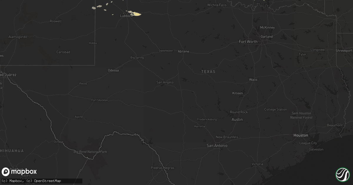
Hail Map in Texas on June 6, 2014
Get this storm
June 6 map
$229
one time, instant access
Download today. No call, no setup
Keep the $229
Bought the map and want the full workflow? Apply the entire $229 to a subscription within 7 days. None of it is wasted.
Every map, not just this one
This buys you this map. Subscription and you get every map we run, in the markets you choose from a few cities to whole states to nationwide. Plus real-time alerts the moment a storm fires.
Contact data
Name, contact info, occupancy, even credit band for addresses in the footprint. You go from where it hit to who to call.
Become the source they trust
Unlimited branding weather history reports on demand. You already have the documented answer ready for the property owner, and you are the one who showed up with it.
Property data and RoofTrace estimates
Pull up any address you have got, its value and the exact code rules for that jurisdiction, straight from One Click Code. Then RoofTrace estimates the squares, pitch, and roof value, priced the way you price.
Storm reports in Texas
Texas
| Date | Description |
|---|---|
| 06/06/20146:52 PM CDT | Golfball size hail on the east side of spearman. |
| 06/06/20146:47 PM CDT | Nickel to quarter sized hail falling |
| 06/06/20141:23 AM CDT | A local report indicates 59 MPH wind near 5 ENE HEREFORD |
| 06/05/201410:35 PM CDT | West texas mesonet |
| 06/05/201410:17 PM CDT | Large elm tree 3 foot diameter uprooted near maintenance headquarters... Damage to waterplant building near lake theo and mesonet site |
| 06/05/201410:12 PM CDT | Via kvii schoolnet |
| 06/05/201410:10 PM CDT | A local report indicates 58 MPH wind near 2 WSW CLARENDON |
| 06/05/201410:05 PM CDT | West texas mesonet - corrected wind speed |
| 06/05/201410:05 PM CDT | A local report indicates 62 MPH wind near 5 NE ALLISON |
| 06/05/201410:05 PM CDT | West texas mesonet |
| 06/05/201410:03 PM CDT | Via kvii schoolnet |
| 06/05/20149:59 PM CDT | Wind damage reported along highway 83 south of canadian including downed 4 to 8 inch tree limbs and downed trees. |
| 06/05/20149:50 PM CDT | Large tree was blocking westbound highway 60 |
| 06/05/20149:49 PM CDT | Via kvii schoolnet |
| 06/05/20149:46 PM CDT | A local report indicates 73 MPH wind near 6 E CANADIAN |
| 06/05/20149:39 PM CDT | Wind gusts observed over a period of 10 minutes. |
| 06/05/20149:35 PM CDT | Major wind damage at hemphill county airport. At least three hangars destroyed with four airplanes either damaged or destroyed. Snapped wooden utility poles and additio |
| 06/05/20149:31 PM CDT | Some damaged roofs and fences |
| 06/05/20149:26 PM CDT | Large tree limbs down near rockwell road and fm 2590 |
| 06/05/20149:26 PM CDT | Several farily large portable steel buildings blown around... One on top of a car and another through a fence |
| 06/05/20149:26 PM CDT | Several reports of large branches and snapped trees near main street and on highway 60. |
| 06/05/20149:23 PM CDT | Via kvii schoolnet |
| 06/05/20149:22 PM CDT | Reports of trees down |
| 06/05/20149:21 PM CDT | Three semi trucks blown over near interstate 40 mile marker 80. |
| 06/05/20149:20 PM CDT | A local report indicates 1.00 inch wind near 5 S MAPLE |
| 06/05/20149:20 PM CDT | Via kvii schoolnet |
| 06/05/20149:15 PM CDT | A local report indicates 67 MPH wind near 5 NNW PAMPA |
| 06/05/20149:15 PM CDT | West texas mesonet |
| 06/05/20149:15 PM CDT | West texas mesonet |
| 06/05/20149:12 PM CDT | One utility pole was down on tx hwy 114. |
| 06/05/20149:12 PM CDT | Via kvii schoolnet |
| 06/05/20149:12 PM CDT | Salty dog kvii school net. |
| 06/05/20149:12 PM CDT | Minor roof damage to permanent structure...rv leaned over onto a home...trampoline in powerlines. Time estimated. Addresses added to internal notes |
| 06/05/20149:12 PM CDT | Trampoline lofted over fence |
| 06/05/20149:11 PM CDT | Via kvii schoolnet |
| 06/05/20149:10 PM CDT | Via kvii schoolnet |
| 06/05/20149:05 PM CDT | West texas mesonet |
| 06/05/20149:00 PM CDT | West texas mesonet |
| 06/05/20149:00 PM CDT | West texas mesonet |
| 06/05/20148:43 PM CDT | Numerous utility poles...power lines...trees and limbs down in town. |
| 06/05/20148:43 PM CDT | Numerous utility poles down along us hwy 385 from 2s to 10s of muleshoe. Utility poles down on fm1055 sw of muleshoe. |
| 06/05/20148:40 PM CDT | West texas mesonet |
| 06/05/20148:15 PM CDT | Also heavy rain falling at the time. |
| 06/05/20148:15 PM CDT | A local report indicates 61 MPH wind near 3 W DUMAS |
| 06/05/20147:52 PM CDT | A local report indicates a tornado near 15 SSE WAKA |
| 06/05/20147:25 PM CDT | Golfball for a few minutes. Nickles continuing at this time. |
| 06/05/20147:24 PM CDT | Roof partially lifted from barn. Shingles lifted from house. Large tree branches down. Time estimated |
| 06/05/20147:15 PM CDT | A local report indicates 1.75 inch wind near 2 S SUNRAY |
| 06/05/20147:15 PM CDT | A local report indicates a tornado near 10 WNW CHANNING |
| 06/05/20147:13 PM CDT | Quarter to golf ball sized hail falling... Getting progressively bigger |
All States Impacted by Hail Map on June 6, 2014
Cities Impacted by Hail Map on June 6, 2014
- Wray, CO
- Idalia, CO
- Dalhart, TX
- Norcatur, KS
- Oberlin, KS
- La Loma, NM
- Smithville, GA
- Sunray, TX
- Saint Paul, NE
- Dannebrog, NE
- West Union, SC
- Holly, CO
- Stratton, CO
- Vona, CO
- Stratton, NE
- Loco, OK
- Duncan, OK
- Graham, OK
- Healdton, OK
- Fernandina Beach, FL
- Callahan, FL
- Pampa, TX
- Bushnell, NE
- Spearman, TX
- Stinnett, TX
- Stratford, TX
- Bison, OK
- Douglas, OK
- Lowndesboro, AL
- Hope Hull, AL
- Montgomery, AL
- Palestine, AR
- Muscle Shoals, AL
- Hollis, OK
- Burlington, CO
- Raton, NM
- Trinchera, CO
- Rockledge, GA
- East Dublin, GA
- Adrian, GA
- Cody, NE
- Nenzel, NE
- Owatonna, MN
- Waseca, MN
- Shattuck, OK
- Laverne, OK
- Elsie, NE
- Wallace, NE
- Chandler, OK
- Lookeba, OK
- Tuthill, SD
- Merriman, NE
- Jennings, KS
- Madill, OK
- Crookston, NE
- Waterford, MS
- Como, MS
- Lagrange, GA
- Arlington, TN
- Miami, TX
- Canadian, TX
- Ellabell, GA
- Enid, OK
- Wagon Mound, NM
- Kensington, KS
- West Blocton, AL
- Kimball, NE
- Holyoke, CO
- Haxtun, CO
- Henderson, TN
- Cherryvale, KS
- Sublette, KS
- Grady, NM
- Hennepin, OK
- Denmark, TN
- Jackson, TN
- Mooreland, OK
- Cullman, AL
- Bamberg, SC
- Solano, NM
- Gruver, TX
- Mosquero, NM
- Medicine Lodge, KS
- Sharon, KS
- Turrell, AR
- Earle, AR
- Tyronza, AR
- Cope, SC
- Branchville, SC
- Smoaks, SC
- Lodge, SC
- Ruffin, SC
- Vega, TX
- Macclenny, FL
- Glen Saint Mary, FL
- Sanderson, FL
- Eclectic, AL
- Lamar, AR
- Wellston, OK
- Rogersville, AL
- Healy, KS
- Borger, TX
- Skellytown, TX
- Jasper, FL
- Burbank, OK
- Akron, CO
- Marion Junction, AL
- Uniontown, AL
- Marion, AL
- Pell City, AL
- Riverside, AL
- Weston, CO
- Boncarbo, CO
- Trinidad, CO
- Weatherford, OK
- Keystone, NE
- Wellington, TX
- Larkspur, CO
- Jackson, GA
- Lamar, MO
- Calera, AL
- Texola, OK
- Erick, OK
- Shamrock, TX
- Brinkley, AR
- Philadelphia, MS
- Haigler, NE
- Smithville, OK
- Watson, OK
- Lexington, MS
- Elida, NM
- Hilliard, FL
- Clanton, AL
- Jemison, AL
- Thorsby, AL
- Verbena, AL
- Mullen, NE
- Comanche, OK
- Walters, OK
- Kit Carson, CO
- Syracuse, KS
- Kendall, KS
- Dodge City, KS
- New Raymer, CO
- Ada, OK
- Kersey, CO
- Hector, AR
- Dover, AR
- Maxwell, NM
- Balko, OK
- Stoneham, CO
- Padroni, CO
- Merino, CO
- Powhatan, AR
- Black Rock, AR
- Iliff, CO
- Crook, CO
- Sedgwick, CO
- Seneca, SC
- Orchard, CO
- Freedom, OK
- Beaver, OK
- Buffalo, OK
- Follett, TX
- May, OK
- Peetz, CO
- Hogansville, GA
- Grantville, GA
- North Platte, NE
- Plains, KS
- Linden, TN
- Decaturville, TN
- Kress, TX
- Paxton, NE
- Ogallala, NE
- Yuma, CO
- Cambridge, NE
- Bartley, NE
- Live Oak, FL
- Keysville, GA
- Letohatchee, AL
- Senoia, GA
- Gay, GA
- Montevallo, AL
- Brierfield, AL
- Alabaster, AL
- Helena, AL
- Medon, TN
- Toone, TN
- Hodges, AL
- Vina, AL
- Ainsworth, NE
- Briggsdale, CO
- Sarah, MS
- Julesburg, CO
- Gordon, NE
- Arapahoe, NE
- Edison, NE
- Pryor, OK
- Claremore, OK
- Hazen, AR
- Pueblo, CO
- Avondale, CO
- Cimarron, KS
- Madrid, NE
- Guntersville, AL
- Albertville, AL
- Rosston, OK
- Boelus, NE
- Kennedy, AL
- Hershey, NE
- Jet, OK
- Elk River, MN
- Ensign, KS
- Montezuma, KS
- Max, NE
- Aguilar, CO
- Longdale, OK
- Nash, OK
- Okmulgee, OK
- Beggs, OK
- Brule, NE
- Crawfordsville, AR
- Hartley, TX
- Wood Lake, NE
- Jacksonville, AL
- Hyannis, NE
- Carrier, OK
- Goltry, OK
- Belzoni, MS
- Ardmore, OK
- Wilson, OK
- Jacksonville, GA
- Stratford, OK
- Kilgore, NE
- Sutherland, NE
- Tryon, NE
- Louisville, AL
- Proctor, AR
- Lawrenceburg, TN
- Woodward, OK
- Fort Supply, OK
- Anniston, AL
- Piedmont, AL
- McRae Helena, GA
- Luray, TN
- Mount Vernon, GA
- Ovid, CO
- Hugoton, KS
- Liberal, KS
- Satanta, KS
- Meade, KS
- Kismet, KS
- Alexander City, AL
- House, NM
- Melrose, NM
- Linn Grove, IA
- Corona, NM
- Bosler, WY
- Rock River, WY
- Hooker, OK
- Stuart, OK
- Chapman, NE
- Saint Edward, NE
- Fullerton, NE
- Forgan, OK
- Lakin, KS
- Northport, AL
- Berry, AL
- Stilwell, OK
- Weleetka, OK
- Lorenzo, TX
- Ralls, TX
- Otis, CO
- Rockville, NE
- Johnstown, NE
- Valentine, NE
- Saint Francis, SD
- Fairview, OK
- Chester, OK
- Clayton, NM
- Kirwin, KS
- Ulysses, KS
- Garden City, KS
- Howells, NE
- Dodson, TX
- Childress, TX
- Butler, GA
- Mauk, GA
- Noble, OK
- Norman, OK
- Wright, KS
- Edson, KS
- Goodland, KS
- Redfield, KS
- Weskan, KS
- Tishomingo, OK
- Milburn, OK
- Saint Francis, KS
- Argonia, KS
- Freeport, KS
- Yulee, FL
- Sheridan Lake, CO
- Willow, OK
- Vinson, OK
- Mangum, OK
- Dublin, GA
- Rentz, GA
- Davis, OK
- Benkelman, NE
- Hartman, AR
- Taloga, OK
- Marlow, OK
- Crawford, OK
- Soperton, GA
- Tarrytown, GA
- Atoka, OK
- Pittsburg, OK
- Ellendale, MN
- Goodwell, OK
- Beulah, CO
- Curtis, NE
- Eva, AL
- Vinemont, AL
- Falkville, AL
- Cheyenne, OK
- Gate, OK
- Ford, KS
- De Soto, GA
- Leesburg, GA
- Perryton, TX
- Bird City, KS
- Washington, OK
- Blanchard, OK
- Coleman, OK
- Clovis, NM
- Ingalls, KS
- Lebanon, NE
- Colorado Springs, CO
- Yoder, CO
- Minneola, KS
- Double Springs, AL
- Albany, GA
- Springview, NE
- Union Springs, AL
- Hennessey, OK
- Marshall, OK
- Idalou, TX
- Slaton, TX
- Fort Stewart, GA
- Cedar, KS
- Gaylord, KS
- Athol, KS
- Hugo, CO
- Marianna, AR
- Moro, AR
- Parks, NE
- Carpenter, WY
- Hereford, CO
- Grover, CO
- Guymon, OK
- Bethune, CO
- Spencer, OK
- Jones, OK
- Arcadia, OK
- Edmond, OK
- Oklahoma City, OK
- Luther, OK
- Cimarron, NM
- Stamford, NE
- Riceboro, GA
- Seiling, OK
- Logan, NM
- Tucumcari, NM
- Marietta, OK
- Camden, AL
- Alberta, AL
- Putnam, OK
- Leedey, OK
- Mathews, AL
- Burns, WY
- Alva, OK
- Sawyerville, AL
- Forkland, AL
- Boligee, AL
- Cherokee, OK
- Pawnee, OK
- Turpin, OK
- Plainview, TX
- Mill Creek, OK
- Mannsville, OK
- Hinton, OK
- Cordele, GA
- McCook, NE
- Cheyenne, WY
- Brookwood, AL
- Adger, AL
- Perryville, AR
- Causey, NM
- Waukomis, OK
- Tyrone, OK
- Gray, GA
- Macon, GA
- Copeland, KS
- Booker, TX
- Wheeler, TX
- Sparks, OK
- Walhalla, SC
- Paoli, CO
- Rogers, NM
- Sulphur, OK
- Hayes Center, NE
- Olar, SC
- Perry, OK
- Tallassee, AL
- Roy, NM
- Amistad, NM
- Nara Visa, NM
- Fort Smith, AR
- Woodrow, CO
- Fay, OK
- Martin, SD
- Clayton, OK
- Pike Road, AL
- Cecil, AL
- Byromville, GA
- Vienna, GA
- Booneville, AR
- Morse, TX
- Elmore City, OK
- Leary, GA
- Deerfield, KS
- Louisville, MS
- Channing, TX
- Henryetta, OK
- Anoka, MN
- Pitts, GA
- Adair, OK
- Stapleton, NE
- Altus, AR
- Farwell, NE
- Ratliff City, OK
- Wynnewood, OK
- Springer, OK
- Dougherty, OK
- Lone Grove, OK
- Ringling, OK
- Colony, OK
- Corn, OK
- Hydro, OK
- Dumas, TX
- Gordo, AL
- Aliceville, AL
- Eutaw, AL
- Lithonia, GA
- Sylacauga, AL
- Talladega, AL
- Savannah, GA
- Indianola, NE
- Jerusalem, AR
- Claxton, GA
- Byhalia, MS
- Glencoe, OK
- Tutwiler, MS
- Charleston, MS
- Sumner, MS
- Elba, NE
- Grant, NE
- Castle Rock, CO
- West, MS
- Fredonia, KS
- Leslie, GA
- Eatonton, GA
- Monticello, GA
- Haddock, GA
- Safford, AL
- Rush, CO
- Statenville, GA
- Lake Park, GA
- Tuscaloosa, AL
- Mount Hope, AL
- Stillwater, OK
- Orlando, OK
- Shidler, OK
- Ripley, TN
- Pauls Valley, OK
- Covington, TN
- Briscoe, TX
- Lexington, AL
- Lamar, CO
- Elbert, CO
- Franktown, CO
- Ashland, KS
- Englewood, KS
- Tribune, KS
- Pritchett, CO
- Glenwood, GA
- Vaughn, NM
- Waynoka, OK
- Batesville, AR
- Williamson, GA
- Concord, GA
- Gordon, GA
- Homerville, GA
- Lake City, KS
- Saint Simons Island, GA
- Lexington, OK
- Wanette, OK
- Bolivar, TN
- Greenville, AL
- Fort Deposit, AL
- Pine Apple, AL
- Minter, AL
- Forest Home, AL
- Hayneville, AL
- Nicollet, MN
- Hickory Ridge, AR
- Custer City, OK
- Rhine, GA
- Yemassee, SC
- Seabrook, SC
- Islandton, SC
- Haswell, CO
- Brent, AL
- Grenada, MS
- Stonewall, OK
- Roff, OK
- Hereford, TX
- Friona, TX
- Summerfield, TX
- Oakwood, OK
- Whitman, NE
- Holcomb, KS
- Karval, CO
- Mcalister, NM
- Selma, AL
- Wellfleet, NE
- Dickens, NE
- Ocate, NM
- Jetmore, KS
- Marshallville, GA
- Harris, MN
- Argyle, GA
- Colt, AR
- Wynne, AR
- Pulaski, GA
- Metter, GA
- Register, GA
- Sterling, CO
- Alcova, WY
- Arapahoe, CO
- Naponee, NE
- Fayetteville, AR
- Waycross, GA
- Tecumseh, OK
- Banks, AL
- Foster, OK
- Crescent, OK
- Meadow Grove, NE
- Pierce, NE
- Norfolk, NE
- Okemah, OK
- Eufaula, AL
- Lambert, MS
- Bryceville, FL
- Greenville, MS
- Sheldon, MO
- Saint George, GA
- Paoli, OK
- Wayne, OK
- Milledgeville, GA
- Lubbock, TX
- Fort Sumner, NM
- Dexter, GA
- Champion, NE
- Alpine, AL
- Fort Morgan, CO
- Vance, AL
- Tumbling Shoals, AR
- Ida, AR
- Drasco, AR
- Wrightsville, GA
- Kite, GA
- Madison, NE
- Ridgeland, WI
- Wheeler, WI
- Maysville, OK
- Dardanelle, AR
- Delaware, AR
- Wilmore, KS
- Ozark, AR
- Forrest City, AR
- Tulia, TX
- Spearville, KS
- Geary, OK
- Sweetwater, OK
- Yale, OK
- La Crescent, MN
- Millport, AL
- Silver City, MS
- Maywood, NE
- Maxwell, NE
- Moorefield, NE
- Warrenton, GA
- Blakely, GA
- Haynes, AR
- Jacksonville, FL
- Marked Tree, AR
- Waynesboro, TN
- Brunswick, GA
- Rochelle, GA
- Huntsville, AR
- Witter, AR
- Conyers, GA
- Covington, GA
- Oxford, GA
- Batesville, MS
- Cuba, AL
- Scott City, KS
- Oakfield, GA
- Sylvester, GA
- Morrilton, AR
- Tillatoba, MS
- Scobey, MS
- Abbeville, AL
- Georgetown, GA
- Holcomb, MS
- Toomsboro, GA
- McIntyre, GA
- Yeso, NM
- Fowler, KS
- Equality, AL
- Rockford, AL
- Cove, AR
- Wickes, AR
- McCrory, AR
- Fitzpatrick, AL
- Jasper, AL
- Conway Springs, KS
- Rogersville, MO
- Arapaho, OK
- Thomas, OK
- Newkirk, OK
- Maple City, KS
- Trenton, SC
- Pulaski, TN
- Glennville, GA
- Milan, GA
- Cedar Rapids, NE
- Elba, AL
- Glenwood, AL
- Bath Springs, TN
- Medford, MN
- New Richland, MN
- Saint Paul, MN
- Lakeville, MN
- Wolbach, NE
- Titus, AL
- Cecil, AR
- Elgin, OK
- Hillsboro, GA
- Elk City, OK
- Brundidge, AL
- Clayton, AL
- Liberal, MO
- Mindenmines, MO
- Sentinel, OK
- Lone Wolf, OK
- Carter, OK
- Tuskegee, AL
- Blanco, OK
- Vilonia, AR
- El Paso, AR
- Earlsboro, OK
- Seminole, OK
- Eads, TN
- Brighton, TN
- Mason, TN
- Memphis, TN
- Cordova, TN
- Arkansas City, KS
- Stroud, OK
- Depew, OK
- London, AR
- Burlington, OK
- Beech Bluff, TN
- San Jon, NM
- Baconton, GA
- Portia, AR
- Trenton, TN
- Deer Trail, CO
- Jonesboro, AR
- Bono, AR
- Quitman, GA
- Pierceville, KS
- Norton, KS
- Coldwater, MS
- Hernando, MS
- McAlpin, FL
- Thomasville, AL
- Oakman, AL
- Townley, AL
- Waverly, TN
- Walterboro, SC
- Hartselle, AL
- Abbeville, GA
- Pineview, GA
- Sayre, OK
- Lindsay, OK
- Bradley, OK
- Ehrhardt, SC
- Tennille, GA
- Selden, KS
- Lonoke, AR
- Hackett, AR
- Cameron, OK
- Happy, TX
- Wayside, TX
- Camargo, OK
- Vici, OK
- Anthony, KS
- Scranton, AR
- Knoxville, AR
- Iuka, MS
- Albion, NE
- Troy, AL
- Moultrie, GA
- Norman Park, GA
- Phillips, NE
- Prague, OK
- Dundee, MS
- Grand Island, NE
- Hale Center, TX
- Tuskegee Institute, AL
- Sturgis, MS
- Orrville, AL
- Paden, OK
- Boley, OK
- Castle, OK
- Arabi, GA
- Seibert, CO
- Flagler, CO
- Reagan, TN
- Noxapater, MS
- Fargo, OK
- Jacksonville, AR
- Rosalie, NE
- Pine Bluffs, WY
- Paris, AR
- Chauncey, GA
- Sledge, MS
- Boone, CO
- Twin City, GA
- Swainsboro, GA
- Pep, NM
- Portales, NM
- Middleburg, FL
- Alma, NE
- Olive Branch, MS
- Benedict, KS
- Manchester, OK
- Wakita, OK
- Weldona, CO
- Augusta, AR
- Courtland, AL
- Moulton, AL
- Hinesville, GA
- Reydon, OK
- Lepanto, AR
- Platte Center, NE
- Long Pine, NE
- Jennings, FL
- Mclean, TX
- Claude, TX
- Saint Libory, NE
- Rich Hill, MO
- Hume, MO
- Akron, AL
- Gallion, AL
- Byars, OK
- Town Creek, AL
- Bristow, OK
- Walsenburg, CO
- Levelland, TX
- Newnan, GA
- Sharpsburg, GA
- Cherokee, IA
- Atkins, AR
- Danville, AL
- Hanna, WY
- Fayette, AL
- Brady, NE
- Palisade, NE
- Mayo, FL
- Wyoming, MN
- Mcalester, OK
- Woodstock, AL
- Madison, AL
- Lumpkin, GA
- Pottsville, AR
- Russellville, AR
- Scotts Hill, TN
- Wapanucka, OK
- Statesboro, GA
- Ringwood, OK
- Helena, OK
- Grove Hill, AL
- Dickinson, AL
- Fowler, CO
- Porum, OK
- Rutledge, AL
- Phil Campbell, AL
- Amorita, OK
- Mena, AR
- Okeene, OK
- Hitchcock, OK
- Kingfisher, OK
- Red Banks, MS
- Dighton, KS
- Center Ridge, AR
- Cleveland, AR
- Gill, CO
- Cascilla, MS
- Amherst, TX
- Enochs, TX
- Ludowici, GA
- Allenhurst, GA
- Wetumpka, AL
- Duck Hill, MS
- Carlsbad, NM
- Canute, OK
- Humphrey, NE
- Silverton, TX
- West Point, NE
- Watonga, OK
- Canton, OK
- Weaver, AL
- Phillipsburg, KS
- Quincy, FL
- Smith Center, KS
- Walsh, CO
- Cushing, OK
- Limon, CO
- Townsend, GA
- Sardis, MS
- Hanceville, AL
- Salem, AL
- Alamo, TN
- Friendship, TN
- Florence, AL
- Little Rock, AR
- Du Pont, GA
- Somerville, AL
- Dudley, GA
- Chester, GA
- Morton, TX
- Dennis, KS
- Autaugaville, AL
- Peyton, CO
- Brush, CO
- Snyder, CO
- Hillrose, CO
- Centreville, AL
- Lawley, AL
- Brooks, GA
- Franklin, GA
- Sudan, TX
- Maple, TX
- Dawson, GA
- Loving, NM
- Cadwell, GA
- Springfield, CO
- Sedalia, CO
- Fitzhugh, OK
- Norway, SC
- Meno, OK
- Broken Arrow, OK
- Dimmitt, TX
- Oxford, MS
- Cleveland, MS
- Merigold, MS
- Isabel, KS
- Pinson, TN
- Winona, MS
- McCarley, MS
- Arnett, OK
- Elkhart, KS
- Tyler, AL
- Epes, AL
- Greensboro, AL
- Marks, MS
- Clopton, AL
- Newville, AL
- Dexter, KS
- Rosemount, MN
- Burnsville, MN
- Coalgate, OK
- Union, MS
- Notasulga, AL
- Germantown, TN
- Toomsuba, MS
- Bancroft, NE
- Fairfax, OK
- Beaver City, NE
- Almena, KS
- Hillsboro, AL
- Granite, OK
- Glade, KS
- Elmore, AL
- Deatsville, AL
- Trinity, AL
- Booneville, MS
- Carthage, MS
- Bradford, AR
- Elkmont, AL
- Venango, NE
- Republican City, NE
- Newbern, AL
- Compton, AR
- Hollywood, SC
- Adams Run, SC
- Wardville, OK
- Drew, MS
- Ruleville, MS
- Wilsonville, NE
- Monroe, GA
- Loganville, GA
- Canyon, TX
- Groom, TX
- Amarillo, TX
- Wildorado, TX
- Panhandle, TX
- Alexander, KS
- Bazine, KS
- Leoti, KS
- Bison, KS
- Albert, KS
- Rush Center, KS
- Otis, KS
- Great Bend, KS
- Nekoma, KS
- Hoisington, KS
- La Crosse, KS
- Olmitz, KS
- Ellinwood, KS
- McCracken, KS
- Hudson, KS
- Ness City, KS
- Farmville, NC
- Greenville, NC
- Chocowinity, NC
- Blounts Creek, NC
- Aurora, NC
- Edward, NC
- Clinton, NC
- La Grange, NC
- Snow Hill, NC
- Newport, NC
- Swansboro, NC
- Stella, NC
- Emerald Isle, NC
- Granby, MO
- Pierce City, MO
- Stark City, MO
- Neosho, MO
- Mount Vernon, MO
- Everton, MO
- Ash Grove, MO
- Miller, MO
- Bois D Arc, MO
- Halltown, MO
- Willard, MO
- Stotts City, MO


