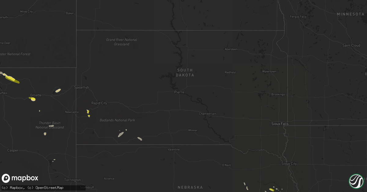
Hail Map in South Dakota on June 4, 2022
Get this storm
June 4 map
$229
one time, instant access
Download today. No call, no setup
Keep the $229
Bought the map and want the full workflow? Apply the entire $229 to a subscription within 7 days. None of it is wasted.
Every map, not just this one
This buys you this map. Subscription and you get every map we run, in the markets you choose from a few cities to whole states to nationwide. Plus real-time alerts the moment a storm fires.
Contact data
Name, contact info, occupancy, even credit band for addresses in the footprint. You go from where it hit to who to call.
Become the source they trust
Unlimited branding weather history reports on demand. You already have the documented answer ready for the property owner, and you are the one who showed up with it.
Property data and RoofTrace estimates
Pull up any address you have got, its value and the exact code rules for that jurisdiction, straight from One Click Code. Then RoofTrace estimates the squares, pitch, and roof value, priced the way you price.
Storm reports in South Dakota
South Dakota
| Date | Description |
|---|---|
| 06/04/20223:10 PM CDT | A local report indicates 1.00 inch wind near 1 SSW CUSTER |
| 06/04/20222:50 PM CDT | A local report indicates 1.00 inch wind near 5 NNW CUSTER |
| 06/04/20227:40 AM CDT | At 1239 AM MDT, a severe thunderstorm was located near Swett, or 10 miles west of Martin, moving east at 15 mph. HAZARD...Ping pong ball size hail. SOURCE...Radar indicated. IMPACT...People and animals outdoors will be injured. Expect damage to roofs, siding, windows, and vehicles. Locations impacted include... Martin, LaCreek North Housing, Sunrise Housing and Lacreek Wildlife Refuge. |
| 06/04/20227:03 AM CDT | At 1202 AM MDT, a severe thunderstorm was located 9 miles west of Merriman, or 17 miles northeast of Gordon, moving southeast at 25 mph. HAZARD...60 mph wind gusts and quarter size hail. SOURCE...Radar indicated. IMPACT...Hail damage to vehicles is expected. Expect wind damage to roofs, siding, and trees. Locations impacted include... Merriman, Highway 61 Crossing The Niobrara River, Irwin, Intersection of Highway 61 and Shadbolt Road and Intersection of Highway 20 and Irwin Road.This includes the following highways... Highway 20 between mile markers 119 and 147. Highway 61 between mile markers 203 and 230. |
| 06/03/20228:44 PM CDT | At 143 PM MDT, a severe thunderstorm was located over Crazy Horse Memorial, or 4 miles north of Custer, moving southeast at 15 mph. HAZARD...Quarter size hail. SOURCE...Radar indicated. IMPACT...Damage to vehicles is expected. This severe thunderstorm will be near... Custer State Park around 150 PM MDT. Custer around 200 PM MDT.Other locations in the path of this severe thunderstorm includeStockade Lake, Center Lake, Black Hills Playhouse, Legion Lake andMount Coolidge. |
All States Impacted by Hail Map on June 4, 2022
Cities Impacted by Hail Map on June 4, 2022
- Columbus, NE
- Silver Creek, NE
- Osceola, NE
- Porcupine, SD
- Cambridge, NE
- Concordia, KS
- Potter, NE
- Norton, KS
- Edna, TX
- Pine Ridge, SD
- Manderson, SD
- Arcadia, NE
- North Platte, NE
- Hershey, NE
- Paxton, NE
- Sutherland, NE
- Lolita, TX
- York, NE
- Hazelton, KS
- Vona, CO
- St John, KS
- Moorcroft, WY
- Upton, WY
- Sundance, WY
- Medicine Lodge, KS
- Sharon, KS
- Eddyville, NE
- Sumner, NE
- Oconto, NE
- Overton, NE
- Clarks, NE
- Harvard, NE
- Ord, NE
- Fullerton, NE
- Polk, NE
- Aurora, NE
- North Loup, NE
- Saint Paul, NE
- Chapman, NE
- Ashton, NE
- Archer, NE
- Hordville, NE
- Scotia, NE
- Marquette, NE
- Hampton, NE
- Central City, NE
- Palmer, NE
- Giltner, NE
- Loup City, NE
- Wolbach, NE
- Elba, NE
- Sheridan, WY
- Clearmont, WY
- Norcatur, KS
- Lenora, KS
- Howells, NE
- Clarkson, NE
- West Point, NE
- Park, KS
- Wisner, NE
- Quinter, KS
- Albert, KS
- Stoneham, CO
- Scandia, KS
- Port Arthur, TX
- Louise, TX
- Douglas, WY
- Colby, KS
- Levant, KS
- Kanorado, KS
- Comstock, NE
- Albion, NE
- Petersburg, NE
- Wakeeney, KS
- Mason City, NE
- Callaway, NE
- Merna, NE
- Ansley, NE
- Westerville, NE
- Broken Bow, NE
- Glendo, WY
- Garber, OK
- Billings, OK
- Sylvan Grove, KS
- Burdett, KS
- Alexander, KS
- Center Conway, NH
- Fryeburg, ME
- Hiram, ME
- Denmark, ME
- Madison, NH
- Sebago, ME
- Conway, NH
- Brownfield, ME
- Larned, KS
- Pawnee Rock, KS
- Wilsonville, NE
- Troy, AL
- Brundidge, AL
- Stockton, KS
- Ravenna, NE
- Shelton, NE
- Ellis, KS
- Leigh, NE
- Harrisburg, NE
- Miller, NE
- Amherst, NE
- Rexford, KS
- Gem, KS
- Atwood, KS
- Hoxie, KS
- Selden, KS
- Hoisington, KS
- Russell, KS
- Olmitz, KS
- Otis, KS
- Platte Center, NE
- Monroe, NE
- Gillette, WY
- Custer, SD
- Brewster, KS
- Natoma, KS
- Martin, SD
- Burlington, CO
- Morland, KS
- Stapleton, NE
- Newcastle, WY
- Wood River, NE
- Elm Creek, NE
- Kearney, NE
- Oberlin, KS
- Victoria, KS
- Bison, KS
- Genoa, NE
- Arnold, KS
- Utica, KS
- Hill City, SD
- Pond Creek, OK
- Hunter, OK
- Elgin, NE
- Healy, KS
- Hill City, KS
- Attica, KS
- Zenda, KS
- Sargent, NE
- Victoria, TX
- Fort Stockton, TX
- Oshkosh, NE
- Leoti, KS
- Thermopolis, WY
- Shoshoni, WY
- Hays, KS
- Liebenthal, KS
- McCracken, KS
- Schoenchen, KS
- Ogallah, KS
- La Crosse, KS
- Lysite, WY
- Woodston, KS
- Clifton, KS
- Coffeyville, KS
- Great Bend, KS
- Rising City, NE
- David City, NE
- McCook, NE
- Jennings, KS
- Bartley, NE
- Danbury, NE
- Moorefield, NE
- Lebanon, NE
- Curtis, NE
- Stockville, NE
- Indianola, NE
- Maxwell, NE
- Farnam, NE
- Dresden, KS
- Maywood, NE
- Brady, NE
- Gaylord, KS
- Alton, KS
- Penokee, KS
- Shelby, NE
- Bellwood, NE
- Big Springs, NE
- Brule, NE
- Chappell, NE
- Port Lavaca, TX
- Stromsburg, NE
- Wellfleet, NE
- Phillipsburg, KS
- Waldo, KS
- Luray, KS
- Grinnell, KS
- Gove, KS
- Perry, OK
- Isabel, KS
- Scribner, NE
- Dryden, TX
- Lenapah, OK
- Macksville, KS
- Byers, KS
- Sawyer, KS
- Iuka, KS
- Pratt, KS
- Nashville, KS
- Cunningham, KS
- Stafford, KS
- Turon, KS
- Dighton, KS
- Refugio, TX
- Schuyler, NE
- Bloomington, TX
- Inez, TX
- La Salle, TX
- Tivoli, TX
- Abie, NE
- Linwood, NE
- Bruno, NE
- Manchester, OK
- Waldron, KS
- Burlington, OK
- Amorita, OK
- Nash, OK
- Jet, OK
- Enid, OK
- Wakita, OK
- Belpre, KS
- Glade, KS
- Grainfield, KS
- Mankato, KS
- Ganado, TX
- Osborne, KS
- Rogers, NE
- Garfield, KS
- Rozel, KS
- Lewis, KS
- Ransom, KS
- Rock Port, MO
- Brownville, NE
- Nemaha, NE
- Medford, OK
- Beeville, TX
- Saint Edward, NE
- Phillips, ME
- Strong, ME
- Clyde, KS
- Kanopolis, KS
- Ellsworth, KS
- Goodland, KS
- Edson, KS
- Jackman, ME
- Pittsburg, NH
- Prague, NE
- Arnold, NE
- Hooper, NE
- Dodge, NE
- Cairo, NE
- Arvada, WY
- Clayton, KS
- Augusta, KS
- Wichita, KS
- Towanda, KS
- Andover, KS


