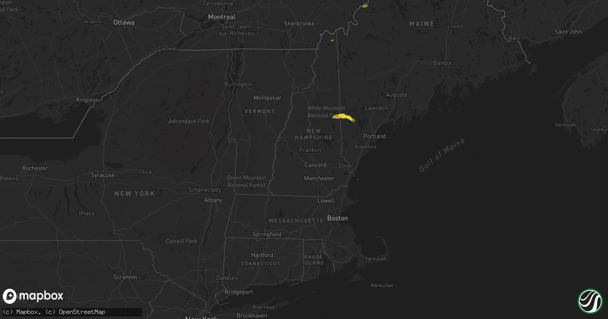
Hail Map in New Hampshire on June 4, 2022
Get this storm
June 4 map
$229
one time, instant access
Download today. No call, no setup
Keep the $229
Bought the map and want the full workflow? Apply the entire $229 to a subscription within 7 days. None of it is wasted.
Every map, not just this one
This buys you this map. Subscription and you get every map we run, in the markets you choose from a few cities to whole states to nationwide. Plus real-time alerts the moment a storm fires.
Contact data
Name, contact info, occupancy, even credit band for addresses in the footprint. You go from where it hit to who to call.
Become the source they trust
Unlimited branding weather history reports on demand. You already have the documented answer ready for the property owner, and you are the one who showed up with it.
Property data and RoofTrace estimates
Pull up any address you have got, its value and the exact code rules for that jurisdiction, straight from One Click Code. Then RoofTrace estimates the squares, pitch, and roof value, priced the way you price.
Storm reports in New Hampshire
New Hampshire
| Date | Description |
|---|---|
| 06/04/20225:58 PM CDT | Hail size slightly larger than a quarter found in conway... Nh. |
| 06/04/20225:47 PM CDT | Time estimated based on radar. |
| 06/04/20225:45 PM CDT | Delayed report. |
| 06/04/20225:42 PM CDT | Delayed report. Strong winds also blew down branches on east end of conway lake. Time estimated from radar. |
| 06/04/20225:42 PM CDT | Delayed report. Reported by weather spotter. |
| 06/04/20224:38 PM CDT | Delayed report. Hail reported by multiple residents. Time estimated from radar. |
| 06/04/20222:05 AM CDT | At 705 PM EDT, a severe thunderstorm was located over Fryeburg, moving northeast at 25 mph. HAZARD...60 mph wind gusts and quarter size hail. SOURCE...Radar indicated. IMPACT...Hail damage to vehicles is expected. Expect wind damage to roofs, siding, and trees. Locations impacted include... Conway, Bridgton, Fryeburg, Naples, Waterford, Harrison, Brownfield, Denmark, Eaton, Sweden and Otisfield. |
| 06/04/20221:30 AM CDT | At 630 PM EDT, a severe thunderstorm was located near Conway, moving northeast at 25 mph. HAZARD...60 mph wind gusts and quarter size hail. SOURCE...Radar indicated. IMPACT...Hail damage to vehicles is expected. Expect wind damage to roofs, siding, and trees. Locations impacted include... Conway, Bridgton, Fryeburg, Madison, Brownfield, Denmark, Lovell, Albany, Eaton and Sweden. |
All States Impacted by Hail Map on June 4, 2022
Cities Impacted by Hail Map on June 4, 2022
- Columbus, NE
- Silver Creek, NE
- Osceola, NE
- Porcupine, SD
- Cambridge, NE
- Concordia, KS
- Potter, NE
- Norton, KS
- Edna, TX
- Pine Ridge, SD
- Manderson, SD
- Arcadia, NE
- North Platte, NE
- Hershey, NE
- Paxton, NE
- Sutherland, NE
- Lolita, TX
- York, NE
- Hazelton, KS
- Vona, CO
- St John, KS
- Moorcroft, WY
- Upton, WY
- Sundance, WY
- Medicine Lodge, KS
- Sharon, KS
- Eddyville, NE
- Sumner, NE
- Oconto, NE
- Overton, NE
- Clarks, NE
- Harvard, NE
- Ord, NE
- Fullerton, NE
- Polk, NE
- Aurora, NE
- North Loup, NE
- Saint Paul, NE
- Chapman, NE
- Ashton, NE
- Archer, NE
- Hordville, NE
- Scotia, NE
- Marquette, NE
- Hampton, NE
- Central City, NE
- Palmer, NE
- Giltner, NE
- Loup City, NE
- Wolbach, NE
- Elba, NE
- Sheridan, WY
- Clearmont, WY
- Norcatur, KS
- Lenora, KS
- Howells, NE
- Clarkson, NE
- West Point, NE
- Park, KS
- Wisner, NE
- Quinter, KS
- Albert, KS
- Stoneham, CO
- Scandia, KS
- Port Arthur, TX
- Louise, TX
- Douglas, WY
- Colby, KS
- Levant, KS
- Kanorado, KS
- Comstock, NE
- Albion, NE
- Petersburg, NE
- Wakeeney, KS
- Mason City, NE
- Callaway, NE
- Merna, NE
- Ansley, NE
- Westerville, NE
- Broken Bow, NE
- Glendo, WY
- Garber, OK
- Billings, OK
- Sylvan Grove, KS
- Burdett, KS
- Alexander, KS
- Center Conway, NH
- Fryeburg, ME
- Hiram, ME
- Denmark, ME
- Madison, NH
- Sebago, ME
- Conway, NH
- Brownfield, ME
- Larned, KS
- Pawnee Rock, KS
- Wilsonville, NE
- Troy, AL
- Brundidge, AL
- Stockton, KS
- Ravenna, NE
- Shelton, NE
- Ellis, KS
- Leigh, NE
- Harrisburg, NE
- Miller, NE
- Amherst, NE
- Rexford, KS
- Gem, KS
- Atwood, KS
- Hoxie, KS
- Selden, KS
- Hoisington, KS
- Russell, KS
- Olmitz, KS
- Otis, KS
- Platte Center, NE
- Monroe, NE
- Gillette, WY
- Custer, SD
- Brewster, KS
- Natoma, KS
- Martin, SD
- Burlington, CO
- Morland, KS
- Stapleton, NE
- Newcastle, WY
- Wood River, NE
- Elm Creek, NE
- Kearney, NE
- Oberlin, KS
- Victoria, KS
- Bison, KS
- Genoa, NE
- Arnold, KS
- Utica, KS
- Hill City, SD
- Pond Creek, OK
- Hunter, OK
- Elgin, NE
- Healy, KS
- Hill City, KS
- Attica, KS
- Zenda, KS
- Sargent, NE
- Victoria, TX
- Fort Stockton, TX
- Oshkosh, NE
- Leoti, KS
- Thermopolis, WY
- Shoshoni, WY
- Hays, KS
- Liebenthal, KS
- McCracken, KS
- Schoenchen, KS
- Ogallah, KS
- La Crosse, KS
- Lysite, WY
- Woodston, KS
- Clifton, KS
- Coffeyville, KS
- Great Bend, KS
- Rising City, NE
- David City, NE
- McCook, NE
- Jennings, KS
- Bartley, NE
- Danbury, NE
- Moorefield, NE
- Lebanon, NE
- Curtis, NE
- Stockville, NE
- Indianola, NE
- Maxwell, NE
- Farnam, NE
- Dresden, KS
- Maywood, NE
- Brady, NE
- Gaylord, KS
- Alton, KS
- Penokee, KS
- Shelby, NE
- Bellwood, NE
- Big Springs, NE
- Brule, NE
- Chappell, NE
- Port Lavaca, TX
- Stromsburg, NE
- Wellfleet, NE
- Phillipsburg, KS
- Waldo, KS
- Luray, KS
- Grinnell, KS
- Gove, KS
- Perry, OK
- Isabel, KS
- Scribner, NE
- Dryden, TX
- Lenapah, OK
- Macksville, KS
- Byers, KS
- Sawyer, KS
- Iuka, KS
- Pratt, KS
- Nashville, KS
- Cunningham, KS
- Stafford, KS
- Turon, KS
- Dighton, KS
- Refugio, TX
- Schuyler, NE
- Bloomington, TX
- Inez, TX
- La Salle, TX
- Tivoli, TX
- Abie, NE
- Linwood, NE
- Bruno, NE
- Manchester, OK
- Waldron, KS
- Burlington, OK
- Amorita, OK
- Nash, OK
- Jet, OK
- Enid, OK
- Wakita, OK
- Belpre, KS
- Glade, KS
- Grainfield, KS
- Mankato, KS
- Ganado, TX
- Osborne, KS
- Rogers, NE
- Garfield, KS
- Rozel, KS
- Lewis, KS
- Ransom, KS
- Rock Port, MO
- Brownville, NE
- Nemaha, NE
- Medford, OK
- Beeville, TX
- Saint Edward, NE
- Phillips, ME
- Strong, ME
- Clyde, KS
- Kanopolis, KS
- Ellsworth, KS
- Goodland, KS
- Edson, KS
- Jackman, ME
- Pittsburg, NH
- Prague, NE
- Arnold, NE
- Hooper, NE
- Dodge, NE
- Cairo, NE
- Arvada, WY
- Clayton, KS
- Augusta, KS
- Wichita, KS
- Towanda, KS
- Andover, KS


