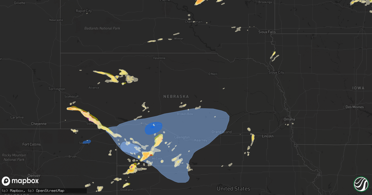
Hail Map in Nebraska on June 2, 2024
Get this storm
June 2 map
$229
one time, instant access
Download today. No call, no setup
Keep the $229
Bought the map and want the full workflow? Apply the entire $229 to a subscription within 7 days. None of it is wasted.
Every map, not just this one
This buys you this map. Subscription and you get every map we run, in the markets you choose from a few cities to whole states to nationwide. Plus real-time alerts the moment a storm fires.
Contact data
Name, contact info, occupancy, even credit band for addresses in the footprint. You go from where it hit to who to call.
Become the source they trust
Unlimited branding weather history reports on demand. You already have the documented answer ready for the property owner, and you are the one who showed up with it.
Property data and RoofTrace estimates
Pull up any address you have got, its value and the exact code rules for that jurisdiction, straight from One Click Code. Then RoofTrace estimates the squares, pitch, and roof value, priced the way you price.
Storm reports in Nebraska
Nebraska
| Date | Description |
|---|---|
| 06/02/20246:58 PM CDT | Picture of hail compared to a quarter via facebook... Stones appear to be larger than the quarter. |
| 06/02/20246:45 PM CDT | Corrects previous tstm wnd gst report from enders. Estimated 85 mph winds with blowing dust. Time is estimated. |
| 06/02/20246:40 PM CDT | A local report indicates 72 MPH wind near Imperial |
| 06/02/20246:32 PM CDT | A local report indicates 60 MPH wind near 7 NE Mullen |
| 06/02/20246:28 PM CDT | A local report indicates 79 MPH wind near 5 N Imperial |
| 06/02/20246:09 PM CDT | 6 inch tree limbs breaking in ogallala. |
| 06/02/20246:09 PM CDT | Large healthy tree knocked down in town. |
| 06/02/20245:58 PM CDT | Golf ball size hail with the 60 mph wind. |
| 06/02/20245:53 PM CDT | A local report indicates 60 MPH wind near 18 N Whitman |
| 06/02/20245:50 PM CDT | Powerline down in venango. |
| 06/02/20244:50 PM CDT | A local report indicates 1.50 inch wind near 28 SSE Clinton |
| 06/02/20244:30 PM CDT | Trained spotter reports hail up to the size of one inch in diameter. Delayed report. |
| 06/02/20244:11 PM CDT | A local report indicates 1.00 inch wind near Gurley |
| 06/02/20244:06 PM CDT | A local report indicates 1.50 inch wind near 14 SSE Hay Springs |
| 06/02/20243:40 PM CDT | Corrects previous hail report from 11 ne potter. Public report relayed by emergency management. |
| 06/02/20243:40 PM CDT | Public report relayed by emergency management. |
| 06/02/20242:40 PM CDT | Storm chaser report of two inch diameter hail near the hilltop cafe off highway 71 in banner county. |
| 06/02/20242:35 PM CDT | Trained spotter reports ping pong size hail stones near the south bound weigh station off highway 71 in banner county... Ne. |
| 06/02/20242:30 PM CDT | Trained weather spotter reports quarter sized hail in harrisburg... Ne. |
| 06/02/202412:04 AM CDT | Personal weather station. |
| 06/01/202410:05 PM CDT | Howard county dispatch reports multiple reports of downed trees and large branches in st paul. Calls started coming in to dispatch at 22:17 cdt. Time of damage estimate |
| 06/01/20249:46 PM CDT | Personal weather station. |
| 06/01/20249:39 PM CDT | Time estimated from radar. There was a tree down across the road in shelton. |
| 06/01/20249:38 PM CDT | A local report indicates 63 MPH wind near 7 S Boelus |
| 06/01/20249:24 PM CDT | Social media report of strong winds and blowing dust resulting in low visibility. |
| 06/01/20249:18 PM CDT | Time is estimated from radar. A power line was down to a home in kearney possibly related to the storm and it started a house fire. |
| 06/01/20249:09 PM CDT | Social media report of estimated winds of 60 mph. Time estimated based on radar. |
| 06/01/20248:55 PM CDT | Pws-kneansle6. |
| 06/01/20248:55 PM CDT | Personal weather station. |
| 06/01/20248:33 PM CDT | A local report indicates 58 MPH wind near 3 NNW Broken Bow |
| 06/01/20248:30 PM CDT | A local report indicates 58 MPH wind near 3.9 NNW Sumner |
| 06/01/20248:12 PM CDT | A local report indicates 65 MPH wind near 8 W Callaway |
| 06/01/20248:05 PM CDT | Mesonet station ur443 willow island |
| 06/01/20248:04 PM CDT | 74 mph wind gust taken with handheld anemometer. |
| 06/01/20248:00 PM CDT | Ne mesonet site. |
| 06/01/20247:59 PM CDT | A local report indicates 60 MPH wind near 6.5 NNE Willow Island |
| 06/01/20247:59 PM CDT | Weatherlink site timmerman house. |
| 06/01/20247:56 PM CDT | A local report indicates 72 MPH wind near 5 S Stockville |
| 06/01/20247:49 PM CDT | A local report indicates 63 MPH wind near 2.8 NNE Gothenburg |
| 06/01/20247:48 PM CDT | A local report indicates 66 MPH wind near 1.9 NE Farnam |
| 06/01/20247:44 PM CDT | Weatherlink site bryans house. |
| 06/01/20247:43 PM CDT | Asos station kmck mccook airport. |
| 06/01/20247:40 PM CDT | Report and photo of a downed tree in mccook. Time estimated. |
| 06/01/20247:39 PM CDT | A local report indicates 58 MPH wind near 6 WSW Brady |
| 06/01/20247:37 PM CDT | Estimated 60 mph wind with large branches down. |
| 06/01/20247:36 PM CDT | Report of tree down at location... Time estimated by radar. Lower branches of tree was not healthy. |
| 06/01/20247:35 PM CDT | Public report via social media of wind damage 5 north and 1 east of culbertson. Report building roofs gone... Pivot overturned... Trees snapped... Some power poles shee |
| 06/01/20247:30 PM CDT | Site aw_2902d. |
| 06/01/20247:27 PM CDT | Reports of trees down all over town... Power outage acr |
| 06/01/20247:27 PM CDT | Reports of trees down all over town... Power outage across almsot entire town. A powerline is down on front street in north platte. |
| 06/01/20247:25 PM CDT | Public report and photo via social media. Estimated ping pong ball size hail from photo. Time estimated from radar. |
| 06/01/20247:24 PM CDT | Picture of golf ball size hail received from social media. Time from radar. |
| 06/01/20247:22 PM CDT | Ambient weather station trenton. |
| 06/01/20247:22 PM CDT | Klbf gusted to 81 mph at 722 pm cdt. |
| 06/01/20247:21 PM CDT | A local report indicates 71 MPH wind near 5 S North Platte |
| 06/01/20247:18 PM CDT | A local report indicates 97 MPH wind near 4 SSW North Platte |
| 06/01/20247:15 PM CDT | Public report via social media of 1 inch hail and a few closer to 2 inches. Time estimated from radar. |
| 06/01/20247:12 PM CDT | Quarter to half dollar size hail reported. |
| 06/01/20247:12 PM CDT | Quarter to half dol |
| 06/01/20247:11 PM CDT | A local report indicates 80 MPH wind near 5 SSW North Platte |
| 06/01/20247:05 PM CDT | Trained spotter reports golf ball size hail. |
| 06/01/20247:05 PM CDT | Report of golf ball size hail. |
| 06/01/20247:05 PM CDT | Report and photo via social media. |
| 06/01/20247:00 PM CDT | Mesonet gust. |
| 06/01/20247:00 PM CDT | Report and photo via social media. |
All States Impacted by Hail Map on June 2, 2024
Cities Impacted by Hail Map on June 2, 2024
- Moorefield, NE
- Shamrock, TX
- Pampa, TX
- Mclean, TX
- Eustis, NE
- Papillion, NE
- Farnam, NE
- Pingree, ND
- Norton, KS
- Elwood, NE
- Offutt Afb, NE
- Bellevue, NE
- Wellington, TX
- Wilsonville, NE
- Hendley, NE
- Council Bluffs, IA
- Cambridge, NE
- Chillicothe, TX
- Eldorado, OK
- Beaver City, NE
- Holbrook, NE
- Arapahoe, NE
- Vernon, TX
- Dodson, TX
- Hollis, OK
- Edison, NE
- Hartland, MN
- Albert Lea, MN
- Long Island, KS
- Oxford, NE
- Gould, OK
- Duke, OK
- Mangum, OK
- Orleans, NE
- Cimarron, KS
- Odell, TX
- Phillipsburg, KS
- Prairie View, KS
- Stamford, NE
- Olustee, OK
- Holdrege, NE
- Atlanta, NE
- Dodge City, KS
- Altus, OK
- Elmer, OK
- Electra, TX
- Blair, OK
- Cleveland, ND
- Harrold, TX
- Medina, ND
- Frederick, OK
- Pierre Part, LA
- Morgan City, LA
- Napoleonville, LA
- Altus Afb, OK
- Iowa Park, TX
- Burkburnett, TX
- Davidson, OK
- Oklaunion, TX
- Spearville, KS
- Loveland, OK
- Arnaudville, LA
- Wichita Falls, TX
- Thibodaux, LA
- Gibson, LA
- Grandfield, OK
- Hollister, OK
- Walters, OK
- Devol, OK
- Schriever, LA
- Donner, LA
- Saint Martinville, LA
- Chattanooga, OK
- Breaux Bridge, LA
- Lawton, OK
- Faxon, OK
- Theriot, LA
- Indiahoma, OK
- Snyder, OK
- Cache, OK
- Medicine Park, OK
- Elba, NE
- Chickasha, OK
- Loreauville, LA
- Jeanerette, LA
- New Iberia, LA
- Cement, OK
- Anadarko, OK
- Fletcher, OK
- Paducah, TX
- Wing, ND
- Temple, OK
- Tuttle, ND
- Petrolia, TX
- Ninnekah, OK
- Verden, OK
- Geronimo, OK
- Waurika, OK
- Sheppard Afb, TX
- Comanche, OK
- Duncan, OK
- Chaseley, ND
- Seymour, TX
- Oklahoma City, OK
- Yukon, OK
- Robinson, ND
- Hurdsfield, ND
- Bowdon, ND
- Edmond, OK
- Walden, CO
- Bethany, OK
- Hastings, OK
- Randlett, OK
- Benjamin, TX
- Dunseith, ND
- Byers, TX
- Knox City, TX
- Munday, TX
- Ryan, OK
- Ringling, OK
- Loco, OK
- New Rockford, ND
- Old Glory, TX
- Mylo, ND
- Henrietta, TX
- Holliday, TX
- Saint John, ND
- Goree, TX
- O'Brien, TX
- Elmore City, OK
- Sheyenne, ND
- Kaplan, LA
- Hennepin, OK
- Ratliff City, OK
- Rocklake, ND
- Graham, OK
- Healdton, OK
- Harrisburg, NE
- Leeds, ND
- Rochester, TX
- Cando, ND
- Springer, OK
- Wilson, OK
- Ardmore, OK
- Davis, OK
- Woodworth, ND
- Weinert, TX
- Terral, OK
- Ringgold, TX
- Throckmorton, TX
- Rule, TX
- Nocona, TX
- Lone Grove, OK
- Mcclusky, ND
- Crawford, NE
- Wishek, ND
- Zeeland, ND
- Hague, ND
- Bellevue, TX
- New England, ND
- Egeland, ND
- Haskell, TX
- Abbeville, LA
- Newcastle, TX
- Bayard, NE
- Langdon, ND
- Munich, ND
- Denhoff, ND
- Olney, TX
- Bowie, TX
- Lindsay, TX
- Saint Jo, TX
- Muenster, TX
- Gainesville, TX
- Goodrich, ND
- Manville, WY
- Dalton, NE
- Bridgeport, NE
- Potter, NE
- Wales, ND
- Prairie City, SD
- Martin, ND
- Montague, TX
- Burneyville, OK
- Leon, OK
- Bushnell, NE
- Las Animas, CO
- Pine Bluffs, WY
- Lusk, WY
- Lehr, ND
- Mud Butte, SD
- Meadow, SD
- Harvey, ND
- Loving, TX
- McLaughlin, SD
- Gering, NE
- Fort Stockton, TX
- Napoleon, ND
- Hay Springs, NE
- Fessenden, ND
- Gurley, NE
- Graham, TX
- Mill Creek, OK
- Tishomingo, OK
- Mott, ND
- New Raymer, CO
- Dickinson, ND
- Jacksboro, TX
- Windthorst, TX
- Forestburg, TX
- Madill, OK
- Gackle, ND
- Sidney, NE
- Whitesboro, TX
- Faith, SD
- Buchanan, ND
- Kenefic, OK
- Ellsworth, NE
- Jermyn, TX
- Bryson, TX
- Padroni, CO
- Krum, TX
- Valley View, TX
- Collinsville, TX
- Gladstone, ND
- Fredonia, ND
- Minnewaukan, ND
- Milburn, OK
- Bingham, NE
- Merriman, NE
- Decatur, TX
- Sanger, TX
- Lemmon, SD
- Tappen, ND
- Saint Peter, MN
- Maddock, ND
- Rushville, NE
- Tioga, TX
- Lodgepole, NE
- Dawson, ND
- Pilot Point, TX
- Le Sueur, MN
- Denton, TX
- Ponder, TX
- Bridgeport, TX
- Devils Lake, ND
- Perrin, TX
- Chico, TX
- Le Center, MN
- Hettinger, ND
- Penn, ND
- Dupree, SD
- Lake Dallas, TX
- Chappell, NE
- Walsh, CO
- Deridder, LA
- Alliance, NE
- Poolville, TX
- Dequincy, LA
- Paradise, TX
- Lewisville, TX
- Argyle, TX
- San Saba, TX
- Sedgwick, CO
- Ovid, CO
- Julesburg, CO
- Pettibone, ND
- Ashby, NE
- Evans, LA
- Goldthwaite, TX
- Rhome, TX
- Little Elm, TX
- Aubrey, TX
- Flower Mound, TX
- Justin, TX
- Frisco, TX
- Keldron, SD
- Montgomery, MN
- Celina, TX
- Holly, CO
- Leesville, LA
- Haslet, TX
- Sterling, CO
- Roanoke, TX
- Iroquois, SD
- Springtown, TX
- Boyd, TX
- Azle, TX
- Longville, LA
- Flagler, CO
- Newark, TX
- The Colony, TX
- Southlake, TX
- Aledo, TX
- Weatherford, TX
- New Prague, MN
- Clear Lake, SD
- Cottonwood, MN
- Fort Worth, TX
- Streeter, ND
- Brinson, GA
- Little Eagle, SD
- Whitman, NE
- Rapid City, SD
- Yale, SD
- Boswell, OK
- Manter, KS
- Syracuse, KS
- Livingston, TX
- Colleyville, TX
- Ragley, LA
- Irving, TX
- Carpenter, SD
- Willow Lake, SD
- Dallas, TX
- Sunray, TX
- Kilkenny, MN
- Waterville, MN
- Jamestown, ND
- Highmore, SD
- Ree Heights, SD
- Happy, TX
- Dublin, TX
- New Leipzig, ND
- Cherry Creek, SD
- Frederick, SD
- Westport, SD
- Faribault, MN
- Dumas, TX
- Haltom City, TX
- North Richland Hills, TX
- Venango, NE
- Cleveland, MN
- Elysian, MN
- Amarillo, TX
- Rice, TX
- Elgin, ND
- Bainbridge, GA
- Canyon, TX
- Midland, SD
- Barnard, SD
- Chatfield, TX
- Miller, SD
- Corsicana, TX
- Kerens, TX
- Saint Lawrence, SD
- Redfield, SD
- Tulare, SD
- Ashton, SD
- Mansfield, SD
- Rockham, SD
- Aberdeen, SD
- Northville, SD
- Huntsville, TX
- Gary, SD
- Marietta, MN
- Holyoke, CO
- Wray, CO
- Ypsilanti, ND
- Canby, MN
- Selfridge, ND
- Imperial, NE
- Linton, ND
- Lower Brule, SD
- Royse City, TX
- Terrell, TX
- Grant, NE
- Quinlan, TX
- Mckinney, TX
- Clark, SD
- Elkhart, KS
- Wessington, SD
- Morgan, TX
- Kopperl, TX
- Nerstrand, MN
- Northfield, MN
- Blum, TX
- Dennison, MN
- Kenyon, MN
- Burleson, TX
- Columbia, SD
- Mansfield, TX
- Corrigan, TX
- Diboll, TX
- Madrid, NE
- Vona, CO
- Kintyre, ND
- Vienna, SD
- Fort Yates, ND
- Wills Point, TX
- Erwin, SD
- Bryant, SD
- Groveton, TX
- Kennard, TX
- Joshua, TX
- Godley, TX
- Crowley, TX
- Powell, TX
- Madison, MN
- Idalia, CO
- Zavalla, TX
- Watertown, SD
- Buffalo, TX
- Allen, TX
- Kaufman, TX
- Oakwood, TX
- Hecla, SD
- Hayes, SD
- Houghton, SD
- Panhandle, TX
- Montpelier, ND
- Bird City, KS
- Stratton, CO
- Stinnett, TX
- Henry, SD
- Fairfield, TX
- Lufkin, TX
- Champion, NE
- Marion, ND
- Elsie, NE
- Hayes Center, NE
- Wauneta, NE
- Burlington, CO
- Apple Springs, TX
- Saint Francis, KS
- Florence, SD
- Stratton, NE
- Mabank, TX
- Kemp, TX
- Emory, TX
- Madison Lake, MN
- Trinidad, TX
- Dryden, TX
- Litchville, ND
- Dickey, ND
- Claremont, SD
- Tennessee Colony, TX
- Palestine, TX
- Trenton, NE
- Webster, SD
- Huntington, TX
- Wayside, TX
- Tulia, TX
- Maywood, NE
- McCook, NE
- Grand Saline, TX
- Alba, TX
- Palisade, NE
- Sutherland, NE
- Claude, TX
- Canton, TX
- Paxton, NE
- Malakoff, TX
- Wallace, SD
- McDonald, KS
- Valentine, NE
- Venus, TX
- Alvarado, TX
- Johnson, KS
- Fritch, TX
- Wellfleet, NE
- Curtis, NE
- Culbertson, NE
- Benkelman, NE
- Saint Francis, SD
- Parmelee, SD
- Mission, SD
- Max, NE
- Waubay, SD
- Montalba, TX
- Mineola, TX
- Miltona, MN
- Carlos, MN
- Parkers Prairie, MN
- Raymond, SD
- Enders, NE
- Stephenville, TX
- Hico, TX
- Cleburne, TX
- Lockney, TX
- Plainview, TX
- Alexandria, MN
- Athens, TX
- Eustace, TX
- Maxwell, NE
- Brady, NE
- Silverton, TX
- Kathryn, ND
- Midlothian, TX
- Sanderson, TX
- Melissa, TX
- Marvin, SD
- Borger, TX
- Lindale, TX
- Chireno, TX
- Etoile, TX
- Ben Wheeler, TX
- Hillsboro, TX
- Itasca, TX
- Lake Norden, SD
- Verona, ND
- Fort Ransom, ND
- Lisbon, ND
- Nome, ND
- Larue, TX
- Winner, SD
- Ortonville, MN
- Odessa, MN
- Goodland, KS
- Nacogdoches, TX
- Avon, MN
- Cold Spring, MN
- Richmond, MN
- Reliance, SD
- Big Sandy, TX
- Hawkins, TX
- Big Stone City, SD
- Rio Vista, TX
- Keene, TX
- Tryon, NE
- North Platte, NE
- Covington, TX
- Tyler, TX
- Chandler, TX
- Pine Island, MN
- New Boston, TX
- Langford, SD
- Enderlin, ND
- Iredell, TX
- Milford, TX
- Fleming, CO
- Haxtun, CO
- Big Springs, NE
- Brule, NE
- Amherst, CO
- Ogallala, NE
- Wallace, NE
- Dickens, NE
- Hershey, NE
- Parks, NE
- Lamoure, ND
- Wolsey, SD
- Garden City, SD
- Fullerton, ND
- Atwood, KS
- Correll, MN
- Chokio, MN
- Strasburg, ND
- Marathon, TX
- Gladewater, TX
- Winona, TX
- Carlton, TX
- Tarzan, TX
- Beardsley, MN
- Clinton, MN
- Wilmot, SD
- Flint, TX
- Fluvanna, TX
- Frankfort, SD
- Gilmer, TX
- Witten, SD
- Ideal, SD
- Breckenridge, TX
- Caddo, TX
- Mingus, TX
- Woodson, TX
- Ranger, TX
- Indianola, NE
- Keystone, NE
- Stapleton, NE
- Cozad, NE
- Callaway, NE
- Gothenburg, NE
- Stockville, NE
- Miami, TX
- Willow Island, NE
- Bartley, NE
- Eddyville, NE
- Mason City, NE
- Broken Bow, NE
- Ansley, NE
- Lexington, NE
- Sumner, NE
- Oconto, NE
- Smithfield, NE
- Overton, NE
- Ellendale, ND
- Anselmo, NE
- Turton, SD
- Doland, SD
- Longview, TX
- Bradley, SD
- Owatonna, MN
- Alberta, MN
- Morris, MN
- White Oak, TX
- Forbes, ND
- Elkhart, TX
- Kilgore, TX
- Whitehouse, TX
- Huron, SD
- Norcatur, KS
- Oberlin, KS
- Lebanon, NE
- Danbury, NE
- Clarendon, TX
- Comstock, TX
- Claremont, MN
- Troup, TX
- Henderson, TX
- Overton, TX
- Roslyn, SD
- Selman City, TX
- Sisseton, SD
- Britton, SD
- Oakes, ND
- Hallsville, TX
- Chamberlain, SD
- Snyder, TX
- Center, TX
- Eden, SD
- Grenville, SD
- Claire City, SD
- Milnor, ND
- Gwinner, ND
- Estelline, SD
- Arlington, SD
- Lidgerwood, ND
- Veblen, SD
- Marshall, TX
- Leola, SD
- Dodge Center, MN
- Wheaton, MN
- Beckville, TX
- Joaquin, TX
- Tenaha, TX
- Donnelly, MN
- Tatum, TX
- Jacksonville, TX
- Alpena, SD
- Zap, ND
- Beulah, ND
- Lenora, KS
- Herndon, KS
- Jennings, KS
- Bertrand, NE
- Miller, NE
- Clayton, KS
- Bruce, SD
- Quitaque, TX
- Jefferson, TX
- Barrett, MN
- Herman, MN
- Burwell, NE
- Comstock, NE
- Kasson, MN
- Long Prairie, MN
- Swanville, MN
- Browerville, MN
- Stirum, ND
- Appleton, MN
- Elm Creek, NE
- Logan, KS
- Hill City, KS
- Loomis, NE
- Almena, KS
- Bogue, KS
- Amherst, NE
- Pleasanton, NE
- Stockton, KS
- Alma, NE
- Grand Island, NE
- Kensington, KS
- Naponee, NE
- Heartwell, NE
- Franklin, NE
- Cairo, NE
- Republican City, NE
- Hazard, NE
- Ravenna, NE
- Litchfield, NE
- Bloomington, NE
- Glade, KS
- Agra, KS
- Boelus, NE
- Upland, NE
- Funk, NE
- Gibbon, NE
- Kenesaw, NE
- Riverdale, NE
- Axtell, NE
- Odessa, NE
- Wood River, NE
- Kearney, NE
- Wilcox, NE
- Hildreth, NE
- Shelton, NE
- Minden, NE
- Rockville, NE
- Arcadia, NE
- Dannebrog, NE
- Loup City, NE
- Ashton, NE
- Arnold, NE
- Westerville, NE
- Merna, NE
- Ord, NE
- North Loup, NE
- Greeley, NE
- Wolbach, NE
- Saint Paul, NE
- Farwell, NE
- Scotia, NE
- Turkey, TX
- Childress, TX
- Oil City, LA
- De Berry, TX
- Randall, MN
- Little Falls, MN
- Ida, LA
- Vivian, LA
- Mantorville, MN
- Holloway, MN
- Wyndmere, ND
- Ennis, TX
- Carthage, TX
- Keatchie, LA
- Logansport, LA
- Gary, TX
- Scurry, TX
- Abbott, TX
- Saint Libory, NE
- Alda, NE
- Halliday, ND
- Hazen, ND
- Byron, MN
- Stonewall, LA
- Grand Cane, LA
- Gloster, LA
- Keithville, LA
- Castlewood, SD
- Bristol, SD
- Mooringsport, LA
- Amherst, SD
- Aquilla, TX
- Whitney, TX
- Palmer, NE
- Chapman, NE
- Archer, NE
- Central City, NE
- Fullerton, NE
- Belgrade, NE
- Groton, SD
- New Salem, ND
- Frierson, LA
- Kimball, SD
- Danvers, MN
- Benson, MN
- Hubbard, TX
- Dawson, TX
- West, TX
- Golden Valley, ND
- Arlington, TX
- Grand Prairie, TX
- Euless, TX
- Hurst, TX
- Meridian, TX
- Barry, TX
- Bedford, TX
- Wylie, TX
- Ewing, NE
- Coolidge, TX
- Alto, TX
- Andover, SD
- Grapevine, TX
- Clearwater, NE
- Murdock, MN
- Rockwall, TX
- Forney, TX
- Sunnyvale, TX
- Garland, TX
- Lavon, TX
- Rowlett, TX
- Mesquite, TX
- Lebanon, KS
- Princeton, TX
- Crandall, TX
- Kerkhoven, MN
- Sunburg, MN
- Ortley, SD
- Conde, SD
- Pennock, MN
- Tintah, MN
- Eads, CO
- Mitchell, SD
- Dundas, MN
- Hendricks, MN
- Willmar, MN
- Elyria, NE
- Burr Oak, KS
- Waco, NE
- Idalou, TX
- Strandburg, SD
- Goodwin, SD
- Ivanhoe, MN
- Arapahoe, CO
- Spicer, MN
- Friend, NE
- Milford, NE
- New London, MN
- Gresham, NE
- Milligan, NE
- Tobias, NE
- Superior, NE
- Mankato, KS
- Beaver Crossing, NE
- Ohiowa, NE
- York, NE
- Van, TX
- Grandview, TX
- Maypearl, TX
- Waxahachie, TX
- Tribune, KS
- Utica, NE
- Labolt, SD
- Revillo, SD
- Hardy, NE
- Dorchester, NE
- Bruning, NE
- Kandiyohi, MN
- Alexandria, SD
- Fulton, SD
- Kingman, KS
- Streetman, TX
- Bynum, TX
- Penelope, TX
- Malone, TX
- Goehner, NE
- Seward, NE
- Spivey, KS
- Sheridan Lake, CO
- Alexandria, NE
- Emery, SD
- Italy, TX
- Pineland, TX
- Salem, SD
- Montrose, SD
- Arp, TX
- Purdon, TX
- Akron, IA
- Canistota, SD
- Bridgewater, SD
- Elk Point, SD
- Norwich, KS
- Richland, TX
- Alcester, SD
- Hawarden, IA
- Leoti, KS
- Rusk, TX
- Cheney, KS
- Wheeler, TX
- Saint Joseph, MN
- Viola, KS
- Milton, KS
- Goddard, KS
- Garden Plain, KS
- Lakin, KS
- Renville, MN
- Galva, KS
- Hitchcock, SD
- Canton, KS
- Olivia, MN
- Redwood Falls, MN
- Danube, MN
- Kendall, KS
- Moundridge, KS
- Newton, KS
- Hillsboro, KS
- Goessel, KS
- Bird Island, MN
- Holcomb, KS
- Wright, KS
- Lehigh, KS
- Marion, KS
- Peabody, KS
- Ulysses, KS
- Edson, KS
- Garden City, KS
- Soper, OK
- Gibbon, MN
- Winthrop, MN
- Hydro, OK
- Binger, OK
- Hugo, OK
- Cassoday, KS
- Durham, KS
- Englewood, KS
- Lookeba, OK
- Montezuma, KS
- Ashland, KS
- Pocasset, OK
- Matfield Green, KS
- Ensign, KS
- Sublette, KS
- Gracemont, OK
- Minco, OK
- Minneola, KS
- Protection, KS
- Copeland, KS
- Fowler, KS
- Amber, OK
- Blanchard, OK
- Ireton, IA
- Choctaw, OK
- Newalla, OK
- Bucklin, KS
- Ford, KS
- Coldwater, KS
- Burns, KS
- Cedar Point, KS
- Hamilton, KS
- Eureka, KS
- Harrah, OK
- Norman, OK
- Wellston, OK
- Luther, OK
- Madison, KS
- Meade, KS
- Mcloud, OK
- Noble, OK
- Mullinville, KS
- Tecumseh, OK
- Virgil, KS
- Spencer, OK
- Pierceville, KS
- Ingalls, KS
- Satanta, KS
- Plains, KS
- Jetmore, KS
- Wilmore, KS
- Haviland, KS
- Greensburg, KS
- Severy, KS
- Shawnee, OK
- Gridley, KS
- Wanette, OK
- Beaver, OK
- Balko, OK
- Coats, KS
- Sun City, KS
- Pratt, KS
- Sawyer, KS
- Asher, OK
- Lake City, KS
- Konawa, OK
- Maud, OK
- Ada, OK
- Toronto, KS
- Macomb, OK
- Yates Center, KS
- Byars, OK
- Arkansas City, KS
- Geuda Springs, KS
- Medicine Lodge, KS
- Hardtner, KS
- Iuka, KS
- Offerle, KS
- Laverne, OK
- Rosston, OK
- Okmulgee, OK
- Independence, KS
- Havana, KS
- Fall River, KS
- Mayfield, KS
- Allen, OK
- Sasakwa, OK
- Shattuck, OK
- Wellington, KS
- Seminole, OK
- Wichita, KS
- Atwood, OK
- Holdenville, OK
- Wewoka, OK
- Cedar Vale, KS
- Moline, KS
- Fargo, OK
- Sedan, KS
- Peck, KS
- Belle Plaine, KS
- Stonewall, OK
- Peru, KS
- Calvin, OK
- Kiowa, KS
- Hazelton, KS
- Sharon, KS
- Isabel, KS
- Rose Hill, KS
- Derby, KS
- Andover, KS
- Howard, KS
- Coffeyville, KS
- Elk Falls, KS
- Valley Center, KS
- Kechi, KS
- Niotaze, KS
- Mulvane, KS
- Gage, OK
- Stockholm, SD
- Kranzburg, SD


