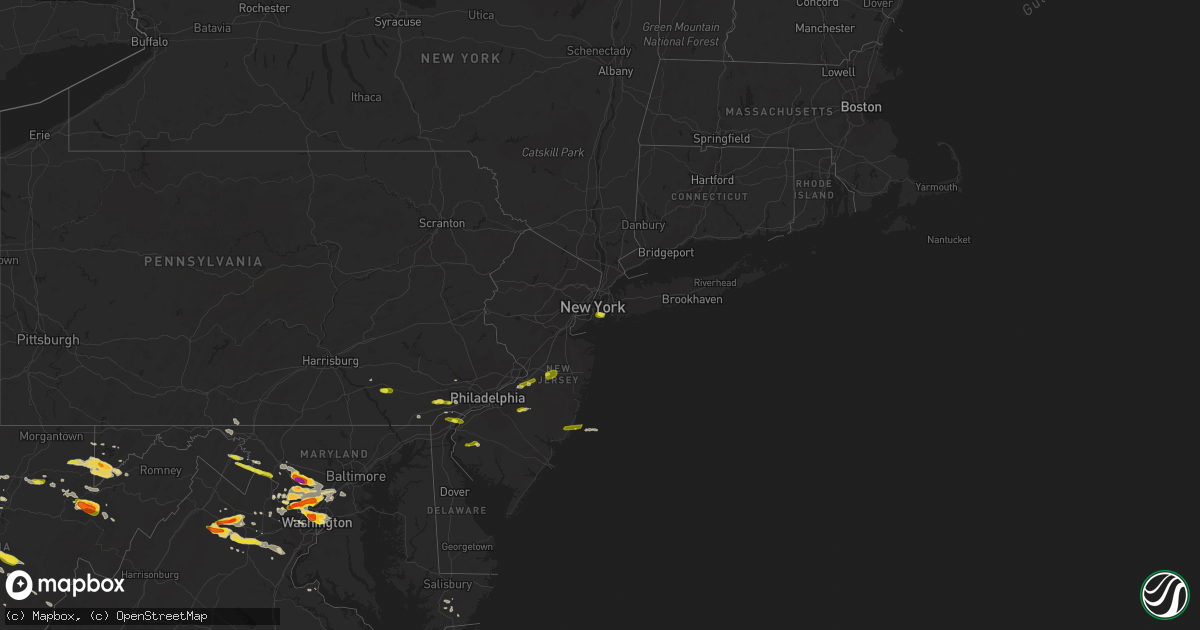
Hail Map on June 2, 2019
Get this storm
June 2 map
$229
one time, instant access
Download today. No call, no setup
Keep the $229
Bought the map and want the full workflow? Apply the entire $229 to a subscription within 7 days. None of it is wasted.
Every map, not just this one
This buys you this map. Subscription and you get every map we run, in the markets you choose from a few cities to whole states to nationwide. Plus real-time alerts the moment a storm fires.
Contact data
Name, contact info, occupancy, even credit band for addresses in the footprint. You go from where it hit to who to call.
Become the source they trust
Unlimited branding weather history reports on demand. You already have the documented answer ready for the property owner, and you are the one who showed up with it.
Property data and RoofTrace estimates
Pull up any address you have got, its value and the exact code rules for that jurisdiction, straight from One Click Code. Then RoofTrace estimates the squares, pitch, and roof value, priced the way you price.
States Impacted by Hail Map on June 2, 2019
Storm reports
Massachusetts
| Date | Description |
|---|---|
| 06/02/20192:45 PM CDT | Two large trees down on wires on west northfield road |
| 06/01/201911:49 PM CDT | At 447 PM EDT, a severe thunderstorm was located near New Salem, or 8 miles south of Orange, moving east at 30 mph. HAZARD...60 mph wind gusts and quarter size hail. SOURCE...Radar indicated. IMPACT...Hail damage to vehicles is possible. Expect damage to trees and power lines. Locations impacted include... Fitchburg, Gardner, Athol, Templeton, Westminster, Ashburnham, Barre, Hubbardston, Phillipston, Petersham and New Salem. |
New Hampshire
| Date | Description |
|---|---|
| 06/02/20192:50 PM CDT | Trees on wires in winchester nh. Cheshire county dispatch. |
| 06/01/201911:52 PM CDT | At 452 PM EDT, severe thunderstorms were located along a line extending from near Hopkinton to near Bedford, moving northeast at 35 mph. These storms were headed toward the Interstate 93 corridor from Manchester to Concord. HAZARD...60 mph wind gusts and penny size hail. SOURCE...Radar indicated. IMPACT...Expect damage to roofs, siding, and trees. Locations impacted include... Manchester, Concord, Derry, Exeter, Merrimack, Northwood, Bedford, Milford, Hooksett, Amherst, Litchfield, Epping, Hopkinton, New Boston, Loudon, Barnstead, Epsom, Brentwood, Gilmanton and Mont Vernon.This includes the following highways... Interstate 293 between mile markers 1 and 11. Interstate 89 between mile markers 0 and 16. Interstate 93 between mile markers 11 and 47. |
| 06/01/201910:36 PM CDT | At 336 PM EDT, a severe thunderstorm was located near Hinsdale, or 18 miles southwest of Keene, moving east at 30 mph. HAZARD...60 mph wind gusts and penny size hail. SOURCE...Radar indicated. IMPACT...Expect damage to roofs, siding, and trees. Locations impacted include... Keene, Jaffrey, Swanzey, Winchester, Dublin, Richmond, Harrisville, Nelson, Marlborough, Hinsdale, Roxbury, Fitzwilliam, Troy, Sullivan, Chesterfield, Westmoreland, Surry and Gilsum. |
| 06/01/201910:18 PM CDT | At 318 PM EDT, a severe thunderstorm was located over Guilford Center, or 7 miles southwest of Brattleboro, moving east at 35 mph. HAZARD...60 mph wind gusts and quarter size hail. SOURCE...Radar indicated. IMPACT...Hail damage to vehicles is expected. Expect wind damage to roofs, siding, and trees. Locations impacted include... Brattleboro, Putney, Vernon, Guilford Center, Guilford, Marlboro, North Vernon, South Newfane, East Dummerston, East Putney, West Dummerston, Fairview Village, Grove, Williamsville, East Putney Station, Dummerston Center, West Brattleboro, Putney Station, Packer Corner and West Guilford. |
North Carolina
| Date | Description |
|---|---|
| 06/02/20195:02 PM CDT | Tree across road and fences blown down along hill valley walk. Power out in area. |
| 06/02/20195:00 PM CDT | Portions of fence and flag pole blown down in deer hill neighborhood along myrtle grove rd. |
| 06/02/20195:00 PM CDT | Tree fell on car in sea breeze community - southern new hanover county |
| 06/02/20194:29 PM CDT | Reported by motorist on hwy 74 who said most traffic was pulling over to the side of the road for the storm. |
| 06/02/20194:20 PM CDT | Tree and power lines knocked down on selden st in elizabeth city. |
| 06/02/20193:14 PM CDT | Hail the size of large gumballs... Or the size of a quarter coin... Reported at tommy's mini mart... On mt misery road. |
| 06/02/20193:00 PM CDT | Media reports hail damage to a car on hooper rd in leland. |
| 06/02/20192:34 AM CDT | At 733 PM EDT, a severe thunderstorm was located near Alligator, or 21 miles south of Weeksville, moving south at 45 mph. HAZARD...Half dollar size hail. SOURCE...Radar indicated. IMPACT...Damage to vehicles is expected. Locations impacted include... Alligator, Gum Neck, Kilkenny, Killkenny, Columbia, Newfoundland, Fort Landing, Lake Mattamuskeet and Frying Pan Landing. |
| 06/02/20191:56 AM CDT | At 655 PM EDT, a severe thunderstorm was located over Newfoundland, or 16 miles south of Weeksville, moving southeast at 30 mph. HAZARD...Half dollar size hail. SOURCE...Radar indicated. IMPACT...Damage to vehicles is expected. Locations impacted include... Stumpy Point, Alligator, Manns Harbor, Mashoes, Manteo, East Lake, Newfoundland, Buffalo City, Wanchese and Bodie Island Lighthouse. |
| 06/02/20191:18 AM CDT | At 617 PM EDT, a severe thunderstorm was located near Newfoundland, or 12 miles south of Weeksville, moving southeast at 30 mph. HAZARD...Half dollar size hail. SOURCE...Radar indicated. IMPACT...Damage to vehicles is expected. Locations impacted include... Alligator, Manns Harbor, Mashoes, Manteo, East Lake, Newfoundland and Buffalo City. |
| 06/02/20191:01 AM CDT | At 600 PM EDT, severe thunderstorms were located along a line extending from near Weeksville to near Nixonton to near Burgess, moving southeast at 5 mph. HAZARD...Ping pong ball size hail and 60 mph wind gusts. SOURCE...Radar indicated. IMPACT...People and animals outdoors will be injured. Expect hail damage to roofs, siding, windows, and vehicles. Expect wind damage to trees and powerlines. These severe thunderstorms will remain over mainly rural areas of southeastern Pasquotank...southern Camden and southeastern Perquimans Counties, including the following locations... Glen Cove, Frog Island, Harvey Point, Listers Corner and Stevenson Point. |
| 06/02/201912:58 AM CDT | At 557 PM EDT, a severe thunderstorm was located over South Masonboro Island, moving southeast at 15 mph. HAZARD...60 mph wind gusts and quarter size hail. SOURCE...Radar indicated. IMPACT...Minor hail damage to vehicles is possible. Expect wind damage to trees and power lines. Locations impacted include... Carolina Beach, Kure Beach, South Masonboro Island, Snows Cut, Myrtle Grove and Sea Breeze. |
| 06/02/201912:19 AM CDT | At 519 PM EDT, severe thunderstorms were located along a line extending from near Elizabeth City to near Elizabeth City State University to near Nixonton, moving east at 5 mph. HAZARD...60 mph wind gusts and half dollar size hail. SOURCE...Radar indicated. IMPACT...Minor damage to vehicles is possible. Expect wind damage to trees and powerlines. Severe thunderstorms will be near, Elizabeth City around 525 PM EDT. Weeksville around 555 PM EDT. Camden, Elizabeth City State University, Whitehall Shores, Shiloh and Old Trap around 600 PM EDT.Other locations impacted by these severe thunderstorms include BobWhite Fork, Rabbit Corner, Symonds Creek, Listers Corner, Glen Cove,Pasquotank, Jacocks, Frog Island, Texas and Goose Creek. |
| 06/01/201911:33 PM CDT | At 433 PM EDT, a severe thunderstorm was located near Phoenix, or 8 miles north of Leland, and is nearly stationary. HAZARD...60 mph wind gusts and quarter size hail. SOURCE...Radar indicated. IMPACT...Minor hail damage to vehicles is possible. Expect wind damage to trees and power lines. Locations impacted include... The Borough and Phoenix. |
| 06/01/201910:49 PM CDT | At 347 PM EDT, a severe thunderstorm was located over Phoenix, or near Leland, moving north at 10 mph. HAZARD...60 mph wind gusts and quarter size hail. SOURCE...Radar indicated. IMPACT...Minor hail damage to vehicles is possible. Expect wind damage to trees and power lines. Locations impacted include... Wilmington, Leland, Northwest, Long Creek, Hightsville, Wrightsboro, Montague, The Borough, Phoenix, Belville, Navassa, Sandy Creek and New Hanover Regional Medical Center. |
| 06/01/201910:35 PM CDT | At 334 PM EDT, a severe thunderstorm was located over Iredell, or near Sunset Beach, moving south at 10 mph. HAZARD...60 mph wind gusts and quarter size hail. SOURCE...Radar indicated. IMPACT...Minor hail damage to vehicles is possible. Expect wind damage to trees and power lines. Locations impacted include... North Myrtle Beach, Sunset Beach, Ocean Isle Beach, Little River, Iredell, Carolina Shores, Calabash, Grissettown, Longwood, Seaside, Russtown, Brooksville and Sea Coast Medical Center. |
| 06/01/20199:54 PM CDT | At 253 PM EDT, a severe thunderstorm was located near Sunbury, moving east at 20 mph. HAZARD...60 mph wind gusts and quarter size hail. SOURCE...Radar indicated. IMPACT...Minor damage to vehicles is possible. Expect wind damage to trees and powerlines. This severe thunderstorm will remain over mainly rural areas of northwestern Pasquotank and eastern Gates Counties, including the following locations... Lynchs Corner, Sandy Cross, Savage, Acorn Hill and Trotville. |
Arkansas
| Date | Description |
|---|---|
| 06/02/20196:25 PM CDT | Shingles blown off of a home. Time estimated by radar. Report on social media. |
| 06/02/20195:52 PM CDT | Some minor tree damage and power outages reported in lowell via social media. Time estimated by radar. |
| 06/02/20195:50 PM CDT | Quarter to ping pong ball size |
| 06/02/201912:38 AM CDT | At 537 PM CDT, a severe thunderstorm was located near Smyrna, or 25 miles southwest of Marshall, moving southeast at 20 mph. HAZARD...60 mph wind gusts and quarter size hail. SOURCE...Radar indicated. IMPACT...Hail damage to vehicles is expected. Expect wind damage to roofs, siding, and trees. Locations impacted include... Moore... Dabney... Solo... Smyrna... Ben Hur... Brock Creek Campground... Sand Gap... Mountain Man Trailhead... Nogo... |
Georgia
| Date | Description |
|---|---|
| 06/02/20193:39 PM CDT | Multiple trees were downed onto power lines on henderson mountain road. |
Ohio
| Date | Description |
|---|---|
| 06/02/20191:04 PM CDT | A local report indicates 1.75 inch wind near SOUTH POINT |
| 06/02/20191:04 PM CDT | Several awnings and car ports damaged on 3rd street and on brubaker drive. Also noted multiple trees damaged in the area. Time estimated from radar. |
| 06/02/201912:54 PM CDT | Tree and power lines down along county road 56. |
| 06/02/201912:44 PM CDT | One downed tree on power lines due to high wind off of bladen road. |
| 06/02/201912:40 PM CDT | A mix of nicket and quarter hail. |
| 06/02/20197:32 AM CDT | At 1231 AM EDT, a severe thunderstorm was located near Mogadore, or near Akron, moving east at 35 mph. HAZARD...60 mph wind gusts and quarter size hail. SOURCE...Radar indicated. IMPACT...Minor damage to vehicles is possible. Expect damage to trees and power lines. Locations impacted include... Akron, Cuyahoga Falls, Kent, Barberton, Green, Alliance, Tallmadge, Mogadore, Hartville, New Franklin, Norton, Brimfield, Fairlawn, Randolph, Lakemore, Atwater, Edinburg, Clinton, Deerfield and Limaville. |
| 06/02/20197:20 AM CDT | At 1220 AM EDT, severe thunderstorms were located along a line extending from near Upper Sandusky to La Rue, moving southeast at 35 mph. HAZARD...60 mph wind gusts and quarter size hail. SOURCE...Radar indicated. IMPACT...Minor damage to vehicles is possible. Expect damage to trees and power lines. Locations impacted include... Marion, Bucyrus, Upper Sandusky, Prospect, New Washington, Sycamore, La Rue, Morral, Waldo, Chatfield, Marseilles, Carey, Benton, Nevada, Caledonia, New Bloomington, Green Camp, Wharton, Tiro and North Robinson. |
| 06/02/20197:12 AM CDT | At 1211 AM EDT, a severe thunderstorm was located over Wapakoneta, moving east at 40 mph. HAZARD...60 mph wind gusts. SOURCE...Radar indicated. IMPACT...Expect damage to trees and power lines. Locations impacted include... Wapakoneta, Fort Shawnee, Cridersville, Jackson Center, Russells Point, Botkins, Lakeview, Waynesfield, Chippewa Park, Roundhead, Huntsville, Uniopolis, Fryburg, Jumbo, St. Johns, Walton, New Hampshire, State Route 195 at State Route 235 and Lewistown.This includes I-75 in Ohio between mile markers 104 and 118. |
| 06/01/20198:44 PM CDT | At 144 AM EDT, a severe thunderstorm was located near Sunbury, moving southeast at 40 mph. HAZARD...60 mph wind gusts. SOURCE...Radar indicated. IMPACT...Expect damage to trees and power lines. Locations impacted include... Columbus, Dublin, Westerville, Reynoldsburg, Delaware, Gahanna, Worthington, Granville, Pataskala, Powell, Johnstown, Sunbury, Utica, Minerva Park, Granville South, Beechwood Trails, Polaris, Easton, Summit Station and Etna.This includes the following Interstates... I-70 in Ohio between mile markers 115 and 124. I-71 in Ohio between mile markers 117 and 138. |
| 06/01/20198:44 PM CDT | At 143 AM EDT, a severe thunderstorm was located near Fredericktown, or 12 miles east of Mount Gilead, moving east at 45 mph. HAZARD...60 mph wind gusts and quarter size hail. SOURCE...Radar indicated. IMPACT...Minor damage to vehicles is possible. Expect damage to trees and power lines. Locations impacted include... Mansfield, Mount Vernon, Ontario, Lexington, Loudonville, Fredericktown, Gambier, Bellville, Centerburg, Danville, Hayesville, Chesterville, Sparta, Waterford, Butler, Perrysville, Lucas, Marengo, Fulton and Martinsburg. |
| 06/01/20198:38 PM CDT | At 137 PM EDT, a severe thunderstorm was located 11 miles southwest of Gallipolis, moving east at 30 mph. HAZARD...60 mph wind gusts and half dollar size hail. SOURCE...Radar indicated. IMPACT...Hail damage to vehicles is expected. Expect wind damage to roofs, siding, and trees. Locations impacted include... Winfield, Eleanor, Buffalo, Teays Valley, Waterloo, Aid, Crown City, Leon, Southside, Ashton, Grimms Landing, Green Bottom and Fraziers Bottom.This includes Interstate 64 in West Virginia between mile markers 37and 40. |
| 06/01/20198:26 PM CDT | At 126 PM EDT, a severe thunderstorm was located over Ironton, moving southeast at 25 mph. HAZARD...65 mph wind gusts and half dollar size hail. SOURCE...Radar indicated. IMPACT...Hail damage to vehicles is expected. Expect wind damage to roofs, siding, and trees. Locations impacted include... Huntington, Ashland, Ironton, Coal Grove, Chesapeake, Proctorville, Lake Vesuvius, Barboursville, Kenova, Catlettsburg, Ceredo, Flatwoods, South Point, Russell, Raceland, Worthington, Burlington, Wurtland, Bellefonte and Westwood.This includes Interstate 64 in West Virginia between mile markers 2and 18. |
| 06/01/20198:25 PM CDT | At 125 AM EDT, a severe thunderstorm was located near Delaware, moving southeast at 40 mph. HAZARD...60 mph wind gusts and penny size hail. SOURCE...Radar indicated. IMPACT...Expect damage to trees and power lines. Locations impacted include... Westerville, Delaware, Powell, Sunbury, Ashley, Polaris, Radnor, Shawnee Hills, Galena, Ostrander, Interstate 71 at US Route 36/State Route 37, Alum Creek State Park, Delaware State Park, Olive Green, Stratford, Bellepoint, Warrensburg, Leonardsburg, Kilbourne and Columbus Zoo.This includes I-71 in Ohio between mile markers 122 and 139. |
| 06/01/20198:12 PM CDT | At 112 AM EDT, a severe thunderstorm was located 7 miles northwest of Mount Gilead, moving east at 30 mph. HAZARD...60 mph wind gusts and quarter size hail. SOURCE...Radar indicated. IMPACT...Minor damage to vehicles is possible. Expect damage to trees and power lines. Locations impacted include... Marion, Bucyrus, Mount Gilead, Galion, Crestline, Cardington, Prospect, Morral, Waldo, Chesterville, Caledonia, New Bloomington, Edison, Green Camp, Tiro, Fulton, North Robinson, Sulpher Springs, Iberia and Shauck. |
| 06/01/20198:04 PM CDT | At 104 PM EDT, a severe thunderstorm was located near Paden City, or near New Martinsville, moving east at 15 mph. HAZARD...Quarter-size hail. SOURCE...Radar. IMPACT...Minor damage to vehicles is possible. Locations impacted include... New Martinsville... Paden City... Sardis... Fly... Antioch... Stafford... Graysville... Porters Falls... Proctor... Hannibal... Rinard Mills... Laings... |
Idaho
| Date | Description |
|---|---|
| 06/02/20195:00 PM CDT | Viewed from idaho falls |
| 06/02/20194:48 PM CDT | Multiple photos of a funnel cloud and tornado from public sources. A damage survey was conducted... But no clear indication of damage was found. This tornado occurred i |
| 06/02/20191:17 AM CDT | At 616 PM MDT, a severe thunderstorm was located 9 miles west of Moran Bay, which is 11 miles northeast of Alta, moving northeast at 20 mph. HAZARD...Quarter size hail. SOURCE...Radar indicated. IMPACT...Damage to vehicles is expected. This severe thunderstorm will remain over mainly rural areas of west central Teton County, including the following locations... Lizard Creek Campground and Jackson Lake. |
| 06/01/201911:50 PM CDT | At 449 PM MDT, a severe thunderstorm was located near Swan Valley, and is nearly stationary. HAZARD...60 mph wind gusts and quarter size hail. SOURCE...Radar indicated. IMPACT...Hail damage to vehicles is expected. Expect wind damage to roofs, siding, and trees. Locations impacted include... Swan Valley and Irwin. |
| 06/01/20198:20 PM CDT | At 119 PM MDT, a severe thunderstorm was located over Laketown, moving north at 15 mph. HAZARD...60 mph wind gusts and quarter size hail. SOURCE...Radar indicated. IMPACT...Hail damage to vehicles is expected. Expect wind damage to roofs, siding, and trees. Locations impacted include... Laketown, Bear Lake Idaho Portion, Garden City, Garden, Meadowville, Pickelville and Lakota. |
Kentucky
| Date | Description |
|---|---|
| 06/02/20192:45 PM CDT | Report relayed via media. |
| 06/02/20192:45 PM CDT | Report relayed via media. |
| 06/02/20191:43 AM CDT | At 643 PM EDT, a severe thunderstorm was located 8 miles east of Oppy, or 11 miles north of Williamson, moving southeast at 25 mph. HAZARD...60 mph wind gusts and quarter size hail. SOURCE...Radar indicated. IMPACT...Hail damage to vehicles is expected. Expect wind damage to roofs, siding, and trees. Locations impacted include... Man, Delbarton, Holden, Mount Gay-Shamrock, Red Jacket, Chattaroy, Hinch, Mallory, Matewan, Chauncey, Myrtle, Switzer, Pie, Dingess, Varney, Sarah Ann, Meador and Lenore.This includes Route 119 between mile markers 1 and 26. |
| 06/02/20191:18 AM CDT | At 617 PM EDT, a severe thunderstorm was located near Dunlow, or 11 miles northeast of Inez, moving southeast at 40 mph. HAZARD...60 mph wind gusts and half dollar size hail. SOURCE...Radar indicated. IMPACT...Hail damage to vehicles is expected. Expect wind damage to roofs, siding, and trees. Locations impacted include... Logan, Delbarton, Holden, Mount Gay-Shamrock, Red Jacket, West Logan, Mount Gay, Verdunville, Chauncey, Myrtle, Crum, Switzer, Dingess, Varney, Wilsondale, Sarah Ann, Lenore and Breeden.This includes Route 119 between mile markers 3 and 30. |
Florida
| Date | Description |
|---|---|
| 06/02/20194:35 PM CDT | Report of small trees downed near the 4600 block of alligator blvd. |
Pennsylvania
| Date | Description |
|---|---|
| 06/02/20196:22 PM CDT | Mping report of trees and power lines down. Time estimated from radar. |
| 06/02/20195:54 PM CDT | Reports of trees down on gill road... Kurtz mill road... And candy road in brecknock twp. Time estimated from radar. |
| 06/02/20195:16 PM CDT | Downed trees near and on the railroad tracks near railroad avenue and oakland avenue. Time estimated from radar. |
| 06/02/20195:03 PM CDT | A local report indicates 1.00 inch wind near LAMPETER |
| 06/02/20193:50 PM CDT | Tree across road cleared by vfd. |
| 06/02/20193:14 PM CDT | Trees on wires across shrimpstown road. |
| 06/02/20192:21 PM CDT | Time estimated from radar. |
| 06/02/20192:19 PM CDT | A local report indicates 1.00 inch wind near GLEN MILLS |
| 06/02/20199:00 AM CDT | Tree and wires down in lake township |
| 06/02/201912:55 AM CDT | At 555 PM EDT, a severe thunderstorm was located over Willow Street, moving east at 25 mph. HAZARD...60 mph wind gusts and quarter size hail. SOURCE...Radar indicated. IMPACT...Hail damage to vehicles is expected. Expect wind damage to trees, roofs, and siding. Locations impacted include... Lancaster, Millersville, Willow Street, New Holland, East Petersburg, Leola, Paradise, Salunga-Landisville, Strasburg, Quarryville, Gap, Leacock, Bareville, Smithville, Safe Harbor, Lampeter, Intercourse, Conestoga, Christiana and Blue Ball. |
| 06/01/201911:48 PM CDT | At 448 PM EDT, a severe thunderstorm was located over Cashtown, moving east at 20 mph. HAZARD...60 mph wind gusts and quarter size hail. SOURCE...Radar indicated. IMPACT...Hail damage to vehicles is expected. Expect wind damage to trees, roofs, and siding. Locations impacted include... Hanover, Gettysburg, Hampton, Littlestown, Carroll Valley, McSherrystown, Lake Meade, Bonneauville, New Oxford, East Berlin, Lake Heritage, Cashtown, Aspers, Orrtanna, Biglerville, Abbottstown, Arendtsville, York Springs, Heidlersburg and Bendersville. |
| 06/01/201910:21 PM CDT | At 321 PM EDT, a severe thunderstorm was located over Cherry Hill Mall, or near Camden, moving east at 30 mph. HAZARD...60 mph wind gusts and quarter size hail. SOURCE...Radar indicated. IMPACT...Minor damage to vehicles is possible. Wind damage to roofs, siding, trees, and power lines is possible. Locations impacted include... Philadelphia, Camden, Cherry Hill, Evesham, Mount Laurel, Willingboro, Medford, Lumberton, Burlington, Mount Holly, Riverside, Palmyra, Tabernacle, Pemberton, Wrightstown, Ramblewood, Barclay-Kingston, Cherry Hill Mall, Golden Triangle and Marlton. |
| 06/01/20197:05 PM CDT | Several reports of trees down around the area... A few of which fell on houses... Mainly in the croydon community. Ramp restrictions at exit 37 of interstate 95 at stat |
| 06/01/20197:00 PM CDT | Trees down including one large tree uprooted. Part of a roof peeled off of a building. Time estimated from radar. |
North Dakota
| Date | Description |
|---|---|
| 06/02/20195:05 PM CDT | Delayed report. Spotter reported that his daughter one mile to his south estimated hail up to golf ball size with possible roof damage. Time estimated by radar. |
| 06/02/20192:25 AM CDT | At 725 PM MDT, a severe thunderstorm was located over Rhame, or 13 miles west of Bowman, moving south at 20 mph. HAZARD...Golf ball size hail and 60 mph wind gusts. SOURCE...Trained weather spotters. IMPACT...People and animals outdoors will be injured. Expect hail damage to roofs, siding, windows, and vehicles. Expect wind damage to roofs, siding, and trees. Locations impacted include... Rhame and Griffin. |
| 06/02/20191:11 AM CDT | At 610 PM MDT, a severe thunderstorm was located 15 miles northeast of Marmarth, or 19 miles west of Amidon, moving south at 15 mph. HAZARD...60 mph wind gusts and half dollar size hail. SOURCE...Radar indicated. IMPACT...Hail damage to vehicles is expected. Expect wind damage to roofs, siding, and trees. This severe thunderstorm will remain over mainly rural areas of western Slope County, including the following locations... Three V Crossing. |
| 06/02/20191:00 AM CDT | At 600 PM MDT, a severe thunderstorm was located 8 miles northwest of Amidon, moving southeast at 10 mph. HAZARD...60 mph wind gusts and half dollar size hail. SOURCE...Radar indicated. IMPACT...Hail damage to vehicles is expected. Expect wind damage to roofs, siding, and trees. Locations impacted include... Amidon. |
| 06/02/201912:12 AM CDT | At 512 PM MDT, a severe thunderstorm was located 15 miles south of Medora, or 16 miles northwest of Amidon, moving southeast at 10 mph. HAZARD...60 mph wind gusts and half dollar size hail. SOURCE...Radar indicated. IMPACT...Hail damage to vehicles is expected. Expect wind damage to roofs, siding, and trees. This severe thunderstorm will remain over mainly rural areas of southwestern Billings and north central Slope Counties. |
| 06/01/201910:48 PM CDT | At 348 PM MDT, a severe thunderstorm was located 6 miles southwest of Medora, or 19 miles east of Beach, moving southeast at 10 mph. HAZARD...60 mph wind gusts and quarter size hail. SOURCE...Radar indicated. IMPACT...Hail damage to vehicles is expected. Expect wind damage to roofs, siding, and trees. Locations impacted include... Medora. |
| 06/01/20198:30 PM CDT | Delayed report. Cocorahs report of half dollar size hail that last 10 minutes and dented cars. Time estimated from radar. |
| 06/01/20198:26 PM CDT | Trained spotter reported golf ball size hail two miles east of rhame. |
| 06/01/20198:25 PM CDT | Trained spotter reported golf ball size hail in rhame with substantial damage to the siding of his home. Trees stripped of leaves. |
Alaska
| Date | Description |
|---|---|
| 06/02/20191:46 AM CDT | At 646 PM AKDT, a severe thunderstorm was located over West Fairbanks and the Fairbanks International Airport. The storm is moving southwest and will also impacts areas along Chena Pump Rd. HAZARD...Quarter size hail, frequent lightning and brief heavy downpours. SOURCE...Radar indicated. IMPACT...Damage to vehicles. This severe thunderstorm will remain over mainly rural areas of southwestern Middle Tanana Valley. |
| 06/02/20191:24 AM CDT | At 624 PM AKDT, a severe thunderstorm was located near Fort Wainwright and the east side of Fairbanks, and is moving soutwest over the city of Fairbanks. HAZARD...Quarter size hail, frequent lightning, and brief heavy downpours. SOURCE...Radar indicated. IMPACT...Damage to vehicles is expected. Locations impacted include... Fairbanks and Fort Wainwright. |
| 06/02/20191:07 AM CDT | At 607 PM AKDT, a severe thunderstorm was located over Birch Hill and moving south over Fort Wainwright. The storm will hit Ft Wainwright by 615. The storm will impact the East side of Fairbanks from Cushman street east by 620 pm. HAZARD...Quarter size hail. Brief heavy downpours and frequent lightning. SOURCE...Radar indicated. IMPACT...Damage to vehicles is expected. Locations impacted include... Fort Wainwright. Fairbanks from Cuchman St East. |
Oklahoma
| Date | Description |
|---|---|
| 06/02/20194:23 AM CDT | At 923 PM CDT, a severe thunderstorm was located 6 miles south of Eva, or 20 miles south of Elkhart, moving east at 40 mph. HAZARD...60 mph wind gusts and half dollar size hail. SOURCE...Radar indicated. IMPACT...Minor damage to roofs, siding, and trees is possible. Hail damage to vehicles is expected. Locations impacted include... Guymon, Goodwell, Optima and Eva. |
| 06/02/20191:29 AM CDT | At 629 PM MDT, a severe thunderstorm was located near Kenton, or 30 miles north of Clayton, moving north at 10 mph. HAZARD...60 mph wind gusts and half dollar size hail. SOURCE...Radar indicated. IMPACT...Hail damage to vehicles is expected. Expect wind damage to roofs, siding, and trees. This severe thunderstorm will remain over mainly rural areas of northeastern Union County. |
| 06/02/20191:06 AM CDT | At 606 PM MDT, a severe thunderstorm was located near Kenton, or 29 miles north of Clayton, moving northeast at 15 mph. HAZARD...60 mph wind gusts and half dollar size hail. SOURCE...Radar indicated. IMPACT...Hail damage to vehicles is expected. Expect wind damage to roofs, siding, and trees. This severe thunderstorm will remain over mainly rural areas of northeastern Union County. |
| 06/01/20199:25 PM CDT | Late report with time estimated from radar. |
| 06/01/20198:35 PM CDT | A local report indicates 1.00 inch wind near 10 W BOISE CITY |
| 06/01/20198:19 PM CDT | A local report indicates 1.75 inch wind near 10 W BOISE CITY |
| 06/01/20198:18 PM CDT | Landspout that lasted 2 minutes with a tubular dust cloud. |
California
| Date | Description |
|---|---|
| 06/02/20191:19 AM CDT | At 619 PM PDT, a severe thunderstorm was located just east of Stirling City, or 8 miles north of Pulga, moving west at 5 mph. HAZARD...60 mph wind gusts and quarter size hail. SOURCE...Radar indicated. IMPACT...Hail damage to vehicles is expected. Expect wind damage to roofs, siding, and trees. Locations impacted include... Stirling City, Storrie, Lovelock, Tobin and Concow. |
| 06/02/201912:19 AM CDT | At 518 PM PDT, a severe thunderstorm was located over Arvin, or 13 miles southeast of Bakersfield, moving southwest at 30 mph. HAZARD...60 mph wind gusts and quarter size hail. SOURCE...Radar indicated. IMPACT...Hail damage to vehicles is expected. Expect wind damage to roofs, siding, and trees. Locations impacted include... Southeast Bakersfield, Arvin, Weedpatch, Lamont and Bear Valley Springs. |
| 06/01/201910:28 PM CDT | At 326 PM PDT, a severe thunderstorm was located 10 miles southeast of California Valley, and just south of Soda Lake, and is nearly stationary. HAZARD...60 mph wind gusts, heavy downpours and quarter size hail. SOURCE...Radar indicated. IMPACT...Hail damage to vehicles is expected. Expect wind damage to roofs, siding, and trees. Locations impacted include... Cuyama...Carrizo Plain... Soda Lake and Highway 166. |
| 06/01/20199:41 PM CDT | At 220 PM PDT, a severe thunderstorm was located 10 miles southeast of California Valley, and was nearly stationary. HAZARD...60 mph wind gusts and quarter size hail. Heavy downpours are expected to cause roadway flooding with flash flooding. SOURCE...Radar indicated. IMPACT...Hail damage to vehicles is expected. Expect wind damage to roofs, siding, and trees. Locations impacted include... Cuyama... Carrizo Plain... and Highway 166 between Twitchell Dam and the Cuyama Valley. |
| 06/01/20199:22 PM CDT | At 220 PM PDT, a severe thunderstorm was located 10 miles southeast of California Valley, and was nearly stationary. HAZARD...60 mph wind gusts and quarter size hail. Heavy downpours may also cause roadway flooding. SOURCE...Radar indicated. IMPACT...Hail damage to vehicles is expected. Expect wind damage to roofs, siding, and trees. Locations impacted include... Cuyama... Carrizo Plain... and Highway 166 between Twitchell Dam and the Cuyama Valley. |
| 06/01/20197:19 PM CDT | Corrects previous report... Moving location slightly to the southeast. Ef0 tornado with estimated wind speed of 65 mph tracked southwestward for a distance of about 300 |
| 06/01/20197:19 PM CDT | Ef0 tornado with estimated wind speed of 65 mph tracked southwestward for a distance of about 300 yards. The tornado touched down in a rural area northeast of bakersfie |
Vermont
| Date | Description |
|---|---|
| 06/01/201910:32 PM CDT | At 332 PM EDT, a severe thunderstorm was located over Bernardston, or near Greenfield, moving east at 30 mph. HAZARD...60 mph wind gusts. SOURCE...Radar indicated. IMPACT...Expect damage to trees and power lines. Locations impacted include... Greenfield, Orange, Deerfield, Athol, Winchendon, Montague, Templeton, Northfield, Fitzwilliam, Bernardston, Shelburne, Erving, Phillipston, Colrain, Gill, Royalston, Richmond, Wendell, Warwick and Leyden. |
South Dakota
| Date | Description |
|---|---|
| 06/02/20196:25 PM CDT | A local report indicates 1.00 inch wind near 13 NW VETAL |
| 06/02/20194:42 PM CDT | A local report indicates 1.00 inch wind near 12 ENE BUFFALO GAP |
| 06/02/20193:55 PM CDT | A local report indicates 1.00 inch wind near 3 SE FAIRBURN |
| 06/02/20193:38 PM CDT | Delayed report; time estimated from radar |
| 06/02/20193:30 PM CDT | A local report indicates 1.75 inch wind near 7 WNW FAIRBURN |
| 06/02/20193:20 PM CDT | A local report indicates 1.50 inch wind near 4 NNW FAIRBURN |
| 06/02/20193:06 PM CDT | Time estimated from radar |
| 06/02/20193:03 PM CDT | Ping pong ball size hail fell for 32 minutes. |
| 06/02/20193:00 PM CDT | A local report indicates 2.50 inch wind near 1 SSW HERMOSA |
| 06/02/20192:48 PM CDT | A local report indicates 2.00 inch wind near 1 W HERMOSA |
| 06/02/20192:40 PM CDT | The largest hail was half dollar size. The average hail size was pea to marble. |
| 06/02/20192:00 PM CDT | A local report indicates 1.25 inch wind near 7 SW RAPID CITY AIRPORT |
| 06/02/20191:40 PM CDT | A local report indicates 1.00 inch wind near 4 SSW DOWNTOWN RAPID CI |
| 06/02/20191:40 PM CDT | A local report indicates 2.25 inch wind near 4 SSW DOWNTOWN RAPID CI |
| 06/02/20191:31 PM CDT | A local report indicates 1.00 inch wind near 2 SSE DOWNTOWN RAPID CI |
| 06/02/20191:30 PM CDT | Quarter to golf ball sized hail |
| 06/02/20191:25 PM CDT | A local report indicates 1.00 inch wind near 2 SW DOWNTOWN RAPID CIT |
| 06/02/20191:25 PM CDT | A local report indicates 1.00 inch wind near 2 SW DOWNTOWN RAPID CIT |
| 06/02/20191:24 PM CDT | A local report indicates 2.00 inch wind near 5 SW DOWNTOWN RAPID CIT |
| 06/02/20191:24 PM CDT | A local report indicates 1.75 inch wind near 4 NE ROCKERVILLE |
| 06/02/20191:22 PM CDT | A local report indicates 1.75 inch wind near 5 SW DOWNTOWN RAPID CIT |
| 06/02/20191:20 PM CDT | A local report indicates 1.75 inch wind near 4 SSW DOWNTOWN RAPID CI |
| 06/02/20191:20 PM CDT | Golf ball to egg sized hail lasted for 15 minutes |
| 06/02/20191:18 PM CDT | A local report indicates 1.00 inch wind near 5 WSW DOWNTOWN RAPID CI |
| 06/02/20191:15 PM CDT | A local report indicates 1.50 inch wind near 4 SW DOWNTOWN RAPID CIT |
| 06/02/20197:58 AM CDT | At 1258 PM MDT, a severe thunderstorm was located over Black Gap, or 9 miles south of Rapid City, moving southeast at 10 mph. HAZARD...Ping pong ball size hail and 60 mph wind gusts. SOURCE...Radar indicated. IMPACT...People and animals outdoors will be injured. Expect hail damage to roofs, siding, windows, and vehicles. Expect wind damage to roofs, siding, and trees. Locations impacted include... Southwestern Rapid Valley, Hermosa, Caputa, Rapid City Airport, Hart Ranch, Black Gap and Thompson Butte. |
| 06/02/20197:17 AM CDT | At 1217 PM MDT, a severe thunderstorm was located 3 miles northwest of Reptile Gardens, or 4 miles southwest of Rapid City, moving southeast at 15 mph. HAZARD...Half dollar size hail. SOURCE...Radar indicated. IMPACT...Damage to vehicles is expected. Locations impacted include... Rapid City, southwestern Rapid Valley, Bear Country, Hart Ranch, Black Gap and Reptile Gardens. |
| 06/02/20197:00 AM CDT | At 1200 PM MDT, a severe thunderstorm was located 3 miles east of Black Hawk, or 4 miles north of Rapid City, moving east at 10 mph. HAZARD...Quarter size hail. SOURCE...Radar indicated. IMPACT...Damage to vehicles is expected. Locations impacted include... Rapid City, northwestern Rapid Valley, northwestern Ellsworth Air Force Base, Black Hawk and Summerset.This includes Interstate 90 in South Dakota between Mile Markers 51and 62. |
| 06/02/20196:14 AM CDT | At 1114 AM MDT, a severe thunderstorm was located over Nemo, or 13 miles northwest of Rapid City, moving southeast at 10 mph. HAZARD...60 mph wind gusts and quarter size hail. SOURCE...Radar indicated. IMPACT...Hail damage to vehicles is expected. Expect wind damage to roofs, siding, and trees. Locations impacted include... Black Hawk, Summerset, Johnson Siding, Nemo, Piedmont and Dalton Lake.This includes Interstate 90 in South Dakota between Mile Markers 45and 52. |
| 06/02/20193:08 AM CDT | At 807 PM CDT/707 PM MDT/, a severe thunderstorm was located near Nenzel, or 28 miles west of Valentine, moving southeast at 35 mph. HAZARD...60 mph wind gusts and quarter size hail. SOURCE...Radar indicated. IMPACT...Hail damage to vehicles is expected. Expect wind damage to roofs, siding, and trees. This severe thunderstorm will be near... Kilgore around 720 PM MDT.Other locations impacted by this severe thunderstorm include Highway97 crossing the Niobrara River, Cody Lake, Crookston and AndersonBridge State Wildlife Management Area.This includes the following highways... Highway 20 between mile markers 159 and 200. Highway 97 between mile markers 116 and 141. Highway 83 between mile markers 213 and 218. Highway 12 between mile markers 1 and 4. |
| 06/02/20191:18 AM CDT | At 618 PM MDT, a severe thunderstorm was located near Chadron Airport, or 9 miles northwest of Chadron, moving northeast at 20 mph. HAZARD...60 mph wind gusts and quarter size hail. SOURCE...Radar indicated. IMPACT...Hail damage to vehicles is expected. Expect wind damage to roofs, siding, and trees. This severe thunderstorm will remain over mainly rural areas of northeastern Dawes County. |
| 06/02/201912:58 AM CDT | At 558 PM MDT/658 PM CDT/, a severe thunderstorm was located 3 miles south of Vetal, or 17 miles east of Martin, moving southeast at 20 mph. HAZARD...Ping pong ball size hail. SOURCE...Radar indicated. IMPACT...People and animals outdoors will be injured. Expect damage to roofs, siding, windows, and vehicles. Locations impacted include... Spring Creek, Tuthill, Vetal, Harrington, and northeastern Lacreek Wildlife Refuge. |
| 06/02/201912:15 AM CDT | At 515 PM MDT, a severe thunderstorm was located 9 miles south of Long Valley, or 16 miles northeast of Martin, moving southeast at 15 mph. HAZARD...Quarter size hail. SOURCE...Radar indicated. IMPACT...Damage to vehicles is expected. Locations impacted include... Vetal. |
| 06/02/201912:07 AM CDT | At 506 PM MDT/606 PM CDT/, a severe thunderstorm was located 9 miles north of Norris, or 20 miles southeast of Kadoka, moving southeast at 20 mph. HAZARD...Half dollar size hail. SOURCE...Radar indicated. IMPACT...Damage to vehicles is expected. Locations impacted include... Norris and Cedar Butte. |
| 06/01/201911:43 PM CDT | At 443 PM MDT/543 PM CDT/, a severe thunderstorm was located 7 miles southeast of Intersection of Highway 73 and White River, or 10 miles southeast of Kadoka, moving east at 15 mph. HAZARD...Half dollar size hail. SOURCE...Radar indicated. IMPACT...Damage to vehicles is expected. This severe thunderstorm will remain over mainly rural areas of western Mellette and east central Jackson Counties. |
| 06/01/201911:35 PM CDT | At 435 PM MDT, a severe thunderstorm was located 6 miles southwest of Long Valley, or 16 miles northeast of Martin, moving northeast at 15 mph. HAZARD...Half dollar size hail. SOURCE...Radar indicated. IMPACT...Damage to vehicles is expected. Locations impacted include... Long Valley. |
| 06/01/201911:06 PM CDT | At 406 PM MDT/506 PM CDT/, a severe thunderstorm was located 5 miles east of Intersection of Highway 73 and White River, or 7 miles southeast of Kadoka, moving east at 15 mph. HAZARD...Quarter size hail. SOURCE...Radar indicated. IMPACT...Damage to vehicles is expected. Locations impacted include... Belvidere.This includes Interstate 90 in South Dakota between Mile Markers 159and 166. |
| 06/01/20199:56 PM CDT | At 255 PM MDT, a severe thunderstorm was located near Fairburn, or 20 miles northeast of Hot Springs, moving southeast at 20 mph. HAZARD...Ping pong ball size hail. SOURCE...Radar indicated. IMPACT...People and animals outdoors will be injured. Expect damage to roofs, siding, windows, and vehicles. Locations impacted include... Fairburn, Red Shirt, and Red Shirt Table Overlook. |
| 06/01/20199:26 PM CDT | At 225 PM MDT, a severe thunderstorm was located over southeastern Custer State Park, or 13 miles southeast of Custer, moving south at 10 mph. HAZARD...Two inch hail. SOURCE...Radar indicated. IMPACT...People and animals outdoors will be injured. Expect damage to roofs, siding, windows, and vehicles. Locations impacted include... Buffalo Corrals, State Game Lodge, eastern Custer State Park and northeastern Wind Cave National Park. |
| 06/01/20198:58 PM CDT | At 158 PM MDT, a severe thunderstorm was located 4 miles south of Hermosa, or 19 miles east of Custer, moving southeast at 10 mph. HAZARD...Two inch hail. SOURCE...Radar indicated. IMPACT...People and animals outdoors will be injured. Expect damage to roofs, siding, windows, and vehicles. Locations impacted include... Hermosa, Fairburn, State Game Lodge and northeastern Custer State Park. |
| 06/01/20198:28 PM CDT | At 128 PM MDT, a severe thunderstorm was located near Hayward, or 14 miles east of Hill City, moving southeast at 10 mph. HAZARD...60 mph wind gusts and half dollar size hail. SOURCE...Radar indicated. IMPACT...Hail damage to vehicles is expected. Expect wind damage to roofs, siding, and trees. Locations impacted include... Hayward and northeastern Custer State Park. |
Wyoming
| Date | Description |
|---|---|
| 06/02/20195:55 PM CDT | Measured at the dixon airport. |
| 06/02/20195:43 PM CDT | Report received via facebook. |
| 06/02/20191:22 AM CDT | At 621 PM MDT, a severe thunderstorm was located 9 miles northeast of Two Moon Campground, or 23 miles southwest of Lusk, moving southeast at 25 mph. HAZARD...60 mph wind gusts and quarter size hail. SOURCE...Radar indicated. IMPACT...Hail damage to vehicles is expected. Expect wind damage to roofs, siding, and trees. Locations impacted include... Rawhide Buttes. |
| 06/02/201912:59 AM CDT | At 559 PM MDT, a severe thunderstorm was located 12 miles north of Glendo, or 19 miles east of Douglas, moving east at 25 mph. HAZARD...60 mph wind gusts and quarter size hail. SOURCE...Radar indicated. IMPACT...Hail damage to vehicles is expected. Expect wind damage to roofs, siding, and trees. Locations impacted include... Keeline and Lost Springs. This includes Interstate 25 in Wyoming near mile marker 119. |
| 06/01/201911:31 PM CDT | At 431 PM MDT, a severe thunderstorm was located over Bordeaux, or near Wheatland, moving east at 30 mph. HAZARD...60 mph wind gusts and quarter size hail. SOURCE...Radar indicated. IMPACT...Hail damage to vehicles is expected. Expect wind damage to roofs, siding, and trees. Locations impacted include... Wheatland, Chugcreek, Bordeaux, Westview Circle, Y-O Ranch, Slater and Lakeview North.This includes Interstate 25 in Wyoming between mile markers 62 and82. |
| 06/01/201911:27 PM CDT | At 426 PM MDT, a severe thunderstorm was located over Grayrocks Reservoir, or 14 miles northeast of Wheatland, moving east at 15 mph. HAZARD...60 mph wind gusts and quarter size hail. SOURCE...Radar indicated. IMPACT...Hail damage to vehicles is expected. Expect wind damage to roofs, siding, and trees. Locations impacted include... Fort Laramie, Grayrocks Reservoir and Fort Laramie National Historic Site. |
| 06/01/20199:13 PM CDT | At 213 PM MDT, a severe thunderstorm was located 10 miles north of Arlington, or 44 miles northwest of Laramie, moving northeast at 20 mph. HAZARD...60 mph wind gusts and quarter size hail. SOURCE...Radar indicated. IMPACT...Hail damage to vehicles is expected. Expect wind damage to roofs, siding, and trees. Locations impacted include... Medicine Bow. |
West Virginia
| Date | Description |
|---|---|
| 06/02/20195:37 PM CDT | Public report via broadcast media twitter with picture |
| 06/02/20195:24 PM CDT | Still occuring at time of call |
| 06/02/20193:28 PM CDT | Hail ongoing |
| 06/02/20192:36 PM CDT | 2 trees downed due to high wind on 6 mile road. |
| 06/02/20192:11 PM CDT | One tree downed on wilson creek due to high wind. |
| 06/02/20192:11 PM CDT | One tree downed at the save a lot due to high wind. |
| 06/02/20192:10 PM CDT | A local report indicates 1.00 inch wind near 2 ENE RED CREEK |
| 06/02/20192:09 PM CDT | A local report indicates 1.00 inch wind near 1 E RED CREEK |
| 06/02/20192:05 PM CDT | The 911 center in wayne county reported a hail size of a quarter. |
| 06/02/20192:04 PM CDT | Nickel to golf ball sized hail at canaan valley state park resort. |
| 06/02/20192:03 PM CDT | Put dent in cars. |
| 06/02/20192:00 PM CDT | A local report indicates 1.00 inch wind near 1 ENE MOUNT ZION |
| 06/02/20191:37 PM CDT | A local report indicates 1.00 inch wind near 2 NE TUNNELTON |
| 06/02/20191:34 PM CDT | Tree down on fisher bowen branch road just outside of beech fork state park. Time estimated from radar. |
| 06/02/20191:33 PM CDT | Updated for increased hail size reported after first call |
| 06/02/20191:31 PM CDT | A local report indicates 1.00 inch wind near 1 SSE FAIRPLAIN |
| 06/02/20191:24 PM CDT | Via twitter with photo |
| 06/02/20191:20 PM CDT | Via facebook private message with picture |
| 06/02/20191:15 PM CDT | A local report indicates 1.00 inch wind near 1 SW SHEPHERDSTOWN |
| 06/02/20191:15 PM CDT | Via facebook private message. |
| 06/02/20191:05 PM CDT | Corrects time for previous hail report from 2 wsw huntington. Hail size of a quarter was reported at a museum in huntington. |
| 06/02/20191:04 PM CDT | Delayed report. Pictures submitted from broadcast media of large hail near coldwater and new milton. |
| 06/02/20191:01 PM CDT | Downed tree due to high wind on state rt. 5. |
| 06/02/20191:00 PM CDT | Via twitter with pictures. Time estimated via radar. |
| 06/02/201912:58 PM CDT | A local report indicates 1.00 inch wind near 2 SE MARTINSBURG |
| 06/02/201912:58 PM CDT | A local report indicates 1.00 inch wind near 2 WNW WINEBRENNERS CROS |
| 06/02/20191:05 AM CDT | Hail size of a quarter was reported at a museum in huntington. |
| 06/02/201912:07 AM CDT | At 507 PM EDT, a severe thunderstorm was located over Bandy, moving southeast at 30 mph. HAZARD...60 mph wind gusts and quarter size hail. SOURCE...Radar indicated. IMPACT...Hail damage to vehicles is expected. Expect wind damage to roofs, siding, and trees. Locations impacted include... Richlands... Tazewell... Cedar Bluff... Amonate... and Claypool Hill. |
| 06/01/201911:41 PM CDT | At 441 PM EDT, a severe thunderstorm was located 7 miles northeast of Addison (Webster Springs), or 7 miles east of Webster Springs, moving southeast at 20 mph. HAZARD...60 mph wind gusts and quarter size hail. SOURCE...Radar indicated. IMPACT...Hail damage to vehicles is expected. Expect wind damage to roofs, siding, and trees. Locations impacted include... Webster Springs, Addison (Webster Springs), Snowshoe, Mingo, Edray, Monterville, Slaty Fork, Bergoo and Waneta. |
| 06/01/201911:18 PM CDT | At 418 PM EDT, a severe thunderstorm was located near Webster Springs, moving southeast at 25 mph. HAZARD...60 mph wind gusts and quarter size hail. SOURCE...Radar indicated. IMPACT...Hail damage to vehicles is expected. Expect wind damage to roofs, siding, and trees. Locations impacted include... Webster Springs, Addison (Webster Springs), Diana, Monterville, Hacker Valley, Bergoo and Waneta. |
| 06/01/201911:11 PM CDT | At 411 PM EDT, a severe thunderstorm was located near Woodman, or 16 miles northeast of Grundy, moving southeast at 30 mph. HAZARD...60 mph wind gusts and quarter size hail. SOURCE...Radar indicated. IMPACT...Hail damage to vehicles is expected. Expect wind damage to roofs, siding, and trees. Locations impacted include... Welch, War, Gilbert Creek, Davy, Bradshaw, Iaeger, Panther, Coalwood, Hurley, Avondale and Jolo. |
| 06/01/201910:45 PM CDT | At 345 PM EDT, a severe thunderstorm was located 8 miles southwest of Claylick, or 9 miles east of Hancock, moving east at 15 mph. HAZARD...60 mph wind gusts and half dollar size hail. SOURCE...Radar indicated. IMPACT...Damaging winds will cause some trees and large branches to fall. This could injure those outdoors, as well as damage homes and vehicles. Roadways may become blocked by downed trees. Localized power outages are possible. Unsecured light objects may become projectiles. Locations impacted include... Hagerstown, Fountainhead-Orchard Hills, Wilson-Conococheague, Williamsport, Long Meadow, Saint James, Halfway, Maugansville, Falling Waters, Clear Spring, Hedgesville, Pecktonville, Big Spring, Big Pool, Middleburg, Johnsontown, Warrenton and Sleepy Creek. |
| 06/01/201910:29 PM CDT | At 328 PM EDT, a severe thunderstorm was located 10 miles northeast of Philippi, moving east at 35 mph. HAZARD...Wind gusts to 60 mph and half dollar-size hail. SOURCE...Radar. IMPACT...Minor hail damage to vehicles is possible. Expect wind damage to trees and power lines, resulting in some power outages. Locations impacted include... Parsons... Thomas... Hannahsville... Silver Lake... Benbush... Lead Mine... Pifer Moutain... Saint George... Israel... Elgon... |
| 06/01/201910:28 PM CDT | At 328 PM EDT, a severe thunderstorm was located over Gill, or 14 miles south of Hamlin, moving southeast at 25 mph. HAZARD...60 mph wind gusts and quarter size hail. SOURCE...Radar indicated. IMPACT...Hail damage to vehicles is expected. Expect wind damage to roofs, siding, and trees. Locations impacted include... Madison, Logan, Chapmanville, Chief Logan State, Ranger, Gill, Harts, Mount Gay-Shamrock, West Logan, Mitchell Heights, Mount Gay, Turtle Creek and Mud.This includes Route 119 between mile markers 28 and 50. |
| 06/01/20199:56 PM CDT | At 255 PM EDT, a severe thunderstorm was located near Hendricks, or near Parsons, moving southeast at 25 mph. HAZARD...60 mph wind gusts and quarter size hail. SOURCE...Radar indicated. IMPACT...Damaging winds will cause some trees and large branches to fall. This could injure those outdoors, as well as damage homes and vehicles. Roadways may become blocked by downed trees. Localized power outages are possible. Unsecured light objects may become projectiles. Locations impacted include... Petersburg, Upper Tract, Seneca Rocks, Onego, Cabins, Landes, Hopeville and Brushy Run. |
| 06/01/20199:54 PM CDT | At 254 PM EDT, a severe thunderstorm was located over Hendricks, or near Parsons, moving southeast at 20 mph. HAZARD...Wind gusts to 60 mph and quarter-size hail. SOURCE...Radar. IMPACT...Minor hail damage to vehicles is possible. Expect wind damage to trees and power lines, resulting in some power outages. Locations impacted include... Parsons... Davis... Hendricks... Hambleton... Elk... Canaan Valley State Park... Pheasant Run... Blackwater Falls... Davisville... Cortland... Laneville... Red Creek... |
| 06/01/20199:42 PM CDT | At 242 PM EDT, a severe thunderstorm was located near Barboursville, or near Beech Fork State Park, moving southeast at 20 mph. HAZARD...Ping pong ball size hail and 60 mph wind gusts. SOURCE...Radar indicated. IMPACT...People and animals outdoors will be injured. Expect hail damage to roofs, siding, windows, and vehicles. Expect wind damage to roofs, siding, and trees. Locations impacted include... Beech Fork State Park, Barboursville, Salt Rock, Pea Ridge and Lavalette.This includes Interstate 64 in West Virginia between mile markers 17and 21. |
| 06/01/20199:34 PM CDT | At 233 PM EDT, a severe thunderstorm was located near Kingwood, moving east at 25 mph. HAZARD...Wind gusts to 60 mph and quarter-size hail. SOURCE...Radar. IMPACT...Minor hail damage to vehicles is possible. Expect wind damage to trees and power lines, resulting in some power outages. Locations impacted include... Kingwood... Terra Alta... Rowlesburg... Albright... Tunnelton... |
| 06/01/20199:32 PM CDT | At 232 PM EDT, a severe thunderstorm was located near Kenna, or 7 miles south of Ripley, moving east at 25 mph. HAZARD...60 mph wind gusts and half dollar size hail. SOURCE...Radar indicated. IMPACT...Hail damage to vehicles is expected. Expect wind damage to roofs, siding, and trees. Locations impacted include... Kenna, Statts Mills, Harmony, Kentuck, Fairplain, Gay, Walton and Gandeeville.This includes Interstate 77 in West Virginia between mile markers 125and 134. |
| 06/01/20199:30 PM CDT | At 230 PM EDT, a severe thunderstorm was located near Shepherdstown, moving east at 10 mph. HAZARD...60 mph wind gusts and quarter size hail. SOURCE...Radar indicated. IMPACT...Damaging winds will cause some trees and large branches to fall. This could injure those outdoors, as well as damage homes and vehicles. Roadways may become blocked by downed trees. Localized power outages are possible. Unsecured light objects may become projectiles. Locations impacted include... Brunswick, Rosemont, Rohrersville, Burkittsville, Gapland, Brownsville, Antietam, Petersville, Arnoldtown, Moler Crossroads and Middletown In Frederick Md. |
| 06/01/20199:24 PM CDT | At 224 PM EDT, a severe thunderstorm was located near Grantsville, moving southeast at 25 mph. HAZARD...60 mph wind gusts and half dollar size hail. This storm is exhibiting rotation. SOURCE...Radar indicated. IMPACT...Hail damage to vehicles is expected. Expect wind damage to roofs, siding, and trees. Locations impacted include... Grantsville, Arnoldsburg, Cedar Creek State Park, Shock, Millstone, Rosedale, Mount Zion, Orma, Creston, Nicut, Stumptown, Annamoriah, Cedarville, Normantown and Munday. |
| 06/01/20199:18 PM CDT | At 218 PM EDT, a severe thunderstorm was located near Oakland, moving east at 20 mph. HAZARD...60 mph wind gusts and quarter size hail. SOURCE...Radar indicated. IMPACT...Damaging winds will cause some trees and large branches to fall. This could injure those outdoors, as well as damage homes and vehicles. Roadways may become blocked by downed trees. Localized power outages are possible. Unsecured light objects may become projectiles. Locations impacted include... Bayard, Elk Garden, Kitzmiller, Gorman, Sulphur City, Emoryville, Hartmansville, New Creek, Martin, Scherr, Mount Pisgah, Bismarck and Mount Storm. |
| 06/01/20199:11 PM CDT | At 210 PM EDT, a severe thunderstorm was located over Chesapeake, moving southeast at 20 mph. HAZARD...Ping pong ball size hail and 60 mph wind gusts. This storm is also exhibiting rotation. SOURCE...Radar indicated. IMPACT...People and animals outdoors will be injured. Expect hail damage to roofs, siding, windows, and vehicles. Expect wind damage to roofs, siding, and trees. Locations impacted include... Huntington, Chesapeake, Proctorville, Beech Fork State Park, Barboursville, Kenova, Milton, Ceredo, Ona, Culloden, South Point, Burlington, Lavalette, Salt Rock and Pea Ridge.This includes Interstate 64 in West Virginia between mile markers 3and 30. |
| 06/01/20199:08 PM CDT | At 208 PM EDT, a severe thunderstorm was located near Inwood, or near Greenwood, moving east at 25 mph. HAZARD...60 mph wind gusts and quarter size hail. SOURCE...Radar indicated. IMPACT...Damaging winds will cause some trees and large branches to fall. This could injure those outdoors, as well as damage homes and vehicles. Roadways may become blocked by downed trees. Localized power outages are possible. Unsecured light objects may become projectiles. Locations impacted include... Martinsburg, Charles Town, Ranson, Inwood, Kearneysville, Corporation Of Ranson, Shenandoah Junction, Winebrenners Cross, Arden, Shanghai, Vanville and Martinsburg Airport. |
| 06/01/20198:28 PM CDT | At 127 PM EDT, a severe thunderstorm was located near Bayard, moving east at 35 mph. HAZARD...60 mph wind gusts and quarter size hail. SOURCE...Radar indicated. IMPACT...Damaging winds will cause some trees and large branches to fall. This could injure those outdoors, as well as damage homes and vehicles. Roadways may become blocked by downed trees. Localized power outages are possible. Unsecured light objects may become projectiles. Locations impacted include... Bayard, Elk Garden, Kitzmiller, Burlington, Gorman, Russelldale, Old Fields, Sulphur City, Purgitsville, Emoryville, Hartmansville, New Creek, Martin, Scherr, Antioch, Medley, Williamsport, Mount Pisgah, Junction and Bismarck. |
| 06/01/20198:28 PM CDT | At 128 PM EDT, a severe thunderstorm was located near Mineralwells, or near Elizabeth, moving east at 25 mph. HAZARD...Ping pong ball size hail and 60 mph wind gusts. SOURCE...Radar indicated. IMPACT...People and animals outdoors will be injured. Expect hail damage to roofs, siding, windows, and vehicles. Expect wind damage to roofs, siding, and trees. Locations impacted include... Parkersburg, Harrisville, Elizabeth, Mineralwells, Lubeck, Cairo, Pullman, Cherry, Peewee, Smithville, Walker, Petroleum, Palestine, Lucille, Freeport, Davisville, Greencastle, Creston, Morristown and Rockport.This includes Interstate 77 in West Virginia between mile markers 156and 173. |
District of Columbia
| Date | Description |
|---|---|
| 06/02/20194:45 PM CDT | A local report indicates 1.25 inch wind near 1 NE AMERICAN UNIVERSIT |
| 06/02/20194:42 PM CDT | Quarter sized hail at lincoln memorial |
| 06/02/20194:41 PM CDT | Penny to quarter size hail by a trained spotter. |
| 06/02/20194:40 PM CDT | Ping pong ball size hail near intersection of connecticut ave nw and brandywine st |
| 06/02/20194:39 PM CDT | A local report indicates 1.75 inch wind near 1 ESE SOMERSET |
| 06/02/20194:37 PM CDT | A local report indicates 1.25 inch wind near 1 NE AMERICAN UNIVERSIT |
| 06/02/20194:32 PM CDT | A local report indicates 1.00 inch wind near ADAMS MORGAN |
| 06/02/20194:15 PM CDT | A local report indicates 1.75 inch wind near 1 SE SOMERSET |
| 06/02/20191:01 AM CDT | At 601 PM EDT, severe thunderstorms were located along a line extending from near Olney to Coral Hills, moving east at 25 mph. HAZARD...60 mph wind gusts and quarter size hail. SOURCE...Radar indicated. IMPACT...Damaging winds will cause some trees and large branches to fall. This could injure those outdoors, as well as damage homes and vehicles. Roadways may become blocked by downed trees. Localized power outages are possible. Unsecured light objects may become projectiles. Locations impacted include... Columbia, Bowie, Severn, Olney, College Park, Crofton, Greenbelt, Langley Park, Beltsville, Elkridge, Largo, Bladensburg, Fedex Field, University of Maryland, Ellicott City, Aspen Hill, Catonsville, Woodlawn, Odenton and Randallstown. |
| 06/02/201912:21 AM CDT | At 521 PM EDT, a severe thunderstorm was located over American Legion Bridge, moving southeast at 20 mph. HAZARD...Quarter size hail. SOURCE...Radar indicated. IMPACT...Some hail damage to vehicles is possible. Locations impacted include... Arlington, Bethesda, Langley Park, Coral Hills, Bladensburg, Mclean, Nationals Park, Howard University, Gallaudet University, American Legion Bridge, Fort Totten, Rosslyn, RFK Stadium, Potomac, North Bethesda, Landover, Hyattsville, Takoma Park, East Riverdale and Chevy Chase. |
Texas
| Date | Description |
|---|---|
| 06/02/20196:53 PM CDT | A local report indicates 1.50 inch wind near 18 NW MARFA |
| 06/02/20196:30 PM CDT | Sheriff's office reported quarter size hail in sierra blanca |
| 06/02/20197:47 AM CDT | At 1247 AM CDT, a severe thunderstorm was located 10 miles southwest of Guthrie, moving northeast at 40 mph. HAZARD...60 mph wind gusts and quarter size hail. SOURCE...Radar indicated. IMPACT...Hail damage to vehicles is expected. Expect wind damage to roofs, siding, and trees. Locations impacted include... Guthrie, Finney and Grow. |
| 06/02/20197:35 AM CDT | At 1235 AM CDT, a severe thunderstorm was located over Benjamin, moving north at 15 mph. HAZARD...60 mph wind gusts and quarter size hail. SOURCE...Radar indicated. IMPACT...Hail damage to vehicles is expected. Expect wind damage to roofs, siding, and trees. Locations impacted include... Gilliland and Truscott. |
| 06/02/20197:33 AM CDT | Partial roof ripped off of a barn. |
| 06/02/20197:33 AM CDT | Tree limbs down. |
| 06/02/20197:27 AM CDT | Observer reports roofs torn off of buildings and power poles leaning over near the highway 87 and fm 2334 area. Timing estimated on radar. |
| 06/02/20197:24 AM CDT | Wind damage to 6 irrigation pivots... Which were flipped over by strong winds near the wall mesonet site. |
| 06/02/20197:13 AM CDT | At 1213 AM CDT, a severe thunderstorm was located 12 miles south of Bronco, or 17 miles southeast of Tatum, moving southeast at 25 mph. HAZARD...60 mph wind gusts and quarter size hail. SOURCE...Radar indicated. IMPACT...Hail damage to vehicles is expected. Expect wind damage to roofs, siding, and trees. Locations impacted include... Denver City. |
| 06/02/20197:09 AM CDT | At 1209 AM CDT, a severe thunderstorm was located 7 miles southeast of Woodrow, or 7 miles southwest of Slaton, moving southeast at 25 mph. HAZARD...60 mph wind gusts and quarter size hail. SOURCE...Radar indicated. IMPACT...Hail damage to vehicles is expected. Expect wind damage to roofs, siding, and trees. Locations impacted include... Slaton, Grassland and Wilson. |
| 06/02/20196:00 AM CDT | At 1059 PM CDT, a severe thunderstorm was located near Reese Center, or 12 miles west of Lubbock, moving east at 25 mph. HAZARD...70 mph wind gusts. SOURCE...Radar indicated. IMPACT...Expect considerable tree damage. Damage is likely to mobile homes, roofs, and outbuildings. Locations impacted include... Lubbock, Slaton, Wolfforth, Shallowater, Idalou, Lorenzo, Ransom Canyon, Lubbock South Plains Mall, Texas Tech University, Lubbock International Airport, Slide, Downtown Lubbock, Woodrow, Reese Center, Smyer and Lubbock Science Spectrum. |
| 06/02/20193:43 AM CDT | At 843 PM CDT/743 PM MDT/, a severe thunderstorm was located 16 miles north of Maljamar, or 21 miles northwest of Lovington, moving east at 20 mph. HAZARD...60 mph wind gusts and half dollar size hail. SOURCE...Radar indicated. IMPACT...Hail damage to vehicles is expected. Expect wind damage to roofs, siding, and trees. Locations impacted include... Lovington, Tatum, McDonald, Knowles, Gladiola and Tatum Airport. |
| 06/02/20192:33 AM CDT | At 732 AM CDT, a severe thunderstorm was located near Vancourt, or 14 miles east of San Angelo, moving east at 25 mph. HAZARD...60 mph wind gusts and quarter size hail. SOURCE...Radar indicated. IMPACT...Hail damage to vehicles is expected. Expect wind damage to roofs, siding, and trees. This severe thunderstorm will be near... Vancourt and Mereta around 740 AM CDT. Eola around 750 AM CDT.Other locations impacted by this severe thunderstorm include Vick,The Intersection Of Ranch Road 380 And Ranch Road 381 and TheIntersection Of Us-83 And Ranch Road 765. |
| 06/02/20192:11 AM CDT | At 711 PM CDT, a severe thunderstorm was located near Bloys Camp, or 11 miles north of Marfa, moving east at 20 mph. HAZARD...Ping pong ball size hail and 60 mph wind gusts. SOURCE...Radar indicated. IMPACT...People and animals outdoors will be injured. Expect hail damage to roofs, siding, windows, and vehicles. Expect wind damage to roofs, siding, and trees. Locations impacted include... Alpine, Marfa, Fort Davis, Bloys Camp, Camp Mitre Peak, Alpine-Casparis Municipal Airport, Davis Mountains State Park, Marfa Municipal Airport, Paisano Pass, Indian Lodge and Fort Davis National Historical Site. |
| 06/02/20191:45 AM CDT | At 643 PM MDT, a severe thunderstorm was located 8 miles east of Milnesand, or 25 miles west of Morton, moving east at 20 mph. HAZARD...60 mph wind gusts and quarter size hail. SOURCE...Radar indicated. IMPACT...Hail damage to vehicles is expected. Expect wind damage to roofs, siding, and trees. This severe thunderstorm will remain over mainly rural areas of southeastern Roosevelt County, including Highway 262 and Highway 114. |
| 06/02/20191:30 AM CDT | At 628 PM MDT, a severe thunderstorm was located 11 miles northwest of Dell City, moving north at 35 mph. HAZARD...Two inch hail and 60 mph wind gusts. SOURCE...Radar indicated. IMPACT...People and animals outdoors will be injured. Expect hail damage to roofs, siding, windows, and vehicles. Expect wind damage to roofs, siding, and trees. Locations impacted include... Cornudas Mountains. |
| 06/02/20191:12 AM CDT | At 612 PM CDT, a severe thunderstorm was located 18 miles northeast of Persimmon Gap, or 37 miles northeast of Panther Junction, moving north at 20 mph. HAZARD...60 mph wind gusts and half dollar size hail. SOURCE...Radar indicated. IMPACT...Hail damage to vehicles is expected. Expect wind damage to roofs, siding, and trees. This severe thunderstorm will remain over mainly rural areas of south central Pecos and central Brewster Counties. |
| 06/02/20191:10 AM CDT | At 610 PM CDT, a severe thunderstorm was located 29 miles northeast of Big Bend Ranch State Park, moving north at 25 mph. HAZARD...60 mph wind gusts and half dollar size hail. SOURCE...Radar indicated. IMPACT...Hail damage to vehicles is expected. Expect wind damage to roofs, siding, and trees. This severe thunderstorm will remain over mainly rural areas of west central Brewster and east central Presidio Counties. |
| 06/02/201912:54 AM CDT | At 554 PM CDT, a severe thunderstorm was located 8 miles southeast of Valentine, or 25 miles northwest of Marfa, moving northeast at 10 mph. HAZARD...60 mph wind gusts and quarter size hail. SOURCE...Radar indicated. IMPACT...Hail damage to vehicles is expected. Expect wind damage to roofs, siding, and trees. Locations impacted include... Bloys Camp. |
| 06/02/201912:44 AM CDT | At 542 PM MDT, multiple severe thunderstorms were located 16 miles northeast of Finlay, moving northeast at 35 mph. HAZARD...60 mph wind gusts and half dollar size hail. SOURCE...Radar indicated. IMPACT...Hail damage to vehicles is expected. Expect wind damage to roofs, siding, and trees. Locations impacted include... Sunset Ranches. |
| 06/02/201912:14 AM CDT | At 512 PM MDT, a severe thunderstorm was located 7 miles north of Frenchman Canyon, moving northeast at 35 mph. HAZARD...60 mph wind gusts and half dollar size hail. SOURCE...Radar indicated. IMPACT...Hail damage to vehicles is expected. Expect wind damage to roofs, siding, and trees. Locations impacted include... Sierra Blanca, Allamoore, Frenchman Canyon, and Interstate 10 between mile markers 92 and 130. |
| 06/02/201912:08 AM CDT | At 506 PM MDT, a severe thunderstorm was located 5 miles southeast of Finlay, moving northeast at 40 mph. HAZARD...60 mph wind gusts and half dollar size hail. SOURCE...Radar indicated. IMPACT...Hail damage to vehicles is expected. Expect wind damage to roofs, siding, and trees. Locations impacted include... Finlay, Sunset Ranches, Round Top Mountain, and Interstate 10 between mile markers 82 and 94. |
| 06/01/201911:24 PM CDT | At 423 PM MDT, a severe thunderstorm was located 7 miles west of Indio Mountains Research Station, in extreme southern Hudspeth County, moving north at 45 mph. HAZARD...60 mph wind gusts and half dollar size hail. SOURCE...Radar indicated. IMPACT...Hail damage to vehicles is expected. Expect wind damage to roofs, siding, and trees. Locations impacted include... Allamoore, Indian Hot Springs, Frenchman Canyon, Indio Mountains Research Station, Green River, Bosque Bonita and Big Box. |
| 06/01/201910:33 PM CDT | At 333 PM CDT, a severe thunderstorm was located over Bland Lake, or 14 miles south of Center, moving south at 25 mph. HAZARD...60 mph wind gusts and quarter size hail. SOURCE...Radar indicated. IMPACT...Hail damage to vehicles is expected. Expect wind damage to roofs, siding, and trees. Locations impacted include... San Augustine, Bland Lake, Macune, Denning, Chinaquapin and Calgary. |
| 06/01/201910:15 PM CDT | A local report indicates 62 MPH wind near 8 WSW SUNDOWN |
| 06/01/201910:06 PM CDT | At 305 AM CDT, severe thunderstorms were located near Albany and Woodson, moving southeast at 25 mph. HAZARD...60 mph wind gusts. SOURCE...Radar indicated. IMPACT...Expect damage to roofs, siding, and trees. This severe thunderstorm will be near... Albany around 320 AM CDT. Ibex around 345 AM CDT. Moran around 355 AM CDT.Other locations impacted by this severe thunderstorm include BigCountry Baptist Assembly, Mccarty Lake, The Intersection Of Us-183 And Us-283, The Intersection Of Us-283 And Ranch Road 209, Us-180 Near The Shackelford-Stephens County Line and Lusk. |
| 06/01/20199:59 PM CDT | At 258 AM CDT, severe thunderstorms were located along a line extending from 6 miles south of Elbert, to near Fort Griffin, to 9 miles north of Albany, moving east at 55 mph. HAZARD...60 mph wind gusts and penny size hail. SOURCE...Radar indicated. IMPACT...Expect damage to roofs, siding, and trees. Locations impacted include... Graham, Breckenridge, Necessity, Gunsight, Crystal Falls, Newcastle and Us-180 Near The Shackelford-Stephens County Line. |
| 06/01/20199:14 PM CDT | At 214 AM CDT, a severe thunderstorm was located near Hamlin, moving southeast at 40 mph. HAZARD...60 mph wind gusts and quarter size hail. SOURCE...Radar indicated. IMPACT...Hail damage to vehicles is expected. Expect wind damage to roofs, siding, and trees. This severe thunderstorm will be near... Hamlin around 220 AM CDT. Neinda around 230 AM CDT. Anson around 245 AM CDT. Hawley around 300 AM CDT. Abilene and Nugent around 305 AM CDT.Other locations impacted by this severe thunderstorm include Funston,Hodges, The Intersection Of Us-180 And Ranch Road 126, Hitson, Tuxedo, Lake Fort Phantom Hill,Stith, Gannon, Truby and The Intersection Of Us-180 And Farm Road 600. |
| 06/01/20199:11 PM CDT | At 211 AM CDT, a severe thunderstorm was located 5 miles south of Aspermont, moving southeast at 40 mph. HAZARD...60 mph wind gusts and quarter size hail. SOURCE...Radar indicated. IMPACT...Hail damage to vehicles is expected. Expect wind damage to roofs, siding, and trees. Locations impacted include... Old Glory. |
| 06/01/20198:59 PM CDT | At 159 AM CDT, a severe thunderstorm was located near Weinert, or 7 miles northeast of Haskell, moving southeast at 50 mph. HAZARD...60 mph wind gusts. SOURCE...Radar indicated. IMPACT...Expect damage to roofs, siding, and trees. This severe thunderstorm will be near... Irby around 210 AM CDT. Throckmorton around 230 AM CDT. Woodson around 245 AM CDT.Other locations impacted by this severe thunderstorm include TheIntersection Of Us-183 And Us-283, Us-183 Near The Throckmorton-Baylor County Line, Us-277 Near The Haskell-Knox County Line, Lusk, The Intersection Of Us-380 And Highway 222, Jud, Us-380 Near The Haskell-Stonewall County Line and The Intersection Of Us-283 And Ranch Road 209. |
Louisiana
| Date | Description |
|---|---|
| 06/02/20192:39 PM CDT | Natchitoches parish sheriff office report large tree down on la hwy 487 near johnnie birdwell road in the ajax community. |
| 06/02/20192:38 PM CDT | Public reports quarter size hail at gas station near the highway 174 and interstate 49 intersection near the ajax community. |
| 06/02/20192:30 PM CDT | Report of trees down between hwy. 177 and la. 510. |
| 06/01/201911:06 PM CDT | At 406 PM CDT, a severe thunderstorm was located over Rosevine, or 25 miles north of Ebenezer, moving southeast at 25 mph. HAZARD...60 mph wind gusts and penny size hail. SOURCE...Radar indicated. IMPACT...Expect damage to roofs, siding, and trees. Locations impacted include... Milam, San Augustine, Hemphill, Pineland, Rosevine, Macune, Chireno, Broaddus, Denning, Sexton, Fairmount, Bronson, McElroy, Yellowpine and Chinaquapin. |
| 06/01/20199:32 PM CDT | At 232 PM CDT, a severe thunderstorm was located 11 miles south of Coushatta, or 17 miles northwest of Natchitoches, moving southeast at 10 mph. HAZARD...60 mph wind gusts and nickel size hail. SOURCE...Radar indicated. IMPACT...Expect damage to roofs, siding, and trees. Locations impacted include... Allen, Lake End and Ajax. |
| 06/01/20199:06 PM CDT | At 206 PM CDT, a severe thunderstorm was located near Mansfield, moving southeast at 15 mph. HAZARD...60 mph wind gusts and penny size hail. SOURCE...Radar indicated. IMPACT...Expect damage to roofs, siding, and trees. Locations impacted include... Mansfield, South Mansfield, Grand Cane, Carmel, Pelican and Evelyn. |
Nebraska
| Date | Description |
|---|---|
| 06/02/20196:57 PM CDT | Reported via facebook. |
| 06/02/20196:31 PM CDT | A local report indicates 1.75 inch wind near 1 NE CRAWFORD |
| 06/02/20196:19 PM CDT | A local report indicates 1.00 inch wind near CRAWFORD |
| 06/02/20193:58 AM CDT | At 858 PM CDT/758 PM MDT/, a severe thunderstorm was located near Cody, or 32 miles southeast of Martin, moving southeast at 15 mph. HAZARD...60 mph wind gusts and half dollar size hail. SOURCE...Radar indicated. IMPACT...Hail damage to vehicles is expected. Expect wind damage to roofs, siding, and trees. Locations impacted include... Nenzel, Steer Creek Campground and Anderson Bridge State Wildlife Management Area.This includes the following highways... Highway 20 between mile markers 163 and 171. Highway 97 between mile markers 119 and 128. |
| 06/02/20191:50 AM CDT | At 649 PM MDT, a severe thunderstorm was located near Kimball, moving northeast at 30 mph. HAZARD...Quarter size hail. SOURCE...Trained weather spotters reported quarter sized hail near Kimball. IMPACT...Damage to vehicles is expected. Locations impacted include... Kimball, Potter, Dix and Kimball Airport. This includes Interstate 80 in Nebraska between mile markers 19 and50. |
| 06/02/20191:03 AM CDT | At 603 PM MDT, a severe thunderstorm was located near Crawford, or 18 miles southwest of Chadron, moving southeast at 10 mph. HAZARD...60 mph wind gusts and half dollar size hail. SOURCE...Radar indicated. IMPACT...Hail damage to vehicles is expected. Expect wind damage to roofs, siding, and trees. Locations impacted include... Crawford, Whitney Lake, Red Cloud Campground, Chadron Campground, Whitney and Chadron St Park. |
| 06/02/201912:41 AM CDT | At 531 PM MDT, a trained spotter reported golf ball size hail 1 mile northeast of Crawford. A severe thunderstorm was located near Whitney Lake, or 19 miles west of Chadron, moving northeast at 15 mph. HAZARD...Golf ball size hail and 60 mph wind gusts. SOURCE...Trained weather spotters. IMPACT...People and animals outdoors will be injured. Expect hail damage to roofs, siding, windows, and vehicles. Expect wind damage to roofs, siding, and trees. Locations impacted include... Crawford, Whitney Lake, Chadron Airport and Whitney. |
| 06/02/201912:31 AM CDT | At 525 PM MDT, a severe thunderstorm was located over Carpenter, or 27 miles east of Cheyenne, moving northeast at 20 mph. HAZARD...60 mph wind gusts and quarter size hail. SOURCE...Radar indicated. IMPACT...Hail damage to vehicles is expected. Expect wind damage to roofs, siding, and trees. Locations impacted include... Pine Bluffs, Burns and Carpenter. This includes the following highways... Interstate 80 in Wyoming between mile markers 385 and 402. Interstate 80 in Nebraska between mile markers 1 and 2. |
| 06/02/201912:19 AM CDT | At 519 PM MDT, a severe thunderstorm was located over Crawford, or 23 miles west of Chadron, and is nearly stationary. HAZARD...60 mph wind gusts and quarter size hail. SOURCE...Radar indicated. IMPACT...Hail damage to vehicles is expected. Expect wind damage to roofs, siding, and trees. Locations impacted include... Crawford, Fort Robinson Campground and Fort Robinson. |
| 06/01/201911:51 PM CDT | At 451 PM MDT, a severe thunderstorm was located over Crawford, or 22 miles west of Chadron, moving southeast at 5 mph. HAZARD...60 mph wind gusts and quarter size hail. SOURCE...Radar indicated. IMPACT...Hail damage to vehicles is expected. Expect wind damage to roofs, siding, and trees. Locations impacted include... Crawford, Fort Robinson Campground and Fort Robinson. |
| 06/01/201911:33 PM CDT | At 433 PM MDT, a severe thunderstorm was located over Chadron Airport, or 7 miles west of Chadron, moving east at 5 mph. HAZARD...60 mph wind gusts and quarter size hail. SOURCE...Radar indicated. IMPACT...Hail damage to vehicles is expected. Expect wind damage to roofs, siding, and trees. Locations impacted include... Chadron, Crawford, Fort Robinson Campground, Chadron Campground, Whitney Lake, Red Cloud Campground, Chadron Airport, Whitney and Chadron St Park. |
| 06/01/20198:59 PM CDT | Quarter size hail and 40 to 50 mph winds. |
| 06/01/20198:27 PM CDT | Quarter size hail along with 30 to 40 mph wind gust. |
| 06/01/20197:50 PM CDT | Hailing for last fifteen minutes. |
Colorado
| Date | Description |
|---|---|
| 06/02/20197:52 AM CDT | At 1252 PM MDT, a severe thunderstorm was located over Center, or 20 miles northwest of Alamosa, moving northeast at 20 mph. HAZARD...60 mph wind gusts and quarter size hail. SOURCE...Radar indicated. IMPACT...Hail damage to vehicles is expected. Expect wind damage to roofs, siding, and trees. Locations impacted include... Center and Hooper. |
| 06/02/20197:09 AM CDT | At 1209 PM MDT, a severe thunderstorm was located 8 miles east of North Pass, or 36 miles west of Hayden Pass Burn Scar, moving east at 10 mph. HAZARD...60 mph wind gusts and quarter size hail. SOURCE...Radar indicated. IMPACT...Hail damage to vehicles is expected. Expect wind damage to roofs, siding, and trees. This severe thunderstorm will remain over mainly rural areas of north central Saguache County. |
| 06/02/20193:15 AM CDT | At 814 PM CDT, a severe thunderstorm was located 10 miles east of Wheeless, or 11 miles west of Boise City, moving north at 20 mph. Additionally, a second severe storm is located near Black Mesa Park, moving southeast at 20 mph. HAZARD...60 mph wind gusts and quarter size hail. SOURCE...Radar indicated. IMPACT...Minor damage to roofs, siding, and trees is possible. Hail damage to vehicles is expected. Locations impacted include... Kenton, Wheeless, Black Mesa Park and Felt. |
| 06/02/20191:42 AM CDT | At 642 PM CDT, a severe thunderstorm was located 4 miles north of Kenton, or 31 miles northwest of Boise City, moving northeast at 25 mph. HAZARD...Ping pong ball size hail and 60 mph wind gusts. SOURCE...Radar indicated. IMPACT...Minor damage to roofs, siding, and trees is possible. People and animals outdoors will be injured. Expect hail damage to roofs, siding, windows, and vehicles. Locations impacted include... Black Mesa Park and Kenton. |
| 06/02/20191:18 AM CDT | At 618 PM MDT, a severe thunderstorm was located 10 miles north of Hasty, or 22 miles northwest of Lamar, moving east at 25 mph. HAZARD...60 mph wind gusts and quarter size hail. SOURCE...Radar indicated. IMPACT...Hail damage to vehicles is expected. Expect wind damage to roofs, siding, and trees. Locations impacted include... Wiley, Neenoshe Reservoir, Neegronda Reservoir and Sweetwater Reservoir. |
| 06/02/201912:38 AM CDT | At 537 PM MDT, a severe thunderstorm was located 12 miles northeast of Haswell, or 38 miles northwest of Lamar, moving northeast at 25 mph. HAZARD...60 mph wind gusts and quarter size hail. SOURCE...Radar indicated. IMPACT...Hail damage to vehicles is expected. Expect wind damage to roofs, siding, and trees. This severe thunderstorm will remain over mainly rural areas of north central Kiowa County. |
| 06/01/201911:26 PM CDT | At 426 PM MDT, a severe thunderstorm was located 9 miles south of Kim, or 36 miles northeast of Des Moines, moving northeast at 25 mph. HAZARD...60 mph wind gusts and half dollar size hail. SOURCE...Radar indicated. IMPACT...Hail damage to vehicles is expected. Expect wind damage to roofs, siding, and trees. Locations impacted include... Kim. |
| 06/01/201911:09 PM CDT | At 408 PM MDT, a severe thunderstorm was located near Schriever AFB, or 16 miles east of Colorado Springs, moving northeast at 15 mph. HAZARD...Golf ball size hail and 60 mph wind gusts. SOURCE...Radar indicated. IMPACT...People and animals outdoors will be injured. Expect hail damage to roofs, siding, windows, and vehicles. Expect wind damage to roofs, siding, and trees. Locations impacted include... Schriever AFB and Ellicott. |
| 06/01/201910:54 PM CDT | At 353 PM MDT, a severe thunderstorm was located 7 miles west of Hanover, or 19 miles southeast of Colorado Springs, moving northeast at 25 mph. HAZARD...60 mph wind gusts and quarter size hail. SOURCE...Radar indicated. IMPACT...Hail damage to vehicles is expected. Expect wind damage to roofs, siding, and trees. Locations impacted include... Hanover. |
| 06/01/20199:06 PM CDT | At 206 PM MDT, a severe thunderstorm was located near Segundo, or 17 miles southwest of Trinidad, moving east northeast at 25 mph. HAZARD...60 mph wind gusts and half dollar size hail. SOURCE...Radar indicated. IMPACT...Hail damage to vehicles is expected. Expect wind damage to roofs, siding, and trees. Locations impacted include... Cokedale, Segundo, Boncarbo and Raton Pass. |
| 06/01/20198:15 PM CDT | At 115 PM MDT, a severe thunderstorm was located near Center, or 23 miles northwest of Alamosa, moving northeast at 15 mph. HAZARD...60 mph wind gusts and quarter size hail. SOURCE...Radar indicated. IMPACT...Hail damage to vehicles is expected. Expect wind damage to roofs, siding, and trees. Locations impacted include... Rural areas northeast of Center. |
| 06/01/20198:00 PM CDT | Brief spin up along the gust front. |
| 06/01/20197:22 PM CDT | A local report indicates 68 MPH wind near FIRSTVIEW |
Missouri
| Date | Description |
|---|---|
| 06/02/20197:28 AM CDT | At 1228 AM CDT, severe thunderstorms were located along a line extending from near Alliance to near Marquand to near Cascade, moving southeast at 40 mph. HAZARD...60 mph wind gusts. SOURCE...Radar indicated. IMPACT...Expect damage to roofs, siding, and trees. Locations impacted include... Marble Hill, Patton, Alliance, Leopold, Grassy, Sedgewickville and Glenallen. |
Delaware
| Date | Description |
|---|---|
| 06/02/20196:56 PM CDT | Report of downed wires on masseys millpond road in smyrna. Time estimated from radar. |
| 06/02/20195:52 PM CDT | A local report indicates 1.00 inch wind near MONROE PARK |
| 06/02/20195:47 PM CDT | Downed wires have closed u.s. Highway 13 south of u.s. Highway 40. Time estimated from radar. |
| 06/02/20195:47 PM CDT | Dime to quarter size hail reported in wilmington. |
| 06/02/20195:45 PM CDT | Report of wires down on dupont highway near wilmington manor. Time estimated from radar. |
| 06/02/20195:39 PM CDT | Trees down at the christiana meadows apartment complex. |
| 06/02/20195:39 PM CDT | Smalleys dam road closed between rivers end drive and wolf drive from downed wires. Time estimated from radar. |
| 06/02/20195:36 PM CDT | Downed wires on cedar ridge court. Time estimated from radar. |
| 06/02/20192:48 AM CDT | At 747 PM EDT, strong winds out ahead of a line of severe thunderstorms were located along a line extending from near Oxford to near Taylors Island to near Chesapeake Ranch Estates to Town Creek, moving southeast at 40 mph. HAZARD...60 mph wind gusts. SOURCE...Radar indicated. IMPACT...Expect damage to trees and powerlines. Severe thunderstorms will be near, Cambridge and University Of Maryland Center For Environmental Studies around 805 PM EDT. Sharptown and Vienna around 830 PM EDT.Other locations impacted by these severe thunderstorms includeGalestown, Green Hill, Catchpenny, Wetipquin, Madison, Brookview,Trinity, Andrews, Royal Oak and Hudson. |
| 06/02/20192:36 AM CDT | At 736 PM EDT, a severe thunderstorm was located near Church Hill, or 11 miles northeast of Centerville, moving east at 45 mph. HAZARD...60 mph wind gusts and quarter size hail. SOURCE...Radar indicated. IMPACT...Minor damage to vehicles is possible. Wind damage to roofs, siding, trees, and power lines is possible. Locations impacted include... Dover, Smyrna, Camden, Clayton, Cheswold, Church Hill, Millington, Sudlersville, Bowers, Goldsboro, Woodside, Viola, Hartly, Rising Sun-Lebanon, Hazlettville, Morgnec, Dover Base Housing, Crumpton, Dover Speedway and Sandtown. |
| 06/02/20191:43 AM CDT | At 643 PM EDT, a severe thunderstorm was located over Elsmere, or over Wilmington, moving east at 25 mph. HAZARD...60 mph wind gusts and quarter size hail. SOURCE...Radar indicated. IMPACT...Minor damage to vehicles is possible. Wind damage to roofs, siding, trees, and power lines is possible. Locations impacted include... Wilmington, Chester, Deptford, West Deptford, Glassboro, Pennsville, Westtown, Woodbury, Pitman, Carneys Point, Folcroft, Swarthmore, Elsmere, Paulsboro, New Castle, Penns Grove, Woodstown, Alloway, Woodbury Heights and National Park. |
Kansas
| Date | Description |
|---|---|
| 06/02/20193:45 AM CDT | At 844 PM MDT, a severe thunderstorm was located 5 miles south of Goodland, moving northeast at 25 mph. HAZARD...60 mph wind gusts. SOURCE...Radar indicated. IMPACT...Expect damage to roofs, siding, and trees. Locations impacted include... Goodland, Ruleton and Edson. This includes Interstate 70 in Kansas between mile markers 9 and 29. |
| 06/02/20191:28 AM CDT | At 628 PM MDT, a severe thunderstorm was located 9 miles west of Cheyenne Wells, moving northeast at 40 mph. HAZARD...70 mph wind gusts and quarter size hail. SOURCE...Radar indicated. IMPACT...Hail damage to vehicles is expected. Expect considerable tree damage. Wind damage is also likely to mobile homes, roofs, and outbuildings. Locations impacted include... Cheyenne Wells and Firstview. This includes Highway 385 between mile markers 146 and 176. |
New Jersey
| Date | Description |
|---|---|
| 06/02/20196:43 PM CDT | A local report indicates 1.00 inch wind near 2 ESE MEDFORD LAKES |
| 06/02/20196:30 PM CDT | Several trees and power lines down. Time estimated from radar. |
| 06/02/20196:17 PM CDT | U.s. Highway 40 closed between state highway 77 and county road 648 owing to downed power cables. Time estimated from radar. |
| 06/02/20192:55 PM CDT | A local report indicates 1.00 inch wind near COLUMBUS |
| 06/02/20194:32 AM CDT | At 931 PM EDT, severe thunderstorms were located along a line extending from near Newark to Tompkinsville to Sandy Hook, moving northeast at 30 mph. HAZARD...60 mph wind gusts and penny size hail. SOURCE...Radar indicated. IMPACT...Expect damage to trees and power lines. Severe thunderstorms will be near... The Verrazano Narrows Bridge around 935 PM EDT. Coney Island and Bay Ridge around 940 PM EDT. Flatbush and Lower East Side around 945 PM EDT. Hoboken and Crown Heights around 950 PM EDT. Rockaway Beach and Ridgefield around 955 PM EDT. Forest Hills and Fort Lee around 1000 PM EDT. Jamaica and Flushing around 1005 PM EDT. East Tremont and Valley Stream around 1010 PM EDT. Garden City and Lynbrook around 1015 PM EDT. |
| 06/02/20194:14 AM CDT | At 913 PM EDT, severe thunderstorms were located along a line extending from Old Bridge to near Allenwood, moving east at 55 mph. HAZARD...60 mph wind gusts and quarter size hail. SOURCE...Radar indicated. IMPACT...Minor damage to vehicles is possible. Wind damage to roofs, siding, trees, and power lines is possible. Locations impacted include... Long Branch, Asbury Park, Sandy Hook, Middletown, Old Bridge, East Brunswick, Marlboro, Tinton Falls, Holmdel, Red Bank, Matawan, Highlands, Brownville, Navesink, Lincroft, Morganville, South River, Eatontown, West Long Branch and Keyport. |
| 06/02/20194:10 AM CDT | At 910 PM EDT, severe thunderstorms were located along a line extending from near Chatham to Sayreville to near Tinton Falls, moving northeast at 75 mph. HAZARD...60 mph wind gusts. SOURCE...Radar indicated. IMPACT...Expect damage to trees and power lines. Severe thunderstorms will be near... Summit and Millburn around 915 PM EDT. Elizabeth and Bloomfield around 920 PM EDT. Newark and Jersey City around 925 PM EDT. Paramus and Ridgewood around 930 PM EDT. |
| 06/02/20194:07 AM CDT | At 906 PM EDT, severe thunderstorms were located along a line extending from Far Hills to near Edison, moving east at 25 mph. HAZARD...60 mph wind gusts and penny size hail. SOURCE...Radar indicated. IMPACT...Damage to roofs, siding, trees, and power lines is possible. Locations impacted include... New Brunswick, Perth Amboy, Morristown, Somerville, Somerset, Edison, East Brunswick, Sayreville, Carteret, Madison, Middlesex, Florham Park, East Hanover, Bound Brook, Chatham, Peapack And Gladstone, Far Hills, Colonia, Martinsville and Millington. |
| 06/02/20193:13 AM CDT | At 813 PM EDT, severe thunderstorms were located along a line extending from near Pemberton to near Penn State Forest, moving east at 35 mph. HAZARD...60 mph wind gusts and quarter size hail. SOURCE...Radar indicated. IMPACT...Minor damage to vehicles is possible. Wind damage to roofs, siding, trees, and power lines is possible. Locations impacted include... Toms River, Lakewood, Jackson, Howell, Barnegat, Tinton Falls, Beachwood, Manasquan, Point Pleasant Beach, Tuckerton, Presidential Lakes Estates, Seaside Heights, Lakehurst, Pemberton, Farmingdale, Surf City, Wrightstown, Mantoloking, Allenwood and Six Flags Theme Park. |
| 06/02/20192:51 AM CDT | At 751 PM EDT, severe thunderstorms were located along a line extending from Woodbury to near Olivet, moving east at 30 mph. HAZARD...60 mph wind gusts and quarter size hail. SOURCE...Radar indicated. IMPACT...Minor damage to vehicles is possible. Wind damage to roofs, siding, trees, and power lines is possible. Locations impacted include... Vineland, Millville, Bridgeton, Gloucester City, Cherry Hill, Evesham, Mount Laurel, Deptford, Voorhees, Medford, Pleasantville, Glassboro, Lindenwold, Hammonton, Lumberton, Bellmawr, Woodbury, Pitman, Northfield and Clayton. |
| 06/02/20192:14 AM CDT | At 714 PM EDT, severe thunderstorms were located along a line extending from Swedesboro to Seabrook Farms, moving east at 30 mph. HAZARD...60 mph wind gusts and quarter size hail. SOURCE...Radar indicated. IMPACT...Minor damage to vehicles is possible. Wind damage to roofs, siding, trees, and power lines is possible. Locations impacted include... Vineland, Millville, Bridgeton, Evesham, Deptford, Voorhees, Medford, West Deptford, Glassboro, Lindenwold, Hammonton, Bellmawr, Woodbury, Pitman, Clayton, Berlin, Shamong, Paulsboro, Buena and Magnolia. |
| 06/02/20192:11 AM CDT | At 711 PM EDT, a severe thunderstorm was located over Pottstown, or 14 miles east of Reading, moving east at 55 mph. HAZARD...60 mph wind gusts and quarter size hail. SOURCE...Radar indicated. IMPACT...Minor damage to vehicles is possible. Wind damage to roofs, siding, trees, and power lines is possible. Locations impacted include... Pottstown, Phoenixville, Lansdale, West Norriton, East Norriton, Perkasie, Doylestown, Byram, Hatboro, Souderton, Bedminster, Ambler, Collegeville, Royersford, Chalfont, Tinicum, Trappe, Hatfield, New Hope and Newtown. |
| 06/01/201911:37 PM CDT | At 437 PM EDT, a severe thunderstorm was located near Beach Haven West, or 18 miles south of Toms River, moving east at 30 mph. HAZARD...60 mph wind gusts and quarter size hail. SOURCE...Radar indicated. IMPACT...Minor damage to vehicles is possible. Wind damage to roofs, siding, trees, and power lines is possible. Locations impacted include... Barnegat, Tuckerton, Surf City, Port Republic, Warren Grove, Bass River State Forest, New Gretna, Beach Haven West, Mystic Island, Manahawkin, Ocean Acres and Waretown. |
| 06/01/201911:34 PM CDT | At 434 PM EDT, a severe thunderstorm was located over Six Flags Theme Park, or 17 miles east of Trenton, moving northeast at 30 mph. HAZARD...60 mph wind gusts and quarter size hail. SOURCE...Radar indicated. IMPACT...Minor damage to vehicles is possible. Wind damage to roofs, siding, trees, and power lines is possible. Locations impacted include... Asbury Park, Lakewood, Middletown, Jackson, Howell, Marlboro, Manalapan, Tinton Falls, Holmdel, Red Bank, Keansburg, Matawan, Farmingdale, Roosevelt, Allenwood, East Freehold, Six Flags Theme Park, West Freehold, Cassville and Adelphia. |
| 06/01/201910:18 PM CDT | At 318 PM EDT, a severe thunderstorm was located over Marshallton, or near West Chester, moving east at 25 mph. HAZARD...60 mph wind gusts and half dollar size hail. SOURCE...Radar indicated. IMPACT...Minor damage to vehicles is possible. Wind damage to roofs, siding, trees, and power lines is possible. Locations impacted include... Philadelphia, West Chester, Norristown, Chester, Phoenixville, West Norriton, East Norriton, Yeadon, Westtown, Downingtown, Conshohocken, Folcroft, Ambler, Swarthmore, Paulsboro, Kennett Square, Narberth, East Lansdowne, Arden and Talleyville. |
| 06/01/20199:40 PM CDT | At 239 PM EDT, a severe thunderstorm was located over Kennett Square, or 10 miles southwest of West Chester, moving northeast at 25 mph. HAZARD...60 mph wind gusts and quarter size hail. SOURCE...Radar indicated. IMPACT...Minor damage to vehicles is possible. Wind damage to roofs, siding, trees, and power lines is possible. Locations impacted include... Wilmington, West Chester, Chester, Westtown, Kennett Square, Arden, Cheyney, North Star, Talleyville, Elam, Marshallton, Lima, Pike Creek, Chelsea, Ashland, Gradyville, Greenville, Paoli, Chester Township and Ladenberg. |
| 06/01/20198:36 PM CDT | A local report indicates 58 MPH wind near 2 S SANDY HOOK |
| 06/01/20198:34 PM CDT | Tree fell on house on lenox avenue between st. Paul street and s euclid avenue |
| 06/01/20198:20 PM CDT | Downed tree on nj 36 northbound in the area of main street. All lanes closed. Time estimated from radar. |
| 06/01/20197:53 PM CDT | Tree into a house and wires down on maple avenue in franklin twp. Time estimated from radar. |
| 06/01/20197:47 PM CDT | Downed tree on u.s. Highway 206 south of brooks blvd. All lanes closed. Time estimated from radar. |
| 06/01/20197:40 PM CDT | Some trees down which took down wires on a portion of sunnymeade road in hillsborough. Time estimated from radar. |
| 06/01/20197:34 PM CDT | A local report indicates 61 MPH wind near WARETOWN |
| 06/01/20197:15 PM CDT | Delayed report. Large trees down at a few residences. Time estimated from radar. |
New York
| Date | Description |
|---|---|
| 06/02/20194:55 PM CDT | A local report indicates 1.00 inch wind near BROWNSVILLE |
| 06/02/20195:02 AM CDT | At 1001 PM EDT, severe thunderstorms were located along a line extending from Lynbrook to near Jones Beach to 6 miles southeast of Lido Beach, moving northeast at 45 mph. HAZARD...60 mph wind gusts and penny size hail. SOURCE...Radar indicated. IMPACT...Expect damage to trees and power lines. Severe thunderstorms will be near... Massapequa and Westbury around 1010 PM EDT. Levittown and Lindenhurst around 1015 PM EDT. Plainview and Syosset around 1020 PM EDT. Huntington Station and Deer Park around 1025 PM EDT. Islip and Brentwood around 1030 PM EDT. Hauppauge and Northport around 1035 PM EDT. Ronkonkoma and Patchogue around 1040 PM EDT. Centereach and Medford around 1045 PM EDT. |
| 06/02/201912:50 AM CDT | At 550 PM EDT, a severe thunderstorm was located over Flatbush, moving east at 25 mph. HAZARD...Quarter size hail. SOURCE...Radar indicated. IMPACT...Minor damage to vehicles is possible. This severe thunderstorm will be near... Canarsie around 555 PM EDT. Forest Hills and Howard Beach around 600 PM EDT. Rockaway Beach around 605 PM EDT. Jamaica and Kennedy Airport around 610 PM EDT. Woodmere and Cedarhurst around 615 PM EDT. Valley Stream and Long Beach around 620 PM EDT. Garden City and Mineola around 625 PM EDT. Levittown and Freeport around 630 PM EDT. |
| 06/01/20199:10 PM CDT | Tree down on ocean avenue at ohio avenue reported by nassau county traffic management. |
| 06/01/20199:08 PM CDT | A local report indicates 60 MPH wind near 1 NNW GREAT NECK |
| 06/01/20199:05 PM CDT | Large tree snapped on sandy lane |
| 06/01/20199:00 PM CDT | Tree down on lincoln avenue at aldred avenue reported by nassau county traffic management. |
Maryland
| Date | Description |
|---|---|
| 06/02/20196:37 PM CDT | U.s. Highway 301 closed at state highway 302 from wind damage and debris. Time estimated from radar. |
| 06/02/20195:41 PM CDT | Several 2 inch tree branches down |
| 06/02/20195:36 PM CDT | Tree branch down about 5 inches in diameter |
| 06/02/20195:31 PM CDT | Thunderstorm wind gust 58 mph |
| 06/02/20195:30 PM CDT | Tree down near on md-124 between kimblehunt dr and goshen school rd |
| 06/02/20195:27 PM CDT | Tree branch onto power lines along howard chapel rd |
| 06/02/20195:25 PM CDT | Couple trees down near intersection of stevens forest rd and broken land parkway |
| 06/02/20195:23 PM CDT | Tree down near intersection of broken land parkway and cradlerrock way |
| 06/02/20195:20 PM CDT | Tree down at the 10600 block of guilford rd |
| 06/02/20194:57 PM CDT | Tree on a house in the 15000 block of hunter mountain lane near park vista drive |
| 06/02/20194:56 PM CDT | A local report indicates 1.00 inch wind near 1 ESE NORBECK |
| 06/02/20194:55 PM CDT | Numerous trees down in aspen hill... Just off the icc. One tree on an suv. |
| 06/02/20194:55 PM CDT | A local report indicates 1.00 inch wind near 1 ESE NORBECK |
| 06/02/20194:54 PM CDT | Tree on house in the 2800 block of big bear terrace. |
| 06/02/20194:54 PM CDT | A local report indicates 1.00 inch wind near 1 S ASPEN HILL |
| 06/02/20194:54 PM CDT | A local report indicates 1.00 inch wind near 1 NNE GLENMONT |
| 06/02/20194:50 PM CDT | A local report indicates 1.75 inch wind near ROCKVILLE |
| 06/02/20194:50 PM CDT | A local report indicates 1.00 inch wind near 2 W COLESVILLE |
| 06/02/20194:47 PM CDT | A local report indicates 1.50 inch wind near 3 SSW DAMASCUS |
| 06/02/20194:46 PM CDT | A local report indicates 1.00 inch wind near 2 NNE POTOMAC |
| 06/02/20194:46 PM CDT | Golf ball size hail near glen echo fire department |
| 06/02/20194:45 PM CDT | Ping pong ball size hail... Several sections of fence damaged... And a couple of tree branches down |
| 06/02/20194:45 PM CDT | A local report indicates 1.50 inch wind near 2 S ROCKVILLE |
| 06/02/20194:45 PM CDT | Tree on car in the 25100 block of ridge road |
| 06/02/20194:45 PM CDT | Hen egg size hail |
| 06/02/20194:45 PM CDT | Ping pong ball size hail... Several sections of fence damaged... And a couple of tree branches down |
| 06/02/20194:45 PM CDT | Tree down at intersection of autumn wind way and rose petal way. |
| 06/02/20194:26 PM CDT | Tree branches down on western ave near fort bayard park. |
| 06/02/20192:06 PM CDT | Quarter sized hail reported in harper's ferry |
| 06/02/20191:24 PM CDT | Quarter to ping pong sized hail. |
| 06/02/20191:22 PM CDT | A local report indicates 1.00 inch wind near OAKLAND |
| 06/02/20192:10 AM CDT | At 710 PM EDT, severe thunderstorms were located along a line extending from 6 miles east of Waldorf to 6 miles southeast of La Plata, moving east at 45 mph. HAZARD...60 mph wind gusts. SOURCE...Radar indicated. IMPACT...Damaging winds will cause some trees and large branches to fall. This could injure those outdoors, as well as damage homes and vehicles. Roadways may become blocked by downed trees. Localized power outages are possible. Unsecured light objects may become projectiles. Locations impacted include... Waldorf, Chesapeake Ranch Estates, Prince Frederick, Sheridan Point, Hallowing Point, Saint Leonard Creek, Flag Harbor, Calvert Cliffs, California, Golden Beach, Lusby, Saint Leonard, Hollywood, Saint Charles, Drum Point, Hughesville, Baden, Long Beach, Mechanicsville and Charlotte Hall. |
| 06/02/20191:53 AM CDT | At 652 PM EDT, a severe thunderstorm was located near Dunkirk, or 8 miles northeast of Waldorf, moving east at 35 mph. HAZARD...60 mph wind gusts. SOURCE...Radar indicated. IMPACT...Damaging winds will cause some trees and large branches to fall. This could injure those outdoors, as well as damage homes and vehicles. Roadways may become blocked by downed trees. Localized power outages are possible. Unsecured light objects may become projectiles. Locations impacted include... Chesapeake Beach, Prince Frederick, Breezy Point, Rosaryville, Dunkirk, Huntingtown, Owings, Baden, Aquasco, Friendship, Eagle Harbor, Lower Marlboro, Sunderland, Cheltenham, Mount Harmony and Dares Beach. |
| 06/02/20191:27 AM CDT | At 627 PM EDT, a severe thunderstorm was located near Fort Belvoir, moving east at 35 mph. HAZARD...60 mph wind gusts and quarter size hail. SOURCE...Radar indicated. IMPACT...Damaging winds will cause some trees and large branches to fall. This could injure those outdoors, as well as damage homes and vehicles. Roadways may become blocked by downed trees. Localized power outages are possible. Unsecured light objects may become projectiles. Locations impacted include... Waldorf, Clinton, Fort Washington, Fort Hunt, Fort Belvoir, Lorton, Hybla Valley, Newington, Rosaryville, Friendly, Marlton, Dunkirk, Saint Charles, Mount Vernon, Accokeek, Bryans Road, Brandywine, Baden, Mason Neck and Potomac Heights. |
| 06/02/20191:25 AM CDT | At 625 PM EDT, a severe thunderstorm was located over Germantown, moving east at 30 mph. HAZARD...60 mph wind gusts and quarter size hail. SOURCE...Radar indicated. IMPACT...Damaging winds will cause some trees and large branches to fall. This could injure those outdoors, as well as damage homes and vehicles. Roadways may become blocked by downed trees. Localized power outages are possible. Unsecured light objects may become projectiles. Locations impacted include... Germantown, Gaithersburg, Olney, Damascus, Montgomery Village, Redland, Boyds, Clarksburg, Washington Grove and Laytonsville. |
| 06/02/20191:24 AM CDT | At 623 PM EDT, severe thunderstorms with a history of producing wind damage were located along a line extending from near Columbia to Fort Meade, moving east at 30 mph. HAZARD...60 mph wind gusts. SOURCE...Trained spotters. IMPACT...Damaging winds will cause some trees and large branches to fall. This could injure those outdoors, as well as damage homes and vehicles. Roadways may become blocked by downed trees. Localized power outages are possible. Unsecured light objects may become projectiles. Locations impacted include... Baltimore, Severn, Pikesville, Middle River, Elkridge, Riviera Beach, Baltimore-Washington Airport, Millers Island, North Point State Park, Sparrows Point, Back River, Glen Burnie, Dundalk, Towson, Catonsville, Essex, Woodlawn, Severna Park, Odenton and Parkville. |
| 06/02/201912:57 AM CDT | At 557 PM EDT, a severe thunderstorm was located near Montclair, or near Dale City, moving east at 20 mph. HAZARD...Ping pong ball size hail and 60 mph wind gusts. SOURCE...Radar indicated. IMPACT...Damaging winds will cause some trees and large branches to fall. This could injure those outdoors, as well as damage homes and vehicles. Roadways may become blocked by downed trees. Localized power outages are possible. Unsecured light objects may become projectiles. Locations impacted include... Dale City, Woodbridge, Quantico, Lake Ridge, Montclair, Triangle, Dumfries, Cherry Hill, Independent Hill, Bryans Road, Potomac Heights, Pomfret, Marbury, Ironsides, Ripley, Rison, Nanjemoy, Aquia, Pisgah and Welcome. |
| 06/02/201912:52 AM CDT | At 552 PM EDT, a severe thunderstorm was located over Oatlands, or near Broadlands, moving southeast at 30 mph. HAZARD...60 mph wind gusts and quarter size hail. SOURCE...Radar indicated. IMPACT...Damaging winds will cause some trees and large branches to fall. This could injure those outdoors, as well as damage homes and vehicles. Roadways may become blocked by downed trees. Localized power outages are possible. Unsecured light objects may become projectiles. Locations impacted include... Centreville, Reston, Leesburg, South Riding, Herndon, Fairfax, Vienna, Broadlands, Lansdowne, Lowes Island, Brambleton, Mantua, Dulles International Airport, Potomac, Ashburn, Oakton, Sterling, Chantilly, Tysons Corner and Wolf Trap. |
| 06/02/201912:46 AM CDT | At 546 PM EDT, severe thunderstorms were located along a line extending from near Delta to near Betterton, moving northeast at 45 mph. HAZARD...60 mph wind gusts and quarter size hail. SOURCE...Radar indicated. IMPACT...Minor damage to vehicles is possible. Wind damage to roofs, siding, trees, and power lines is possible. Locations impacted include... Newark, Middletown, Elkton, Calvert, Coatesville, Kennett Square, Chestertown, Oxford, Parkesburg, North East, West Grove, Rising Sun, Honey Brook, Delaware City, Elverson, Charlestown, Cecilton, Betterton, Glen Roy and Blake. |
| 06/02/201912:46 AM CDT | At 546 PM EDT, a severe thunderstorm was located over Damascus, moving southeast at 30 mph. HAZARD...Ping pong ball size hail and 60 mph wind gusts. SOURCE...Radar indicated. IMPACT...Damaging winds will cause some trees and large branches to fall. This could injure those outdoors, as well as damage homes and vehicles. Roadways may become blocked by downed trees. Localized power outages are possible. Unsecured light objects may become projectiles. Locations impacted include... Columbia, Germantown, Olney, Damascus, Montgomery Village, Redland, Clarksburg, Highland, Laytonsville, Brookeville, Clarksville, Dayton, Roxbury Mills, Glenelg and Brinklow. |
| 06/02/201912:43 AM CDT | At 543 PM EDT, a severe thunderstorm with a history of producing large hail was located over Potomac, or near Rockville, moving east at 20 mph. HAZARD...60 mph wind gusts and half dollar size hail. SOURCE...Trained spotters. IMPACT...Damaging winds will cause some trees and large branches to fall. This could injure those outdoors, as well as damage homes and vehicles. Roadways may become blocked by downed trees. Localized power outages are possible. Unsecured light objects may become projectiles. Locations impacted include... Rockville, Bethesda, Olney, Aspen Hill, Potomac, North Bethesda, North Potomac, Fairland, White Oak, Redland, Colesville, Kemp Mill, Chevy Chase, North Kensington, South Kensington, Forest Glen, Hillandale, North Chevy Chase, Wheaton-Glenmont and Rossmoor. |
| 06/02/201912:39 AM CDT | At 539 PM EDT, a severe thunderstorm was located near Bel Air South, or near Aberdeen, moving east at 25 mph. HAZARD...60 mph wind gusts and quarter size hail. SOURCE...Radar indicated. IMPACT...Damaging winds will cause some trees and large branches to fall. This could injure those outdoors, as well as damage homes and vehicles. Roadways may become blocked by downed trees. Localized power outages are possible. Unsecured light objects may become projectiles. Locations impacted include... Aberdeen, Havre De Grace, Aberdeen Proving Ground, Bel Air South, Bel Air North, Riverside, Perryman, Edgewood, Churchville, Carsins, Harford Furnace, Abingdon and Belcamp. |
| 06/02/201912:19 AM CDT | At 518 PM EDT, a severe thunderstorm was located over Ballenger Creek, or over Harry Grove Stadium, moving east at 30 mph. HAZARD...60 mph wind gusts and quarter size hail. SOURCE...Radar indicated. IMPACT...Damaging winds will cause some trees and large branches to fall. This could injure those outdoors, as well as damage homes and vehicles. Roadways may become blocked by downed trees. Localized power outages are possible. Unsecured light objects may become projectiles. Locations impacted include... Frederick, Damascus, Harry Grove Stadium, Eldersburg, Ballenger Creek, Mount Airy, Sykesville, New Market, Green Valley, Linganore-Bartonsville, Clover Hill, Clarksburg, Adamstown, Buckeystown, Monrovia, Doubs, Park Mills, Gaither, Poplar Springs and Roxbury Mills. |
| 06/02/201912:18 AM CDT | At 518 PM EDT, a severe thunderstorm was located near Jarrettsville, or 9 miles north of Cockeysville, moving east at 15 mph. HAZARD...60 mph wind gusts and quarter size hail. SOURCE...Radar indicated. IMPACT...Damaging winds will cause some trees and large branches to fall. This could injure those outdoors, as well as damage homes and vehicles. Roadways may become blocked by downed trees. Localized power outages are possible. Unsecured light objects may become projectiles. Locations impacted include... Bel Air North, Fallston, Jarrettsville, Pylesville, Darlington, Cardiff, Norrisville, Scarboro, Forest Hill, Chrome Hill, Bynum, Street, Rocks, Hickory and Whiteford. |
| 06/02/201912:13 AM CDT | At 512 PM EDT, a severe thunderstorm was located over Brambleton, moving east at 30 mph. HAZARD...Quarter size hail. SOURCE...Radar indicated. IMPACT...Some hail damage to agriculture is expected. Locations impacted include... Reston, Annandale, South Riding, Herndon, Vienna, Brambleton, Mantua, Dulles International Airport, Potomac, Ashburn, Oakton, Sterling, Chantilly, Tysons Corner, Wolf Trap, Great Falls, Merrifield, Arcola, I66 and I495 Interchange and Dunn Loring. |
| 06/01/201911:40 PM CDT | At 440 PM EDT, a severe thunderstorm was located over Countryside, or near Lowes Island, moving east at 25 mph. HAZARD...Quarter size hail. SOURCE...Radar indicated. IMPACT...Some hail damage to agriculture is expected. Locations impacted include... Germantown, Rockville, Bethesda, Gaithersburg, Olney, Lansdowne, Lowes Island, Poolesville, Mclean, American Legion Bridge, Aspen Hill, Potomac, North Bethesda, Ashburn, North Potomac, Fairland, White Oak, Redland, Great Falls and Colesville. |
| 06/01/201911:00 PM CDT | Courthouse hill rd between cokesbury and pocomoke city. |
| 06/01/201910:53 PM CDT | At 352 PM EDT, a severe thunderstorm was located near Big Cove Tannery, moving east at 20 mph. HAZARD...60 mph wind gusts and quarter size hail. SOURCE...Radar indicated. IMPACT...Hail damage to vehicles is expected. Expect wind damage to trees, roofs, and siding. Locations impacted include... Waynesboro, Greencastle, Wayne Heights, Mont Alto, Mercersburg, Rouzerville, Marion, Claylick, State Line, Quincy, Williamson, Upton, Whitetail Ski Area and Penn State Mont Alto.This includes Interstate 81 from mile markers 1 to 11. |
| 06/01/201910:17 PM CDT | At 317 PM EDT, a severe thunderstorm with a history of producing quarter size hail was located over Brunswick, or 10 miles east of Charles Town, moving east at 10 mph. HAZARD...Quarter size hail. SOURCE...Trained weather spotters. IMPACT...Some hail damage to agriculture is expected. Locations impacted include... Brunswick, Point Of Rocks, Adamstown, Lovettsville, Buckeystown, Rosemont, Knoxville, Petersville, Doubs, Tuscarora, Lucketts and Taylorstown. |
| 06/01/20199:16 PM CDT | At 216 PM EDT, a severe thunderstorm was located near Oakland, moving east at 30 mph. HAZARD...Wind gusts to 60 mph and quarter-size hail. SOURCE...Radar. IMPACT...Minor hail damage to vehicles is possible. Expect wind damage to trees and power lines, resulting in some power outages. Locations impacted include... Mountain Lake Park... Oakland... Bayard... Loch Lynn Heights... Deer Park... Redhouse... Hutton... Gorman... Crellin... Cathedral State Park... Aurora... Elgon... |
| 06/01/20197:25 PM CDT | Trees downed onto power line in the area of wildwood trail in princess anne. |
New Mexico
| Date | Description |
|---|---|
| 06/02/20196:35 PM CDT | A local report indicates 65 MPH wind near STANLEY |
| 06/02/20196:30 PM CDT | A local report indicates 1.50 inch wind near SANTA FE |
| 06/02/20196:25 PM CDT | A local report indicates 1.00 inch wind near 2 ESE AGUA FRIA |
| 06/02/20196:18 PM CDT | A local report indicates 1.00 inch wind near 1 S SANTA FE |
| 06/02/20196:11 PM CDT | A local report indicates 1.75 inch wind near 6 SW HAGERMAN |
| 06/02/20195:59 PM CDT | A local report indicates 1.00 inch wind near PHILMONT SCOUT RANCH |
| 06/02/20195:45 PM CDT | Reported by storm spotter at us 285 and state rd. 559 intersection |
| 06/02/20195:45 PM CDT | A local report indicates 1.00 inch wind near 3 SE LOS CERRILLOS |
| 06/02/20195:45 PM CDT | A local report indicates 1.00 inch wind near 3 NNE LOS CERRILLOS |
| 06/02/20195:43 PM CDT | A local report indicates 1.00 inch wind near 4 E SANDIA PARK |
| 06/02/20195:36 PM CDT | Elevation 7228. |
| 06/02/20195:30 PM CDT | A local report indicates 1.75 inch wind near 1 WSW SEDILLO |
| 06/02/20195:27 PM CDT | A local report indicates 1.00 inch wind near 2 NW EDGEWOOD |
| 06/02/20195:25 PM CDT | A local report indicates 1.50 inch wind near 8 SSE TIJERAS |
| 06/02/20195:25 PM CDT | A local report indicates 1.00 inch wind near 1 S SANTA FE |
| 06/02/20195:20 PM CDT | 2 miles south of the colfax tavern. |
| 06/02/20195:20 PM CDT | A local report indicates 1.75 inch wind near 1 S PONDEROSA |
| 06/02/20195:00 PM CDT | A local report indicates 1.75 inch wind near 25 SW ROSWELL |
| 06/02/20195:00 PM CDT | A local report indicates 1.50 inch wind near LOS LUNAS |
| 06/02/20194:10 PM CDT | A local report indicates 1.00 inch wind near 1 SSW PHILMONT SCOUT RA |
| 06/02/20192:30 PM CDT | A local report indicates 1.00 inch wind near CHAMA |
| 06/02/20195:45 AM CDT | At 1045 PM CDT/945 PM MDT/, a severe thunderstorm was located 9 miles northwest of Seminole, moving east at 50 mph. HAZARD...60 mph wind gusts and quarter size hail. SOURCE...Radar indicated. IMPACT...Hail damage to vehicles is expected. Expect wind damage to roofs, siding, and trees. Locations impacted include... Hobbs, Seminole, Seagraves, Nadine, Seagraves Airport, Gaines County Airport, Loop, Knowles, Paynes Corner, Higginbotham, McKenzie Lake and Gaines County Park. |
| 06/02/20193:07 AM CDT | At 806 PM MDT, a severe thunderstorm was located near Dunken, or 25 miles west of Hope, moving northeast at 30 mph. HAZARD...60 mph wind gusts and quarter size hail. SOURCE...Radar indicated. IMPACT...Hail damage to vehicles is expected. Expect wind damage to roofs, siding, and trees. Locations impacted include... Dunken, US Highway 82, NM Highway 24, and NM Highway 13. |
| 06/02/20192:56 AM CDT | At 756 PM MDT, a severe thunderstorm was located 9 miles southwest of Maljamar, or 31 miles east of Artesia, moving east at 25 mph. HAZARD...Ping pong ball size hail and 60 mph wind gusts. SOURCE...Radar indicated. IMPACT...People and animals outdoors will be injured. Expect hail damage to roofs, siding, windows, and vehicles. Expect wind damage to roofs, siding, and trees. Locations impacted include... Maljamar, Lea County Zip Franklin Memorial Airport, Halfway and Loco Hills. |
| 06/02/20192:42 AM CDT | At 741 PM MDT, a severe thunderstorm was located 10 miles east of Dunken, or 17 miles west of Hope, moving north at 55 mph. HAZARD...60 mph wind gusts and half dollar size hail. SOURCE...Radar indicated. IMPACT...Hail damage to vehicles is expected. Expect wind damage to roofs, siding, and trees. This severe thunderstorm will remain over mainly rural areas of southeastern Lincoln and southwestern Chaves Counties. This includes US Highway 82 and NM Highway 13. |
| 06/02/20192:15 AM CDT | At 715 PM MDT, a severe thunderstorm was located 5 miles northwest of Lincoln National Forest, moving northeast at 50 mph. HAZARD...Two inch hail and 60 mph wind gusts. SOURCE...Radar indicated. IMPACT...People and animals outdoors will be injured. Expect hail damage to roofs, siding, windows, and vehicles. Expect wind damage to roofs, siding, and trees. Locations impacted include... Lincoln National Forest and Crow Flats. |
| 06/02/20191:57 AM CDT | At 655 PM MDT, a severe thunderstorm was located 7 miles northwest of Hope, moving east at 25 mph. HAZARD...60 mph wind gusts and half dollar size hail. SOURCE...Radar indicated. IMPACT...Hail damage to vehicles is expected. Expect wind damage to roofs, siding, and trees. Locations impacted include... Hope, Seven Rivers Airport, Brantley Lake State Park and Artesia Municipal Airport. |
| 06/02/20191:47 AM CDT | At 646 PM MDT, a severe thunderstorm was located 13 miles west of Lovington, moving east at 25 mph. HAZARD...60 mph wind gusts and half dollar size hail. SOURCE...Radar indicated. IMPACT...Hail damage to vehicles is expected. Expect wind damage to roofs, siding, and trees. Locations impacted include... Hobbs, Lovington, Tatum, McDonald, Humble City, Knowles, Gladiola and Tatum Airport. |
| 06/02/20191:24 AM CDT | At 623 PM MDT, a severe thunderstorm was located 19 miles north of Loco Hills, or 32 miles northeast of Artesia, moving east at 25 mph. This is a very dangerous storm. HAZARD...Three inch hail and 70 mph wind gusts. SOURCE...Radar indicated. IMPACT...People and animals outdoors will be severely injured. Expect shattered windows, extensive damage to roofs, siding, and vehicles. This severe thunderstorm will remain over mainly rural areas of east central Chaves County including Highay 249 and Highway 172. |
| 06/02/20191:03 AM CDT | At 603 PM MDT, a severe thunderstorm was located 10 miles northeast of Hope, moving east at 25 mph. HAZARD...60 mph wind gusts and quarter size hail. SOURCE...Radar indicated. IMPACT...Hail damage to vehicles is expected. Expect wind damage to roofs, siding, and trees. Locations impacted include... Artesia, Artesia Municipal Airport and Atoka. |
| 06/02/201912:58 AM CDT | At 556 PM MDT, a severe thunderstorm was located 6 miles southeast of Cornudas, moving northeast at 40 mph. HAZARD...60 mph wind gusts and half dollar size hail. SOURCE...Radar indicated. IMPACT...Hail damage to vehicles is expected. Expect wind damage to roofs, siding, and trees. Locations impacted include... Dell City, Cornudas, Salt Flat, Guadalupe Mountains National Park, Cornudas Mountains, Far Western Portions of Guadalupe Mountains National Park, Gypsum Dunes at Guadalupe National Park, and US Highway 62/180 between Cornudas and mile marker 100. |
| 06/02/201912:54 AM CDT | At 553 PM MDT, a severe thunderstorm was located 14 miles north of Hope, moving east at 25 mph. HAZARD...60 mph wind gusts and quarter size hail. SOURCE...Radar indicated. IMPACT...Hail damage to vehicles is expected. Expect wind damage to roofs, siding, and trees. Locations impacted include... Lake Arthur and Roswell Correctional Facility. This includes Highway 285 between Mile Markers 79 and 92. |
| 06/02/201912:33 AM CDT | At 533 PM MDT, a severe thunderstorm was located near Cochiti Pueblo, or 21 miles west of Santa Fe, moving northeast at 10 mph. HAZARD...60 mph wind gusts and quarter size hail. SOURCE...Radar indicated. IMPACT...Hail damage to vehicles is expected. Expect wind damage to roofs, siding, and trees. Locations impacted include... Santo Domingo Pueblo, Cochiti Pueblo, La Bajada, Cochiti Lake, Domingo, Pena Blanca and La Cienega. |
| 06/02/201912:25 AM CDT | At 524 PM MDT, a severe thunderstorm was located near Hagerman, or 21 miles southeast of Roswell, moving east at 25 mph. This is a very dangerous storm. HAZARD...Three inch hail and 70 mph wind gusts. SOURCE...Radar indicated. IMPACT...People and animals outdoors will be severely injured. Expect shattered windows, extensive damage to roofs, siding, and vehicles. Locations impacted include... Dexter, Hagerman, Lake Arthur and Greenfield. This includes Highway 249 and Highway 172. |
| 06/02/201912:24 AM CDT | At 524 PM MDT, a severe thunderstorm was located over eastern Santa Fe, moving northeast at 35 mph. HAZARD...60 mph wind gusts and quarter size hail. SOURCE...Radar indicated. IMPACT...Hail damage to vehicles is expected. Expect wind damage to roofs, siding, and trees. Locations impacted include... Santa Fe, Cundiyo, Canada De Los Alamos, Cowles, Rio Chiquito, Hyde Memorial State Park, Rio En Medio in Santa Fe County, Tesuque, Cordova and Chupadero.This includes Interstate 25 between Mile Markers 278 and 288. |
| 06/01/201911:41 PM CDT | At 441 PM MDT, a severe thunderstorm was located over Cedarvale, or 9 miles northwest of Corona, moving east at 20 mph. This is a very dangerous storm. HAZARD...80 mph wind gusts and half dollar size hail. SOURCE...Radar indicated. IMPACT...Flying debris will be dangerous to those caught without shelter. Mobile homes will be heavily damaged. Expect considerable damage to roofs, windows, and vehicles. Extensive tree damage and power outages are likely. Locations impacted include... Cedarvale. |
| 06/01/201911:36 PM CDT | At 436 PM MDT, a severe thunderstorm was located near Dexter, or 16 miles south of Roswell, moving east at 30 mph. This is a very dangerous storm. HAZARD...80 mph wind gusts and two inch hail. SOURCE...Radar indicated. IMPACT...Flying debris will be dangerous to those caught without shelter. Mobile homes will be heavily damaged. Expect considerable damage to roofs, windows, and vehicles. Extensive tree damage and power outages are likely. Locations impacted include... Dexter, Hagerman, Lake Arthur, Greenfield and Roswell Correctional Facility.This includes Highway 285 between Mile Markers 79 and 99. |
| 06/01/201911:30 PM CDT | At 430 PM MDT, a severe thunderstorm was located near Escabosa, or 19 miles west of Estancia, moving east at 30 mph. HAZARD...Ping pong ball size hail and 60 mph wind gusts. SOURCE...Radar indicated. IMPACT...People and animals outdoors will be injured. Expect hail damage to roofs, siding, windows, and vehicles. Expect wind damage to roofs, siding, and trees. Locations impacted include... Escabosa, Torreon, Tajique, Chilili, Ponderosa Pines, Miera and Meadow Lake. |
| 06/01/201911:20 PM CDT | At 420 PM MDT, a severe thunderstorm was located near Escabosa, or 13 miles west of Moriarty, moving north at 30 mph. HAZARD...60 mph wind gusts and quarter size hail. SOURCE...Radar indicated. IMPACT...Hail damage to vehicles is expected. Expect wind damage to roofs, siding, and trees. Locations impacted include... Edgewood, Tijeras, Cedar Crest, Cedar Grove, Sedillo, Madrid, Galisteo, Golden, Cedro and Ponderosa Pines.This includes the following highways... Interstate 40 between Mile Markers 175 and 192. Highway 285 between Mile Markers 276 and 279. |
| 06/01/201910:58 PM CDT | At 357 PM MDT, a severe thunderstorm was located over Maxwell, or 10 miles north of Springer, moving east at 25 mph. HAZARD...60 mph wind gusts and quarter size hail. SOURCE...Radar indicated. IMPACT...Hail damage to vehicles is expected. Expect wind damage to roofs, siding, and trees. Locations impacted include... Maxwell and Raton Crews Airport. This includes Interstate 25 between Mile Markers 416 and 442. |
| 06/01/201910:51 PM CDT | At 351 PM MDT, a severe thunderstorm was located over Los Lunas, moving northeast at 20 mph. HAZARD...60 mph wind gusts and quarter size hail. SOURCE...Radar indicated. IMPACT...Hail damage to vehicles is expected. Expect wind damage to roofs, siding, and trees. Locations impacted include... Valencia, Los Lunas, Belen, Bosque Farms, Peralta, Rio Communities North, Isleta Pueblo, El Cerro Mission, Los Trujillos-Gabaldon and Tome.This includes Interstate 25 between Mile Markers 192 and 211. |
| 06/01/201910:10 PM CDT | At 310 PM MDT, a severe thunderstorm was located 16 miles west of Belen, moving east at 15 mph. HAZARD...Ping pong ball size hail and 60 mph wind gusts. SOURCE...Radar indicated. IMPACT...People and animals outdoors will be injured. Expect hail damage to roofs, siding, windows, and vehicles. Expect wind damage to roofs, siding, and trees. Locations impacted include... Belen, Casa Colorada, Jarales, Los Trujillos-Gabaldon and Los Chaves.This includes Interstate 25 between Mile Markers 183 and 197. |
| 06/01/20199:59 PM CDT | At 259 PM MDT, a severe thunderstorm was located 16 miles southeast of Tinnie, or 30 miles west of Roswell, moving east at 15 mph. This is a very dangerous storm. HAZARD...80 mph wind gusts and tennis ball size hail. SOURCE...Radar indicated. IMPACT...Flying debris will be dangerous to those caught without shelter. Mobile homes will be heavily damaged. Expect considerable damage to roofs, windows, and vehicles. Extensive tree damage and power outages are likely. This severe thunderstorm will remain over mainly rural areas of southeastern Lincoln and west central Chaves Counties. |
| 06/01/20199:43 PM CDT | At 243 PM MDT, a severe thunderstorm was located 9 miles south of Encino, or 16 miles west of Vaughn, moving east at 15 mph. This is a very dangerous storm. HAZARD...80 mph wind gusts and three inch hail. SOURCE...Radar indicated. IMPACT...Flying debris will be dangerous to those caught without shelter. Mobile homes will be heavily damaged. Expect considerable damage to roofs, windows, and vehicles. Extensive tree damage and power outages are likely. Locations impacted include... Vaughn and Duran. This includes Highway 285 near Mile Marker 204. |
| 06/01/20199:23 PM CDT | At 222 PM MDT, a severe thunderstorm was located 10 miles east of Black Lake, or 26 miles west of Springer, moving northeast at 20 mph. HAZARD...60 mph wind gusts and quarter size hail. SOURCE...Radar indicated. IMPACT...Hail damage to vehicles is expected. Expect wind damage to roofs, siding, and trees. Locations impacted include... Angel Fire, Cimarron, Black Lake, Philmont Scout Ranch, Rayado and Miami. |
| 06/01/20199:17 PM CDT | At 216 PM MDT, a severe thunderstorm was located 26 miles southeast of Acoma Pueblo, or 31 miles west of Belen, moving northeast at 15 mph. HAZARD...60 mph wind gusts and quarter size hail. SOURCE...Radar indicated. IMPACT...Hail damage to vehicles is expected. Expect wind damage to roofs, siding, and trees. This severe thunderstorm will remain over mainly rural areas of southeastern Cibola...west central Valencia and north central Socorro Counties. |
| 06/01/20199:09 PM CDT | At 209 PM MDT, a severe thunderstorm was located 12 miles northeast of Elk Silver, moving northeast at 15 mph. HAZARD...60 mph wind gusts and half dollar size hail. SOURCE...Radar indicated. IMPACT...Hail damage to vehicles is expected. Expect wind damage to roofs, siding, and trees. This severe thunderstorm will remain over mainly rural areas of north central Otero County. |
| 06/01/20199:06 PM CDT | At 206 PM MDT, a severe thunderstorm was located 13 miles northeast of Elk Silver, or 23 miles southeast of Ruidoso, moving east at 10 mph. HAZARD...Ping pong ball size hail and 60 mph wind gusts. SOURCE...Radar indicated. IMPACT...People and animals outdoors will be injured. Expect hail damage to roofs, siding, windows, and vehicles. Expect wind damage to roofs, siding, and trees. This severe thunderstorm will remain over mainly rural areas of southeastern Lincoln and west central Chaves Counties. |
| 06/01/20199:05 PM CDT | A local report indicates 58 MPH wind near 2 SW TATUM |
| 06/01/20199:05 PM CDT | A local report indicates 58 MPH wind near TATUM |
| 06/01/20198:23 PM CDT | At 123 PM MDT, a severe thunderstorm was located 11 miles southeast of Willard, or 20 miles southeast of Estancia, moving northeast at 25 mph. HAZARD...60 mph wind gusts and quarter size hail. SOURCE...Radar indicated. IMPACT...Hail damage to vehicles is expected. Expect wind damage to roofs, siding, and trees. This severe thunderstorm will remain over mainly rural areas of southeastern Torrance County. |
| 06/01/20198:15 PM CDT | A local report indicates 1.25 inch wind near HOPE |
| 06/01/20197:41 PM CDT | A local report indicates 61 MPH wind near 3 W ARTESIA |
Virginia
| Date | Description |
|---|---|
| 06/02/20196:53 PM CDT | Multiple trees down in eastern bedford county. Particularly on jordantown rd and hardy rd. |
| 06/02/20196:50 PM CDT | Numerous trees and power lines down in the 700 block of shelbourne ave... As well as nearby areas of clairborne ave and hardy road... All in the vinton area of far east |
| 06/02/20196:48 PM CDT | Trees down on beagle club rd. |
| 06/02/20196:42 PM CDT | Power pole snapped. Several trees down. |
| 06/02/20196:39 PM CDT | Corrects previous tstm wnd dmg report from 2 ne stewartsville. Tree down on cars on underhill ave. No injuries reported. Time estimated by radar. |
| 06/02/20196:39 PM CDT | Tree down on house on shelbourne ave. Time estimated by radar. |
| 06/02/20196:39 PM CDT | Tree down on cars on underhill ave. No injuries reported. Time estimated by radar. |
| 06/02/20196:32 PM CDT | Tree down on 13th street. Time estimated by radar. |
| 06/02/20196:32 PM CDT | An area of paneling torn off of the roanoke times building in downtown roanoke. It was indicated there was already some missing before the storm occurred. Time estimate |
| 06/02/20196:22 PM CDT | 8-inch diameter tree branch down shenandoah rd in salem. |
| 06/02/20195:59 PM CDT | Multiple trees down at the intersection of izaak walton dr. And bristow rd. |
| 06/02/20195:45 PM CDT | Spotter reports several trees and large limbs down on his property. |
| 06/02/20195:37 PM CDT | Tree down across bellona road at bel air road |
| 06/02/20195:30 PM CDT | House damage from limbs from two trees. One nearby tree down and another with the top snapped off. |
| 06/02/20195:14 PM CDT | Tree blocking horner rd and summerland dr |
| 06/02/20194:45 PM CDT | Multiple trees down at the intersection of izaak walton dr. And bristow rd. |
| 06/02/20194:40 PM CDT | Large tree down across crockett road at hooe road. |
| 06/02/20194:31 PM CDT | A local report indicates 1.75 inch wind near 1 NW GREAT FALLS |
| 06/02/20194:31 PM CDT | Hail up to golf ball sized. |
| 06/02/20194:29 PM CDT | Dime to quarter size hail at dulles shopping center |
| 06/02/20194:27 PM CDT | A local report indicates 1.00 inch wind near 2 NW GREAT FALLS |
| 06/02/20194:26 PM CDT | Quarter size hail near george washington parkway and turkey run rd |
| 06/02/20194:02 PM CDT | Quarter size hail at giant food pharmacy |
| 06/02/20194:02 PM CDT | Tree down blocking road in 1200 block of maiden springs rd. Time estimated by radar. |
| 06/02/20194:02 PM CDT | One tree down on maiden springs rd. Time estimated by radar. |
| 06/02/20193:57 PM CDT | A local report indicates 1.00 inch wind near HUME |
| 06/02/20193:42 PM CDT | A local report indicates 1.00 inch wind near COUNTRYSIDE |
| 06/02/20193:30 PM CDT | Social media pictures of several small trees down along with small hail. |
| 06/02/20193:20 PM CDT | Golf ball size hail at aspen dale winery at the barn |
| 06/02/20193:15 PM CDT | Ping pong ball size hail at linden vineyards |
| 06/02/20192:06 PM CDT | Quarter sized hail reported in harper's ferry |
| 06/02/20196:44 AM CDT | At 1144 PM EDT, severe thunderstorms were located along a line extending from near Parsonsburg to 7 miles northwest of Snow Hill to near University Of Maryland Eastern Shore, moving southeast at 25 mph. HAZARD...Ping pong ball size hail and 60 mph wind gusts. SOURCE...Radar indicated. IMPACT...People and animals outdoors will be injured. Expect hail damage to roofs, siding, windows, and vehicles. Expect wind damage to trees and powerlines. Severe thunderstorms will be near, Pocomoke City and Snow Hill around 1200 AM EDT. Berlin and Newark around 1210 AM EDT.Other locations impacted by these severe thunderstorms includeHorntown, Boxiron, Ocean City Municipality, Salisbury-Wicomico,Cokesbury, Goodwill, Public Landing, Greenbackville, Ironshire andWillards. |
| 06/02/20194:17 AM CDT | At 916 PM EDT, severe thunderstorms were located along a line extending from near Gumboro to near Newark to near West Pocomoke, moving east at 35 mph. HAZARD...60 mph wind gusts and quarter size hail. SOURCE...Radar indicated. IMPACT...Minor damage to vehicles is possible. Expect wind damage to trees and powerlines. Severe thunderstorms will be near, Snow Hill and Newark around 920 PM EDT. Berlin and Ocean Pines around 930 PM EDT. Ocean City and Cape Isle Of Wight around 940 PM EDT.Other locations impacted by these severe thunderstorms includeHorntown, Bishop, Ocean City Municipality, Cokesbury, Goodwill,Greenbackville, Kingston, Cedartown, Pittsville and Powellville. |
| 06/02/20193:38 AM CDT | At 838 PM EDT, a severe thunderstorm was located over Dahlgren, moving east at 45 mph. HAZARD...60 mph wind gusts and quarter size hail. SOURCE...Radar indicated. IMPACT...Damaging winds will cause some trees and large branches to fall. This could injure those outdoors, as well as damage homes and vehicles. Roadways may become blocked by downed trees. Localized power outages are possible. Unsecured light objects may become projectiles. Locations impacted include... Leonardtown, Dahlgren, Port Tobacco River, Wicomico River, Popes Creek, Golden Beach, Wicomico, Hughesville, Mechanicsville, Charlotte Hall, Cobb Island, Aquasco, Rock Point, Bushwood, Clements, Issue, Tompkinsville, Abell, Chaptico and Ninde. |
| 06/02/20192:53 AM CDT | At 753 PM EDT, severe thunderstorms were located along a line extending from near Montvale to Goodview to near Burnt Chimney, moving east at 35 mph. HAZARD...60 mph wind gusts and quarter size hail. SOURCE...Radar indicated. IMPACT...Hail damage to vehicles is expected. Expect wind damage to roofs, siding, and trees. Locations impacted include... Bedford... Stewartsville... Huddleston... Montvale... and Moneta.This includes The following Location The National D-Day Memorial. |
| 06/02/20191:28 AM CDT | At 628 PM EDT, a severe thunderstorm was located near Mountain Grove, or 9 miles southeast of Marlinton, moving southeast at 25 mph. HAZARD...60 mph wind gusts and quarter size hail. SOURCE...Radar indicated. IMPACT...Hail damage to vehicles is expected. Expect wind damage to roofs, siding, and trees. Locations impacted include... Minnehaha Springs. |
| 06/02/201912:54 AM CDT | At 554 PM EDT, a severe thunderstorm was located near Warrenton, moving east at 20 mph. HAZARD...60 mph wind gusts. SOURCE...Radar indicated. IMPACT...Damaging winds will cause some trees and large branches to fall. This could injure those outdoors, as well as damage homes and vehicles. Roadways may become blocked by downed trees. Localized power outages are possible. Unsecured light objects may become projectiles. Locations impacted include... Warrenton, Bealeton, Opal, Catlett, Calverton, Midland, Turnbull, Casanova and Jeffersonton. |
| 06/02/201912:37 AM CDT | At 536 PM EDT, a severe thunderstorm was located near Linton Hall, or 9 miles southwest of Centreville, moving east at 30 mph. HAZARD...Half dollar size hail. SOURCE...Radar indicated. IMPACT...Some hail damage to agriculture is expected. Locations impacted include... Dale City, Springfield, Fort Belvoir, Woodbridge, Lake Ridge, Burke, Linton Hall, Lincolnia, Montclair, Lorton, Franconia, Bull Run, Newington, I395 and I495 Interchange, Manassas, West Springfield, Manassas Park, Fairfax Station, New Baltimore and Independent Hill. |
| 06/02/201912:25 AM CDT | At 525 PM EDT, a severe thunderstorm was located over Sterling, or over Lowes Island, moving east at 20 mph. HAZARD...60 mph wind gusts and quarter size hail. SOURCE...Radar indicated. IMPACT...Damaging winds will cause some trees and large branches to fall. This could injure those outdoors, as well as damage homes and vehicles. Roadways may become blocked by downed trees. Localized power outages are possible. Unsecured light objects may become projectiles. Locations impacted include... Germantown, Rockville, Gaithersburg, Reston, Herndon, Lowes Island, American Legion Bridge, Potomac, Ashburn, Montgomery Village, Sterling, North Potomac, Wolf Trap, Great Falls, Countryside, Darnestown, Cabin John, Belleview, Bradley Farms and Congressional Manor. |
| 06/01/201911:45 PM CDT | At 445 PM EDT, a severe thunderstorm was located near Warrenton, moving east at 20 mph. HAZARD...60 mph wind gusts and quarter size hail. SOURCE...Radar indicated. IMPACT...Damaging winds will cause some trees and large branches to fall. This could injure those outdoors, as well as damage homes and vehicles. Roadways may become blocked by downed trees. Localized power outages are possible. Unsecured light objects may become projectiles. Locations impacted include... Warrenton, Linton Hall, Gainesville, New Baltimore, Catlett, Calverton, Turnbull, Airlie, Broken Hill, Auburn, Casanova and Greenwich. |
| 06/01/201911:42 PM CDT | Tree downed along va-178 near pungoteague road. |
| 06/01/201911:36 PM CDT | At 436 PM EDT, a severe thunderstorm was located near Front Royal, moving east at 25 mph. HAZARD...60 mph wind gusts and quarter size hail. SOURCE...Radar indicated. IMPACT...Damaging winds will cause some trees and large branches to fall. This could injure those outdoors, as well as damage homes and vehicles. Roadways may become blocked by downed trees. Localized power outages are possible. Unsecured light objects may become projectiles. Locations impacted include... Front Royal, Hume, Marshall, Chester Gap, Flint Hill, Glen Echo, Huntly, Arco, Ashville, Cresthill, Orlean and Ada. |
| 06/01/201911:30 PM CDT | Tree and power line down with power outages. |
| 06/01/201911:25 PM CDT | Tree downed along bradley bridge road near woodpecker road va-626. Time is radar estimated. |
| 06/01/201911:21 PM CDT | At 421 PM EDT, a severe thunderstorm was located over Delaplane, or 11 miles east of Front Royal, moving east at 25 mph. HAZARD...60 mph wind gusts and quarter size hail. SOURCE...Radar indicated. IMPACT...Damaging winds will cause some trees and large branches to fall. This could injure those outdoors, as well as damage homes and vehicles. Roadways may become blocked by downed trees. Localized power outages are possible. Unsecured light objects may become projectiles. Locations impacted include... Middleburg, Delaplane, Marshall, Saint Louis, Aldie, Halfway, Ashville and Rectortown. |
| 06/01/201910:51 PM CDT | At 350 PM EDT, a severe thunderstorm was located 8 miles south of Front Royal, moving east at 25 mph. HAZARD...60 mph wind gusts and quarter size hail. SOURCE...Radar indicated. IMPACT...Damaging winds will cause some trees and large branches to fall. This could injure those outdoors, as well as damage homes and vehicles. Roadways may become blocked by downed trees. Localized power outages are possible. Unsecured light objects may become projectiles. Locations impacted include... Hume, Linden, Chester Gap, Flint Hill, Huntly, Arco, Cresthill, Orlean, Karo, Glen Echo, Bentonville, Markham and Browntown. |
| 06/01/201910:45 PM CDT | At 345 PM EDT, a severe thunderstorm was located over Buskirk, or 9 miles southeast of Williamson, moving east at 25 mph. HAZARD...60 mph wind gusts and quarter size hail. SOURCE...Radar indicated. IMPACT...Hail damage to vehicles is expected. Expect wind damage to roofs, siding, and trees. Locations impacted include... Jamboree, Argo, Majestic, Board Tree, Phelps, Woodman and Edgarton. |
| 06/01/201910:32 PM CDT | At 332 PM EDT, a severe thunderstorm was located near Bridgewater, or 9 miles west of Harrisonburg, moving east at 20 mph. HAZARD...60 mph wind gusts and quarter size hail. SOURCE...Radar indicated. IMPACT...Damaging winds will cause some trees and large branches to fall. This could injure those outdoors, as well as damage homes and vehicles. Roadways may become blocked by downed trees. Localized power outages are possible. Unsecured light objects may become projectiles. Locations impacted include... Harrisonburg, Bridgewater, Dale Enterprise, Dayton, Mount Crawford, Penn Laird, Montezuma, Clover Hill, Pleasant Valley, Keezletown and Hinton. |
| 06/01/201910:01 PM CDT | At 301 PM EDT, a severe thunderstorm was located near Harpers Ferry, or near Charles Town, moving east at 10 mph. HAZARD...Quarter size hail. SOURCE...Radar indicated. IMPACT...Some hail damage to agriculture is expected. Locations impacted include... Ranson, Harpers Ferry, Bolivar, Shenandoah Junction, Brownsville, Pleasantville, Neersville, Millville, Halltown and Bakerton. |
| 06/01/20198:49 PM CDT | At 149 PM EDT, a severe thunderstorm was located near Martinsburg, moving east at 10 mph. HAZARD...60 mph wind gusts and quarter size hail. SOURCE...Radar indicated. IMPACT...Damaging winds will cause some trees and large branches to fall. This could injure those outdoors, as well as damage homes and vehicles. Roadways may become blocked by downed trees. Localized power outages are possible. Unsecured light objects may become projectiles. Locations impacted include... Shepherdstown, Ranson, Harpers Ferry, Kearneysville, Keedysville, Bolivar, Sharpsburg, Shenandoah Junction, Rohrersville, Gapland, Brownsville, Antietam, Winebrenners Cross, Moler Crossroads, Pleasantville, Bakerton and Halltown. |
Cities Impacted by Hail Map on June 2, 2019
- Ripley, WV
- Cream Ridge, NJ
- Hope, NM
- Artesia, NM
- Fayetteville, AR
- Springdale, AR
- Gainesville, VA
- Glen Echo, MD
- McLean, VA
- Chevy Chase, MD
- Washington, DC
- Bethesda, MD
- Santa Fe, NM
- Salem, WV
- Clarksburg, WV
- West Union, WV
- New Milton, WV
- Roswell, NM
- Ceredo, WV
- Ashland, KY
- Huntington, WV
- Catlettsburg, KY
- Kenova, WV
- South Point, OH
- Hagerman, NM
- Lovington, NM
- Tinnie, NM
- Dexter, NM
- Harts, WV
- West Chester, PA
- Delaplane, VA
- Markham, VA
- Tijeras, NM
- Given, WV
- Lake Arthur, NM
- Clear Spring, MD
- Big Pool, MD
- Marlinton, WV
- The Plains, VA
- Jacksonburg, WV
- Alma, WV
- Chapmanville, WV
- Hermosa, SD
- Rapid City, SD
- Black Hawk, SD
- Fairburn, SD
- Buffalo Gap, SD
- Keystone, SD
- Orma, WV
- Arnoldsburg, WV
- Mount Zion, WV
- Grantsville, WV
- Normantown, WV
- Millstone, WV
- Goodwell, OK
- Harrisville, WV
- Smithville, WV
- Medora, ND
- Oakland, MD
- Lowell, AR
- Rogers, AR
- Wilmington, DE
- Mineral Wells, WV
- Elizabeth, WV
- Sandia Park, NM
- Peralta, NM
- Edgewood, NM
- Raton, NM
- Saint Paul, NE
- Bladensburg, MD
- Arlington, VA
- Brentwood, MD
- Potomac, MD
- Rockville, MD
- Kensington, MD
- Garrett Park, MD
- Silver Spring, MD
- Hyattsville, MD
- Derwood, MD
- Great Falls, VA
- Spencerville, MD
- Mount Rainier, MD
- Cabin John, MD
- Gaithersburg, MD
- Clarksburg, MD
- Germantown, MD
- Ijamsville, MD
- Damascus, MD
- Kimball, NE
- Bosque Farms, NM
- Los Lunas, NM
- Belen, NM
- Maxwell, NM
- Cimarron, NM
- Bowman, ND
- Rhame, ND
- Amidon, ND
- Vincentown, NJ
- Yoder, WY
- Guernsey, WY
- Wheatland, WY
- Robeline, LA
- Coushatta, LA
- Marthaville, LA
- Pedro, OH
- Ironton, OH
- Franklin Furnace, OH
- Walker, WV
- Scottown, OH
- Willow Wood, OH
- Pine Bluffs, WY
- Shawnee, WY
- Greenup, KY
- Columbus, NJ
- Friendsville, MD
- Terra Alta, WV
- McHenry, MD
- Sharpsburg, MD
- Rohrersville, MD
- Keedysville, MD
- Knoxville, MD
- Marshall, VA
- Linden, VA
- Front Royal, VA
- Upperville, VA
- Campo, CO
- Boise City, OK
- Kenton, OK
- Upper Tract, WV
- Cabins, WV
- Marathon, TX
- Philippi, WV
- Moatsville, WV
- Rowlesburg, WV
- Eglon, WV
- Gormania, WV
- Tunnelton, WV
- Aurora, WV
- Grenville, NM
- Spencer, WV
- Seminole, TX
- Elmer, NJ
- Dryfork, WV
- Davis, WV
- Parsons, WV
- Red Creek, WV
- Hambleton, WV
- Hendricks, WV
- Crawford, NE
- Cheyenne, WY
- Sterling, VA
- Milnesand, NM
- Burlington, NJ
- Shenandoah Junction, WV
- Brunswick, MD
- Kearneysville, WV
- Lovettsville, VA
- Point Of Rocks, MD
- Harpers Ferry, WV
- Jefferson, MD
- King George, VA
- Saint Francis, KS
- Mount Airy, MD
- Brookeville, MD
- Monrovia, MD
- Ulysses, KS
- Satanta, KS
- Ashburn, VA
- Herndon, VA
- Williamson, WV
- Belfry, KY
- Martinsburg, WV
- Shepherdstown, WV
- Leland, NC
- Valentine, TX
- Martin, SD
- Manassas, VA
- Nokesville, VA
- Bristow, VA
- Sentinel Butte, ND
- Douglas, WY
- Hertford, NC
- Malvern, PA
- Phoenixville, PA
- Eads, CO
- Kenna, WV
- Liberty, WV
- Bordentown, NJ
- Mount Holly, NJ
- Kermit, WV
- Crum, WV
- Lenore, WV
- Dunlow, WV
- Warfield, KY
- Dingess, WV
- Breeden, WV
- Lovely, KY
- Wilsondale, WV
- Genoa, WV
- Fort Gay, WV
- Shock, WV
- Catlett, VA
- Warrenton, VA
- Tuthill, SD
- Dover, DE
- Cheswold, DE
- Troy, WV
- Columbia, MD
- Fulton, MD
- Ashton, MD
- Laurel, MD
- Lincoln University, PA
- Oxford, PA
- West Grove, PA
- Webster Springs, WV
- Diana, WV
- Hacker Valley, WV
- Cowen, WV
- Sutton, WV
- Pocomoke City, MD
- Palestine, WV
- Columbia, NC
- Lancaster, PA
- Willow Street, PA
- Nemo, SD
- Piedmont, SD
- Munday, WV
- Springer, NM
- Flemington, WV
- Chester Gap, VA
- Hume, VA
- Flint Hill, VA
- Huntly, VA
- Cerrillos, NM
- Bushnell, NE
- Poolesville, MD
- Boyds, MD
- Cody, NE
- Weston, WV
- Jane Lew, WV
- Kitts Hill, OH
- Chesapeake, OH
- Burnsville, WV
- Linn, WV
- Carpenter, WY
- Burns, WY
- Elk Garden, WV
- Mount Storm, WV
- Crookston, NE
- Harrisburg, NE
- Dickerson, MD
- Jarales, NM
- Laguna, NM
- Delbarton, WV
- Golva, ND
- Dell City, TX
- East Lynn, WV
- Ranger, WV
- Branchland, WV
- Mercersburg, PA
- Haswell, CO
- Kilgore, NE
- Saint Francis, SD
- Accident, MD
- Swanton, MD
- Birch River, WV
- Rosedale, WV
- Gassaway, WV
- Cheyney, PA
- Glen Mills, PA
- Thornton, PA
- Little Birch, WV
- Forest Hills, KY
- Hardy, KY
- McCarr, KY
- Alpine, TX
- Glenville, WV
- Camden, WV
- Estancia, NM
- Brooklyn, NY
- Aldie, VA
- Belleville, WV
- Ravenswood, WV
- Rockport, WV
- Majestic, KY
- Hurley, VA
- Matewan, WV
- Stopover, KY
- Elkins, AR
- Lavalette, WV
- Barboursville, WV
- Wayne, WV
- Paden City, WV
- New Martinsville, WV
- Sardis, OH
- Fort Davis, TX
- Marfa, TX
- Nenzel, NE
- Chadron, NE
- Newburg, WV
- Kingwood, WV
- Wesley, AR
- Wanblee, SD
- Harrison, NE
- Whitney, NE
- Princess Anne, MD
- Elizabeth City, NC
- Wheelersburg, OH
- Salt Flat, TX
- Kadoka, SD
- White River, SD
- Long Valley, SD
- Annapolis Junction, MD
- Jessup, MD
- Hanover, MD
- Fort George G Meade, MD
- Severn, MD
- Colorado Springs, CO
- Medford, NJ
- Wasco, CA
- Capitan, NM
- Quantico, VA
- Auburn, WV
- Deadwood, SD
- Leesburg, VA
- Pennsboro, WV
- Allen, SD
- Montgomery Village, MD
- Sidney, NE
- Gardners, PA
- Arlington, CO
- Woodsfield, OH
- Montrose, WV
- Prichard, WV
- Cloudcroft, NM
- Bridgeton, NJ
- Wilmington, NC
- Frederick, MD
- Manville, WY
- Coxs Mills, WV
- Alum Bridge, WV
- Petroleum, WV
- Evans, WV
- Leon, WV
- Woodbridge, VA
- Worthington, KY
- Tatum, NM
- Sandy Spring, MD
- Olney, MD
- Hay Springs, NE
- Creston, WV
- Moriarty, NM
- Thomas, WV
- French Creek, WV
- Freeburn, KY
- South Williamson, KY
- Jeffersonton, VA
- Encino, NM
- Bridgeport, WV
- Kitzmiller, MD
- Amissville, VA
- Patriot, OH
- Coatesville, PA
- Kennett Square, PA
- Cottageville, WV
- Vienna, VA
- Grafton, WV
- Berkeley Springs, WV
- Fort Hancock, TX
- Broken Bow, NE
- Felt, OK
- Rushville, NE
- Merchantville, NJ
- Pennsauken, NJ
- Cubero, NM
- Mount Joy, PA
- Landisville, PA
- Manheim, PA
- Parkersburg, WV
- Washington, WV
- Reedy, WV
- Narvon, PA
- Stevens, PA
- Ephrata, PA
- Denver, PA
- New Holland, PA
- Calhan, CO
- Middleburg, VA
- Fort Laramie, WY
- Takoma Park, MD
- Riverdale, MD
- Beltsville, MD
- Burtonsville, MD
- Capitol Heights, MD
- Brinklow, MD
- Washington Grove, MD
- Highland, MD
- Clarksville, MD
- Dayton, MD
- Calabash, NC
- Ash, NC
- Holden, WV
- Center Point, WV
- Yoder, CO
- Falls Church, VA
- Kerens, WV
- Dunn Loring, VA
- Coalinga, CA
- Sugar City, CO
- Big Bend National Park, TX
- Crown City, OH
- Boyce, VA
- Big Springs, WV
- Graysville, OH
- Keyser, WV
- New Creek, WV
- Dix, NE
- Willard, NM
- Tierra Amarilla, NM
- Chama, NM
- Mayhill, NM
- Sistersville, WV
- Purcellville, VA
- Charles Town, WV
- Harman, WV
- Bowden, WV
- Kiahsville, WV
- Bentonville, VA
- Caputa, SD
- Pine Ridge, SD
- Belvidere, SD
- Norris, SD
- Ocean Isle Beach, NC
- Sunset Beach, NC
- Longwood, NC
- Merriman, NE
- Chesterfield, NJ
- Freehold, NJ
- Jackson, NJ
- New Egypt, NJ
- Millstone Township, NJ
- Allentown, NJ
- West Creek, NJ
- Manahawkin, NJ
- Beach Haven, NJ
- Millersville, PA
- Strasburg, PA
- Pedricktown, NJ
- Penns Grove, NJ
- Woodstown, NJ
- Alloway, NJ
- Salem, NJ
- Sierra Blanca, TX
- Wall, TX
- San Angelo, TX
- Morton, TX
- Whiteface, TX
- Tokio, TX
- Meadow, TX
- Levelland, TX
- Plains, TX
- Ropesville, TX
- Weston, CO
- Las Animas, CO
- Glendo, WY