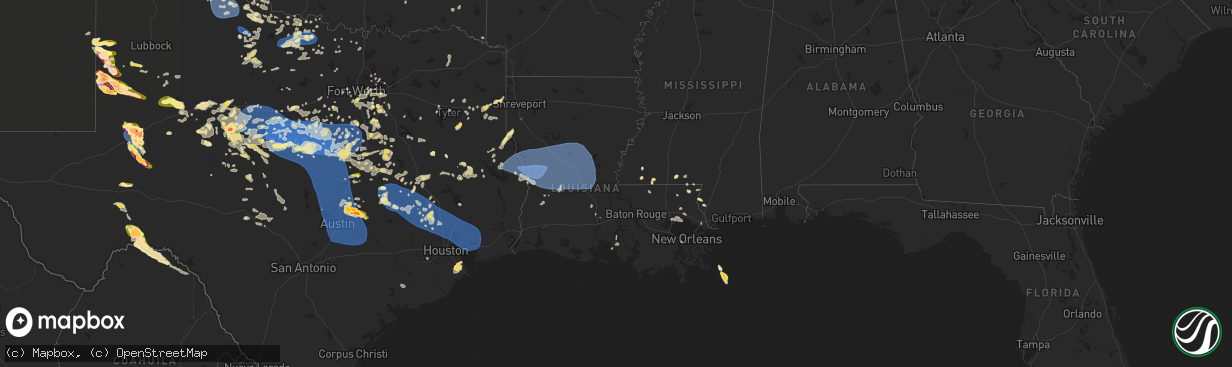
Hail Map in Louisiana on May 30, 2024
The weather event in Louisiana on May 30, 2024 includes Wind, Hail, and Tornado maps. 13 states and 806 cities were impacted and suffered possible damage. The total estimated number of properties impacted is 0.
Want more than just the map?
Turn this storm into a full workflow.
- Owner + property data so you know who to knock
- OnDemand branded weather history reports to win the "did we even have hail?" argument
- RoofTrace estimate so reps stop guessing numbers at the door
Bought this map? Upgrade within 7 days and we'll credit the $230. (10-15 min setup call)
Wind
Hail
Tornado
0
Estimated number of impacted properties by a 1.00" hail or larger0
Estimated number of impacted properties by a 1.75" hail or larger0
Estimated number of impacted properties by a 2.50" hail or largerStorm reports in Louisiana
Louisiana
| Date | Description |
|---|---|
| 05/29/202410:19 PM CDT | Report from mping: trees uprooted or snapped; roof blown off. |
| 05/29/202410:19 PM CDT | Em reports trees down and numerous power outages in opelousas. Time estimated by radar. |
| 05/29/202410:00 PM CDT | Report from mping: 3-inch tree limbs broken; power poles broken. |
| 05/29/20249:49 PM CDT | Report from mping: trees uprooted or snapped; roof blown off. |
| 05/29/20249:35 PM CDT | Utility company reports damage to powerlines at oberlin. Time estimated by radar. |
| 05/29/20249:32 PM CDT | Utility company reports numerous power poles broken and trees on lines in the glenmora area. Time estimated by radar. |
| 05/29/20249:32 PM CDT | Utility company reports tree damage to powerlines in the kinder area. Time estimated by radar. |
| 05/29/20249:23 PM CDT | Utility company reports numerous power poles broken and trees on lines in the elizabeth area. Time estimated by radar. |
| 05/29/20249:20 PM CDT | Photos received of large oak tree blown down onto outdoor garage covering. Possible tornado. Time estimated by radar. |
| 05/29/20249:20 PM CDT | Photos received of numerous trees snapped off on a property. Possible tornado. Time estimated by radar. |
| 05/29/20249:09 PM CDT | Report from mping: 1-inch tree limbs broken; shingles blown off. |
| 05/29/20249:04 PM CDT | Report from mping: 3-inch tree limbs broken; power poles broken. |
| 05/29/20248:55 PM CDT | Awos station kpoe fort polk fr. |
| 05/29/20248:43 PM CDT | Social media report of tree down on hwy 10 at lookout rd. Time estimated by radar. |
| 05/29/20248:40 PM CDT | Utility company reports numerous power poles broken and trees on lines in the anacoco area. Time estimated by radar. |
| 05/29/20247:50 PM CDT | Trees down across la hwy 175 about a mile south of i-49. Time estimated from radar. |
| 05/29/20247:30 PM CDT | Corrected location previous tstm wnd dmg report from 10 s zwolle. Law enforcement advised reports of numerous trees and power lines downed up and down hwy 191 and hwy 1 |
| 05/29/20247:30 PM CDT | Law enforcement advised reports of numerous trees and power liens downed up and down hwy 191. |
All States Impacted by Hail Map on May 30, 2024
Cities Impacted by Hail Map on May 30, 2024
- Melrose, NM
- Clovis, NM
- Weinert, TX
- Olney, TX
- Haskell, TX
- Holliday, TX
- Pampa, TX
- Clarendon, TX
- Lelia Lake, TX
- Hedley, TX
- Wichita Falls, TX
- Silverton, TX
- Paducah, TX
- Henrietta, TX
- Throckmorton, TX
- Seymour, TX
- Bogue Chitto, MS
- Saint Paul, NE
- Dannebrog, NE
- Munday, TX
- Mclean, TX
- Childress, TX
- Memphis, TX
- Jacksboro, TX
- Bowie, TX
- Bellevue, TX
- Matador, TX
- Tell, TX
- Quanah, TX
- Cee Vee, TX
- Magnolia, MS
- Crowell, TX
- Mccomb, MS
- Tylertown, MS
- Gainesville, TX
- Muenster, TX
- Lindsay, TX
- Valley View, TX
- Loving, TX
- Windthorst, TX
- Medford, OK
- Caldwell, KS
- Westwego, LA
- Sandy Hook, MS
- Angie, LA
- South Haven, KS
- Franklinton, LA
- Kentwood, LA
- Amite, LA
- Archer City, TX
- Dallas, TX
- Carrollton, TX
- Lewisville, TX
- Deer Creek, OK
- Braman, OK
- Nardin, OK
- Carriere, MS
- Ponchatoula, LA
- Atoka, OK
- Covington, LA
- Picayune, MS
- Folsom, LA
- Madisonville, LA
- Mandeville, LA
- Slidell, LA
- Duncanville, TX
- Breckenridge, TX
- Blackwell, TX
- Miami, FL
- Era, TX
- Eastland, TX
- Granbury, TX
- Ranger, TX
- Cedar Hill, TX
- The Colony, TX
- Grenville, NM
- Kenton, OK
- Saltillo, TX
- Mount Vernon, TX
- Clinton, LA
- Nolan, TX
- Rattan, OK
- Desdemona, TX
- Cross Plains, TX
- Cisco, TX
- Lancaster, TX
- Hutchins, TX
- Valliant, OK
- Dublin, TX
- Stephenville, TX
- Rising Star, TX
- Talco, TX
- Midlothian, TX
- Tolar, TX
- Glen Rose, TX
- Bogata, TX
- Pleasant Dale, NE
- Clayton, NM
- Rainbow, TX
- Nemo, TX
- Waxahachie, TX
- Italy, TX
- Milford, TX
- Kopperl, TX
- Cleburne, TX
- Red Oak, TX
- Meridian, TX
- Rio Vista, TX
- Hico, TX
- Blum, TX
- Bluff Dale, TX
- Covington, TX
- Foreman, AR
- Venus, TX
- Maypearl, TX
- Hallsville, TX
- Colorado Springs, CO
- Walnut Springs, TX
- Morgan, TX
- Haworth, OK
- Iredell, TX
- Grand Prairie, TX
- Clifton, TX
- Grandview, TX
- Hillsboro, TX
- Boise City, OK
- Marshall, TX
- Valley Mills, TX
- Ennis, TX
- Itasca, TX
- Whitney, TX
- Umpire, AR
- Brewster, NE
- Ferris, TX
- Dalhart, TX
- Bynum, TX
- Liberty, MS
- Larkspur, CO
- Mertens, TX
- Jonesboro, TX
- Cranfills Gap, TX
- Abbott, TX
- Hawkins, TX
- Lindale, TX
- Gatesville, TX
- Fort Stockton, TX
- Malone, TX
- Penelope, TX
- Centreville, MS
- West, TX
- Hubbard, TX
- Frost, TX
- Fountain, CO
- Pueblo, CO
- Elm Mott, TX
- Waco, TX
- Blooming Grove, TX
- Milnesand, NM
- Groesbeck, TX
- Kemp, TX
- Morton, TX
- Bassett, NE
- Crawford, TX
- Oglesby, TX
- Dawson, TX
- Andrews, TX
- Prairie Hill, TX
- Tyler, TX
- Ochopee, FL
- Athens, TX
- Woodway, TX
- Coolidge, TX
- Mart, TX
- Gladewater, TX
- Gardendale, TX
- Purdon, TX
- Mexia, TX
- Wortham, TX
- Gloster, MS
- Crosby, MS
- Chilton, TX
- Lorena, TX
- Immokalee, FL
- Brownsboro, TX
- Chandler, TX
- Ben Wheeler, TX
- Big Sandy, TX
- McGregor, TX
- Hewitt, TX
- Midland, TX
- Odessa, TX
- Waskom, TX
- Troup, TX
- North Fort Myers, FL
- Cape Coral, FL
- Kilgore, TX
- Fairfield, TX
- Overton, TX
- Melvin, TX
- Riesel, TX
- Marlin, TX
- Georgetown, TX
- Plains, TX
- Karnack, TX
- Marquez, TX
- Denver City, TX
- Lott, TX
- Rosebud, TX
- Reagan, TX
- Garden City, TX
- Longview, TX
- Henderson, TX
- Clewiston, FL
- Belton, TX
- Temple, TX
- Dryden, TX
- Stanton, TX
- Mitchell, SD
- Pflugerville, TX
- Thornton, TX
- Elkhart, TX
- Tennessee Colony, TX
- Cameron, TX
- Bremond, TX
- Kosse, TX
- Stratford, TX
- Gruver, TX
- Spearman, TX
- Sunray, TX
- Stinnett, TX
- Cactus, TX
- Channing, TX
- Dumas, TX
- Morse, TX
- Hartley, TX
- Tatum, TX
- Hutto, TX
- Taylor, NE
- Mosquero, NM
- Calvert, TX
- Fort Myers, FL
- Manor, TX
- Taylor, TX
- Coupland, TX
- Milano, TX
- Caldwell, TX
- Franklin, TX
- Madisonville, TX
- Boone, CO
- Gause, TX
- Olney Springs, CO
- Navasota, TX
- Anderson, TX
- Granger, TX
- Causey, NM
- Anselmo, NE
- Grapeland, TX
- Fowler, CO
- Normangee, TX
- Beckville, TX
- Troy, TX
- Seagraves, TX
- Seminole, TX
- Whiteface, TX
- Masterson, TX
- Borger, TX
- Amarillo, TX
- Fritch, TX
- Nara Visa, NM
- Amistad, NM
- Vega, TX
- Leona, TX
- Midway, TX
- Pep, NM
- Tyrone, OK
- Huntington, TX
- Ordway, CO
- Kennard, TX
- Hearne, TX
- Goodwell, OK
- Guymon, OK
- Texhoma, TX
- Texhoma, OK
- Hardesty, OK
- Moody, TX
- Bryan, TX
- Manzanola, CO
- Centerville, TX
- Crockett, TX
- Broken Bow, NE
- Diboll, TX
- Hugoton, KS
- Lufkin, TX
- Pollok, TX
- Montgomery, TX
- San Augustine, TX
- Bronson, TX
- North Zulch, TX
- Richards, TX
- Karval, CO
- Sugar City, CO
- Lovelady, TX
- Breaux Bridge, LA
- Lafitte, LA
- Church Point, LA
- Kinder, LA
- Braithwaite, LA
- Napoleonville, LA
- Plaquemine, LA
- Thibodaux, LA
- Bokeelia, FL
- Basile, LA
- Des Allemands, LA
- Carencro, LA
- Boca Grande, FL
- Barataria, LA
- Plattenville, LA
- Sunset, LA
- Belle Rose, LA
- Eunice, LA
- Liberal, KS
- Groveton, TX
- Pennington, TX
- Apple Springs, TX
- Rocky Ford, CO
- Chireno, TX
- Tatum, NM
- Bedias, TX
- Carthage, TX
- Arlington, CO
- Logan, NM
- Loop, TX
- McCamey, TX
- Crane, TX
- Midkiff, TX
- San Jon, NM
- Perryton, TX
- Balko, OK
- Miami, TX
- Canyon, TX
- Panhandle, TX
- Skellytown, TX
- White Deer, TX
- Merna, NE
- Clinton, MN
- Kismet, KS
- Turpin, OK
- Elgin, TX
- Iola, TX
- Corrigan, TX
- Nacogdoches, TX
- Somerville, TX
- Broaddus, TX
- Wilmot, SD
- Ortonville, MN
- Beardsley, MN
- Seibert, CO
- Forgan, OK
- Huntsville, TX
- College Station, TX
- Ethan, SD
- Parkston, SD
- Emery, SD
- Rye, CO
- Center, TX
- Walsenburg, CO
- De Berry, TX
- Thorndale, TX
- Alexandria, SD
- La Junta, CO
- Vona, CO
- Stratton, CO
- Scotland, SD
- Joaquin, TX
- Shelbyville, TX
- Thrall, TX
- Oakhurst, TX
- Zavalla, TX
- Hereford, TX
- Wiergate, TX
- Lexington, TX
- McDade, TX
- Muleshoe, TX
- Freeman, SD
- Bridgewater, SD
- Plantersville, TX
- Logansport, LA
- Mansfield, LA
- Grand Cane, LA
- Bethune, CO
- Las Animas, CO
- Tuscola, TX
- Wingate, TX
- Coldspring, TX
- Ansley, NE
- Junction, TX
- Merkel, TX
- Abilene, TX
- Groom, TX
- Claude, TX
- Canadian, TX
- Burlington, CO
- McClave, CO
- Hasty, CO
- Tabor, SD
- Lesterville, SD
- Winters, TX
- Ovalo, TX
- Hemphill, TX
- Buffalo Gap, TX
- Bloomfield, NE
- Magnolia, TX
- Iraan, TX
- Brownfield, TX
- Goldsboro, TX
- Novice, TX
- Lawn, TX
- Wayside, TX
- Utica, SD
- Talpa, TX
- Yankton, SD
- Clyde, TX
- Coleman, TX
- Marion, SD
- Kirk, CO
- Burkeville, TX
- Leesville, LA
- Evans, LA
- Anacoco, LA
- Clearwater, NE
- Oconto, NE
- Conroe, TX
- Milam, TX
- Pineland, TX
- Zwolle, LA
- Many, LA
- Florien, LA
- Fisher, LA
- Hornbeck, LA
- Provencal, LA
- New Llano, LA
- Robeline, LA
- Quail, TX
- Tahoka, TX
- Lamesa, TX
- Plainview, NE
- Eads, CO
- Cozad, NE
- Lexington, NE
- Pinehurst, TX
- Justiceburg, TX
- Baird, TX
- Briscoe, TX
- Pitkin, LA
- Fort Polk, LA
- Slagle, LA
- Burkett, TX
- Elgin, NE
- Wellington, TX
- Shamrock, TX
- Post, TX
- Frierson, LA
- Reydon, OK
- Sweetwater, OK
- Longville, LA
- Welch, TX
- Mora, LA
- Cloutierville, LA
- Natchez, LA
- Simpson, LA
- Natchitoches, LA
- Melrose, LA
- Flatwoods, LA
- Lena, LA
- Hineston, LA
- Idalia, CO
- Holly, CO
- Cheyenne, OK
- Mission Hill, SD
- Volin, SD
- Deridder, LA
- Sumner, NE
- Miller, NE
- Santa Anna, TX
- Carbon, TX
- Gorman, TX
- Sidney, TX
- Brownwood, TX
- Bangs, TX
- May, TX
- Comanche, TX
- De Leon, TX
- Early, TX
- Sieper, LA
- Montgomery, LA
- Boyce, LA
- New Waverly, TX
- Elmer, LA
- Oakdale, LA
- Otis, LA
- Glenmora, LA
- Colfax, LA
- Elizabeth, LA
- Willis, TX
- Cleveland, TX
- Dayton, TX
- Liberty, TX
- Splendora, TX
- Baytown, TX
- Waller, TX
- Snook, TX
- Huffman, TX
- Hockley, TX
- Crosby, TX
- Washington, TX
- New Caney, TX
- Tomball, TX
- Brenham, TX
- Spring, TX
- Kingwood, TX
- Porter, TX
- Houston, TX
- Highlands, TX
- Channelview, TX
- Humble, TX
- Hempstead, TX
- Odonnell, TX
- Gail, TX
- Tribune, KS
- Sheridan Lake, CO
- Longmont, CO
- Boulder, CO
- Sayre, OK
- Erick, OK
- Saint Francis, KS
- Ewing, NE
- Devers, TX
- Hull, TX
- Wallisville, TX
- Anahuac, TX
- Hankamer, TX
- Atlanta, LA
- Dry Prong, LA
- Pineville, LA
- Alexandria, LA
- Woodworth, LA
- Bentley, LA
- Forest Hill, LA
- Georgetown, LA
- Ville Platte, LA
- Pollock, LA
- Lecompte, LA
- Cheneyville, LA
- Saint Landry, LA
- Bunkie, LA
- Ball, LA
- Hessmer, LA
- Marksville, LA
- Deville, LA
- Blanket, TX
- Gustine, TX
- Zephyr, TX
- Wray, CO
- Osmond, NE
- Fort Lupton, CO
- Hudson, CO
- Santo, TX
- Lipan, TX
- Syracuse, KS
- Niwot, CO
- Lafayette, CO
- Erie, CO
- O'Brien, TX
- Rochester, TX
- Wiggins, CO
- Roggen, CO
- Mingus, TX
- Brighton, CO
- Rule, TX
- Dacono, CO
- Big Spring, TX
- Knott, TX
- Eldorado, OK
- Gould, OK
- Leoti, KS
- Keenesburg, CO
- Carlton, TX
- Priddy, TX
- Hamilton, TX
- Mullin, TX
- Pottsville, TX
- Coahoma, TX
- Alvarado, TX
- Mansfield, TX
- Burleson, TX
- Lillian, TX
- Broomfield, CO
- Opelousas, LA
- Duke, OK
- Commerce City, CO
- Denver, CO
- Thornton, CO
- Westminster, CO
- Winona, KS
- Sweetwater, TX
- Chillicothe, TX
- Arlington, TX
- Moorefield, NE
- Sharon Springs, KS
- Palmer, TX
- Roscoe, TX
- Fort Worth, TX
- Henderson, CO
- Dupont, CO
- Mansura, LA
- Cottonport, LA
- Effie, LA
- Center Point, LA
- Jena, LA
- Evergreen, LA
- Trout, LA
- Evant, TX
- Loraine, TX
- Colorado City, TX
- Westbrook, TX
- Haigler, NE
- Parks, NE
- Olustee, OK
- Odell, TX
- Wallace, KS
- Arnaudville, LA
- Goree, TX
- Goldthwaite, TX
- Bennett, CO
- Trent, TX
- Crowley, TX
- Kennedale, TX
- Aurora, CO
- Stockville, NE
- Watkins, CO
- Benkelman, NE
- Joshua, TX
- Vernon, TX
- Monument, KS
- Edson, KS
- Byers, CO
- Aledo, TX
- Maryneal, TX
- Bird City, KS
- Sterling City, TX
- Perrin, TX
- Bronte, TX
- Irving, TX
- Woodrow, CO
- Aquilla, TX
- China Spring, TX
- Goodland, KS
- Robert Lee, TX
- Newcastle, TX
- Mason City, NE
- Jeanerette, LA
- Electra, TX
- Graham, TX
- Paradise, TX
- Franklin, LA
- Tye, TX
- Deer Trail, CO
- Harrold, TX
- Purmela, TX
- Grinnell, KS
- Baldwin, LA
- Norton, TX
- Brewster, KS
- Iowa Park, TX
- Scotland, TX
- Oakley, KS
- Genoa, CO
- Burkburnett, TX
- Ballinger, TX
- Rowena, TX
- Akron, CO
- Lindon, CO
- Colby, KS
- Bartley, NE
- Indianola, NE
- Callaway, NE
- Wauneta, NE
- Limon, CO
- Sheppard Afb, TX
- Bartlett, NE
- Miles, TX
- Arriba, CO
- Stratton, NE
- Bruceville, TX
- Hayes Center, NE
- Byers, TX
- Eddy, TX
- Petrolia, TX
- Palisade, NE
- Sunset, TX
- Gouldbusk, TX
- Valera, TX
- Paint Rock, TX
- Nocona, TX
- Roosevelt, OK
- Mountain View, OK
- Creighton, NE
- Merino, CO
- Millersview, TX
- San Angelo, TX
- Wall, TX
- Vancourt, TX
- Eola, TX
- Montague, TX
- Saint Jo, TX
- Farnam, NE
- Brunswick, NE
- Pierce, NE
- Neligh, NE
- Oakdale, NE
- Rockwood, TX
- Atwood, CO
- Doole, TX
- Eden, TX
- Brookesmith, TX
- Atwood, KS
- Lohn, TX
- Rochelle, TX
- Christoval, TX
- Flagler, CO
- Grover, CO
- Pine Bluffs, WY
- Bushnell, NE
- Carpenter, WY
- Oberlin, KS
- Brady, TX
- Menard, TX
- Star, TX
- Lometa, TX
- Lampasas, TX
- Copperas Cove, TX
- Axtell, TX
- Norton, KS
- Castell, TX
- Mason, TX
- Art, TX
- Llano, TX
- Stockton, KS
- Woodston, KS
- Pontotoc, TX
- Fredonia, TX
- Round Rock, TX
- Marble Falls, TX
- Salado, TX
- Nolanville, TX
- Fort Hood, TX
- Harker Heights, TX
- Killeen, TX
- Florence, TX
- Jarrell, TX
- Holland, TX
- Bartlett, TX
- Paige, TX
- Maxwell, TX
- Dale, TX
- Briggs, TX
- San Marcos, TX
- Leander, TX
- Kyle, TX
- Liberty Hill, TX
- Buda, TX
- Cedar Park, TX
- Bastrop, TX
- Cedar Creek, TX
- Austin, TX
- Bertram, TX
- Kempner, TX
- Del Valle, TX
- Lockhart, TX
- Manchaca, TX
- Burnet, TX
- Spicewood, TX
- Red Rock, TX
- Waelder, TX
- Smithville, TX
- Muldoon, TX
- Rosanky, TX
- Flatonia, TX
- Voss, TX
- Harper, TX
- Mountain Home, TX
- Santa Fe, TX
- Texas City, TX
- Hitchcock, TX
- Dickinson, TX
- La Marque, TX
- Alvin, TX
- League City, TX
- El Campo, TX
- Louise, TX
- Bacliff, TX
- Kemah, TX
- Richmond, TX
- Rosenberg, TX
- Hemingford, NE
- Alliance, NE


