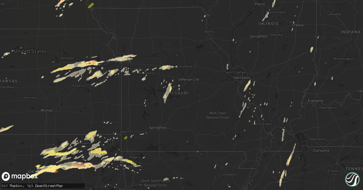
Hail Map in Missouri on May 30, 2013
Get this storm
May 30 map
$229
one time, instant access
Download today. No call, no setup
Keep the $229
Bought the map and want the full workflow? Apply the entire $229 to a subscription within 7 days. None of it is wasted.
Every map, not just this one
This buys you this map. Subscription and you get every map we run, in the markets you choose from a few cities to whole states to nationwide. Plus real-time alerts the moment a storm fires.
Contact data
Name, contact info, occupancy, even credit band for addresses in the footprint. You go from where it hit to who to call.
Become the source they trust
Unlimited branding weather history reports on demand. You already have the documented answer ready for the property owner, and you are the one who showed up with it.
Property data and RoofTrace estimates
Pull up any address you have got, its value and the exact code rules for that jurisdiction, straight from One Click Code. Then RoofTrace estimates the squares, pitch, and roof value, priced the way you price.
Storm reports in Missouri
Missouri
| Date | Description |
|---|---|
| 05/30/20136:56 PM CDT | A local report indicates 60 MPH wind near 4 NNE ORCHARD FARMS |
| 05/30/20136:55 PM CDT | Asos at smart field - st. Charles missouri - 61 mph at 655 pm cdt. |
| 05/30/20136:40 PM CDT | Six inch diamter tree limb down. |
| 05/30/20136:38 PM CDT | Multiple 3 inch diameter tree limbs blown down in creve coeur |
| 05/30/20136:03 PM CDT | 3 foot diameter tree split off with numerous smaller limbs down. |
| 05/30/20135:50 PM CDT | Two trees blown down and partially blocking highway f at highway mm. Time estimated from radar |
| 05/30/20135:45 PM CDT | Several large trees and power lines down along county road 163 |
| 05/30/20135:16 PM CDT | Several medium to large trees were down by downburst winds in fredricktown mo around 516 pm cdt. |
| 05/30/20134:53 PM CDT | 2 trees blown down on pet street...one dead one healthy...healthy tree was 1 to 1.5 feet in diameter |
| 05/30/20133:56 PM CDT | Several large trees down. |
| 05/30/20133:25 PM CDT | A local report indicates 1.00 inch wind near GRAVOIS MILLS |
| 05/30/20132:54 PM CDT | A local report indicates 80 MPH wind near MEMPHIS |
| 05/30/20132:54 PM CDT | Large uprooted tree down near courthouse with several tree branches down in town as well. Power out in town. |
| 05/30/20132:50 PM CDT | Heavy tree damage throughout county with several damaged outbuildings and approx 30 power poles snapped. Tree damage is mainly located to bible grove to memphis...time |
| 05/30/20132:49 PM CDT | 60 to 70 mph winds estimated. |
| 05/30/20132:32 PM CDT | Delayed report. Numerous large tree limbs were broken and strewn about the yard. Winds persisted approximately 15 to 20 minutes before subsiding. Time is estimated. |
| 05/30/20132:20 PM CDT | Power poles and roof damage over the south half of kirksville reported by local police. Reliable storm chaser witnessed this and confirmed it was straight-line wind tha |
| 05/30/20136:05 AM CDT | Strong winds destroyed two homes on mount lebanon road. Several other homes had roof and some structural damage.winds moved cars and trucks a significant amount.all the |
| 05/30/20134:20 AM CDT | Relayed via social media. |
| 05/30/20134:15 AM CDT | Relay of report of quater size hail at mkc charles wheeler downtown airport by broadcast media |
| 05/30/201312:40 AM CDT | Several buildings damaged near hutton valley. Possible tornado. |
| 05/30/201312:29 AM CDT | Tree down |
| 05/30/201312:20 AM CDT | A tornado uprooted numerous trees from four miles west to two miles northwest of pomona. |
| 05/29/20138:15 PM CDT | Trees down along highway h east of edgar springs. |
All States Impacted by Hail Map on May 30, 2013
Cities Impacted by Hail Map on May 30, 2013
- Leon, OK
- Reedsburg, WI
- La Valle, WI
- Hillpoint, WI
- Lime Ridge, WI
- Cazenovia, WI
- Coleman, MI
- Mount Pleasant, MI
- Midland, MI
- Mountain Lake, MN
- Butterfield, MN
- Shepherd, MI
- Owensboro, KY
- Dyer, IN
- Chicago Heights, IL
- Munster, IN
- Hammond, IN
- Lansing, IL
- Big Cabin, OK
- East Jordan, MI
- Elmira, MI
- Martell, NE
- Hickman, NE
- Roca, NE
- Ellis Grove, IL
- Modoc, IL
- Rogers, AR
- Eureka Springs, AR
- Independence, MO
- Rogers City, MI
- Pontiac, MI
- Troy, MI
- Auburn Hills, MI
- Bloomfield Hills, MI
- Rochester, MI
- Dennard, AR
- Gladwin, MI
- Harrison, MI
- Kansas City, KS
- Basehor, KS
- Mena, AR
- Mount Vernon, AR
- Enola, AR
- Berryton, KS
- Lecompton, KS
- Tecumseh, KS
- Bradley, OK
- Alex, OK
- Lake City, MI
- Millersburg, MI
- Chouteau, OK
- Pryor, OK
- Locust Grove, OK
- Pomona, KS
- Fletcher, OK
- Rose, OK
- Salina, OK
- Anadarko, OK
- Elkins, AR
- Red Rock, OK
- Gentry, AR
- Springdale, AR
- Siloam Springs, AR
- Sulphur, OK
- Stratford, OK
- Maysville, OK
- Roff, OK
- Lindsay, OK
- Davis, OK
- Wynnewood, OK
- Pauls Valley, OK
- Clio, MI
- Millington, MI
- Wann, OK
- Coffeyville, KS
- S Coffeyville, OK
- Lenapah, OK
- Pelahatchie, MS
- Lawrence, KS
- Lyndon, KS
- Osage City, KS
- Quenemo, KS
- Ottawa, KS
- Vassar, KS
- Baldwin City, KS
- Overbrook, KS
- Waverly, NE
- Greenwood, NE
- Davey, NE
- Lincoln, NE
- Dermott, AR
- Gravois Mills, MO
- Hector, AR
- Witts Springs, AR
- Pelsor, AR
- Nocona, TX
- Saint Jo, TX
- Burneyville, OK
- Garber, OK
- Morrison, OK
- Pawhuska, OK
- Fairfax, OK
- Wynona, OK
- Pawnee, OK
- Ponca City, OK
- Billings, OK
- Marland, OK
- Perry, OK
- Hominy, OK
- Ralston, OK
- Higbee, MO
- Continental, OH
- Cloverdale, OH
- Boonville, MO
- Nelson, MO
- Blackwater, MO
- Pilot Grove, MO
- Hughesville, MO
- Gardner, KS
- Spring Hill, KS
- New Century, KS
- Edgerton, KS
- Olathe, KS
- National City, MI
- Tawas City, MI
- Jay, OK
- Colcord, OK
- Topeka, KS
- Lavinia, TN
- Cedar Grove, TN
- Jackson, TN
- Ringgold, TX
- Tulsa, OK
- Broken Arrow, OK
- Henrietta, TX
- Collinsville, OK
- Talala, OK
- Chelsea, OK
- Claremore, OK
- Oologah, OK
- Strang, OK
- Owasso, OK
- Adair, OK
- Vinita, OK
- Hays, KS
- La Porte, IN
- Union Pier, MI
- New Buffalo, MI
- Three Oaks, MI
- Burbank, OK
- Parsons, KS
- McCune, KS
- Mahomet, IL
- Shirley, AR
- Burbank, SD
- Elk Point, SD
- Cashion, OK
- Guthrie, OK
- Kingfisher, OK
- Okarche, OK
- Crescent, OK
- Fremont, WI
- Crete, NE
- Auburn, MI
- Linwood, MI
- Kawkawlin, MI
- Wapello, IA
- Muscatine, IA
- Remus, MI
- Barryton, MI
- Miami, OK
- Kent, IL
- Lena, IL
- Alvo, NE
- Lyndon Station, WI
- Weeping Water, NE
- Plattsmouth, NE
- Murdock, NE
- Louisville, NE
- Fife Lake, MI
- Junction City, KS
- White City, KS
- Chapman, KS
- Hope, KS
- Woodbine, KS
- Alma, KS
- Dwight, KS
- Alta Vista, KS
- Foster, OK
- Marlow, OK
- Rush Springs, OK
- Mount Ida, AR
- Oden, AR
- Hardtner, KS
- Medicine Lodge, KS
- Ashland, KS
- Coldwater, KS
- Lake City, KS
- Protection, KS
- Marshall, IL
- Dennison, IL
- Whitefield, OK
- Cleveland, OK
- Denton, NE
- Ashland, NE
- Ward, AR
- Austin, AR
- Lonoke, AR
- Glenwood, IL
- Tahlequah, OK
- Perkins, OK
- Bismarck, AR
- Malvern, AR
- Hemlock, MI
- Merrill, MI
- Williamsfield, IL
- Pacific Junction, IA
- Raymore, MO
- Paris, TN
- Gleason, TN
- Henry, TN
- McKenzie, TN
- Kenefic, OK
- Durant, OK
- Madill, OK
- Kingston, OK
- Caddo, OK
- Mead, OK
- Saint Louis, MI
- Grantville, KS
- Perryville, MO
- Fayetteville, AR
- Prairie Grove, AR
- Summers, AR
- Lincoln, AR
- Harmon, IL
- Amboy, IL
- Walnut, IL
- Ohio, IL
- Osceola, MO
- Water Valley, MS
- Oxford, MS
- Paris, MS
- Danvers, IL
- Levering, MI
- Cheboygan, MI
- Apple River, IL
- Barnett, MO
- Versailles, MO
- Bartlesville, OK
- Cottage Grove, TN
- Kansas City, MO
- Lees Summit, MO
- Auburn, KS
- Burlingame, KS
- Cement, OK
- Bennet, NE
- Palmyra, NE
- Tonganoxie, KS
- Hallam, NE
- Osborne, KS
- Waldo, KS
- Prescott, MI
- Sterling, MI
- Twining, MI
- Atlanta, MI
- Mayfield, KY
- Wahoo, NE
- Ithaca, NE
- Mead, NE
- Yutan, NE
- Marshall, OK
- Linton, IN
- Beaverton, MI
- Venedocia, OH
- Paoli, OK
- Elmore City, OK
- De Witt, NE
- Stover, MO
- Reynolds, IL
- Milan, IL
- Aledo, IL
- Cuba City, WI
- Sainte Genevieve, MO
- Sparta, IL
- Hawks, MI
- Marion, WI
- Weidman, MI
- Farwell, MI
- Clare, MI
- Lake, MI
- Liberty, KS
- Delaware, OK
- Copan, OK
- Spavinaw, OK
- Eucha, OK
- Caney, OK
- Ringling, OK
- Wilson, OK
- Providence, KY
- Verden, OK
- Whittemore, MI
- Omer, MI
- Treece, KS
- Picher, OK
- Baxter Springs, KS
- Fancy Farm, KY
- Boaz, KY
- West Paducah, KY
- Paducah, KY
- Melber, KY
- Metropolis, IL
- Hickory, KY
- Lexington, OK
- Noble, OK
- Washington, OK
- Wanette, OK
- Macomb, OK
- Purcell, OK
- Hot Springs National Park, AR
- Pearcy, AR
- Royal, AR
- Sabula, IA
- Wolverine, MI
- Sebewaing, MI
- Bay Port, MI
- Randolph, WI
- Fall River, WI
- Avoca, NE
- Maple Hill, KS
- Bonner Springs, KS
- Riverside, MO
- Liberty, MO
- Excelsior Springs, MO
- Orrick, MO
- Missouri City, MO
- Delphos, OH
- Fort Jennings, OH
- Ottoville, OH
- Blair, NE
- Ryan, OK
- Mount Carroll, IL
- Savanna, IL
- Sapulpa, OK
- Mannford, OK
- Jennings, OK
- Sand Springs, OK
- Cushing, OK
- Drumright, OK
- Bristow, OK
- Pickrell, NE
- Dolton, IL
- Calumet City, IL
- Chicago, IL
- South Holland, IL
- Stuttgart, AR
- Altheimer, AR
- Norman, AR
- Lonsdale, AR
- Apache, OK
- Elgin, OK
- Belleville, IL
- Cape Girardeau, MO
- Saint Charles, MI
- Saginaw, MI
- Medina, TN
- Milan, TN
- Oakfield, TN
- Medon, TN
- Princeton, KS
- Olney, IL
- Lewis, IA
- Belton, MO
- Stilwell, KS
- Grandview, MO
- Sperry, OK
- Prue, OK
- Osage, OK
- Skiatook, OK
- Williamsburg, KS
- Duncan, OK
- Ninnekah, OK
- Tussy, OK
- Lawton, OK
- Hennepin, OK
- Springer, OK
- Brinkley, AR
- Warrensburg, MO
- Toulon, IL
- Hensley, AR
- Rantoul, KS
- Coyle, OK
- Columbus, WI
- Rio, WI
- Sun Prairie, WI
- Madison, WI
- Deforest, WI
- Windsor, WI
- Vergennes, IL
- Murphysboro, IL
- Paron, AR
- Watts, OK
- Pierce City, MO
- Brant, MI
- Chesaning, MI
- Oakley, MI
- Merrillville, IN
- Crown Point, IN
- Hamburg, AR
- Montrose, AR
- Atwood, TN
- Assaria, KS
- Gypsum, KS
- Mancelona, MI
- Kuttawa, KY
- Eddyville, KY
- Fredonia, KY
- Princeton, KY
- Little Rock, AR
- Scott, AR
- North Little Rock, AR
- Red Oak, OK
- Wister, OK
- Vilonia, AR
- Council Grove, KS
- Beebe, AR
- Carlisle, AR
- Chickasha, OK
- Amber, OK
- Barnsdall, OK
- Newaygo, MI
- Grant, MI
- Fullerton, NE
- Conway, AR
- Mayflower, AR
- Bigelow, AR
- Roland, AR
- Mulhall, OK
- Hodgen, OK
- Poplar Bluff, MO
- Peace Valley, MO
- Paxico, KS
- Eskridge, KS
- Allen, KS
- Wellsville, KS
- Saulsbury, TN
- Atoka, OK
- Minier, IL
- Marshall, WI
- Grayling, MI
- Hoisington, KS
- Gaylord, MI
- Dewey, OK
- Independence, KS
- Caney, KS
- Dearing, KS
- Bentley, MI
- Standish, MI
- Alger, MI
- Wellston, OK
- Stillwater, OK
- Yale, OK
- Ripley, OK
- Tryon, OK
- Brownell, KS
- Caddo Gap, AR
- Pinconning, MI
- Hartman, AR
- Zalma, MO
- Overbrook, OK
- Waurika, OK
- Waverly, KS
- Melvern, KS
- Catoosa, OK
- Bixby, OK
- Jenks, OK
- Canton, SD
- Harrisburg, SD
- Hazleton, IN
- Patoka, IN
- Coweta, OK
- Porter, OK
- Fort Calhoun, NE
- Omaha, NE
- Granby, MO
- Bentonville, AR
- Ava, IL
- Brandon, WI
- Rosendale, WI
- Odell, IL
- Bluejacket, OK
- Wakarusa, KS
- Cerulean, KY
- Clinton, AR
- Sedalia, MO
- Houstonia, MO
- Marshall, MO
- Ness City, KS
- Nickerson, NE
- West Liberty, IL
- Delta, OH
- Greensburg, IN
- Windom, MN
- Monee, IL
- University Park, IL
- Riverdale, IL
- Park Forest, IL
- Gary, IN
- Grant Park, IL
- Peotone, IL
- Steger, IL
- Highland, IN
- Thornton, IL
- Crete, IL
- Whiting, IN
- Schererville, IN
- Beecher, IL
- East Chicago, IN
- Manteno, IL
- Broken Bow, OK
- Harveyville, KS
- Sallisaw, OK
- Salem, AR
- Kalkaska, MI
- Frederic, MI
- Elwell, MI
- Alma, MI
- Neponset, IL
- La Fayette, IL
- Davenport, IA
- Coal Valley, IL
- Moline, IL
- Bettendorf, IA
- Eldridge, IA
- Rock Island, IL
- Vermillion, SD
- Dexter, KY
- Murray, KY
- Hazel, KY
- Almo, KY
- Puryear, TN
- Verona, WI
- Belleville, WI
- Oregon, WI
- Glenwood, IA
- Manley, NE
- West Fork, AR
- McGehee, AR
- Greenville, MS
- Platteville, WI
- Sheridan, AR
- Benton, AR
- Donaldson, AR
- Blanchard, OK
- Bingham Lake, MN
- Fort Cobb, OK
- Van Wert, OH
- Hulbert, OK
- Overland Park, KS
- Paola, KS
- Peculiar, MO
- Harrisonville, MO
- Pleasant Hill, MO
- Greenwood, MO
- Tekamah, NE
- Rhodes, MI
- Romance, AR
- Greenbrier, AR
- Concordia, MO
- Bonnerdale, AR
- Glenwood, AR
- Amity, AR
- Monett, MO
- Verona, MO
- Iron Ridge, WI
- Horicon, WI
- Maramec, OK
- Glencoe, OK
- Shidler, OK
- Proctor, OK
- Dewitt, MI
- Lincolnville, KS
- Herington, KS
- Wilsey, KS
- Burdick, KS
- Lost Springs, KS
- Delaplaine, AR
- Walnut Ridge, AR
- Beech Grove, AR
- Elkton, MI
- Bad Axe, MI
- Melvin, IA
- Sanborn, IA
- Honobia, OK
- Hennessey, OK
- Morton, MS
- Lena, MS
- Wilburton, OK
- Ransom, KS
- Meriden, KS
- Ozawkie, KS
- Washington, MI
- Ray, MI
- Oak Ridge, MO
- Friedheim, MO
- Daisy, MO
- Downers Grove, IL
- Pigeon, MI
- Odessa, MO
- Smithville, OK
- Humboldt, TN
- Trenton, TN
- Waldron, AR
- Wolf Lake, IL
- Jackson, MO
- Concord, NE
- Dixon, NE
- Gresham, WI
- Shawano, WI
- Keshena, WI
- Coleman, OK
- Perry, KS
- Sioux City, IA
- Sergeant Bluff, IA
- Lawton, IA
- Kingsley, IA
- Moville, IA
- Abilene, KS
- Beloit, KS
- Boles, AR
- Vandervoort, AR
- Cove, AR
- New Haven, MI
- Waupun, WI
- Markesan, WI
- Parks, AR
- Bucyrus, KS
- Olivet, MI
- Watson, OK
- Manton, MI
- Kennard, NE
- Ramona, OK
- Ochelata, OK
- Dixon, KY
- Sterling Heights, MI
- Unionville, MI
- Fredericktown, MO
- La Monte, MO
- Sweet Springs, MO
- Cotton Plant, AR
- Wheatley, AR
- Wickes, AR
- Emporia, KS
- Admire, KS
- Reading, KS
- Cross Timbers, MO
- Macks Creek, MO
- Climax Springs, MO
- Tunas, MO
- Roach, MO
- Edwards, MO
- Red Bud, IL
- Camp, AR
- Charlotte, MI
- Coffeeville, MS
- Chilhowee, MO
- Leeton, MO
- Harrisburg, AR
- Cherry Valley, AR
- Nowata, OK
- Prairie Du Rocher, IL
- Scranton, KS
- Franklin, MI
- Carbondale, KS
- Wheeler, MI
- Old Monroe, MO
- Winfield, MO
- O'Fallon, MO
- Sheffield, IL
- Princeton, IL
- Wyanet, IL
- Pierson, IA
- Mount Morris, MI
- Saint Mary, MO
- Booneville, AR
- Mansfield, AR
- Armington, IL
- Stanford, IL
- Atlanta, IL
- Delavan, IL
- Emden, IL
- Hartsburg, IL
- Calhoun, KY
- Rumsey, KY
- Magnolia, MN
- Spencerville, IN
- Hicksville, OH
- Burfordville, MO
- Whitewater, MO
- Lakefield, MN
- Tipton, MO
- Fortuna, MO
- Latham, MO
- Ellis, KS
- Mauston, WI
- Loganville, WI
- Johannesburg, MI
- Mascoutah, IL
- Champaign, IL
- Roberts, IL
- Saint Anne, IL
- Streator, IL
- Ransom, IL
- Grand Ridge, IL
- Seneca, IL
- Marseilles, IL
- Jacksonville, AR
- Le Mars, IA
- Remsen, IA
- Deerfield, WI
- Waterloo, WI
- Bluffs, IL
- Winchester, IL
- Alcester, SD
- Belleville, MI
- New Boston, MI
- Millstadt, IL
- Smithton, IL
- Hot Springs Village, AR
- Collins, MO
- Bazine, KS
- Baldwin, IL
- Palmyra, IL
- Carlinville, IL
- Alexander, KS
- Welch, OK
- Coatesville, IN
- Holgate, OH
- Golconda, IL
- Madison, VA
- Alexandria, MO
- Ashton, IA
- Freeburg, IL
- Waterloo, IL
- Galena, IL
- Eldon, MO
- Olean, MO
- Howe, OK
- Fox Lake, WI
- Ozark, AR
- Potterville, MI
- Jessieville, AR
- Hatfield, AR
- Langley, AR
- Umpire, AR
- Valliant, OK
- Raymond, NE
- Winslow, AR
- Wapanucka, OK
- Grove, OK
- Gore, OK
- Vian, OK
- Terlton, OK
- Oskaloosa, KS
- McFarland, KS
- Enterprise, KS
- Kingsville, MO
- Bates City, MO
- Holden, MO
- England, AR
- Hartley, IA
- Ocheyedan, IA
- Lakeside, MI
- Harbert, MI
- Cabot, AR
- Lincoln, IL
- El Paso, IL
- Leslie, AR
- Paradise, KS
- Brandon, MS
- Princeton, IA
- Long Grove, IA
- Prudenville, MI
- Houghton Lake, MI
- Eldorado, IL
- Springville, TN
- Portage, IN
- Roscommon, MI
- Decatur, IN
- Ossian, IN
- Loogootee, IN
- Marble Hill, MO
- White Cloud, MI
- Frohna, MO
- Pearl City, IL
- Stockton, IL
- Centerview, MO
- Evansville, IL
- Hazen, AR
- De Valls Bluff, AR
- Carnegie, OK
- Heavener, OK
- Webbers Falls, OK
- Wagoner, OK
- Moyers, OK
- Antlers, OK
- Wooldridge, MO
- Columbus, KS
- Grand Junction, TN
- Somerville, TN
- Carson, IA
- Macedonia, IA
- Montpelier, IN
- Hartford City, IN
- Rocky Mount, MO
- Genoa, NE
- Janesville, WI
- West Point, IA
- Donnellson, IA
- Fort Madison, IA
- Byars, OK
- Ada, OK
- Temple, OK
- Middle Point, OH
- Downs, KS
- Fults, IL
- New Athens, IL
- Boyne Falls, MI
- Tuckerman, AR
- Paxton, IL
- Dewey, IL
- Sibley, MO
- Richmond, MO
- Buckner, MO
- Kankakee, IL
- Marion, KS
- Ramona, KS
- Sanford, MI
- Wayne, NE
- Malcolm, NE
- Gretna, NE
- Silver City, IA
- Maumelle, AR
- Southgate, MI
- Riverview, MI
- Wyandotte, MI
- Hillman, MI
- Corunna, MI
- Owosso, MI
- Maysville, AR
- Decatur, AR
- Hindsville, AR
- Peggs, OK
- Inola, OK
- Kansas, OK
- Fairgrove, MI
- Cadiz, KY
- Gracey, KY
- Eldorado, WI
- Eufaula, OK
- Ithaca, MI
- Williamsville, MO
- Cole Camp, MO
- Wilber, NE
- Marshall, MI
- Carthage, MS
- Chesterton, IN
- Valparaiso, IN
- Flint, MI
- Hillsdale, IN
- Clinton, IN
- Dana, IN
- Charlevoix, MI
- Simpson, IL
- Pellston, MI
- Brutus, MI
- Sadorus, IL
- Ivesdale, IL
- Mora, MO
- Lake Station, IN
- Gravelly, AR
- Bluffton, AR
- Broughton, IL
- Aurora, MO
- Walsh, IL
- Blairstown, MO
- Stockton, MO
- Humansville, MO
- Freeland, MI
- Secor, IL
- Minonk, IL
- Carlock, IL
- Cortland, NE
- Dora, MO
- Cannelburg, IN
- Black Rock, AR
- Smithville, AR
- Powhatan, AR
- Saint Johns, MI
- Ashley, MI
- Elsie, MI
- Bannister, MI
- Clinton, IA
- Williamstown, MO
- Canton, MO
- Mountain Pine, AR
- Silver Lake, KS
- Delia, KS
- Henderson, MI
- Natoma, KS
- Hinton, IA
- Wichita Falls, TX
- Mountain View, OK
- Camanche, IA
- Pleasant Dale, NE
- Westville, OK
- Agra, OK
- Crescent, IA
- Missouri Valley, IA
- Honey Creek, IA
- Nebraska City, NE
- Sidney, IA
- Hamburg, IA
- Ratliff City, OK
- Pocasset, OK
- Gracemont, OK
- Norman, OK
- Tuttle, OK
- Cyril, OK
- Pontiac, IL
- Cornell, IL
- Chenoa, IL
- Dixon, IL
- De Witt, IA
- Boyne City, MI
- Mecosta, MI
- Neosho, MO


