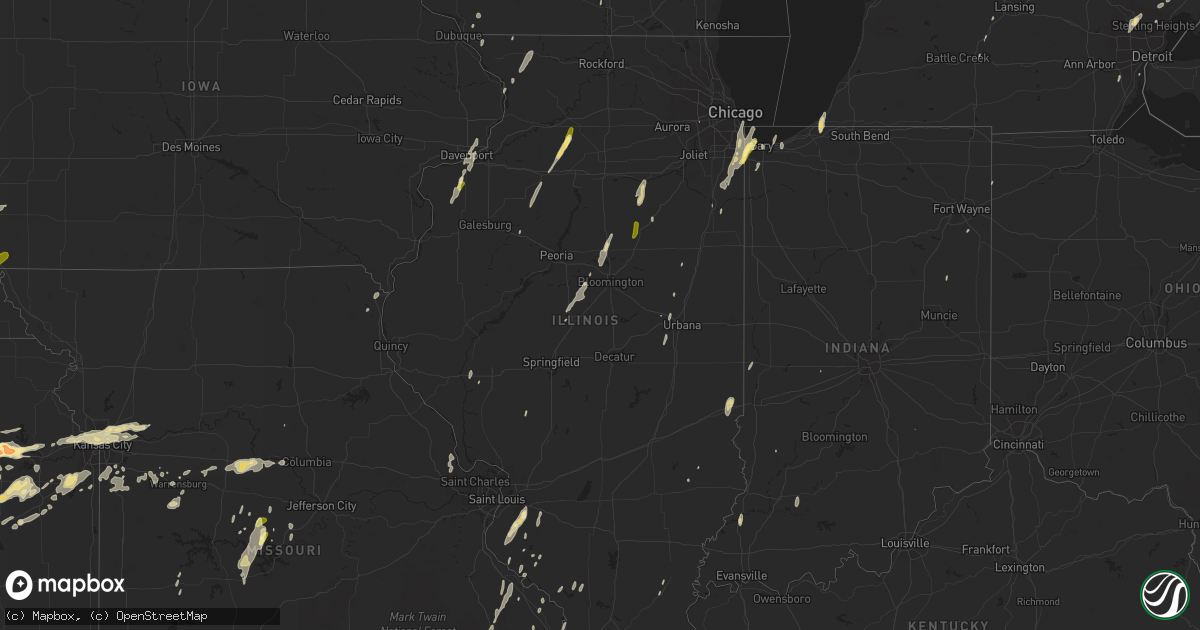
Hail Map in Illinois on May 30, 2013
Get this storm
May 30 map
$229
one time, instant access
Download today. No call, no setup
Keep the $229
Bought the map and want the full workflow? Apply the entire $229 to a subscription within 7 days. None of it is wasted.
Every map, not just this one
This buys you this map. Subscription and you get every map we run, in the markets you choose from a few cities to whole states to nationwide. Plus real-time alerts the moment a storm fires.
Contact data
Name, contact info, occupancy, even credit band for addresses in the footprint. You go from where it hit to who to call.
Become the source they trust
Unlimited branding weather history reports on demand. You already have the documented answer ready for the property owner, and you are the one who showed up with it.
Property data and RoofTrace estimates
Pull up any address you have got, its value and the exact code rules for that jurisdiction, straight from One Click Code. Then RoofTrace estimates the squares, pitch, and roof value, priced the way you price.
Storm reports in Illinois
Illinois
| Date | Description |
|---|---|
| 05/30/20136:50 PM CDT | Damage from loudon state park to stillman valley. Trees down. From sheriffs department. |
| 05/30/20136:50 PM CDT | Eight homes in the okawville area sustained varying degrees of shingle damage. Numerous trees and large tree branches were down by downburst winds. |
| 05/30/20136:45 PM CDT | Trees and wires down at holcomb road and stillman road. |
| 05/30/20136:45 PM CDT | Trees down. |
| 05/30/20136:35 PM CDT | Shed blown down. |
| 05/30/20136:33 PM CDT | Several medium to large trees down...power lines down - shingles from roofs from four homes were removed. |
| 05/30/20136:30 PM CDT | 1 foot diameter limb of maple tree down at rte. 75 and winneshiek. Adjacent field has a section of oats flattened. Time estimated off radar as between 630 and 635 pm cd |
| 05/30/20136:29 PM CDT | Delayed report from may 30. |
| 05/30/20136:28 PM CDT | Large tree down over the north side of ofallon illinois. |
| 05/30/20136:25 PM CDT | Large tree limb 12 inches in diameter fell on top of a building at a car dealship |
| 05/30/20136:25 PM CDT | Trees and power lines blown down. |
| 05/30/20136:20 PM CDT | Trees and wires down. |
| 05/30/20136:20 PM CDT | Several large tree limbs 6 to 10 inches down north side of chester il |
| 05/30/20136:17 PM CDT | Sustained wind of 50mph or higher for 10 minutes. |
| 05/30/20136:17 PM CDT | Some 6 to 8 inch tree limbs down in town. |
| 05/30/20136:14 PM CDT | Large tree down at lefevre rd and avenue k resting on power lines...time estimated from radar. |
| 05/30/20135:55 PM CDT | Large 22 inch diameter tree snapped a foot off the ground...time estimated from radar. |
| 05/30/20135:50 PM CDT | Large tree blown partially over. |
| 05/30/20135:40 PM CDT | Large 8 inch tree limb down at residence. |
| 05/30/20135:37 PM CDT | Confirmed tornado on spring hill and vandam road |
| 05/30/20135:10 PM CDT | Tree reported blown down in hamburg...size of tree unknown |
| 05/30/20134:55 PM CDT | A local report indicates 60 MPH wind near 2 ESE EAST MOLINE |
| 05/30/20134:45 PM CDT | Large trees down. Wind estimated at 70 mph. |
| 05/30/20134:45 PM CDT | Some small trees blown down at the weinberg king state fish and wildlife area. Larger trees blown down along highway 101 east of augusta near the schuyler and hancock c |
| 05/30/20134:40 PM CDT | 6-8 inch diameter branches blown down. Time approximate from radar. |
| 05/30/20134:34 PM CDT | Roof blown off of metal building near 4 way stop in town and poles down near augusta...time estimated from radar. |
| 05/30/20134:20 PM CDT | Trees and power lines down around henderson county. Oquawka in particular sustained significant damage. |
| 05/30/20134:15 PM CDT | Downtown. Numerous 3 to 6 inch limbs down. |
| 05/30/20133:45 PM CDT | Several large trees blown down...as well as power lines. |
| 05/30/20133:43 PM CDT | Tree down with gusts to around 50 mph. From county ema. |
| 05/30/20133:32 PM CDT | 16-30 inch diameter tree down...blocking illinois route 116 at 3000 e and 1900 n. From county ema. |
| 05/30/20133:27 PM CDT | Estimated 40 mph sustained and 50 to 60 mph wind gusts with heavy rainfall. Report via facebook. |
| 05/30/20133:20 PM CDT | Trees and power lines blown down...from sheriff dispatch via county ema. |
| 05/30/20133:15 PM CDT | Quarter size hail reported. |
| 05/30/20132:52 PM CDT | Trees snapped. |
| 05/30/20132:50 PM CDT | Quarter to half dollar sized hail and torrential downpours. |
| 05/30/20131:31 PM CDT | 6-8 inch diameter branches blown down. |
| 05/30/20131:31 PM CDT | Several large trees blown down...as well as power lines. |
| 05/29/201311:00 PM CDT | Some trees blown down in clarksville |
| 05/29/201310:40 PM CDT | Trees down and parts of a roof off a storage unit and a train depot. |
| 05/29/201310:25 PM CDT | Trees and powerlines down |
| 05/29/201310:10 PM CDT | Semi over turned on i-57 |
| 05/29/201310:07 PM CDT | Grain bins blown across the road just north of island grove. |
| 05/29/201310:05 PM CDT | Semi truck was blown over on route 33 near dieterich. |
| 05/29/20139:55 PM CDT | A local report indicates 59 MPH wind near 3 SSW BUCKLEY |
| 05/29/20139:25 PM CDT | Estimated 60 mph thunderstorm wind gust snapped flag pole. |
| 05/29/20139:22 PM CDT | A local report indicates 62 MPH wind near WILLARD AIRPORT |
| 05/29/20138:50 PM CDT | A few trees blown down at new salem state park along state highway 97. |
| 05/29/20138:02 PM CDT | Estimated 70 mph wind gust from trained spotter...relayed through emergency manager. |
| 05/29/20137:58 PM CDT | Large tree limbs down in metropolis |
| 05/29/20137:58 PM CDT | Power poles were snapped near loami causing power outages in loami...relayed through emergency manager. |
| 05/29/20137:52 PM CDT | Two grain bins and two grain dryers were destoroyed on a farm...relayed through emergency manager. |
| 05/29/20137:52 PM CDT | Six power poles were snapped close to a substation located near auburn rd and lead line rd...relayed through emergency manager. |
| 05/29/20137:48 PM CDT | Empty train cars blown over near lowder...report from sheriffs office...relayed by broadcast media. |
| 05/29/20137:45 PM CDT | Several large trees are down from the west of side girard to 5.0 miles west of girard. |
| 05/29/20137:39 PM CDT | Several large tree limbs 6 to 8 inches were down 7 miles north of hillsboro il |
| 05/29/20137:32 PM CDT | A few large trees were down in the hillsboro il area. One tree fell on top of a vehicle. |
| 05/29/20137:23 PM CDT | 2 foot diameter walnut tree uprooted. |
| 05/29/20137:10 PM CDT | Numerous small tree limbs down...and a few limbs measuring 6 to 8 inches in diameter. |
| 05/29/20137:03 PM CDT | Few large trees down in trenton illinois. |
| 05/29/20137:00 PM CDT | Trees and wires down at lindenwood. |
| 05/29/20137:00 PM CDT | Trees uprooted along intersection olgeby and monahue rd about 1 to 1.5 foot diameter uprooted. |
All States Impacted by Hail Map on May 30, 2013
Cities Impacted by Hail Map on May 30, 2013
- Leon, OK
- Reedsburg, WI
- La Valle, WI
- Hillpoint, WI
- Lime Ridge, WI
- Cazenovia, WI
- Coleman, MI
- Mount Pleasant, MI
- Midland, MI
- Mountain Lake, MN
- Butterfield, MN
- Shepherd, MI
- Owensboro, KY
- Dyer, IN
- Chicago Heights, IL
- Munster, IN
- Hammond, IN
- Lansing, IL
- Big Cabin, OK
- East Jordan, MI
- Elmira, MI
- Martell, NE
- Hickman, NE
- Roca, NE
- Ellis Grove, IL
- Modoc, IL
- Rogers, AR
- Eureka Springs, AR
- Independence, MO
- Rogers City, MI
- Pontiac, MI
- Troy, MI
- Auburn Hills, MI
- Bloomfield Hills, MI
- Rochester, MI
- Dennard, AR
- Gladwin, MI
- Harrison, MI
- Kansas City, KS
- Basehor, KS
- Mena, AR
- Mount Vernon, AR
- Enola, AR
- Berryton, KS
- Lecompton, KS
- Tecumseh, KS
- Bradley, OK
- Alex, OK
- Lake City, MI
- Millersburg, MI
- Chouteau, OK
- Pryor, OK
- Locust Grove, OK
- Pomona, KS
- Fletcher, OK
- Rose, OK
- Salina, OK
- Anadarko, OK
- Elkins, AR
- Red Rock, OK
- Gentry, AR
- Springdale, AR
- Siloam Springs, AR
- Sulphur, OK
- Stratford, OK
- Maysville, OK
- Roff, OK
- Lindsay, OK
- Davis, OK
- Wynnewood, OK
- Pauls Valley, OK
- Clio, MI
- Millington, MI
- Wann, OK
- Coffeyville, KS
- S Coffeyville, OK
- Lenapah, OK
- Pelahatchie, MS
- Lawrence, KS
- Lyndon, KS
- Osage City, KS
- Quenemo, KS
- Ottawa, KS
- Vassar, KS
- Baldwin City, KS
- Overbrook, KS
- Waverly, NE
- Greenwood, NE
- Davey, NE
- Lincoln, NE
- Dermott, AR
- Gravois Mills, MO
- Hector, AR
- Witts Springs, AR
- Pelsor, AR
- Nocona, TX
- Saint Jo, TX
- Burneyville, OK
- Garber, OK
- Morrison, OK
- Pawhuska, OK
- Fairfax, OK
- Wynona, OK
- Pawnee, OK
- Ponca City, OK
- Billings, OK
- Marland, OK
- Perry, OK
- Hominy, OK
- Ralston, OK
- Higbee, MO
- Continental, OH
- Cloverdale, OH
- Boonville, MO
- Nelson, MO
- Blackwater, MO
- Pilot Grove, MO
- Hughesville, MO
- Gardner, KS
- Spring Hill, KS
- New Century, KS
- Edgerton, KS
- Olathe, KS
- National City, MI
- Tawas City, MI
- Jay, OK
- Colcord, OK
- Topeka, KS
- Lavinia, TN
- Cedar Grove, TN
- Jackson, TN
- Ringgold, TX
- Tulsa, OK
- Broken Arrow, OK
- Henrietta, TX
- Collinsville, OK
- Talala, OK
- Chelsea, OK
- Claremore, OK
- Oologah, OK
- Strang, OK
- Owasso, OK
- Adair, OK
- Vinita, OK
- Hays, KS
- La Porte, IN
- Union Pier, MI
- New Buffalo, MI
- Three Oaks, MI
- Burbank, OK
- Parsons, KS
- McCune, KS
- Mahomet, IL
- Shirley, AR
- Burbank, SD
- Elk Point, SD
- Cashion, OK
- Guthrie, OK
- Kingfisher, OK
- Okarche, OK
- Crescent, OK
- Fremont, WI
- Crete, NE
- Auburn, MI
- Linwood, MI
- Kawkawlin, MI
- Wapello, IA
- Muscatine, IA
- Remus, MI
- Barryton, MI
- Miami, OK
- Kent, IL
- Lena, IL
- Alvo, NE
- Lyndon Station, WI
- Weeping Water, NE
- Plattsmouth, NE
- Murdock, NE
- Louisville, NE
- Fife Lake, MI
- Junction City, KS
- White City, KS
- Chapman, KS
- Hope, KS
- Woodbine, KS
- Alma, KS
- Dwight, KS
- Alta Vista, KS
- Foster, OK
- Marlow, OK
- Rush Springs, OK
- Mount Ida, AR
- Oden, AR
- Hardtner, KS
- Medicine Lodge, KS
- Ashland, KS
- Coldwater, KS
- Lake City, KS
- Protection, KS
- Marshall, IL
- Dennison, IL
- Whitefield, OK
- Cleveland, OK
- Denton, NE
- Ashland, NE
- Ward, AR
- Austin, AR
- Lonoke, AR
- Glenwood, IL
- Tahlequah, OK
- Perkins, OK
- Bismarck, AR
- Malvern, AR
- Hemlock, MI
- Merrill, MI
- Williamsfield, IL
- Pacific Junction, IA
- Raymore, MO
- Paris, TN
- Gleason, TN
- Henry, TN
- McKenzie, TN
- Kenefic, OK
- Durant, OK
- Madill, OK
- Kingston, OK
- Caddo, OK
- Mead, OK
- Saint Louis, MI
- Grantville, KS
- Perryville, MO
- Fayetteville, AR
- Prairie Grove, AR
- Summers, AR
- Lincoln, AR
- Harmon, IL
- Amboy, IL
- Walnut, IL
- Ohio, IL
- Osceola, MO
- Water Valley, MS
- Oxford, MS
- Paris, MS
- Danvers, IL
- Levering, MI
- Cheboygan, MI
- Apple River, IL
- Barnett, MO
- Versailles, MO
- Bartlesville, OK
- Cottage Grove, TN
- Kansas City, MO
- Lees Summit, MO
- Auburn, KS
- Burlingame, KS
- Cement, OK
- Bennet, NE
- Palmyra, NE
- Tonganoxie, KS
- Hallam, NE
- Osborne, KS
- Waldo, KS
- Prescott, MI
- Sterling, MI
- Twining, MI
- Atlanta, MI
- Mayfield, KY
- Wahoo, NE
- Ithaca, NE
- Mead, NE
- Yutan, NE
- Marshall, OK
- Linton, IN
- Beaverton, MI
- Venedocia, OH
- Paoli, OK
- Elmore City, OK
- De Witt, NE
- Stover, MO
- Reynolds, IL
- Milan, IL
- Aledo, IL
- Cuba City, WI
- Sainte Genevieve, MO
- Sparta, IL
- Hawks, MI
- Marion, WI
- Weidman, MI
- Farwell, MI
- Clare, MI
- Lake, MI
- Liberty, KS
- Delaware, OK
- Copan, OK
- Spavinaw, OK
- Eucha, OK
- Caney, OK
- Ringling, OK
- Wilson, OK
- Providence, KY
- Verden, OK
- Whittemore, MI
- Omer, MI
- Treece, KS
- Picher, OK
- Baxter Springs, KS
- Fancy Farm, KY
- Boaz, KY
- West Paducah, KY
- Paducah, KY
- Melber, KY
- Metropolis, IL
- Hickory, KY
- Lexington, OK
- Noble, OK
- Washington, OK
- Wanette, OK
- Macomb, OK
- Purcell, OK
- Hot Springs National Park, AR
- Pearcy, AR
- Royal, AR
- Sabula, IA
- Wolverine, MI
- Sebewaing, MI
- Bay Port, MI
- Randolph, WI
- Fall River, WI
- Avoca, NE
- Maple Hill, KS
- Bonner Springs, KS
- Riverside, MO
- Liberty, MO
- Excelsior Springs, MO
- Orrick, MO
- Missouri City, MO
- Delphos, OH
- Fort Jennings, OH
- Ottoville, OH
- Blair, NE
- Ryan, OK
- Mount Carroll, IL
- Savanna, IL
- Sapulpa, OK
- Mannford, OK
- Jennings, OK
- Sand Springs, OK
- Cushing, OK
- Drumright, OK
- Bristow, OK
- Pickrell, NE
- Dolton, IL
- Calumet City, IL
- Chicago, IL
- South Holland, IL
- Stuttgart, AR
- Altheimer, AR
- Norman, AR
- Lonsdale, AR
- Apache, OK
- Elgin, OK
- Belleville, IL
- Cape Girardeau, MO
- Saint Charles, MI
- Saginaw, MI
- Medina, TN
- Milan, TN
- Oakfield, TN
- Medon, TN
- Princeton, KS
- Olney, IL
- Lewis, IA
- Belton, MO
- Stilwell, KS
- Grandview, MO
- Sperry, OK
- Prue, OK
- Osage, OK
- Skiatook, OK
- Williamsburg, KS
- Duncan, OK
- Ninnekah, OK
- Tussy, OK
- Lawton, OK
- Hennepin, OK
- Springer, OK
- Brinkley, AR
- Warrensburg, MO
- Toulon, IL
- Hensley, AR
- Rantoul, KS
- Coyle, OK
- Columbus, WI
- Rio, WI
- Sun Prairie, WI
- Madison, WI
- Deforest, WI
- Windsor, WI
- Vergennes, IL
- Murphysboro, IL
- Paron, AR
- Watts, OK
- Pierce City, MO
- Brant, MI
- Chesaning, MI
- Oakley, MI
- Merrillville, IN
- Crown Point, IN
- Hamburg, AR
- Montrose, AR
- Atwood, TN
- Assaria, KS
- Gypsum, KS
- Mancelona, MI
- Kuttawa, KY
- Eddyville, KY
- Fredonia, KY
- Princeton, KY
- Little Rock, AR
- Scott, AR
- North Little Rock, AR
- Red Oak, OK
- Wister, OK
- Vilonia, AR
- Council Grove, KS
- Beebe, AR
- Carlisle, AR
- Chickasha, OK
- Amber, OK
- Barnsdall, OK
- Newaygo, MI
- Grant, MI
- Fullerton, NE
- Conway, AR
- Mayflower, AR
- Bigelow, AR
- Roland, AR
- Mulhall, OK
- Hodgen, OK
- Poplar Bluff, MO
- Peace Valley, MO
- Paxico, KS
- Eskridge, KS
- Allen, KS
- Wellsville, KS
- Saulsbury, TN
- Atoka, OK
- Minier, IL
- Marshall, WI
- Grayling, MI
- Hoisington, KS
- Gaylord, MI
- Dewey, OK
- Independence, KS
- Caney, KS
- Dearing, KS
- Bentley, MI
- Standish, MI
- Alger, MI
- Wellston, OK
- Stillwater, OK
- Yale, OK
- Ripley, OK
- Tryon, OK
- Brownell, KS
- Caddo Gap, AR
- Pinconning, MI
- Hartman, AR
- Zalma, MO
- Overbrook, OK
- Waurika, OK
- Waverly, KS
- Melvern, KS
- Catoosa, OK
- Bixby, OK
- Jenks, OK
- Canton, SD
- Harrisburg, SD
- Hazleton, IN
- Patoka, IN
- Coweta, OK
- Porter, OK
- Fort Calhoun, NE
- Omaha, NE
- Granby, MO
- Bentonville, AR
- Ava, IL
- Brandon, WI
- Rosendale, WI
- Odell, IL
- Bluejacket, OK
- Wakarusa, KS
- Cerulean, KY
- Clinton, AR
- Sedalia, MO
- Houstonia, MO
- Marshall, MO
- Ness City, KS
- Nickerson, NE
- West Liberty, IL
- Delta, OH
- Greensburg, IN
- Windom, MN
- Monee, IL
- University Park, IL
- Riverdale, IL
- Park Forest, IL
- Gary, IN
- Grant Park, IL
- Peotone, IL
- Steger, IL
- Highland, IN
- Thornton, IL
- Crete, IL
- Whiting, IN
- Schererville, IN
- Beecher, IL
- East Chicago, IN
- Manteno, IL
- Broken Bow, OK
- Harveyville, KS
- Sallisaw, OK
- Salem, AR
- Kalkaska, MI
- Frederic, MI
- Elwell, MI
- Alma, MI
- Neponset, IL
- La Fayette, IL
- Davenport, IA
- Coal Valley, IL
- Moline, IL
- Bettendorf, IA
- Eldridge, IA
- Rock Island, IL
- Vermillion, SD
- Dexter, KY
- Murray, KY
- Hazel, KY
- Almo, KY
- Puryear, TN
- Verona, WI
- Belleville, WI
- Oregon, WI
- Glenwood, IA
- Manley, NE
- West Fork, AR
- McGehee, AR
- Greenville, MS
- Platteville, WI
- Sheridan, AR
- Benton, AR
- Donaldson, AR
- Blanchard, OK
- Bingham Lake, MN
- Fort Cobb, OK
- Van Wert, OH
- Hulbert, OK
- Overland Park, KS
- Paola, KS
- Peculiar, MO
- Harrisonville, MO
- Pleasant Hill, MO
- Greenwood, MO
- Tekamah, NE
- Rhodes, MI
- Romance, AR
- Greenbrier, AR
- Concordia, MO
- Bonnerdale, AR
- Glenwood, AR
- Amity, AR
- Monett, MO
- Verona, MO
- Iron Ridge, WI
- Horicon, WI
- Maramec, OK
- Glencoe, OK
- Shidler, OK
- Proctor, OK
- Dewitt, MI
- Lincolnville, KS
- Herington, KS
- Wilsey, KS
- Burdick, KS
- Lost Springs, KS
- Delaplaine, AR
- Walnut Ridge, AR
- Beech Grove, AR
- Elkton, MI
- Bad Axe, MI
- Melvin, IA
- Sanborn, IA
- Honobia, OK
- Hennessey, OK
- Morton, MS
- Lena, MS
- Wilburton, OK
- Ransom, KS
- Meriden, KS
- Ozawkie, KS
- Washington, MI
- Ray, MI
- Oak Ridge, MO
- Friedheim, MO
- Daisy, MO
- Downers Grove, IL
- Pigeon, MI
- Odessa, MO
- Smithville, OK
- Humboldt, TN
- Trenton, TN
- Waldron, AR
- Wolf Lake, IL
- Jackson, MO
- Concord, NE
- Dixon, NE
- Gresham, WI
- Shawano, WI
- Keshena, WI
- Coleman, OK
- Perry, KS
- Sioux City, IA
- Sergeant Bluff, IA
- Lawton, IA
- Kingsley, IA
- Moville, IA
- Abilene, KS
- Beloit, KS
- Boles, AR
- Vandervoort, AR
- Cove, AR
- New Haven, MI
- Waupun, WI
- Markesan, WI
- Parks, AR
- Bucyrus, KS
- Olivet, MI
- Watson, OK
- Manton, MI
- Kennard, NE
- Ramona, OK
- Ochelata, OK
- Dixon, KY
- Sterling Heights, MI
- Unionville, MI
- Fredericktown, MO
- La Monte, MO
- Sweet Springs, MO
- Cotton Plant, AR
- Wheatley, AR
- Wickes, AR
- Emporia, KS
- Admire, KS
- Reading, KS
- Cross Timbers, MO
- Macks Creek, MO
- Climax Springs, MO
- Tunas, MO
- Roach, MO
- Edwards, MO
- Red Bud, IL
- Camp, AR
- Charlotte, MI
- Coffeeville, MS
- Chilhowee, MO
- Leeton, MO
- Harrisburg, AR
- Cherry Valley, AR
- Nowata, OK
- Prairie Du Rocher, IL
- Scranton, KS
- Franklin, MI
- Carbondale, KS
- Wheeler, MI
- Old Monroe, MO
- Winfield, MO
- O'Fallon, MO
- Sheffield, IL
- Princeton, IL
- Wyanet, IL
- Pierson, IA
- Mount Morris, MI
- Saint Mary, MO
- Booneville, AR
- Mansfield, AR
- Armington, IL
- Stanford, IL
- Atlanta, IL
- Delavan, IL
- Emden, IL
- Hartsburg, IL
- Calhoun, KY
- Rumsey, KY
- Magnolia, MN
- Spencerville, IN
- Hicksville, OH
- Burfordville, MO
- Whitewater, MO
- Lakefield, MN
- Tipton, MO
- Fortuna, MO
- Latham, MO
- Ellis, KS
- Mauston, WI
- Loganville, WI
- Johannesburg, MI
- Mascoutah, IL
- Champaign, IL
- Roberts, IL
- Saint Anne, IL
- Streator, IL
- Ransom, IL
- Grand Ridge, IL
- Seneca, IL
- Marseilles, IL
- Jacksonville, AR
- Le Mars, IA
- Remsen, IA
- Deerfield, WI
- Waterloo, WI
- Bluffs, IL
- Winchester, IL
- Alcester, SD
- Belleville, MI
- New Boston, MI
- Millstadt, IL
- Smithton, IL
- Hot Springs Village, AR
- Collins, MO
- Bazine, KS
- Baldwin, IL
- Palmyra, IL
- Carlinville, IL
- Alexander, KS
- Welch, OK
- Coatesville, IN
- Holgate, OH
- Golconda, IL
- Madison, VA
- Alexandria, MO
- Ashton, IA
- Freeburg, IL
- Waterloo, IL
- Galena, IL
- Eldon, MO
- Olean, MO
- Howe, OK
- Fox Lake, WI
- Ozark, AR
- Potterville, MI
- Jessieville, AR
- Hatfield, AR
- Langley, AR
- Umpire, AR
- Valliant, OK
- Raymond, NE
- Winslow, AR
- Wapanucka, OK
- Grove, OK
- Gore, OK
- Vian, OK
- Terlton, OK
- Oskaloosa, KS
- McFarland, KS
- Enterprise, KS
- Kingsville, MO
- Bates City, MO
- Holden, MO
- England, AR
- Hartley, IA
- Ocheyedan, IA
- Lakeside, MI
- Harbert, MI
- Cabot, AR
- Lincoln, IL
- El Paso, IL
- Leslie, AR
- Paradise, KS
- Brandon, MS
- Princeton, IA
- Long Grove, IA
- Prudenville, MI
- Houghton Lake, MI
- Eldorado, IL
- Springville, TN
- Portage, IN
- Roscommon, MI
- Decatur, IN
- Ossian, IN
- Loogootee, IN
- Marble Hill, MO
- White Cloud, MI
- Frohna, MO
- Pearl City, IL
- Stockton, IL
- Centerview, MO
- Evansville, IL
- Hazen, AR
- De Valls Bluff, AR
- Carnegie, OK
- Heavener, OK
- Webbers Falls, OK
- Wagoner, OK
- Moyers, OK
- Antlers, OK
- Wooldridge, MO
- Columbus, KS
- Grand Junction, TN
- Somerville, TN
- Carson, IA
- Macedonia, IA
- Montpelier, IN
- Hartford City, IN
- Rocky Mount, MO
- Genoa, NE
- Janesville, WI
- West Point, IA
- Donnellson, IA
- Fort Madison, IA
- Byars, OK
- Ada, OK
- Temple, OK
- Middle Point, OH
- Downs, KS
- Fults, IL
- New Athens, IL
- Boyne Falls, MI
- Tuckerman, AR
- Paxton, IL
- Dewey, IL
- Sibley, MO
- Richmond, MO
- Buckner, MO
- Kankakee, IL
- Marion, KS
- Ramona, KS
- Sanford, MI
- Wayne, NE
- Malcolm, NE
- Gretna, NE
- Silver City, IA
- Maumelle, AR
- Southgate, MI
- Riverview, MI
- Wyandotte, MI
- Hillman, MI
- Corunna, MI
- Owosso, MI
- Maysville, AR
- Decatur, AR
- Hindsville, AR
- Peggs, OK
- Inola, OK
- Kansas, OK
- Fairgrove, MI
- Cadiz, KY
- Gracey, KY
- Eldorado, WI
- Eufaula, OK
- Ithaca, MI
- Williamsville, MO
- Cole Camp, MO
- Wilber, NE
- Marshall, MI
- Carthage, MS
- Chesterton, IN
- Valparaiso, IN
- Flint, MI
- Hillsdale, IN
- Clinton, IN
- Dana, IN
- Charlevoix, MI
- Simpson, IL
- Pellston, MI
- Brutus, MI
- Sadorus, IL
- Ivesdale, IL
- Mora, MO
- Lake Station, IN
- Gravelly, AR
- Bluffton, AR
- Broughton, IL
- Aurora, MO
- Walsh, IL
- Blairstown, MO
- Stockton, MO
- Humansville, MO
- Freeland, MI
- Secor, IL
- Minonk, IL
- Carlock, IL
- Cortland, NE
- Dora, MO
- Cannelburg, IN
- Black Rock, AR
- Smithville, AR
- Powhatan, AR
- Saint Johns, MI
- Ashley, MI
- Elsie, MI
- Bannister, MI
- Clinton, IA
- Williamstown, MO
- Canton, MO
- Mountain Pine, AR
- Silver Lake, KS
- Delia, KS
- Henderson, MI
- Natoma, KS
- Hinton, IA
- Wichita Falls, TX
- Mountain View, OK
- Camanche, IA
- Pleasant Dale, NE
- Westville, OK
- Agra, OK
- Crescent, IA
- Missouri Valley, IA
- Honey Creek, IA
- Nebraska City, NE
- Sidney, IA
- Hamburg, IA
- Ratliff City, OK
- Pocasset, OK
- Gracemont, OK
- Norman, OK
- Tuttle, OK
- Cyril, OK
- Pontiac, IL
- Cornell, IL
- Chenoa, IL
- Dixon, IL
- De Witt, IA
- Boyne City, MI
- Mecosta, MI
- Neosho, MO


