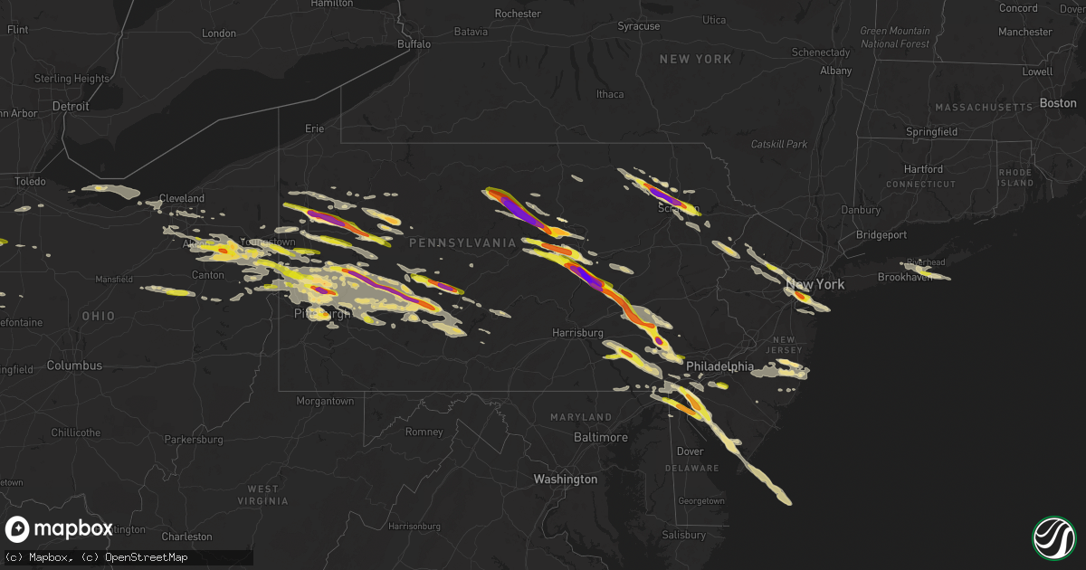
Hail Map in Pennsylvania on May 28, 2019
Get this storm
May 28 map
$229
one time, instant access
Download today. No call, no setup
Keep the $229
Bought the map and want the full workflow? Apply the entire $229 to a subscription within 7 days. None of it is wasted.
Every map, not just this one
This buys you this map. Subscription and you get every map we run, in the markets you choose from a few cities to whole states to nationwide. Plus real-time alerts the moment a storm fires.
Contact data
Name, contact info, occupancy, even credit band for addresses in the footprint. You go from where it hit to who to call.
Become the source they trust
Unlimited branding weather history reports on demand. You already have the documented answer ready for the property owner, and you are the one who showed up with it.
Property data and RoofTrace estimates
Pull up any address you have got, its value and the exact code rules for that jurisdiction, straight from One Click Code. Then RoofTrace estimates the squares, pitch, and roof value, priced the way you price.
Storm reports in Pennsylvania
Pennsylvania
| Date | Description |
|---|---|
| 05/28/20196:18 PM CDT | Tree down on pa-100. |
| 05/28/20196:04 PM CDT | Two 30 foot tall trees down on windy hill lane |
| 05/28/20195:54 PM CDT | Large tree down damaging two vehicles near the intersection of nine gates road and old kennett road in kennett twp. Time estimated from radar. |
| 05/28/20195:53 PM CDT | Multiple trees down in a yard in sterling township. |
| 05/28/20195:50 PM CDT | Numerous trees down. |
| 05/28/20195:49 PM CDT | Microburst in madison twp |
| 05/28/20195:49 PM CDT | Tree down blocking barker drive at marydell drive. Time estimated from radar. |
| 05/28/20195:48 PM CDT | A local report indicates 1.00 inch wind near 2 WNW BLACK LICK |
| 05/28/20195:45 PM CDT | Numerous trees down... Some on houses in madison township. |
| 05/28/20195:41 PM CDT | Downed tree on weatherstone drive near valley road in willistown twp. Time estimated from radar. |
| 05/28/20195:40 PM CDT | Tree down on top of a trailer. |
| 05/28/20195:38 PM CDT | Tree down blocking meadowbrook lane near boot road. Time estimated from radar. |
| 05/28/20195:38 PM CDT | Wires down on drinker street. |
| 05/28/20195:36 PM CDT | Large tree down blocking all of buck run road near glenrose road. Time estimated from radar. |
| 05/28/20195:35 PM CDT | Tree down on pa-100. |
| 05/28/20195:34 PM CDT | Trees and wires down |
| 05/28/20195:34 PM CDT | A local report indicates 1.25 inch wind near THROOP |
| 05/28/20195:33 PM CDT | Tree and wires down on cahill road |
| 05/28/20195:33 PM CDT | Large tree blown down near the intersection of foundry road and foundry street in caln twp. Time estimated from radar. |
| 05/28/20195:33 PM CDT | Trees down |
| 05/28/20195:33 PM CDT | Downed tree and wires on red shale drive. Time estimated from radar. |
| 05/28/20195:32 PM CDT | A local report indicates 1.25 inch wind near DICKSON CITY |
| 05/28/20195:30 PM CDT | A local report indicates 1.00 inch wind near EXTON |
| 05/28/20195:28 PM CDT | Downed tree blocking the southbound lane of rock raymond drive near the u.s. 30 bypass. Time estimated from radar. |
| 05/28/20195:28 PM CDT | A local report indicates 1.00 inch wind near 1 N WEST CHESTER |
| 05/28/20195:28 PM CDT | A local report indicates 1.00 inch wind near DICKSON CITY |
| 05/28/20195:25 PM CDT | A local report indicates 1.50 inch wind near CLARKS SUMMIT |
| 05/28/20195:25 PM CDT | Tree down at owen road and kirby drive in west goshen twp. All lanes closed. Time estimated from radar. |
| 05/28/20195:21 PM CDT | Trees and wires down on a vehicle with occupants in the vicinity of ransom blvd. No injuries reported. |
| 05/28/20195:19 PM CDT | Numerous trees down... Some on houses in newton township. |
| 05/28/20195:18 PM CDT | Ef-1 tornado in newton twp with estimated max wind speed of 90 mph. The tornado touched down near orchard dr and windmill dr. The max path width was 125 yards. The torn |
| 05/28/20195:14 PM CDT | Numerous trees and wires down. Tree into a storage building. |
| 05/28/20195:13 PM CDT | Powerlines down with associated fire in the vicinity of falls road and buttermilk road in falls township... Pa. |
| 05/28/20195:13 PM CDT | Trees and wires down. |
| 05/28/20195:12 PM CDT | Downed tree on easter street near main street in centre twp. Time estimated from radar. |
| 05/28/20195:10 PM CDT | A local report indicates 1.00 inch wind near LANCASTER |
| 05/28/20195:10 PM CDT | A local report indicates 1.00 inch wind near CLARKS SUMMIT |
| 05/28/20195:10 PM CDT | *** 1 inj *** ef-0 tornado in falls township with max wind speed of 80 mph. The tornado touched down near pine hill road... Then lifted three minutes later near butterm |
| 05/28/20195:08 PM CDT | Two dozen trees down in martinsburg. Time estimated from radar. |
| 05/28/20195:04 PM CDT | Size estimated from video. |
| 05/28/20195:04 PM CDT | A local report indicates 1.50 inch wind near 2 NNW NEW MORGAN |
| 05/28/20195:04 PM CDT | Size estimated from video. |
| 05/28/20195:03 PM CDT | A local report indicates 1.75 inch wind near TUNKHANNOCK |
| 05/28/20195:02 PM CDT | 1.5 inch hail in manheim twp. |
| 05/28/20194:59 PM CDT | Measured by personal weather station in close proximity to the tornado that moved through town. This was the last available observation before a power outage occurred. |
| 05/28/20194:56 PM CDT | Possible tornado damage in caernarvon twp and morgantown with buildings and homes damaged and numerous trees down. Time estimated from radar. |
| 05/28/20194:55 PM CDT | A local report indicates 2.00 inch wind near MORGANTOWN |
| 05/28/20194:55 PM CDT | Significant roof and tree damage reported in morgantown. Time estimated from radar. |
| 05/28/20194:54 PM CDT | Turkey barn destroyed in caernarvon twp. |
| 05/28/20194:53 PM CDT | Time estimated from radar. |
| 05/28/20194:52 PM CDT | Numerous trees and wires down in penn and manheim twps. |
| 05/28/20194:52 PM CDT | Maximum ef scale rating ef2 with estimated maximum winds of 120 mph. |
| 05/28/20194:50 PM CDT | Accompanied by torrential rain |
| 05/28/20194:50 PM CDT | A local report indicates 1.00 inch wind near READING |
| 05/28/20194:48 PM CDT | A local report indicates 1.75 inch wind near RUSSELL HILL |
| 05/28/20194:46 PM CDT | Some stones may have been larger |
| 05/28/20194:45 PM CDT | A local report indicates 1.75 inch wind near WEST LAWN |
| 05/28/20194:45 PM CDT | Note: delayed report from late may... Drone footage provided today from the evans city area confirms a downburst began near the evans city cemetery and spread into the |
| 05/28/20194:45 PM CDT | Location updated based on additional details. Accompanied by torrential rain |
| 05/28/20194:45 PM CDT | Trees snapped and uprooted |
| 05/28/20194:43 PM CDT | A local report indicates 1.00 inch wind near MARS |
| 05/28/20194:43 PM CDT | Report of funnel cloud... Flying debris... And a debris field in the vicinity of laceyville moving east along the susquehanna river. |
| 05/28/20194:42 PM CDT | A local report indicates 1.75 inch wind near BAKERSTOWN |
| 05/28/20194:40 PM CDT | Corrected location based on additional information |
| 05/28/20194:40 PM CDT | Powerlines down and associated fire in the vicinity of 9966 sr-6... Meshoppen... Pa. |
| 05/28/20194:40 PM CDT | A local report indicates 1.75 inch wind near GIBSONIA |
| 05/28/20194:37 PM CDT | Along four lakes drive |
| 05/28/20194:36 PM CDT | A local report indicates 1.25 inch wind near 2 SE VALENCIA |
| 05/28/20194:36 PM CDT | A local report indicates 1.00 inch wind near WYOMISSING |
| 05/28/20194:36 PM CDT | A local report indicates 1.75 inch wind near WYOMISSING |
| 05/28/20194:36 PM CDT | A local report indicates 2.00 inch wind near BAKERSTOWN STATION |
| 05/28/20194:35 PM CDT | A local report indicates 1.75 inch wind near VALENCIA |
| 05/28/20194:35 PM CDT | Tree down and blocking the road at the intersection of freeport road and whistle pig lane. |
| 05/28/20194:35 PM CDT | A local report indicates 1.50 inch wind near WYOMISSING |
| 05/28/20194:34 PM CDT | A local report indicates 1.00 inch wind near ZELIENOPLE |
| 05/28/20194:33 PM CDT | A local report indicates 1.25 inch wind near 1 S WEST WYOMISSING |
| 05/28/20194:30 PM CDT | A local report indicates 1.25 inch wind near SINKING SPRING |
| 05/28/20194:30 PM CDT | A local report indicates 1.00 inch wind near SINKING SPRING |
| 05/28/20194:30 PM CDT | Quarter was average size with some larger stones. |
| 05/28/20194:29 PM CDT | A local report indicates 1.50 inch wind near 1 ESE SEVEN FIELDS |
| 05/28/20194:29 PM CDT | Reported along church rd |
| 05/28/20194:28 PM CDT | A local report indicates 1.25 inch wind near CRANBERRY |
| 05/28/20194:26 PM CDT | Numerous trees down in cresson |
| 05/28/20194:26 PM CDT | Trees down on power lines in porter twp. |
| 05/28/20194:25 PM CDT | A local report indicates 1.25 inch wind near 1 N ENON VALLEY |
| 05/28/20194:23 PM CDT | A local report indicates 1.50 inch wind near LEWISBURG |
| 05/28/20194:22 PM CDT | A local report indicates 2.00 inch wind near 3 SW PITMAN |
| 05/28/20194:15 PM CDT | Numerous trees and wires down from trevorton east along route 225 |
| 05/28/20194:15 PM CDT | A local report indicates 3.00 inch wind near LINDEN |
| 05/28/20194:10 PM CDT | A local report indicates 1.50 inch wind near TREVORTON |
| 05/28/20194:09 PM CDT | Time estimated from radar. |
| 05/28/20194:03 PM CDT | Multiple trees down in jackson twp. Time estimated from radar. |
| 05/28/20194:02 PM CDT | Multiple reports of trees down in rome area. |
| 05/28/20194:01 PM CDT | Time estimated from radar. |
| 05/28/20194:00 PM CDT | A local report indicates 1.50 inch wind near MILTON |
| 05/28/20194:00 PM CDT | Corrected time from previous report of 534 pm |
| 05/28/20193:59 PM CDT | Time estimated from radar. |
| 05/28/20193:57 PM CDT | Microburst began along dry run road... With intermittent damage noted to pa-187. Max path width was 400 yards and path length was 1.5 miles. |
| 05/28/20193:57 PM CDT | A local report indicates 1.00 inch wind near SHAMOKIN DAM |
| 05/28/20193:54 PM CDT | A local report indicates 1.50 inch wind near HUMMELS WHARF |
| 05/28/20193:54 PM CDT | Trees down in the vicinity of maloney rd. In rome... Pa. |
| 05/28/20193:54 PM CDT | Report of a house totaled with a roof torn off near lake road and maloney road |
| 05/28/20193:52 PM CDT | A local report indicates 2.50 inch wind near SHAMOKIN DAM |
| 05/28/20193:51 PM CDT | A local report indicates 1.00 inch wind near 1 N CLIMAX |
| 05/28/20193:51 PM CDT | Nearby elders ridge rd |
| 05/28/20193:50 PM CDT | Ef-1 tornado touched down just north of intersection of ghent hill and sackett roads. It traveled southeast for 3.2 miles with an estimated max wind speed of 100 mph. T |
| 05/28/20193:46 PM CDT | Tractor trailer tipped over with a barn destroyed. |
| 05/28/20193:45 PM CDT | A local report indicates 1.00 inch wind near NEW CASTLE |
| 05/28/20193:41 PM CDT | Hail dented a vehicle |
| 05/28/20193:40 PM CDT | Trees down on power lines on west washington street in union township |
| 05/28/20193:38 PM CDT | A local report indicates 1.00 inch wind near 2 NE CLYMER |
| 05/28/20193:27 PM CDT | Tree and utility pole down in porter twp. |
| 05/28/20193:22 PM CDT | A local report indicates 1.75 inch wind near VALLEY VIEW |
| 05/28/20193:22 PM CDT | A local report indicates 1.75 inch wind near HEGINS |
| 05/28/20193:19 PM CDT | A local report indicates 1.00 inch wind near ELDORADO |
| 05/28/20193:12 PM CDT | A local report indicates 1.00 inch wind near JULIAN |
| 05/28/20193:10 PM CDT | A local report indicates 1.50 inch wind near COLVER |
| 05/28/20193:08 PM CDT | Multiple trees down on old state rd at cold castle ln |
| 05/28/20193:00 PM CDT | Trees and wires down |
| 05/28/20193:00 PM CDT | A local report indicates 1.75 inch wind near PITMAN |
| 05/28/20193:00 PM CDT | Trees and wires down across rt. 15 south... Near grangers rd. |
| 05/28/20192:57 PM CDT | A local report indicates 1.00 inch wind near ANTES FORT |
| 05/28/20192:55 PM CDT | Trees and wires down across valley rd at east ridge rd |
| 05/28/20192:55 PM CDT | Time estimated from radar. |
| 05/28/20192:55 PM CDT | A local report indicates 1.25 inch wind near TREVORTON |
| 05/28/20192:52 PM CDT | A local report indicates 1.75 inch wind near JERSEY SHORE |
| 05/28/20192:52 PM CDT | A local report indicates 1.00 inch wind near 1 N KITTANNING |
| 05/28/20192:50 PM CDT | Tree and power lines down on pa-553. Time estimated from radar. |
| 05/28/20192:48 PM CDT | A local report indicates 1.50 inch wind near SELINSGROVE |
| 05/28/20192:47 PM CDT | A local report indicates 1.00 inch wind near FROGTOWN |
| 05/28/20192:45 PM CDT | Large tree down on route 288 at bowers drive blocking the road. A detour is being set up. |
| 05/28/20192:45 PM CDT | Ef0 tornado along state route 553. |
| 05/28/20192:45 PM CDT | Powerline down and blocking road near intersection of pump station road and wallaceville road. |
| 05/28/20192:44 PM CDT | Tree down blocking road in jackson township. |
| 05/28/20192:42 PM CDT | 2 inch hail reported at glendale high school. |
| 05/28/20192:42 PM CDT | A local report indicates 1.00 inch wind near 1 S COALPORT |
| 05/28/20192:40 PM CDT | Utility poles snapped and wires on road at shaffer ln at kratzerville rd. |
| 05/28/20192:34 PM CDT | Quarter hail reported at jimmy stewart airport |
| 05/28/20192:34 PM CDT | Multiple trees down in union twp. |
| 05/28/20192:33 PM CDT | A local report indicates 1.25 inch wind near 2 N INDIANA |
| 05/28/20192:30 PM CDT | A local report indicates 1.50 inch wind near 1 NNE HANEYVILLE |
| 05/28/20192:28 PM CDT | Picture provided. |
| 05/28/20192:27 PM CDT | A local report indicates 1.00 inch wind near 1 E ELDERTON |
| 05/28/20192:19 PM CDT | Picture provided. |
| 05/28/20192:14 PM CDT | 4th avenue |
| 05/28/20192:10 PM CDT | A mix of half dollar and quarter size hail. |
| 05/28/20192:05 PM CDT | A local report indicates 1.50 inch wind near KITTANNING |
| 05/28/20192:01 PM CDT | A local report indicates 1.75 inch wind near 2 S KITTANNING |
| 05/28/20192:00 PM CDT | A local report indicates 1.25 inch wind near WEST KITTANNING |
| 05/28/20191:55 PM CDT | A local report indicates 1.50 inch wind near WEST KITTANNING |
| 05/28/20191:52 PM CDT | A local report indicates 1.50 inch wind near 3 N BULLION |
| 05/28/20191:52 PM CDT | Photo provided by former nws employee. |
| 05/28/20191:52 PM CDT | Ground is covered with hail. Citizen reported that hail was breaking his windows. |
| 05/28/20191:48 PM CDT | Numerous trees 12 inches in diameter downed. |
| 05/28/20191:47 PM CDT | A local report indicates 1.75 inch wind near 1 NNE SANDY LAKE |
| 05/28/20191:47 PM CDT | Picture provide. |
| 05/28/20191:46 PM CDT | 12 inch diameter tree downed. |
| 05/28/20191:46 PM CDT | Power lines down on burke road |
| 05/28/20191:44 PM CDT | Multiple trees down near patton road. |
| 05/28/20191:44 PM CDT | A local report indicates 1.75 inch wind near STONEBORO |
| 05/28/20191:42 PM CDT | Trees and power pole down on eastbrook harlansburg road and route 19 blocking the road. |
| 05/28/20191:41 PM CDT | A local report indicates 2.50 inch wind near 1 NNW SANDY LAKE |
| 05/28/20191:40 PM CDT | Multiple trees down near mckeever environmental center. |
| 05/28/20191:39 PM CDT | Windows were being broken. Cars were being damaged. |
| 05/28/20191:38 PM CDT | Near a hundred trees lake hill road. |
| 05/28/20191:35 PM CDT | A local report indicates 1.00 inch wind near STONEBORO |
| 05/28/20191:35 PM CDT | A local report indicates 1.00 inch wind near HARLANSBURG |
| 05/28/20191:26 PM CDT | A local report indicates 1.00 inch wind near 2 SE HADLEY |
| 05/28/20197:12 AM CDT | A local report indicates 2.00 inch wind near BAKERSTOWN STATION |
| 05/28/20195:50 AM CDT | At 1050 PM EDT, a severe thunderstorm was located over Ogletown, moving east at 55 mph. HAZARD...60 mph wind gusts. SOURCE...Radar indicated. IMPACT...Expect damage to trees, roofs, and siding. Locations impacted include... Bedford, Breezewood, New Enterprise, Everett, Osterburg, Dudley, St. Clairsville, Blue Knob State Park, Queen, Cessna, Saxton, Schellsburg, Manns Choice, Woodbury, Defiance, Hopewell, New Paris, Coalmont and Blue Knob Ski Resort.This includes the following Interstates... Interstate 70 from mile markers 147 to 150. The Pennsylvania Turnpike from mile markers 140 to 165. Interstate 99 from mile markers 0 to 14. |
| 05/28/20195:37 AM CDT | At 1037 PM EDT, a severe thunderstorm was located over Tire Hill, moving east at 50 mph. HAZARD...60 mph wind gusts. SOURCE...Radar indicated. IMPACT...Expect damage to trees, roofs, and siding. Locations impacted include... Johnstown, Westmont, Windber, Belmont, Geistown, Southmont, Dale, East Conemaugh, Salix-Beauty Line Park, Davidsville, Beaverdale-Lloydell, Paint, Jerome, Scalp Level, Sidman, St. Michael, Dunlo, Daisytown, Ogletown and Tire Hill. |
| 05/28/20195:12 AM CDT | At 1011 PM EDT, a severe thunderstorm was located over Bellevue, or over Ross Township, moving east at 45 mph. HAZARD...Wind gusts to 60 mph and quarter-size hail. SOURCE...Radar. IMPACT...Minor hail damage to vehicles is possible. Expect wind damage to trees and power lines, resulting in some power outages. Locations impacted include... Pittsburgh... Penn Hills... Mount Lebanon... Ross Township... McCandless Township... Monroeville... Greensburg... McKeesport... Franklin Park... Jeannette... Shaler Township... Plum...This includes the following highways... Interstate 70 in Pennsylvania near mile marker 57. Pennsylvania Turnpike between mile markers 49 and 77. Interstate 79 in Pennsylvania between mile markers 58 and 63. Interstate 376 in Pennsylvania between mile markers 62 and 84. |
| 05/28/20195:07 AM CDT | At 1006 PM EDT, a severe thunderstorm was located near Latrobe, moving east at 45 mph. HAZARD...Wind gusts to 60 mph and quarter-size hail. SOURCE...Radar. IMPACT...Minor hail damage to vehicles is possible. Expect wind damage to trees and power lines, resulting in some power outages. Locations impacted include... Latrobe... McChesneytown-Loyalhanna... Blairsville... Derry... Lawson Heights... Ligonier... New Florence... New Alexandria... Bolivar... Youngstown... Laurel Mountain... Crabtree... |
| 05/28/20193:44 AM CDT | At 843 PM EDT, a severe thunderstorm was located over Allamuchy-Panther Valley, or 8 miles southwest of Newton, moving southeast at 45 mph. HAZARD...60 mph wind gusts and half dollar size hail. SOURCE...Radar indicated. IMPACT...Minor damage to vehicles is possible. Wind damage to roofs, siding, trees, and power lines is possible. Locations impacted include... Morristown, Newton, Dover, Madison, Hopatcong, Florham Park, East Hanover, Lincoln Park, Kinnelon, Hackettstown, Chatham, Boonton, Butler, Wharton, Rockaway, Blairstown, Morris Plains, Mount Arlington, Franklin and Mendham. |
| 05/28/20192:39 AM CDT | At 738 PM EDT, a severe thunderstorm was located near Bushkill, or 16 miles southwest of Montague, moving southeast at 45 mph. HAZARD...60 mph wind gusts and quarter size hail. SOURCE...Radar indicated. IMPACT...Minor damage to vehicles is possible. Wind damage to roofs, siding, trees, and power lines is possible. Locations impacted include... Morristown, Newton, Dover, Madison, Hopatcong, Florham Park, East Hanover, Lincoln Park, Kinnelon, Chatham, Boonton, Butler, Wharton, Rockaway, Morris Plains, Mount Arlington, Franklin, Mendham, Mountain Lakes and Stanhope. |
| 05/28/20191:58 AM CDT | At 656 PM EDT, a severe thunderstorm was located over Evans Falls, or near Tunkhannock, moving southeast at 40 mph. HAZARD...60 mph wind gusts. SOURCE...Radar indicated. IMPACT...Expect damage to roofs, siding, and trees. Locations impacted include... Scranton, Wilkes-Barre, Falls, Dunmore, Kingston, Plains, Old Forge, Pittston, Blakely and Taylor. |
| 05/28/20191:31 AM CDT | At 631 PM EDT, a severe thunderstorm was located near Gap, moving southeast at 35 mph. HAZARD...Ping pong ball size hail and 60 mph wind gusts. SOURCE...Radar indicated. IMPACT...People and animals outdoors will be injured. Expect hail damage to roofs, siding, windows, and vehicles. Expect wind damage to trees, roofs, and siding. Locations impacted include... Quarryville, Gap, Christiana, Georgetown, Kirkwood and White Horse. |
| 05/28/20191:28 AM CDT | At 628 PM EDT, a severe thunderstorm was located over Rockhill Furnace, moving east at 50 mph. HAZARD...60 mph wind gusts and quarter size hail. SOURCE...Radar indicated. IMPACT...Hail damage to vehicles is expected. Expect wind damage to trees, roofs, and siding. Locations impacted include... Shippensburg, Waterfall, Rockhill Furnace, Dudley, Roxbury, Doylesburg, Shy Beaver, Upper Strasburg, Willow Hill, Entriken, Fannettsburg, Broad Top City, Three Springs, Orbisonia, Saltillo, Orrstown, Shirleysburg, Cassville, Coalmont and Shade Gap.This includes the following Interstates... The Pennsylvania Turnpike from mile markers 184 to 201. Interstate 81 near mile marker 25. |
| 05/28/20191:18 AM CDT | At 616 PM EDT, clusters of severe thunderstorms extended from Meshoppen to Elmhurst. The strongest thunderstorm was located near Falls, or near Waverly, moving southeast at 35 mph. HAZARD...Two inch hail and 70 mph wind gusts. SOURCE...Emergency management. Numerous reports of wind damage and golfball sized hail have been associated with these thunderstorms. IMPACT...People and animals outdoors will be injured. Expect hail damage to roofs, siding, windows, and vehicles. Expect considerable tree damage. Wind damage is also likely to mobile homes, roofs, and outbuildings. Locations impacted include... Scranton, Falls, Dunmore, Carbondale, Old Forge, Pittston, Archbald, Blakely, Taylor and Dickson City. |
| 05/28/20191:16 AM CDT | At 616 PM EDT, a severe thunderstorm was located over Leesport, or 7 miles north of Reading, moving east at 40 mph. HAZARD...60 mph wind gusts and quarter size hail. SOURCE...Radar indicated. IMPACT...Minor damage to vehicles is possible. Wind damage to roofs, siding, trees, and power lines is possible. Locations impacted include... Reading, Pottstown, Quakertown, Collegeville, Fleetwood, Laureldale, Trappe, East Greenville, Leesport, Schwenksville, Bally, Bechtelsville, Green Lane, Lyons, Spring Mount, Fairview Hgts, Geryville, Gilbertsville, Skippack and Stowe. |
| 05/28/20191:15 AM CDT | At 614 PM EDT, a severe thunderstorm was located over Apollo, moving east at 45 mph. Another severe storm was near Curtisville. HAZARD...Ping-pong ball-size hail and wind gusts to 60 mph. SOURCE...Radar. IMPACT...People and animals outdoors will be injured. Expect hail damage to roofs, siding, windows, and vehicles. Expect wind damage to trees and power lines, resulting in some power outages. Locations impacted include... Penn Hills... McCandless Township... Indiana... Vandergrift... Homer City... Apollo... Shaler Township... Plum... Murrysville... Hampton Township... New Kensington... Lower Burrell...This includes Pennsylvania Turnpike between mile markers 34 and 52. |
| 05/28/20191:12 AM CDT | At 611 PM EDT, severe thunderstorms were located over southern Bradford county, moving southeast at 35 mph. HAZARD...Ping pong ball size hail and 60 mph wind gusts. SOURCE...Radar indicated. IMPACT...People and animals outdoors will be injured. Expect hail damage to roofs, siding, windows, and vehicles. Expect wind damage to trees, roofs, and siding. This severe thunderstorm will be near... Ricketts Glen State Park around 650 PM EDT.Other locations impacted by this severe thunderstorm include Dushore,Laporte, Eagles Mere and Forksville. |
| 05/28/20191:11 AM CDT | At 610 PM EDT, a severe thunderstorm was located over Pleasant Hill, or near Elkton, moving east at 35 mph. HAZARD...60 mph wind gusts and half dollar size hail. SOURCE...Radar indicated. IMPACT...Minor damage to vehicles is possible. Wind damage to roofs, siding, trees, and power lines is possible. Locations impacted include... Newark, Middletown, Elkton, Pennsville, Carneys Point, New Castle, Salem, North East, Woodstown, Alloway, Quinton, Delaware City, Charlestown, Newport, Greenwich, Shiloh, Zion, Blake, Barksdale and Stanton. |
| 05/28/20191:05 AM CDT | At 604 PM EDT, a severe thunderstorm was located over Numidia, moving east at 40 mph. HAZARD...60 mph wind gusts and quarter size hail. SOURCE...Radar indicated. IMPACT...Hail damage to vehicles is expected. Expect wind damage to trees, roofs, and siding. Locations impacted include... Tamaqua, Shenandoah, Mahanoy City, Frackville, Mcadoo, Girardville, Hometown, Tuscarora, Oneida, Grier City-Park Crest, Altamont, Englewood, Delano, Aristes, Numidia, Sheppton, Brandonville, Coaldale, Slabtown and Wilburton Number Two.This includes Interstate 81 from mile markers 124 to 139. |
| 05/28/201912:58 AM CDT | At 556 PM EDT, a severe thunderstorm was located over Leacock, moving east at 45 mph. HAZARD...Ping pong ball size hail and 60 mph wind gusts. SOURCE...Radar indicated. IMPACT...People and animals outdoors will be injured. Expect hail damage to roofs, siding, windows, and vehicles. Expect wind damage to trees, roofs, and siding. Locations impacted include... Lancaster, Ephrata, Lititz, Millersville, Willow Street, New Holland, Akron, Leola, Paradise, Denver, Reamstown, Rothsville, Strasburg, Gap, Adamstown, Terre Hill, Churchtown, Leacock, Bareville and Bowmansville.This includes The Pennsylvania Turnpike from mile markers 278 to 295. |
| 05/28/201912:56 AM CDT | At 555 PM EDT, severe thunderstorms were located along a line extending from Canton to Franklindale, moving southeast at 40 mph. HAZARD...60 mph wind gusts and nickel size hail. SOURCE...Radar indicated. IMPACT...Expect damage to roofs, siding, and trees. Locations impacted include... Falls, Vernon, Harveys Lake, Canton, West Franklin, Orange, Wilmot, Hollenback, Noxen and Monroe. |
| 05/28/201912:49 AM CDT | At 548 PM EDT, a severe thunderstorm was located over South Fork, moving southeast at 40 mph. HAZARD...60 mph wind gusts and quarter size hail. SOURCE...Radar indicated. IMPACT...Hail damage to vehicles is expected. Expect wind damage to trees, roofs, and siding. Locations impacted include... Johnstown, Westmont, Windber, Ebensburg, Belmont, Nanty-Glo, Portage, Roaring Spring, Geistown, Southmont, New Enterprise, Martinsburg, Claysburg, Vinco, Dale, East Conemaugh, Osterburg, Salix-Beauty Line Park, Beaverdale-Lloydell and Paint.This includes Interstate 99 from mile markers 8 to 23. |
| 05/28/201912:45 AM CDT | At 545 PM EDT, a severe thunderstorm was located over Elverson, or 12 miles southeast of Reading, moving southeast at 35 mph. HAZARD...Golf ball size hail and 60 mph wind gusts. SOURCE...Trained weather spotters. IMPACT...People and animals outdoors will be injured. Expect hail damage to roofs, siding, windows, and vehicles. Wind damage to roofs, siding, trees, and power lines is possible. Locations impacted include... West Chester, Phoenixville, Coatesville, Westtown, Downingtown, Kennett Square, Honey Brook, Elverson, New Morgan, Pughtown, Marshallton, Lionville-Marchwood, Valley Forge, Glenmoore, Paoli, Chester Springs, Lionville, Cedarville, West Goshen and Stowe. |
| 05/28/201912:38 AM CDT | At 537 PM EDT, a severe thunderstorm was located over Sugar Run, or over Wyalusing, moving southeast at 45 mph. HAZARD...70 mph wind gusts and ping pong ball size hail. SOURCE...Radar indicated. IMPACT...People and animals outdoors will be injured. Expect hail damage to roofs, siding, windows, and vehicles. Expect considerable tree damage. Wind damage is also likely to mobile homes, roofs, and outbuildings. Locations impacted include... Scranton, Wilkes-Barre, Falls, Dunmore, Kingston, Plains, Carbondale, Old Forge, Pittston and Archbald. |
| 05/28/201912:36 AM CDT | At 536 PM EDT, a severe thunderstorm was located over Pine Grove, or 9 miles southwest of Minersville, moving southeast at 30 mph. HAZARD...60 mph wind gusts and quarter size hail. SOURCE...Radar indicated. IMPACT...Minor damage to vehicles is possible. Wind damage to roofs, siding, trees, and power lines is possible. Locations impacted include... Hamburg, Womelsdorf, Leesport, Shoemakersville, Bernville, Strausstown, Lenhartsville, Fairview Hgts and Centerport. |
| 05/28/201912:29 AM CDT | At 528 PM EDT, a severe thunderstorm was located over Seven Fields, or near Cranberry, moving east at 35 mph. HAZARD...Wind gusts to 60 mph and quarter-size hail. SOURCE...Radar. IMPACT...Minor hail damage to vehicles is possible. Expect wind damage to trees and power lines, resulting in some power outages. Locations impacted include... Penn Hills... Ross Township... McCandless Township... Monroeville... Cranberry... Franklin Park... Vandergrift... Apollo... Shaler Township... Plum... Murrysville... Hampton Township...This includes the following highways... Pennsylvania Turnpike between mile markers 28 and 55. Interstate 79 in Pennsylvania between mile markers 72 and 81. |
| 05/28/201912:28 AM CDT | At 527 PM EDT, a severe thunderstorm was located near Punxsutawney, moving southeast at 40 mph. HAZARD...Wind gusts to 60 mph and quarter-size hail. SOURCE...Radar. IMPACT...Minor hail damage to vehicles is possible. Expect wind damage to trees and power lines, resulting in some power outages. Locations impacted include... Punxsutawney... Rossiter... Glen Campbell... |
| 05/28/201912:26 AM CDT | At 525 PM EDT, a severe thunderstorm was located near Donaldson, moving east southeast at 35 mph. HAZARD...Two inch hail and 60 mph wind gusts. SOURCE...Radar indicated. IMPACT...People and animals outdoors will be injured. Expect hail damage to roofs, siding, windows, and vehicles. Expect wind damage to trees, roofs, and siding. This severe thunderstorm will be near... Pine Grove, Branchdale and Buck Run around 530 PM EDT. Schuylkill Haven, Pottsville, St. Clair, Minersville, Friedensburg, Renningers, Marlin, Mechanicsville, Seltzer and Port Carbon around 540 PM EDT. McKeansburg and Orwigsburg around 550 PM EDT.Other locations impacted by this severe thunderstorm include Ravine,Auburn, Deer Lake, Landingville, Newtown, Palo Alto, Mount Carbon,Cressona, Muir and Lake Wynonah.This includes Interstate 81 from mile markers 97 to 115. |
| 05/28/201912:25 AM CDT | At 525 PM EDT, a severe thunderstorm was located over Montandon, moving east at 40 mph. HAZARD...60 mph wind gusts and half dollar size hail. SOURCE...Radar indicated. IMPACT...Hail damage to vehicles is expected. Expect wind damage to trees, roofs, and siding. Locations impacted include... Sunbury, Shamokin, Milton, Lewisburg, Danville, Northumberland, Kulpmont, Winfield, Elysburg, Fairview-Ferndale, Riverside, Trevorton, Catawissa, Linntown, Marshallton, New Columbia, Montandon, Mechanicsville, Vicksburg and Numidia.For those driving on Interstate 80, this includes areas between theMile Run and Buckhorn exits, specifically from mile markers 209 to226. |
| 05/28/201912:22 AM CDT | Trees down over guys run road |
| 05/28/201912:19 AM CDT | At 519 PM EDT, a severe thunderstorm was located near Homer City, moving east at 20 mph. HAZARD...Wind gusts to 60 mph and quarter-size hail. SOURCE...Radar. IMPACT...Minor hail damage to vehicles is possible. Expect wind damage to trees and power lines, resulting in some power outages. Locations impacted include... Homer City... Black Lick... Lucerne Mines... Brush Vly... |
| 05/28/201912:08 AM CDT | At 507 PM EDT, a severe thunderstorm was located over Womelsdorf, or 9 miles east of Myerstown, moving southeast at 20 mph. HAZARD...70 mph wind gusts and half dollar size hail. SOURCE...Radar indicated. IMPACT...Minor damage to vehicles is possible. Expect considerable tree damage. Wind damage is also likely to mobile homes, roofs, and outbuildings. Locations impacted include... Reading, Wyomissing, Birdsboro, Sinking Spring, Womelsdorf, Wernersville, Newmanstown, New Morgan, Spring Ridge, Shillington, West Reading, Mount Penn, Mohnton, Kenhorst, St. Lawrence, Wyomissing Hills, West Lawn, Lorane, Reiffton and Amity Gardens. |
| 05/28/201912:04 AM CDT | At 504 PM EDT, a severe thunderstorm was located over R.B. Winter State Park, moving southeast at 45 mph. HAZARD...Ping pong ball size hail and 60 mph wind gusts. SOURCE...Radar indicated. IMPACT...People and animals outdoors will be injured. Expect hail damage to roofs, siding, windows, and vehicles. Expect wind damage to trees, roofs, and siding. Locations impacted include... Lewisburg, Mifflinburg, Winfield, Linntown, Middleburg, Kreamer, Penns Creek, Kratzerville, Vicksburg, R.B. Winter State Park, Forest Hill, Sand Bridge State Park, New Berlin, Hartleton and Bucknell.For those driving on Interstate 80, this includes areas between theJersey Shore and Mile Run exits, specifically from mile markers 195to 198. |
| 05/28/201912:00 AM CDT | At 500 PM EDT, a severe thunderstorm was located near Waterville, moving southeast at 45 mph. HAZARD...Ping pong ball size hail and 60 mph wind gusts. SOURCE...Radar indicated. IMPACT...People and animals outdoors will be injured. Expect hail damage to roofs, siding, windows, and vehicles. Expect wind damage to trees, roofs, and siding. Locations impacted include... Williamsport, Milton, Lewisburg, Jersey Shore, Watsontown, Montgomery, Linntown, Avis, Duboistown, New Columbia, Montandon, Allenwood, Elimsport, Waterville, Spruce Run Reservoir, Collomsville, Delaware Run, South Williamsport, West Milton and Oval.For those driving on Interstate 80, this includes areas between theJersey Shore and Limestoneville exits, specifically from mile markers198 to 212.This includes Interstate 180 between mile markers 1 and 8, and nearmile marker 29. |
| 05/27/201911:59 PM CDT | At 458 PM EDT, a severe thunderstorm was located over Richland, moving southeast at 20 mph. HAZARD...Golf ball size hail and 60 mph wind gusts. SOURCE...Radar indicated. IMPACT...People and animals outdoors will be injured. Expect hail damage to roofs, siding, windows, and vehicles. Expect wind damage to trees, roofs, and siding. This severe thunderstorm will be near... Richland around 500 PM EDT. Newmanstown and Kleinfeltersville around 510 PM EDT.Other locations impacted by this severe thunderstorm include AvonHeights. |
| 05/27/201911:54 PM CDT | At 454 PM EDT, a severe thunderstorm was located over Hummels Wharf, moving southeast at 40 mph. HAZARD...Ping pong ball size hail and 60 mph wind gusts. SOURCE...Radar indicated. IMPACT...People and animals outdoors will be injured. Expect hail damage to roofs, siding, windows, and vehicles. Expect wind damage to trees, roofs, and siding. Locations impacted include... Sunbury, Shamokin, Milton, Mount Carmel, Lewisburg, Selinsgrove, Northumberland, Kulpmont, Ashland, Elysburg, Fairview-Ferndale, Riverside, Trevorton, Shamokin Dam, Girardville, Marshallton, Williamstown, Hummels Wharf, Tower City and Montandon.This includes Interstate 81 from mile markers 115 to 117. |
| 05/27/201911:50 PM CDT | At 449 PM EDT, a severe thunderstorm was located near Northern Cambria, moving southeast at 55 mph. HAZARD...60 mph wind gusts and quarter size hail. SOURCE...Radar indicated. IMPACT...Hail damage to vehicles is expected. Expect wind damage to trees, roofs, and siding. Locations impacted include... Ebensburg, Nanty-Glo, Northern Cambria, Patton, Cresson, Gallitzin, Loretto, Hastings, Lilly, Carrolltown, Sankertown, Blandburg, Belsano, Prince Gallitzin State Park, Colver, Tunnelhill, Ashville, Chest Springs, Cassandra and Saint Francis University. |
| 05/27/201911:49 PM CDT | At 449 PM EDT, a severe thunderstorm was located near Mount Union, moving southeast at 35 mph. HAZARD...60 mph wind gusts and half dollar size hail. SOURCE...Radar indicated. IMPACT...Hail damage to vehicles is expected. Expect wind damage to trees, roofs, and siding. Locations impacted include... Mount Union, Honey Grove, East Waterford, Perulack, Blacklog, McVeytown, Kistler, Newton Hamilton and Atkinson Mills. |
| 05/27/201911:45 PM CDT | At 445 PM EDT, a severe thunderstorm was located over Roaring Spring, moving southeast at 35 mph. HAZARD...60 mph wind gusts and half dollar size hail. SOURCE...Radar indicated. IMPACT...Hail damage to vehicles is expected. Expect wind damage to trees, roofs, and siding. Locations impacted include... Hollidaysburg, Roaring Spring, Martinsburg, Claysburg, Duncansville, Ski Gap, Queen, East Freedom, Saxton, Tunnelhill, Woodbury, Newry, Defiance, Hopewell, Blue Knob Ski Resort, Allegheny Portage Railroad National Historic Site and Altoona-Blair County Airport.This includes Interstate 99 from mile markers 14 to 29. |
| 05/27/201911:45 PM CDT | At 445 PM EDT, a severe thunderstorm was located over Apollo, moving east at 20 mph. HAZARD...Wind gusts to 60 mph and quarter-size hail. SOURCE...Radar. IMPACT...Minor hail damage to vehicles is possible. Expect wind damage to trees and power lines, resulting in some power outages. Locations impacted include... Indiana... Vandergrift... Homer City... Apollo... North Apollo... Avonmore... Orchard Hills... Oklahoma... West Lebanon... East Vandergrift... Chevy Chase Heights... North Vandergrift... |
| 05/27/201911:41 PM CDT | At 441 PM EDT, a severe thunderstorm was located over Castanea, moving east at 45 mph. HAZARD...60 mph wind gusts and half dollar size hail. SOURCE...Radar indicated. IMPACT...Hail damage to vehicles is expected. Expect wind damage to trees, roofs, and siding. Locations impacted include... Lock Haven, Carroll, Mill Hall, Dunnstown, Flemington, Castanea, McElhattan, Mackeyville, Loganton and Lock Haven University.For those driving on Interstate 80, this includes areas between theLamar and Mile Run exits, specifically from mile markers 177 to 194. |
| 05/27/201911:37 PM CDT | At 437 PM EDT, a severe thunderstorm was located 8 miles east of Indiana, moving southeast at 45 mph. HAZARD...Wind gusts to 60 mph and quarter-size hail. SOURCE...Radar. IMPACT...Minor hail damage to vehicles is possible. Expect wind damage to trees and power lines, resulting in some power outages. Locations impacted include... Indiana... Clymer... Chevy Chase Heights... Marion Center... Vintondale... Cherry Tree... Dixonville... Commodore... Yellow Creek State Park... |
| 05/27/201911:36 PM CDT | At 436 PM EDT, a severe thunderstorm was located 10 miles northeast of Clarion, moving east at 45 mph. HAZARD...Wind gusts to 60 mph and quarter-size hail. SOURCE...Radar. IMPACT...Minor hail damage to vehicles is possible. Expect wind damage to trees and power lines, resulting in some power outages. Locations impacted include... Reynoldsville... Brockway... Sykesville... Falls Creek... Sigel... Leeper... Fisher... Clarington... Clear Creek State Park... Cook Forest State Park...This includes Interstate 80 in Pennsylvania between mile markers 82and 96. |
| 05/27/201911:28 PM CDT | At 426 PM EDT, a severe thunderstorm was located over Spruce Run Reservoir, moving southeast at 35 mph. HAZARD...60 mph wind gusts and half dollar size hail. SOURCE...Radar indicated. IMPACT...Hail damage to vehicles is expected. Expect wind damage to trees, roofs, and siding. Locations impacted include... Sunbury, Milton, Lewisburg, Northumberland, Winfield, Watsontown, Linntown, New Columbia, Montandon, Allenwood, Spruce Run Reservoir, Mooresburg, West Milton, McEwensville and Bucknell.For those driving on Interstate 80, this includes areas between theJersey Shore and Buckhorn exits, specifically from mile markers 196to 224.This includes Interstate 180 from mile markers 1 to 3. |
| 05/27/201911:28 PM CDT | At 428 PM EDT, a severe thunderstorm was located 8 miles west of Rimersburg, moving east at 45 mph. HAZARD...Wind gusts to 60 mph and quarter-size hail. SOURCE...Radar. IMPACT...Minor hail damage to vehicles is possible. Expect wind damage to trees and power lines, resulting in some power outages. Locations impacted include... Punxsutawney... Rimersburg... New Bethlehem... East Brady... Parker... Sligo... Big Run... Dayton... Bruin... Rossiter... Hawthorn... Marion Center... |
| 05/27/201911:27 PM CDT | At 427 PM EDT, a severe thunderstorm was located near Huntingdon, moving southeast at 40 mph. HAZARD...Ping pong ball size hail and 60 mph wind gusts. SOURCE...Radar indicated. IMPACT...People and animals outdoors will be injured. Expect hail damage to roofs, siding, windows, and vehicles. Expect wind damage to trees, roofs, and siding. Locations impacted include... Huntingdon, Mount Union, Raystown Dam, McConnellstown, Petersburg, Alexandria, Mill Creek, Kistler and Juniata College. |
| 05/27/201911:27 PM CDT | At 426 PM EDT, a severe thunderstorm was located near Pine Grove, or 11 miles southwest of Minersville, moving southeast at 25 mph. HAZARD...70 mph wind gusts and ping pong ball size hail. SOURCE...Radar indicated. Storm has a history of producing large hail. IMPACT...People and animals outdoors will be injured. Expect hail damage to roofs, siding, windows, and vehicles. Expect considerable tree damage. Wind damage is also likely to mobile homes, roofs, and outbuildings. Locations impacted include... Laureldale, Womelsdorf, Wernersville, Newmanstown, Leesport, Bernville, Strausstown, Fairview Hgts, Spring Ridge and Centerport. |
| 05/27/201911:08 PM CDT | At 408 PM EDT, a severe thunderstorm was located near Carroll, moving east at 45 mph. HAZARD...Ping pong ball size hail and 60 mph wind gusts. SOURCE...Radar indicated. IMPACT...People and animals outdoors will be injured. Expect hail damage to roofs, siding, windows, and vehicles. Expect wind damage to trees, roofs, and siding. Locations impacted include... Sunbury, Milton, Lewisburg, Selinsgrove, Northumberland, Mifflinburg, Carroll, Woodward, Winfield, Shamokin Dam, Linntown, Hummels Wharf, Middleburg, Montandon, Kreamer, Port Trevorton, Penns Creek, Rebersburg, Mount Pleasant Mills and Kratzerville.For those driving on Interstate 80, this includes areas between theLamar and Jersey Shore exits, specifically from mile markers 175 to187. |
| 05/27/201910:50 PM CDT | At 350 PM EDT, a severe thunderstorm was located over Kittanning, moving southeast at 35 mph. HAZARD...Wind gusts to 60 mph and quarter-size hail. SOURCE...Radar. IMPACT...Minor hail damage to vehicles is possible. Expect wind damage to trees and power lines, resulting in some power outages. Locations impacted include... Indiana... Kittanning... Ford City... West Kittanning... Rural Valley... Worthington... Chevy Chase Heights... West Hills... Ernest... Marion Center... Manorville... Ford Cliff... |
| 05/27/201910:47 PM CDT | At 347 PM EDT, a severe thunderstorm was located near Jersey Shore, moving southeast at 45 mph. HAZARD...Two inch hail and 60 mph wind gusts. SOURCE...Radar indicated. IMPACT...People and animals outdoors will be injured. Expect hail damage to roofs, siding, windows, and vehicles. Expect wind damage to trees, roofs, and siding. Locations impacted include... Williamsport, Milton, Lewisburg, Jersey Shore, Carroll, Watsontown, Montgomery, Linntown, Avis, Duboistown, New Columbia, Montandon, McElhattan, Allenwood, Vicksburg, Elimsport, Waterville, Forest Hill, Sand Bridge State Park and Little Pine State Park.For those driving on Interstate 80, this includes areas between theLoganton and Danville exits, specifically from mile markers 190 to216.This includes Interstate 180 between mile markers 1 and 9...and frommile markers 26 to 29. |
| 05/27/201910:43 PM CDT | At 343 PM EDT, a severe thunderstorm was located near Sugarcreek, or 9 miles northwest of Franklin, moving east at 35 mph. HAZARD...Wind gusts to 60 mph and quarter-size hail. SOURCE...Radar. IMPACT...Minor hail damage to vehicles is possible. Expect wind damage to trees and power lines, resulting in some power outages. Locations impacted include... Oil City... Franklin... Sugarcreek... Tionesta... Hasson Heights... Seneca... Rouseville... Shippenville... Cooperstown... Woodland Heights... Fryburg... Oil Creek State Park... |
| 05/27/201910:41 PM CDT | At 341 PM EDT, a severe thunderstorm was located near Grove City, moving east at 35 mph. HAZARD...Wind gusts to 60 mph and quarter-size hail. SOURCE...Radar. IMPACT...Minor hail damage to vehicles is possible. Expect wind damage to trees and power lines, resulting in some power outages. Locations impacted include... Grove City... Slippery Rock... Mercer... Chicora... Harrisville... Parker... Emlenton... Bruin... Clintonville... St. Petersburg... Eau Claire... Petrolia...This includes the following highways... Interstate 79 in Pennsylvania between mile markers 111 and 121. Interstate 80 in Pennsylvania between mile markers 14 and 47. |
| 05/27/201910:40 PM CDT | At 339 PM EDT, a severe thunderstorm was located near Indiana, moving southeast at 40 mph. HAZARD...Ping pong ball size hail and 60 mph wind gusts. SOURCE...Radar indicated. IMPACT...People and animals outdoors will be injured. Expect hail damage to roofs, siding, windows, and vehicles. Expect wind damage to trees, roofs, and siding. Locations impacted include... Altoona, Hollidaysburg, Ebensburg, Nanty-Glo, Portage, Roaring Spring, Lakemont, Cresson, Gallitzin, Claysburg, Vinco, Loretto, Duncansville, Osterburg, Salix-Beauty Line Park, Beaverdale-Lloydell, Lilly, South Fork, Carrolltown and Sankertown.This includes Interstate 99 from mile markers 8 to 33. |
| 05/27/201910:36 PM CDT | At 335 PM EDT, a severe thunderstorm was located near Ellwood City, or 7 miles northwest of Beaver Falls, moving east at 25 mph. HAZARD...Wind gusts to 60 mph and quarter-size hail. SOURCE...Radar. IMPACT...Minor hail damage to vehicles is possible. Expect wind damage to trees and power lines, resulting in some power outages. Locations impacted include... Butler... Beaver Falls... Ellwood City... Homeacre-Lyndora... New Brighton... Shanor-Northvue... Meridian... Zelienople... Meadowood... Oak Hills... Evans City... Patterson Township...This includes the following highways... Pennsylvania Turnpike between mile markers 3 and 23. Interstate 79 in Pennsylvania between mile markers 83 and 100. Interstate 376 in Pennsylvania between mile markers 31 and 32. |
| 05/27/201910:30 PM CDT | At 329 PM EDT, severe thunderstorms were located near Knox, moving southeast at 40 mph. HAZARD...Wind gusts to 60 mph and quarter-size hail. SOURCE...Radar. IMPACT...Minor hail damage to vehicles is possible. Expect wind damage to trees and power lines, resulting in some power outages. Locations impacted include... Punxsutawney... Clarion... Brookville... Reynoldsville... Sykesville... Falls Creek... Sligo... Big Run... Strattanville... Summerville... Rossiter... Limestone...This includes Interstate 80 in Pennsylvania between mile markers 53and 96. |
| 05/27/201910:28 PM CDT | At 328 PM EDT, a severe thunderstorm was located over Vicksburg, moving southeast at 25 mph. HAZARD...Golf ball size hail and 60 mph wind gusts. SOURCE...Radar indicated. IMPACT...People and animals outdoors will be injured. Expect hail damage to roofs, siding, windows, and vehicles. Expect wind damage to trees, roofs, and siding. This severe thunderstorm will be near... Linntown around 330 PM EDT. Lewisburg, Kratzerville, Winfield, Kreamer and Montandon around 340 PM EDT. Selinsgrove, Northumberland and Hummels Wharf around 350 PM EDT. Sunbury and Shamokin Dam around 400 PM EDT.Other locations impacted by this severe thunderstorm includeEdgewood, Seven Points, New Berlin, Marion Heights, Snydertown,Selinsgrove Airport, Bucknell, Freeburg and Herndon. |
| 05/27/201910:18 PM CDT | At 317 PM EDT, a severe thunderstorm was located 8 miles north of Northern Cambria, moving east at 35 mph. HAZARD...Ping pong ball size hail and 60 mph wind gusts. SOURCE...Radar indicated. IMPACT...People and animals outdoors will be injured. Expect hail damage to roofs, siding, windows, and vehicles. Expect wind damage to trees, roofs, and siding. Locations impacted include... Altoona, Tyrone, Bald Eagle, Bellwood, Warriors Mark, Patton, Hastings, Williamsburg, Tipton, Blandburg, Spruce Creek, Birmingham, Franklinville, Prince Gallitzin State Park, Sinking Valley, Irvona, Coalport, Petersburg, Westover and Alexandria.This includes Interstate 99 from mile markers 36 to 53. |
| 05/27/20199:59 PM CDT | At 259 PM EDT, a severe thunderstorm was located near Cross Fork, moving southeast at 40 mph. HAZARD...Golf ball size hail and 60 mph wind gusts. SOURCE...Radar indicated. IMPACT...People and animals outdoors will be injured. Expect hail damage to roofs, siding, windows, and vehicles. Expect wind damage to trees, roofs, and siding. This severe thunderstorm will be near... Cross Fork and Tamarack around 300 PM EDT. South Renovo and Renovo around 310 PM EDT. Hyner and Glen Union around 320 PM EDT. Waterville, Little Pine State Park and Cammal around 330 PM EDT.Other locations impacted by this severe thunderstorm includeSalladasburg and Oval.For those driving on Interstate 80, this includes areas between theLoganton and Jersey Shore exits, specifically near mile marker 188. |
| 05/27/20199:59 PM CDT | At 258 PM EDT, a severe thunderstorm was located over West Kittanning, or over Kittanning, moving east at 45 mph. HAZARD...Golf ball-size hail and wind gusts to 70 mph. SOURCE...Radar. IMPACT...People and animals outdoors will be injured. Expect hail damage to roofs, siding, windows, and vehicles. Trees snapped and uprooted. Power outages can be expected. Locations impacted include... Indiana... Kittanning... Ford City... West Kittanning... Clymer... Rural Valley... Worthington... Chevy Chase Heights... West Hills... Ernest... Marion Center... Manorville... |
| 05/27/20199:54 PM CDT | At 253 PM EDT, a severe thunderstorm was located 9 miles southwest of Sugarcreek, or 9 miles southwest of Franklin, moving southeast at 35 mph. This is a very dangerous storm. HAZARD...Destructive, baseball-size hail and wind gusts to 70 mph. SOURCE...Radar. IMPACT...People and animals outdoors will be severely injured. Expect shattered windows, extensive damage to roofs, siding, and vehicles. Locations impacted include... Knox... Parker... Sligo... Emlenton... Clintonville... St. Petersburg... Eau Claire... Kennerdell... Callensburg... Foxburg... Cherry Valley... Cranberry Township...This includes Interstate 80 in Pennsylvania between mile markers 34and 57. |
| 05/27/20199:41 PM CDT | At 240 PM EDT, a severe thunderstorm was located near Wharton, moving east at 45 mph. HAZARD...60 mph wind gusts and quarter size hail. SOURCE...Radar indicated. IMPACT...Hail damage to vehicles is expected. Expect wind damage to trees, roofs, and siding. This severe thunderstorm will be near... Cherry Springs State Park and Cross Fork around 250 PM EDT. Ole Bull State Park around 300 PM EDT. Cedar Run, Leetonia and Slate Run around 310 PM EDT.Other locations impacted by this severe thunderstorm include Austinand Ski Sawmill Ski Area. |
| 05/27/20199:28 PM CDT | At 227 PM EDT, a severe thunderstorm was located over New Castle Northwest, or over New Castle, moving east at 25 mph. HAZARD...Wind gusts to 60 mph and quarter-size hail. SOURCE...Radar. IMPACT...Minor hail damage to vehicles is possible. Expect wind damage to trees and power lines, resulting in some power outages. Locations impacted include... New Castle... Butler... Kittanning... Homeacre-Lyndora... Shanor-Northvue... Meridian... Slippery Rock... Ford City... Meadowood... Oakwood... New Castle Northwest... West Kittanning...This includes the following highways... Interstate 79 in Pennsylvania between mile markers 96 and 107. Interstate 376 in Pennsylvania between mile markers 8 and 14. |
| 05/27/20199:15 PM CDT | Damage to cars. Car alarms also activated. |
| 05/27/20199:15 PM CDT | At 215 PM EDT, a severe thunderstorm was located over Greenville, or 11 miles north of Sharpsville, moving east at 45 mph. HAZARD...Wind gusts to 60 mph. SOURCE...Radar. IMPACT...Expect damage to trees and power lines, resulting in some power outages. Locations impacted include... Franklin... Greenville... Sugarcreek... Stoneboro... Polk... Sandy Lake... Jamestown... Kennerdell... Utica... New Lebanon... Sheakleyville... Maurice K Goddard State Park...This includes Interstate 79 in Pennsylvania between mile markers 126and 137. |
| 05/27/20199:11 PM CDT | A local report indicates 1.00 inch wind near 2 NNE DERRY |
| 05/27/20198:43 PM CDT | Multiple trees down |
All States Impacted by Hail Map on May 28, 2019
Cities Impacted by Hail Map on May 28, 2019
- Big Spring, TX
- Lancaster, PA
- Linden, PA
- Jersey Shore, PA
- Williamsport, PA
- Dalton, PA
- Enon Valley, PA
- Garwood, NJ
- Staten Island, NY
- Roselle, NJ
- Clark, NJ
- Linden, NJ
- Westfield, NJ
- Rahway, NJ
- Cranford, NJ
- Carteret, NJ
- Mountainside, NJ
- Hutchinson, KS
- Abbyville, KS
- Partridge, KS
- Nickerson, KS
- Columbus, KS
- Chetopa, KS
- Miami, OK
- Welch, OK
- Manchester Township, NJ
- Atlanta, MO
- Peru, NE
- Julian, NE
- Nebraska City, NE
- Brock, NE
- Fremont, MO
- Alton, MO
- Doniphan, MO
- Iowa Park, TX
- Randlett, OK
- Duncan, OK
- Foster, OK
- Konawa, OK
- Sasakwa, OK
- Tussy, OK
- Temple, OK
- Allen, OK
- Comanche, OK
- Devol, OK
- Burkburnett, TX
- Grandfield, OK
- Walters, OK
- Wynnewood, OK
- Pauls Valley, OK
- Ada, OK
- Hennepin, OK
- Elmore City, OK
- Holdenville, OK
- Davis, OK
- Marlow, OK
- Stratford, OK
- Tingley, IA
- Diagonal, IA
- Mount Ayr, IA
- Bairdford, PA
- Saxonburg, PA
- Tarentum, PA
- Mars, PA
- Cranberry Township, PA
- Warrendale, PA
- Glenshaw, PA
- Beaver Falls, PA
- Evans City, PA
- Gibsonia, PA
- Sewickley, PA
- Bakerstown, PA
- Baden, PA
- Zelienople, PA
- Russellton, PA
- Renfrew, PA
- Rochester, PA
- Cheswick, PA
- Callery, PA
- Freedom, PA
- Wexford, PA
- New Brighton, PA
- Allison Park, PA
- Valencia, PA
- Butler, PA
- Pittsburgh, PA
- East Freedom, PA
- New Enterprise, PA
- Claysburg, PA
- Portage, PA
- Duncansville, PA
- Roaring Spring, PA
- Sproul, PA
- Imler, PA
- Martinsburg, PA
- White Heath, IL
- Mansfield, IL
- Cisco, IL
- Weldon, IL
- Mahomet, IL
- Seymour, IL
- De Land, IL
- Monticello, IL
- Clubb, MO
- Silva, MO
- Greenville, MO
- Reinholds, PA
- Womelsdorf, PA
- Elverson, PA
- Wernersville, PA
- Richland, PA
- Mohnton, PA
- Morgantown, PA
- Narvon, PA
- Glenmoore, PA
- Robesonia, PA
- Birdsboro, PA
- Bernville, PA
- Reading, PA
- Ellis, KS
- Wakeeney, KS
- Ogallah, KS
- Collyer, KS
- Rush Springs, OK
- Roscoe, TX
- Sweetwater, TX
- Loraine, TX
- Scandia, KS
- Belleville, KS
- Wapakoneta, OH
- Huntsville, OH
- Belle Center, OH
- Lakeview, OH
- Jackson, MO
- Wellsville, OH
- East Liverpool, OH
- Van Wert, IA
- Grand River, IA
- Exton, PA
- Downingtown, PA
- Benton, KS
- Burns, KS
- Whitewater, KS
- Potwin, KS
- Mehoopany, PA
- Tunkhannock, PA
- Olyphant, PA
- Factoryville, PA
- Scranton, PA
- Clarks Summit, PA
- Laceyville, PA
- Moscow, PA
- Lake Ariel, PA
- Falls, PA
- Meshoppen, PA
- Belvue, KS
- Chatsworth, NJ
- North East, MD
- Charlestown, MD
- Perryville, MD
- Elkton, MD
- Manhattan, KS
- Rotan, TX
- New Galilee, PA
- Du Bois, NE
- Hiawatha, KS
- Blue Rapids, KS
- Goff, KS
- Craig, MO
- Guilford, MO
- Sabetha, KS
- Vermillion, KS
- Axtell, KS
- Amazonia, MO
- Soldier, KS
- Morrill, KS
- Olsburg, KS
- Holton, KS
- Forest City, MO
- Robinson, KS
- Fairview, KS
- Savannah, MO
- Netawaka, KS
- Rulo, NE
- Fillmore, MO
- Oneida, KS
- White Cloud, KS
- Barnard, MO
- Baileyville, KS
- Maitland, MO
- Oregon, MO
- Frankfort, KS
- Horton, KS
- Westmoreland, KS
- Falls City, NE
- Humboldt, NE
- Emmett, KS
- Bolckow, MO
- Bern, KS
- Mound City, MO
- Highland, KS
- Rosendale, MO
- Wetmore, KS
- Delia, KS
- Whiting, KS
- Centralia, KS
- Circleville, KS
- Seneca, KS
- Everest, KS
- Corning, KS
- Dawson, NE
- Latrobe, PA
- Leetsdale, PA
- Cabot, PA
- Hinckley, OH
- New Florence, PA
- Berlin Center, OH
- Greensburg, PA
- Sarver, PA
- Ebensburg, PA
- Cowansville, PA
- Monaca, PA
- Kent, OH
- Akron, OH
- Indiana, PA
- Gallitzin, PA
- Darlington, PA
- McIntyre, PA
- Creighton, PA
- Diamond, OH
- Homer City, PA
- Brush Valley, PA
- Wampum, PA
- Beloit, OH
- Woodbury, PA
- Blairsville, PA
- Spring Church, PA
- Johnstown, PA
- McGrann, PA
- Nanty Glo, PA
- Rootstown, OH
- North Benton, OH
- Hartville, OH
- South Heights, PA
- Yatesboro, PA
- Shelocta, PA
- Delmont, PA
- Portersville, PA
- Ashville, PA
- Barberton, OH
- North Apollo, PA
- Vintondale, PA
- Louisville, OH
- Aultman, PA
- Ravenna, OH
- Oakmont, PA
- Crescent, PA
- Canfield, OH
- Salineville, OH
- Saxton, PA
- McKees Rocks, PA
- Marion Center, PA
- Washingtonville, OH
- Sebring, OH
- Chicora, PA
- North Jackson, OH
- Youngstown, OH
- Medina, OH
- New Springfield, OH
- Apollo, PA
- Ford Cliff, PA
- Sidman, PA
- Clinton, PA
- Avonmore, PA
- Munroe Falls, OH
- Freeport, PA
- Rogers, OH
- Export, PA
- Uniontown, OH
- Fenelton, PA
- James Creek, PA
- Negley, OH
- Bridgeville, PA
- West Lebanon, PA
- Coraopolis, PA
- Beaver, PA
- Lakemore, OH
- Harmony, PA
- Deerfield, OH
- West Mifflin, PA
- Newry, PA
- Indianola, PA
- Coral, PA
- Josephine, PA
- Saltsburg, PA
- Ellwood City, PA
- Fombell, PA
- Leetonia, OH
- Rural Valley, PA
- Midland, PA
- Starford, PA
- Lisbon, OH
- Cuyahoga Falls, OH
- New Waterford, OH
- Springdale, PA
- Pulaski, PA
- Carnegie, PA
- Edinburg, PA
- Limaville, OH
- Natrona Heights, PA
- Vandergrift, PA
- Slippery Rock, PA
- Commodore, PA
- New Kensington, PA
- Bradfordwoods, PA
- Heilwood, PA
- East Palestine, OH
- Hanoverton, OH
- Slickville, PA
- Williamsburg, PA
- Damascus, OH
- Brackenridge, PA
- Home, PA
- Connoquenessing, PA
- Tallmadge, OH
- Ambridge, PA
- Black Lick, PA
- Clymer, PA
- Lyndora, PA
- Koppel, PA
- Mineral Point, PA
- East Butler, PA
- Presto, PA
- New Alexandria, PA
- Conway, PA
- Twin Rocks, PA
- Petersburg, OH
- New Derry, PA
- Summerhill, PA
- Harwick, PA
- Industry, PA
- North Canton, OH
- New Castle, PA
- Penn Run, PA
- Seward, PA
- East Rochester, OH
- Ford City, PA
- Northern Cambria, PA
- Braddock, PA
- Hillsville, PA
- Campbell, OH
- Carrolltown, PA
- Clarksburg, PA
- Leechburg, PA
- North Lima, OH
- Lake Milton, OH
- Columbiana, OH
- Loretto, PA
- Derry, PA
- Salem, OH
- Bessemer, PA
- Elderton, PA
- Manorville, PA
- Clune, PA
- Mogadore, OH
- Homestead, PA
- Worthington, PA
- Brunswick, OH
- Prospect, PA
- Colver, PA
- Canton, OH
- Belsano, PA
- Aliquippa, PA
- Oakdale, PA
- Hollidaysburg, PA
- Cresson, PA
- Dilltown, PA
- Alliance, OH
- Struthers, OH
- Lucernemines, PA
- Kittanning, PA
- Valley City, OH
- Ernest, PA
- Atwater, OH
- Creekside, PA
- Crabtree, PA
- Dixonville, PA
- Verona, PA
- Murrysville, PA
- South Fork, PA
- Lilly, PA
- Lowellville, OH
- Nicktown, PA
- Sagamore, PA
- Adrian, PA
- Mentcle, PA
- Armagh, PA
- Strongstown, PA
- Pawnee City, NE
- Yukon, OK
- Edmond, OK
- Cashion, OK
- El Reno, OK
- Okarche, OK
- Piedmont, OK
- Berwick, IL
- Kirkwood, IL
- Roseville, IL
- Cameron, IL
- Smithshire, IL
- Stronghurst, IL
- Raritan, IL
- Biggsville, IL
- Media, IL
- Monmouth, IL
- Clarion, PA
- Sligo, PA
- Perkins, OK
- Stillwater, OK
- Toms River, NJ
- Alexandria, PA
- Altoona, PA
- Tyrone, PA
- Atoka, OK
- Coleman, OK
- Kenefic, OK
- Green City, MO
- Unionville, MO
- Murray, IA
- Steele City, NE
- Mahaska, KS
- Esbon, KS
- Randall, KS
- Waldo, KS
- Paradise, KS
- Formoso, KS
- Plainville, KS
- Marysville, KS
- Luray, KS
- Beloit, KS
- Morrowville, KS
- Odell, NE
- Courtland, KS
- Fairbury, NE
- Bremen, KS
- Haddam, KS
- Jewell, KS
- Beatrice, NE
- Natoma, KS
- Cawker City, KS
- Glen Elder, KS
- Diller, NE
- Linn, KS
- Clifton, KS
- Osborne, KS
- Alton, KS
- Cuba, KS
- Endicott, NE
- Blue Springs, NE
- Mankato, KS
- Narka, KS
- Norway, KS
- Tipton, KS
- Washington, KS
- Munden, KS
- Downs, KS
- Hanover, KS
- Hollenberg, KS
- Wymore, NE
- Geneva, IN
- Stanton, TX
- Fisher, IL
- Gibson City, IL
- Dewey, IL
- Thomasboro, IL
- Ludlow, IL
- Champaign, IL
- Paxton, IL
- Rantoul, IL
- Valley Center, KS
- Sandy Lake, PA
- Lickingville, PA
- Cooksburg, PA
- Clarington, PA
- Tionesta, PA
- Fryburg, PA
- Vowinckel, PA
- Lucinda, PA
- Sigel, PA
- Venus, PA
- Leeper, PA
- Strattanville, PA
- Brookville, PA
- Ringtown, PA
- Shenandoah, PA
- Catawissa, PA
- Elysburg, PA
- Wilburton, PA
- Brashear, MO
- Hurdland, MO
- Baring, MO
- Mifflinburg, PA
- Stoneboro, PA
- Polk, PA
- Fredonia, PA
- Clarks Mills, PA
- Cheyenne Wells, CO
- Pinckneyville, IL
- Lomax, IL
- Scott City, KS
- Saint Georges, DE
- New Castle, DE
- Delaware City, DE
- Salem, NJ
- Middletown, DE
- Bear, DE
- Newark, DE
- Hope, KS
- Arapahoe, CO
- Newton, KS
- Mill Creek, PA
- Huntingdon, PA
- Orbisonia, PA
- McVeytown, PA
- Oakley, KS
- Tonganoxie, KS
- Linwood, KS
- Lawrence, KS
- Pleasantville, PA
- Kokomo, IN
- Manahawkin, NJ
- Barnegat, NJ
- Waynesfield, OH
- Lima, OH
- Uniopolis, OH
- Coyle, OK
- Bloomfield, IA
- Bendena, KS
- Troy, KS
- Overbrook, KS
- Carbondale, KS
- Scranton, KS
- Berryton, KS
- Alma, KS
- Topeka, KS
- Sugar Run, PA
- Wyalusing, PA
- New Albany, PA
- Nottingham, PA
- Peach Bottom, PA
- New London, MO
- Center, MO
- Mcalester, OK
- Indiahoma, OK
- Wallace, KS
- Cottonwood Falls, KS
- Braddyville, IA
- North Bend, PA
- Lock Haven, PA
- Lawton, OK
- Flinton, PA
- Fallentimber, PA
- La Harpe, IL
- Albia, IA
- Dallas City, IL
- Osceola, IA
- Keosauqua, IA
- Continental, OH
- Miller City, OH
- Ottawa, OH
- Leipsic, OH
- Calverton, NY
- Purcell, OK
- Montandon, PA
- Lewisburg, PA
- Milton, PA
- Elizabeth, NJ
- Newark, NJ
- Quinter, KS
- Maple Hill, KS
- Russell, IA
- Chariton, IA
- Pulaski, IA
- Guthrie, OK
- Osage City, KS
- Lyndon, KS
- Midland, TX
- Parker, PA
- Harrisville, PA
- Boyers, PA
- Petrolia, PA
- Hilliards, PA
- West Burlington, IA
- Burlington, IA
- Sperry, IA
- Pennsville, NJ
- Templeton, PA
- Westover, PA
- Coalport, PA
- Hastings, PA
- Glen Campbell, PA
- Patton, PA
- La Jose, PA
- Cherry Tree, PA
- Concordia, KS
- Jamestown, KS
- Sharon Springs, KS
- Penns Grove, NJ
- Wilmington, DE
- Alloway, NJ
- Shiloh, NJ
- Woodstown, NJ
- Bridgeton, NJ
- Speer, IL
- Gracemont, OK
- Brookfield, MO
- Blythedale, MO
- Ridgeway, MO
- Cainsville, MO
- Richmond, MO
- Rayville, MO
- Polo, MO
- Cowgill, MO
- Whitefield, OK
- Stigler, OK
- Oakwood, OH
- Mercer, PA
- Grove City, PA
- Bruin, PA
- West Sunbury, PA
- Remsenburg, NY
- Speonk, NY
- Paris, MO
- Shelbina, MO
- Memphis, MO
- Arbela, MO
- Morris Plains, NJ
- Hammonton, NJ
- Cantril, IA
- Leonard, MO
- Shelbyville, MO
- Bethel, MO
- Weldon, IA
- Cutler, IN
- Bringhurst, IN
- Rossville, IN
- Browning, IL
- Havana, IL
- Astoria, IL
- Burr Oak, KS
- Red Cloud, NE
- Lebanon, KS
- Strasburg, PA
- Manheim, PA
- Gordonville, PA
- Smoketown, PA
- Ronks, PA
- Bird In Hand, PA
- Paradise, PA
- East Petersburg, PA
- Lititz, PA
- Fletcher, OK
- East Stroudsburg, PA
- Blairstown, NJ
- Columbia, NJ
- Catlin, IL
- Tilton, IL
- Oakwood, IL
- Fithian, IL
- Covington, IN
- Fairmount, IL
- Danville, IL
- Harrod, OH
- Havensville, KS
- Dwight, KS
- Alta Vista, KS
- Wamego, KS
- Junction City, KS
- Saint Marys, KS
- Clearfield, IA
- Argenta, IL
- Novelty, MO
- La Plata, MO
- Eufaula, OK
- Berne, IN
- Rockford, OH
- Bryant, IN
- Celina, OH
- Keystone, IN
- Coldwater, OH
- Tecumseh, NE
- Cook, NE
- Steinauer, NE
- Elk Creek, NE
- Imboden, AR
- Sheppard Afb, TX
- Wichita Falls, TX
- Rockton, PA
- Cassville, PA
- Mapleton Depot, PA
- Cache, OK
- Fort Sill, OK
- Honey Brook, PA
- Hinton, OK
- Darlington, MO
- Albany, MO
- McFall, MO
- Gilman City, MO
- Rea, MO
- Stanberry, MO
- Princeton, MO
- King City, MO
- Eagleville, MO
- Union Star, MO
- Bethany, MO
- New Hampton, MO
- Kermit, TX
- Cross Fork, PA
- Monroe, CT
- Ansonia, CT
- Orange, CT
- Woodbridge, CT
- Shelton, CT
- New Haven, CT
- Derby, CT
- Newtown, CT
- West Haven, CT
- Keansburg, NJ
- Calvin, OK
- Clay Center, KS
- Knox, PA
- Shamokin, PA
- Klingerstown, PA
- Leck Kill, PA
- Dornsife, PA
- Selinsgrove, PA
- Paxinos, PA
- Middleburg, PA
- Winfield, PA
- Sunbury, PA
- Trevorton, PA
- Shamokin Dam, PA
- Rebuck, PA
- Goldsmith, TX
- Ripley, OK
- Monticello, MO
- Lewistown, MO
- Weskan, KS
- Stevensville, PA
- Monroeville, IN
- Woodburn, IN
- New Haven, IN
- Fort Wayne, IN
- Coahoma, TX
- Glencoe, OK
- Yale, OK
- Roby, TX
- Sylvester, TX
- Arriba, CO
- Emporia, KS
- Mccurtain, OK
- Bokoshe, OK
- Sheffield, PA
- Knoxville, IL
- Gilson, IL
- Glen Mills, PA
- Garnet Valley, PA
- Chadds Ford, PA
- Hermitage, PA
- Westboro, MO
- Tarkio, MO
- Gravity, IA
- New Market, IA
- Bedford, IA
- Blanchard, IA
- Shannon City, IA
- Shubert, NE
- Clarinda, IA
- Nemaha, NE
- Hopkins, MO
- Sharpsburg, IA
- Lenox, IA
- Clearmont, MO
- Elmo, MO
- Rock Port, MO
- Fairfax, MO
- Convoy, OH
- Oley, PA
- Douglassville, PA
- Gibbs, MO
- Fort Riley, KS
- Riley, KS
- McCaulley, TX
- Trent, TX
- Westbrook, TX
- Colorado City, TX
- Lincolnville, KS
- Lost Springs, KS
- Landisville, PA
- Leola, PA
- Parkesburg, PA
- Cochranville, PA
- Christiana, PA
- Atglen, PA
- Quarryville, PA
- Elgin, OK
- Green Valley, IL
- Pekin, IL
- Lawrenceville, IL
- Vincennes, IN
- Apache, OK
- Urbana, IN
- Andrews, IN
- Lenorah, TX
- Knott, TX
- Kellyville, OK
- Milford, IL
- Onarga, IL
- Ritzville, WA
- Sewell, NJ
- Lovilia, IA
- Yarmouth, IA
- Middletown, IA
- Danville, IA
- New London, IA
- Barstow, TX
- Monahans, TX
- Pyote, TX
- Mill Hall, PA
- Chelsea, OK
- Tremont, IL
- Fowler, IN
- Claymont, DE
- Pedricktown, NJ
- Swedesboro, NJ
- Pollock, MO
- Milan, MO
- Muldrow, OK
- Sallisaw, OK
- Holliday, TX
- Byers, TX
- Petrolia, TX
- Electra, TX
- Cammal, PA
- Manito, IL
- Canton, IL
- Glasford, IL
- Beattie, KS
- Home, KS
- Maywood, MO
- Ewing, MO
- Palmyra, MO
- Philadelphia, MO
- Emden, MO
- Taylor, MO
- Andrews, TX
- Gardendale, TX
- Odessa, TX
- La Belle, MO
- Madison, MO
- Anabel, MO
- Holliday, MO
- Hannibal, MO
- Lentner, MO
- Hunnewell, MO
- Stoutsville, MO
- Clarence, MO
- Monroe City, MO
- Olpe, KS
- Madison, KS
- Hartford, KS
- Wildwood, NJ
- Cape May Court House, NJ
- Haddonfield, NJ
- Cherry Hill, NJ
- Decker, IN
- Mount Carmel, IL
- New Columbia, PA
- Loganton, PA
- Saint Marys, OH
- Kelleys Island, OH
- Rehrersburg, PA
- Maryville, MO
- Fredericksburg, OH
- Millersburg, OH
- Shoals, IN
- New Cambria, MO
- Callao, MO
- Mcpherson, KS
- Denton, KS
- Shreve, OH
- Bradley, OK
- Lindsay, OK
- Clinton, AR
- Leslie, AR
- Lagro, IN
- Huntington, IN
- Elbing, KS
- Arcadia, PA
- Blandburg, PA
- Hillsdale, PA
- Delavan, IL
- Hopedale, IL
- Ethel, MO
- Ramona, KS
- Marion, KS
- Good Hope, IL
- Sciota, IL
- Jackson Center, PA
- Kennerdell, PA
- Marienville, PA
- Montgomery, IN
- Pitman, PA
- New Berlin, PA
- Hegins, PA
- Chesapeake City, MD
- Strong City, KS
- Milton, IA
- Leon, IA
- Woodburn, IA
- Blackwood, NJ
- Mantua, NJ
- Cedar Point, KS
- Morris, PA
- Cedar Run, PA
- Forked River, NJ
- Cunningham, KS
- Pratt, KS
- Saint Paul, AR
- Combs, AR
- Hill City, KS
- Park, KS
- Halstead, KS
- Chillicothe, MO
- Chula, MO
- Loveland, OK
- Chattanooga, OK
- Utica, PA
- Lorain, OH
- Mount Union, IA
- Mount Pleasant, IA
- Goldsmith, IN
- Tipton, IN
- Frankfort, IN
- Russiaville, IN
- Coffey, MO
- Bayville, NJ
- Lanoka Harbor, NJ
- Faxon, OK
- Marietta, IL
- Pocola, OK
- Spiro, OK
- Fort Smith, AR
- Arkoma, OK
- Simpson, KS
- Asher, OK
- Leesburg, NJ
- Newport, NJ
- Cedarville, NJ
- Port Norris, NJ
- Heislerville, NJ
- Millville, NJ
- Delmont, NJ
- Tamiment, PA
- Bushkill, PA
- Hillsboro, IN
- Grandin, MO
- Austin, PA
- Waterville, PA
- Allenwood, PA
- Montgomery, PA
- Renovo, PA
- Winigan, MO
- Browning, MO
- Green Castle, MO
- Linneus, MO
- New Boston, MO
- Bucklin, MO
- Purdin, MO
- Humphreys, MO
- Denison, KS
- Auburn, KS
- Harveyville, KS
- Silver Lake, KS
- Hoyt, KS
- Mayetta, KS
- Sedgwick, KS
- Peabody, KS
- Florence, KS
- Melrose, IA
- Monroeville, PA
- Henryville, PA
- Cannelburg, IN
- Loogootee, IN
- Stow, OH
- Peninsula, OH
- Hudson, OH
- Bowling Green, OH
- Palco, KS
- Elmdale, KS
- Nicholson, PA
- Springville, PA
- Vincentown, NJ
- Pine Grove, PA
- Tremont, PA
- Valley View, PA
- Elmwood, IL
- Williamsfield, IL
- Smithville, AR
- Black Rock, AR
- Spickard, MO
- Northumberland, PA
- Franklin, PA
- Wathena, KS
- Saint Joseph, MO
- Kenilworth, NJ
- Springfield, NJ
- Scotch Plains, NJ
- Roselle Park, NJ
- Colonia, NJ
- Kennett Square, PA
- Cassoday, KS
- Wabash, IN
- Stanhope, NJ
- Andover, NJ
- Quinton, OK
- Porum, OK
- Checotah, OK
- Quogue, NY
- Westhampton Beach, NY
- Rochester Mills, PA
- Pickering, MO
- Inman, KS
- Red Oak, IA
- Stanton, IA
- Essex, IA
- Gepp, AR
- Frederick, OK
- Hollister, OK
- Thayer, IA
- Ellston, IA
- Gypsum, KS
- Ninnekah, OK
- Tarzan, TX
- Canton, PA
- Eastport, NY
- Westhampton, NY
- Indianola, OK
- Crowder, OK
- Webbers Falls, OK
- Canadian, OK
- Hermleigh, TX
- Snyder, TX
- Laurelton, PA
- Sacramento, PA
- Rebersburg, PA
- Millmont, PA
- Muir, PA
- Tower City, PA
- Skidmore, MO
- Burlington Junction, MO
- Filley, NE
- Intercourse, PA
- Washington Boro, PA
- Gap, PA
- Elizabethtown, PA
- Mountville, PA
- Wrightsville, PA
- Kinzers, PA
- York, PA
- West Grove, PA
- Mount Joy, PA
- Columbia, PA
- Coatesville, PA
- Winona, KS
- Macomb, IL
- Herington, KS
- Liberty, NE
- Abilene, KS
- Burchard, NE
- Onaga, KS
- Clyde, KS
- Lancaster, MO
- Kirksville, MO
- Douds, IA
- Enterprise, KS
- Gorham, KS
- Durham, KS
- Waterville, KS
- Lucerne, MO
- Martinsville, MO
- Conception Junction, MO
- Trenton, MO
- Victoria, KS
- Novinger, MO
- Harris, MO
- Bonaparte, IA
- Stockport, IA
- Graham, MO
- Luray, MO
- Galt, MO
- Stockton, KS
- Livonia, MO
- Denver, MO
- Catharine, KS
- Helena, MO
- Verdon, NE
- Conception, MO
- Greenleaf, KS
- Oketo, KS
- Saint George, KS
- Mount Sterling, IA
- Exline, IA
- Moulton, IA
- Barnes, KS
- Newtown, MO
- Glenwood, MO
- Salem, NE
- Birmingham, IA
- Woodbine, KS
- Chapman, KS
- Downing, MO
- Worthington, MO
- Coatsville, MO
- Gentry, MO
- Agenda, KS
- Pattonsburg, MO
- Greentop, MO
- Farmington, IA
- Tampa, KS
- Pawnee, OK
- Maramec, OK
- Calumet, OK
- Maize, KS
- Admire, KS
- Kechi, KS
- Wichita, KS
- Matfield Green, KS
- Reading, KS
- Vinita, OK
- Bluejacket, OK
- Lakehurst, NJ
- Danville, PA
- Beech Creek, PA
- Herndon, PA
- West Milton, PA
- Beach City, OH
- Dundee, OH
- Wilmot, OH
- Saybrook, IL
- Penfield, IL
- Saint Joseph, IL
- Ogden, IL
- Foosland, IL
- Urbana, IL
- Bondville, IL
- Arrowsmith, IL
- Bellflower, IL
- Columbus Grove, OH
- Cogan Station, PA
- Afton, IA
- Twinsburg, OH
- Miller Place, NY
- Middle Island, NY
- Ashwood, OR
- Poplar Bluff, MO
- Ellsinore, MO
- Bristow, OK
- Decatur, IN
- Grinnell, KS
- Grainfield, KS
- Gove, KS
- East Hanover, NJ
- Wharton, NJ
- Kenvil, NJ
- Whippany, NJ
- Randolph, NJ
- Dover, NJ
- Parsippany, NJ
- Denville, NJ
- Cedar Knolls, NJ
- La Fontaine, IN
- Leopold, MO
- West Middlesex, PA
- Bayonne, NJ
- Jersey City, NJ
- Ottumwa, IA
- Unionville, IA
- Moravia, IA
- Blakesburg, IA
- Kellerton, IA
- Dravosburg, PA
- Greenock, PA
- Clairton, PA
- Mckeesport, PA
- Elizabeth, PA
- Duquesne, PA
- Glassport, PA
- Irwin, PA
- Geary, OK
- Brockway, PA
- Alex, OK
- Lexington, OK
- Noble, OK
- Maysville, OK
- Byars, OK
- New Virginia, IA
- Abingdon, IL
- Saint Augustine, IL
- Higden, AR
- Drasco, AR
- Heber Springs, AR
- Buhler, KS
- Smithfield, IL
- Cuba, IL
- Lewistown, IL
- London Mills, IL
- Saint David, IL
- Topeka, IL
- Table Grove, IL
- South Pekin, IL
- Norris, IL
- Avon, IL
- Farmington, IL
- Bryant, IL
- Fairview, IL
- Groveland, IL
- Ellisville, IL
- Prosser, WA
- Benton City, WA
- Ellensburg, WA
- Kingfisher, OK
- Elmer, MO
- Newark, MO
- Marion, IN
- Watsontown, PA
- Short Hills, NJ
- Maplewood, NJ
- Landing, NJ
- Morristown, NJ
- Irvington, NJ
- Livingston, NJ
- West Orange, NJ
- Hopatcong, NJ
- Florham Park, NJ
- Millburn, NJ
- Mine Hill, NJ
- Rockaway, NJ
- Mount Tabor, NJ
- Mount Arlington, NJ
- South Orange, NJ
- Bethel, PA
- Myerstown, PA
- Bolivar, PA
- Salem, IA
- Rupert, ID
- Port Deposit, MD
- North Ridgeville, OH
- North Olmsted, OH
- Avon, OH
- Bay Village, OH
- Westlake, OH
- Sheffield Lake, OH
- Seminole, PA
- New Bethlehem, PA
- North Versailles, PA
- Moxee, WA
- Farragut, IA
- Frederick, IL
- Philipsburg, PA
- Stanford, IL
- Randolph, KS
- Mountain View, AR
- Hockessin, DE
- Landenberg, PA
- Mahaffey, PA
- Turbotville, PA
- Muncy, PA
- Seymour, TX
- Shenandoah, IA
- Cleveland, OH
- Strongsville, OH
- Riverton, IA
- Ratliff City, OK
- Laredo, MO
- Perry, MO
- Corsica, PA
- Humeston, IA
- Decatur, IA
- Lamoni, IA
- Curwensville, PA
- Oxford, PA
- Kenton, OH
- Dysart, PA
- Hatfield, MO
- Eskridge, KS
- Hanna, OK
- Auburn, NE
- Brownville, NE
- Titusville, PA
- Tamaroa, IL
- Maud, OK
- Macomb, OK
- Wanette, OK
- Atlantic, PA
- Olmsted Falls, OH
- Effingham, KS
- Muscotah, KS
- Peoria, IL
- Liverpool, IL
- Trivoli, IL
- Adair, IL
- Hanna City, IL
- Galesburg, IL
- Bushnell, IL
- Morton, IL
- Prairie City, IL
- Bardolph, IL
- Carman, IL
- Oquawka, IL
- Mapleton, IL
- Kingston Mines, IL
- Forest City, IL
- Gladstone, IL
- Viola, AR
- Moody, MO
- West Plains, MO
- North Royalton, OH
- Kensington, OH
- Three Springs, PA
- Cooperstown, PA
- Cochranton, PA
- North Manchester, IN
- Leesport, PA
- Green, KS
- Bussey, IA
- Knoxville, IA
- Hamilton, IA
- Washington, IN
- White City, KS
- Batesville, AR
- Hesston, KS
- Goessel, KS
- Moundridge, KS
- Hillsboro, KS
- Napoleon, OH
- Defiance, OH
- Holgate, OH
- Delphi, IN
- Oil City, PA
- Alexis, IL
- Gerlaw, IL
- Sterling, PA
- Jessup, PA
- Towanda, PA
- Wysox, PA
- Thayer, MO
- Couch, MO
- Cosby, MO
- Easton, MO
- Danbury, CT
- Bethel, CT
- Hiram, OH
- Mantua, OH
- Chagrin Falls, OH
- McComb, OH
- Paulding, OH
- Chester, NE
- Hebron, NE
- Beardstown, IL
- Pettigrew, AR
- Garden City, TX
- Notrees, TX
- Mount Hope, KS
- East Earl, PA
- Tecumseh, KS
- Newton, NJ
- Fairmount City, PA
- Hadley, PA
- Summerville, PA
- Mayport, PA
- Emlenton, PA
- Claremore, OK
- Solon, OH
- Chester, PA
- Wallingford, PA
- Brookhaven, PA
- Aston, PA
- Woodlyn, PA
- Mercer, MO
- Lineville, IA
- Parkersburg, IL
- Olney, IL
- Troy, PA
- Vandalia, IL
- Greenville, IL
- Keyesport, IL
- Manorville, NY
- East Moriches, NY
- Irvona, PA
- Macon, MO
- Bevier, MO
- Boyertown, PA
- Vienna, OH
- Warren, OH
- Strasburg, OH
- Holmesville, OH
- Armington, IL
- Minier, IL
- Leonardville, KS
- Karval, CO
- Sapulpa, OK
- Knox City, MO
- Oxford, CT
- Marlton, NJ
- Wakefield, KS
- Salem, AR
- Coyanosa, TX
- Pitman, NJ
- Clarksboro, NJ
- Gibbstown, NJ
- Mickleton, NJ
- Wenonah, NJ
- Clarksdale, MO
- Amity, MO
- Craigville, IN
- Roann, IN
- Warren, IN
- Peru, IN
- Ossian, IN
- Markle, IN
- Van Buren, IN
- Bluffton, IN
- Denver, IN
- Uniondale, IN
- Potomac, IL
- Rossville, IL
- Benton, IA
- Pine Beach, NJ
- Seaside Park, NJ
- Browns Mills, NJ
- Island Heights, NJ
- Pemberton, NJ
- Beachwood, NJ
- Farmer City, IL
- Hillsboro, IA
- Downs, IL
- Le Roy, IL
- New Wilmington, PA
- Pemberville, OH
- Woodville, OH
- Gibsonburg, OH
- Maple Heights, OH
- Talmage, NE
- Yakima, WA
- Veedersburg, IN
- Carey, OH
- McCutchenville, OH
- Rising Sun, MD
- Wakarusa, KS
- Deer, AR
- Dorchester, NJ
- Avondale, PA
- Woodbine, NJ
- Lincoln University, PA
- Bedford, OH
- Brecksville, OH
- Northfield, OH
- Macedonia, OH
- Independence, OH
- Broadview Heights, OH
- Ellery, IL
- Golden Gate, IL
- Albion, IL
- Goddard, KS
- Lake Hopatcong, NJ
- Mechanicstown, OH
- Carrollton, OH
- Temple, PA
- Eldon, IA
- Dellroy, OH
- Mineral City, OH
- Corning, IA
- Canton, MO
- Williamstown, MO
- Port Clinton, OH
- Ridge, NY
- Riverhead, NY
- East Quogue, NY
- Anson, TX
- Greenville, PA
- Lewiston, NE
- Fort Jennings, OH
- West Chester, PA
- Newmanstown, PA
- New Vernon, NJ
- Green Village, NJ
- Chatham, NJ
- Mendham, NJ
- Flanders, NJ
- Hackettstown, NJ
- Basking Ridge, NJ
- Succasunna, NJ
- Chester, NJ
- Budd Lake, NJ
- Todd, PA
- Oark, AR
- Plevna, KS
- Turon, KS
- Arlington, KS
- Eddyville, IA
- Big Prairie, OH
- Lakeville, OH
- Volant, PA
- Karns City, PA
- Rimersburg, PA
- Mohrsville, PA
- Lamar, PA
- New Holland, PA
- Strausstown, PA
- Thorndale, PA
- Schuylkill Haven, PA
- Canadensis, PA
- Greentown, PA
- Newfoundland, PA
- Cresco, PA
- Vauxhall, NJ
- Hillside, NJ
- Union, NJ
- Meriden, KS
- Grantville, KS
- Hamburg, IA
- Concord, AR
- Pottstown, PA
- Locust Grove, AR
- Wheeling, MO
- Reno, PA
- Seneca, PA
- Guys Mills, PA
- Douglas, NE
- Sterling, NE
- Burr, NE
- Amboy, IN
- Summitville, OH
- Vian, OK
- Waynetown, IN
- Dover, OH
- Perrysville, IN
- Fawn Grove, PA
- Delta, PA
- Drumore, PA
- Hector, AR
- Dennard, AR
- Oskaloosa, IA
- Findlay, OH
- Alvada, OH
- Bonner Springs, KS
- Basehor, KS
- Burlingame, KS
- Eudora, KS
- Spencerville, OH
- Mendon, OH
- Davis City, IA
- Darlington, IN
- West Point, IA
- Loudonville, OH
- Clinton, IL
- Maroa, IL
- Patterson, MO
- Gatewood, MO
- Aurora, OH
- Kinta, OK
- Jamestown, PA
- Alvin, IL
- Gouldsboro, PA
- Tobyhanna, PA
- South Hutchinson, KS
- Princeville, IL
- Toulon, IL
- Vassar, KS
- Quenemo, KS
- Jamesport, MO
- Moosic, PA
- Taylor, PA
- Pittston, PA
- Hookstown, PA
- Durham, MO
- Montrose, PA
- Gipsy, PA
- Punxsutawney, PA
- Rossiter, PA
- Drakesville, IA
- Holt, MO
- Kearney, MO
- Owensville, IN
- Davidson, OK
- Roland, OK
- Keota, OK
- Cameron, OK
- Van Buren, AR
- Atlanta, IL
- Burrton, KS
- Wheatland, PA
- Farrell, PA
- Sharon, PA
- Hubbard, OH
- Masury, OH
- Calhoun, IL
- Nowata, OK
- Galva, KS
- Quitman, AR
- Carbondale, PA
- Jermyn, PA
- Quincy, IL
- Meadville, PA
- Hartstown, PA
- Conneaut Lake, PA
- Ohio City, OH
- Willshire, OH
- Wren, OH
- Anadarko, OK
- Cranberry, PA
- Shippenville, PA
- Elk Mills, MD
- Malvern, PA
- Grenloch, NJ
- Tipton, PA
- Nodaway, IA
- Lucas, IA
- Villisca, IA
- Derby, IA
- Marienthal, KS
- Healy, KS
- Dighton, KS
- Hays, KS
- Tribune, KS
- Reynolds, NE
- Payne, OH
- Fort Recovery, OH
- Rushville, IL
- Lane, IL
- Ipava, IL
- Blanchard, OK


