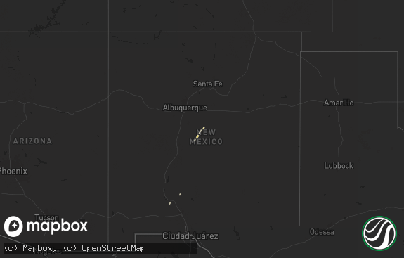
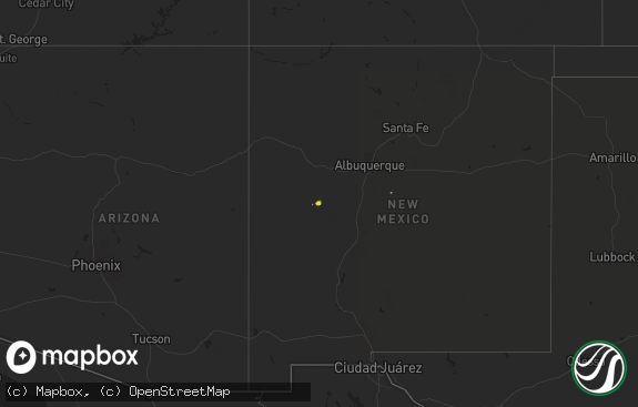
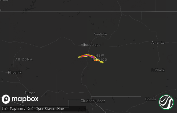
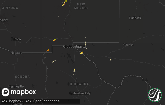
Hail Map in New Mexico on May 25, 2019
The weather event in New Mexico on May 25, 2019 includes Hail map. 20 states and 860 cities were impacted and suffered possible damage. The total estimated number of properties impacted is 6,905.

Hail
6,905
Estimated number of impacted properties by a 1.00" hail or larger1,582
Estimated number of impacted properties by a 1.75" hail or larger1,572
Estimated number of impacted properties by a 2.50" hail or largerStorm reports in New Mexico
New Mexico
| Date | Description |
|---|---|
| 05/25/20194:05 PM CDT | A local report indicates 2.00 inch wind near 3 S HOBBS |
| 05/25/20193:30 PM CDT | Hail lasted from 325-330 pm cdt. Mostly golfball sized hail with some a little bigger. |
| 05/25/20193:18 PM CDT | A local report indicates 1.50 inch wind near JAL |
| 05/25/20192:30 PM CDT | A local report indicates 1.25 inch wind near 3 WNW RANCHVALE |
| 05/25/20191:40 PM CDT | A local report indicates 1.00 inch wind near 1 W CLOVIS |
| 05/25/20191:38 PM CDT | Clovis high school |
| 05/25/20197:37 AM CDT | At 1236 PM CDT, a severe thunderstorm was located 10 miles south of Bledsoe, or 21 miles northeast of Tatum, moving northeast at 35 mph. HAZARD...Ping pong ball size hail and 60 mph wind gusts. SOURCE...Radar indicated. IMPACT...People and animals outdoors will be injured. Expect hail damage to roofs, siding, windows, and vehicles. Expect wind damage to roofs, siding, and trees. Locations impacted include... Morton, Bledsoe and Lehman. |
| 05/25/20196:56 AM CDT | At 1156 AM MDT, a severe thunderstorm was located 13 miles west of Milnesand, or 33 miles northwest of Tatum, moving northeast at 25 mph. HAZARD...60 mph wind gusts and half dollar size hail. SOURCE...Radar indicated. IMPACT...Hail damage to vehicles is expected. Expect wind damage to roofs, siding, and trees. Locations impacted include... Dora, Causey and Pep. |
| 05/24/20199:51 PM CDT | At 250 PM CDT/150 PM MDT/, a severe thunderstorm was located near Wink, moving north at 40 mph. HAZARD...Golf ball size hail and 60 mph wind gusts. SOURCE...Radar indicated. IMPACT...People and animals outdoors will be injured. Expect hail damage to roofs, siding, windows, and vehicles. Expect wind damage to roofs, siding, and trees. Locations impacted include... Kermit, Eunice, Jal, Wink, Nadine, Jal Airport, Monument, Eunice Airport, Bennett, Frankel City, Oil Center and Winkler County Airport. |
| 05/24/20198:33 PM CDT | At 133 PM MDT, a severe thunderstorm was located 10 miles north of Ranchvale, or 18 miles northwest of Clovis, moving north at 30 mph. HAZARD...60 mph wind gusts and half dollar size hail. SOURCE...Radar indicated. IMPACT...Hail damage to vehicles is expected. Expect wind damage to roofs, siding, and trees. This severe thunderstorm will remain over mainly rural areas of southeastern Quay and central Curry Counties. |
| 05/24/20198:09 PM CDT | At 108 PM MDT, a severe thunderstorm was located near Bellview, or 30 miles northwest of Friona, moving northeast at 15 mph. HAZARD...60 mph wind gusts and half dollar size hail. SOURCE...Radar indicated. IMPACT...Hail damage to vehicles is expected. Expect wind damage to roofs, siding, and trees. Locations impacted include... Broadview and Bellview. |
| 05/24/20198:05 PM CDT | At 105 PM MDT, a severe thunderstorm was located near Cannon Air Force Base, or 11 miles west of Clovis, moving northeast at 20 mph. HAZARD...Ping pong ball size hail and 60 mph wind gusts. SOURCE...Radar indicated. IMPACT...People and animals outdoors will be injured. Expect hail damage to roofs, siding, windows, and vehicles. Expect wind damage to roofs, siding, and trees. Locations impacted include... Clovis, Saint Vrain, Cannon Air Force Base, Ranchvale and Portair. |
All States Impacted by Hail Map on May 25, 2019
Cities Impacted by Hail Map on May 25, 2019
- Ogallah, KS
- Dalton, OH
- Dill City, OK
- Willow, OK
- Sentinel, OK
- Carter, OK
- Sayre, OK
- Canute, OK
- Lone Wolf, OK
- Granite, OK
- Fort Stockton, TX
- Cheyenne, OK
- Hammon, OK
- Panhandle, TX
- Groom, TX
- Barnesville, OH
- Bethesda, OH
- Walsh, CO
- New Hampton, MO
- Bethany, MO
- Bard, NM
- San Jon, NM
- Franklinville, NC
- Briggsdale, CO
- Tulia, TX
- Gilman City, MO
- Jal, NM
- Clymer, NY
- Panama, NY
- Booker, TX
- Delavan, IL
- Creston, WV
- Spencer, WV
- Maryville, MO
- Lore City, OH
- Freeport, OH
- Cambridge, OH
- Kimbolton, OH
- Cannon Afb, NM
- Clovis, NM
- Bloomfield, IA
- Milton, IA
- Hereford, TX
- Wellington, CO
- Carr, CO
- Nunn, CO
- Stafford, VA
- Salesville, OH
- Old Washington, OH
- Imperial, TX
- Grandfalls, TX
- Newman, IL
- Quitaque, TX
- Silverton, TX
- Crane, TX
- Transfer, PA
- Sharpsville, PA
- Burghill, OH
- Alva, OK
- Bushnell, NE
- Francesville, IN
- Drakes Branch, VA
- Keysville, VA
- Cherokee, OK
- Balko, OK
- Green City, MO
- Green Castle, MO
- Kirksville, MO
- Clarence, MO
- Emden, MO
- Leonard, MO
- Novinger, MO
- Novelty, MO
- Philadelphia, MO
- Bethel, MO
- Atlanta, MO
- Shelbyville, MO
- Monroe City, MO
- La Plata, MO
- Milan, MO
- Elmer, MO
- Albion, IL
- Ellery, IL
- Plainview, TX
- Dimmitt, TX
- Harrod, OH
- Lima, OH
- Apple Creek, OH
- New Matamoras, OH
- Middlebourne, WV
- New Martinsville, WV
- Reader, WV
- Sistersville, WV
- Pine Grove, WV
- Laverne, OK
- Spearman, TX
- Collison, IL
- Potomac, IL
- Portales, NM
- Reynolds, IL
- Taylor Ridge, IL
- Milan, IL
- Gate, OK
- Maroa, IL
- Littlefield, TX
- Mellott, IN
- Veedersburg, IN
- Lakin, KS
- Garden City, KS
- Ulysses, KS
- Satanta, KS
- Mount Eaton, OH
- Coyanosa, TX
- Clinton, IL
- Kenney, IL
- Chestnut, IL
- Bakersfield, CA
- Tupman, CA
- Bealeton, VA
- Mustang, OK
- Clarendon, TX
- Unionville, MO
- Princeton, MO
- Corydon, IA
- Newtown, MO
- Seymour, IA
- Powersville, MO
- Lucerne, MO
- Esmont, VA
- Arvonia, VA
- Howardsville, VA
- Scottsville, VA
- Dillwyn, VA
- Worthington, MO
- Greentop, MO
- Perryton, TX
- Amarillo, TX
- Plymouth, IL
- Downing, MO
- Littleton, IL
- Alexandria, MO
- Sutter, IL
- Basco, IL
- Memphis, MO
- Wyaconda, MO
- Canton, MO
- Industry, IL
- Colchester, IL
- Augusta, IL
- Gorin, MO
- West Point, IL
- Pollock, MO
- Warsaw, IL
- Queen City, MO
- Bowen, IL
- Astoria, IL
- Ursa, IL
- Rushville, IL
- Rutledge, MO
- Macomb, IL
- Carthage, IL
- Edina, MO
- Loraine, IL
- Ipava, IL
- Mendon, IL
- Williamstown, MO
- Baring, MO
- Kahoka, MO
- Vermont, IL
- Brashear, MO
- Saint Patrick, MO
- Monticello, MO
- La Belle, MO
- Pyote, TX
- Barstow, TX
- Port Republic, VA
- Mount Crawford, VA
- Larned, KS
- Kingman, KS
- Yukon, OK
- Manter, KS
- Fowler, IN
- Fairfield, IL
- Golden Gate, IL
- Grayville, IL
- Wildorado, TX
- Vega, TX
- Morton, TX
- Rozel, KS
- Texico, NM
- Floyd, NM
- Pep, NM
- Elida, NM
- Albany, MO
- Broadview, NM
- Midkiff, TX
- McCamey, TX
- Ozona, TX
- Iraan, TX
- Stafford, KS
- Plainville, KS
- Shattuck, OK
- Arnett, OK
- Gassaway, WV
- Frametown, WV
- Rosedale, WV
- Uhrichsville, OH
- Gnadenhutten, OH
- Port Washington, OH
- Tolono, IL
- Waukomis, OK
- Bison, OK
- Masterson, TX
- Grottoes, VA
- Penn Laird, VA
- McGaheysville, VA
- Crozet, VA
- Earlysville, VA
- Elkton, VA
- Weyers Cave, VA
- Free Union, VA
- Harrisonburg, VA
- Bridgewater, VA
- Dyke, VA
- Fairfield, VA
- Kress, TX
- Bement, IL
- Charlottesville, VA
- Mount Sidney, VA
- Catoosa, OK
- Tulsa, OK
- New Boston, IL
- Joy, IL
- Jacksonville, IL
- Murrayville, IL
- Alton, KS
- Woodston, KS
- Cordell, OK
- Plains, TX
- Denver City, TX
- Pleasantville, PA
- Tionesta, PA
- Titusville, PA
- Oil City, PA
- Cooperstown, PA
- Franklin, PA
- Marienville, PA
- Buttonwillow, CA
- McKittrick, CA
- Grover, CO
- Pulaski, IA
- Mercer, MO
- Danville, IL
- Bismarck, IL
- Shamrock, TX
- Mannford, OK
- Birmingham, IA
- Frederick, IL
- Taylorville, IL
- Stonington, IL
- Assumption, IL
- Moweaqua, IL
- Medford, OK
- Okeene, OK
- Olton, TX
- Avoca, NY
- Bath, NY
- Hornell, NY
- Cohocton, NY
- Jefferson, PA
- Schuyler, VA
- Cumberland, VA
- New Canton, VA
- Buckingham, VA
- Derby, IA
- Humeston, IA
- Chariton, IA
- Piedmont, OH
- Flushing, OH
- Quaker City, OH
- Morse, TX
- Stinnett, TX
- Melcher Dallas, IA
- Pleasantville, IA
- Knoxville, IA
- Navarre, OH
- Mars, PA
- Valencia, PA
- Gibsonia, PA
- Freedom, PA
- Warrendale, PA
- Cranberry Township, PA
- Zelienople, PA
- Wexford, PA
- Freedom, OK
- Raymond, KS
- Levelland, TX
- Pep, TX
- Enid, OK
- Kyle, SD
- Pine Ridge, SD
- Kenton, OK
- Erick, OK
- Amherst, TX
- Anton, TX
- Mcdonald, NM
- Fieldton, TX
- Lovington, NM
- Tatum, NM
- Whiteface, TX
- Hale Center, TX
- Kimball, NE
- Cheyenne, WY
- Burns, WY
- Carpenter, WY
- Pine Bluffs, WY
- Orrville, OH
- Denver, MO
- Worth, MO
- Sheridan, MO
- Pecos, TX
- Wink, TX
- Lexington, VA
- Vesuvius, VA
- Borger, TX
- Barberton, OH
- Akron, OH
- Tallmadge, OH
- Kent, OH
- Mogadore, OH
- Orma, WV
- Nickerson, KS
- Hutchinson, KS
- Carnegie, OK
- Decatur, IL
- Forsyth, IL
- Lewistown, IL
- Bryant, IL
- Canton, IL
- Cuba, IL
- Lacona, IA
- Lost Creek, WV
- Jane Lew, WV
- Mount Clare, WV
- Coldwater, KS
- Fredericksburg, VA
- Goldvein, VA
- Conception Junction, MO
- Gentry, MO
- Clyde, MO
- Stanberry, MO
- Ravenwood, MO
- Milo, IA
- Fairmont, NE
- Pampa, TX
- Lockney, TX
- Friona, TX
- Argenta, IL
- Beason, IL
- Weldon, IL
- Providence, NC
- Pelham, NC
- Blanch, NC
- Yanceyville, NC
- Logan, NM
- Massillon, OH
- North Lawrence, OH
- Moline, IL
- East Moline, IL
- Silvis, IL
- Aledo, IL
- Coal Valley, IL
- Rock Island, IL
- Tremont, IL
- Green Valley, IL
- Mackinaw, IL
- Minier, IL
- Pekin, IL
- Danvers, IL
- Bloomington, IL
- Manito, IL
- Hopedale, IL
- Stanford, IL
- Winamac, IN
- Wilmot, OH
- Dundee, OH
- Blythedale, MO
- Cainsville, MO
- Armington, IL
- Shirley, IL
- Topeka, IL
- McCracken, KS
- Andale, KS
- Mount Hope, KS
- Somonauk, IL
- Sandwich, IL
- Leland, IL
- Lucas, IA
- Woodburn, IA
- Alger, OH
- Wellington, TX
- Texola, OK
- Hammondsport, NY
- Drummond, OK
- Meno, OK
- Ames, OK
- Claremore, OK
- Mutual, OK
- Vici, OK
- Meeker, OK
- Harrah, OK
- Mcloud, OK
- Surry, VA
- Smithfield, VA
- Edgar, NE
- Montrose, WV
- Parsons, WV
- Hobart, OK
- Mangum, OK
- Seminole, TX
- Centerville, IA
- Bellflower, IL
- Canyon, TX
- Coatsville, MO
- Selma, IA
- Livonia, MO
- Stockport, IA
- Glenwood, MO
- Fairfield, IA
- Lancaster, MO
- Keosauqua, IA
- Douds, IA
- Meade, KS
- Dumas, TX
- Findlay, OH
- McComb, OH
- Arcadia, OH
- New Raymer, CO
- Ridgeway, OH
- Kenton, OH
- Fowler, OH
- Farmdale, OH
- New Boston, MO
- Ethel, MO
- Arnoldsburg, WV
- Mount Zion, WV
- Reedy, WV
- Flemington, WV
- Shinnston, WV
- Bridgeport, WV
- Grafton, WV
- Ness City, KS
- Cortland, OH
- Kinsman, OH
- Carrollton, OH
- Dellroy, OH
- Amelia Court House, VA
- Church Road, VA
- Halstead, KS
- Aliquippa, PA
- Moundsville, WV
- Liberal, KS
- Rosston, OK
- Mankato, KS
- Burr Oak, KS
- Esbon, KS
- Gretna, VA
- Miami, TX
- Sedgwick, KS
- Campo, CO
- Springfield, CO
- Mineral City, OH
- Bolivar, OH
- Magnolia, OH
- Trenton, MO
- Norwich, KS
- Arcadia, OK
- Jones, OK
- Luther, OK
- Wakita, OK
- Oklahoma City, OK
- Edmond, OK
- Gibson City, IL
- Saybrook, IL
- Graham, NC
- Snow Camp, NC
- Valley Center, KS
- Newton, KS
- Amistad, NM
- Wilmore, KS
- El Reno, OK
- Union City, OK
- Gaylord, KS
- Longdale, OK
- Martinsville, VA
- Wheeler, TX
- Sweetwater, OK
- Lafayette, IN
- Clarksburg, WV
- Lahoma, OK
- Colona, IL
- Illinois City, IL
- Villa Grove, IL
- Longview, IL
- Warrenton, VA
- Marshall, VA
- Liverpool, IL
- Nash, OK
- Grady, NM
- Midland, VA
- Barboursville, VA
- Ridgeway, MO
- Front Royal, VA
- Buffalo, OK
- Catlett, VA
- Sumerduck, VA
- Eunice, NM
- Warsaw, IN
- North Webster, IN
- Leesburg, IN
- Bowerston, OH
- Frankfort, IN
- Pratt, KS
- Mystic, IA
- New Concord, OH
- Norwich, OH
- Urbana, IL
- Champaign, IL
- Rensselaer, IN
- Remington, IN
- De Land, IL
- Mount Solon, VA
- Medicine Lodge, KS
- Attica, KS
- Zenda, KS
- Nashville, KS
- Johnson, KS
- Rochester, IN
- Paxton, IL
- Udall, KS
- Gordonsville, VA
- Greensburg, KS
- Adamsville, OH
- Belmont, OH
- Macksville, KS
- Hennessey, OK
- Ramseur, NC
- Philippi, WV
- Piedmont, OK
- Abbyville, KS
- Sterling, KS
- Plevna, KS
- Sylvia, KS
- St John, KS
- Fairmount, IL
- New Berlin, IL
- Pleasant Plains, IL
- Hydro, OK
- Binger, OK
- Fowler, KS
- Friendly, WV
- Kermit, TX
- Hobbs, NM
- Andrews, TX
- Havana, IL
- Tennessee, IL
- Golden, IL
- Elvaston, IL
- Table Grove, IL
- Adair, IL
- Shelbina, MO
- Hamilton, IL
- Harris, MO
- Mulberry, IN
- Mooreland, OK
- Rochester, PA
- Dodson, TX
- Raphine, VA
- Rockbridge Baths, VA
- Wabash, IN
- Hunter, OK
- Doylestown, OH
- Clinton, OH
- Ambia, IN
- Williamsport, IN
- Saint Clairsville, OH
- Bridgeport, OH
- Rossville, IL
- Wellston, OK
- Chandler, OK
- Elk City, OK
- Monon, IN
- Monticello, IN
- Remington, VA
- King George, VA
- Sparks, OK
- Ellinwood, KS
- Wolcott, IN
- Penfield, IL
- Gurley, NE
- New Kensington, PA
- Prophetstown, IL
- Kearney, MO
- Buhler, KS
- Dalhart, TX
- Newalla, OK
- Choctaw, OK
- Winchester, IN
- Union City, IN
- Danville, VA
- Anadarko, OK
- Pocasset, OK
- Gotebo, OK
- Roosevelt, OK
- Mountain View, OK
- Beaver, OK
- Minco, OK
- Boise City, OK
- Chesterhill, OH
- Strasburg, VA
- Decatur, IN
- Monroeville, IN
- Lamont, OK
- Stockport, OH
- Butler, OK
- Maywood, MO
- La Grange, MO
- Caldwell, KS
- Moravia, IA
- Corn, OK
- Lyons, KS
- Beaver, PA
- New Brighton, PA
- Sewickley, PA
- Ambridge, PA
- Beaver Falls, PA
- Baden, PA
- Bradfordwoods, PA
- Bakerstown, PA
- Allison Park, PA
- Ashland, KS
- Greenville, OH
- Arcanum, OH
- Rock Port, MO
- Fairfax, MO
- Crewe, VA
- Blackstone, VA
- Briscoe, TX
- Claude, TX
- Memphis, TX
- Hereford, CO
- Homer, IL
- Nokesville, VA
- Quantico, VA
- South Hutchinson, KS
- Armstrong, IL
- Fithian, IL
- Bellaire, OH
- Zanesville, OH
- Shadyside, OH
- Jacobsburg, OH
- Dresden, OH
- Toms Brook, VA
- Maurertown, VA
- Star Tannery, VA
- May, OK
- Fairmont, OK
- Hendricks, WV
- Hambleton, WV
- Hardtner, KS
- Cawker City, KS
- Burlington, OK
- Plano, IA
- Promise City, IA
- Waynesburg, PA
- Sharon, KS
- North Manchester, IN
- Wooster, OH
- Kinsley, KS
- Spivey, KS
- King City, MO
- Thomasboro, IL
- Rantoul, IL
- Jet, OK
- Newcomerstown, OH
- Royal Center, IN
- Pawnee Rock, KS
- Hays, KS
- Schoenchen, KS
- Hazelton, KS
- Seiling, OK
- Clinton, OK
- Englewood, KS
- Offerle, KS
- Sand Springs, OK
- Sapulpa, OK
- Calumet, OK
- Okarche, OK
- Hudson, KS
- Earlville, IL
- Haviland, KS
- Glouster, OH
- North Bloomfield, OH
- Bristolville, OH
- Rankin, IL
- Covington, IN
- Latham, IL
- Warrensburg, IL
- Lookeba, OK
- Happy, TX
- Huntington, IN
- Brewster, OH
- Beach City, OH
- Tarentum, PA
- Brackenridge, PA
- Creighton, PA
- Clarks Hill, IN
- Bloomingdale, IN
- Montezuma, IN
- Attica, IN
- Plains, KS
- Hurdle Mills, NC
- Leasburg, NC
- Roxboro, NC
- Mullinville, KS
- Grafton, NE
- Sutton, NE
- Fairmont, WV
- Fairview, OK
- Drumright, OK
- Bristow, OK
- Martinsville, MO
- Skidmore, MO
- Eagleville, MO
- Gracemont, OK
- Fort Cobb, OK
- Sadorus, IL
- East Canton, OH
- Hoopeston, IL
- White Heath, IL
- Mansfield, IL
- Seymour, IL
- Mahomet, IL
- Graysville, PA
- Isabella, OK
- Sidell, IL
- Westville, IL
- Catlin, IL
- Tilton, IL
- Lewis, KS
- Bovina, TX
- Moulton, IA
- Mount Airy, MD
- New Market, MD
- Ohio, IL
- Indianola, IL
- Foss, OK
- Blair, OK
- Vinson, OK
- Kansas City, MO
- Waldron, KS
- Idaville, IN
- Chester, OK
- Davis City, IA
- Roswell, NM
- Hart, TX
- Smithfield, IL
- Canton, OH
- Palco, KS
- Bethany, OK
- Romney, IN
- New Richmond, IN
- Forgan, OK
- Muleshoe, TX
- Sudan, TX
- Balmorhea, TX
- Ossian, IN
- Burrton, KS
- Convoy, OH
- Philo, IL
- Sidney, IL
- Canadian, TX
- Nazareth, TX
- Atlantic, PA
- Luray, MO
- Jetmore, KS
- Waynesville, IL
- Atlanta, IL
- Lincoln, IL
- Geary, OK
- Fort Collins, CO
- Lineville, IA
- Osborne, KS
- Floris, IA
- Libertyville, IA
- Ladoga, IN
- Waveland, IN
- Reidsville, NC
- Kewanna, IN
- Saint Joseph, IL
- Oreana, IL
- Sunray, TX
- Downs, IL
- Le Roy, IL
- Mclean, TX
- Lewistown, MO
- Ewing, MO
- Durham, MO
- Cheney, KS
- La Moille, IL
- La Rue, OH
- New Bloomington, OH
- Mount Victory, OH
- Clarendon, NC
- Richwood, OH
- Radnor, OH
- Lumberport, WV
- Meadowbrook, WV
- Spelter, WV
- Ong, NE
- Spickard, MO
- Potter, NE
- Wapello, IA
- Enochs, TX
- Dix, NE
- McLean, IL
- Steward, IL
- Lee, IL
- Paw Paw, IL
- Compton, IL
- Beallsville, OH
- Alledonia, OH
- Jerusalem, OH
- Mebane, NC
- Protection, KS
- Dennison, OH
- New Philadelphia, OH
- Monticello, IL
- Prague, OK
- Minneola, KS
- Linville, VA
- Ivesdale, IL
- Pesotum, IL
- Platte City, MO
- Murdock, KS
- Bassett, VA
- Arbela, MO
- Scio, OH
- Tippecanoe, OH
- Fresno, OH
- Wayland, NY
- Savoy, IL
- Delphos, OH
- Saint David, IL
- Monahans, TX
- Big Lake, TX
- Pella, IA
- Orion, IL
- Ravenna, OH
- Rootstown, OH


