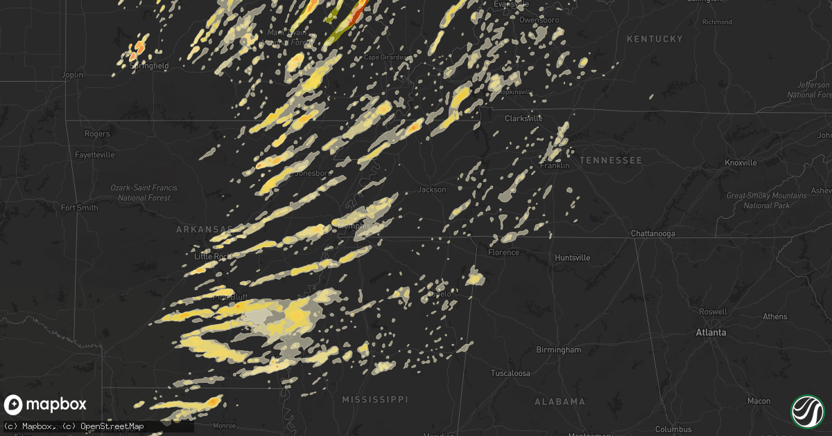
Hail Map in Tennessee on May 25, 2011
Get this storm
May 25 map
$229
one time, instant access
Download today. No call, no setup
Keep the $229
Bought the map and want the full workflow? Apply the entire $229 to a subscription within 7 days. None of it is wasted.
Every map, not just this one
This buys you this map. Subscription and you get every map we run, in the markets you choose from a few cities to whole states to nationwide. Plus real-time alerts the moment a storm fires.
Contact data
Name, contact info, occupancy, even credit band for addresses in the footprint. You go from where it hit to who to call.
Become the source they trust
Unlimited branding weather history reports on demand. You already have the documented answer ready for the property owner, and you are the one who showed up with it.
Property data and RoofTrace estimates
Pull up any address you have got, its value and the exact code rules for that jurisdiction, straight from One Click Code. Then RoofTrace estimates the squares, pitch, and roof value, priced the way you price.
Storm reports in Tennessee
Tennessee
| Date | Description |
|---|---|
| 05/25/20116:50 PM CDT | Half dollar sized hail and 55 mph winds blew small tree limbs down. |
| 05/25/20112:50 AM CDT | Trees and power lines down near cleveland...tennessee. |
| 05/25/20112:15 AM CDT | A few trees down near sunbright...tennessee |
| 05/25/20112:03 AM CDT | Trees and power lines were blown down. Much of the area is still without power. |
| 05/25/20111:45 AM CDT | Numerous trees...powerlines and telephone lines down in and around dunlap. Reported by dispatch. |
| 05/25/20111:41 AM CDT | Trees down near the intersection of dry valley road and maxwell road. |
| 05/25/20111:36 AM CDT | Trees and power lines down in several areas in dekalb county. |
| 05/25/20111:36 AM CDT | Trees and power lines down near highway 56 and seals hollow road. |
| 05/25/20111:35 AM CDT | Trees down on lillys chapel road. Roof blown off out building. |
| 05/25/20111:35 AM CDT | Large tree blown down near intersection of hwy 41 and hwy 53. |
| 05/25/20111:30 AM CDT | Numerous trees down countywide. Reported by dispatch. |
| 05/25/20111:15 AM CDT | Multiple reports of trees blown down. |
| 05/25/20111:15 AM CDT | Tree down i-40 at mile marker 273. |
| 05/25/20111:10 AM CDT | Power lines down 3804 stewarts ferry pike. |
| 05/25/20111:10 AM CDT | Several trees were blown down in gainsboro and power was knocked out. |
| 05/25/20111:05 AM CDT | Tema reports a convenient store was leveled in smithville. This is a possible tornado but uncomfirmed at this time. |
| 05/25/20111:00 AM CDT | Power lines down near symrna. |
| 05/25/20111:00 AM CDT | Power lines down at 121 taylor drive in lavergne. |
| 05/25/20111:00 AM CDT | Poles and power lines down at 2850 posey hill road. |
| 05/25/20111:00 AM CDT | A brief tornado occurred in smithville at 1am cdt on may 26. It severely damaged a gas station building but the canopy remained in tact. It also damaged a nearby restau |
| 05/25/201112:59 AM CDT | Emergency manager reports 6-10 roads in sumner county closed due to trees and power lines down. |
| 05/25/201112:50 AM CDT | Trees down northern part of county...fredonia road. |
| 05/25/201112:49 AM CDT | Numerous trees were blown down including one on a house and two on cars. |
| 05/25/201112:45 AM CDT | Possible tornado just southeast of murfreesboro. Houses damaged. Residents trapped inside. |
| 05/25/201112:31 AM CDT | Large tree down at burnt knob road and blackman road. |
| 05/25/201112:31 AM CDT | Reported thunderstorm wind gust to 60 mph. |
| 05/25/201112:30 AM CDT | State route 20 in northern part of county closed. Large tree on power line. |
| 05/25/201112:30 AM CDT | Trees were blown down in the providence community. |
| 05/25/201112:30 AM CDT | A local report indicates 1.00 inch wind near SMYRNA |
| 05/25/201112:25 AM CDT | Many trees are down with structural damage in fayetteville. |
| 05/25/201112:25 AM CDT | Possible tornado near murfreesboro. |
| 05/25/201112:20 AM CDT | A local report indicates 60 MPH wind near MURFREESBORO |
| 05/25/201112:20 AM CDT | Reports of trees and power lines down in parts of smyrna and lavergne. |
| 05/25/201112:15 AM CDT | A local report indicates 1.00 inch wind near SHELBYVILLE |
| 05/25/201112:10 AM CDT | Trees down on carport. Hwy 91 and us 31. |
| 05/25/201112:01 AM CDT | Numerous trees were blown down. |
| 05/25/201112:00 AM CDT | Tree down on house. New prospect community. |
| 05/24/201111:56 PM CDT | Trees were blown down. |
| 05/24/201111:50 PM CDT | Roof blown off home in gandy community. |
| 05/24/201111:50 PM CDT | Trees down and damage to commercial building. Door blown in. |
| 05/24/201111:45 PM CDT | Multiple trees uprooted and 2 houses with trees on them near hidden lake circle |
| 05/24/201111:44 PM CDT | Several trees were blown down. |
| 05/24/201111:40 PM CDT | Mobile home turned over. Person trapped inside. |
| 05/24/201111:40 PM CDT | Trees down blocking hwy 64 west |
| 05/24/201111:40 PM CDT | Trees down blocking hwy 43 near city. |
| 05/24/201111:34 PM CDT | Tree down on house. |
| 05/24/201111:25 PM CDT | Trees down on power lines in portland. |
| 05/24/201111:25 PM CDT | Trees down on cars and power outages. Howard switch and memorial road intersection. |
| 05/24/201111:22 PM CDT | Quarter size hail reported near lawrenceburg. |
| 05/24/201111:20 PM CDT | Trees down on power lines in portland. |
| 05/24/201111:18 PM CDT | Power poles down just east of lawrenceburg. |
| 05/24/201111:17 PM CDT | Trees were blown down on cane creek rd near pleasantville. |
| 05/24/201111:15 PM CDT | Large tree limbs and branches down. |
| 05/24/201111:15 PM CDT | 60 mph wind gust. |
| 05/24/201110:55 PM CDT | Trees down hwy 25 and 71w. |
| 05/24/201110:50 PM CDT | Trees down in city. |
| 05/24/201110:45 PM CDT | Trees down in springfield. |
| 05/24/201110:42 PM CDT | Numerous trees and powerlines were blown down. |
| 05/24/201110:39 PM CDT | Numerous trees and power lines down. One tree on a house and two trees on cars. |
| 05/24/201110:35 PM CDT | Tree down. |
| 05/24/201110:30 PM CDT | Trees down north of city. |
| 05/24/201110:29 PM CDT | Multiple trees down and snapped trees on mosley ferry road. |
| 05/24/201110:25 PM CDT | Trees down across county. |
| 05/24/201110:15 PM CDT | Trees down. |
| 05/24/201110:03 PM CDT | Trees and lines were blown down all across northern perry county. |
| 05/24/201110:00 PM CDT | Trees down hwy 25 and 71w. |
| 05/24/201110:00 PM CDT | Trees down. |
| 05/24/201110:00 PM CDT | Trees down with line of storms countywide. |
| 05/24/20119:41 PM CDT | Several trees were blown down including one on a house. |
| 05/24/20119:40 PM CDT | Possible tornado. Multiple trees and lines down across the county. Industrial buildings damaged. |
| 05/24/20119:30 PM CDT | Multiple trees down. |
| 05/24/20119:28 PM CDT | Significant tree damage reported on rushing creek road in the land between the lakes. |
| 05/24/20119:25 PM CDT | Trees and power lines down in northwest portion of the county. |
| 05/24/20119:17 PM CDT | A local report indicates 60 MPH wind near 5 SE JACKSON |
| 05/24/20119:15 PM CDT | Roof damaged on several houses. |
| 05/24/20118:53 PM CDT | A local report indicates 61 MPH wind near 5 SW JACKSON |
| 05/24/20118:45 PM CDT | A local report indicates 58 MPH wind near 5 SW JACKSON |
| 05/24/20118:21 PM CDT | Small tree limbs down and powerlines down damage extends to 3 ne of brownsville. |
| 05/24/20118:10 PM CDT | A local report indicates 1.25 inch wind near 7 N MASON |
| 05/24/20117:55 PM CDT | A local report indicates 1.75 inch wind near UNION CITY |
| 05/24/20117:50 PM CDT | A local report indicates 1.00 inch wind near 2 NNW LAKELAND |
| 05/24/20117:50 PM CDT | Trees down...flag pole broken...strong winds and heavy rain lasted about 10 minutes. Some minor street flooding. |
| 05/24/20117:49 PM CDT | A local report indicates 1.00 inch wind near ATOKA |
| 05/24/20117:47 PM CDT | Possible tornado on ground |
| 05/24/20117:39 PM CDT | Multiple trees and powerlines down. Minor roof damage to homes. |
| 05/24/20117:38 PM CDT | Multiple power outtages and homes with minor roof damage |
| 05/24/20117:37 PM CDT | A local report indicates 80 MPH wind near 2 N NEWBERN |
| 05/24/20117:36 PM CDT | Quarter sized hail near macedonia rd. |
| 05/24/20117:30 PM CDT | Power lines down...roof damage from winds. No trees down. |
| 05/24/20117:19 PM CDT | Trees and powerlines down at summer and raleigh lagrange road. |
| 05/24/20117:00 PM CDT | Reports of significant damage in tiptonville area. Sturctural damage to an apartment. |
| 05/24/20117:00 PM CDT | Power lines and large trees down |
All States Impacted by Hail Map on May 25, 2011
Cities Impacted by Hail Map on May 25, 2011
- Brighton, IL
- Climax Springs, MO
- Edwards, MO
- Trafalgar, IN
- Nineveh, IN
- Nashville, IN
- Morgantown, IN
- Obion, TN
- South Fulton, TN
- Rives, TN
- Union City, TN
- Fulton, KY
- Hornbeak, TN
- Troy, TN
- Coushatta, LA
- Dawson Springs, KY
- Hamburg, AR
- Bernie, MO
- Dexter, MO
- Vandalia, IL
- Kampsville, IL
- Hartford City, IN
- Muncie, IN
- Upland, IN
- Francesville, IN
- Spencerville, IN
- Fort Wayne, IN
- Grabill, IN
- Harlan, IN
- Woodburn, IN
- New Haven, IN
- Tunica, MS
- Meta, MO
- Dixon, MO
- Argyle, MO
- Vienna, MO
- Brinktown, MO
- Connersville, IN
- Centerville, IN
- Cord, AR
- Brownsville, TN
- Colfax, LA
- Troy, MO
- Moscow Mills, MO
- Foristell, MO
- Wentzville, MO
- Old Monroe, MO
- Harrisburg, IL
- Noble, IL
- Florence, AL
- Iron City, TN
- Killen, AL
- Jena, LA
- Piedmont, MO
- Rison, AR
- Cortland, OH
- Spring Valley, OH
- Xenia, OH
- Dayton, OH
- Bellbrook, OH
- Gore Springs, MS
- Duck Hill, MS
- Atlanta, IL
- Wapella, IL
- Clinton, IL
- Waynesville, IL
- McLean, IL
- Kenney, IL
- Heyworth, IL
- Rittman, OH
- Wadsworth, OH
- Doylestown, OH
- Cotton Valley, LA
- Benton, LA
- Romance, AR
- Rose Bud, AR
- Sikeston, MO
- Essex, MO
- Bell City, MO
- Vanduser, MO
- Bloomfield, MO
- Creston, OH
- Seville, OH
- Sidon, MS
- Greenwood, MS
- Brookville, IN
- Oxford, OH
- Cedar Grove, IN
- Doniphan, MO
- Strawberry, AR
- Poughkeepsie, AR
- Batesville, AR
- Alicia, AR
- Smithville, AR
- Sulphur Rock, AR
- Cave City, AR
- Walnut Ridge, AR
- Hoxie, AR
- Portia, AR
- Black Rock, AR
- Lynn, AR
- Powhatan, AR
- Bloomington, IN
- Lovington, IL
- Baring, MO
- Ashland, OH
- New London, OH
- Nova, OH
- Sullivan, OH
- Greenville, MS
- Benoit, MS
- Oak Harbor, OH
- Port Clinton, OH
- Piasa, IL
- Shipman, IL
- Medora, IL
- Griffithville, AR
- Searcy, AR
- Cambridge Springs, PA
- Union City, PA
- Thornton, AR
- Bearden, AR
- Avon, OH
- Olmsted Falls, OH
- North Olmsted, OH
- North Ridgeville, OH
- Westlake, OH
- Shelby, MS
- Clarksdale, MS
- Mexico, MO
- Miller City, IL
- Charleston, MO
- Cairo, IL
- Osceola, MO
- Lowry City, MO
- West Plains, MO
- Attica, OH
- Bloomville, OH
- Tiffin, OH
- Republic, OH
- Cole Camp, MO
- Oakland, MS
- Water Valley, MS
- Bauxite, AR
- Bryant, AR
- New Riegel, OH
- Weimar, TX
- Schulenburg, TX
- Deville, LA
- Pineville, LA
- Ball, LA
- Center Point, LA
- Marksville, LA
- Effie, LA
- South Bend, IN
- Merigold, MS
- Beulah, MS
- Cleveland, MS
- Belleville, IL
- Freeburg, IL
- Tamms, IL
- Thebes, IL
- Olive Branch, IL
- Villa Ridge, IL
- Pulaski, IL
- Mounds, IL
- Bernice, LA
- Morrisville, MO
- Brighton, MO
- Willard, MO
- Walnut Grove, MO
- Waynesville, MO
- Lebanon, MO
- Falcon, MO
- Laquey, MO
- Ledbetter, TX
- Giddings, TX
- West Lafayette, IN
- Ellington, MO
- Gosport, IN
- Corunna, IN
- Kendallville, IN
- Avilla, IN
- Jacksonville, AR
- Converse, LA
- Pine Bluff, AR
- Malvern, AR
- Sherrill, AR
- Leola, AR
- Jefferson, AR
- Grapevine, AR
- Sheridan, AR
- Arkadelphia, AR
- White Hall, AR
- Carthage, AR
- Payne, OH
- Antwerp, OH
- Cascilla, MS
- Arnold, MO
- Imperial, MO
- Marysville, OH
- Van Buren, MO
- Edinburg, IL
- Barry, IL
- New Canton, IL
- Oakdale, IL
- Nashville, IL
- Guthrie, KY
- Trenton, KY
- Crowley, LA
- Ganado, TX
- Markle, IN
- Bluffton, IN
- Uniondale, IN
- Roanoke, IN
- Huntington, IN
- Ossian, IN
- Salem, IL
- Iuka, IL
- Oil Trough, AR
- Martinsville, IL
- Marshall, IL
- Rosedale, IN
- Mammoth Spring, AR
- Camp, AR
- Glencoe, AR
- Couch, MO
- Alton, MO
- Ravenden, AR
- Myrtle, MO
- Osage Beach, MO
- Sunrise Beach, MO
- Newport, AR
- Newark, AR
- Conroe, TX
- Cleveland, TX
- Lexa, AR
- Poplar Grove, AR
- Hornbeck, LA
- Milroy, IN
- Rushville, IN
- Greensburg, IN
- Napoleon, MO
- Bates City, MO
- Oak Grove, MO
- Biscoe, AR
- Des Arc, AR
- Stover, MO
- Smithton, MO
- Warsaw, MO
- Florence, MO
- Lincoln, MO
- Mora, MO
- Ashkum, IL
- Castalia, OH
- Vickery, OH
- Sandusky, OH
- Huron, OH
- Old Fort, OH
- Clyde, OH
- Milan, OH
- Fremont, OH
- Monroeville, OH
- Green Springs, OH
- Bellevue, OH
- Berlin Heights, OH
- Grady, AR
- Bloomsdale, MO
- Wakeman, OH
- Vermilion, OH
- Paoli, IN
- French Lick, IN
- Morral, OH
- Marion, OH
- Sainte Genevieve, MO
- Rochester, IL
- Rocheport, MO
- Mulberry Grove, IL
- Ramsey, IL
- Beecher, IL
- Grovespring, MO
- Bloomfield, IN
- Shelbyville, TX
- Tipton, IN
- Odessa, MO
- Lone Jack, MO
- Vulcan, MO
- Montgomery, IN
- Plainville, IN
- Loogootee, IN
- Elnora, IN
- Washington, IN
- Owensburg, IN
- Crane, IN
- Odon, IN
- Springville, IN
- Worthington, IN
- Millington, TN
- Wabash, IN
- Maynard, AR
- Oxly, MO
- Okeana, OH
- Anahuac, TX
- Winnie, TX
- Robertsville, MO
- Parker City, IN
- Albany, IN
- Gibsonburg, OH
- Luckey, OH
- Woodville, OH
- Pemberville, OH
- Genoa, OH
- Ridgely, TN
- Mascoutah, IL
- Pawnee, IL
- Mount Blanchard, OH
- New Lebanon, OH
- Duke, MO
- Newburg, MO
- Devils Elbow, MO
- Palacios, TX
- Blessing, TX
- Columbia City, IN
- Spencer, IN
- Solsberry, IN
- Castor, LA
- New Madrid, MO
- Hiram, OH
- Jonesburg, MO
- Warrenton, MO
- Raymondville, MO
- Frankfort, IN
- Cutler, IN
- Russiaville, IN
- Woodville, MS
- Henning, TN
- Ellettsville, IN
- Delphi, IN
- Brookston, IN
- Brookville, OH
- Cedarville, OH
- Wilberforce, OH
- Alpha, OH
- Eolia, MO
- Silex, MO
- Fulton, MO
- Roundhill, KY
- Brownsville, KY
- Sweeden, KY
- Ringgold, LA
- Jamestown, LA
- Goldonna, LA
- Saline, LA
- Ashland, LA
- Hall Summit, LA
- San Augustine, TX
- Ravenna, OH
- Williams, IN
- Matthews, MO
- Lilbourn, MO
- Mansfield, LA
- Pelican, LA
- Natchitoches, LA
- Natchez, LA
- Robeline, LA
- Pleasant Hill, LA
- Noble, LA
- Marthaville, LA
- Saint Louis, MO
- Warren, OH
- Newton Falls, OH
- Leavittsburg, OH
- Niles, OH
- Pevely, MO
- Festus, MO
- Hillsboro, MO
- Milmine, IL
- Monticello, IL
- Belzoni, MS
- Collierville, TN
- Germantown, TN
- Rossville, TN
- Eads, TN
- Memphis, TN
- Cordova, TN
- Alhambra, IL
- Marine, IL
- Westphalia, MO
- Saint Thomas, MO
- Billings, MO
- Republic, MO
- Bastrop, TX
- Paige, TX
- Garwood, TX
- Louise, TX
- Hallettsville, TX
- Woodstock, OH
- Milford Center, OH
- North Lewisburg, OH
- Ethel, MS
- Vaiden, MS
- Kilmichael, MS
- Plain City, OH
- Lizton, IN
- Jamestown, IN
- Minter City, MS
- Belleview, MO
- Cadet, MO
- Mineral Point, MO
- Bonne Terre, MO
- Belgrade, MO
- De Soto, MO
- Potosi, MO
- Blackwell, MO
- Bixby, MO
- Cabot, AR
- Elyria, OH
- Pope, MS
- Enid, MS
- Batesville, MS
- Courtland, MS
- Bowling Green, IN
- Coal City, IN
- Centerpoint, IN
- Clay City, IN
- Bentley, LA
- Dry Prong, LA
- Cloutierville, LA
- Montgomery, LA
- Shelbyville, IN
- Indianapolis, IN
- Greenwood, IN
- New Palestine, IN
- Boggstown, IN
- Whiteland, IN
- Franklin, IN
- Needham, IN
- Fairland, IN
- Bargersville, IN
- Martinsville, IN
- Lyon, MS
- Coahoma, MS
- Springfield, MO
- Chrisman, IL
- South Charleston, OH
- South Solon, OH
- Calhoun, MO
- Windsor, MO
- West Alexandria, OH
- Farmersville, OH
- Vienna, IL
- Stonefort, IL
- Simpson, IL
- Ozark, IL
- Grantsburg, IL
- Mayfield, KY
- West College Corner, IN
- Louisville, MS
- Ingraham, IL
- Dieterich, IL
- Newton, IL
- Clifford, IN
- Flat Rock, IN
- Hope, IN
- Columbus, IN
- Tatum, TX
- Henderson, TX
- Beckville, TX
- Chester, IL
- Steeleville, IL
- Kenton, OH
- Columbus, TX
- Ash Grove, MO
- Lakeview, OH
- Perryville, MO
- Mulberry, IN
- Greenville, OH
- Gettysburg, OH
- Bradford, OH
- Nashville, TN
- Kokomo, IN
- Kempton, IN
- Sharpsville, IN
- Portland, AR
- Montrose, AR
- Lake Village, AR
- Viburnum, MO
- Steelville, MO
- Marion, IN
- Itta Bena, MS
- Schlater, MS
- Ecru, MS
- New Albany, MS
- Grandin, MO
- Fairdealing, MO
- Stockdale, TX
- Nixon, TX
- Bucyrus, OH
- Fayette, AL
- Berry, AL
- Bankston, AL
- Centerburg, OH
- Sunbury, OH
- Marengo, OH
- Somerville, OH
- West Harrison, IN
- Laurel, IN
- Germantown, OH
- Metamora, IN
- Hamilton, OH
- Bath, IN
- Franklin, OH
- Middletown, OH
- Miamisburg, OH
- Sunman, IN
- College Corner, OH
- Trenton, OH
- Liberty, IN
- Scott, AR
- Jasper, AL
- Houston, MO
- Cabool, MO
- Solo, MO
- Mountain Grove, MO
- Edna, TX
- Sheridan, TX
- Madison, IL
- Fenton, MO
- Chesterfield, MO
- Ballwin, MO
- Valley Park, MO
- Granite City, IL
- Venice, IL
- Decaturville, TN
- Starkville, MS
- Beebe, AR
- Danville, IL
- Oakwood, IL
- Bronson, TX
- Hemphill, TX
- Milam, TX
- Franklin, TN
- Lillie, LA
- Spearsville, LA
- League City, TX
- New Haven, IL
- Ridgway, IL
- Cotton Plant, AR
- Hazen, AR
- Carlisle, AR
- Laddonia, MO
- Greencastle, IN
- Placedo, TX
- Bloomington, TX
- Jadwin, MO
- Salem, MO
- Mitchell, IN
- Greenfield, IN
- Owensville, IN
- Velpen, IN
- Norman, IN
- Stinesville, IN
- Avoca, IN
- Shoals, IN
- Princeton, IN
- Jasper, IN
- Patoka, IN
- Heltonville, IN
- Oolitic, IN
- Hartsville, IN
- Saint Paul, IN
- Edinburgh, IN
- Fountaintown, IN
- Mooresville, IN
- Freedom, IN
- Lyons, IN
- Bedford, IN
- Manilla, IN
- Oldenburg, IN
- Wheatland, IN
- Newberry, IN
- Switz City, IN
- Freetown, IN
- Huntingburg, IN
- Waldron, IN
- Monroe City, IN
- Paragon, IN
- Taylorsville, IN
- Hazleton, IN
- Vincennes, IN
- Decker, IN
- Seymour, IN
- Batesville, IN
- Winslow, IN
- Okolona, MS
- Shannon, MS
- Almyra, AR
- Crocketts Bluff, AR
- Stuttgart, AR
- Humphrey, AR
- Casscoe, AR
- Eminence, MO
- Metropolis, IL
- Niangua, MO
- Hartville, MO
- Evansville, IN
- Cisco, IL
- Cerro Gordo, IL
- Otterbein, IN
- Derby, IN
- Liberty, TX
- Licking, MO
- Beulah, MO
- Edgar Springs, MO
- Success, MO
- Roby, MO
- Seymour, IL
- Weldon, IL
- Mansfield, IL
- Champaign, IL
- Sadorus, IL
- De Land, IL
- Rantoul, IL
- Thomasboro, IL
- Bondville, IL
- Fisher, IL
- White Heath, IL
- Dewey, IL
- Ivesdale, IL
- Urbana, IL
- Savoy, IL
- Mahomet, IL
- Tolono, IL
- Windham, OH
- Mantua, OH
- Garrettsville, OH
- Lohman, MO
- Russellville, MO
- Rocky Mount, MO
- Gravois Mills, MO
- Olean, MO
- Centertown, MO
- Latham, MO
- Jefferson City, MO
- California, MO
- Versailles, MO
- Eldon, MO
- Barnett, MO
- Straughn, IN
- New Castle, IN
- New Washington, OH
- Mill Spring, MO
- Ellsinore, MO
- Williamsville, MO
- Pocahontas, IL
- Breese, IL
- Pleasant Hill, IL
- Annada, MO
- Hawk Point, MO
- Bowling Green, MO
- Elsberry, MO
- Pearl, IL
- Middletown, MO
- Nebo, IL
- Hamburg, IL
- Clarksville, MO
- Truxton, MO
- Yuma, TN
- Lexington, TN
- Wildersville, TN
- Lisbon, LA
- Farmerville, LA
- Minden, LA
- Homer, LA
- Dubach, LA
- Marion, LA
- Lolita, TX
- Somerville, TN
- Morristown, IN
- Carthage, IN
- Arlington, IN
- Oxford, MS
- Osgood, IN
- Westfield, IN
- Hillview, IL
- Browns, IL
- Mount Carmel, IL
- Yorktown, TX
- Foley, MO
- Ruleville, MS
- Spring Valley, IL
- Granville, IL
- Atlanta, IN
- Montgomery City, MO
- Wellsville, MO
- Bellflower, MO
- Texico, IL
- Mount Vernon, IL
- Walnut Hill, IL
- Dix, IL
- Kell, IL
- Seymour, MO
- Linden, TN
- Berger, MO
- Gas City, IN
- Fowlerton, IN
- Summitville, IN
- Fairmount, IN
- Jonesboro, IN
- Charleston, MS
- Lovejoy, IL
- Culver, IN
- Syracuse, IN
- Milford, IN
- Windfall, IN
- Elwood, IN
- Romney, IN
- Crawfordsville, IN
- Lafayette, IN
- New Richmond, IN
- Clarks Hill, IN
- Linden, IN
- Dickson, TN
- Widener, AR
- Wynne, AR
- Colt, AR
- Parkin, AR
- Heth, AR
- Palestine, AR
- Earle, AR
- Forrest City, AR
- Eddyville, KY
- Van Buren, IN
- Piqua, OH
- Houston, OH
- Hinckley, OH
- Upper Sandusky, OH
- Nevada, OH
- Findlay, OH
- Middletown, IN
- Shirley, IN
- Gonzales, TX
- Shiner, TX
- Urbana, OH
- Springfield, OH
- Tremont City, OH
- Bluffton, OH
- Defiance, MO
- O'Fallon, MO
- Lake Saint Louis, MO
- Watson, AR
- Olmstead, KY
- Fort Leonard Wood, MO
- Vichy, MO
- Freeburg, MO
- Richland, MO
- Belle, MO
- Jerome, MO
- Crocker, MO
- Rolla, MO
- Saint Robert, MO
- Linn, MO
- Brazil, IN
- Whites Creek, TN
- Ironton, MO
- Annapolis, MO
- Morocco, IN
- Lima, OH
- Springboro, OH
- Paris, IL
- Little Rock, AR
- Roland, AR
- Ottawa, OH
- Leipsic, OH
- Cross Timbers, MO
- Sycamore, OH
- Mechanicsburg, OH
- Horseshoe Bend, AR
- Carey, OH
- Demotte, IN
- Rossville, IN
- Bringhurst, IN
- Reynolds, IN
- Chalmers, IN
- Monticello, IN
- Zwolle, LA
- Blytheville, AR
- Caruthersville, MO
- Steele, MO
- Cooter, MO
- Florien, LA
- Leesville, LA
- Boyce, LA
- Elmer, LA
- Lena, LA
- Flatwoods, LA
- Mora, LA
- Monterey, LA
- Alexandria, LA
- Provencal, LA
- Acme, LA
- Pollock, LA
- Jonesville, LA
- Fortuna, MO
- East Liberty, OH
- Tutwiler, MS
- Lambert, MS
- Williamstown, OH
- Forest, OH
- Dunkirk, OH
- Arlington, OH
- Waynetown, IN
- Crete, IL
- Cleveland, OH
- Independence, OH
- Elkland, MO
- Gillett, AR
- Tichnor, AR
- De Witt, AR
- Gould, AR
- Yorktown, AR
- Star City, AR
- Beaumont, TX
- Plainfield, IN
- Clayton, IN
- Moreauville, LA
- Danville, IN
- Coatesville, IN
- Benton, KY
- Crofton, KY
- Russellville, AL
- Pontotoc, MS
- Alexander, AR
- Ravenden Springs, AR
- Imboden, AR
- Arlington, KY
- Everton, MO
- Prospect, OH
- Wheatley, AR
- Goodwin, AR
- Hume, IL
- Brentwood, TN
- Spiceland, IN
- Knightstown, IN
- Hampton, AR
- Antioch, TN
- Van Wert, OH
- Mentone, IN
- Claypool, IN
- Burket, IN
- Counce, TN
- Shiloh, TN
- Moscow, TX
- Mabelvale, AR
- Benton, AR
- Naylor, MO
- Edinboro, PA
- Saegertown, PA
- Venango, PA
- Little York, IL
- Poplar Bluff, MO
- Patterson, MO
- Arbela, MO
- Midfield, TX
- Bay City, TX
- Bolivar, MO
- Marshall, IN
- Bloomingdale, IN
- Montezuma, IN
- New Waverly, TX
- Huntsville, TX
- Thaxton, MS
- Randolph, MS
- Paris, MS
- Houlka, MS
- Andrews, IN
- Pasadena, TX
- Adamsville, TN
- Milledgeville, TN
- Morris Chapel, TN
- Bethel Springs, TN
- Sardis, TN
- Carlinville, IL
- Gillespie, IL
- Greenville, MO
- Marquand, MO
- Clubb, MO
- Silva, MO
- Crumrod, AR
- Duncan, MS
- Alligator, MS
- Addieville, IL
- Richmond, IN
- Amo, IN
- Eaton, OH
- Dumas, AR
- Wilmar, AR
- Snow Lake, AR
- McGehee, AR
- Tillar, AR
- Kingsland, AR
- Mellwood, AR
- Fordyce, AR
- Gunnison, MS
- New Edinburg, AR
- Monticello, AR
- Rosedale, MS
- Pickens, AR
- Rohwer, AR
- Mound Bayou, MS
- Winchester, AR
- Portageville, MO
- Altheimer, AR
- Wabbaseka, AR
- Miller, MO
- Creve Coeur, IL
- Pekin, IL
- East Peoria, IL
- Evansville, IL
- Modoc, IL
- Providence, KY
- Dixon, KY
- Coffeeville, MS
- Redfield, AR
- Hensley, AR
- Nokomis, IL
- Grovertown, IN
- Knox, IN
- Columbus Grove, OH
- Cecil, OH
- Paulding, OH
- Lakewood, IL
- Shelbyville, IL
- Strasburg, IL
- Buffalo, IL
- Eldorado, OH
- New Paris, OH
- Marthasville, MO
- Hopkinsville, KY
- Weiner, AR
- Fisher, AR
- Crenshaw, MS
- Sledge, MS
- Venedocia, OH
- Ada, OH
- Vanlue, OH
- Wharton, OH
- Dola, OH
- Arcanum, OH
- Tuscumbia, AL
- Parma, MO
- Bremen, AL
- Saint Mary, MO
- Farmington, MO
- Fredericktown, MO
- Pinckneyville, IL
- Tilden, IL
- Ellis Grove, IL
- Baldwin, IL
- Marissa, IL
- Sparta, IL
- Coulterville, IL
- Walsh, IL
- Hannibal, MO
- Monroe City, MO
- Palmyra, MO
- Center, MO
- Perry, MO
- Shreveport, LA
- Yoakum, TX
- Union Hill, IL
- Herscher, IL
- Buckingham, IL
- Bonfield, IL
- Vina, AL
- Goliad, TX
- Preston, MO
- Hermitage, MO
- Culleoka, TN
- Columbia, TN
- Spring Hill, TN
- Wilson, LA
- Clinton, LA
- Jetson, KY
- Caneyville, KY
- Shelby, OH
- Mansfield, OH
- Shiloh, OH
- Cuba, MO
- Hartville, OH
- Akron, OH
- Kent, OH
- Clinton, OH
- Canal Fulton, OH
- Massillon, OH
- Rootstown, OH
- Uniontown, OH
- Atwater, OH
- Alliance, OH
- Mogadore, OH
- North Canton, OH
- Boss, MO
- Roach, MO
- Camdenton, MO
- Waggoner, IL
- Divernon, IL
- Girard, IL
- Farmersville, IL
- Harvel, IL
- Morrisonville, IL
- Virden, IL
- Mechanicsburg, IL
- Millstadt, IL
- Palmyra, IL
- High Hill, MO
- Leighton, AL
- Splendora, TX
- Hankamer, TX
- Bedias, TX
- Dayton, TX
- Willis, TX
- Devers, TX
- Norwalk, OH
- Collins, OH
- New Carlisle, OH
- Fostoria, OH
- Teutopolis, IL
- Winona, MO
- Redford, MO
- Plato, MO
- Marianna, AR
- North Baltimore, OH
- Cygnet, OH
- Jerry City, OH
- West Terre Haute, IN
- Terre Haute, IN
- Dennison, IL
- Navasota, TX
- Anderson, TX
- Xenia, IL
- Kinmundy, IL
- Hazel, KY
- Murray, KY
- Clinton, IN
- Hillsdale, IN
- Vermilion, IL
- Arcola, IL
- Humboldt, IL
- Tuscola, IL
- Pesotum, IL
- Arthur, IL
- Veedersburg, IN
- Kingman, IN
- Hillsboro, IN
- Swifton, AR
- Churubusco, IN
- Yoder, IN
- Arcola, IN
- South Whitley, IN
- Cabery, IL
- Kempton, IL
- Burton, TX
- Clinton, MO
- Peace Valley, MO
- Birch Tree, MO
- Roachdale, IN
- Pulaski, TN
- Gideon, MO
- Ward, AR
- Salem, KY
- Warren, IN
- Greentown, IN
- Swayzee, IN
- Sheridan, IN
- Tallula, IL
- New Madison, OH
- West Manchester, OH
- Memphis, MO
- Findlay, IL
- Windsor, IL
- Tower Hill, IL
- Cowden, IL
- Gardner, IL
- Dwight, IL
- Athens, LA
- Simsboro, LA
- Arcadia, LA
- Downsville, LA
- Ruston, LA
- Gibsland, LA
- Arcadia, OH
- Alvada, OH
- Risingsun, OH
- Rawson, OH
- Van Buren, OH
- Kansas, OH
- Bloomdale, OH
- McComb, OH
- Lonoke, AR
- Madison, AR
- Brinkley, AR
- Crawfordsville, AR
- Anacoco, LA
- Many, LA
- Sherwood, AR
- Kansas City, MO
- Pocahontas, AR
- Hardy, AR
- Lodi, MO
- Success, AR
- Harviell, MO
- Fremont, MO
- Thayer, MO
- Neelyville, MO
- Warm Springs, AR
- Gatewood, MO
- Price, TX
- Cave City, KY
- Horse Cave, KY
- Grand Chain, IL
- Stilesville, IN
- Franklin, AR
- Melbourne, AR
- Grand Rivers, KY
- Marion, AR
- Westhoff, TX
- Royal Center, IN
- Salem, AR
- Lafe, AR
- Marmaduke, AR
- Paragould, AR
- Rector, AR
- Albion, PA
- Madison, TN
- El Dorado, AR
- Junction City, AR
- Belton, MO
- Grandview, MO
- Crestline, OH
- Oakland, IL
- Camargo, IL
- Hindsboro, IL
- Charleston, IL
- Newman, IL
- Carmine, TX
- Falkner, MS
- Tiplersville, MS
- Aberdeen, MS
- Centralia, IL
- Independence, MO
- Millport, AL
- Steens, MS
- Columbus, MS
- Ethelsville, AL
- Lamar, IN
- Chrisney, IN
- Sturdivant, MO
- Old Hickory, TN
- Chesterton, IN
- Ulman, MO
- Ora, IN
- Monterey, IN
- Clayton, IL
- Bois D Arc, MO
- Jersey, AR
- Hermitage, AR
- Fountain Hill, AR
- Drew, MS
- Banks, AR
- Camden, AR
- Harrell, AR
- Warren, AR
- Celina, OH
- Mendon, OH
- Rockford, OH
- Powell, OH
- Ostrander, OH
- Delaware, OH
- Tremont, MS
- Lenox, MO
- Amboy, IN
- Whitesville, KY
- Fordsville, KY
- Hartford, KY
- Reynolds Station, KY
- South Vienna, OH
- London, OH
- Fairborn, OH
- Yellow Springs, OH
- Norwood, MO
- Marvell, AR
- Linton, IN
- Jasonville, IN
- Portland, MO
- Rhineland, MO
- Ludlow Falls, OH
- Troy, OH
- West Milton, OH
- Waverly, IL
- Auburn, IL
- Coldwater, MS
- Hernando, MS
- Raleigh, IL
- Galatia, IL
- Clifton, TN
- Hermitage, TN
- Edgewood, IL
- Farina, IL
- Louisville, IL
- Austin, AR
- Vilonia, AR
- McRae, AR
- Garner, AR
- Leopold, MO
- Marble Hill, MO
- Wickliffe, KY
- Barlow, KY
- Butler, IN
- Greenway, AR
- Piggott, AR
- Bunceton, MO
- Newburgh, IN
- Boonville, IN
- Chandler, IN
- Woodlawn, IL
- Macks Creek, MO
- Ohio City, OH
- Decatur, IN
- Monroe, IN
- Willshire, OH
- England, AR
- Normal, IL
- Towanda, IL
- Gurdon, AR
- New London, MO
- Bardwell, KY
- Perrysville, IN
- Covington, IN
- Sorento, IL
- Greenville, IL
- Daleville, IN
- Yorktown, IN
- Sparkman, AR
- Vidalia, LA
- Owensboro, KY
- Selmer, TN
- Saltillo, TN
- Scotts Hill, TN
- Finger, TN
- Enville, TN
- Portland, IN
- Clay, KY
- Slaughters, KY
- West Salem, OH
- Polk, OH
- Pendleton, IN
- Rochester, KY
- Morgantown, KY
- Lewisville, IN
- Cambridge City, IN
- Harpster, OH
- Willow Springs, MO
- Liberty, IL
- Sullivan, MO
- Bourbon, MO
- Dittmer, MO
- Oconee, IL
- Pana, IL
- Hickman, KY
- Wright City, MO
- Fayetteville, TN
- Belknap, IL
- Brenham, TX
- Sims, IL
- Cisne, IL
- Inez, TX
- Victoria, TX
- Lostant, IL
- Hagerstown, IN
- Milton, IN
- Falmouth, IN
- Cuero, TX
- Olivehill, TN
- Bono, AR
- Cash, AR
- Bastrop, LA
- Belden, MS
- Tupelo, MS
- Linn Creek, MO
- West Helena, AR
- Helena, AR
- Loudonville, OH
- Goodlettsville, TN
- Cedar Hill, MO
- House Springs, MO
- West Farmington, OH
- Middlefield, OH
- Southington, OH
- Burton, OH
- Attica, IN
- Belmont, LA
- Santa Fe, MO
- Argenta, IL
- Beecher City, IL
- Urbana, MO
- Louisburg, MO
- Vienna, OH
- Aurora, OH
- Diamond, OH
- Fowler, OH
- Macedonia, OH
- Hudson, OH
- Brookfield, OH
- Twinsburg, OH
- Kinsman, OH
- Streetsboro, OH
- Burghill, OH
- Sherwood, OH
- Arcadia, MO
- Economy, IN
- Greens Fork, IN
- Williamsburg, IN
- Dudley, MO
- Kankakee, IL
- Trumann, AR
- Leasburg, MO
- Sterlington, LA
- Mount Vernon, OH
- Marion, KY
- La Fontaine, IN
- White House, TN
- Greenbrier, TN
- Washington, MO
- Mason, TN
- Covington, TN
- La Grange, TX
- Smithville, TX
- Tipton, MO
- Clarksburg, MO
- Piper City, IL
- Cullom, IL
- Forrest, IL
- Emington, IL
- Reddick, IL
- East Saint Louis, IL
- Columbia, IL
- Waterloo, IL
- Continental, OH
- Golden, MS
- Red Bay, AL
- Union City, OH
- Ansonia, OH
- Brunswick, OH
- Peninsula, OH
- Brecksville, OH
- Richfield, OH
- Northfield, OH
- Broadview Heights, OH
- Medina, OH
- North Royalton, OH
- Red Bud, IL
- New Athens, IL
- Benton Ridge, OH
- Bascom, OH
- Jenera, OH
- Mount Cory, OH
- Duck River, TN
- Centerville, TN
- Brighton, TN
- Arlington, TN
- Griffin, IN
- Harrod, OH
- Petersburg, TN
- Shelbyville, TN
- Mansfield, MO
- Saint Charles, MO
- Saint Peters, MO
- Golden Eagle, IL
- Brussels, IL
- Labadie, MO
- Augusta, MO
- Black Oak, AR
- Lake City, AR
- Lebanon, IN
- Bethalto, IL
- Bucyrus, MO
- Peru, IN
- Fieldon, IL
- Kane, IL
- Carrollton, IL
- Eldred, IL
- Summersville, MO
- Carlyle, IL
- Bartelso, IL
- Otwell, IN
- Neoga, IL
- Gays, IL
- Mattoon, IL
- Radnor, OH
- Lagrange, OH
- Petroleum, IN
- Leo, IN
- Alger, OH
- Burgoon, OH
- Keystone, IN
- Lorain, OH
- Albion, IN
- Converse, IN
- Monroeville, IN
- Haviland, OH
- Gomer, OH
- Hicksville, OH
- Whitestown, IN
- Zanesville, IN
- Belle Center, OH
- Huntertown, IN
- Middle Point, OH
- Green Camp, OH
- Latty, OH
- Larwill, IN
- Oakwood, OH
- Wren, OH
- Delphos, OH
- Mark Center, OH
- Uniopolis, OH
- Grafton, OH
- Bradner, OH
- Helena, OH
- Cairo, OH
- Hoagland, IN
- Geneva, IN
- Richwood, OH
- Vaughnsville, OH
- Oberlin, OH
- New Hampshire, OH
- Kelleys Island, OH
- Sheffield Lake, OH
- Lagro, IN
- Hamler, OH
- Pierceton, IN
- Ashley, OH
- Melrose, OH
- Ottoville, OH
- Waldo, OH
- Amherst, OH
- La Rue, OH
- Poneto, IN
- Defiance, OH
- Lakeside Marblehead, OH
- Bay Village, OH
- McCutchenville, OH
- Caledonia, OH
- Saint Marys, OH
- Middle Bass, OH
- Beaverdam, OH
- Spencerville, OH
- Montpelier, IN
- Lafayette, OH
- Deshler, OH
- Cloverdale, OH
- Scott, OH
- Kalida, OH
- McGuffey, OH
- Lewistown, OH
- Arcadia, IN
- Laotto, IN
- Liberty Center, IN
- Grover Hill, OH
- Elmore, OH
- Roundhead, OH
- New Bloomington, OH
- New Bavaria, OH
- Gaston, IN
- Lewis Center, OH
- Bettsville, OH
- Ney, OH
- Dublin, OH
- Bryant, IN
- Put In Bay, OH
- Pandora, OH
- Avon Lake, OH
- Holgate, OH
- Wapakoneta, OH
- Convoy, OH
- Urbana, IN
- Miller City, OH
- Fort Jennings, OH
- Botkins, OH
- Lindsey, OH
- Waynesfield, OH
- Berne, IN
- Pennville, IN
- Patton, MO
- Blue Springs, MS
- Warsaw, IN
- Portland, TN
- Saint Ann, MO
- Barnhart, MO
- Maryland Heights, MO
- East Alton, IL
- Hartford, IL
- Edwardsville, IL
- High Ridge, MO
- Dennis, MS
- Belmont, MS
- Manteno, IL
- Grant Park, IL
- Valmeyer, IL
- Rocky Ridge, OH
- Graytown, OH
- Camden, OH
- Winamac, IN
- Florissant, MO
- New Haven, MO
- Coila, MS
- Martinsburg, MO
- Williamsburg, MO
- Waynesboro, TN
- Lyles, TN
- Holly Grove, AR
- Battle Ground, IN
- Oran, MO
- Trinity, TX
- Oakhurst, TX
- Waltonville, IL
- Olive Branch, MS
- Grayville, IL
- Eupora, MS
- Cherryville, MO
- Valparaiso, IN
- La Crosse, IN
- Wanatah, IN
- Kouts, IN
- Cloverdale, IN
- Poland, IN
- Quincy, IN
- Murphysboro, IL
- Ava, IL
- Englewood, OH
- Clayton, OH
- Vandalia, OH
- Smiley, TX
- Bingham, IL
- Fillmore, IL
- Coffeen, IL
- Flat Rock, IL
- Mountain View, MO
- Vanleer, TN
- Erin, TN
- White Bluff, TN
- Refugio, TX
- Blanchard, LA
- Sunflower, MS
- Doddsville, MS
- Eureka, MO
- Blue Mound, IL
- Stonington, IL
- Pacific, MO
- Saint Albans, MO
- Wildwood, MO
- Proctor, AR
- O'Fallon, IL
- Scott Air Force Base, IL
- West Point, TX
- Fulton, MS
- Nettleton, MS
- Amory, MS
- Houston, TX
- La Porte, TX
- Deer Park, TX
- South Houston, TX
- Mount Olive, IL
- Walshville, IL
- Litchfield, IL
- New Douglas, IL
- Staunton, IL
- Livingston, IL
- Princeton, KY
- Cerulean, KY
- Cadiz, KY
- Spruce Pine, AL
- Davisville, MO
- Nunnelly, TN
- Ladoga, IN
- Mantachie, MS
- Zionsville, IN
- Atwood, IL
- New Berlin, IL
- West Point, MS
- Marshfield, MO
- Kimmell, IN
- Lawrenceville, IL
- Stanton, TN
- Atoka, TN
- Wingo, KY
- Harrisburg, AR
- La Salle, TX
- Bunker Hill, IL
- Losantville, IN
- Modoc, IN
- Caraway, AR
- Westpoint, IN
- Mount Vernon, MO
- Moro, IL
- Wood River, IL
- Cardington, OH
- Effingham, IL
- Wheeler, IL
- Trilla, IL
- Jewett, IL
- Toledo, IL
- Lerna, IL
- Sigel, IL
- Montrose, IL
- Double Springs, AL
- Houston, AL
- Hardin, KY
- Farmington, KY
- Kirksey, KY
- Almo, KY
- Gilbertsville, KY
- Tunas, MO
- Saint Francisville, LA
- Eldridge, AL
- Carbon Hill, AL
- Marshallville, OH
- Orrville, OH
- Oaktown, IN
- Edwardsport, IN
- Bicknell, IN
- Freelandville, IN
- Bruceville, IN
- Beaver Dam, KY
- Central City, KY
- Rockport, KY
- Oak Ridge, MO
- Altenburg, MO
- Jackson, MO
- Wheatland, MO
- Quincy, MO
- Norwood, LA
- Centreville, MS
- Isola, MS
- Leland, MS
- Inverness, MS
- Indianola, MS
- Moorhead, MS
- Nauvoo, AL
- Charlotte, TN
- Moweaqua, IL
- Sidney, AR
- Evening Shade, AR
- Winchester, IN
- Monmouth, IL
- Springboro, PA
- Du Quoin, IL
- Vergennes, IL
- Elkville, IL
- Auxvasse, MO
- Kingdom City, MO
- Avon, IN
- Rolling Fork, MS
- Louise, MS
- New Weston, OH
- Fort Recovery, OH
- Union City, IN
- Momence, IL
- Pembroke Township, IL
- Idaville, IN
- Apple Creek, OH
- Wooster, OH
- Roodhouse, IL
- Martinton, IL
- Donovan, IL
- Beaverville, IL
- Park Hills, MO
- Doe Run, MO
- Fayetteville, TX
- Bon Aqua, TN
- Finley, TN
- Dyersburg, TN
- Tiptonville, TN
- Hayti, MO
- Hebron, IN
- Lewisburg, OH
- Clarksville, TN
- Bowling Green, OH
- Perrysburg, OH
- Modesto, IL
- Calvert City, KY
- Heflin, LA
- Dubberly, LA
- Hazelwood, MO
- Cherry Valley, AR
- Jamestown, MO
- Tishomingo, MS
- Bloomington, IL
- French Camp, MS
- Galion, OH
- Calico Rock, AR
- Excello, MO
- Huntsville, MO
- Craigville, IN
- Madisonville, KY
- North Lawrence, OH
- Dalton, OH
- Smithville, OH
- Worden, IL
- Sidney, OH
- New Bloomfield, MO
- Cable, OH
- Malden, MO
- Campbell, MO
- Franklin, MO
- New Franklin, MO
- Bunker, MO
- Pine Village, IN
- Crown Point, IN
- Lowell, IN
- Cedar Lake, IN
- Kirkwood, IL
- Gerlaw, IL
- Hermann, MO
- Armstrong, MO
- Higbee, MO
- Fayette, MO
- Saint Henry, OH
- Maria Stein, OH
- Rossburg, OH
- Bremen, KY
- Bristolville, OH
- North Bloomfield, OH
- Farmdale, OH
- Prairie, MS
- Des Arc, MO
- Camden, IN
- Flora, IN
- Buck Creek, IN
- Mountain View, AR
- Locust Grove, AR
- Drasco, AR
- Winchester, IL
- Sedalia, MO
- Sumner, MS
- Green Ridge, MO
- Mccordsville, IN
- Pegram, TN
- Fairview, TN
- Lynn, IN
- Fountain City, IN
- West Memphis, AR
- Half Way, MO
- Elizabeth, AR
- Fredericktown, OH
- Butler, OH
- Enfield, IL
- Carmi, IL
- Norris City, IL
- Versailles, OH
- McLeansboro, IL
- Savannah, TN
- Bald Knob, AR
- Maroa, IL
- East Prairie, MO
- North Fairfield, OH
- Willard, OH
- Quincy, OH
- Conover, OH
- Ridge Farm, IL
- Russellville, KY
- Lewisburg, KY
- Villa Grove, IL
- Longview, IL
- Brookport, IL
- Witt, IL
- Hillsboro, IL
- Carbon, IN
- Island, KY
- Sacramento, KY
- Medora, IN
- Jackson, LA
- Sidney, IL
- Saint Joseph, IL
- Philo, IL
- North Manchester, IN
- Waverly, KY
- Saltillo, MS
- Sturgis, MS
- Waterloo, IN
- Auburn, IN
- Meredosia, IL
- Bluffs, IL
- West Frankfort, IL
- Philipp, MS
- Burlington, IN
- Burnettsville, IN
- Wingate, IN
- Richwoods, MO
- Lewisport, KY
- Hawesville, KY
- Eagle Lake, TX
- Sedgewickville, MO
- Shelburn, IN
- Sullivan, IN
- Conneaut, OH
- Bertrand, MO
- Ashland, IL
- Joelton, TN
- Ashland City, TN
- Mount Pleasant, TN
- Spencer, OH
- Percy, IL
- Rockwood, IL
- Lawrenceburg, TN
- Ethridge, TN
- Dunkirk, IN
- Beason, IL
- Chestnut, IL
- Carrier Mills, IL
- Broughton, IL
- Eldorado, IL
- Williford, AR
- Corinth, MS
- McCrory, AR
- O'Kean, AR
- Saffell, AR
- Peach Orchard, AR
- Corning, AR
- Knobel, AR
- Delaplaine, AR
- Heber Springs, AR
- Elizabethtown, IL
- Cave In Rock, IL
- McCarley, MS
- Winona, MS
- North Carrollton, MS
- Carrollton, MS
- Saint Jacob, IL
- Lebanon, IL
- Troy, IL
- Westfield, IL
- Kansas, IL
- Sullivan, IL
- Omaha, IL
- Shawneetown, IL
- Mount Vernon, IN
- Carthage, IL
- Strong, AR
- Huttig, AR
- Steedman, MO
- Assumption, IL
- Ullin, IL
- Cypress, IL
- Dongola, IL
- Mortons Gap, KY
- White Plains, KY
- Bellville, OH
- Hubbard, OH
- Greenwich, OH
- Irwin, OH
- Wyaconda, MO
- La Belle, MO
- Shaw, MS
- McEwen, TN
- Oakland, TX
- Matagorda, TX
- Ellinger, TX
- El Campo, TX
- Fair Grove, MO
- Selma, IN
- Mooreland, IN
- Petersburg, IL
- Bland, MO
- Thida, AR
- Tuckerman, AR
- Bradford, AR
- Union, MO
- Gillett, TX
- Perrysville, OH
- Lucas, OH
- McKean, PA
- Augusta, AR
- Monee, IL
- Peotone, IL
- Huggins, MO
- Rinard, IL
- Smithboro, IL
- Irving, IL
- Herrick, IL
- Thorntown, IN
- Gallatin, TN
- Argos, IN
- Plymouth, IN
- Saint Joe, IN
- Paducah, KY
- Anna, OH
- Collins, MO
- Fredonia, KY
- Strafford, MO
- North Hampton, OH
- Dundee, MS
- Haynesville, LA
- Greenup, IL
- Casey, IL
- Greenville, PA
- Columbia, MO
- Bowling Green, KY
- Charlotte, AR
- Reelsville, IN
- Jonesboro, AR
- Custar, OH
- Milton Center, OH
- Rudolph, OH
- Weston, OH
- Gorham, IL
- Marks, MS
- Paron, AR
- Olmsted, IL
- Prattsville, AR
- Lake Village, IN
- Donnellson, IL
- Wayne, OH
- Portage, OH
- Williamsport, IN
- Ambia, IN
- West Lebanon, IN
- Alvin, IL
- Bethany, IL
- Summertown, TN
- Gwynneville, IN
- Charlottesville, IN
- Palestine, OH
- Mays, IN
- Covington, OH
- Hollansburg, OH
- Russia, OH
- Webster, IN
- Townley, AL
- Holton, IN
- Cottage Hills, IL
- Smiths Grove, KY
- Hohenwald, TN
- Hodges, AL
- Hamilton, AL
- Iberia, MO
- Maplewood, OH
- Martin, TN
- Higden, AR
- Sharon, TN
- Cranesville, PA
- Conneautville, PA
- Ashtabula, OH
- Tipp City, OH
- Arlington, IL
- La Moille, IL
- Pleasant View, TN
- Chapmansboro, TN
- Cherokee, AL
- Mount Hermon, LA
- Maumelle, AR
- Galveston, IN
- Forest, IN
- Catron, MO
- Clarkton, MO
- Kennett, MO
- Holcomb, MO
- Boonville, MO
- Eaton, IN
- Brickeys, AR
- Hughes, AR
- Huntington, TX
- Primm Springs, TN
- Santa Fe, TN
- Moro, AR
- West, MS
- Petersburg, IN
- Beaufort, MO
- Luebbering, MO
- Grubville, MO
- Lonedell, MO
- Catawissa, MO
- Merrillville, IN
- Shumway, IL
- Altamont, IL
- Henderson, KY
- Lake Ozark, MO
- Hartsburg, MO
- Eugene, MO
- Ashland, MO
- Tuscumbia, MO
- Henley, MO
- Wellington, OH
- Macon, MO
- Syracuse, MO
- Eudora, AR
- Somerville, TX
- Odin, IL
- Clarendon, AR
- Homerville, OH
- Canalou, MO
- Gibson, MO
- Marston, MO
- Kingston Springs, TN
- Bridgeton, MO
- Irondale, MO
- Caledonia, MO
- East Carondelet, IL
- Black, MO
- South Roxana, IL
- Roxana, IL
- Hanson, KY
- Morganfield, KY
- Grand Tower, IL
- Frohna, MO
- Glenwood, IN
- Brownsville, IN
- Winfield, MO
- Franklinton, LA
- Angie, LA
- Scipio, IN
- Elizabethtown, IN
- Bath Springs, TN
- Marshall, TX
- Dodson, LA
- Rochester, IN
- Utica, KY
- Calhoun, KY
- Bay, AR
- Kirklin, IN
- Prospect, TN
- Hickory, KY
- Maben, MS
- Muscle Shoals, AL
- Town Creek, AL
- Kentwood, LA
- Grandview, IN
- North Little Rock, AR
- Monette, AR
- Leachville, AR
- Manila, AR
- Hornersville, MO
- La Monte, MO
- Irvington, IL
- Litchfield, OH
- Buncombe, IL
- Osyka, MS
- Griggsville, IL
- Rocky Hill, KY
- Park City, KY
- Leitchfield, KY
- Bruce, MS
- Manito, IL
- Lynnville, IN
- Oakland City, IN
- Elberfeld, IN
- Burkesville, KY
- Novelty, MO
- Ivan, AR
- Goodspring, TN
- Villa Ridge, MO
- Walnut, MS
- Penfield, IL
- Armstrong, IL
- Collison, IL
- Potomac, IL
- Farmland, IN
- Lees Summit, MO
- Dermott, AR
- Palmersville, TN
- Prescott, AR
- Highland, IL
- Smithton, IL
- Aviston, IL
- Albers, IL
- Trenton, IL
- Summerfield, IL
- Fults, IL
- Hecker, IL
- New Baden, IL
- Germantown, IL
- Hollandale, MS
- West Jefferson, OH
- Michigantown, IN
- Golconda, IL
- Smithland, KY
- Ledbetter, KY
- Sturgis, KY
- Burna, KY
- Tiline, KY
- Abbeville, MS
- Illiopolis, IL
- Saint Paris, OH
- Macon, IL
- Decatur, IL
- French Village, MO
- Hammond, IL
- Bement, IL
- Cromwell, KY
- Horse Branch, KY
- Owensville, MO
- Girard, PA
- Kuttawa, KY
- Saint Elizabeth, MO
- Virginia, IL
- Jacksonville, IL
- New Florence, MO
- Rienzi, MS
- Booneville, MS
- Holcomb, MS
- Kenton, TN
- Ackerman, MS
- Weir, MS
- Leoma, TN
- Loretto, TN
- Johnsonville, IL
- Hartshorn, MO
- Alexandria, IN
- Waskom, TX
- Mount Sterling, IL
- Versailles, IL
- Cottontown, TN
- Hendersonville, TN
- Westville, IL
- Georgetown, IL
- Lumberton, MS
- Chagrin Falls, OH
- Alamo, IN
- Walton, IN
- Rockville, IN
- Young America, IN
- Darlington, IN
- Mellott, IN
- Cayuga, IN
- Newtown, IN
- Metcalf, IL
- Logansport, IN
- Dana, IN
- Edina, MO
- Lowndes, MO
- Summerfield, LA
- Gracey, KY
- Jeromesville, OH
- Rushville, IL
- Deepwater, MO
- Taylorville, IL
- Lexington, MS
- Franklin, IL
- Chatham, MS
- Tiro, OH
- Chaffee, MO
- Cape Girardeau, MO
- Whitewater, MO
- Thompson, MO
- Glen Allan, MS
- Kincaid, IL
- Cook Sta, MO
- Tillatoba, MS
- Southaven, MS
- Horn Lake, MS
- Oakland, TN
- Moberly, MO
- Etowah, AR
- Tamaroa, IL
- Boston, IN
- Pittsboro, IN
- Westport, IN
- Casstown, OH
- Fort Branch, IN
- Cannelburg, IN
- Dubois, IN
- Catawba, OH
- Homer, IN
- Fillmore, IN
- New Harmony, IN
- Wilkinson, IN
- Orleans, IN
- Saint Francisville, IL
- Guilford, IN
- Pitsburg, OH
- North Salem, IN
- Poseyville, IN
- Wadesville, IN
- Medway, OH
- Beech Grove, IN
- Laura, OH
- Crossville, IL
- West Liberty, OH
- Albion, IL
- Allendale, IL
- Bellmont, IL
- Christiansburg, OH
- Stendal, IN
- Milan, IN
- Lake Cormorant, MS
- Kevil, KY
- Saulsbury, TN
- Plantersville, MS
- Gilman, IL
- Onarga, IL
- Transfer, PA
- Jamestown, PA
- Rumsey, KY
- Centertown, KY
- Philpot, KY
- Livermore, KY
- Biggers, AR
- Saint Francis, AR
- Nilwood, IL
- Dorsey, IL
- Chesterfield, IL
- Raymond, IL
- Bunker Hill, IN
- Jefferson, OH
- Pierpont, OH
- North Kingsville, OH
- Kingsville, OH
- Dalton City, IL
- Mt Zion, IL
- Flatonia, TX
- Ligonier, IN
- Equality, IL
- Alexander, IL
- Wheatfield, IN
- Holts Summit, MO
- Tennessee Ridge, TN
- Stewart, TN
- Floral, AR
- Godfrey, IL
- Thawville, IL
- Cottage Grove, TN
- Sedalia, KY
- Dukedom, TN
- Puryear, TN
- Fair Oaks, IN
- Butler, IL
- Stewart, MS
- Maryville, IL
- Glen Carbon, IL
- Collinsville, IL
- Potts Camp, MS
- Warrensburg, IL
- Lesterville, MO
- Chidester, AR
- Sandoval, IL
- Okawville, IL
- Hallsville, MO
- Sturgeon, MO
- Lodi, OH
- East Springfield, PA
- North Springfield, PA
- Uniontown, KY
- Grand Rapids, OH
- Madison, MO
- Benton, MO
- San Pierre, IN
- North Judson, IN
- Youngstown, OH
- Campbell, OH
- Rankin, IL
- Saint James, MO
- Byhalia, MS
- Fairmount, IL
- Stewardson, IL
- Homer, IL
- Murdock, IL
- Allerton, IL
- Broadlands, IL
- Brocton, IL
- Sidell, IL
- Dresden, TN
- Caledonia, MS
- Coalmont, IN
- Lewis, IN
- Roann, IN
- Silver Lake, IN
- Holladay, TN
- Parsons, TN
- Water Valley, KY
- Hardin, IL
- Bienville, LA
- Sugar Tree, TN
- New Knoxville, OH
- New Bremen, OH
- Lake Milton, OH
- Alma, IL
- Patoka, IL
- Hoyleton, IL
- Richview, IL
- Melber, KY
- Redkey, IN
- Greensburg, LA
- Graham, KY
- Hickory Ridge, AR
- Hennepin, IL
- McNabb, IL
- Browder, KY
- Belton, KY
- Drakesboro, KY
- Niantic, IL
- Mount Pulaski, IL
- Latham, IL
- Mount Auburn, IL
- Auburn, KY
- Blue Springs, MO
- Valles Mines, MO
- Chapin, IL
- Forsyth, IL
- Columbus, OH
- Millersville, MO
- Burfordville, MO
- Boaz, KY
- Bismarck, MO
- Little Rock Air Force Base, AR
- Marked Tree, AR
- Higginson, AR
- Conway, AR
- Vance, MS
- Crossett, AR
- Arkansas City, AR
- Boyle, MS
- Unionville, IN
- Scotland, IN
- Corydon, KY
- Robards, KY
- Elk Creek, MO
- Gorin, MO
- Scott City, MO
- Sebree, KY
- Mount Gilead, OH
- Edison, OH
- Anderson, IN
- Grenada, MS
- Choudrant, LA
- Saint Clair, MO
- Rosebud, MO
- Gerald, MO
- Dunmor, KY
- Darden, TN
- Westport, TN
- Camden, TN
- Star City, IN
- Keenes, IL
- North Henderson, IL
- Rio, IL
- Adams, TN
- Lynchburg, MO
- Lowellville, OH
- Templeton, IN
- Oxford, IN
- Leesburg, IN
- Rutledge, MO
- Lagrange, IN
- Wolcottville, IN
- Buffalo, MO
- Paris, MO
- Royal, IL
- Ogden, IL
- Fowler, IN
- Otterville, MO
- Lewistown, MO
- Haubstadt, IN
- Birdseye, IN
- Celestine, IN
- Lexington, AL
- Anderson, AL
- Pollard, AR
- Houston, MS
- Masury, OH
- West Middlesex, PA
- Struthers, OH
- Ferdinand, IN
- Grafton, IL
- Cutler, IL
- Vernon, IL
- Shobonier, IL
- Rosamond, IL
- Burkettsville, OH
- Chickasaw, OH
- Yukon, MO
- Eunice, MO
- Princeton, IL
- Baldwyn, MS
- Guntown, MS
- Cleveland, MO
- Waterford, PA
- Phil Campbell, AL
- Hackleburg, AL
- Zalma, MO
- Oak Grove, LA
- Medaryville, IN
- Saint Charles, KY
- Nortonville, KY
- Banner, MS
- Diboll, TX
- Ridgeville, IN
- Saratoga, IN
- Westerville, OH
- Collinwood, TN
- Cypress Inn, TN
- Lynnville, TN
- Fortville, IN
- Broseley, MO
- Qulin, MO
- Mathiston, MS
- Brownstown, IN
- Vallonia, IN
- Harriet, AR
- Tallmadge, OH
- Saint Peter, IL
- Greenville, KY
- Elkmont, AL
- Overland Park, KS
- Dale, IN
- Santa Claus, IN
- Bolivar, TN
- Loda, IL
- Ludlow, IL
- Paxton, IL
- Gifford, IL
- Topeka, IN
- Galesburg, IL
- Cannelton, IN
- Harrisburg, MO
- Stow, OH
- Cuyahoga Falls, OH
- Du Bois, IL
- Plymouth, OH
- Rockport, IN
- Anguilla, MS
- Lewisburg, TN
- Unionville, TN
- Chapel Hill, TN
- New Concord, KY
- Cedarbluff, MS
- Pheba, MS
- Richmond, MO
- Camden, MO
- Ashland, MS
- Round Top, TX
- Farmer City, IL
- Five Points, TN
- Saint Joseph, TN
- Hettick, IL
- Fishers, IN
- Noblesville, IN
- Sterling, OH
- Burbank, OH
- Carmel, IN
- Reed, KY
- Jonesboro, IL
- Koshkonong, MO
- Topeka, IL
- Clinton, KY
- Graff, MO
- Bluford, IL
- Rogersville, MO
- Hilliard, OH
- Galloway, OH
- Elkton, KY
- Patterson, IL
- White Hall, IL
- Buchanan, TN
- Big Sandy, TN
- Springville, TN
- New Ross, IN
- Rockfield, KY
- Pilot Grove, MO
- Bismarck, IL
- Scheller, IL
- Earl Park, IN
- Sheldon, IL
- Spottsville, KY
- North Jackson, OH
- Bellflower, IL
- Lacon, IL
- Varna, IL
- Brownsburg, IN
- Rosie, AR
- Pleasant Plains, AR
- Beech Grove, AR
- Francisco, IN
- Nebo, KY
- Fithian, IL
- Minster, OH
- Ripley, MS
- Ramer, TN
- Canton, OH
- Deerfield, OH
- Girard, OH
- Sharpsville, PA
- Canfield, OH
- McDonald, OH
- Lakemore, OH
- Traskwood, AR
- Silver City, MS
- Centralia, MO
- Ripley, TN
- Mayersville, MS
- Carlisle, IN
- Dugger, IN
- Michie, TN
- West Paducah, KY
- Ashley, IL
- La Place, IL
- Richards, TX
- Fort Loramie, OH
- Cynthiana, IN
- Muldoon, TX
- Elmaton, TX
- Glidden, TX
- Cissna Park, IL
- Markham, TX
- Alleyton, TX
- Moulton, TX
- Calhoun City, MS
- Big Creek, MS
- Bainbridge, IN
- Lonsdale, AR
- Oakman, AL
- Olaton, KY
- Cumberland Furnace, TN
- Cicero, IN
- Benld, IL
- Sawyerville, IL
- Taylor Springs, IL
- Brookpark, OH
- Rocky River, OH


