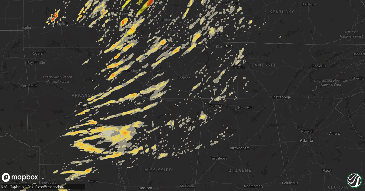
Hail Map on May 25, 2011
Get this storm
May 25 map
$229
one time, instant access
Download today. No call, no setup
Keep the $229
Bought the map and want the full workflow? Apply the entire $229 to a subscription within 7 days. None of it is wasted.
Every map, not just this one
This buys you this map. Subscription and you get every map we run, in the markets you choose from a few cities to whole states to nationwide. Plus real-time alerts the moment a storm fires.
Contact data
Name, contact info, occupancy, even credit band for addresses in the footprint. You go from where it hit to who to call.
Become the source they trust
Unlimited branding weather history reports on demand. You already have the documented answer ready for the property owner, and you are the one who showed up with it.
Property data and RoofTrace estimates
Pull up any address you have got, its value and the exact code rules for that jurisdiction, straight from One Click Code. Then RoofTrace estimates the squares, pitch, and roof value, priced the way you price.
States Impacted by Hail Map on May 25, 2011
Storm reports
South Carolina
| Date | Description |
|---|---|
| 05/25/20112:50 AM CDT | Trees and power lines down near cleveland...tennessee. |
Ohio
| Date | Description |
|---|---|
| 05/25/20116:55 PM CDT | A local report indicates 1.00 inch wind near CASTINE |
| 05/25/20116:52 PM CDT | Nickel to quarter size hail. |
| 05/25/20116:48 PM CDT | A local report indicates 1.00 inch wind near STREETSBORO |
| 05/25/20116:47 PM CDT | A local report indicates 1.75 inch wind near CEDARVILLE |
| 05/25/20116:45 PM CDT | One tree and numerous branches down. The tree fell onto a porch and destroyed the porch. |
| 05/25/20116:37 PM CDT | A local report indicates 1.00 inch wind near RICHFIELD |
| 05/25/20116:36 PM CDT | Time estimated from radar. |
| 05/25/20116:35 PM CDT | Multiple trees down on power lines/transformer on fire |
| 05/25/20116:31 PM CDT | A local report indicates 1.50 inch wind near BEAVERCREEK |
| 05/25/20116:30 PM CDT | Golf ball to baseball size hail. Extensive damage to cars and other flat surfaces exposed to the hail. Tree limbs 4-5 inches in diameter broken off. Rainfall amount 0.9 |
| 05/25/20116:29 PM CDT | A local report indicates 1.75 inch wind near 4 N SPRING VALLEY |
| 05/25/20116:28 PM CDT | A local report indicates 1.00 inch wind near BEAVERCREEK |
| 05/25/20116:28 PM CDT | Also limbs down with minor structural damage |
| 05/25/20116:28 PM CDT | A local report indicates 2.00 inch wind near XENIA |
| 05/25/20116:21 PM CDT | Time estimated from radar. |
| 05/25/20116:20 PM CDT | A local report indicates 2.00 inch wind near N BELLBROOK |
| 05/25/20116:20 PM CDT | Hail increased from 1 to 2 inches in diameter between 720 and 730 pm. |
| 05/25/20116:19 PM CDT | A local report indicates 1.00 inch wind near KETTERING |
| 05/25/20116:17 PM CDT | Nr intersection sr48/i675 |
| 05/25/20116:17 PM CDT | A local report indicates 1.75 inch wind near 1 WNW BELLBROOK |
| 05/25/20116:15 PM CDT | Covering the ground |
| 05/25/20116:15 PM CDT | A local report indicates 2.00 inch wind near BELLBROOK |
| 05/25/20116:14 PM CDT | A local report indicates 1.75 inch wind near CENTERVILLE |
| 05/25/20116:11 PM CDT | A local report indicates 3.00 inch wind near 5 ESE MIAMISBURG |
| 05/25/20116:10 PM CDT | Ef0 tornado confirmed in centerville. Trees downed and snapped on the north end of the property of miami valley hospital south. |
| 05/25/20116:06 PM CDT | Hail increased from golf ball to tennis ball size. |
| 05/25/20116:04 PM CDT | Quarter size hail and 70 mph wind gusts in miami township south of dayton mall. |
| 05/25/20116:00 PM CDT | A local report indicates 1.00 inch wind near NORWALK |
| 05/25/20116:00 PM CDT | Nr intersection i75 and i675 |
| 05/25/20115:57 PM CDT | A local report indicates 1.00 inch wind near NORTH OLMSTED |
| 05/25/20115:52 PM CDT | Also reported winds est 50 mph |
| 05/25/20115:51 PM CDT | A local report indicates 1.75 inch wind near 5 NNW MIDDLETOWN |
| 05/25/20115:49 PM CDT | A local report indicates 1.25 inch wind near 6 NW MIDDLETOWN |
| 05/25/20115:35 PM CDT | A local report indicates 1.00 inch wind near OXFORD |
| 05/25/20115:32 PM CDT | Also reported winds est 50 mph. Corrected time. |
| 05/25/20115:30 PM CDT | A local report indicates 1.00 inch wind near VERMILION |
| 05/25/20115:25 PM CDT | A local report indicates 1.75 inch wind near BLOOMVILLE |
| 05/25/20115:14 PM CDT | Tornado observed by fire dept personnel briefly touching down in field. No damage observed |
| 05/25/20115:14 PM CDT | Trees/power lines down |
| 05/25/20115:10 PM CDT | Golf ball size hail. |
| 05/25/20115:10 PM CDT | A possible tornado. A metal building totally destroyed. |
| 05/25/20115:06 PM CDT | A local report indicates 1.75 inch wind near 5 S SANDUSKY |
| 05/25/20115:06 PM CDT | A local report indicates 1.50 inch wind near 3 N MILAN |
| 05/25/20115:05 PM CDT | A local report indicates 1.00 inch wind near 3 S BELLEVUE |
| 05/25/20115:05 PM CDT | A local report indicates 1.00 inch wind near S FOSTORIA |
| 05/25/20115:00 PM CDT | A local report indicates 1.75 inch wind near 3 NE REPUBLIC |
| 05/25/20114:58 PM CDT | A local report indicates 1.00 inch wind near BLOOMVILLE |
| 05/25/20114:53 PM CDT | A local report indicates 2.75 inch wind near BELLEVUE |
| 05/25/20114:48 PM CDT | A local report indicates 2.50 inch wind near CLYDE |
| 05/25/20114:45 PM CDT | Power lines down across the ageather rd... East of kemp road and reservoir on the west side of lima |
| 05/25/20114:38 PM CDT | A local report indicates 1.75 inch wind near GREEN SPRINGS |
| 05/25/20114:17 PM CDT | A local report indicates 1.75 inch wind near 1 SW FOSTORIA |
| 05/25/20114:17 PM CDT | A local report indicates 1.75 inch wind near FOSTORIA |
| 05/25/20114:15 PM CDT | Estimated 65 mph winds blew down a five inch diameter tree onto a house. |
| 05/25/20114:15 PM CDT | A local report indicates 60 MPH wind near FOSTORIA |
| 05/25/20113:55 PM CDT | A local report indicates 1.75 inch wind near 4 SW FINDLAY |
| 05/25/20113:52 PM CDT | Broke car windows. |
| 05/25/20113:51 PM CDT | Measured 58 mph winds and ping pong size hail |
| 05/25/20113:49 PM CDT | A local report indicates 2.00 inch wind near FINDLAY |
| 05/25/20113:48 PM CDT | A local report indicates 1.75 inch wind near FINDLAY |
| 05/25/20113:45 PM CDT | Tree down. 36 inch diameter |
| 05/25/20113:43 PM CDT | A local report indicates 1.00 inch wind near FINDLAY |
| 05/25/20113:40 PM CDT | Tractor trailor blown over by e75mph winds exit 145 i75s |
| 05/25/20113:26 PM CDT | 2 trees down |
| 05/25/20113:10 PM CDT | 1 inch hail |
| 05/25/20112:26 PM CDT | Ef-0 damage to power polls along kear road. Damage path was two tenths of a mile long and 40 yards wide. Witnesses stated that the tornado was on the ground for just a |
| 05/25/20111:53 PM CDT | A local report indicates 1.00 inch wind near 2 SW ANTWERP |
| 05/25/20112:00 AM CDT | One tree down. |
| 05/25/20111:40 AM CDT | Large limb down. |
| 05/25/20111:13 AM CDT | On hamilton road |
| 05/25/20111:07 AM CDT | A local report indicates 68 MPH wind near DELAWARE |
| 05/25/20111:07 AM CDT | A local report indicates 65 MPH wind near RADNOR |
| 05/25/20111:05 AM CDT | Some large branches down. |
| 05/25/20111:05 AM CDT | A local report indicates 60 MPH wind near 2 S WHITEHALL |
| 05/25/201112:52 AM CDT | Damage to barns and a roof removed from a garage. |
| 05/25/201112:50 AM CDT | Barn blown down on state route 568. |
| 05/25/201112:50 AM CDT | Tree and powerlines down. |
| 05/25/201112:43 AM CDT | Five minutes with sustained winds 50 mph. Gusts estimated at 65 mph. |
| 05/25/201112:29 AM CDT | A local report indicates 60 MPH wind near 2 N LONDON |
| 05/25/201112:26 AM CDT | Two barns suffered roof damage... And a large tree was uprooted. The debris from one barn was strewn to the west and the other to the east. The uprooted tree was orient |
| 05/25/201112:25 AM CDT | 2 pines trees snapped off along with numerous limbs and branches broken at 4025 st. Rte 323. |
| 05/25/201112:25 AM CDT | Ef0 tornado 3 miles west of bloomingburg...with barn damage on lewis road. |
| 05/25/201112:24 AM CDT | Barn destroyed on lewis road. Time estimated. |
| 05/25/201112:15 AM CDT | Large trees down on gregg road. Time is estimated. |
| 05/25/201112:10 AM CDT | Multiple telephone poles snapped...trees downed...and a roof blown off a barn near ohio 72 and burr road. |
| 05/25/201112:01 AM CDT | Measured at nws wilmington |
| 05/24/201111:57 PM CDT | A barn was damaged with pieces blown into nearby fields. |
| 05/24/201111:55 PM CDT | A barn was damaged on gurneyville road northwest of wilmington. Part of the roof was blown off. Numerous trees downed. |
| 05/24/201111:54 PM CDT | Dime size hail. |
| 05/24/201111:53 PM CDT | Trees and power poles downed on state route 380. |
| 05/24/201111:45 PM CDT | Corrected time. |
| 05/24/201111:45 PM CDT | Tree limbs down. Corrected time. |
| 05/24/201111:40 PM CDT | Large branches snapped from trees along interstate 75 just south of the kyles station road overpass. |
| 05/24/201111:37 PM CDT | A local report indicates 61 MPH wind near KVES VERSAILLES APT |
| 05/24/201111:34 PM CDT | Multiple trees downed along glendale drive. |
| 05/24/201111:32 PM CDT | Peak gust at lunken airport asos |
| 05/24/201111:30 PM CDT | Entire roof lifted from single family home and carried approximately 200 yards. Automobile flipped over with another moved by winds. A separate home suffered lifting of |
| 05/24/201111:27 PM CDT | Two very large trees 2-3 feet in diameter were snapped off. |
| 05/24/201111:25 PM CDT | Numerous tree branches snapped...along with siding and minor roof damage to several homes in the greenbrier subdivision. |
| 05/24/201111:22 PM CDT | 2 homes heavily damaged. 5 homes moderately damaged. 1 overturned vehicle. |
| 05/24/201111:21 PM CDT | A local report indicates 1.75 inch wind near WARREN |
| 05/24/201111:20 PM CDT | A number of structures sustained roof and chimney damage... And a carport collapsed. Large trees as big as 5 feet in diameter were snapped and uprooted. 20 cars were da |
| 05/24/201111:20 PM CDT | A local report indicates 1.25 inch wind near WARREN |
| 05/24/201111:11 PM CDT | Trees down. |
| 05/24/201111:10 PM CDT | Trees twisted and powers knocked down. |
| 05/24/201110:58 PM CDT | A local report indicates 1.75 inch wind near 3 S RAVENNA |
| 05/24/201110:45 PM CDT | A local report indicates 1.00 inch wind near FAIRFAX |
| 05/24/201110:45 PM CDT | Tree limbs down |
| 05/24/201110:29 PM CDT | Trees and power lines down in city...blocking walnut and harrison streets. |
| 05/24/201110:15 PM CDT | Several large trees down |
| 05/24/201110:09 PM CDT | Trees were also reported down county wide. |
| 05/24/201110:09 PM CDT | Measured brief 60 mph gust in west jefferson |
| 05/24/20119:44 PM CDT | Trees down. Corrected time. |
| 05/24/20119:23 PM CDT | A local report indicates 1.00 inch wind near DELAWARE |
| 05/24/20119:19 PM CDT | Tree down on mason rd. |
| 05/24/20119:17 PM CDT | Trees down along miami-shelby rd. Corrected time. |
| 05/24/20119:15 PM CDT | A local report indicates 1.00 inch wind near OSTRANDER |
| 05/24/20119:12 PM CDT | A local report indicates 1.75 inch wind near 8 SE MARYSVILLE |
| 05/24/20119:07 PM CDT | Quarter size hail. |
| 05/24/20119:05 PM CDT | A local report indicates 61 MPH wind near PLAIN CITY |
| 05/24/20119:00 PM CDT | A local report indicates 59 MPH wind near JACKSON CENTER |
| 05/24/20118:57 PM CDT | A local report indicates 1.00 inch wind near 1 E COVINGTON |
| 05/24/20118:57 PM CDT | A local report indicates 1.00 inch wind near MARYSVILLE |
| 05/24/20118:47 PM CDT | Ping pong ball size hail. |
| 05/24/20118:36 PM CDT | Also 45-50 mph winds |
| 05/24/20118:35 PM CDT | A local report indicates 1.00 inch wind near 1 N GREENVILLE |
| 05/24/20118:34 PM CDT | Also half inch hail |
| 05/24/20118:30 PM CDT | A local report indicates 1.75 inch wind near GREENVILLE |
| 05/24/20118:19 PM CDT | A local report indicates 1.25 inch wind near 2 E NEW MADISON |
| 05/24/20117:55 PM CDT | Tree down on 3600 block of lefevre rd. |
| 05/24/20117:47 PM CDT | A local report indicates 1.00 inch wind near VANDALIA |
| 05/24/20117:47 PM CDT | A local report indicates 1.00 inch wind near CANTON |
| 05/24/20117:45 PM CDT | Large limb down. |
| 05/24/20117:41 PM CDT | Largest hailstone the spotter observed. |
| 05/24/20117:41 PM CDT | A local report indicates 1.75 inch wind near CLAYTON |
| 05/24/20117:39 PM CDT | A local report indicates 1.75 inch wind near ENGLEWOOD |
| 05/24/20117:34 PM CDT | A local report indicates 1.75 inch wind near BROOKVILLE |
| 05/24/20117:24 PM CDT | A local report indicates 1.00 inch wind near 1 NW NEW LEBANON |
| 05/24/20117:23 PM CDT | A local report indicates 1.00 inch wind near WEST ALEXANDRIA |
| 05/24/20117:22 PM CDT | A local report indicates 1.75 inch wind near HIRAM |
| 05/24/20117:20 PM CDT | Hail rapidly increased from pea size to golf ball size. |
| 05/24/20117:20 PM CDT | Tree on a house. |
| 05/24/20117:16 PM CDT | Several trees down |
| 05/24/20117:15 PM CDT | A local report indicates 1.00 inch wind near 5 SSE EATON |
| 05/24/20117:00 PM CDT | Roofs reported off industrial buildings. Also gutters torn off buildings. |
Mississippi
| Date | Description |
|---|---|
| 05/25/20111:02 AM CDT | Large trees downed and uprooted along cuts road in ackerman. |
| 05/24/201110:37 PM CDT | Roof blown off mobile home |
| 05/24/201110:35 PM CDT | A few trees were down on cr 316. |
| 05/24/201110:30 PM CDT | A few trees down. |
| 05/24/201110:20 PM CDT | A local report indicates 1.25 inch wind near W TUPELO |
| 05/24/201110:15 PM CDT | Trees were downed across eastern grenada county...including one across pleasant grove rd. |
| 05/24/201110:07 PM CDT | A few trees down. |
| 05/24/201110:06 PM CDT | A local report indicates 65 MPH wind near FALKNER |
| 05/24/201110:00 PM CDT | A few trees and power lines down. |
| 05/24/201110:00 PM CDT | Trees downed in the holcomb and leflore areas |
| 05/24/20119:58 PM CDT | Powerlines down across parts of southern and central pontotoc county |
| 05/24/20119:55 PM CDT | Trees and power lines down across much of the county. |
| 05/24/20119:53 PM CDT | Power outages were reported. |
| 05/24/20119:53 PM CDT | Several trees down along cr 518. |
| 05/24/20119:50 PM CDT | A few trees and power poles down. |
| 05/24/20119:36 PM CDT | A couple power lines were blown down. |
| 05/24/20119:30 PM CDT | Trees down on county road 149 and anchorage road. |
| 05/24/20119:25 PM CDT | Numerous trees and power lines downed in the city of grenada and north of the city in grenada county. One tree fell on a moving vehicle. |
| 05/24/20119:20 PM CDT | Numerous trees downed across washington county in a corridor from south of greenville to the tribbett area. |
| 05/24/20119:10 PM CDT | A window at a restaurant was blown out by strong winds |
| 05/24/20119:10 PM CDT | Numerous trees and power lines downed between greenville and wayside. Also windshields shattered by large hail in the area...hail size unknown. |
| 05/24/20119:00 PM CDT | Tree was blown down on 1st street. |
| 05/24/20118:45 PM CDT | A local report indicates 1.00 inch wind near 5 W COURTLAND |
| 05/24/20118:40 PM CDT | A local report indicates a tornado near CROWDER |
| 05/24/20118:15 PM CDT | Multiple trees downed in rosedale...including one that fell on a house...and one blocking a road. |
| 05/24/20118:05 PM CDT | A local report indicates 1.00 inch wind near 2 S HERNANDO |
| 05/24/20118:05 PM CDT | A local report indicates 1.00 inch wind near 6 S HERNANDO |
| 05/24/20118:00 PM CDT | A local report indicates 1.75 inch wind near 2 NE GUNNISON |
| 05/24/20117:57 PM CDT | A local report indicates 1.00 inch wind near GUNNISON |
| 05/24/20117:45 PM CDT | A local report indicates a tornado near 6 SE TUNICA |
| 05/24/20117:34 PM CDT | A local report indicates a tornado near 6 SE TUNICA |
| 05/24/20117:20 PM CDT | A local report indicates a tornado near 1 W AUSTIN |
Kansas
| Date | Description |
|---|---|
| 05/25/201111:38 AM CDT | Tornado at exit 224 on i-35 overland park |
| 05/25/201111:22 AM CDT | Law enforcement reports tornado on ground 135 and metcalf |
| 05/25/201111:18 AM CDT | Tornado on ground 137 and metcalf.this report was not confirmed. |
| 05/25/201111:15 AM CDT | Delayed report. Ef-0 confirmed. Just north of 159th between nall and roe. Trees were uprooted. Surveyed by law enforcement. |
| 05/25/201111:10 AM CDT | Minor roof damage to blue valley middle school |
| 05/25/201110:45 AM CDT | Law enforcement reports tornado on the ground near louisburg kansas. |
Alabama
| Date | Description |
|---|---|
| 05/25/201112:52 AM CDT | Public report of quarter size hail. |
| 05/25/201112:44 AM CDT | Several large trees down on rimevillage dr behind the target off of university drive. Time of damage estimated based on radar. |
| 05/25/201112:17 AM CDT | A tornado briefly touched down near meridianville and skipped northeast snapping and uprooting trees along its path between hazel green and new market. Several residenc |
| 05/25/201112:15 AM CDT | Roofs damaged and trees down in the lagrange mountain area. |
| 05/25/201112:15 AM CDT | Numerous trees down in decatur. |
| 05/25/201112:00 AM CDT | Several trees were snapped/uprooted along a southwest to northeast path beginning along thach rd...crossing hwy 251 and ending up near bethel rd and hwy 53...just over |
| 05/24/201111:49 PM CDT | A tornado crossed hwy 99/buck island rd near lydia corey rd uprooting several large trees with one falling on the side of a house. Across the street...a large barn was |
| 05/24/201111:47 PM CDT | Widespread wind damage and power outages. Significant damage to a mobile home. |
| 05/24/201111:43 PM CDT | Trees down and power outages. |
| 05/24/201111:43 PM CDT | Trees down and widespread power outages. Tree on a mobile home at the intersection of 798 and cr 235. |
| 05/24/201111:42 PM CDT | Unknown damage reported in anderson. Spotter reported hearing a roar. |
| 05/24/201111:40 PM CDT | A tornado touched down just north of the davis/snake road intersection and tracked nearly 2 miles northeast before lifting near fielding rd/cr 15 and stanford rd. Sever |
| 05/24/201111:30 PM CDT | Roof torn off of hr block building on the corner of avalon ave and woodward. |
| 05/24/201111:30 PM CDT | Top of large hardwood tree broken at coves court residence. Took down power line to house. All power out in neighborhood. |
| 05/24/201111:30 PM CDT | A short-lived tornado developed along a squall line of severe thunderstorms. Based on ground surveys...the tornado initially touched down just west of county road cr 92 |
| 05/24/201111:24 PM CDT | Widespread wind damage is being reported all across colbert county. Large trees have been reported down on cars and houses and are blocking roadways. Widespread power o |
| 05/24/201111:17 PM CDT | Measured gust to 67 mph. |
| 05/24/201111:14 PM CDT | Widespread power outages. Numerous trees and power lines down throughout the city. 30 to 50 power poles were knocked down with up to 20000 customers without power. |
| 05/24/201110:55 PM CDT | Trees and power lines down on cr 128. |
| 05/24/201110:43 PM CDT | Large swath of trees and power lines down throughout the city of cherokee. Entire city without power. Also reports of damage to a railroad crossing arm. |
| 05/24/201110:42 PM CDT | Trees down blocking highway 72 eastbound. Debris in the roadway. |
| 05/24/201110:41 PM CDT | Tree down on a house on guthrie street. |
Illinois
| Date | Description |
|---|---|
| 05/25/20116:59 PM CDT | State police sited tornado on west side of champaign |
| 05/25/20116:58 PM CDT | Tree damage from tornado brief touchdown. From county emergency management storm summary followup. |
| 05/25/20116:55 PM CDT | A local report indicates 1.50 inch wind near CAMARGO |
| 05/25/20116:53 PM CDT | Local fire department spotters sighted tornado on ground moving east near interstate 72...from champaign emergency management |
| 05/25/20116:53 PM CDT | A local report indicates 60 MPH wind near 3 W HERRIN |
| 05/25/20116:50 PM CDT | Public report of tornado on ground...from champaign emergency management |
| 05/25/20116:49 PM CDT | A local report indicates 1.75 inch wind near SEYMOUR |
| 05/25/20116:47 PM CDT | Wind gusts estimated 50 to 60 mph. Report of trees and power lines down northwest of town. |
| 05/25/20116:46 PM CDT | Limbs down and property damage reported. Portable garage buildings rolled over. |
| 05/25/20116:45 PM CDT | Update...half dozen trees down with widespread power outages reported throughout the community due to blown transformers. |
| 05/25/20116:45 PM CDT | A storm damage survey revealed an ef1 tornado on the ground for 7.5 miles from 1.5 miles southeast of pulaski to 6.5 miles northwest of grand chain. See public informat |
| 05/25/20116:40 PM CDT | Storm damage survey revealed an ef1 tornado that moved from the southwest side of mound city to 5 miles northeast of mound city. Details can be found in public informat |
| 05/25/20116:38 PM CDT | A local report indicates 80 MPH wind near MULKEYTOWN |
| 05/25/20116:34 PM CDT | Broken limbs with wind gusts estimated 50 mph. |
| 05/25/20116:30 PM CDT | Some shingles blown off a house roof...doors blown off an outbuilding...and 10 inch diameter tree limbs down. Time estimated. |
| 05/25/20116:30 PM CDT | Some small to medium tree limbs down...and a few power lines down. |
| 05/25/20116:25 PM CDT | A local report indicates 1.00 inch wind near PESOTUM |
| 05/25/20116:22 PM CDT | Tornado moving northeast |
| 05/25/20116:18 PM CDT | Tree blown down along us-150. Time estimated. |
| 05/25/20116:15 PM CDT | Delayed report. Power poles down and part of a machine shed blown apart. Time estimated. |
| 05/25/20116:15 PM CDT | Tornado moving northeast |
| 05/25/20116:13 PM CDT | Semi blown over at i-74 mile marker 145 |
| 05/25/20116:12 PM CDT | A local report indicates 1.00 inch wind near 4 S MC NABB |
| 05/25/20116:11 PM CDT | Tree and power poles snapped off |
| 05/25/20116:09 PM CDT | Semi blown over at i-74 mile marker 145. From county emergency management storm summary followup. |
| 05/25/20116:09 PM CDT | A local report indicates 60 MPH wind near RIO |
| 05/25/20116:08 PM CDT | Trees down along route 3 between rockwood and chester. |
| 05/25/20116:08 PM CDT | Update report from em...event occurred between eddyville and glendale illinois. Large trees down. Power outages along state hwy 147. Partial roof removed on home and ba |
| 05/25/20116:07 PM CDT | A local report indicates 1.00 inch wind near RIO |
| 05/25/20116:06 PM CDT | Grain bin destroyed. From county emergency management storm summary followup. |
| 05/25/20116:05 PM CDT | 3 inch diameter tree branch blown down |
| 05/25/20116:02 PM CDT | 10 inch tree limb snapped off live maple tree approximately 8 feet above ground |
| 05/25/20116:00 PM CDT | Numerous branches and limbs over streets...some as large as 6 to 8 inches in diameter. |
| 05/25/20115:58 PM CDT | Utility poles blown over on the east side of chester. |
| 05/25/20115:57 PM CDT | A local report indicates 1.00 inch wind near CENTRALIA |
| 05/25/20115:57 PM CDT | Trees blown down on the kickapoo edwards blacktop...south of route 150 by about one 10th of a mile. From peoria county emergency management damage summary sheet. |
| 05/25/20115:55 PM CDT | 10 inch tree blown down blocking road...14305 n. Edgewater drive. From damage summary sheet from peoria county emergency management. |
| 05/25/20115:55 PM CDT | Tree blown down blocking road...3 miles south of edwards...near corner of route 8 and heinz lane. From damage summary sheet from peoria county emergency management offi |
| 05/25/20115:52 PM CDT | Numerous trees and power lines blown down at numerous locations across the city of peoria. Many traffic lights out. Time of occurance was between 552 pm and 605 pm. Fro |
| 05/25/20115:52 PM CDT | Wind gust estimated near lamp road |
| 05/25/20115:52 PM CDT | Tornado moving northeast |
| 05/25/20115:51 PM CDT | Recorded at peoria airport |
| 05/25/20115:50 PM CDT | A local report indicates 61 MPH wind near 1 N ABINGDON |
| 05/25/20115:50 PM CDT | Power lines down |
| 05/25/20115:50 PM CDT | Trees and power lines down |
| 05/25/20115:49 PM CDT | A local report indicates 60 MPH wind near 3 SW ALEXIS |
| 05/25/20115:49 PM CDT | Numerous branches and limbs over streets...some as large as 6 to 8 inches in diameter. |
| 05/25/20115:46 PM CDT | Large limbs blown down and a fence blown down. West of bartonville at the corner of oak grove road and smithville road...4 miles south of trivoli. From damage summary s |
| 05/25/20115:42 PM CDT | Numerous reports of trees and tree limbs down. Shed blown off foundation at 309 part street. 4 foot tree fell on house. From damage summary sheet from peoria county eme |
| 05/25/20115:42 PM CDT | Numerous large trees down...power out. Minor road flooding as well. Time is approximate. |
| 05/25/20115:40 PM CDT | 6-7 inch diameter tree snapped of at the base causing some roof damage |
| 05/25/20115:30 PM CDT | Powerline blown down. |
| 05/25/20115:28 PM CDT | Tree topped at wfo lincoln |
| 05/25/20115:28 PM CDT | A local report indicates 60 MPH wind near CHESTNUT |
| 05/25/20115:25 PM CDT | Large tree limb broken off...one foot in diameter...in lincoln on 5th street. From two nws employees. |
| 05/25/20115:25 PM CDT | Major structural damage to popcorn factory |
| 05/25/20115:25 PM CDT | Trees down in town |
| 05/25/20115:25 PM CDT | Hail increased from nickel size to golf ball size. |
| 05/25/20115:21 PM CDT | 2-3 inch limbs down |
| 05/25/20115:20 PM CDT | Tree fell on a house. |
| 05/25/20115:19 PM CDT | A local report indicates 1.75 inch wind near PARIS |
| 05/25/20115:12 PM CDT | A local report indicates 1.00 inch wind near MASCOUTAH |
| 05/25/20115:08 PM CDT | A local report indicates 60 MPH wind near WOOD RIVER |
| 05/25/20115:07 PM CDT | A local report indicates 1.25 inch wind near MECHANICSBURG |
| 05/25/20115:05 PM CDT | A local report indicates 60 MPH wind near FREEBURG |
| 05/25/20115:05 PM CDT | A local report indicates 1.50 inch wind near FREEBURG |
| 05/25/20115:03 PM CDT | Also a wind gust to 47 mph. |
| 05/25/20115:00 PM CDT | Trees down and power out. Time estimated. |
| 05/25/20114:58 PM CDT | Between hwy 3 and 111 |
| 05/25/20114:56 PM CDT | A local report indicates 1.75 inch wind near GRANITE CITY |
| 05/25/20114:50 PM CDT | Relayed from a public report |
| 05/25/20114:45 PM CDT | Tree fell on house on kenny street in town. |
| 05/25/20114:45 PM CDT | Trees and powerlines blown down |
| 05/25/20114:42 PM CDT | At the corner of lynch and vine avenues. |
| 05/25/20114:38 PM CDT | A local report indicates 1.00 inch wind near GRANITE CITY |
| 05/25/20114:35 PM CDT | Trees and power lines down reported by cass county sheriff office |
| 05/25/20114:18 PM CDT | Storage shed destroyed. |
| 05/25/20114:15 PM CDT | 1 inch hail on route 4. |
| 05/25/20114:10 PM CDT | A local report indicates 1.00 inch wind near 1 W WINCHESTER |
| 05/25/20114:10 PM CDT | Tree limbs...trees...power poles and power lines blown down. |
| 05/25/20114:03 PM CDT | A local report indicates 1.50 inch wind near 1 S CARLINVILLE |
| 05/25/20113:55 PM CDT | Near intersection of hwy 138 and 159 |
| 05/25/20113:45 PM CDT | 3-inch limbs were down with pea-size hail. |
| 05/25/20113:05 PM CDT | A local report indicates 1.00 inch wind near TAYLOR SPRINGS |
| 05/25/20111:47 PM CDT | A local report indicates 1.00 inch wind near 1 N STEWARDSON |
| 05/25/20111:46 PM CDT | A local report indicates 1.00 inch wind near 4 NW WINDSOR |
| 05/25/201112:57 PM CDT | A local report indicates 1.75 inch wind near RAMSEY |
| 05/25/20119:15 AM CDT | House damaged. |
| 05/25/20119:04 AM CDT | Tornado began at 7000 s and 12753 e and ended at 2500 s and 16000 e. Tornado was rated ef1 with path length of 6 miles and width of about 50 yards. |
| 05/25/20118:58 AM CDT | Power lines down on the east side of danville. |
| 05/25/20118:57 AM CDT | Trees and powerlines down |
| 05/25/20118:55 AM CDT | A local report indicates 62 MPH wind near HOOPESTON |
| 05/25/20118:40 AM CDT | Trees down and siding off a house |
| 05/25/20118:36 AM CDT | Numerous trees and powerlines down |
| 05/25/20118:29 AM CDT | 2 semis blown over on i-74 between mm 194 and 195. |
| 05/25/20118:20 AM CDT | 7 power poles down |
| 05/25/20118:17 AM CDT | Powerlines down |
| 05/25/20118:15 AM CDT | Powerlines and power poles down |
| 05/25/20118:10 AM CDT | Old flat roof barn blown off. |
| 05/25/20118:10 AM CDT | Semi blown over on i-57. One injury. |
| 05/25/20118:08 AM CDT | Trees down from county em |
| 05/25/20118:00 AM CDT | Tree down on railroad tracks |
| 05/25/20117:45 AM CDT | 2 outbuildings and 1 grain bin destroyed. From macon county emergency management. |
| 05/25/20117:40 AM CDT | Several farm outbuildings destroyed. Time estimated. |
| 05/25/20117:39 AM CDT | 1 outbuilding destroyed. From county emergency management storm summary followup. |
| 05/25/20117:35 AM CDT | 2 farm outbuildings and 2 grain bins destroyed. From county emergency management storm summary followup. |
| 05/24/20118:12 PM CDT | Tree down on house |
| 05/24/20118:10 PM CDT | 12 power poles broken and lines down. Damage scattered in an area paralleling i-70 from clark center to the indiana border. |
| 05/24/20118:00 PM CDT | Numerous trees down along route 1 toward birds...some trees 2 to 3 feet in diamater |
| 05/24/20118:00 PM CDT | Numerous trees down...one tree down on mobile home |
| 05/24/20118:00 PM CDT | Houses demolished...additional structural damage in the area |
| 05/24/20118:00 PM CDT | Trees and power lines down |
| 05/24/20117:57 PM CDT | 14 homes damaged...3 uninhabitable. From county emergency management storm summary followup. |
| 05/24/20117:51 PM CDT | Roof blown off of the gallatin county school. |
| 05/24/20117:51 PM CDT | Microburst with 90 mph peak winds from equality to at least 5 miles east. See public information statement for details. |
| 05/24/20117:47 PM CDT | A local report indicates 60 MPH wind near LAWRENCEVILLE |
| 05/24/20117:46 PM CDT | Trees down. |
| 05/24/20117:43 PM CDT | A local report indicates 1.25 inch wind near BELLMONT |
| 05/24/20117:40 PM CDT | A local report indicates 1.00 inch wind near BELLMONT |
| 05/24/20117:39 PM CDT | Significant tree damage in the jamesburg area. Roads are blocked. |
| 05/24/20117:35 PM CDT | Brief tornado touchdown in field. From county emergency management storm summary followup. |
| 05/24/20117:35 PM CDT | Brief tornado touchdown |
| 05/24/20117:33 PM CDT | Numerous trees down. |
| 05/24/20117:30 PM CDT | Several buildings were damaged on the south side of newton. |
| 05/24/20117:30 PM CDT | Numerous trees down and signs blown over. |
| 05/24/20117:27 PM CDT | 75 mph wind estimated in downbust. Damage was located on southeast side of town. Garage flattened by uprooted tree. Some other uprooted trees and hundreds limbs down. I |
| 05/24/20117:22 PM CDT | Measured with davis weather-view wind equipment. |
| 05/24/20117:22 PM CDT | A local report indicates 60 MPH wind near LAWRENCEVILLE |
| 05/24/20117:20 PM CDT | Numerous trees blown down along route 50 from two miles east of clay city to the richland county line. |
| 05/24/20117:20 PM CDT | Numerous trees blown down in town |
| 05/24/20117:17 PM CDT | A local report indicates 68 MPH wind near OGDEN |
| 05/24/20117:15 PM CDT | Late report...multiple trees down with some homes receiving minor damage. Winds with the storm were estimated 60 to 70 mph. |
| 05/24/20117:14 PM CDT | Several trees down with wind gusts estimated at 70 mph. |
| 05/24/20117:10 PM CDT | Trees and power lines blown down...one tree was blown down on house |
| 05/24/20117:09 PM CDT | Trees down and electical transformers blowing up. |
| 05/24/20117:07 PM CDT | Wind gust reported from champaign airport |
| 05/24/20117:05 PM CDT | 8 and 12 inch diameter branches fell on wood fence. |
| 05/24/20117:01 PM CDT | State trooper reports wind gusts 70 to 80 mph. |
| 05/24/20117:00 PM CDT | Late report...destoryed shed with multiple trees down with some uprooted and snapped. Event occurred in the community of grantsburg illinois. |
| 05/24/20117:00 PM CDT | Late report...destoryed shed with multiple trees down with some uprooted and snapped. |
Pennsylvania
| Date | Description |
|---|---|
| 05/25/201112:30 AM CDT | Large branches and power lines down |
| 05/25/201112:00 AM CDT | Several trees down across the county. |
| 05/24/201111:50 PM CDT | Trees down across hyner mtn rd. |
| 05/24/201110:48 PM CDT | Trees down across road on rt 46 near emporium. |
| 05/24/201110:40 PM CDT | Numerous trees and wires down on rt 872 near austin. |
| 05/24/201110:00 PM CDT | A few hundred trees uprooted and snapped along kansas branch rd. A few houses along the same road had shingles blown off the roof. |
| 05/24/20119:56 PM CDT | Trees and wires down countywide. |
| 05/24/20119:27 PM CDT | Large trees blown down. |
| 05/24/20119:22 PM CDT | Several trees down |
| 05/24/20119:17 PM CDT | Numerous trees down |
| 05/24/20119:10 PM CDT | Large trees blown down. |
| 05/24/20119:03 PM CDT | 1 tree blown down. |
| 05/24/20118:54 PM CDT | Large tree blown down. |
| 05/24/20118:49 PM CDT | 1 large tree blown down on ray milton rd |
| 05/24/20118:47 PM CDT | Numerous trees down |
| 05/24/20118:39 PM CDT | Numerous trees blown down countywide. |
| 05/24/20118:38 PM CDT | Large trees blown down on east brook-harlansburg rd... Scott twp |
| 05/24/20118:35 PM CDT | Trees down |
| 05/24/20118:35 PM CDT | Large trees blown down on lakewood-neshannock rd... Hickory twp |
| 05/24/20118:35 PM CDT | Large trees blown down on graceland rd... Neshannock twp |
| 05/24/20118:05 PM CDT | Numerous trees blown down. |
| 05/24/20118:05 PM CDT | Numerous trees blown down. |
| 05/24/20117:57 PM CDT | Numerous trees down several locations. |
Texas
| Date | Description |
|---|---|
| 05/25/20113:29 AM CDT | Nickel to quarter size hail for 15 minutes |
| 05/25/20113:00 AM CDT | Power lines downed. Transformer on fire. |
| 05/25/20112:50 AM CDT | Strong winds also reported |
| 05/25/20112:36 AM CDT | A local report indicates 60 MPH wind near 4 NW INEZ |
| 05/25/20112:18 AM CDT | Estimated at the jail. |
| 05/25/20111:50 AM CDT | Windows broken on cars...houses and apartment complex due to the hail |
| 05/25/20111:50 AM CDT | Wind gust measured with a portable weather station |
| 05/25/20111:43 AM CDT | Up to ping pong size hail in pasadena area |
| 05/25/20111:18 AM CDT | A local report indicates 1.75 inch wind near WINNIE |
| 05/25/20111:17 AM CDT | Roof ripped off a trailer home |
| 05/25/20111:02 AM CDT | Hail pockmarks on car |
| 05/25/201112:55 AM CDT | A local report indicates 2.75 inch wind near SHERIDAN |
| 05/25/201112:28 AM CDT | A local report indicates 1.75 inch wind near 1 N SCHULENBURG |
| 05/25/201112:24 AM CDT | Trees blown down in westlake. |
| 05/25/201112:15 AM CDT | Trees down on fm 1008. Some blocking streets. |
| 05/25/201112:05 AM CDT | A local report indicates 1.00 inch wind near SCHULENBURG |
| 05/25/201112:03 AM CDT | A local report indicates 1.00 inch wind near WEIMAR |
| 05/25/201112:00 AM CDT | A local report indicates 1.00 inch wind near WEIMAR |
| 05/24/201111:50 PM CDT | Golf ball size hail in altair at the intersection of highways 71 and 98. |
| 05/24/201111:50 PM CDT | A local report indicates 1.75 inch wind near 9 S COLUMBUS |
| 05/24/201111:49 PM CDT | Public report. No confirmation of damage. |
| 05/24/201111:40 PM CDT | Baseball to grapefruit sized hail all around cleveland |
| 05/24/201111:40 PM CDT | A local report indicates 1.00 inch wind near 7 N SCHULENBURG |
| 05/24/201111:32 PM CDT | Golfball to tea cup sized hail at intersection of fm highway 1725 and tony tap road. |
| 05/24/201111:30 PM CDT | A local report indicates 1.75 inch wind near 2 N CLEVELAND |
| 05/24/201111:30 PM CDT | A local report indicates 1.00 inch wind near COLUMBUS |
| 05/24/201111:00 PM CDT | Tennis ball to tea cup size hail in southern san jacinto county |
| 05/24/201110:54 PM CDT | Golfball sized hail at state highway 150 and fm highway 1097 |
| 05/24/201110:50 PM CDT | Pea up to quarter size hail |
| 05/24/201110:40 PM CDT | Golfball sized hail at intersection of state highway 30 and fm highway 1791. |
| 05/24/201110:30 PM CDT | A local report indicates 1.00 inch wind near 2 S HUNTSVILLE |
| 05/24/201110:24 PM CDT | A local report indicates 1.00 inch wind near LA GRANGE |
| 05/24/201110:23 PM CDT | A local report indicates 1.00 inch wind near LA GRANGE |
| 05/24/20119:40 PM CDT | A local report indicates 1.00 inch wind near 4 SSW GIDDINGS |
| 05/24/20119:15 PM CDT | Quarter size hail...tree damage...and privacy fence damage near lake thunderbird. |
| 05/24/20119:11 PM CDT | A local report indicates 1.00 inch wind near SOMERVILLE |
| 05/24/20119:10 PM CDT | A local report indicates 1.75 inch wind near 5 ENE LA GRANGE |
| 05/24/20118:30 PM CDT | A local report indicates 1.00 inch wind near 8 E SMITHVILLE |
| 05/24/20118:28 PM CDT | A local report indicates 1.00 inch wind near 8 E SMITHVILLE |
| 05/24/20118:23 PM CDT | A local report indicates 1.25 inch wind near 10 NW LA GRANGE |
| 05/24/20118:20 PM CDT | A local report indicates 1.75 inch wind near GIDDINGS |
| 05/24/20118:18 PM CDT | A local report indicates 1.00 inch wind near PAIGE |
| 05/24/20117:24 PM CDT | Golf ball size hail at the intersection of hwy 21 and fm 3121 |
| 05/24/20117:02 PM CDT | At geneva |
New York
| Date | Description |
|---|---|
| 05/24/201111:45 PM CDT | Telephone pole snapped. |
| 05/24/201110:30 PM CDT | Barn knocked down |
| 05/24/201110:28 PM CDT | Trees down. |
| 05/24/20119:00 PM CDT | Tree down across route 62 |
Arkansas
| Date | Description |
|---|---|
| 05/25/20116:51 PM CDT | Multiple homes and business damaged in the southern part of town. Multiple power lines across the county. |
| 05/25/20116:50 PM CDT | Law enforcement reports a brief tornado touchdown near tichnor. Some powerlines are down and deputies are in route to further assess the damage. |
| 05/25/20116:42 PM CDT | Numerous trees...power lines...and power poles are down across the town of gillett. Multiple houses have sustained minor to moderate roof damage. |
| 05/25/20116:42 PM CDT | A local report indicates 1.00 inch wind near GILLETT |
| 05/25/20116:17 PM CDT | A local report indicates 1.75 inch wind near 1 N LUCERNE |
| 05/25/20116:11 PM CDT | A local report indicates 1.75 inch wind near TARRY |
| 05/25/20116:01 PM CDT | A local report indicates 1.00 inch wind near 2 E FORREST CITY |
| 05/25/20115:49 PM CDT | Also falling debris. |
| 05/25/20115:40 PM CDT | Quarter sized hail in the town of harrisburg. |
| 05/25/20115:32 PM CDT | Trees down... Powerlines down |
| 05/25/20115:30 PM CDT | A local report indicates 1.00 inch wind near MARMADUKE |
| 05/25/20115:30 PM CDT | A local report indicates 60 MPH wind near MARMADUKE |
| 05/25/20115:21 PM CDT | A local report indicates 1.00 inch wind near 2 SE FISHER |
| 05/25/20115:17 PM CDT | A local report indicates 75 MPH wind near CORNING |
| 05/25/20115:14 PM CDT | A local report indicates 2.00 inch wind near RISON |
| 05/25/20115:05 PM CDT | A local report indicates 1.00 inch wind near 7 SE SEDGWICK |
| 05/25/20115:00 PM CDT | A local report indicates 1.75 inch wind near WHITE HALL |
| 05/25/20114:59 PM CDT | A local report indicates 1.00 inch wind near WHITE HALL |
| 05/25/20114:46 PM CDT | Power lines down in walnut ridge. |
| 05/25/20114:23 PM CDT | A local report indicates 1.75 inch wind near LYNN |
| 05/25/20114:15 PM CDT | Trees down on powerlines along hwy 14 between southside and oil trough. |
| 05/25/20114:15 PM CDT | An ef1 tornado began 2.9 miles east of oil trough in southeast independence county and lifted 2.2 miles northwest of jacksonport in western jackson county. Several powe |
| 05/25/20114:15 PM CDT | Large wide tornado on the ground heading towards jacksonport. |
| 05/25/20114:15 PM CDT | Two homes were damaged on the corner of hwy 14 and sisk loop 3 miles ese of oil trough. Numerous trees and powerlines are also down in that area. |
| 05/25/20114:15 PM CDT | Structure damage was reported between oil trough and thida. |
| 05/25/20114:14 PM CDT | A local report indicates 1.00 inch wind near LYNN |
| 05/25/20114:14 PM CDT | A local report indicates 2.00 inch wind near NEWARK |
| 05/25/20114:13 PM CDT | Tornado on the ground 3 miles se of oil trough. |
| 05/25/20114:10 PM CDT | A local report indicates 1.75 inch wind near NNE IMBODEN |
| 05/25/20113:59 PM CDT | A local report indicates 1.75 inch wind near RAVENDEN |
| 05/25/20113:57 PM CDT | House along hwy 230 was damaged inside of cave city. Powelines are also down. |
| 05/25/20113:52 PM CDT | A local report indicates 1.75 inch wind near 1 W CAVE CITY |
| 05/25/20113:48 PM CDT | A local report indicates 1.75 inch wind near CAVE CITY |
| 05/25/20113:47 PM CDT | A local report indicates 1.00 inch wind near 2 N LITTLE ROCK AIR FOR |
| 05/25/20113:45 PM CDT | A local report indicates 1.00 inch wind near 3 W BEEBE |
| 05/25/20113:41 PM CDT | A local report indicates 1.50 inch wind near BENTON |
| 05/25/20113:39 PM CDT | A local report indicates 1.75 inch wind near BAUXITE |
| 05/25/20113:37 PM CDT | A local report indicates 1.00 inch wind near BAUXITE |
| 05/25/20113:37 PM CDT | A local report indicates 1.00 inch wind near BRYANT |
| 05/25/20113:35 PM CDT | A local report indicates 1.00 inch wind near 5 W WARD |
| 05/25/20113:30 PM CDT | A local report indicates 1.75 inch wind near BAUXITE |
| 05/25/20113:28 PM CDT | Reported at employees house. |
| 05/25/20113:18 PM CDT | Quarter size hail reported at villages of wellington in west little rock. |
| 05/25/20113:05 PM CDT | A local report indicates 1.00 inch wind near 5 SSE NORFORK |
| 05/25/20112:06 PM CDT | Two powerpoles were snapped just outside of horseshoe bend along hwy 298. Power is currently out to several businesses. |
| 05/24/20119:00 PM CDT | Swath of large hail up to golfball size from lake chicot state park to the us highway 82 mississippi river bridge. |
| 05/24/20118:58 PM CDT | Numerous trees downed along lakehall road at chicot county park. |
| 05/24/20118:58 PM CDT | Couple powerpoles snapped on north lake shore dr along with snapped trees. |
| 05/24/20118:56 PM CDT | Trees down across hwy 159 between jennie and lake village. |
| 05/24/20118:55 PM CDT | A local report indicates 1.50 inch wind near 1 WSW LAKE VILLAGE |
| 05/24/20118:40 PM CDT | Large oak trees uprooted and porch damaged along hwy 160. |
| 05/24/20118:38 PM CDT | A shed was damaged in the portland area...also several trees and power lines were down. |
| 05/24/20118:38 PM CDT | 8 powerpoles snapped along 165. Several trees snapped and uprooted. Tree down on mobile home on cr 53. Damage to outbuidlings. |
| 05/24/20118:37 PM CDT | Tornado moved to 6 ne portland. 6.25 mile length and 0.2 mile max width. 10 power poles snapped...several overturned irrigation pivots...minor damage to several roofs o |
| 05/24/20117:55 PM CDT | A few trees down |
| 05/24/20117:01 PM CDT | Powerlines down. |
California
| Date | Description |
|---|---|
| 05/24/20119:10 PM CDT | A local report indicates 1.00 inch wind near 8 SSW PARADISE |
| 05/24/20119:00 PM CDT | Possible outbuilding/barn tornado damage at 2910 table mountain blvd. |
| 05/24/20119:00 PM CDT | Outbuilding/barn/detached garage/tree damage at table mountain blvd. |
| 05/24/20119:00 PM CDT | Observer spotted tornado approx. 1 mile south. |
| 05/24/20118:40 PM CDT | Trees down on taylor ave. Just south of the town of durham. |
| 05/24/20118:20 PM CDT | Tornado on the ground filmed live by media helicopters near durham. |
| 05/24/20118:08 PM CDT | Tornado on the ground filmed live by media helicopter southeast of ord bend. |
| 05/24/20117:18 PM CDT | Glenn county sheriff reported a tornado just south of hamilton city. |
| 05/24/20117:12 PM CDT | Glenn county sheriff reported a tornado northeast of willows near county road 36 and u street. |
Indiana
| Date | Description |
|---|---|
| 05/25/20116:55 PM CDT | A local report indicates 1.00 inch wind near LEBANON |
| 05/25/20116:54 PM CDT | Southern bedford. |
| 05/25/20116:50 PM CDT | A local report indicates 1.25 inch wind near 4 NNW BEDFORD |
| 05/25/20116:49 PM CDT | Pea to baseball size hail. |
| 05/25/20116:47 PM CDT | A local report indicates 1.00 inch wind near 2 N GREENFIELD |
| 05/25/20116:42 PM CDT | Tree doown on house on sr 135...1 block sout of johnson and marion county line. |
| 05/25/20116:35 PM CDT | Hail fell from 727 to 735 pm. |
| 05/25/20116:30 PM CDT | A local report indicates 1.75 inch wind near E GAS CITY |
| 05/25/20116:28 PM CDT | 1 w of greenwood airport. |
| 05/25/20116:26 PM CDT | A local report indicates 1.00 inch wind near 1 E STINESVILLE |
| 05/25/20116:25 PM CDT | A local report indicates 1.75 inch wind near PARAGON |
| 05/25/20116:25 PM CDT | At southport and franklin. |
| 05/25/20116:24 PM CDT | 7000 e and 6000 s. |
| 05/25/20116:20 PM CDT | A local report indicates 1.75 inch wind near AMO |
| 05/25/20116:20 PM CDT | Getting larger as falling. |
| 05/25/20116:20 PM CDT | 1 w of i-65. |
| 05/25/20116:19 PM CDT | At stop 11 and emerson. |
| 05/25/20116:14 PM CDT | A local report indicates 1.25 inch wind near GREENWOOD |
| 05/25/20116:13 PM CDT | Us 31 and tracy rd. |
| 05/25/20116:12 PM CDT | A local report indicates 1.00 inch wind near 1 W GREENWOOD |
| 05/25/20115:52 PM CDT | A local report indicates 1.50 inch wind near 10 N MORGANTOWN |
| 05/25/20115:51 PM CDT | A local report indicates 1.00 inch wind near 5 E MARTINSVILLE |
| 05/25/20115:47 PM CDT | A local report indicates 1.75 inch wind near 1 S IRELAND |
| 05/25/20115:44 PM CDT | A local report indicates 1.00 inch wind near 5 E MARTINSVILLE |
| 05/25/20115:41 PM CDT | A local report indicates 1.00 inch wind near 2 E MARTINSVILLE |
| 05/25/20115:30 PM CDT | Hail pea to quarter size. |
| 05/25/20115:27 PM CDT | Storm survey revealed an ef1 tornado that started just south of marquand in madison county and moved to just west of alliance in bollinger county. See public informatio |
| 05/25/20115:25 PM CDT | A local report indicates 1.75 inch wind near 3 S PARAGON |
| 05/25/20115:22 PM CDT | A local report indicates 1.75 inch wind near STINESVILLE |
| 05/25/20115:15 PM CDT | A local report indicates 1.00 inch wind near ELLETTSVILLE |
| 05/25/20115:15 PM CDT | Huntington park area |
| 05/25/20115:12 PM CDT | A local report indicates 1.00 inch wind near MUNCIE |
| 05/25/20115:10 PM CDT | A local report indicates 3.00 inch wind near 5 E BROOKVILLE |
| 05/25/20114:55 PM CDT | A local report indicates 1.00 inch wind near 2 S LAUREL |
| 05/25/20114:55 PM CDT | Half inch to one inch diameter hail. |
| 05/25/20114:47 PM CDT | Windshields broken |
| 05/25/20114:46 PM CDT | Half dollar size hail caused broken windshields. |
| 05/25/20114:40 PM CDT | A local report indicates 1.00 inch wind near 1 NE BLOOMFIELD |
| 05/25/20114:37 PM CDT | Semi tipped over at sr 3 and 280 w. |
| 05/25/20114:35 PM CDT | Barn and home damaged in greensburg...no location given. |
| 05/25/20114:32 PM CDT | 16 inch live tree down blocking highway at sr 3 and 46. |
| 05/25/20114:30 PM CDT | Several buildings destroyed at the decatur co. Fairgrounds. |
| 05/25/20114:30 PM CDT | Trees 8 to 12 inches in diameter uprooted at 300 n and 400 e. |
| 05/25/20114:30 PM CDT | Measured on 4th st. |
| 05/25/20114:27 PM CDT | Semi blown over at sr 3 and i-74. |
| 05/25/20114:25 PM CDT | Golf ball size hail on w washington st. |
| 05/25/20114:25 PM CDT | A local report indicates 1.00 inch wind near SANDUSKY |
| 05/25/20114:25 PM CDT | Three barns damaged along with a silo at 250 e and 100 s. |
| 05/25/20114:24 PM CDT | A local report indicates 4.00 inch wind near 1 E GREENSBURG |
| 05/25/20114:23 PM CDT | At 500 n and 400 e. |
| 05/25/20114:22 PM CDT | A local report indicates 1.75 inch wind near HOPE |
| 05/25/20114:20 PM CDT | Ef1 tornado northwest of greensburg moved across the rolling meadows subdivision. Max winds speeds of 90 mph with a path length of 0.5 miles and a max path width of 400 |
| 05/25/20114:18 PM CDT | Accompanied by golfball size hail. |
| 05/25/20114:15 PM CDT | Ef1 tornado on southwest side of greensburg impacting decatur county airport...greensburg city park and the greensburg country club. Maximum wind speeds 100-105 mph wit |
| 05/25/20114:15 PM CDT | Trees also downed. |
| 05/25/20114:13 PM CDT | Grain bins blown 100 yards at 300 n and sr 3. |
| 05/25/20113:55 PM CDT | A local report indicates 1.00 inch wind near NEWBERN |
| 05/25/20113:55 PM CDT | Tress up to 3 feet in diameter downed on the north side of columbus. |
| 05/25/20113:45 PM CDT | Large trees down. Roof damage to barn. |
| 05/25/20113:43 PM CDT | 0.5 mile south of 25th and taylor rd...8 inch tree limbs down. |
| 05/25/20113:10 PM CDT | A local report indicates 2.50 inch wind near BEDFORD |
| 05/25/20112:59 PM CDT | A local report indicates 2.75 inch wind near BEDFORD |
| 05/25/20112:57 PM CDT | A local report indicates 1.00 inch wind near BEDFORD |
| 05/25/20112:55 PM CDT | Telephone pole blow over with wires not on the ground. Numerous 2-3 inch branches broken off trees all near ardmore ave a quarter mile south of engle road |
| 05/25/20112:51 PM CDT | 2 foot diameter tree uprooted in the 3400 block of indiana ave in fort wayne...time estimated from radar |
| 05/25/20112:45 PM CDT | A local report indicates 1.75 inch wind near 1 NE BLOOMFIELD |
| 05/25/20112:45 PM CDT | A local report indicates 1.00 inch wind near WILLIAMS |
| 05/25/20112:42 PM CDT | A local report indicates 1.75 inch wind near OWENSBURG |
| 05/25/20112:34 PM CDT | A local report indicates 1.00 inch wind near GREENTOWN |
| 05/25/20112:31 PM CDT | Two rounds of hail. Most recent was up to size of quarters. |
| 05/25/20112:30 PM CDT | A local report indicates 1.75 inch wind near CRANE |
| 05/25/20112:25 PM CDT | A local report indicates 1.25 inch wind near 4 NNW BEDFORD |
| 05/25/20112:15 PM CDT | Time estimated from radar. |
| 05/25/20112:03 PM CDT | 10 inch tree limb downed. |
| 05/25/20112:00 PM CDT | A local report indicates 1.00 inch wind near BARGERSVILLE |
| 05/25/20111:59 PM CDT | Also observed possible funnel cloud. |
| 05/25/20111:53 PM CDT | A local report indicates 2.00 inch wind near 4 ESE SOUTHPORT |
| 05/25/20111:48 PM CDT | Power lines down in beech grove. |
| 05/25/20111:42 PM CDT | A local report indicates 1.00 inch wind near GREENWOOD |
| 05/25/20111:42 PM CDT | A local report indicates 1.00 inch wind near NEW WHITELAND |
| 05/25/20111:39 PM CDT | A local report indicates 1.00 inch wind near ROSSVILLE |
| 05/25/20111:30 PM CDT | 0.50 inches of rain also. |
| 05/25/20111:19 PM CDT | Power lines down at cherry and mitchell st. |
| 05/25/20111:19 PM CDT | A local report indicates 1.00 inch wind near MARTINSVILLE |
| 05/25/20111:13 PM CDT | Measured at 1100 grant st. |
| 05/25/20111:11 PM CDT | A local report indicates 1.00 inch wind near MARTINSVILLE |
| 05/25/20111:09 PM CDT | 62 mph wind gust measured in waynedale |
| 05/25/20111:03 PM CDT | One inch hail on the north side of fort wayne...innovation blvd and cook road. Lasted for two minutes. |
| 05/25/201112:55 PM CDT | Golfball size hail reported on sr 14 just east of the allen and whitley county line. |
| 05/25/201112:55 PM CDT | I-69 and leesburg rd. |
| 05/25/201112:46 PM CDT | Hail fell approx for 2 minutes...broke one half to one inch diameter maple tree limbs |
| 05/25/201112:43 PM CDT | A local report indicates 1.75 inch wind near ROANOKE |
| 05/25/201112:40 PM CDT | Hail to size of quarters at us 30 and leesburg rd |
| 05/25/201112:38 PM CDT | A local report indicates 1.00 inch wind near ABOITE |
| 05/25/201111:49 AM CDT | A local report indicates 1.00 inch wind near 5 N FRANKFORT |
| 05/25/201111:24 AM CDT | Time estimated. |
| 05/25/201110:40 AM CDT | Large tree branch blown down |
| 05/25/201110:20 AM CDT | A local report indicates 1.75 inch wind near 4 NE DELPHI |
| 05/25/201110:10 AM CDT | Power pole down at 550 w and 350 s. |
| 05/25/201110:10 AM CDT | A local report indicates 1.75 inch wind near 5 SW DELPHI |
| 05/25/20119:48 AM CDT | Trees downed up to 2 feet in diameter near nw edge of west lafayette. Time estimated from radar. |
| 05/25/20119:45 AM CDT | Ef-0 tornado damage to power poles on route 421...pole barn destroyed at bill st and james st and trees down on 400 block of east montgomery. Path length was 0.8 miles |
| 05/25/20119:45 AM CDT | Structural damage reported in francesville. No further details. Time estimated. |
| 05/25/20119:32 AM CDT | A local report indicates 1.00 inch wind near 5 SE ATTICA |
| 05/25/20119:30 AM CDT | 14132 state highway 246. Barn destroyed and blown across road. Power lines down. Trees down and law enforcement reports the tops are twisted. Time estimated. |
| 05/25/20119:25 AM CDT | Shed heavily damaged. Utility poles down. Near state road 55 and county rd 600s. |
| 05/25/20119:24 AM CDT | Sr 55 and county road 600s. Possible tornado. Structural damage to house...2 farm sheds...and grain bin. |
| 05/25/20119:24 AM CDT | Sr 55 and us 14. Possible tornado. Structural damage to house...2 farm sheds...and grain bin. |
| 05/25/20119:24 AM CDT | Trees down. Sr 14 near 200 w. |
| 05/25/20119:24 AM CDT | Trees down south side of town. |
| 05/25/20119:24 AM CDT | Possible tornado. Power lines down...shingles lost...truck overturned at 231 and drexel. Also tree limbs down along sr114 and 150e. |
| 05/25/20119:20 AM CDT | Possible tornado. State road 55 and 600s |
| 05/25/20119:08 AM CDT | Estimated winds of 50 to 60 mph and had pea size hail. |
| 05/24/201111:03 PM CDT | Measured 62mph wind gust. Limbs and large branches down blocking the road. |
| 05/24/201110:55 PM CDT | A local report indicates 60 MPH wind near SELMA |
| 05/24/201110:53 PM CDT | A local report indicates 1.00 inch wind near MUNCIE |
| 05/24/201110:53 PM CDT | Accompanied by 1 inch hail |
| 05/24/201110:44 PM CDT | Trees down. Time estimated from radar. |
| 05/24/201110:32 PM CDT | 4 inch diameter tree limbs down on some of the roads near marion |
| 05/24/201110:28 PM CDT | Two semi trucks blown off of interstate 70 |
| 05/24/201110:23 PM CDT | A local report indicates 60 MPH wind near JEFFERSONVILLE |
| 05/24/201110:15 PM CDT | *** 1 inj *** ef0 tornado knocked down or snapped numerous trees along the big blue river and asbury road. Two homes sustained minor damage. At one of the homes...a man |
| 05/24/201110:15 PM CDT | Two foot diameter tree down. Time estimated based on radar. |
| 05/24/201110:00 PM CDT | A local report indicates 82 MPH wind near ARCADIA |
| 05/24/20119:56 PM CDT | A local report indicates 60 MPH wind near EDINBURGH |
| 05/24/20119:50 PM CDT | Several large trees down. |
| 05/24/20119:50 PM CDT | 12 ft diameter tree down across rd at 1763e and 500n. |
| 05/24/20119:49 PM CDT | A local report indicates 60 MPH wind near CORYDON |
| 05/24/20119:48 PM CDT | Several large trees down. One blocking sr 75 |
| 05/24/20119:45 PM CDT | Sr 39 and sr 32. Ply wood on street. Roof off apartment building. |
| 05/24/20119:45 PM CDT | Trees down on south side of bloomington. |
| 05/24/20119:40 PM CDT | A local report indicates 65 MPH wind near RAMSEY |
| 05/24/20119:40 PM CDT | Trees down...some damage to homes including siding blown off homes |
| 05/24/20119:38 PM CDT | A local report indicates 1.00 inch wind near 8 NE LAFAYETTE |
| 05/24/20119:35 PM CDT | Roof off barn at 500 s and sr 136. Reported at 1035 pm. |
| 05/24/20119:35 PM CDT | Large tree down near intersection of 9th street and south e street. |
| 05/24/20119:32 PM CDT | Multiple large trees down on the south side of town. |
| 05/24/20119:31 PM CDT | Ef-1 with 95 mph winds. Metal outbuilding heavily damaged. Many trees snapped or uprooted. |
| 05/24/20119:30 PM CDT | Tractor trailer blown over |
| 05/24/20119:30 PM CDT | Scattered power outages and tree damage across crawford county |
| 05/24/20119:30 PM CDT | 14132 state highway 246. Barn destroyed and blown across road. Power lines down. Trees down and law enforcement reports the tops are twisted. Time estimated. |
| 05/24/20119:29 PM CDT | A local report indicates 65 MPH wind near MILLTOWN |
| 05/24/20119:28 PM CDT | Twenty high voltage towers in a row were twisted or knocked to the ground 1900 west barner street...just north of state route 28 and just outside of the business park. |
| 05/24/20119:28 PM CDT | Ef-1 with 100 mph winds. Large wood barn destroyed. Many trees snapped or uprooted. 3.2 mile path. |
| 05/24/20119:27 PM CDT | A local report indicates 70 MPH wind near CURBY |
| 05/24/20119:25 PM CDT | A local report indicates 69 MPH wind near ODON |
| 05/24/20119:24 PM CDT | A local report indicates 60 MPH wind near 2 SE AVON |
| 05/24/20119:22 PM CDT | Ef-2 with 115 mph winds. Two brick homes and one wood frame home heavily damaged. Wood barn and metal outbuildings destroyed. 4.7 mile long path. |
| 05/24/20119:19 PM CDT | A local report indicates 60 MPH wind near ARCADIA |
| 05/24/20119:15 PM CDT | A local report indicates 65 MPH wind near BLOOMINGTON |
| 05/24/20119:15 PM CDT | Many trees and limbs down...one was 2 feet in diameter at 2nd st and wayman. |
| 05/24/20119:15 PM CDT | A local report indicates 60 MPH wind near 10 W ENGLISH |
| 05/24/20119:13 PM CDT | Tree knocked down blocking wagner road. |
| 05/24/20119:10 PM CDT | A local report indicates 62 MPH wind near ROCKPORT |
| 05/24/20119:05 PM CDT | A local report indicates 70 MPH wind near LOOGOOTEE |
| 05/24/20119:00 PM CDT | Outbuildings demolished and trees down |
| 05/24/20118:56 PM CDT | Tractor trailer blown over. Corrected time. |
| 05/24/20118:55 PM CDT | Overturned mobile homes |
| 05/24/20118:55 PM CDT | Updated...numerous trees and power lines down. Widespread power outages reported in jasper. |
| 05/24/20118:54 PM CDT | A local report indicates 1.00 inch wind near 2 N WEST LAFAYETTE |
| 05/24/20118:54 PM CDT | Ef-1 with 100 mph winds. Home in haysville lost its roof. Many trees damaged. |
| 05/24/20118:50 PM CDT | Ef-2 with 115 mph winds |
| 05/24/20118:46 PM CDT | University drive |
| 05/24/20118:45 PM CDT | A local report indicates 1.00 inch wind near LAFAYETTE |
| 05/24/20118:42 PM CDT | Downed pwr lines sr 241 and hart st rd |
| 05/24/20118:39 PM CDT | A damage survey revealed an ef1 tornado that moved from 4 miles south of winslow to 4.25 miles southeast of winslow. See public information statement for details. |
| 05/24/20118:36 PM CDT | Storm damage survey revealed an ef1 tornado that moved from just north of cole indiana to 4 miles southeast of winslow. See public information statement for details. |
| 05/24/20118:36 PM CDT | Power poles snapped near the honda plant. |
| 05/24/20118:35 PM CDT | Siding torn off a business |
| 05/24/20118:30 PM CDT | A local report indicates 80 MPH wind near 3 N TERRE HAUTE |
| 05/24/20118:30 PM CDT | *** 1 inj *** large tree fell on home injuring one person. |
| 05/24/20118:25 PM CDT | A local report indicates 70 MPH wind near W DUGGER |
| 05/24/20118:25 PM CDT | Update..numerous trees and power poles down. Major power line down with much of the west side of the metro area without power. |
| 05/24/20118:24 PM CDT | Straight line winds estimated at 70 mph. Several trees uprooted. Shingles blown off fire station. Large tree blown over onto a garage. Damage was generally from just so |
| 05/24/20118:23 PM CDT | A local report indicates 75 MPH wind near EVANSVILLE |
| 05/24/20118:20 PM CDT | A local report indicates 60 MPH wind near FAIRBANKS |
| 05/24/20118:17 PM CDT | Trees and power lines down throughout the community. Wind gusts estimated 80 mph. |
| 05/24/20118:15 PM CDT | A local report indicates 1.25 inch wind near MORRISTOWN |
| 05/24/20118:15 PM CDT | Power lines down and transformers popping. |
| 05/24/20118:11 PM CDT | Trees down. |
| 05/24/20118:09 PM CDT | Multiple trees down across the city...with one falling on a house located on hunt street. |
| 05/24/20118:08 PM CDT | Wind gusts estimated 60 to 70 mph. |
| 05/24/20118:05 PM CDT | A local report indicates 1.00 inch wind near MORRISTOWN |
| 05/24/20118:01 PM CDT | Rocky ford and 330 central. |
| 05/24/20117:57 PM CDT | Central ave and us 31. |
| 05/24/20117:53 PM CDT | Quarter size hail reported in economy and williamsburg. |
| 05/24/20117:49 PM CDT | A local report indicates 1.00 inch wind near 3 SW COLUMBUS |
| 05/24/20117:45 PM CDT | A local report indicates 4.25 inch wind near 1 NE STRAUGHN |
| 05/24/20117:43 PM CDT | A local report indicates 1.50 inch wind near NEW CASTLE |
| 05/24/20117:42 PM CDT | Golf ball hail. |
| 05/24/20117:35 PM CDT | A local report indicates 2.00 inch wind near 2 NW STRAUGHN |
| 05/24/20117:33 PM CDT | A local report indicates 1.75 inch wind near NEW CASTLE |
| 05/24/20117:23 PM CDT | Eastern dunreith. |
| 05/24/20117:20 PM CDT | A local report indicates 1.00 inch wind near 2 NE MARION |
| 05/24/20117:17 PM CDT | A local report indicates a tornado near 9 ENE BEDFORD |
| 05/24/20117:16 PM CDT | A local report indicates 1.00 inch wind near KNIGHTSTOWN |
| 05/24/20117:12 PM CDT | Possible debris ball on radar |
| 05/24/20117:00 PM CDT | A local report indicates a tornado near BEDFORD |
Missouri
| Date | Description |
|---|---|
| 05/25/20116:50 PM CDT | Straight lines winds came through town at 650 pm and lasted for 30 minutes. No stuctural damage. Some power lines down across county. |
| 05/25/20116:40 PM CDT | There is some wind damage. |
| 05/25/20116:40 PM CDT | A local report indicates 1.00 inch wind near COOTER |
| 05/25/20116:40 PM CDT | An ef0 tornado downed a couple of trees and tree limbs at the 80 mile marker along interstate 55. A spotter reported a funnel cloud at this location. |
| 05/25/20116:30 PM CDT | Golf ball size hail reported in town. |
| 05/25/20116:30 PM CDT | Late report...destroyed wooden barn. |
| 05/25/20116:25 PM CDT | Roof blown off of barn. Wall cloud associated with this storm. |
| 05/25/20116:23 PM CDT | Tree limbs down and damage to carport. |
| 05/25/20116:18 PM CDT | Storm survey revealed an ef1 tornado. See public information statement for details. |
| 05/25/20115:48 PM CDT | Winds estimated 70 to 80 mph countywide. Trees reported down on several roadways. One tree on home along hwy 72. Marble size hail reported throughout the county. |
| 05/25/20115:42 PM CDT | Part of a roof blown off house... Numerous tree limbs down |
| 05/25/20115:34 PM CDT | Large tree down along 11th street. |
| 05/25/20115:21 PM CDT | Large tree fell on police vehicle. |
| 05/25/20115:21 PM CDT | Numerous trees and power lines down. Power out in most of the town. |
| 05/25/20115:14 PM CDT | Brief touchdown. |
| 05/25/20115:13 PM CDT | A local report indicates 70 MPH wind near FARMINGTON |
| 05/25/20115:03 PM CDT | Tornado out of sight but debris falling along missouri hwy yy and a. |
| 05/25/20115:01 PM CDT | A local report indicates 1.25 inch wind near 1 W MYRTLE |
| 05/25/20114:58 PM CDT | Brief touchdown. |
| 05/25/20114:53 PM CDT | A local report indicates 60 MPH wind near 3 SE MURPHY |
| 05/25/20114:51 PM CDT | An ef0 tornado downed several trees and tree limbs along highway bb about 7 miles southwest of silver lake. |
| 05/25/20114:50 PM CDT | Two separate brief tornado touchdowns with dirt and debris airborne. |
| 05/25/20114:47 PM CDT | *** 2 inj *** update 1020 pm...most of the damage along county road 208. Countless trees and power poles down. Many homes damaged with one home completely gone. 2 injur |
| 05/25/20114:44 PM CDT | An ef0 tornado downed a few trees and tree limbs along highway e near the current river. |
| 05/25/20114:42 PM CDT | Golf ball size hail reported south of doniphan. |
| 05/25/20114:42 PM CDT | Baseball to softball size hail on south side of city. |
| 05/25/20114:40 PM CDT | On saint louis university campus...relayed by meteorology graduate students. |
| 05/25/20114:37 PM CDT | Damage survey revealed an ef1 tornado that began around mill springs and moved northeast to sam a baker state park. Details can be found in the public information state |
| 05/25/20114:35 PM CDT | At gravois and heidelberg. |
| 05/25/20114:33 PM CDT | Tornado reported in the community of greenville. |
| 05/25/20114:33 PM CDT | Tornado near mill creek picking up debris moving north northeast. |
| 05/25/20114:32 PM CDT | At the intersection of i-44 and grand blvd. |
| 05/25/20114:30 PM CDT | Downtown |
| 05/25/20114:30 PM CDT | 2 foot tree was split on top of a house at brittany place and highway n. |
| 05/25/20114:30 PM CDT | Large tornado reported just north of community moving northeast reported by em. |
| 05/25/20114:30 PM CDT | Debris reported flying through the air in fredericktown. |
| 05/25/20114:29 PM CDT | Funnel cloud also observed to the east |
| 05/25/20114:25 PM CDT | A local report indicates 1.00 inch wind near WEBSTER GROVES |
| 05/25/20114:25 PM CDT | Trees down between johnson shut-ins and ironton. |
| 05/25/20114:23 PM CDT | Several trees down on state route 106 |
| 05/25/20114:23 PM CDT | Several trees down on hwy 60 |
| 05/25/20114:22 PM CDT | Oblong 3 inch hail. |
| 05/25/20114:20 PM CDT | Trees down on hwy 19 |
| 05/25/20114:20 PM CDT | Near i44 and kingshighway |
| 05/25/20114:19 PM CDT | Golf ball size hail reported. Reported between mill spring and williamsville. |
| 05/25/20114:15 PM CDT | A local report indicates 60 MPH wind near 4 NNE ORCHARD FARMS |
| 05/25/20114:15 PM CDT | 0.75 to 1 inch hail |
| 05/25/20114:15 PM CDT | A local report indicates 1.75 inch wind near CRESTWOOD |
| 05/25/20114:15 PM CDT | A local report indicates 1.00 inch wind near BIRCH TREE |
| 05/25/20114:15 PM CDT | Jefferson barracksd |
| 05/25/20114:15 PM CDT | Est 60 mph gusts...in washington county near big river |
| 05/25/20114:14 PM CDT | Numerous 3 inch diameter tree limbs down. |
| 05/25/20114:12 PM CDT | A local report indicates 60 MPH wind near WYACONDA |
| 05/25/20114:12 PM CDT | A local report indicates 1.75 inch wind near CADET |
| 05/25/20114:12 PM CDT | Tree limbs down around town. |
| 05/25/20114:12 PM CDT | At lemay and lindbergh. |
| 05/25/20114:12 PM CDT | 4 foot tree down over the road at old troy road. |
| 05/25/20114:10 PM CDT | 1 to 1.25 inch hail. |
| 05/25/20114:10 PM CDT | A local report indicates 1.75 inch wind near POTOSI |
| 05/25/20114:10 PM CDT | Power lines down. Delayed report...time estimated. |
| 05/25/20114:09 PM CDT | Hail size increased quickly from quarters to ping pong balls. |
| 05/25/20114:07 PM CDT | Observed looking south from intersection of highways 47 and 30. |
| 05/25/20114:05 PM CDT | A local report indicates 1.75 inch wind near ARNOLD |
| 05/25/20114:04 PM CDT | A local report indicates 1.00 inch wind near ARNOLD |
| 05/25/20114:03 PM CDT | A local report indicates 1.75 inch wind near POTOSI |
| 05/25/20114:01 PM CDT | Tornado is sucking up trees into the funnel along highway 60. |
| 05/25/20114:01 PM CDT | A local report indicates 1.50 inch wind near IMPERIAL |
| 05/25/20114:00 PM CDT | At city hall |
| 05/25/20114:00 PM CDT | Tornado along hwy 21 and hwy 60 between ellsinore and van buren. |
| 05/25/20113:58 PM CDT | At the intersection of i-55 and richardson road. |
| 05/25/20113:57 PM CDT | A local report indicates 1.00 inch wind near IMPERIAL |
| 05/25/20113:57 PM CDT | A local report indicates 60 MPH wind near O'FALLON |
| 05/25/20113:56 PM CDT | Trees down and community is without power. Structural damage reported to include a church. |
| 05/25/20113:56 PM CDT | ...update...3 mile debris field 2 to 5 miles west of town. Two people trapped in semi between two trees. All cell phone service is out. This damage occurred from the fi |
| 05/25/20113:56 PM CDT | ...update 715pm...tornado was 0.5 to 0.75 miles wide at times. Went through the entire county and into wayne county. Multiple homes destroyed. Hundreds of acres of down |
| 05/25/20113:56 PM CDT | Reported just south of town.debris visible and storm is moving ne. |
| 05/25/20113:55 PM CDT | A local report indicates 1.00 inch wind near FARMINGTON |
| 05/25/20113:50 PM CDT | 2 mobile homes destroyed. |
| 05/25/20113:40 PM CDT | A local report indicates 1.00 inch wind near 4 E FORISTELL |
| 05/25/20113:34 PM CDT | A local report indicates 1.00 inch wind near 3 ESE HILLSBORO |
| 05/25/20113:30 PM CDT | A local report indicates 1.00 inch wind near 8 NE EDINA |
| 05/25/20113:29 PM CDT | A local report indicates 2.75 inch wind near DE SOTO |
| 05/25/20113:25 PM CDT | A local report indicates 1.00 inch wind near WEST PLAINS |
| 05/25/20113:23 PM CDT | A local report indicates 1.75 inch wind near ELLINGTON |
| 05/25/20113:20 PM CDT | Delayed report of farm damage along highway jj east of prices branch. |
| 05/25/20113:20 PM CDT | A nws survey team determined that downburst winds uprooted several trees along and just east of highway 72 from about 3 miles north of lake spring to 5 miles east of ro |
| 05/25/20113:16 PM CDT | Rural farm damage near highway 161 and davis road. Delayed report. |
| 05/25/20113:15 PM CDT | A local report indicates 1.00 inch wind near DUTZOW |
| 05/25/20113:15 PM CDT | A local report indicates 1.75 inch wind near MONTAUK |
| 05/25/20113:10 PM CDT | A local report indicates 1.75 inch wind near 6 N ELLINGTON |
| 05/25/20113:06 PM CDT | Hail covered ground. |
| 05/25/20113:05 PM CDT | Trees down along county road 225 just south of county road 305. |
| 05/25/20113:05 PM CDT | Quarter size hail reported. |
| 05/25/20113:05 PM CDT | A local report indicates 1.50 inch wind near LAKE ST. LOUIS |
| 05/25/20113:02 PM CDT | A local report indicates 1.75 inch wind near ELLINGTON |
| 05/25/20113:00 PM CDT | Trees and power lines down along county road 244 |
| 05/25/20113:00 PM CDT | A local report indicates 1.75 inch wind near COUCH |
| 05/25/20112:56 PM CDT | A nws survey team determined that an ef-1 tornado with winds of 90 to 100 mph occurred in southern oregon county on wednesday. The tornado touched down about 3 miles no |
| 05/25/20112:52 PM CDT | A local report indicates 1.00 inch wind near PERRY |
| 05/25/20112:50 PM CDT | A local report indicates 1.00 inch wind near 4 W STEELVILLE |
| 05/25/20112:50 PM CDT | A local report indicates 1.00 inch wind near WEST PLAINS |
| 05/25/20112:45 PM CDT | A local report indicates 1.25 inch wind near VIENNA |
| 05/25/20112:45 PM CDT | A local report indicates 1.00 inch wind near HOUSTON |
| 05/25/20112:41 PM CDT | A local report indicates 1.00 inch wind near ST. MARTINS |
| 05/25/20112:40 PM CDT | Metal roofing blown of of barn. Several trees also reported down in the area. |
| 05/25/20112:40 PM CDT | A local report indicates 1.00 inch wind near KINGDOM CITY |
| 05/25/20112:30 PM CDT | Brief tornado touchdown along i-70 at the 144 mile marker near the intersection with highway 54. Two additional funnels were observed. |
| 05/25/20112:30 PM CDT | A local report indicates 1.50 inch wind near 4 SW MIDDLETOWN |
| 05/25/20112:25 PM CDT | Trees and power lines down along with unknown structural damage near the intersection of missouri highways v and f. The storm was moving toward bellflower. Homes damage |
| 05/25/20112:20 PM CDT | Two tornadoes on ground near intersection of highways v and f. |
| 05/25/20112:20 PM CDT | Tree blown across a power line. |
| 05/25/20112:20 PM CDT | A local report indicates 1.50 inch wind near 2 NNE MONTGOMERY CITY |
| 05/25/20112:15 PM CDT | A local report indicates 1.75 inch wind near MONTGOMERY CITY |
| 05/25/20112:05 PM CDT | A local report indicates 1.75 inch wind near 3 N MONTGOMERY CITY |
| 05/25/20112:00 PM CDT | A local report indicates 1.75 inch wind near LOHMAN |
| 05/25/20112:00 PM CDT | A large six inch tree limb was downed on a powerline. |
| 05/25/20111:52 PM CDT | Dime to quarter sized hail. |
| 05/25/20111:45 PM CDT | Report of tornado on waterford road in centertown relayed by jefferson city eoc. |
| 05/25/20111:40 PM CDT | A local report indicates 1.75 inch wind near OLEAN |
| 05/25/20111:35 PM CDT | A local report indicates 1.75 inch wind near 1 SE OLEAN |
| 05/25/20111:33 PM CDT | A local report indicates 70 MPH wind near ELKLAND |
| 05/25/20111:32 PM CDT | Several large tree limbs were downed by winds. |
| 05/25/20111:32 PM CDT | Several large tree limbs were downed by winds. |
| 05/25/20111:32 PM CDT | Several large tree limbs were downed by winds. |
| 05/25/20111:32 PM CDT | A local report indicates 1.00 inch wind near DIXON |
| 05/25/20111:25 PM CDT | 2 to 3 inch tree limbs down and fr159 and hwy aa |
| 05/25/20111:22 PM CDT | A local report indicates 1.75 inch wind near BARNETT |
| 05/25/20111:20 PM CDT | A local report indicates 1.00 inch wind near FAIR GROVE |
| 05/25/20111:18 PM CDT | Estimated 50 mph winds |
| 05/25/20111:16 PM CDT | Campbell and james river |
| 05/25/20111:16 PM CDT | Estimated 50 mph winds |
| 05/25/20111:10 PM CDT | 3.5 mile marker at horseshoe bend |
| 05/25/20111:07 PM CDT | Brief touchdown near intersection of mm and hwy 13 |
| 05/25/20111:06 PM CDT | Farm road 94 and hwy h |
| 05/25/20111:06 PM CDT | A local report indicates 1.00 inch wind near 2 ENE LAQUEY |
| 05/25/20111:04 PM CDT | Tornado on ground |
| 05/25/20111:00 PM CDT | Along i-44 in north springfield |
| 05/25/201112:59 PM CDT | Tornado reported on the ground 3 miles west of hwy jj and hwy 135 intersection...moving nne. |
| 05/25/201112:54 PM CDT | Hail at wfo |
| 05/25/201112:53 PM CDT | Tornado reported on the ground 3 miles west of hwy jj and hwy 135 intersection...moving nne. |
| 05/25/201112:50 PM CDT | A local report indicates 1.75 inch wind near TWIN BRIDGES |
| 05/25/201112:47 PM CDT | A local report indicates 1.75 inch wind near 1 W BRIGHTON |
| 05/25/201112:46 PM CDT | A local report indicates 1.00 inch wind near STOVER |
| 05/25/201112:45 PM CDT | Brief touchdown |
| 05/25/201112:42 PM CDT | A local report indicates 1.75 inch wind near 5 SW COMPETITION |
| 05/25/201112:42 PM CDT | A local report indicates 1.75 inch wind near CLIMAX SPRINGS |
| 05/25/201112:42 PM CDT | A local report indicates 1.75 inch wind near 1 W BRIGHTON |
| 05/25/201112:39 PM CDT | A local report indicates 1.00 inch wind near 9 N HARTVILLE |
| 05/25/201112:33 PM CDT | Brief touch down near intersection hwy 152 and hwy 291 |
| 05/25/201112:32 PM CDT | A local report indicates 1.00 inch wind near OAK GROVE |
| 05/25/201112:30 PM CDT | A local report indicates 1.75 inch wind near MORRISVILLE |
| 05/25/201112:28 PM CDT | A local report indicates 1.00 inch wind near 1 S OAK GROVE |
| 05/25/201112:28 PM CDT | A local report indicates 3.00 inch wind near 1 S MORRISVILLE |
| 05/25/201112:25 PM CDT | A local report indicates 2.75 inch wind near ASH GROVE |
| 05/25/201112:25 PM CDT | A local report indicates 1.75 inch wind near CLIMAX SPRINGS |
| 05/25/201112:24 PM CDT | Tornado on ground in sedalia |
| 05/25/201112:24 PM CDT | A local report indicates 1.75 inch wind near ASH GROVE |
| 05/25/201112:22 PM CDT | Spotters report tornado on the ground just inside county line |
| 05/25/201112:22 PM CDT | Significant damage to numerous homes and businesses...tanker truck overturned...unknown number of injuries |
| 05/25/201112:21 PM CDT | A local report indicates 2.00 inch wind near ASH GROVE |
| 05/25/201112:19 PM CDT | A local report indicates 2.75 inch wind near 3 SE WALNUT GROVE |
| 05/25/201112:18 PM CDT | A local report indicates 1.00 inch wind near ASH GROVE |
| 05/25/201112:15 PM CDT | A local report indicates 1.75 inch wind near WALNUT GROVE |
| 05/25/201112:10 PM CDT | A local report indicates 1.75 inch wind near COLE CAMP |
| 05/25/201111:45 AM CDT | A local report indicates 1.50 inch wind near GRANDVIEW |
| 05/25/201111:35 AM CDT | Law enforcement reports tornado on the ground southeast of harrisonville |
| 05/25/201111:00 AM CDT | A local report indicates 1.00 inch wind near OSCEOLA |
Louisiana
| Date | Description |
|---|---|
| 05/25/20116:41 PM CDT | Hail as large as quarters covered the ground in the north part of town |
| 05/25/201112:25 AM CDT | Public reported via facebook several trees uprooted and minor roof damage to homes in marksville |
| 05/25/201112:20 AM CDT | Cleco and entergy both reported widespread power outages in avoyelles parish due to downed trees and tree limbs on power lines. |
| 05/25/201112:10 AM CDT | Cleco reported widespread power outages in rapides parish due to downed trees and tree limbs on power lines. |
| 05/25/201112:07 AM CDT | Photos from public via facebook show several hailstones ranging from 2 to 2.5 inches fell in deville |
| 05/24/201111:55 PM CDT | Kalb-tv had a reliable report of tennis ball size hail in the community of philadelphia...just to the south-southwest of esler field. |
| 05/24/201111:50 PM CDT | Kalb-tv received report of quarter size hail that lasted for 10 minutes on philadelphia road in libuse. |
| 05/24/201111:50 PM CDT | Kalb-tv received viewer picture of hen egg sized hail that fell in the philadelphia community 1 mile east of the baptist church. |
| 05/24/201111:34 PM CDT | Ball police department reports some hail up to quarter size. |
| 05/24/201111:15 PM CDT | A local report indicates 1.00 inch wind near 5 E COLFAX |
| 05/24/201110:40 PM CDT | A local report indicates 1.00 inch wind near CLARENCE |
| 05/24/201110:24 PM CDT | A local report indicates 1.25 inch wind near 5 N NATCHITOCHES |
| 05/24/201110:22 PM CDT | An ef0 tornado touched down one mile northeast of natchez and moved north-northeast in parallel to fish hatchery road. The tornado ripped the tops off several trees...k |
| 05/24/201110:20 PM CDT | A local report indicates 1.00 inch wind near NATCHITOCHES |
| 05/24/201110:03 PM CDT | One mile southeast of allen. |
| 05/24/20119:42 PM CDT | Several trees downed in morehouse parish and in the city of bastrop...some blocking roadways. |
| 05/24/20119:10 PM CDT | Trees down on morgan quick road...just west of the chestnut community. |
| 05/24/20118:45 PM CDT | Trees and powerlines down on tech drive. Tree on residence. |
| 05/24/20118:23 PM CDT | A local report indicates 1.75 inch wind near 4 N MARTIN |
| 05/24/20118:22 PM CDT | Public reported hail for approximately 2-3 mins with hail size ranging nickel to half-dollar as shown in pictures sent to tv station. |
| 05/24/20118:20 PM CDT | An ef1 tornado touched down west of farmerville south of hwy 2 and tracked east northeast. Numerous trees and powerlines were snapped. The highschool football stadium s |
| 05/24/20118:15 PM CDT | Numerous reports of downed trees and powerlines inside city limits. Power outages at other locations across union parish. Trees blocking some roads. |
| 05/24/20118:08 PM CDT | A local report indicates 1.00 inch wind near S FARMERVILLE |
| 05/24/20117:58 PM CDT | An ef0 tornado touched down over bayou darbonne and moved east across southeast farmerville. A few trees and tree limbs were snapped along the shoreline and along terra |
| 05/24/20117:57 PM CDT | A local report indicates 1.75 inch wind near 10 NE FARMERVILLE |
| 05/24/20117:55 PM CDT | A local report indicates 1.25 inch wind near 2 W FARMERVILLE |
| 05/24/20117:34 PM CDT | Hail as large as quarters covered the ground in the north part of town |
Kentucky
| Date | Description |
|---|---|
| 05/25/20116:55 PM CDT | Damage survey revealed an ef2 tornado with a 17 mile long path from pulaski...to massac...to johnson...to pope county. See public information statement for details. |
| 05/25/20113:23 AM CDT | Tree down on grannys branch road. |
| 05/25/20113:17 AM CDT | Tree down on state route 638. |
| 05/25/20112:58 AM CDT | Tree down on east highway 577. |
| 05/25/20112:47 AM CDT | A power line was blown down on laurel lake road in keavy. |
| 05/25/20112:45 AM CDT | 3 large trees down across hwy 1227. |
| 05/25/20112:43 AM CDT | Tree blown down outside of the jail in london. |
| 05/25/20112:21 AM CDT | Power outages were reported in mount victory. |
| 05/25/20112:18 AM CDT | Trees down in a persons yard. |
| 05/25/20112:15 AM CDT | Power outages were reported in burnside. |
| 05/25/20112:05 AM CDT | Limb broken off of a walnut tree and blow down the street. Also had pea sized hail almost covering the ground. |
| 05/25/20112:04 AM CDT | Trees were blown down on hwy 80 just west of somerset. |
| 05/25/20111:55 AM CDT | Trees were blown down onto a trailer home on evelyn avenue in monticello. |
| 05/25/20111:50 AM CDT | A tree was blown down onto a house along hwy 1546 in murl. |
| 05/25/20111:45 AM CDT | Barn blown into ky 200 near hwy 167. |
| 05/25/201112:09 AM CDT | Several trees downed across green county...including one in greensburg. |
| 05/24/201111:44 PM CDT | Trees down in bradford area. |
| 05/24/201111:42 PM CDT | Several trees down |
| 05/24/201111:29 PM CDT | Extensive tree damage in alexandria including numerous trees snapped and uprooted. Minor roof damage to a few structures. Power poles snapped. |
| 05/24/201111:28 PM CDT | Three foot diameter trees down across the area. Power out in alexandria with lines down. Road signs blown down. Ky hwy 915 blocked by fallen trees. |
| 05/24/201111:27 PM CDT | Large branches broken |
| 05/24/201111:20 PM CDT | Trained spotter reported winds in excess of 60 mph near bowling green junior high |
| 05/24/201111:16 PM CDT | Large branches broken |
| 05/24/201111:15 PM CDT | Large branches broken. Time estimated from radar. |
| 05/24/201111:15 PM CDT | Gusts to 60 mph at hooper station road four miles southeast of shelbyville. |
| 05/24/201111:13 PM CDT | A local report indicates 58 MPH wind near BOWLING GREEN |
| 05/24/201111:12 PM CDT | Barn and trees down |
| 05/24/201111:10 PM CDT | Large branches broken |
| 05/24/201111:10 PM CDT | An apartment building was damaged in bowling green with part of the roof torn off...shingles in the courtyard...and shutters ripped off of brick siding. |
| 05/24/201111:07 PM CDT | Downed trees blocking roads across simpson county |
| 05/24/201111:03 PM CDT | Many hardwood trees down along and near bogle road |
| 05/24/201111:00 PM CDT | Several trees down and debris from a roof at the intersection of hwy 23 and hwy 621 |
| 05/24/201110:55 PM CDT | Power outage also |
| 05/24/201110:46 PM CDT | Trees and power lines down throughout logan county |
| 05/24/201110:40 PM CDT | Measured at the shelby county mesonet site. |
| 05/24/201110:36 PM CDT | A local report indicates 65 MPH wind near ANCHORAGE |
| 05/24/201110:30 PM CDT | 60 to 70 mph wind estimated in douglass hills |
| 05/24/201110:25 PM CDT | A local report indicates 60 MPH wind near PEMBROKE |
| 05/24/201110:20 PM CDT | Trees and power lines down |
| 05/24/201110:18 PM CDT | A local report indicates 59 MPH wind near 5 N OAK GROVE |
| 05/24/201110:18 PM CDT | Roof of one home blown off. |
| 05/24/201110:15 PM CDT | Report of trees and power lines down |
| 05/24/201110:09 PM CDT | Occurring on north side of town. |
| 05/24/201110:06 PM CDT | Measured at flaherty ham radio site. Time estimated based on radar passage of gust front. |
| 05/24/20119:50 PM CDT | Trees down blocking roadways. Power outages reported. Wind gusts with storm were measured at 56 mph. |
| 05/24/20119:50 PM CDT | A local report indicates 58 MPH wind near HARDINSBURG |
| 05/24/20119:47 PM CDT | Measured at higway 800 and the pennyrile parkway. |
| 05/24/20119:41 PM CDT | Tree on a home |
| 05/24/20119:40 PM CDT | Late report...part of roof off of linton methodist church and numerous trees down. |
| 05/24/20119:37 PM CDT | Reported by jackson purchase energy...over 6400 customers without power in 6 counties across the kentucky purchase area. |
| 05/24/20119:35 PM CDT | A local report indicates 60 MPH wind near 4 SW CADIZ |
| 05/24/20119:32 PM CDT | 8500 customers in calloway...marshall and graves have no power. |
| 05/24/20119:23 PM CDT | Trees and power lines down near the community. Winds estimated 60 mph associated with this storm. |
| 05/24/20119:17 PM CDT | Ef0 tornado occurred with wind speeds estimated at 85 mph. About a dozen trees were down and several tree tops snapped. One car was completely destroyed by a large tree |
| 05/24/20119:17 PM CDT | A local report indicates 70 MPH wind near HAWESVILLE |
| 05/24/20119:10 PM CDT | Microburst occurred with wind speeds estimated at around 100 mph. There was light to moderate damage to about 30 homes...mainly due to fallen trees. One home destroyed |
| 05/24/20119:09 PM CDT | 10 power poles blown down along hwy 141. |
| 05/24/20119:06 PM CDT | Occurred along pleasant valley road. |
| 05/24/20119:02 PM CDT | A local report indicates 60 MPH wind near EARLINGTON |
| 05/24/20119:01 PM CDT | Trees down near apollo high school. |
| 05/24/20118:55 PM CDT | A local report indicates 60 MPH wind near 2 SE PRINCETON |
| 05/24/20118:54 PM CDT | A local report indicates 61 MPH wind near OWENSBORO |
| 05/24/20118:52 PM CDT | Measured along interstate 64 near mile marker 56. |
| 05/24/20118:46 PM CDT | A local report indicates 60 MPH wind near 10 W OWENSBORO |
| 05/24/20118:45 PM CDT | On hwy 147 or wrightsburg rd and bd luck road...4 chicken houses were destroyed and a total loss. These chicken houses were approximately 50 ft wide and 500 to 550 ft l |
| 05/24/20118:45 PM CDT | A local report indicates 61 MPH wind near 5 NW CALHOUN |
| 05/24/20118:44 PM CDT | Numerous trees down. |
| 05/24/20118:34 PM CDT | 10 power poles blown down along hwy 141. |
| 05/24/20118:29 PM CDT | Large tree fell across mobile home. |
| 05/24/20118:19 PM CDT | Ef0 tornado. 2.5 miles northwest of kirksey ky or 10 miles northwest of murray ky. Peak wind 70 mph. Ave. Path width 50 yards. Path length 0.25 miles. Several dozen...m |
| 05/24/20118:17 PM CDT | A local report indicates 60 MPH wind near BREWERS |
| 05/24/20118:04 PM CDT | A local report indicates 69 MPH wind near CALVERT CITY |
| 05/24/20117:56 PM CDT | Wind gusts estimated. Event occurred at intersection of hwys 62 and 95. |
| 05/24/20117:55 PM CDT | A local report indicates 60 MPH wind near UNIONTOWN |
| 05/24/20117:52 PM CDT | A local report indicates 70 MPH wind near PALMA |
| 05/24/20117:45 PM CDT | Late report...3 to 3.5 inch diameter tree branches ripped off of trees. |
| 05/24/20117:43 PM CDT | A local report indicates 1.00 inch wind near HICKMAN |
| 05/24/20117:34 PM CDT | Wind gusts estimated 70 to 80 mph in the farley area. |
| 05/24/20117:25 PM CDT | Reported at barkley regional airport. |
| 05/24/20117:13 PM CDT | A local report indicates 62 MPH wind near WEST PADUCAH |
| 05/24/20117:10 PM CDT | Trees and limbs down along interstate 24 near mile marker 21. |
Tennessee
| Date | Description |
|---|---|
| 05/25/20116:50 PM CDT | Half dollar sized hail and 55 mph winds blew small tree limbs down. |
| 05/25/20112:50 AM CDT | Trees and power lines down near cleveland...tennessee. |
| 05/25/20112:15 AM CDT | A few trees down near sunbright...tennessee |
| 05/25/20112:03 AM CDT | Trees and power lines were blown down. Much of the area is still without power. |
| 05/25/20111:45 AM CDT | Numerous trees...powerlines and telephone lines down in and around dunlap. Reported by dispatch. |
| 05/25/20111:41 AM CDT | Trees down near the intersection of dry valley road and maxwell road. |
| 05/25/20111:36 AM CDT | Trees and power lines down near highway 56 and seals hollow road. |
| 05/25/20111:36 AM CDT | Trees and power lines down in several areas in dekalb county. |
| 05/25/20111:35 AM CDT | Trees down on lillys chapel road. Roof blown off out building. |
| 05/25/20111:35 AM CDT | Large tree blown down near intersection of hwy 41 and hwy 53. |
| 05/25/20111:30 AM CDT | Numerous trees down countywide. Reported by dispatch. |
| 05/25/20111:15 AM CDT | Multiple reports of trees blown down. |
| 05/25/20111:15 AM CDT | Tree down i-40 at mile marker 273. |
| 05/25/20111:10 AM CDT | Power lines down 3804 stewarts ferry pike. |
| 05/25/20111:10 AM CDT | Several trees were blown down in gainsboro and power was knocked out. |
| 05/25/20111:05 AM CDT | Tema reports a convenient store was leveled in smithville. This is a possible tornado but uncomfirmed at this time. |
| 05/25/20111:00 AM CDT | Poles and power lines down at 2850 posey hill road. |
| 05/25/20111:00 AM CDT | A brief tornado occurred in smithville at 1am cdt on may 26. It severely damaged a gas station building but the canopy remained in tact. It also damaged a nearby restau |
| 05/25/20111:00 AM CDT | Power lines down at 121 taylor drive in lavergne. |
| 05/25/20111:00 AM CDT | Power lines down near symrna. |
| 05/25/201112:59 AM CDT | Emergency manager reports 6-10 roads in sumner county closed due to trees and power lines down. |
| 05/25/201112:50 AM CDT | Trees down northern part of county...fredonia road. |
| 05/25/201112:49 AM CDT | Numerous trees were blown down including one on a house and two on cars. |
| 05/25/201112:45 AM CDT | Possible tornado just southeast of murfreesboro. Houses damaged. Residents trapped inside. |
| 05/25/201112:31 AM CDT | Large tree down at burnt knob road and blackman road. |
| 05/25/201112:31 AM CDT | Reported thunderstorm wind gust to 60 mph. |
| 05/25/201112:30 AM CDT | State route 20 in northern part of county closed. Large tree on power line. |
| 05/25/201112:30 AM CDT | Trees were blown down in the providence community. |
| 05/25/201112:30 AM CDT | A local report indicates 1.00 inch wind near SMYRNA |
| 05/25/201112:25 AM CDT | Many trees are down with structural damage in fayetteville. |
| 05/25/201112:25 AM CDT | Possible tornado near murfreesboro. |
| 05/25/201112:20 AM CDT | Reports of trees and power lines down in parts of smyrna and lavergne. |
| 05/25/201112:20 AM CDT | A local report indicates 60 MPH wind near MURFREESBORO |
| 05/25/201112:15 AM CDT | A local report indicates 1.00 inch wind near SHELBYVILLE |
| 05/25/201112:10 AM CDT | Trees down on carport. Hwy 91 and us 31. |
| 05/25/201112:01 AM CDT | Numerous trees were blown down. |
| 05/25/201112:00 AM CDT | Tree down on house. New prospect community. |
| 05/24/201111:56 PM CDT | Trees were blown down. |
| 05/24/201111:50 PM CDT | Roof blown off home in gandy community. |
| 05/24/201111:50 PM CDT | Trees down and damage to commercial building. Door blown in. |
| 05/24/201111:45 PM CDT | Multiple trees uprooted and 2 houses with trees on them near hidden lake circle |
| 05/24/201111:44 PM CDT | Several trees were blown down. |
| 05/24/201111:40 PM CDT | Trees down blocking hwy 43 near city. |
| 05/24/201111:40 PM CDT | Mobile home turned over. Person trapped inside. |
| 05/24/201111:40 PM CDT | Trees down blocking hwy 64 west |
| 05/24/201111:34 PM CDT | Tree down on house. |
| 05/24/201111:25 PM CDT | Trees down on power lines in portland. |
| 05/24/201111:25 PM CDT | Trees down on cars and power outages. Howard switch and memorial road intersection. |
| 05/24/201111:22 PM CDT | Quarter size hail reported near lawrenceburg. |
| 05/24/201111:20 PM CDT | Trees down on power lines in portland. |
| 05/24/201111:18 PM CDT | Power poles down just east of lawrenceburg. |
| 05/24/201111:17 PM CDT | Trees were blown down on cane creek rd near pleasantville. |
| 05/24/201111:15 PM CDT | 60 mph wind gust. |
| 05/24/201111:15 PM CDT | Large tree limbs and branches down. |
| 05/24/201110:55 PM CDT | Trees down hwy 25 and 71w. |
| 05/24/201110:50 PM CDT | Trees down in city. |
| 05/24/201110:45 PM CDT | Trees down in springfield. |
| 05/24/201110:42 PM CDT | Numerous trees and powerlines were blown down. |
| 05/24/201110:39 PM CDT | Numerous trees and power lines down. One tree on a house and two trees on cars. |
| 05/24/201110:35 PM CDT | Tree down. |
| 05/24/201110:30 PM CDT | Trees down north of city. |
| 05/24/201110:29 PM CDT | Multiple trees down and snapped trees on mosley ferry road. |
| 05/24/201110:25 PM CDT | Trees down across county. |
| 05/24/201110:15 PM CDT | Trees down. |
| 05/24/201110:03 PM CDT | Trees and lines were blown down all across northern perry county. |
| 05/24/201110:00 PM CDT | Trees down with line of storms countywide. |
| 05/24/201110:00 PM CDT | Trees down. |
| 05/24/201110:00 PM CDT | Trees down hwy 25 and 71w. |
| 05/24/20119:41 PM CDT | Several trees were blown down including one on a house. |
| 05/24/20119:40 PM CDT | Possible tornado. Multiple trees and lines down across the county. Industrial buildings damaged. |
| 05/24/20119:30 PM CDT | Multiple trees down. |
| 05/24/20119:28 PM CDT | Significant tree damage reported on rushing creek road in the land between the lakes. |
| 05/24/20119:25 PM CDT | Trees and power lines down in northwest portion of the county. |
| 05/24/20119:17 PM CDT | A local report indicates 60 MPH wind near 5 SE JACKSON |
| 05/24/20119:15 PM CDT | Roof damaged on several houses. |
| 05/24/20118:53 PM CDT | A local report indicates 61 MPH wind near 5 SW JACKSON |
| 05/24/20118:45 PM CDT | A local report indicates 58 MPH wind near 5 SW JACKSON |
| 05/24/20118:21 PM CDT | Small tree limbs down and powerlines down damage extends to 3 ne of brownsville. |
| 05/24/20118:10 PM CDT | A local report indicates 1.25 inch wind near 7 N MASON |
| 05/24/20117:55 PM CDT | A local report indicates 1.75 inch wind near UNION CITY |
| 05/24/20117:50 PM CDT | Trees down...flag pole broken...strong winds and heavy rain lasted about 10 minutes. Some minor street flooding. |
| 05/24/20117:50 PM CDT | A local report indicates 1.00 inch wind near 2 NNW LAKELAND |
| 05/24/20117:49 PM CDT | A local report indicates 1.00 inch wind near ATOKA |
| 05/24/20117:47 PM CDT | Possible tornado on ground |
| 05/24/20117:39 PM CDT | Multiple trees and powerlines down. Minor roof damage to homes. |
| 05/24/20117:38 PM CDT | Multiple power outtages and homes with minor roof damage |
| 05/24/20117:37 PM CDT | A local report indicates 80 MPH wind near 2 N NEWBERN |
| 05/24/20117:36 PM CDT | Quarter sized hail near macedonia rd. |
| 05/24/20117:30 PM CDT | Power lines down...roof damage from winds. No trees down. |
| 05/24/20117:19 PM CDT | Trees and powerlines down at summer and raleigh lagrange road. |
| 05/24/20117:00 PM CDT | Power lines and large trees down |
| 05/24/20117:00 PM CDT | Reports of significant damage in tiptonville area. Sturctural damage to an apartment. |
Iowa
| Date | Description |
|---|---|
| 05/25/20115:08 PM CDT | Entire roof blown off of a barn. |
| 05/25/20114:58 PM CDT | A local report indicates 60 MPH wind near 5 NW BURLINGTON |
| 05/25/20114:52 PM CDT | Debris flying in sky just east of highway 34 truckstop with a debris field from truckstop to 2 blocks west of gear avenue. |
Cities Impacted by Hail Map on May 25, 2011
- Brighton, IL
- Climax Springs, MO
- Edwards, MO
- Trafalgar, IN
- Nineveh, IN
- Nashville, IN
- Morgantown, IN
- Obion, TN
- South Fulton, TN
- Rives, TN
- Union City, TN
- Fulton, KY
- Hornbeak, TN
- Troy, TN
- Coushatta, LA
- Dawson Springs, KY
- Hamburg, AR
- Bernie, MO
- Dexter, MO
- Vandalia, IL
- Kampsville, IL
- Hartford City, IN
- Muncie, IN
- Upland, IN
- Francesville, IN
- Spencerville, IN
- Fort Wayne, IN
- Grabill, IN
- Harlan, IN
- Woodburn, IN
- New Haven, IN
- Tunica, MS
- Meta, MO
- Dixon, MO
- Argyle, MO
- Vienna, MO
- Brinktown, MO
- Connersville, IN
- Centerville, IN
- Cord, AR
- Brownsville, TN
- Colfax, LA
- Troy, MO
- Moscow Mills, MO
- Foristell, MO
- Wentzville, MO
- Old Monroe, MO
- Harrisburg, IL
- Noble, IL
- Florence, AL
- Iron City, TN
- Killen, AL
- Jena, LA
- Piedmont, MO
- Rison, AR
- Cortland, OH
- Spring Valley, OH
- Xenia, OH
- Dayton, OH
- Bellbrook, OH
- Gore Springs, MS
- Duck Hill, MS
- Atlanta, IL
- Wapella, IL
- Clinton, IL
- Waynesville, IL
- McLean, IL
- Kenney, IL
- Heyworth, IL
- Rittman, OH
- Wadsworth, OH
- Doylestown, OH
- Cotton Valley, LA
- Benton, LA
- Romance, AR
- Rose Bud, AR
- Sikeston, MO
- Essex, MO
- Bell City, MO
- Vanduser, MO
- Bloomfield, MO
- Creston, OH
- Seville, OH
- Sidon, MS
- Greenwood, MS
- Brookville, IN
- Oxford, OH
- Cedar Grove, IN
- Doniphan, MO
- Strawberry, AR
- Poughkeepsie, AR
- Batesville, AR
- Alicia, AR
- Smithville, AR
- Sulphur Rock, AR
- Cave City, AR
- Walnut Ridge, AR
- Hoxie, AR
- Portia, AR
- Black Rock, AR
- Lynn, AR
- Powhatan, AR
- Bloomington, IN
- Lovington, IL
- Baring, MO
- Ashland, OH
- New London, OH
- Nova, OH
- Sullivan, OH
- Greenville, MS
- Benoit, MS
- Oak Harbor, OH
- Port Clinton, OH
- Piasa, IL
- Shipman, IL
- Medora, IL
- Griffithville, AR
- Searcy, AR
- Cambridge Springs, PA
- Union City, PA
- Thornton, AR
- Bearden, AR
- Avon, OH
- Olmsted Falls, OH
- North Olmsted, OH
- North Ridgeville, OH
- Westlake, OH
- Shelby, MS
- Clarksdale, MS
- Mexico, MO
- Miller City, IL
- Charleston, MO
- Cairo, IL
- Osceola, MO
- Lowry City, MO
- West Plains, MO
- Attica, OH
- Bloomville, OH
- Tiffin, OH
- Republic, OH
- Cole Camp, MO
- Oakland, MS
- Water Valley, MS
- Bauxite, AR
- Bryant, AR
- New Riegel, OH
- Weimar, TX
- Schulenburg, TX
- Deville, LA
- Pineville, LA
- Ball, LA
- Center Point, LA
- Marksville, LA
- Effie, LA
- South Bend, IN
- Merigold, MS
- Beulah, MS
- Cleveland, MS
- Belleville, IL
- Freeburg, IL
- Tamms, IL
- Thebes, IL
- Olive Branch, IL
- Villa Ridge, IL
- Pulaski, IL
- Mounds, IL
- Bernice, LA
- Morrisville, MO
- Brighton, MO
- Willard, MO
- Walnut Grove, MO
- Waynesville, MO
- Lebanon, MO
- Falcon, MO
- Laquey, MO
- Ledbetter, TX
- Giddings, TX
- West Lafayette, IN
- Ellington, MO
- Gosport, IN
- Corunna, IN
- Kendallville, IN
- Avilla, IN
- Jacksonville, AR
- Converse, LA
- Pine Bluff, AR
- Malvern, AR
- Sherrill, AR
- Leola, AR
- Jefferson, AR
- Grapevine, AR
- Sheridan, AR
- Arkadelphia, AR
- White Hall, AR
- Carthage, AR
- Payne, OH
- Antwerp, OH
- Cascilla, MS
- Arnold, MO
- Imperial, MO
- Marysville, OH
- Van Buren, MO
- Edinburg, IL
- Barry, IL
- New Canton, IL
- Oakdale, IL
- Nashville, IL
- Guthrie, KY
- Trenton, KY
- Crowley, LA
- Ganado, TX
- Markle, IN
- Bluffton, IN
- Uniondale, IN
- Roanoke, IN
- Huntington, IN
- Ossian, IN
- Salem, IL
- Iuka, IL
- Oil Trough, AR
- Martinsville, IL
- Marshall, IL
- Rosedale, IN
- Mammoth Spring, AR
- Camp, AR
- Glencoe, AR
- Couch, MO
- Alton, MO
- Ravenden, AR
- Myrtle, MO
- Osage Beach, MO
- Sunrise Beach, MO
- Newport, AR
- Newark, AR
- Conroe, TX
- Cleveland, TX
- Lexa, AR
- Poplar Grove, AR
- Hornbeck, LA
- Milroy, IN
- Rushville, IN
- Greensburg, IN
- Napoleon, MO
- Bates City, MO
- Oak Grove, MO
- Biscoe, AR
- Des Arc, AR
- Stover, MO
- Smithton, MO
- Warsaw, MO
- Florence, MO
- Lincoln, MO
- Mora, MO
- Ashkum, IL
- Castalia, OH
- Vickery, OH
- Sandusky, OH
- Huron, OH
- Old Fort, OH
- Clyde, OH
- Milan, OH
- Fremont, OH
- Monroeville, OH
- Green Springs, OH
- Bellevue, OH
- Berlin Heights, OH
- Grady, AR
- Bloomsdale, MO
- Wakeman, OH
- Vermilion, OH
- Paoli, IN
- French Lick, IN
- Morral, OH
- Marion, OH
- Sainte Genevieve, MO
- Rochester, IL
- Rocheport, MO
- Mulberry Grove, IL
- Ramsey, IL
- Beecher, IL
- Grovespring, MO
- Bloomfield, IN
- Shelbyville, TX
- Tipton, IN
- Odessa, MO
- Lone Jack, MO
- Vulcan, MO
- Montgomery, IN
- Plainville, IN
- Loogootee, IN
- Elnora, IN
- Washington, IN
- Owensburg, IN
- Crane, IN
- Odon, IN
- Springville, IN
- Worthington, IN
- Millington, TN
- Wabash, IN
- Maynard, AR
- Oxly, MO
- Okeana, OH
- Anahuac, TX
- Winnie, TX
- Robertsville, MO
- Parker City, IN
- Albany, IN
- Gibsonburg, OH
- Luckey, OH
- Woodville, OH
- Pemberville, OH
- Genoa, OH
- Ridgely, TN
- Mascoutah, IL
- Pawnee, IL
- Mount Blanchard, OH
- New Lebanon, OH
- Duke, MO
- Newburg, MO
- Devils Elbow, MO
- Palacios, TX
- Blessing, TX
- Columbia City, IN
- Spencer, IN
- Solsberry, IN
- Castor, LA
- New Madrid, MO
- Hiram, OH
- Jonesburg, MO
- Warrenton, MO
- Raymondville, MO
- Frankfort, IN
- Cutler, IN
- Russiaville, IN
- Woodville, MS
- Henning, TN
- Ellettsville, IN
- Delphi, IN
- Brookston, IN
- Brookville, OH
- Cedarville, OH
- Wilberforce, OH
- Alpha, OH
- Eolia, MO
- Silex, MO
- Fulton, MO
- Roundhill, KY
- Brownsville, KY
- Sweeden, KY
- Ringgold, LA
- Jamestown, LA
- Goldonna, LA
- Saline, LA
- Ashland, LA
- Hall Summit, LA
- San Augustine, TX
- Ravenna, OH
- Williams, IN
- Matthews, MO
- Lilbourn, MO
- Mansfield, LA
- Pelican, LA
- Natchitoches, LA
- Natchez, LA
- Robeline, LA
- Pleasant Hill, LA
- Noble, LA
- Marthaville, LA
- Saint Louis, MO
- Warren, OH
- Newton Falls, OH
- Leavittsburg, OH
- Niles, OH
- Pevely, MO
- Festus, MO
- Hillsboro, MO
- Milmine, IL
- Monticello, IL
- Belzoni, MS
- Collierville, TN
- Germantown, TN
- Rossville, TN
- Eads, TN
- Memphis, TN
- Cordova, TN
- Alhambra, IL
- Marine, IL
- Westphalia, MO
- Saint Thomas, MO
- Billings, MO
- Republic, MO
- Bastrop, TX
- Paige, TX
- Garwood, TX
- Louise, TX
- Hallettsville, TX
- Woodstock, OH
- Milford Center, OH
- North Lewisburg, OH
- Ethel, MS
- Vaiden, MS
- Kilmichael, MS
- Plain City, OH
- Lizton, IN
- Jamestown, IN
- Minter City, MS
- Belleview, MO
- Cadet, MO
- Mineral Point, MO
- Bonne Terre, MO
- Belgrade, MO
- De Soto, MO
- Potosi, MO
- Blackwell, MO
- Bixby, MO
- Cabot, AR
- Elyria, OH
- Pope, MS
- Enid, MS
- Batesville, MS
- Courtland, MS
- Bowling Green, IN
- Coal City, IN
- Centerpoint, IN
- Clay City, IN
- Bentley, LA
- Dry Prong, LA
- Cloutierville, LA
- Montgomery, LA
- Shelbyville, IN
- Indianapolis, IN
- Greenwood, IN
- New Palestine, IN
- Boggstown, IN
- Whiteland, IN
- Franklin, IN
- Needham, IN
- Fairland, IN
- Bargersville, IN
- Martinsville, IN
- Lyon, MS
- Coahoma, MS
- Springfield, MO
- Chrisman, IL
- South Charleston, OH
- South Solon, OH
- Calhoun, MO
- Windsor, MO
- West Alexandria, OH
- Farmersville, OH
- Vienna, IL
- Stonefort, IL
- Simpson, IL
- Ozark, IL
- Grantsburg, IL
- Mayfield, KY
- West College Corner, IN
- Louisville, MS
- Ingraham, IL
- Dieterich, IL
- Newton, IL
- Clifford, IN
- Flat Rock, IN
- Hope, IN
- Columbus, IN
- Tatum, TX
- Henderson, TX
- Beckville, TX
- Chester, IL
- Steeleville, IL
- Kenton, OH
- Columbus, TX
- Ash Grove, MO
- Lakeview, OH
- Perryville, MO
- Mulberry, IN
- Greenville, OH
- Gettysburg, OH
- Bradford, OH
- Nashville, TN
- Kokomo, IN
- Kempton, IN
- Sharpsville, IN
- Portland, AR
- Montrose, AR
- Lake Village, AR
- Viburnum, MO
- Steelville, MO
- Marion, IN
- Itta Bena, MS
- Schlater, MS
- Ecru, MS
- New Albany, MS
- Grandin, MO
- Fairdealing, MO
- Stockdale, TX
- Nixon, TX
- Bucyrus, OH
- Fayette, AL
- Berry, AL
- Bankston, AL
- Centerburg, OH
- Sunbury, OH
- Marengo, OH
- Somerville, OH
- West Harrison, IN
- Laurel, IN
- Germantown, OH
- Metamora, IN
- Hamilton, OH
- Bath, IN
- Franklin, OH
- Middletown, OH
- Miamisburg, OH
- Sunman, IN
- College Corner, OH
- Trenton, OH
- Liberty, IN
- Scott, AR
- Jasper, AL
- Houston, MO
- Cabool, MO
- Solo, MO
- Mountain Grove, MO
- Edna, TX
- Sheridan, TX
- Madison, IL
- Fenton, MO
- Chesterfield, MO
- Ballwin, MO
- Valley Park, MO
- Granite City, IL
- Venice, IL
- Decaturville, TN
- Starkville, MS
- Beebe, AR
- Danville, IL
- Oakwood, IL
- Bronson, TX
- Hemphill, TX
- Milam, TX
- Franklin, TN
- Lillie, LA
- Spearsville, LA
- League City, TX
- New Haven, IL
- Ridgway, IL
- Cotton Plant, AR
- Hazen, AR
- Carlisle, AR
- Laddonia, MO
- Greencastle, IN
- Placedo, TX
- Bloomington, TX
- Jadwin, MO
- Salem, MO
- Mitchell, IN
- Greenfield, IN
- Owensville, IN
- Velpen, IN
- Norman, IN
- Stinesville, IN
- Avoca, IN
- Shoals, IN
- Princeton, IN
- Jasper, IN
- Patoka, IN
- Heltonville, IN
- Oolitic, IN
- Hartsville, IN
- Saint Paul, IN
- Edinburgh, IN
- Fountaintown, IN
- Mooresville, IN
- Freedom, IN
- Lyons, IN
- Bedford, IN
- Manilla, IN
- Oldenburg, IN
- Wheatland, IN
- Newberry, IN
- Switz City, IN
- Freetown, IN
- Huntingburg, IN
- Waldron, IN
- Monroe City, IN
- Paragon, IN
- Taylorsville, IN
- Hazleton, IN
- Vincennes, IN
- Decker, IN
- Seymour, IN
- Batesville, IN
- Winslow, IN
- Okolona, MS
- Shannon, MS
- Almyra, AR
- Crocketts Bluff, AR
- Stuttgart, AR
- Humphrey, AR
- Casscoe, AR
- Eminence, MO
- Metropolis, IL
- Niangua, MO
- Hartville, MO
- Evansville, IN
- Cisco, IL
- Cerro Gordo, IL
- Otterbein, IN
- Derby, IN
- Liberty, TX
- Licking, MO
- Beulah, MO
- Edgar Springs, MO
- Success, MO
- Roby, MO
- Seymour, IL
- Weldon, IL
- Mansfield, IL
- Champaign, IL
- Sadorus, IL
- De Land, IL
- Rantoul, IL
- Thomasboro, IL
- Bondville, IL
- Fisher, IL
- White Heath, IL
- Dewey, IL
- Ivesdale, IL
- Urbana, IL
- Savoy, IL
- Mahomet, IL
- Tolono, IL
- Windham, OH
- Mantua, OH
- Garrettsville, OH
- Lohman, MO
- Russellville, MO
- Rocky Mount, MO
- Gravois Mills, MO
- Olean, MO
- Centertown, MO
- Latham, MO
- Jefferson City, MO
- California, MO
- Versailles, MO
- Eldon, MO
- Barnett, MO
- Straughn, IN
- New Castle, IN
- New Washington, OH
- Mill Spring, MO
- Ellsinore, MO
- Williamsville, MO
- Pocahontas, IL
- Breese, IL
- Pleasant Hill, IL
- Annada, MO
- Hawk Point, MO
- Bowling Green, MO
- Elsberry, MO
- Pearl, IL
- Middletown, MO
- Nebo, IL
- Hamburg, IL
- Clarksville, MO
- Truxton, MO
- Yuma, TN
- Lexington, TN
- Wildersville, TN
- Lisbon, LA
- Farmerville, LA
- Minden, LA
- Homer, LA
- Dubach, LA
- Marion, LA
- Lolita, TX
- Somerville, TN
- Morristown, IN
- Carthage, IN
- Arlington, IN
- Oxford, MS
- Osgood, IN
- Westfield, IN
- Hillview, IL
- Browns, IL
- Mount Carmel, IL
- Yorktown, TX
- Foley, MO
- Ruleville, MS
- Spring Valley, IL
- Granville, IL
- Atlanta, IN
- Montgomery City, MO
- Wellsville, MO
- Bellflower, MO
- Texico, IL
- Mount Vernon, IL
- Walnut Hill, IL
- Dix, IL
- Kell, IL
- Seymour, MO
- Linden, TN
- Berger, MO
- Gas City, IN
- Fowlerton, IN
- Summitville, IN
- Fairmount, IN
- Jonesboro, IN
- Charleston, MS
- Lovejoy, IL
- Culver, IN
- Syracuse, IN
- Milford, IN
- Windfall, IN
- Elwood, IN
- Romney, IN
- Crawfordsville, IN
- Lafayette, IN
- New Richmond, IN
- Clarks Hill, IN
- Linden, IN
- Dickson, TN
- Widener, AR
- Wynne, AR
- Colt, AR
- Parkin, AR
- Heth, AR
- Palestine, AR
- Earle, AR
- Forrest City, AR
- Eddyville, KY
- Van Buren, IN
- Piqua, OH
- Houston, OH
- Hinckley, OH
- Upper Sandusky, OH
- Nevada, OH
- Findlay, OH
- Middletown, IN
- Shirley, IN
- Gonzales, TX
- Shiner, TX
- Urbana, OH
- Springfield, OH
- Tremont City, OH
- Bluffton, OH
- Defiance, MO
- O'Fallon, MO
- Lake Saint Louis, MO
- Watson, AR
- Olmstead, KY
- Fort Leonard Wood, MO
- Vichy, MO
- Freeburg, MO
- Richland, MO
- Belle, MO
- Jerome, MO
- Crocker, MO
- Rolla, MO
- Saint Robert, MO
- Linn, MO
- Brazil, IN
- Whites Creek, TN
- Ironton, MO
- Annapolis, MO
- Morocco, IN
- Lima, OH
- Springboro, OH
- Paris, IL
- Little Rock, AR
- Roland, AR
- Ottawa, OH
- Leipsic, OH
- Cross Timbers, MO
- Sycamore, OH
- Mechanicsburg, OH
- Horseshoe Bend, AR
- Carey, OH
- Demotte, IN
- Rossville, IN
- Bringhurst, IN
- Reynolds, IN
- Chalmers, IN
- Monticello, IN
- Zwolle, LA
- Blytheville, AR
- Caruthersville, MO
- Steele, MO
- Cooter, MO
- Florien, LA
- Leesville, LA
- Boyce, LA
- Elmer, LA
- Lena, LA
- Flatwoods, LA
- Mora, LA
- Monterey, LA
- Alexandria, LA
- Provencal, LA
- Acme, LA
- Pollock, LA
- Jonesville, LA
- Fortuna, MO
- East Liberty, OH
- Tutwiler, MS
- Lambert, MS
- Williamstown, OH
- Forest, OH
- Dunkirk, OH
- Arlington, OH
- Waynetown, IN
- Crete, IL
- Cleveland, OH
- Independence, OH
- Elkland, MO
- Gillett, AR
- Tichnor, AR
- De Witt, AR
- Gould, AR
- Yorktown, AR
- Star City, AR
- Beaumont, TX
- Plainfield, IN
- Clayton, IN
- Moreauville, LA
- Danville, IN
- Coatesville, IN
- Benton, KY
- Crofton, KY
- Russellville, AL
- Pontotoc, MS
- Alexander, AR
- Ravenden Springs, AR
- Imboden, AR
- Arlington, KY
- Everton, MO
- Prospect, OH
- Wheatley, AR
- Goodwin, AR
- Hume, IL
- Brentwood, TN
- Spiceland, IN
- Knightstown, IN
- Hampton, AR
- Antioch, TN
- Van Wert, OH
- Mentone, IN
- Claypool, IN
- Burket, IN
- Counce, TN
- Shiloh, TN
- Moscow, TX
- Mabelvale, AR
- Benton, AR
- Naylor, MO
- Edinboro, PA
- Saegertown, PA
- Venango, PA
- Little York, IL
- Poplar Bluff, MO
- Patterson, MO
- Arbela, MO
- Midfield, TX
- Bay City, TX
- Bolivar, MO
- Marshall, IN
- Bloomingdale, IN
- Montezuma, IN
- New Waverly, TX
- Huntsville, TX
- Thaxton, MS
- Randolph, MS
- Paris, MS
- Houlka, MS
- Andrews, IN
- Pasadena, TX
- Adamsville, TN
- Milledgeville, TN
- Morris Chapel, TN
- Bethel Springs, TN
- Sardis, TN
- Carlinville, IL
- Gillespie, IL
- Greenville, MO
- Marquand, MO
- Clubb, MO
- Silva, MO
- Crumrod, AR
- Duncan, MS
- Alligator, MS
- Addieville, IL
- Richmond, IN
- Amo, IN
- Eaton, OH
- Dumas, AR
- Wilmar, AR
- Snow Lake, AR
- McGehee, AR
- Tillar, AR
- Kingsland, AR
- Mellwood, AR
- Fordyce, AR
- Gunnison, MS
- New Edinburg, AR
- Monticello, AR
- Rosedale, MS
- Pickens, AR
- Rohwer, AR
- Mound Bayou, MS
- Winchester, AR
- Portageville, MO
- Altheimer, AR
- Wabbaseka, AR
- Miller, MO
- Creve Coeur, IL
- Pekin, IL
- East Peoria, IL
- Evansville, IL
- Modoc, IL
- Providence, KY
- Dixon, KY
- Coffeeville, MS
- Redfield, AR
- Hensley, AR
- Nokomis, IL
- Grovertown, IN
- Knox, IN
- Columbus Grove, OH
- Cecil, OH
- Paulding, OH
- Lakewood, IL
- Shelbyville, IL
- Strasburg, IL
- Buffalo, IL
- Eldorado, OH
- New Paris, OH
- Marthasville, MO
- Hopkinsville, KY
- Weiner, AR
- Fisher, AR
- Crenshaw, MS
- Sledge, MS
- Venedocia, OH
- Ada, OH
- Vanlue, OH
- Wharton, OH
- Dola, OH
- Arcanum, OH
- Tuscumbia, AL
- Parma, MO
- Bremen, AL
- Saint Mary, MO
- Farmington, MO
- Fredericktown, MO
- Pinckneyville, IL
- Tilden, IL
- Ellis Grove, IL
- Baldwin, IL
- Marissa, IL
- Sparta, IL
- Coulterville, IL
- Walsh, IL
- Hannibal, MO
- Monroe City, MO
- Palmyra, MO
- Center, MO
- Perry, MO
- Shreveport, LA
- Yoakum, TX
- Union Hill, IL
- Herscher, IL
- Buckingham, IL
- Bonfield, IL
- Vina, AL
- Goliad, TX
- Preston, MO
- Hermitage, MO
- Culleoka, TN
- Columbia, TN
- Spring Hill, TN
- Wilson, LA
- Clinton, LA
- Jetson, KY
- Caneyville, KY
- Shelby, OH
- Mansfield, OH
- Shiloh, OH
- Cuba, MO
- Hartville, OH
- Akron, OH
- Kent, OH
- Clinton, OH
- Canal Fulton, OH
- Massillon, OH
- Rootstown, OH
- Uniontown, OH
- Atwater, OH
- Alliance, OH
- Mogadore, OH
- North Canton, OH
- Boss, MO
- Roach, MO
- Camdenton, MO
- Waggoner, IL
- Divernon, IL
- Girard, IL
- Farmersville, IL
- Harvel, IL
- Morrisonville, IL
- Virden, IL
- Mechanicsburg, IL
- Millstadt, IL
- Palmyra, IL
- High Hill, MO
- Leighton, AL
- Splendora, TX
- Hankamer, TX
- Bedias, TX
- Dayton, TX
- Willis, TX
- Devers, TX
- Norwalk, OH
- Collins, OH
- New Carlisle, OH
- Fostoria, OH
- Teutopolis, IL
- Winona, MO
- Redford, MO
- Plato, MO
- Marianna, AR
- North Baltimore, OH
- Cygnet, OH
- Jerry City, OH
- West Terre Haute, IN
- Terre Haute, IN
- Dennison, IL
- Navasota, TX
- Anderson, TX
- Xenia, IL
- Kinmundy, IL
- Hazel, KY
- Murray, KY
- Clinton, IN
- Hillsdale, IN
- Vermilion, IL
- Arcola, IL
- Humboldt, IL
- Tuscola, IL
- Pesotum, IL
- Arthur, IL
- Veedersburg, IN
- Kingman, IN
- Hillsboro, IN
- Swifton, AR
- Churubusco, IN
- Yoder, IN
- Arcola, IN
- South Whitley, IN
- Cabery, IL
- Kempton, IL
- Burton, TX
- Clinton, MO
- Peace Valley, MO
- Birch Tree, MO
- Roachdale, IN
- Pulaski, TN
- Gideon, MO
- Ward, AR
- Salem, KY
- Warren, IN
- Greentown, IN
- Swayzee, IN
- Sheridan, IN
- Tallula, IL
- New Madison, OH
- West Manchester, OH
- Memphis, MO
- Findlay, IL
- Windsor, IL
- Tower Hill, IL
- Cowden, IL
- Gardner, IL
- Dwight, IL
- Athens, LA
- Simsboro, LA
- Arcadia, LA
- Downsville, LA
- Ruston, LA
- Gibsland, LA
- Arcadia, OH
- Alvada, OH
- Risingsun, OH
- Rawson, OH
- Van Buren, OH
- Kansas, OH
- Bloomdale, OH
- McComb, OH
- Lonoke, AR
- Madison, AR
- Brinkley, AR
- Crawfordsville, AR
- Anacoco, LA
- Many, LA
- Sherwood, AR
- Kansas City, MO
- Pocahontas, AR
- Hardy, AR
- Lodi, MO
- Success, AR
- Harviell, MO
- Fremont, MO
- Thayer, MO
- Neelyville, MO
- Warm Springs, AR
- Gatewood, MO
- Price, TX
- Cave City, KY
- Horse Cave, KY
- Grand Chain, IL
- Stilesville, IN
- Franklin, AR
- Melbourne, AR
- Grand Rivers, KY
- Marion, AR
- Westhoff, TX
- Royal Center, IN
- Salem, AR
- Lafe, AR
- Marmaduke, AR
- Paragould, AR
- Rector, AR
- Albion, PA
- Madison, TN
- El Dorado, AR
- Junction City, AR
- Belton, MO
- Grandview, MO
- Crestline, OH
- Oakland, IL
- Camargo, IL
- Hindsboro, IL
- Charleston, IL
- Newman, IL
- Carmine, TX
- Falkner, MS
- Tiplersville, MS
- Aberdeen, MS
- Centralia, IL
- Independence, MO
- Millport, AL
- Steens, MS
- Columbus, MS
- Ethelsville, AL
- Lamar, IN
- Chrisney, IN
- Sturdivant, MO
- Old Hickory, TN
- Chesterton, IN
- Ulman, MO
- Ora, IN
- Monterey, IN
- Clayton, IL
- Bois D Arc, MO
- Jersey, AR
- Hermitage, AR
- Fountain Hill, AR
- Drew, MS
- Banks, AR
- Camden, AR
- Harrell, AR
- Warren, AR
- Celina, OH
- Mendon, OH
- Rockford, OH
- Powell, OH
- Ostrander, OH
- Delaware, OH
- Tremont, MS
- Lenox, MO
- Amboy, IN
- Whitesville, KY
- Fordsville, KY
- Hartford, KY
- Reynolds Station, KY
- South Vienna, OH
- London, OH
- Fairborn, OH
- Yellow Springs, OH
- Norwood, MO
- Marvell, AR
- Linton, IN
- Jasonville, IN
- Portland, MO
- Rhineland, MO
- Ludlow Falls, OH
- Troy, OH
- West Milton, OH
- Waverly, IL
- Auburn, IL
- Coldwater, MS
- Hernando, MS
- Raleigh, IL
- Galatia, IL
- Clifton, TN
- Hermitage, TN
- Edgewood, IL
- Farina, IL
- Louisville, IL
- Austin, AR
- Vilonia, AR
- McRae, AR
- Garner, AR
- Leopold, MO
- Marble Hill, MO
- Wickliffe, KY
- Barlow, KY
- Butler, IN
- Greenway, AR
- Piggott, AR
- Bunceton, MO
- Newburgh, IN
- Boonville, IN
- Chandler, IN
- Woodlawn, IL
- Macks Creek, MO
- Ohio City, OH
- Decatur, IN
- Monroe, IN
- Willshire, OH
- England, AR
- Normal, IL
- Towanda, IL
- Gurdon, AR
- New London, MO
- Bardwell, KY
- Perrysville, IN
- Covington, IN
- Sorento, IL
- Greenville, IL
- Daleville, IN
- Yorktown, IN
- Sparkman, AR
- Vidalia, LA
- Owensboro, KY
- Selmer, TN
- Saltillo, TN
- Scotts Hill, TN
- Finger, TN
- Enville, TN
- Portland, IN
- Clay, KY
- Slaughters, KY
- West Salem, OH
- Polk, OH
- Pendleton, IN
- Rochester, KY
- Morgantown, KY
- Lewisville, IN
- Cambridge City, IN
- Harpster, OH
- Willow Springs, MO
- Liberty, IL
- Sullivan, MO
- Bourbon, MO
- Dittmer, MO
- Oconee, IL
- Pana, IL
- Hickman, KY
- Wright City, MO
- Fayetteville, TN
- Belknap, IL
- Brenham, TX
- Sims, IL
- Cisne, IL
- Inez, TX
- Victoria, TX
- Lostant, IL
- Hagerstown, IN
- Milton, IN
- Falmouth, IN
- Cuero, TX
- Olivehill, TN
- Bono, AR
- Cash, AR
- Bastrop, LA
- Belden, MS
- Tupelo, MS
- Linn Creek, MO
- West Helena, AR
- Helena, AR
- Loudonville, OH
- Goodlettsville, TN
- Cedar Hill, MO
- House Springs, MO
- West Farmington, OH
- Middlefield, OH
- Southington, OH
- Burton, OH
- Attica, IN
- Belmont, LA
- Santa Fe, MO
- Argenta, IL
- Beecher City, IL
- Urbana, MO
- Louisburg, MO
- Vienna, OH
- Aurora, OH
- Diamond, OH
- Fowler, OH
- Macedonia, OH
- Hudson, OH
- Brookfield, OH
- Twinsburg, OH
- Kinsman, OH
- Streetsboro, OH
- Burghill, OH
- Sherwood, OH
- Arcadia, MO
- Economy, IN
- Greens Fork, IN
- Williamsburg, IN
- Dudley, MO
- Kankakee, IL
- Trumann, AR
- Leasburg, MO
- Sterlington, LA
- Mount Vernon, OH
- Marion, KY
- La Fontaine, IN
- White House, TN
- Greenbrier, TN
- Washington, MO
- Mason, TN
- Covington, TN
- La Grange, TX
- Smithville, TX
- Tipton, MO
- Clarksburg, MO
- Piper City, IL
- Cullom, IL
- Forrest, IL
- Emington, IL
- Reddick, IL
- East Saint Louis, IL
- Columbia, IL
- Waterloo, IL
- Continental, OH
- Golden, MS
- Red Bay, AL
- Union City, OH
- Ansonia, OH
- Brunswick, OH
- Peninsula, OH
- Brecksville, OH
- Richfield, OH
- Northfield, OH
- Broadview Heights, OH
- Medina, OH
- North Royalton, OH
- Red Bud, IL
- New Athens, IL
- Benton Ridge, OH
- Bascom, OH
- Jenera, OH
- Mount Cory, OH
- Duck River, TN
- Centerville, TN
- Brighton, TN
- Arlington, TN
- Griffin, IN
- Harrod, OH
- Petersburg, TN
- Shelbyville, TN
- Mansfield, MO
- Saint Charles, MO
- Saint Peters, MO
- Golden Eagle, IL
- Brussels, IL
- Labadie, MO
- Augusta, MO
- Black Oak, AR
- Lake City, AR
- Lebanon, IN
- Bethalto, IL
- Bucyrus, MO
- Peru, IN
- Fieldon, IL
- Kane, IL
- Carrollton, IL
- Eldred, IL
- Summersville, MO
- Carlyle, IL
- Bartelso, IL
- Otwell, IN
- Neoga, IL
- Gays, IL
- Mattoon, IL
- Radnor, OH
- Lagrange, OH
- Petroleum, IN
- Leo, IN
- Alger, OH
- Burgoon, OH
- Keystone, IN
- Lorain, OH
- Albion, IN
- Converse, IN
- Monroeville, IN
- Haviland, OH
- Gomer, OH
- Hicksville, OH
- Whitestown, IN
- Zanesville, IN
- Belle Center, OH
- Huntertown, IN
- Middle Point, OH
- Green Camp, OH
- Latty, OH
- Larwill, IN
- Oakwood, OH
- Wren, OH
- Delphos, OH
- Mark Center, OH
- Uniopolis, OH
- Grafton, OH
- Bradner, OH
- Helena, OH
- Cairo, OH
- Hoagland, IN
- Geneva, IN
- Richwood, OH
- Vaughnsville, OH
- Oberlin, OH
- New Hampshire, OH
- Kelleys Island, OH
- Sheffield Lake, OH
- Lagro, IN
- Hamler, OH
- Pierceton, IN
- Ashley, OH
- Melrose, OH
- Ottoville, OH
- Waldo, OH
- Amherst, OH
- La Rue, OH
- Poneto, IN
- Defiance, OH
- Lakeside Marblehead, OH
- Bay Village, OH
- McCutchenville, OH
- Caledonia, OH
- Saint Marys, OH
- Middle Bass, OH
- Beaverdam, OH
- Spencerville, OH
- Montpelier, IN
- Lafayette, OH
- Deshler, OH
- Cloverdale, OH
- Scott, OH
- Kalida, OH
- McGuffey, OH
- Lewistown, OH
- Arcadia, IN
- Laotto, IN
- Liberty Center, IN
- Grover Hill, OH
- Elmore, OH
- Roundhead, OH
- New Bloomington, OH
- New Bavaria, OH
- Gaston, IN
- Lewis Center, OH
- Bettsville, OH
- Ney, OH
- Dublin, OH
- Bryant, IN
- Put In Bay, OH
- Pandora, OH
- Avon Lake, OH
- Holgate, OH
- Wapakoneta, OH
- Convoy, OH
- Urbana, IN
- Miller City, OH
- Fort Jennings, OH
- Botkins, OH
- Lindsey, OH
- Waynesfield, OH
- Berne, IN
- Pennville, IN
- Patton, MO
- Blue Springs, MS
- Warsaw, IN
- Portland, TN
- Saint Ann, MO
- Barnhart, MO
- Maryland Heights, MO
- East Alton, IL
- Hartford, IL
- Edwardsville, IL
- High Ridge, MO
- Dennis, MS
- Belmont, MS
- Manteno, IL
- Grant Park, IL
- Valmeyer, IL
- Rocky Ridge, OH
- Graytown, OH
- Camden, OH
- Winamac, IN
- Florissant, MO
- New Haven, MO
- Coila, MS
- Martinsburg, MO
- Williamsburg, MO
- Waynesboro, TN
- Lyles, TN
- Holly Grove, AR
- Battle Ground, IN
- Oran, MO
- Trinity, TX
- Oakhurst, TX
- Waltonville, IL
- Olive Branch, MS
- Grayville, IL
- Eupora, MS
- Cherryville, MO
- Valparaiso, IN
- La Crosse, IN
- Wanatah, IN
- Kouts, IN
- Cloverdale, IN
- Poland, IN
- Quincy, IN
- Murphysboro, IL
- Ava, IL
- Englewood, OH
- Clayton, OH
- Vandalia, OH
- Smiley, TX
- Bingham, IL
- Fillmore, IL
- Coffeen, IL
- Flat Rock, IL
- Mountain View, MO
- Vanleer, TN
- Erin, TN
- White Bluff, TN
- Refugio, TX
- Blanchard, LA
- Sunflower, MS
- Doddsville, MS
- Eureka, MO
- Blue Mound, IL
- Stonington, IL
- Pacific, MO
- Saint Albans, MO
- Wildwood, MO
- Proctor, AR
- O'Fallon, IL
- Scott Air Force Base, IL
- West Point, TX
- Fulton, MS
- Nettleton, MS
- Amory, MS
- Houston, TX
- La Porte, TX
- Deer Park, TX
- South Houston, TX
- Mount Olive, IL
- Walshville, IL
- Litchfield, IL
- New Douglas, IL
- Staunton, IL
- Livingston, IL
- Princeton, KY
- Cerulean, KY
- Cadiz, KY
- Spruce Pine, AL
- Davisville, MO
- Nunnelly, TN
- Ladoga, IN
- Mantachie, MS
- Zionsville, IN
- Atwood, IL
- New Berlin, IL
- West Point, MS
- Marshfield, MO
- Kimmell, IN
- Lawrenceville, IL
- Stanton, TN
- Atoka, TN
- Wingo, KY
- Harrisburg, AR
- La Salle, TX
- Bunker Hill, IL
- Losantville, IN
- Modoc, IN
- Caraway, AR
- Westpoint, IN
- Mount Vernon, MO
- Moro, IL
- Wood River, IL
- Cardington, OH
- Effingham, IL
- Wheeler, IL
- Trilla, IL
- Jewett, IL
- Toledo, IL
- Lerna, IL
- Sigel, IL
- Montrose, IL
- Double Springs, AL
- Houston, AL
- Hardin, KY
- Farmington, KY
- Kirksey, KY
- Almo, KY
- Gilbertsville, KY
- Tunas, MO
- Saint Francisville, LA
- Eldridge, AL
- Carbon Hill, AL
- Marshallville, OH
- Orrville, OH
- Oaktown, IN
- Edwardsport, IN
- Bicknell, IN
- Freelandville, IN
- Bruceville, IN
- Beaver Dam, KY
- Central City, KY
- Rockport, KY
- Oak Ridge, MO
- Altenburg, MO
- Jackson, MO
- Wheatland, MO
- Quincy, MO
- Norwood, LA
- Centreville, MS
- Isola, MS
- Leland, MS
- Inverness, MS
- Indianola, MS
- Moorhead, MS
- Nauvoo, AL
- Charlotte, TN
- Moweaqua, IL
- Sidney, AR
- Evening Shade, AR
- Winchester, IN
- Monmouth, IL
- Springboro, PA
- Du Quoin, IL
- Vergennes, IL
- Elkville, IL
- Auxvasse, MO
- Kingdom City, MO
- Avon, IN
- Rolling Fork, MS
- Louise, MS
- New Weston, OH
- Fort Recovery, OH
- Union City, IN
- Momence, IL
- Pembroke Township, IL
- Idaville, IN
- Apple Creek, OH
- Wooster, OH
- Roodhouse, IL
- Martinton, IL
- Donovan, IL
- Beaverville, IL
- Park Hills, MO
- Doe Run, MO
- Fayetteville, TX
- Bon Aqua, TN
- Finley, TN
- Dyersburg, TN
- Tiptonville, TN
- Hayti, MO
- Hebron, IN
- Lewisburg, OH
- Clarksville, TN
- Bowling Green, OH
- Perrysburg, OH
- Modesto, IL
- Calvert City, KY
- Heflin, LA
- Dubberly, LA
- Hazelwood, MO
- Cherry Valley, AR
- Jamestown, MO
- Tishomingo, MS
- Bloomington, IL
- French Camp, MS
- Galion, OH
- Calico Rock, AR
- Excello, MO
- Huntsville, MO
- Craigville, IN
- Madisonville, KY
- North Lawrence, OH
- Dalton, OH
- Smithville, OH
- Worden, IL
- Sidney, OH
- New Bloomfield, MO
- Cable, OH
- Malden, MO
- Campbell, MO
- Franklin, MO
- New Franklin, MO
- Bunker, MO
- Pine Village, IN
- Crown Point, IN
- Lowell, IN
- Cedar Lake, IN
- Kirkwood, IL
- Gerlaw, IL
- Hermann, MO
- Armstrong, MO
- Higbee, MO
- Fayette, MO
- Saint Henry, OH
- Maria Stein, OH
- Rossburg, OH
- Bremen, KY
- Bristolville, OH
- North Bloomfield, OH
- Farmdale, OH
- Prairie, MS
- Des Arc, MO
- Camden, IN
- Flora, IN
- Buck Creek, IN
- Mountain View, AR
- Locust Grove, AR
- Drasco, AR
- Winchester, IL
- Sedalia, MO
- Sumner, MS
- Green Ridge, MO
- Mccordsville, IN
- Pegram, TN
- Fairview, TN
- Lynn, IN
- Fountain City, IN
- West Memphis, AR
- Half Way, MO
- Elizabeth, AR
- Fredericktown, OH
- Butler, OH
- Enfield, IL
- Carmi, IL
- Norris City, IL
- Versailles, OH
- McLeansboro, IL
- Savannah, TN
- Bald Knob, AR
- Maroa, IL
- East Prairie, MO
- North Fairfield, OH
- Willard, OH
- Quincy, OH
- Conover, OH
- Ridge Farm, IL
- Russellville, KY
- Lewisburg, KY
- Villa Grove, IL
- Longview, IL
- Brookport, IL
- Witt, IL
- Hillsboro, IL
- Carbon, IN
- Island, KY
- Sacramento, KY
- Medora, IN
- Jackson, LA
- Sidney, IL
- Saint Joseph, IL
- Philo, IL
- North Manchester, IN
- Waverly, KY
- Saltillo, MS
- Sturgis, MS
- Waterloo, IN
- Auburn, IN
- Meredosia, IL
- Bluffs, IL
- West Frankfort, IL
- Philipp, MS
- Burlington, IN
- Burnettsville, IN
- Wingate, IN
- Richwoods, MO
- Lewisport, KY
- Hawesville, KY
- Eagle Lake, TX
- Sedgewickville, MO
- Shelburn, IN
- Sullivan, IN
- Conneaut, OH
- Bertrand, MO
- Ashland, IL
- Joelton, TN
- Ashland City, TN
- Mount Pleasant, TN
- Spencer, OH
- Percy, IL
- Rockwood, IL
- Lawrenceburg, TN
- Ethridge, TN
- Dunkirk, IN
- Beason, IL
- Chestnut, IL
- Carrier Mills, IL
- Broughton, IL
- Eldorado, IL
- Williford, AR
- Corinth, MS
- McCrory, AR
- O'Kean, AR
- Saffell, AR
- Peach Orchard, AR
- Corning, AR
- Knobel, AR
- Delaplaine, AR
- Heber Springs, AR
- Elizabethtown, IL
- Cave In Rock, IL
- McCarley, MS
- Winona, MS
- North Carrollton, MS
- Carrollton, MS
- Saint Jacob, IL
- Lebanon, IL
- Troy, IL
- Westfield, IL
- Kansas, IL
- Sullivan, IL
- Omaha, IL
- Shawneetown, IL
- Mount Vernon, IN
- Carthage, IL
- Strong, AR
- Huttig, AR
- Steedman, MO
- Assumption, IL
- Ullin, IL
- Cypress, IL
- Dongola, IL
- Mortons Gap, KY
- White Plains, KY
- Bellville, OH
- Hubbard, OH
- Greenwich, OH
- Irwin, OH
- Wyaconda, MO
- La Belle, MO
- Shaw, MS
- McEwen, TN
- Oakland, TX
- Matagorda, TX
- Ellinger, TX
- El Campo, TX
- Fair Grove, MO
- Selma, IN
- Mooreland, IN
- Petersburg, IL
- Bland, MO
- Thida, AR
- Tuckerman, AR
- Bradford, AR
- Union, MO
- Gillett, TX
- Perrysville, OH
- Lucas, OH
- McKean, PA
- Augusta, AR
- Monee, IL
- Peotone, IL
- Huggins, MO
- Rinard, IL
- Smithboro, IL
- Irving, IL
- Herrick, IL
- Thorntown, IN
- Gallatin, TN
- Argos, IN
- Plymouth, IN
- Saint Joe, IN
- Paducah, KY
- Anna, OH
- Collins, MO
- Fredonia, KY
- Strafford, MO
- North Hampton, OH
- Dundee, MS
- Haynesville, LA
- Greenup, IL
- Casey, IL
- Greenville, PA
- Columbia, MO
- Bowling Green, KY
- Charlotte, AR
- Reelsville, IN
- Jonesboro, AR
- Custar, OH
- Milton Center, OH
- Rudolph, OH
- Weston, OH
- Gorham, IL
- Marks, MS
- Paron, AR
- Olmsted, IL
- Prattsville, AR
- Lake Village, IN
- Donnellson, IL
- Wayne, OH
- Portage, OH
- Williamsport, IN
- Ambia, IN
- West Lebanon, IN
- Alvin, IL
- Bethany, IL
- Summertown, TN
- Gwynneville, IN
- Charlottesville, IN
- Palestine, OH
- Mays, IN
- Covington, OH
- Hollansburg, OH
- Russia, OH
- Webster, IN
- Townley, AL
- Holton, IN
- Cottage Hills, IL
- Smiths Grove, KY
- Hohenwald, TN
- Hodges, AL
- Hamilton, AL
- Iberia, MO
- Maplewood, OH
- Martin, TN
- Higden, AR
- Sharon, TN
- Cranesville, PA
- Conneautville, PA
- Ashtabula, OH
- Tipp City, OH
- Arlington, IL
- La Moille, IL
- Pleasant View, TN
- Chapmansboro, TN
- Cherokee, AL
- Mount Hermon, LA
- Maumelle, AR
- Galveston, IN
- Forest, IN
- Catron, MO
- Clarkton, MO
- Kennett, MO
- Holcomb, MO
- Boonville, MO
- Eaton, IN
- Brickeys, AR
- Hughes, AR
- Huntington, TX
- Primm Springs, TN
- Santa Fe, TN
- Moro, AR
- West, MS
- Petersburg, IN
- Beaufort, MO
- Luebbering, MO
- Grubville, MO
- Lonedell, MO
- Catawissa, MO
- Merrillville, IN
- Shumway, IL
- Altamont, IL
- Henderson, KY
- Lake Ozark, MO
- Hartsburg, MO
- Eugene, MO
- Ashland, MO
- Tuscumbia, MO
- Henley, MO
- Wellington, OH
- Macon, MO
- Syracuse, MO
- Eudora, AR
- Somerville, TX
- Odin, IL
- Clarendon, AR
- Homerville, OH
- Canalou, MO
- Gibson, MO
- Marston, MO
- Kingston Springs, TN
- Bridgeton, MO
- Irondale, MO
- Caledonia, MO
- East Carondelet, IL
- Black, MO
- South Roxana, IL
- Roxana, IL
- Hanson, KY
- Morganfield, KY
- Grand Tower, IL
- Frohna, MO
- Glenwood, IN
- Brownsville, IN
- Winfield, MO
- Franklinton, LA
- Angie, LA
- Scipio, IN
- Elizabethtown, IN
- Bath Springs, TN
- Marshall, TX
- Dodson, LA
- Rochester, IN
- Utica, KY
- Calhoun, KY
- Bay, AR
- Kirklin, IN
- Prospect, TN
- Hickory, KY
- Maben, MS
- Muscle Shoals, AL
- Town Creek, AL
- Kentwood, LA
- Grandview, IN
- North Little Rock, AR
- Monette, AR
- Leachville, AR
- Manila, AR
- Hornersville, MO
- La Monte, MO
- Irvington, IL
- Litchfield, OH
- Buncombe, IL
- Osyka, MS
- Griggsville, IL
- Rocky Hill, KY
- Park City, KY
- Leitchfield, KY
- Bruce, MS
- Manito, IL
- Lynnville, IN
- Oakland City, IN
- Elberfeld, IN
- Burkesville, KY
- Novelty, MO
- Ivan, AR
- Goodspring, TN
- Villa Ridge, MO
- Walnut, MS
- Penfield, IL
- Armstrong, IL
- Collison, IL
- Potomac, IL
- Farmland, IN
- Lees Summit, MO
- Dermott, AR
- Palmersville, TN
- Prescott, AR
- Highland, IL
- Smithton, IL
- Aviston, IL
- Albers, IL
- Trenton, IL
- Summerfield, IL
- Fults, IL
- Hecker, IL
- New Baden, IL
- Germantown, IL
- Hollandale, MS
- West Jefferson, OH
- Michigantown, IN
- Golconda, IL
- Smithland, KY
- Ledbetter, KY
- Sturgis, KY
- Burna, KY
- Tiline, KY
- Abbeville, MS
- Illiopolis, IL
- Saint Paris, OH
- Macon, IL
- Decatur, IL
- French Village, MO
- Hammond, IL
- Bement, IL
- Cromwell, KY
- Horse Branch, KY
- Owensville, MO
- Girard, PA
- Kuttawa, KY
- Saint Elizabeth, MO
- Virginia, IL
- Jacksonville, IL
- New Florence, MO
- Rienzi, MS
- Booneville, MS
- Holcomb, MS
- Kenton, TN
- Ackerman, MS
- Weir, MS
- Leoma, TN
- Loretto, TN
- Johnsonville, IL
- Hartshorn, MO
- Alexandria, IN
- Waskom, TX
- Mount Sterling, IL
- Versailles, IL
- Cottontown, TN
- Hendersonville, TN
- Westville, IL
- Georgetown, IL
- Lumberton, MS
- Chagrin Falls, OH
- Alamo, IN
- Walton, IN
- Rockville, IN
- Young America, IN
- Darlington, IN
- Mellott, IN
- Cayuga, IN
- Newtown, IN
- Metcalf, IL
- Logansport, IN
- Dana, IN
- Edina, MO
- Lowndes, MO
- Summerfield, LA
- Gracey, KY
- Jeromesville, OH
- Rushville, IL
- Deepwater, MO
- Taylorville, IL
- Lexington, MS
- Franklin, IL
- Chatham, MS
- Tiro, OH
- Chaffee, MO
- Cape Girardeau, MO
- Whitewater, MO
- Thompson, MO
- Glen Allan, MS
- Kincaid, IL
- Cook Sta, MO
- Tillatoba, MS
- Southaven, MS
- Horn Lake, MS
- Oakland, TN
- Moberly, MO
- Etowah, AR
- Tamaroa, IL
- Boston, IN
- Pittsboro, IN
- Westport, IN
- Casstown, OH
- Fort Branch, IN
- Cannelburg, IN
- Dubois, IN
- Catawba, OH
- Homer, IN
- Fillmore, IN
- New Harmony, IN
- Wilkinson, IN
- Orleans, IN
- Saint Francisville, IL
- Guilford, IN
- Pitsburg, OH
- North Salem, IN
- Poseyville, IN
- Wadesville, IN
- Medway, OH
- Beech Grove, IN
- Laura, OH
- Crossville, IL
- West Liberty, OH
- Albion, IL
- Allendale, IL
- Bellmont, IL
- Christiansburg, OH
- Stendal, IN
- Milan, IN
- Lake Cormorant, MS
- Kevil, KY
- Saulsbury, TN
- Plantersville, MS
- Gilman, IL
- Onarga, IL
- Transfer, PA
- Jamestown, PA
- Rumsey, KY
- Centertown, KY
- Philpot, KY
- Livermore, KY
- Biggers, AR
- Saint Francis, AR
- Nilwood, IL
- Dorsey, IL
- Chesterfield, IL
- Raymond, IL
- Bunker Hill, IN
- Jefferson, OH
- Pierpont, OH
- North Kingsville, OH
- Kingsville, OH
- Dalton City, IL
- Mt Zion, IL
- Flatonia, TX
- Ligonier, IN
- Equality, IL
- Alexander, IL
- Wheatfield, IN
- Holts Summit, MO
- Tennessee Ridge, TN
- Stewart, TN
- Floral, AR
- Godfrey, IL
- Thawville, IL
- Cottage Grove, TN
- Sedalia, KY
- Dukedom, TN
- Puryear, TN
- Fair Oaks, IN
- Butler, IL
- Stewart, MS
- Maryville, IL
- Glen Carbon, IL
- Collinsville, IL
- Potts Camp, MS
- Warrensburg, IL
- Lesterville, MO
- Chidester, AR
- Sandoval, IL
- Okawville, IL
- Hallsville, MO
- Sturgeon, MO
- Lodi, OH
- East Springfield, PA
- North Springfield, PA
- Uniontown, KY
- Grand Rapids, OH
- Madison, MO
- Benton, MO
- San Pierre, IN
- North Judson, IN
- Youngstown, OH
- Campbell, OH
- Rankin, IL
- Saint James, MO
- Byhalia, MS
- Fairmount, IL
- Stewardson, IL
- Homer, IL
- Murdock, IL
- Allerton, IL
- Broadlands, IL
- Brocton, IL
- Sidell, IL
- Dresden, TN
- Caledonia, MS
- Coalmont, IN
- Lewis, IN
- Roann, IN
- Silver Lake, IN
- Holladay, TN
- Parsons, TN
- Water Valley, KY
- Hardin, IL
- Bienville, LA
- Sugar Tree, TN
- New Knoxville, OH
- New Bremen, OH
- Lake Milton, OH
- Alma, IL
- Patoka, IL
- Hoyleton, IL
- Richview, IL
- Melber, KY
- Redkey, IN
- Greensburg, LA
- Graham, KY
- Hickory Ridge, AR
- Hennepin, IL
- McNabb, IL
- Browder, KY
- Belton, KY
- Drakesboro, KY
- Niantic, IL
- Mount Pulaski, IL
- Latham, IL
- Mount Auburn, IL
- Auburn, KY
- Blue Springs, MO
- Valles Mines, MO
- Chapin, IL
- Forsyth, IL
- Columbus, OH
- Millersville, MO
- Burfordville, MO
- Boaz, KY
- Bismarck, MO
- Little Rock Air Force Base, AR
- Marked Tree, AR
- Higginson, AR
- Conway, AR
- Vance, MS
- Crossett, AR
- Arkansas City, AR
- Boyle, MS
- Unionville, IN
- Scotland, IN
- Corydon, KY
- Robards, KY
- Elk Creek, MO
- Gorin, MO
- Scott City, MO
- Sebree, KY
- Mount Gilead, OH
- Edison, OH
- Anderson, IN
- Grenada, MS
- Choudrant, LA
- Saint Clair, MO
- Rosebud, MO
- Gerald, MO
- Dunmor, KY
- Darden, TN
- Westport, TN
- Camden, TN
- Star City, IN
- Keenes, IL
- North Henderson, IL
- Rio, IL
- Adams, TN
- Lynchburg, MO
- Lowellville, OH
- Templeton, IN
- Oxford, IN
- Leesburg, IN
- Rutledge, MO
- Lagrange, IN
- Wolcottville, IN
- Buffalo, MO
- Paris, MO
- Royal, IL
- Ogden, IL
- Fowler, IN
- Otterville, MO
- Lewistown, MO
- Haubstadt, IN
- Birdseye, IN
- Celestine, IN
- Lexington, AL
- Anderson, AL
- Pollard, AR
- Houston, MS
- Masury, OH
- West Middlesex, PA
- Struthers, OH
- Ferdinand, IN
- Grafton, IL
- Cutler, IL
- Vernon, IL
- Shobonier, IL
- Rosamond, IL
- Burkettsville, OH
- Chickasaw, OH
- Yukon, MO
- Eunice, MO
- Princeton, IL
- Baldwyn, MS
- Guntown, MS
- Cleveland, MO
- Waterford, PA
- Phil Campbell, AL
- Hackleburg, AL
- Zalma, MO
- Oak Grove, LA
- Medaryville, IN
- Saint Charles, KY
- Nortonville, KY
- Banner, MS
- Diboll, TX
- Ridgeville, IN
- Saratoga, IN
- Westerville, OH
- Collinwood, TN
- Cypress Inn, TN
- Lynnville, TN
- Fortville, IN
- Broseley, MO
- Qulin, MO
- Mathiston, MS
- Brownstown, IN
- Vallonia, IN
- Harriet, AR
- Tallmadge, OH
- Saint Peter, IL
- Greenville, KY
- Elkmont, AL
- Overland Park, KS
- Dale, IN
- Santa Claus, IN
- Bolivar, TN
- Loda, IL
- Ludlow, IL
- Paxton, IL
- Gifford, IL
- Topeka, IN
- Galesburg, IL
- Cannelton, IN
- Harrisburg, MO
- Stow, OH
- Cuyahoga Falls, OH
- Du Bois, IL
- Plymouth, OH
- Rockport, IN
- Anguilla, MS
- Lewisburg, TN
- Unionville, TN
- Chapel Hill, TN
- New Concord, KY
- Cedarbluff, MS
- Pheba, MS
- Richmond, MO
- Camden, MO
- Ashland, MS
- Round Top, TX
- Farmer City, IL
- Five Points, TN
- Saint Joseph, TN
- Hettick, IL
- Fishers, IN
- Noblesville, IN
- Sterling, OH
- Burbank, OH
- Carmel, IN
- Reed, KY
- Jonesboro, IL
- Koshkonong, MO
- Topeka, IL
- Clinton, KY
- Graff, MO
- Bluford, IL
- Rogersville, MO
- Hilliard, OH
- Galloway, OH
- Elkton, KY
- Patterson, IL
- White Hall, IL
- Buchanan, TN
- Big Sandy, TN
- Springville, TN
- New Ross, IN
- Rockfield, KY
- Pilot Grove, MO
- Bismarck, IL
- Scheller, IL
- Earl Park, IN
- Sheldon, IL
- Spottsville, KY
- North Jackson, OH
- Bellflower, IL
- Lacon, IL
- Varna, IL
- Brownsburg, IN
- Rosie, AR
- Pleasant Plains, AR
- Beech Grove, AR
- Francisco, IN
- Nebo, KY
- Fithian, IL
- Minster, OH
- Ripley, MS
- Ramer, TN
- Canton, OH
- Deerfield, OH
- Girard, OH
- Sharpsville, PA
- Canfield, OH
- McDonald, OH
- Lakemore, OH
- Traskwood, AR
- Silver City, MS
- Centralia, MO
- Ripley, TN
- Mayersville, MS
- Carlisle, IN
- Dugger, IN
- Michie, TN
- West Paducah, KY
- Ashley, IL
- La Place, IL
- Richards, TX
- Fort Loramie, OH
- Cynthiana, IN
- Muldoon, TX
- Elmaton, TX
- Glidden, TX
- Cissna Park, IL
- Markham, TX
- Alleyton, TX
- Moulton, TX
- Calhoun City, MS
- Big Creek, MS
- Bainbridge, IN
- Lonsdale, AR
- Oakman, AL
- Olaton, KY
- Cumberland Furnace, TN
- Cicero, IN
- Benld, IL
- Sawyerville, IL
- Taylor Springs, IL
- Brookpark, OH
- Rocky River, OH