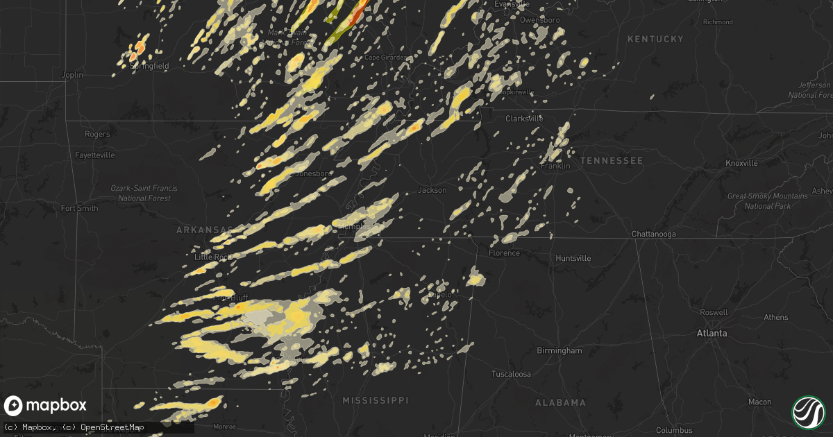
Hail Map in Indiana on May 25, 2011
Get this storm
May 25 map
$229
one time, instant access
Download today. No call, no setup
Keep the $229
Bought the map and want the full workflow? Apply the entire $229 to a subscription within 7 days. None of it is wasted.
Every map, not just this one
This buys you this map. Subscription and you get every map we run, in the markets you choose from a few cities to whole states to nationwide. Plus real-time alerts the moment a storm fires.
Contact data
Name, contact info, occupancy, even credit band for addresses in the footprint. You go from where it hit to who to call.
Become the source they trust
Unlimited branding weather history reports on demand. You already have the documented answer ready for the property owner, and you are the one who showed up with it.
Property data and RoofTrace estimates
Pull up any address you have got, its value and the exact code rules for that jurisdiction, straight from One Click Code. Then RoofTrace estimates the squares, pitch, and roof value, priced the way you price.
Storm reports in Indiana
Indiana
| Date | Description |
|---|---|
| 05/25/20116:55 PM CDT | A local report indicates 1.00 inch wind near LEBANON |
| 05/25/20116:54 PM CDT | Southern bedford. |
| 05/25/20116:50 PM CDT | A local report indicates 1.25 inch wind near 4 NNW BEDFORD |
| 05/25/20116:49 PM CDT | Pea to baseball size hail. |
| 05/25/20116:47 PM CDT | A local report indicates 1.00 inch wind near 2 N GREENFIELD |
| 05/25/20116:42 PM CDT | Tree doown on house on sr 135...1 block sout of johnson and marion county line. |
| 05/25/20116:35 PM CDT | Hail fell from 727 to 735 pm. |
| 05/25/20116:30 PM CDT | A local report indicates 1.75 inch wind near E GAS CITY |
| 05/25/20116:28 PM CDT | 1 w of greenwood airport. |
| 05/25/20116:26 PM CDT | A local report indicates 1.00 inch wind near 1 E STINESVILLE |
| 05/25/20116:25 PM CDT | A local report indicates 1.75 inch wind near PARAGON |
| 05/25/20116:25 PM CDT | At southport and franklin. |
| 05/25/20116:24 PM CDT | 7000 e and 6000 s. |
| 05/25/20116:20 PM CDT | 1 w of i-65. |
| 05/25/20116:20 PM CDT | Getting larger as falling. |
| 05/25/20116:20 PM CDT | A local report indicates 1.75 inch wind near AMO |
| 05/25/20116:19 PM CDT | At stop 11 and emerson. |
| 05/25/20116:14 PM CDT | A local report indicates 1.25 inch wind near GREENWOOD |
| 05/25/20116:13 PM CDT | Us 31 and tracy rd. |
| 05/25/20116:12 PM CDT | A local report indicates 1.00 inch wind near 1 W GREENWOOD |
| 05/25/20115:52 PM CDT | A local report indicates 1.50 inch wind near 10 N MORGANTOWN |
| 05/25/20115:51 PM CDT | A local report indicates 1.00 inch wind near 5 E MARTINSVILLE |
| 05/25/20115:47 PM CDT | A local report indicates 1.75 inch wind near 1 S IRELAND |
| 05/25/20115:44 PM CDT | A local report indicates 1.00 inch wind near 5 E MARTINSVILLE |
| 05/25/20115:41 PM CDT | A local report indicates 1.00 inch wind near 2 E MARTINSVILLE |
| 05/25/20115:30 PM CDT | Hail pea to quarter size. |
| 05/25/20115:27 PM CDT | Storm survey revealed an ef1 tornado that started just south of marquand in madison county and moved to just west of alliance in bollinger county. See public informatio |
| 05/25/20115:25 PM CDT | A local report indicates 1.75 inch wind near 3 S PARAGON |
| 05/25/20115:22 PM CDT | A local report indicates 1.75 inch wind near STINESVILLE |
| 05/25/20115:15 PM CDT | Huntington park area |
| 05/25/20115:15 PM CDT | A local report indicates 1.00 inch wind near ELLETTSVILLE |
| 05/25/20115:12 PM CDT | A local report indicates 1.00 inch wind near MUNCIE |
| 05/25/20115:10 PM CDT | A local report indicates 3.00 inch wind near 5 E BROOKVILLE |
| 05/25/20114:55 PM CDT | A local report indicates 1.00 inch wind near 2 S LAUREL |
| 05/25/20114:55 PM CDT | Half inch to one inch diameter hail. |
| 05/25/20114:47 PM CDT | Windshields broken |
| 05/25/20114:46 PM CDT | Half dollar size hail caused broken windshields. |
| 05/25/20114:40 PM CDT | A local report indicates 1.00 inch wind near 1 NE BLOOMFIELD |
| 05/25/20114:37 PM CDT | Semi tipped over at sr 3 and 280 w. |
| 05/25/20114:35 PM CDT | Barn and home damaged in greensburg...no location given. |
| 05/25/20114:32 PM CDT | 16 inch live tree down blocking highway at sr 3 and 46. |
| 05/25/20114:30 PM CDT | Several buildings destroyed at the decatur co. Fairgrounds. |
| 05/25/20114:30 PM CDT | Measured on 4th st. |
| 05/25/20114:30 PM CDT | Trees 8 to 12 inches in diameter uprooted at 300 n and 400 e. |
| 05/25/20114:27 PM CDT | Semi blown over at sr 3 and i-74. |
| 05/25/20114:25 PM CDT | Golf ball size hail on w washington st. |
| 05/25/20114:25 PM CDT | Three barns damaged along with a silo at 250 e and 100 s. |
| 05/25/20114:25 PM CDT | A local report indicates 1.00 inch wind near SANDUSKY |
| 05/25/20114:24 PM CDT | A local report indicates 4.00 inch wind near 1 E GREENSBURG |
| 05/25/20114:23 PM CDT | At 500 n and 400 e. |
| 05/25/20114:22 PM CDT | A local report indicates 1.75 inch wind near HOPE |
| 05/25/20114:20 PM CDT | Ef1 tornado northwest of greensburg moved across the rolling meadows subdivision. Max winds speeds of 90 mph with a path length of 0.5 miles and a max path width of 400 |
| 05/25/20114:18 PM CDT | Accompanied by golfball size hail. |
| 05/25/20114:15 PM CDT | Trees also downed. |
| 05/25/20114:15 PM CDT | Ef1 tornado on southwest side of greensburg impacting decatur county airport...greensburg city park and the greensburg country club. Maximum wind speeds 100-105 mph wit |
| 05/25/20114:13 PM CDT | Grain bins blown 100 yards at 300 n and sr 3. |
| 05/25/20113:55 PM CDT | Tress up to 3 feet in diameter downed on the north side of columbus. |
| 05/25/20113:55 PM CDT | A local report indicates 1.00 inch wind near NEWBERN |
| 05/25/20113:45 PM CDT | Large trees down. Roof damage to barn. |
| 05/25/20113:43 PM CDT | 0.5 mile south of 25th and taylor rd...8 inch tree limbs down. |
| 05/25/20113:10 PM CDT | A local report indicates 2.50 inch wind near BEDFORD |
| 05/25/20112:59 PM CDT | A local report indicates 2.75 inch wind near BEDFORD |
| 05/25/20112:57 PM CDT | A local report indicates 1.00 inch wind near BEDFORD |
| 05/25/20112:55 PM CDT | Telephone pole blow over with wires not on the ground. Numerous 2-3 inch branches broken off trees all near ardmore ave a quarter mile south of engle road |
| 05/25/20112:51 PM CDT | 2 foot diameter tree uprooted in the 3400 block of indiana ave in fort wayne...time estimated from radar |
| 05/25/20112:45 PM CDT | A local report indicates 1.00 inch wind near WILLIAMS |
| 05/25/20112:45 PM CDT | A local report indicates 1.75 inch wind near 1 NE BLOOMFIELD |
| 05/25/20112:42 PM CDT | A local report indicates 1.75 inch wind near OWENSBURG |
| 05/25/20112:34 PM CDT | A local report indicates 1.00 inch wind near GREENTOWN |
| 05/25/20112:31 PM CDT | Two rounds of hail. Most recent was up to size of quarters. |
| 05/25/20112:30 PM CDT | A local report indicates 1.75 inch wind near CRANE |
| 05/25/20112:25 PM CDT | A local report indicates 1.25 inch wind near 4 NNW BEDFORD |
| 05/25/20112:15 PM CDT | Time estimated from radar. |
| 05/25/20112:03 PM CDT | 10 inch tree limb downed. |
| 05/25/20112:00 PM CDT | A local report indicates 1.00 inch wind near BARGERSVILLE |
| 05/25/20111:59 PM CDT | Also observed possible funnel cloud. |
| 05/25/20111:53 PM CDT | A local report indicates 2.00 inch wind near 4 ESE SOUTHPORT |
| 05/25/20111:48 PM CDT | Power lines down in beech grove. |
| 05/25/20111:42 PM CDT | A local report indicates 1.00 inch wind near NEW WHITELAND |
| 05/25/20111:42 PM CDT | A local report indicates 1.00 inch wind near GREENWOOD |
| 05/25/20111:39 PM CDT | A local report indicates 1.00 inch wind near ROSSVILLE |
| 05/25/20111:30 PM CDT | 0.50 inches of rain also. |
| 05/25/20111:19 PM CDT | Power lines down at cherry and mitchell st. |
| 05/25/20111:19 PM CDT | A local report indicates 1.00 inch wind near MARTINSVILLE |
| 05/25/20111:13 PM CDT | Measured at 1100 grant st. |
| 05/25/20111:11 PM CDT | A local report indicates 1.00 inch wind near MARTINSVILLE |
| 05/25/20111:09 PM CDT | 62 mph wind gust measured in waynedale |
| 05/25/20111:03 PM CDT | One inch hail on the north side of fort wayne...innovation blvd and cook road. Lasted for two minutes. |
| 05/25/201112:55 PM CDT | Golfball size hail reported on sr 14 just east of the allen and whitley county line. |
| 05/25/201112:55 PM CDT | I-69 and leesburg rd. |
| 05/25/201112:46 PM CDT | Hail fell approx for 2 minutes...broke one half to one inch diameter maple tree limbs |
| 05/25/201112:43 PM CDT | A local report indicates 1.75 inch wind near ROANOKE |
| 05/25/201112:40 PM CDT | Hail to size of quarters at us 30 and leesburg rd |
| 05/25/201112:38 PM CDT | A local report indicates 1.00 inch wind near ABOITE |
| 05/25/201111:49 AM CDT | A local report indicates 1.00 inch wind near 5 N FRANKFORT |
| 05/25/201111:24 AM CDT | Time estimated. |
| 05/25/201110:40 AM CDT | Large tree branch blown down |
| 05/25/201110:20 AM CDT | A local report indicates 1.75 inch wind near 4 NE DELPHI |
| 05/25/201110:10 AM CDT | Power pole down at 550 w and 350 s. |
| 05/25/201110:10 AM CDT | A local report indicates 1.75 inch wind near 5 SW DELPHI |
| 05/25/20119:48 AM CDT | Trees downed up to 2 feet in diameter near nw edge of west lafayette. Time estimated from radar. |
| 05/25/20119:45 AM CDT | Structural damage reported in francesville. No further details. Time estimated. |
| 05/25/20119:45 AM CDT | Ef-0 tornado damage to power poles on route 421...pole barn destroyed at bill st and james st and trees down on 400 block of east montgomery. Path length was 0.8 miles |
| 05/25/20119:32 AM CDT | A local report indicates 1.00 inch wind near 5 SE ATTICA |
| 05/25/20119:30 AM CDT | 14132 state highway 246. Barn destroyed and blown across road. Power lines down. Trees down and law enforcement reports the tops are twisted. Time estimated. |
| 05/25/20119:25 AM CDT | Shed heavily damaged. Utility poles down. Near state road 55 and county rd 600s. |
| 05/25/20119:24 AM CDT | Sr 55 and county road 600s. Possible tornado. Structural damage to house...2 farm sheds...and grain bin. |
| 05/25/20119:24 AM CDT | Possible tornado. Power lines down...shingles lost...truck overturned at 231 and drexel. Also tree limbs down along sr114 and 150e. |
| 05/25/20119:24 AM CDT | Sr 55 and us 14. Possible tornado. Structural damage to house...2 farm sheds...and grain bin. |
| 05/25/20119:24 AM CDT | Trees down. Sr 14 near 200 w. |
| 05/25/20119:24 AM CDT | Trees down south side of town. |
| 05/25/20119:20 AM CDT | Possible tornado. State road 55 and 600s |
| 05/25/20119:08 AM CDT | Estimated winds of 50 to 60 mph and had pea size hail. |
| 05/24/201111:03 PM CDT | Measured 62mph wind gust. Limbs and large branches down blocking the road. |
| 05/24/201110:55 PM CDT | A local report indicates 60 MPH wind near SELMA |
| 05/24/201110:53 PM CDT | A local report indicates 1.00 inch wind near MUNCIE |
| 05/24/201110:53 PM CDT | Accompanied by 1 inch hail |
| 05/24/201110:44 PM CDT | Trees down. Time estimated from radar. |
| 05/24/201110:32 PM CDT | 4 inch diameter tree limbs down on some of the roads near marion |
| 05/24/201110:28 PM CDT | Two semi trucks blown off of interstate 70 |
| 05/24/201110:23 PM CDT | A local report indicates 60 MPH wind near JEFFERSONVILLE |
| 05/24/201110:15 PM CDT | Two foot diameter tree down. Time estimated based on radar. |
| 05/24/201110:15 PM CDT | *** 1 inj *** ef0 tornado knocked down or snapped numerous trees along the big blue river and asbury road. Two homes sustained minor damage. At one of the homes...a man |
| 05/24/201110:00 PM CDT | A local report indicates 82 MPH wind near ARCADIA |
| 05/24/20119:56 PM CDT | A local report indicates 60 MPH wind near EDINBURGH |
| 05/24/20119:50 PM CDT | 12 ft diameter tree down across rd at 1763e and 500n. |
| 05/24/20119:50 PM CDT | Several large trees down. |
| 05/24/20119:49 PM CDT | A local report indicates 60 MPH wind near CORYDON |
| 05/24/20119:48 PM CDT | Several large trees down. One blocking sr 75 |
| 05/24/20119:45 PM CDT | Trees down on south side of bloomington. |
| 05/24/20119:45 PM CDT | Sr 39 and sr 32. Ply wood on street. Roof off apartment building. |
| 05/24/20119:40 PM CDT | A local report indicates 65 MPH wind near RAMSEY |
| 05/24/20119:40 PM CDT | Trees down...some damage to homes including siding blown off homes |
| 05/24/20119:38 PM CDT | A local report indicates 1.00 inch wind near 8 NE LAFAYETTE |
| 05/24/20119:35 PM CDT | Large tree down near intersection of 9th street and south e street. |
| 05/24/20119:35 PM CDT | Roof off barn at 500 s and sr 136. Reported at 1035 pm. |
| 05/24/20119:32 PM CDT | Multiple large trees down on the south side of town. |
| 05/24/20119:31 PM CDT | Ef-1 with 95 mph winds. Metal outbuilding heavily damaged. Many trees snapped or uprooted. |
| 05/24/20119:30 PM CDT | 14132 state highway 246. Barn destroyed and blown across road. Power lines down. Trees down and law enforcement reports the tops are twisted. Time estimated. |
| 05/24/20119:30 PM CDT | Scattered power outages and tree damage across crawford county |
| 05/24/20119:30 PM CDT | Tractor trailer blown over |
| 05/24/20119:29 PM CDT | A local report indicates 65 MPH wind near MILLTOWN |
| 05/24/20119:28 PM CDT | Twenty high voltage towers in a row were twisted or knocked to the ground 1900 west barner street...just north of state route 28 and just outside of the business park. |
| 05/24/20119:28 PM CDT | Ef-1 with 100 mph winds. Large wood barn destroyed. Many trees snapped or uprooted. 3.2 mile path. |
| 05/24/20119:27 PM CDT | A local report indicates 70 MPH wind near CURBY |
| 05/24/20119:25 PM CDT | A local report indicates 69 MPH wind near ODON |
| 05/24/20119:24 PM CDT | A local report indicates 60 MPH wind near 2 SE AVON |
| 05/24/20119:22 PM CDT | Ef-2 with 115 mph winds. Two brick homes and one wood frame home heavily damaged. Wood barn and metal outbuildings destroyed. 4.7 mile long path. |
| 05/24/20119:19 PM CDT | A local report indicates 60 MPH wind near ARCADIA |
| 05/24/20119:15 PM CDT | Many trees and limbs down...one was 2 feet in diameter at 2nd st and wayman. |
| 05/24/20119:15 PM CDT | A local report indicates 60 MPH wind near 10 W ENGLISH |
| 05/24/20119:15 PM CDT | A local report indicates 65 MPH wind near BLOOMINGTON |
| 05/24/20119:13 PM CDT | Tree knocked down blocking wagner road. |
| 05/24/20119:10 PM CDT | A local report indicates 62 MPH wind near ROCKPORT |
| 05/24/20119:05 PM CDT | A local report indicates 70 MPH wind near LOOGOOTEE |
| 05/24/20119:00 PM CDT | Outbuildings demolished and trees down |
| 05/24/20118:56 PM CDT | Tractor trailer blown over. Corrected time. |
| 05/24/20118:55 PM CDT | Overturned mobile homes |
| 05/24/20118:55 PM CDT | Updated...numerous trees and power lines down. Widespread power outages reported in jasper. |
| 05/24/20118:54 PM CDT | A local report indicates 1.00 inch wind near 2 N WEST LAFAYETTE |
| 05/24/20118:54 PM CDT | Ef-1 with 100 mph winds. Home in haysville lost its roof. Many trees damaged. |
| 05/24/20118:50 PM CDT | Ef-2 with 115 mph winds |
| 05/24/20118:46 PM CDT | University drive |
| 05/24/20118:45 PM CDT | A local report indicates 1.00 inch wind near LAFAYETTE |
| 05/24/20118:42 PM CDT | Downed pwr lines sr 241 and hart st rd |
| 05/24/20118:39 PM CDT | A damage survey revealed an ef1 tornado that moved from 4 miles south of winslow to 4.25 miles southeast of winslow. See public information statement for details. |
| 05/24/20118:36 PM CDT | Power poles snapped near the honda plant. |
| 05/24/20118:36 PM CDT | Storm damage survey revealed an ef1 tornado that moved from just north of cole indiana to 4 miles southeast of winslow. See public information statement for details. |
| 05/24/20118:35 PM CDT | Siding torn off a business |
| 05/24/20118:30 PM CDT | *** 1 inj *** large tree fell on home injuring one person. |
| 05/24/20118:30 PM CDT | A local report indicates 80 MPH wind near 3 N TERRE HAUTE |
| 05/24/20118:25 PM CDT | A local report indicates 70 MPH wind near W DUGGER |
| 05/24/20118:25 PM CDT | Update..numerous trees and power poles down. Major power line down with much of the west side of the metro area without power. |
| 05/24/20118:24 PM CDT | Straight line winds estimated at 70 mph. Several trees uprooted. Shingles blown off fire station. Large tree blown over onto a garage. Damage was generally from just so |
| 05/24/20118:23 PM CDT | A local report indicates 75 MPH wind near EVANSVILLE |
| 05/24/20118:20 PM CDT | A local report indicates 60 MPH wind near FAIRBANKS |
| 05/24/20118:17 PM CDT | Trees and power lines down throughout the community. Wind gusts estimated 80 mph. |
| 05/24/20118:15 PM CDT | A local report indicates 1.25 inch wind near MORRISTOWN |
| 05/24/20118:15 PM CDT | Power lines down and transformers popping. |
| 05/24/20118:11 PM CDT | Trees down. |
| 05/24/20118:09 PM CDT | Multiple trees down across the city...with one falling on a house located on hunt street. |
| 05/24/20118:08 PM CDT | Wind gusts estimated 60 to 70 mph. |
| 05/24/20118:05 PM CDT | A local report indicates 1.00 inch wind near MORRISTOWN |
| 05/24/20118:01 PM CDT | Rocky ford and 330 central. |
| 05/24/20117:57 PM CDT | Central ave and us 31. |
| 05/24/20117:53 PM CDT | Quarter size hail reported in economy and williamsburg. |
| 05/24/20117:49 PM CDT | A local report indicates 1.00 inch wind near 3 SW COLUMBUS |
| 05/24/20117:45 PM CDT | A local report indicates 4.25 inch wind near 1 NE STRAUGHN |
| 05/24/20117:43 PM CDT | A local report indicates 1.50 inch wind near NEW CASTLE |
| 05/24/20117:42 PM CDT | Golf ball hail. |
| 05/24/20117:35 PM CDT | A local report indicates 2.00 inch wind near 2 NW STRAUGHN |
| 05/24/20117:33 PM CDT | A local report indicates 1.75 inch wind near NEW CASTLE |
| 05/24/20117:23 PM CDT | Eastern dunreith. |
| 05/24/20117:20 PM CDT | A local report indicates 1.00 inch wind near 2 NE MARION |
| 05/24/20117:17 PM CDT | A local report indicates a tornado near 9 ENE BEDFORD |
| 05/24/20117:16 PM CDT | A local report indicates 1.00 inch wind near KNIGHTSTOWN |
| 05/24/20117:12 PM CDT | Possible debris ball on radar |
| 05/24/20117:00 PM CDT | A local report indicates a tornado near BEDFORD |
All States Impacted by Hail Map on May 25, 2011
Cities Impacted by Hail Map on May 25, 2011
- Brighton, IL
- Climax Springs, MO
- Edwards, MO
- Trafalgar, IN
- Nineveh, IN
- Nashville, IN
- Morgantown, IN
- Obion, TN
- South Fulton, TN
- Rives, TN
- Union City, TN
- Fulton, KY
- Hornbeak, TN
- Troy, TN
- Coushatta, LA
- Dawson Springs, KY
- Hamburg, AR
- Bernie, MO
- Dexter, MO
- Vandalia, IL
- Kampsville, IL
- Hartford City, IN
- Muncie, IN
- Upland, IN
- Francesville, IN
- Spencerville, IN
- Fort Wayne, IN
- Grabill, IN
- Harlan, IN
- Woodburn, IN
- New Haven, IN
- Tunica, MS
- Meta, MO
- Dixon, MO
- Argyle, MO
- Vienna, MO
- Brinktown, MO
- Connersville, IN
- Centerville, IN
- Cord, AR
- Brownsville, TN
- Colfax, LA
- Troy, MO
- Moscow Mills, MO
- Foristell, MO
- Wentzville, MO
- Old Monroe, MO
- Harrisburg, IL
- Noble, IL
- Florence, AL
- Iron City, TN
- Killen, AL
- Jena, LA
- Piedmont, MO
- Rison, AR
- Cortland, OH
- Spring Valley, OH
- Xenia, OH
- Dayton, OH
- Bellbrook, OH
- Gore Springs, MS
- Duck Hill, MS
- Atlanta, IL
- Wapella, IL
- Clinton, IL
- Waynesville, IL
- McLean, IL
- Kenney, IL
- Heyworth, IL
- Rittman, OH
- Wadsworth, OH
- Doylestown, OH
- Cotton Valley, LA
- Benton, LA
- Romance, AR
- Rose Bud, AR
- Sikeston, MO
- Essex, MO
- Bell City, MO
- Vanduser, MO
- Bloomfield, MO
- Creston, OH
- Seville, OH
- Sidon, MS
- Greenwood, MS
- Brookville, IN
- Oxford, OH
- Cedar Grove, IN
- Doniphan, MO
- Strawberry, AR
- Poughkeepsie, AR
- Batesville, AR
- Alicia, AR
- Smithville, AR
- Sulphur Rock, AR
- Cave City, AR
- Walnut Ridge, AR
- Hoxie, AR
- Portia, AR
- Black Rock, AR
- Lynn, AR
- Powhatan, AR
- Bloomington, IN
- Lovington, IL
- Baring, MO
- Ashland, OH
- New London, OH
- Nova, OH
- Sullivan, OH
- Greenville, MS
- Benoit, MS
- Oak Harbor, OH
- Port Clinton, OH
- Piasa, IL
- Shipman, IL
- Medora, IL
- Griffithville, AR
- Searcy, AR
- Cambridge Springs, PA
- Union City, PA
- Thornton, AR
- Bearden, AR
- Avon, OH
- Olmsted Falls, OH
- North Olmsted, OH
- North Ridgeville, OH
- Westlake, OH
- Shelby, MS
- Clarksdale, MS
- Mexico, MO
- Miller City, IL
- Charleston, MO
- Cairo, IL
- Osceola, MO
- Lowry City, MO
- West Plains, MO
- Attica, OH
- Bloomville, OH
- Tiffin, OH
- Republic, OH
- Cole Camp, MO
- Oakland, MS
- Water Valley, MS
- Bauxite, AR
- Bryant, AR
- New Riegel, OH
- Weimar, TX
- Schulenburg, TX
- Deville, LA
- Pineville, LA
- Ball, LA
- Center Point, LA
- Marksville, LA
- Effie, LA
- South Bend, IN
- Merigold, MS
- Beulah, MS
- Cleveland, MS
- Belleville, IL
- Freeburg, IL
- Tamms, IL
- Thebes, IL
- Olive Branch, IL
- Villa Ridge, IL
- Pulaski, IL
- Mounds, IL
- Bernice, LA
- Morrisville, MO
- Brighton, MO
- Willard, MO
- Walnut Grove, MO
- Waynesville, MO
- Lebanon, MO
- Falcon, MO
- Laquey, MO
- Ledbetter, TX
- Giddings, TX
- West Lafayette, IN
- Ellington, MO
- Gosport, IN
- Corunna, IN
- Kendallville, IN
- Avilla, IN
- Jacksonville, AR
- Converse, LA
- Pine Bluff, AR
- Malvern, AR
- Sherrill, AR
- Leola, AR
- Jefferson, AR
- Grapevine, AR
- Sheridan, AR
- Arkadelphia, AR
- White Hall, AR
- Carthage, AR
- Payne, OH
- Antwerp, OH
- Cascilla, MS
- Arnold, MO
- Imperial, MO
- Marysville, OH
- Van Buren, MO
- Edinburg, IL
- Barry, IL
- New Canton, IL
- Oakdale, IL
- Nashville, IL
- Guthrie, KY
- Trenton, KY
- Crowley, LA
- Ganado, TX
- Markle, IN
- Bluffton, IN
- Uniondale, IN
- Roanoke, IN
- Huntington, IN
- Ossian, IN
- Salem, IL
- Iuka, IL
- Oil Trough, AR
- Martinsville, IL
- Marshall, IL
- Rosedale, IN
- Mammoth Spring, AR
- Camp, AR
- Glencoe, AR
- Couch, MO
- Alton, MO
- Ravenden, AR
- Myrtle, MO
- Osage Beach, MO
- Sunrise Beach, MO
- Newport, AR
- Newark, AR
- Conroe, TX
- Cleveland, TX
- Lexa, AR
- Poplar Grove, AR
- Hornbeck, LA
- Milroy, IN
- Rushville, IN
- Greensburg, IN
- Napoleon, MO
- Bates City, MO
- Oak Grove, MO
- Biscoe, AR
- Des Arc, AR
- Stover, MO
- Smithton, MO
- Warsaw, MO
- Florence, MO
- Lincoln, MO
- Mora, MO
- Ashkum, IL
- Castalia, OH
- Vickery, OH
- Sandusky, OH
- Huron, OH
- Old Fort, OH
- Clyde, OH
- Milan, OH
- Fremont, OH
- Monroeville, OH
- Green Springs, OH
- Bellevue, OH
- Berlin Heights, OH
- Grady, AR
- Bloomsdale, MO
- Wakeman, OH
- Vermilion, OH
- Paoli, IN
- French Lick, IN
- Morral, OH
- Marion, OH
- Sainte Genevieve, MO
- Rochester, IL
- Rocheport, MO
- Mulberry Grove, IL
- Ramsey, IL
- Beecher, IL
- Grovespring, MO
- Bloomfield, IN
- Shelbyville, TX
- Tipton, IN
- Odessa, MO
- Lone Jack, MO
- Vulcan, MO
- Montgomery, IN
- Plainville, IN
- Loogootee, IN
- Elnora, IN
- Washington, IN
- Owensburg, IN
- Crane, IN
- Odon, IN
- Springville, IN
- Worthington, IN
- Millington, TN
- Wabash, IN
- Maynard, AR
- Oxly, MO
- Okeana, OH
- Anahuac, TX
- Winnie, TX
- Robertsville, MO
- Parker City, IN
- Albany, IN
- Gibsonburg, OH
- Luckey, OH
- Woodville, OH
- Pemberville, OH
- Genoa, OH
- Ridgely, TN
- Mascoutah, IL
- Pawnee, IL
- Mount Blanchard, OH
- New Lebanon, OH
- Duke, MO
- Newburg, MO
- Devils Elbow, MO
- Palacios, TX
- Blessing, TX
- Columbia City, IN
- Spencer, IN
- Solsberry, IN
- Castor, LA
- New Madrid, MO
- Hiram, OH
- Jonesburg, MO
- Warrenton, MO
- Raymondville, MO
- Frankfort, IN
- Cutler, IN
- Russiaville, IN
- Woodville, MS
- Henning, TN
- Ellettsville, IN
- Delphi, IN
- Brookston, IN
- Brookville, OH
- Cedarville, OH
- Wilberforce, OH
- Alpha, OH
- Eolia, MO
- Silex, MO
- Fulton, MO
- Roundhill, KY
- Brownsville, KY
- Sweeden, KY
- Ringgold, LA
- Jamestown, LA
- Goldonna, LA
- Saline, LA
- Ashland, LA
- Hall Summit, LA
- San Augustine, TX
- Ravenna, OH
- Williams, IN
- Matthews, MO
- Lilbourn, MO
- Mansfield, LA
- Pelican, LA
- Natchitoches, LA
- Natchez, LA
- Robeline, LA
- Pleasant Hill, LA
- Noble, LA
- Marthaville, LA
- Saint Louis, MO
- Warren, OH
- Newton Falls, OH
- Leavittsburg, OH
- Niles, OH
- Pevely, MO
- Festus, MO
- Hillsboro, MO
- Milmine, IL
- Monticello, IL
- Belzoni, MS
- Collierville, TN
- Germantown, TN
- Rossville, TN
- Eads, TN
- Memphis, TN
- Cordova, TN
- Alhambra, IL
- Marine, IL
- Westphalia, MO
- Saint Thomas, MO
- Billings, MO
- Republic, MO
- Bastrop, TX
- Paige, TX
- Garwood, TX
- Louise, TX
- Hallettsville, TX
- Woodstock, OH
- Milford Center, OH
- North Lewisburg, OH
- Ethel, MS
- Vaiden, MS
- Kilmichael, MS
- Plain City, OH
- Lizton, IN
- Jamestown, IN
- Minter City, MS
- Belleview, MO
- Cadet, MO
- Mineral Point, MO
- Bonne Terre, MO
- Belgrade, MO
- De Soto, MO
- Potosi, MO
- Blackwell, MO
- Bixby, MO
- Cabot, AR
- Elyria, OH
- Pope, MS
- Enid, MS
- Batesville, MS
- Courtland, MS
- Bowling Green, IN
- Coal City, IN
- Centerpoint, IN
- Clay City, IN
- Bentley, LA
- Dry Prong, LA
- Cloutierville, LA
- Montgomery, LA
- Shelbyville, IN
- Indianapolis, IN
- Greenwood, IN
- New Palestine, IN
- Boggstown, IN
- Whiteland, IN
- Franklin, IN
- Needham, IN
- Fairland, IN
- Bargersville, IN
- Martinsville, IN
- Lyon, MS
- Coahoma, MS
- Springfield, MO
- Chrisman, IL
- South Charleston, OH
- South Solon, OH
- Calhoun, MO
- Windsor, MO
- West Alexandria, OH
- Farmersville, OH
- Vienna, IL
- Stonefort, IL
- Simpson, IL
- Ozark, IL
- Grantsburg, IL
- Mayfield, KY
- West College Corner, IN
- Louisville, MS
- Ingraham, IL
- Dieterich, IL
- Newton, IL
- Clifford, IN
- Flat Rock, IN
- Hope, IN
- Columbus, IN
- Tatum, TX
- Henderson, TX
- Beckville, TX
- Chester, IL
- Steeleville, IL
- Kenton, OH
- Columbus, TX
- Ash Grove, MO
- Lakeview, OH
- Perryville, MO
- Mulberry, IN
- Greenville, OH
- Gettysburg, OH
- Bradford, OH
- Nashville, TN
- Kokomo, IN
- Kempton, IN
- Sharpsville, IN
- Portland, AR
- Montrose, AR
- Lake Village, AR
- Viburnum, MO
- Steelville, MO
- Marion, IN
- Itta Bena, MS
- Schlater, MS
- Ecru, MS
- New Albany, MS
- Grandin, MO
- Fairdealing, MO
- Stockdale, TX
- Nixon, TX
- Bucyrus, OH
- Fayette, AL
- Berry, AL
- Bankston, AL
- Centerburg, OH
- Sunbury, OH
- Marengo, OH
- Somerville, OH
- West Harrison, IN
- Laurel, IN
- Germantown, OH
- Metamora, IN
- Hamilton, OH
- Bath, IN
- Franklin, OH
- Middletown, OH
- Miamisburg, OH
- Sunman, IN
- College Corner, OH
- Trenton, OH
- Liberty, IN
- Scott, AR
- Jasper, AL
- Houston, MO
- Cabool, MO
- Solo, MO
- Mountain Grove, MO
- Edna, TX
- Sheridan, TX
- Madison, IL
- Fenton, MO
- Chesterfield, MO
- Ballwin, MO
- Valley Park, MO
- Granite City, IL
- Venice, IL
- Decaturville, TN
- Starkville, MS
- Beebe, AR
- Danville, IL
- Oakwood, IL
- Bronson, TX
- Hemphill, TX
- Milam, TX
- Franklin, TN
- Lillie, LA
- Spearsville, LA
- League City, TX
- New Haven, IL
- Ridgway, IL
- Cotton Plant, AR
- Hazen, AR
- Carlisle, AR
- Laddonia, MO
- Greencastle, IN
- Placedo, TX
- Bloomington, TX
- Jadwin, MO
- Salem, MO
- Mitchell, IN
- Greenfield, IN
- Owensville, IN
- Velpen, IN
- Norman, IN
- Stinesville, IN
- Avoca, IN
- Shoals, IN
- Princeton, IN
- Jasper, IN
- Patoka, IN
- Heltonville, IN
- Oolitic, IN
- Hartsville, IN
- Saint Paul, IN
- Edinburgh, IN
- Fountaintown, IN
- Mooresville, IN
- Freedom, IN
- Lyons, IN
- Bedford, IN
- Manilla, IN
- Oldenburg, IN
- Wheatland, IN
- Newberry, IN
- Switz City, IN
- Freetown, IN
- Huntingburg, IN
- Waldron, IN
- Monroe City, IN
- Paragon, IN
- Taylorsville, IN
- Hazleton, IN
- Vincennes, IN
- Decker, IN
- Seymour, IN
- Batesville, IN
- Winslow, IN
- Okolona, MS
- Shannon, MS
- Almyra, AR
- Crocketts Bluff, AR
- Stuttgart, AR
- Humphrey, AR
- Casscoe, AR
- Eminence, MO
- Metropolis, IL
- Niangua, MO
- Hartville, MO
- Evansville, IN
- Cisco, IL
- Cerro Gordo, IL
- Otterbein, IN
- Derby, IN
- Liberty, TX
- Licking, MO
- Beulah, MO
- Edgar Springs, MO
- Success, MO
- Roby, MO
- Seymour, IL
- Weldon, IL
- Mansfield, IL
- Champaign, IL
- Sadorus, IL
- De Land, IL
- Rantoul, IL
- Thomasboro, IL
- Bondville, IL
- Fisher, IL
- White Heath, IL
- Dewey, IL
- Ivesdale, IL
- Urbana, IL
- Savoy, IL
- Mahomet, IL
- Tolono, IL
- Windham, OH
- Mantua, OH
- Garrettsville, OH
- Lohman, MO
- Russellville, MO
- Rocky Mount, MO
- Gravois Mills, MO
- Olean, MO
- Centertown, MO
- Latham, MO
- Jefferson City, MO
- California, MO
- Versailles, MO
- Eldon, MO
- Barnett, MO
- Straughn, IN
- New Castle, IN
- New Washington, OH
- Mill Spring, MO
- Ellsinore, MO
- Williamsville, MO
- Pocahontas, IL
- Breese, IL
- Pleasant Hill, IL
- Annada, MO
- Hawk Point, MO
- Bowling Green, MO
- Elsberry, MO
- Pearl, IL
- Middletown, MO
- Nebo, IL
- Hamburg, IL
- Clarksville, MO
- Truxton, MO
- Yuma, TN
- Lexington, TN
- Wildersville, TN
- Lisbon, LA
- Farmerville, LA
- Minden, LA
- Homer, LA
- Dubach, LA
- Marion, LA
- Lolita, TX
- Somerville, TN
- Morristown, IN
- Carthage, IN
- Arlington, IN
- Oxford, MS
- Osgood, IN
- Westfield, IN
- Hillview, IL
- Browns, IL
- Mount Carmel, IL
- Yorktown, TX
- Foley, MO
- Ruleville, MS
- Spring Valley, IL
- Granville, IL
- Atlanta, IN
- Montgomery City, MO
- Wellsville, MO
- Bellflower, MO
- Texico, IL
- Mount Vernon, IL
- Walnut Hill, IL
- Dix, IL
- Kell, IL
- Seymour, MO
- Linden, TN
- Berger, MO
- Gas City, IN
- Fowlerton, IN
- Summitville, IN
- Fairmount, IN
- Jonesboro, IN
- Charleston, MS
- Lovejoy, IL
- Culver, IN
- Syracuse, IN
- Milford, IN
- Windfall, IN
- Elwood, IN
- Romney, IN
- Crawfordsville, IN
- Lafayette, IN
- New Richmond, IN
- Clarks Hill, IN
- Linden, IN
- Dickson, TN
- Widener, AR
- Wynne, AR
- Colt, AR
- Parkin, AR
- Heth, AR
- Palestine, AR
- Earle, AR
- Forrest City, AR
- Eddyville, KY
- Van Buren, IN
- Piqua, OH
- Houston, OH
- Hinckley, OH
- Upper Sandusky, OH
- Nevada, OH
- Findlay, OH
- Middletown, IN
- Shirley, IN
- Gonzales, TX
- Shiner, TX
- Urbana, OH
- Springfield, OH
- Tremont City, OH
- Bluffton, OH
- Defiance, MO
- O'Fallon, MO
- Lake Saint Louis, MO
- Watson, AR
- Olmstead, KY
- Fort Leonard Wood, MO
- Vichy, MO
- Freeburg, MO
- Richland, MO
- Belle, MO
- Jerome, MO
- Crocker, MO
- Rolla, MO
- Saint Robert, MO
- Linn, MO
- Brazil, IN
- Whites Creek, TN
- Ironton, MO
- Annapolis, MO
- Morocco, IN
- Lima, OH
- Springboro, OH
- Paris, IL
- Little Rock, AR
- Roland, AR
- Ottawa, OH
- Leipsic, OH
- Cross Timbers, MO
- Sycamore, OH
- Mechanicsburg, OH
- Horseshoe Bend, AR
- Carey, OH
- Demotte, IN
- Rossville, IN
- Bringhurst, IN
- Reynolds, IN
- Chalmers, IN
- Monticello, IN
- Zwolle, LA
- Blytheville, AR
- Caruthersville, MO
- Steele, MO
- Cooter, MO
- Florien, LA
- Leesville, LA
- Boyce, LA
- Elmer, LA
- Lena, LA
- Flatwoods, LA
- Mora, LA
- Monterey, LA
- Alexandria, LA
- Provencal, LA
- Acme, LA
- Pollock, LA
- Jonesville, LA
- Fortuna, MO
- East Liberty, OH
- Tutwiler, MS
- Lambert, MS
- Williamstown, OH
- Forest, OH
- Dunkirk, OH
- Arlington, OH
- Waynetown, IN
- Crete, IL
- Cleveland, OH
- Independence, OH
- Elkland, MO
- Gillett, AR
- Tichnor, AR
- De Witt, AR
- Gould, AR
- Yorktown, AR
- Star City, AR
- Beaumont, TX
- Plainfield, IN
- Clayton, IN
- Moreauville, LA
- Danville, IN
- Coatesville, IN
- Benton, KY
- Crofton, KY
- Russellville, AL
- Pontotoc, MS
- Alexander, AR
- Ravenden Springs, AR
- Imboden, AR
- Arlington, KY
- Everton, MO
- Prospect, OH
- Wheatley, AR
- Goodwin, AR
- Hume, IL
- Brentwood, TN
- Spiceland, IN
- Knightstown, IN
- Hampton, AR
- Antioch, TN
- Van Wert, OH
- Mentone, IN
- Claypool, IN
- Burket, IN
- Counce, TN
- Shiloh, TN
- Moscow, TX
- Mabelvale, AR
- Benton, AR
- Naylor, MO
- Edinboro, PA
- Saegertown, PA
- Venango, PA
- Little York, IL
- Poplar Bluff, MO
- Patterson, MO
- Arbela, MO
- Midfield, TX
- Bay City, TX
- Bolivar, MO
- Marshall, IN
- Bloomingdale, IN
- Montezuma, IN
- New Waverly, TX
- Huntsville, TX
- Thaxton, MS
- Randolph, MS
- Paris, MS
- Houlka, MS
- Andrews, IN
- Pasadena, TX
- Adamsville, TN
- Milledgeville, TN
- Morris Chapel, TN
- Bethel Springs, TN
- Sardis, TN
- Carlinville, IL
- Gillespie, IL
- Greenville, MO
- Marquand, MO
- Clubb, MO
- Silva, MO
- Crumrod, AR
- Duncan, MS
- Alligator, MS
- Addieville, IL
- Richmond, IN
- Amo, IN
- Eaton, OH
- Dumas, AR
- Wilmar, AR
- Snow Lake, AR
- McGehee, AR
- Tillar, AR
- Kingsland, AR
- Mellwood, AR
- Fordyce, AR
- Gunnison, MS
- New Edinburg, AR
- Monticello, AR
- Rosedale, MS
- Pickens, AR
- Rohwer, AR
- Mound Bayou, MS
- Winchester, AR
- Portageville, MO
- Altheimer, AR
- Wabbaseka, AR
- Miller, MO
- Creve Coeur, IL
- Pekin, IL
- East Peoria, IL
- Evansville, IL
- Modoc, IL
- Providence, KY
- Dixon, KY
- Coffeeville, MS
- Redfield, AR
- Hensley, AR
- Nokomis, IL
- Grovertown, IN
- Knox, IN
- Columbus Grove, OH
- Cecil, OH
- Paulding, OH
- Lakewood, IL
- Shelbyville, IL
- Strasburg, IL
- Buffalo, IL
- Eldorado, OH
- New Paris, OH
- Marthasville, MO
- Hopkinsville, KY
- Weiner, AR
- Fisher, AR
- Crenshaw, MS
- Sledge, MS
- Venedocia, OH
- Ada, OH
- Vanlue, OH
- Wharton, OH
- Dola, OH
- Arcanum, OH
- Tuscumbia, AL
- Parma, MO
- Bremen, AL
- Saint Mary, MO
- Farmington, MO
- Fredericktown, MO
- Pinckneyville, IL
- Tilden, IL
- Ellis Grove, IL
- Baldwin, IL
- Marissa, IL
- Sparta, IL
- Coulterville, IL
- Walsh, IL
- Hannibal, MO
- Monroe City, MO
- Palmyra, MO
- Center, MO
- Perry, MO
- Shreveport, LA
- Yoakum, TX
- Union Hill, IL
- Herscher, IL
- Buckingham, IL
- Bonfield, IL
- Vina, AL
- Goliad, TX
- Preston, MO
- Hermitage, MO
- Culleoka, TN
- Columbia, TN
- Spring Hill, TN
- Wilson, LA
- Clinton, LA
- Jetson, KY
- Caneyville, KY
- Shelby, OH
- Mansfield, OH
- Shiloh, OH
- Cuba, MO
- Hartville, OH
- Akron, OH
- Kent, OH
- Clinton, OH
- Canal Fulton, OH
- Massillon, OH
- Rootstown, OH
- Uniontown, OH
- Atwater, OH
- Alliance, OH
- Mogadore, OH
- North Canton, OH
- Boss, MO
- Roach, MO
- Camdenton, MO
- Waggoner, IL
- Divernon, IL
- Girard, IL
- Farmersville, IL
- Harvel, IL
- Morrisonville, IL
- Virden, IL
- Mechanicsburg, IL
- Millstadt, IL
- Palmyra, IL
- High Hill, MO
- Leighton, AL
- Splendora, TX
- Hankamer, TX
- Bedias, TX
- Dayton, TX
- Willis, TX
- Devers, TX
- Norwalk, OH
- Collins, OH
- New Carlisle, OH
- Fostoria, OH
- Teutopolis, IL
- Winona, MO
- Redford, MO
- Plato, MO
- Marianna, AR
- North Baltimore, OH
- Cygnet, OH
- Jerry City, OH
- West Terre Haute, IN
- Terre Haute, IN
- Dennison, IL
- Navasota, TX
- Anderson, TX
- Xenia, IL
- Kinmundy, IL
- Hazel, KY
- Murray, KY
- Clinton, IN
- Hillsdale, IN
- Vermilion, IL
- Arcola, IL
- Humboldt, IL
- Tuscola, IL
- Pesotum, IL
- Arthur, IL
- Veedersburg, IN
- Kingman, IN
- Hillsboro, IN
- Swifton, AR
- Churubusco, IN
- Yoder, IN
- Arcola, IN
- South Whitley, IN
- Cabery, IL
- Kempton, IL
- Burton, TX
- Clinton, MO
- Peace Valley, MO
- Birch Tree, MO
- Roachdale, IN
- Pulaski, TN
- Gideon, MO
- Ward, AR
- Salem, KY
- Warren, IN
- Greentown, IN
- Swayzee, IN
- Sheridan, IN
- Tallula, IL
- New Madison, OH
- West Manchester, OH
- Memphis, MO
- Findlay, IL
- Windsor, IL
- Tower Hill, IL
- Cowden, IL
- Gardner, IL
- Dwight, IL
- Athens, LA
- Simsboro, LA
- Arcadia, LA
- Downsville, LA
- Ruston, LA
- Gibsland, LA
- Arcadia, OH
- Alvada, OH
- Risingsun, OH
- Rawson, OH
- Van Buren, OH
- Kansas, OH
- Bloomdale, OH
- McComb, OH
- Lonoke, AR
- Madison, AR
- Brinkley, AR
- Crawfordsville, AR
- Anacoco, LA
- Many, LA
- Sherwood, AR
- Kansas City, MO
- Pocahontas, AR
- Hardy, AR
- Lodi, MO
- Success, AR
- Harviell, MO
- Fremont, MO
- Thayer, MO
- Neelyville, MO
- Warm Springs, AR
- Gatewood, MO
- Price, TX
- Cave City, KY
- Horse Cave, KY
- Grand Chain, IL
- Stilesville, IN
- Franklin, AR
- Melbourne, AR
- Grand Rivers, KY
- Marion, AR
- Westhoff, TX
- Royal Center, IN
- Salem, AR
- Lafe, AR
- Marmaduke, AR
- Paragould, AR
- Rector, AR
- Albion, PA
- Madison, TN
- El Dorado, AR
- Junction City, AR
- Belton, MO
- Grandview, MO
- Crestline, OH
- Oakland, IL
- Camargo, IL
- Hindsboro, IL
- Charleston, IL
- Newman, IL
- Carmine, TX
- Falkner, MS
- Tiplersville, MS
- Aberdeen, MS
- Centralia, IL
- Independence, MO
- Millport, AL
- Steens, MS
- Columbus, MS
- Ethelsville, AL
- Lamar, IN
- Chrisney, IN
- Sturdivant, MO
- Old Hickory, TN
- Chesterton, IN
- Ulman, MO
- Ora, IN
- Monterey, IN
- Clayton, IL
- Bois D Arc, MO
- Jersey, AR
- Hermitage, AR
- Fountain Hill, AR
- Drew, MS
- Banks, AR
- Camden, AR
- Harrell, AR
- Warren, AR
- Celina, OH
- Mendon, OH
- Rockford, OH
- Powell, OH
- Ostrander, OH
- Delaware, OH
- Tremont, MS
- Lenox, MO
- Amboy, IN
- Whitesville, KY
- Fordsville, KY
- Hartford, KY
- Reynolds Station, KY
- South Vienna, OH
- London, OH
- Fairborn, OH
- Yellow Springs, OH
- Norwood, MO
- Marvell, AR
- Linton, IN
- Jasonville, IN
- Portland, MO
- Rhineland, MO
- Ludlow Falls, OH
- Troy, OH
- West Milton, OH
- Waverly, IL
- Auburn, IL
- Coldwater, MS
- Hernando, MS
- Raleigh, IL
- Galatia, IL
- Clifton, TN
- Hermitage, TN
- Edgewood, IL
- Farina, IL
- Louisville, IL
- Austin, AR
- Vilonia, AR
- McRae, AR
- Garner, AR
- Leopold, MO
- Marble Hill, MO
- Wickliffe, KY
- Barlow, KY
- Butler, IN
- Greenway, AR
- Piggott, AR
- Bunceton, MO
- Newburgh, IN
- Boonville, IN
- Chandler, IN
- Woodlawn, IL
- Macks Creek, MO
- Ohio City, OH
- Decatur, IN
- Monroe, IN
- Willshire, OH
- England, AR
- Normal, IL
- Towanda, IL
- Gurdon, AR
- New London, MO
- Bardwell, KY
- Perrysville, IN
- Covington, IN
- Sorento, IL
- Greenville, IL
- Daleville, IN
- Yorktown, IN
- Sparkman, AR
- Vidalia, LA
- Owensboro, KY
- Selmer, TN
- Saltillo, TN
- Scotts Hill, TN
- Finger, TN
- Enville, TN
- Portland, IN
- Clay, KY
- Slaughters, KY
- West Salem, OH
- Polk, OH
- Pendleton, IN
- Rochester, KY
- Morgantown, KY
- Lewisville, IN
- Cambridge City, IN
- Harpster, OH
- Willow Springs, MO
- Liberty, IL
- Sullivan, MO
- Bourbon, MO
- Dittmer, MO
- Oconee, IL
- Pana, IL
- Hickman, KY
- Wright City, MO
- Fayetteville, TN
- Belknap, IL
- Brenham, TX
- Sims, IL
- Cisne, IL
- Inez, TX
- Victoria, TX
- Lostant, IL
- Hagerstown, IN
- Milton, IN
- Falmouth, IN
- Cuero, TX
- Olivehill, TN
- Bono, AR
- Cash, AR
- Bastrop, LA
- Belden, MS
- Tupelo, MS
- Linn Creek, MO
- West Helena, AR
- Helena, AR
- Loudonville, OH
- Goodlettsville, TN
- Cedar Hill, MO
- House Springs, MO
- West Farmington, OH
- Middlefield, OH
- Southington, OH
- Burton, OH
- Attica, IN
- Belmont, LA
- Santa Fe, MO
- Argenta, IL
- Beecher City, IL
- Urbana, MO
- Louisburg, MO
- Vienna, OH
- Aurora, OH
- Diamond, OH
- Fowler, OH
- Macedonia, OH
- Hudson, OH
- Brookfield, OH
- Twinsburg, OH
- Kinsman, OH
- Streetsboro, OH
- Burghill, OH
- Sherwood, OH
- Arcadia, MO
- Economy, IN
- Greens Fork, IN
- Williamsburg, IN
- Dudley, MO
- Kankakee, IL
- Trumann, AR
- Leasburg, MO
- Sterlington, LA
- Mount Vernon, OH
- Marion, KY
- La Fontaine, IN
- White House, TN
- Greenbrier, TN
- Washington, MO
- Mason, TN
- Covington, TN
- La Grange, TX
- Smithville, TX
- Tipton, MO
- Clarksburg, MO
- Piper City, IL
- Cullom, IL
- Forrest, IL
- Emington, IL
- Reddick, IL
- East Saint Louis, IL
- Columbia, IL
- Waterloo, IL
- Continental, OH
- Golden, MS
- Red Bay, AL
- Union City, OH
- Ansonia, OH
- Brunswick, OH
- Peninsula, OH
- Brecksville, OH
- Richfield, OH
- Northfield, OH
- Broadview Heights, OH
- Medina, OH
- North Royalton, OH
- Red Bud, IL
- New Athens, IL
- Benton Ridge, OH
- Bascom, OH
- Jenera, OH
- Mount Cory, OH
- Duck River, TN
- Centerville, TN
- Brighton, TN
- Arlington, TN
- Griffin, IN
- Harrod, OH
- Petersburg, TN
- Shelbyville, TN
- Mansfield, MO
- Saint Charles, MO
- Saint Peters, MO
- Golden Eagle, IL
- Brussels, IL
- Labadie, MO
- Augusta, MO
- Black Oak, AR
- Lake City, AR
- Lebanon, IN
- Bethalto, IL
- Bucyrus, MO
- Peru, IN
- Fieldon, IL
- Kane, IL
- Carrollton, IL
- Eldred, IL
- Summersville, MO
- Carlyle, IL
- Bartelso, IL
- Otwell, IN
- Neoga, IL
- Gays, IL
- Mattoon, IL
- Radnor, OH
- Lagrange, OH
- Petroleum, IN
- Leo, IN
- Alger, OH
- Burgoon, OH
- Keystone, IN
- Lorain, OH
- Albion, IN
- Converse, IN
- Monroeville, IN
- Haviland, OH
- Gomer, OH
- Hicksville, OH
- Whitestown, IN
- Zanesville, IN
- Belle Center, OH
- Huntertown, IN
- Middle Point, OH
- Green Camp, OH
- Latty, OH
- Larwill, IN
- Oakwood, OH
- Wren, OH
- Delphos, OH
- Mark Center, OH
- Uniopolis, OH
- Grafton, OH
- Bradner, OH
- Helena, OH
- Cairo, OH
- Hoagland, IN
- Geneva, IN
- Richwood, OH
- Vaughnsville, OH
- Oberlin, OH
- New Hampshire, OH
- Kelleys Island, OH
- Sheffield Lake, OH
- Lagro, IN
- Hamler, OH
- Pierceton, IN
- Ashley, OH
- Melrose, OH
- Ottoville, OH
- Waldo, OH
- Amherst, OH
- La Rue, OH
- Poneto, IN
- Defiance, OH
- Lakeside Marblehead, OH
- Bay Village, OH
- McCutchenville, OH
- Caledonia, OH
- Saint Marys, OH
- Middle Bass, OH
- Beaverdam, OH
- Spencerville, OH
- Montpelier, IN
- Lafayette, OH
- Deshler, OH
- Cloverdale, OH
- Scott, OH
- Kalida, OH
- McGuffey, OH
- Lewistown, OH
- Arcadia, IN
- Laotto, IN
- Liberty Center, IN
- Grover Hill, OH
- Elmore, OH
- Roundhead, OH
- New Bloomington, OH
- New Bavaria, OH
- Gaston, IN
- Lewis Center, OH
- Bettsville, OH
- Ney, OH
- Dublin, OH
- Bryant, IN
- Put In Bay, OH
- Pandora, OH
- Avon Lake, OH
- Holgate, OH
- Wapakoneta, OH
- Convoy, OH
- Urbana, IN
- Miller City, OH
- Fort Jennings, OH
- Botkins, OH
- Lindsey, OH
- Waynesfield, OH
- Berne, IN
- Pennville, IN
- Patton, MO
- Blue Springs, MS
- Warsaw, IN
- Portland, TN
- Saint Ann, MO
- Barnhart, MO
- Maryland Heights, MO
- East Alton, IL
- Hartford, IL
- Edwardsville, IL
- High Ridge, MO
- Dennis, MS
- Belmont, MS
- Manteno, IL
- Grant Park, IL
- Valmeyer, IL
- Rocky Ridge, OH
- Graytown, OH
- Camden, OH
- Winamac, IN
- Florissant, MO
- New Haven, MO
- Coila, MS
- Martinsburg, MO
- Williamsburg, MO
- Waynesboro, TN
- Lyles, TN
- Holly Grove, AR
- Battle Ground, IN
- Oran, MO
- Trinity, TX
- Oakhurst, TX
- Waltonville, IL
- Olive Branch, MS
- Grayville, IL
- Eupora, MS
- Cherryville, MO
- Valparaiso, IN
- La Crosse, IN
- Wanatah, IN
- Kouts, IN
- Cloverdale, IN
- Poland, IN
- Quincy, IN
- Murphysboro, IL
- Ava, IL
- Englewood, OH
- Clayton, OH
- Vandalia, OH
- Smiley, TX
- Bingham, IL
- Fillmore, IL
- Coffeen, IL
- Flat Rock, IL
- Mountain View, MO
- Vanleer, TN
- Erin, TN
- White Bluff, TN
- Refugio, TX
- Blanchard, LA
- Sunflower, MS
- Doddsville, MS
- Eureka, MO
- Blue Mound, IL
- Stonington, IL
- Pacific, MO
- Saint Albans, MO
- Wildwood, MO
- Proctor, AR
- O'Fallon, IL
- Scott Air Force Base, IL
- West Point, TX
- Fulton, MS
- Nettleton, MS
- Amory, MS
- Houston, TX
- La Porte, TX
- Deer Park, TX
- South Houston, TX
- Mount Olive, IL
- Walshville, IL
- Litchfield, IL
- New Douglas, IL
- Staunton, IL
- Livingston, IL
- Princeton, KY
- Cerulean, KY
- Cadiz, KY
- Spruce Pine, AL
- Davisville, MO
- Nunnelly, TN
- Ladoga, IN
- Mantachie, MS
- Zionsville, IN
- Atwood, IL
- New Berlin, IL
- West Point, MS
- Marshfield, MO
- Kimmell, IN
- Lawrenceville, IL
- Stanton, TN
- Atoka, TN
- Wingo, KY
- Harrisburg, AR
- La Salle, TX
- Bunker Hill, IL
- Losantville, IN
- Modoc, IN
- Caraway, AR
- Westpoint, IN
- Mount Vernon, MO
- Moro, IL
- Wood River, IL
- Cardington, OH
- Effingham, IL
- Wheeler, IL
- Trilla, IL
- Jewett, IL
- Toledo, IL
- Lerna, IL
- Sigel, IL
- Montrose, IL
- Double Springs, AL
- Houston, AL
- Hardin, KY
- Farmington, KY
- Kirksey, KY
- Almo, KY
- Gilbertsville, KY
- Tunas, MO
- Saint Francisville, LA
- Eldridge, AL
- Carbon Hill, AL
- Marshallville, OH
- Orrville, OH
- Oaktown, IN
- Edwardsport, IN
- Bicknell, IN
- Freelandville, IN
- Bruceville, IN
- Beaver Dam, KY
- Central City, KY
- Rockport, KY
- Oak Ridge, MO
- Altenburg, MO
- Jackson, MO
- Wheatland, MO
- Quincy, MO
- Norwood, LA
- Centreville, MS
- Isola, MS
- Leland, MS
- Inverness, MS
- Indianola, MS
- Moorhead, MS
- Nauvoo, AL
- Charlotte, TN
- Moweaqua, IL
- Sidney, AR
- Evening Shade, AR
- Winchester, IN
- Monmouth, IL
- Springboro, PA
- Du Quoin, IL
- Vergennes, IL
- Elkville, IL
- Auxvasse, MO
- Kingdom City, MO
- Avon, IN
- Rolling Fork, MS
- Louise, MS
- New Weston, OH
- Fort Recovery, OH
- Union City, IN
- Momence, IL
- Pembroke Township, IL
- Idaville, IN
- Apple Creek, OH
- Wooster, OH
- Roodhouse, IL
- Martinton, IL
- Donovan, IL
- Beaverville, IL
- Park Hills, MO
- Doe Run, MO
- Fayetteville, TX
- Bon Aqua, TN
- Finley, TN
- Dyersburg, TN
- Tiptonville, TN
- Hayti, MO
- Hebron, IN
- Lewisburg, OH
- Clarksville, TN
- Bowling Green, OH
- Perrysburg, OH
- Modesto, IL
- Calvert City, KY
- Heflin, LA
- Dubberly, LA
- Hazelwood, MO
- Cherry Valley, AR
- Jamestown, MO
- Tishomingo, MS
- Bloomington, IL
- French Camp, MS
- Galion, OH
- Calico Rock, AR
- Excello, MO
- Huntsville, MO
- Craigville, IN
- Madisonville, KY
- North Lawrence, OH
- Dalton, OH
- Smithville, OH
- Worden, IL
- Sidney, OH
- New Bloomfield, MO
- Cable, OH
- Malden, MO
- Campbell, MO
- Franklin, MO
- New Franklin, MO
- Bunker, MO
- Pine Village, IN
- Crown Point, IN
- Lowell, IN
- Cedar Lake, IN
- Kirkwood, IL
- Gerlaw, IL
- Hermann, MO
- Armstrong, MO
- Higbee, MO
- Fayette, MO
- Saint Henry, OH
- Maria Stein, OH
- Rossburg, OH
- Bremen, KY
- Bristolville, OH
- North Bloomfield, OH
- Farmdale, OH
- Prairie, MS
- Des Arc, MO
- Camden, IN
- Flora, IN
- Buck Creek, IN
- Mountain View, AR
- Locust Grove, AR
- Drasco, AR
- Winchester, IL
- Sedalia, MO
- Sumner, MS
- Green Ridge, MO
- Mccordsville, IN
- Pegram, TN
- Fairview, TN
- Lynn, IN
- Fountain City, IN
- West Memphis, AR
- Half Way, MO
- Elizabeth, AR
- Fredericktown, OH
- Butler, OH
- Enfield, IL
- Carmi, IL
- Norris City, IL
- Versailles, OH
- McLeansboro, IL
- Savannah, TN
- Bald Knob, AR
- Maroa, IL
- East Prairie, MO
- North Fairfield, OH
- Willard, OH
- Quincy, OH
- Conover, OH
- Ridge Farm, IL
- Russellville, KY
- Lewisburg, KY
- Villa Grove, IL
- Longview, IL
- Brookport, IL
- Witt, IL
- Hillsboro, IL
- Carbon, IN
- Island, KY
- Sacramento, KY
- Medora, IN
- Jackson, LA
- Sidney, IL
- Saint Joseph, IL
- Philo, IL
- North Manchester, IN
- Waverly, KY
- Saltillo, MS
- Sturgis, MS
- Waterloo, IN
- Auburn, IN
- Meredosia, IL
- Bluffs, IL
- West Frankfort, IL
- Philipp, MS
- Burlington, IN
- Burnettsville, IN
- Wingate, IN
- Richwoods, MO
- Lewisport, KY
- Hawesville, KY
- Eagle Lake, TX
- Sedgewickville, MO
- Shelburn, IN
- Sullivan, IN
- Conneaut, OH
- Bertrand, MO
- Ashland, IL
- Joelton, TN
- Ashland City, TN
- Mount Pleasant, TN
- Spencer, OH
- Percy, IL
- Rockwood, IL
- Lawrenceburg, TN
- Ethridge, TN
- Dunkirk, IN
- Beason, IL
- Chestnut, IL
- Carrier Mills, IL
- Broughton, IL
- Eldorado, IL
- Williford, AR
- Corinth, MS
- McCrory, AR
- O'Kean, AR
- Saffell, AR
- Peach Orchard, AR
- Corning, AR
- Knobel, AR
- Delaplaine, AR
- Heber Springs, AR
- Elizabethtown, IL
- Cave In Rock, IL
- McCarley, MS
- Winona, MS
- North Carrollton, MS
- Carrollton, MS
- Saint Jacob, IL
- Lebanon, IL
- Troy, IL
- Westfield, IL
- Kansas, IL
- Sullivan, IL
- Omaha, IL
- Shawneetown, IL
- Mount Vernon, IN
- Carthage, IL
- Strong, AR
- Huttig, AR
- Steedman, MO
- Assumption, IL
- Ullin, IL
- Cypress, IL
- Dongola, IL
- Mortons Gap, KY
- White Plains, KY
- Bellville, OH
- Hubbard, OH
- Greenwich, OH
- Irwin, OH
- Wyaconda, MO
- La Belle, MO
- Shaw, MS
- McEwen, TN
- Oakland, TX
- Matagorda, TX
- Ellinger, TX
- El Campo, TX
- Fair Grove, MO
- Selma, IN
- Mooreland, IN
- Petersburg, IL
- Bland, MO
- Thida, AR
- Tuckerman, AR
- Bradford, AR
- Union, MO
- Gillett, TX
- Perrysville, OH
- Lucas, OH
- McKean, PA
- Augusta, AR
- Monee, IL
- Peotone, IL
- Huggins, MO
- Rinard, IL
- Smithboro, IL
- Irving, IL
- Herrick, IL
- Thorntown, IN
- Gallatin, TN
- Argos, IN
- Plymouth, IN
- Saint Joe, IN
- Paducah, KY
- Anna, OH
- Collins, MO
- Fredonia, KY
- Strafford, MO
- North Hampton, OH
- Dundee, MS
- Haynesville, LA
- Greenup, IL
- Casey, IL
- Greenville, PA
- Columbia, MO
- Bowling Green, KY
- Charlotte, AR
- Reelsville, IN
- Jonesboro, AR
- Custar, OH
- Milton Center, OH
- Rudolph, OH
- Weston, OH
- Gorham, IL
- Marks, MS
- Paron, AR
- Olmsted, IL
- Prattsville, AR
- Lake Village, IN
- Donnellson, IL
- Wayne, OH
- Portage, OH
- Williamsport, IN
- Ambia, IN
- West Lebanon, IN
- Alvin, IL
- Bethany, IL
- Summertown, TN
- Gwynneville, IN
- Charlottesville, IN
- Palestine, OH
- Mays, IN
- Covington, OH
- Hollansburg, OH
- Russia, OH
- Webster, IN
- Townley, AL
- Holton, IN
- Cottage Hills, IL
- Smiths Grove, KY
- Hohenwald, TN
- Hodges, AL
- Hamilton, AL
- Iberia, MO
- Maplewood, OH
- Martin, TN
- Higden, AR
- Sharon, TN
- Cranesville, PA
- Conneautville, PA
- Ashtabula, OH
- Tipp City, OH
- Arlington, IL
- La Moille, IL
- Pleasant View, TN
- Chapmansboro, TN
- Cherokee, AL
- Mount Hermon, LA
- Maumelle, AR
- Galveston, IN
- Forest, IN
- Catron, MO
- Clarkton, MO
- Kennett, MO
- Holcomb, MO
- Boonville, MO
- Eaton, IN
- Brickeys, AR
- Hughes, AR
- Huntington, TX
- Primm Springs, TN
- Santa Fe, TN
- Moro, AR
- West, MS
- Petersburg, IN
- Beaufort, MO
- Luebbering, MO
- Grubville, MO
- Lonedell, MO
- Catawissa, MO
- Merrillville, IN
- Shumway, IL
- Altamont, IL
- Henderson, KY
- Lake Ozark, MO
- Hartsburg, MO
- Eugene, MO
- Ashland, MO
- Tuscumbia, MO
- Henley, MO
- Wellington, OH
- Macon, MO
- Syracuse, MO
- Eudora, AR
- Somerville, TX
- Odin, IL
- Clarendon, AR
- Homerville, OH
- Canalou, MO
- Gibson, MO
- Marston, MO
- Kingston Springs, TN
- Bridgeton, MO
- Irondale, MO
- Caledonia, MO
- East Carondelet, IL
- Black, MO
- South Roxana, IL
- Roxana, IL
- Hanson, KY
- Morganfield, KY
- Grand Tower, IL
- Frohna, MO
- Glenwood, IN
- Brownsville, IN
- Winfield, MO
- Franklinton, LA
- Angie, LA
- Scipio, IN
- Elizabethtown, IN
- Bath Springs, TN
- Marshall, TX
- Dodson, LA
- Rochester, IN
- Utica, KY
- Calhoun, KY
- Bay, AR
- Kirklin, IN
- Prospect, TN
- Hickory, KY
- Maben, MS
- Muscle Shoals, AL
- Town Creek, AL
- Kentwood, LA
- Grandview, IN
- North Little Rock, AR
- Monette, AR
- Leachville, AR
- Manila, AR
- Hornersville, MO
- La Monte, MO
- Irvington, IL
- Litchfield, OH
- Buncombe, IL
- Osyka, MS
- Griggsville, IL
- Rocky Hill, KY
- Park City, KY
- Leitchfield, KY
- Bruce, MS
- Manito, IL
- Lynnville, IN
- Oakland City, IN
- Elberfeld, IN
- Burkesville, KY
- Novelty, MO
- Ivan, AR
- Goodspring, TN
- Villa Ridge, MO
- Walnut, MS
- Penfield, IL
- Armstrong, IL
- Collison, IL
- Potomac, IL
- Farmland, IN
- Lees Summit, MO
- Dermott, AR
- Palmersville, TN
- Prescott, AR
- Highland, IL
- Smithton, IL
- Aviston, IL
- Albers, IL
- Trenton, IL
- Summerfield, IL
- Fults, IL
- Hecker, IL
- New Baden, IL
- Germantown, IL
- Hollandale, MS
- West Jefferson, OH
- Michigantown, IN
- Golconda, IL
- Smithland, KY
- Ledbetter, KY
- Sturgis, KY
- Burna, KY
- Tiline, KY
- Abbeville, MS
- Illiopolis, IL
- Saint Paris, OH
- Macon, IL
- Decatur, IL
- French Village, MO
- Hammond, IL
- Bement, IL
- Cromwell, KY
- Horse Branch, KY
- Owensville, MO
- Girard, PA
- Kuttawa, KY
- Saint Elizabeth, MO
- Virginia, IL
- Jacksonville, IL
- New Florence, MO
- Rienzi, MS
- Booneville, MS
- Holcomb, MS
- Kenton, TN
- Ackerman, MS
- Weir, MS
- Leoma, TN
- Loretto, TN
- Johnsonville, IL
- Hartshorn, MO
- Alexandria, IN
- Waskom, TX
- Mount Sterling, IL
- Versailles, IL
- Cottontown, TN
- Hendersonville, TN
- Westville, IL
- Georgetown, IL
- Lumberton, MS
- Chagrin Falls, OH
- Alamo, IN
- Walton, IN
- Rockville, IN
- Young America, IN
- Darlington, IN
- Mellott, IN
- Cayuga, IN
- Newtown, IN
- Metcalf, IL
- Logansport, IN
- Dana, IN
- Edina, MO
- Lowndes, MO
- Summerfield, LA
- Gracey, KY
- Jeromesville, OH
- Rushville, IL
- Deepwater, MO
- Taylorville, IL
- Lexington, MS
- Franklin, IL
- Chatham, MS
- Tiro, OH
- Chaffee, MO
- Cape Girardeau, MO
- Whitewater, MO
- Thompson, MO
- Glen Allan, MS
- Kincaid, IL
- Cook Sta, MO
- Tillatoba, MS
- Southaven, MS
- Horn Lake, MS
- Oakland, TN
- Moberly, MO
- Etowah, AR
- Tamaroa, IL
- Boston, IN
- Pittsboro, IN
- Westport, IN
- Casstown, OH
- Fort Branch, IN
- Cannelburg, IN
- Dubois, IN
- Catawba, OH
- Homer, IN
- Fillmore, IN
- New Harmony, IN
- Wilkinson, IN
- Orleans, IN
- Saint Francisville, IL
- Guilford, IN
- Pitsburg, OH
- North Salem, IN
- Poseyville, IN
- Wadesville, IN
- Medway, OH
- Beech Grove, IN
- Laura, OH
- Crossville, IL
- West Liberty, OH
- Albion, IL
- Allendale, IL
- Bellmont, IL
- Christiansburg, OH
- Stendal, IN
- Milan, IN
- Lake Cormorant, MS
- Kevil, KY
- Saulsbury, TN
- Plantersville, MS
- Gilman, IL
- Onarga, IL
- Transfer, PA
- Jamestown, PA
- Rumsey, KY
- Centertown, KY
- Philpot, KY
- Livermore, KY
- Biggers, AR
- Saint Francis, AR
- Nilwood, IL
- Dorsey, IL
- Chesterfield, IL
- Raymond, IL
- Bunker Hill, IN
- Jefferson, OH
- Pierpont, OH
- North Kingsville, OH
- Kingsville, OH
- Dalton City, IL
- Mt Zion, IL
- Flatonia, TX
- Ligonier, IN
- Equality, IL
- Alexander, IL
- Wheatfield, IN
- Holts Summit, MO
- Tennessee Ridge, TN
- Stewart, TN
- Floral, AR
- Godfrey, IL
- Thawville, IL
- Cottage Grove, TN
- Sedalia, KY
- Dukedom, TN
- Puryear, TN
- Fair Oaks, IN
- Butler, IL
- Stewart, MS
- Maryville, IL
- Glen Carbon, IL
- Collinsville, IL
- Potts Camp, MS
- Warrensburg, IL
- Lesterville, MO
- Chidester, AR
- Sandoval, IL
- Okawville, IL
- Hallsville, MO
- Sturgeon, MO
- Lodi, OH
- East Springfield, PA
- North Springfield, PA
- Uniontown, KY
- Grand Rapids, OH
- Madison, MO
- Benton, MO
- San Pierre, IN
- North Judson, IN
- Youngstown, OH
- Campbell, OH
- Rankin, IL
- Saint James, MO
- Byhalia, MS
- Fairmount, IL
- Stewardson, IL
- Homer, IL
- Murdock, IL
- Allerton, IL
- Broadlands, IL
- Brocton, IL
- Sidell, IL
- Dresden, TN
- Caledonia, MS
- Coalmont, IN
- Lewis, IN
- Roann, IN
- Silver Lake, IN
- Holladay, TN
- Parsons, TN
- Water Valley, KY
- Hardin, IL
- Bienville, LA
- Sugar Tree, TN
- New Knoxville, OH
- New Bremen, OH
- Lake Milton, OH
- Alma, IL
- Patoka, IL
- Hoyleton, IL
- Richview, IL
- Melber, KY
- Redkey, IN
- Greensburg, LA
- Graham, KY
- Hickory Ridge, AR
- Hennepin, IL
- McNabb, IL
- Browder, KY
- Belton, KY
- Drakesboro, KY
- Niantic, IL
- Mount Pulaski, IL
- Latham, IL
- Mount Auburn, IL
- Auburn, KY
- Blue Springs, MO
- Valles Mines, MO
- Chapin, IL
- Forsyth, IL
- Columbus, OH
- Millersville, MO
- Burfordville, MO
- Boaz, KY
- Bismarck, MO
- Little Rock Air Force Base, AR
- Marked Tree, AR
- Higginson, AR
- Conway, AR
- Vance, MS
- Crossett, AR
- Arkansas City, AR
- Boyle, MS
- Unionville, IN
- Scotland, IN
- Corydon, KY
- Robards, KY
- Elk Creek, MO
- Gorin, MO
- Scott City, MO
- Sebree, KY
- Mount Gilead, OH
- Edison, OH
- Anderson, IN
- Grenada, MS
- Choudrant, LA
- Saint Clair, MO
- Rosebud, MO
- Gerald, MO
- Dunmor, KY
- Darden, TN
- Westport, TN
- Camden, TN
- Star City, IN
- Keenes, IL
- North Henderson, IL
- Rio, IL
- Adams, TN
- Lynchburg, MO
- Lowellville, OH
- Templeton, IN
- Oxford, IN
- Leesburg, IN
- Rutledge, MO
- Lagrange, IN
- Wolcottville, IN
- Buffalo, MO
- Paris, MO
- Royal, IL
- Ogden, IL
- Fowler, IN
- Otterville, MO
- Lewistown, MO
- Haubstadt, IN
- Birdseye, IN
- Celestine, IN
- Lexington, AL
- Anderson, AL
- Pollard, AR
- Houston, MS
- Masury, OH
- West Middlesex, PA
- Struthers, OH
- Ferdinand, IN
- Grafton, IL
- Cutler, IL
- Vernon, IL
- Shobonier, IL
- Rosamond, IL
- Burkettsville, OH
- Chickasaw, OH
- Yukon, MO
- Eunice, MO
- Princeton, IL
- Baldwyn, MS
- Guntown, MS
- Cleveland, MO
- Waterford, PA
- Phil Campbell, AL
- Hackleburg, AL
- Zalma, MO
- Oak Grove, LA
- Medaryville, IN
- Saint Charles, KY
- Nortonville, KY
- Banner, MS
- Diboll, TX
- Ridgeville, IN
- Saratoga, IN
- Westerville, OH
- Collinwood, TN
- Cypress Inn, TN
- Lynnville, TN
- Fortville, IN
- Broseley, MO
- Qulin, MO
- Mathiston, MS
- Brownstown, IN
- Vallonia, IN
- Harriet, AR
- Tallmadge, OH
- Saint Peter, IL
- Greenville, KY
- Elkmont, AL
- Overland Park, KS
- Dale, IN
- Santa Claus, IN
- Bolivar, TN
- Loda, IL
- Ludlow, IL
- Paxton, IL
- Gifford, IL
- Topeka, IN
- Galesburg, IL
- Cannelton, IN
- Harrisburg, MO
- Stow, OH
- Cuyahoga Falls, OH
- Du Bois, IL
- Plymouth, OH
- Rockport, IN
- Anguilla, MS
- Lewisburg, TN
- Unionville, TN
- Chapel Hill, TN
- New Concord, KY
- Cedarbluff, MS
- Pheba, MS
- Richmond, MO
- Camden, MO
- Ashland, MS
- Round Top, TX
- Farmer City, IL
- Five Points, TN
- Saint Joseph, TN
- Hettick, IL
- Fishers, IN
- Noblesville, IN
- Sterling, OH
- Burbank, OH
- Carmel, IN
- Reed, KY
- Jonesboro, IL
- Koshkonong, MO
- Topeka, IL
- Clinton, KY
- Graff, MO
- Bluford, IL
- Rogersville, MO
- Hilliard, OH
- Galloway, OH
- Elkton, KY
- Patterson, IL
- White Hall, IL
- Buchanan, TN
- Big Sandy, TN
- Springville, TN
- New Ross, IN
- Rockfield, KY
- Pilot Grove, MO
- Bismarck, IL
- Scheller, IL
- Earl Park, IN
- Sheldon, IL
- Spottsville, KY
- North Jackson, OH
- Bellflower, IL
- Lacon, IL
- Varna, IL
- Brownsburg, IN
- Rosie, AR
- Pleasant Plains, AR
- Beech Grove, AR
- Francisco, IN
- Nebo, KY
- Fithian, IL
- Minster, OH
- Ripley, MS
- Ramer, TN
- Canton, OH
- Deerfield, OH
- Girard, OH
- Sharpsville, PA
- Canfield, OH
- McDonald, OH
- Lakemore, OH
- Traskwood, AR
- Silver City, MS
- Centralia, MO
- Ripley, TN
- Mayersville, MS
- Carlisle, IN
- Dugger, IN
- Michie, TN
- West Paducah, KY
- Ashley, IL
- La Place, IL
- Richards, TX
- Fort Loramie, OH
- Cynthiana, IN
- Muldoon, TX
- Elmaton, TX
- Glidden, TX
- Cissna Park, IL
- Markham, TX
- Alleyton, TX
- Moulton, TX
- Calhoun City, MS
- Big Creek, MS
- Bainbridge, IN
- Lonsdale, AR
- Oakman, AL
- Olaton, KY
- Cumberland Furnace, TN
- Cicero, IN
- Benld, IL
- Sawyerville, IL
- Taylor Springs, IL
- Brookpark, OH
- Rocky River, OH


