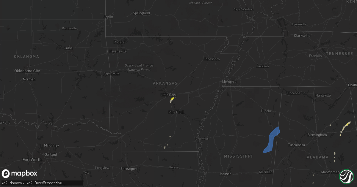
Hail Map in Arkansas on May 24, 2022
Get this storm
May 24 map
$229
one time, instant access
Download today. No call, no setup
Keep the $229
Bought the map and want the full workflow? Apply the entire $229 to a subscription within 7 days. None of it is wasted.
Every map, not just this one
This buys you this map. Subscription and you get every map we run, in the markets you choose from a few cities to whole states to nationwide. Plus real-time alerts the moment a storm fires.
Contact data
Name, contact info, occupancy, even credit band for addresses in the footprint. You go from where it hit to who to call.
Become the source they trust
Unlimited branding weather history reports on demand. You already have the documented answer ready for the property owner, and you are the one who showed up with it.
Property data and RoofTrace estimates
Pull up any address you have got, its value and the exact code rules for that jurisdiction, straight from One Click Code. Then RoofTrace estimates the squares, pitch, and roof value, priced the way you price.
Storm reports in Arkansas
Arkansas
| Date | Description |
|---|---|
| 05/24/20225:35 PM CDT | A large tree was blown down... Partially onto a home. A metal carport was also damaged. |
| 05/24/20224:15 AM CDT | At 914 PM CDT, a severe thunderstorm was located near Greenfield, or 8 miles southwest of Jonesboro, moving northeast at 35 mph. HAZARD...60 mph wind gusts and penny size hail. SOURCE...Radar indicated. IMPACT...Expect damage to roofs, siding, and trees. Locations impacted include... Jonesboro, Paragould, Bono, Bay, Brookland, Crowleys Ridge State Park, Lake Frierson State Park, Cash, Walcott, Fontaine, Greenfield, Hergett, Apt, Valley View, Schug, Gum Point, Farrville, Dorothy, Winesburg and Light. |
| 05/24/20223:39 AM CDT | At 839 PM CDT, a severe thunderstorm was located over Hickory Ridge, or 13 miles northwest of Wynne, moving northeast at 40 mph. HAZARD...60 mph wind gusts and nickel size hail. SOURCE...Radar indicated. IMPACT...Expect damage to roofs, siding, and trees. Locations impacted include... Jonesboro, Harrisburg, Weiner, Cash, Hickory Ridge, Waldenburg, Greenfield, Fisher, Hydrick, Wiley Crossing, Pittinger, Supply, Tilton, Brushy Lake, Risher, Gilkerson, Otwell, Cary, Hamlin and Dryden. |
| 05/24/20222:35 AM CDT | At 735 PM CDT, severe thunderstorms were located along a line extending from 8 miles southeast of Cass to Woodland to Scranton, moving northeast at 40 mph. HAZARD...60 mph wind gusts and penny size hail. SOURCE...Radar indicated. IMPACT...Expect damage to roofs, siding, and trees. Locations impacted include... Clarksville... Lamar... Knoxville... Scranton... Dillen... Woodland... Upper Buffalo Wilderness Area... Devils Knob... Midway in Logan County... Walnut... Spadra... Bertha... Tokalon... Holman... Rosetta... Lake Dardanelle... Morrison Bluff... Oak Grove in Johnson County... Catalpa... Fort Douglas...This includes Interstate 40 between mile markers 54 and 68. |
| 05/24/20221:55 AM CDT | At 655 PM CDT, severe thunderstorms were located along a line extending from near Ozark to near Paris, moving northeast at 50 mph. HAZARD...60 mph wind gusts and penny size hail. SOURCE...Radar indicated. IMPACT...Expect damage to roofs, siding, and trees. Locations impacted include... Clarksville... Paris... Lamar... Magazine... Knoxville... Subiaco... Hartman... Scranton... Ratcliff... Blue Mountain... Woodland... Hinkle... Hoyt... Mount Magazine... Midway in Logan County... Spadra... Tokalon... Lake Dardanelle... Coal Hill... Caulksville...This includes Interstate 40 between mile markers 44 and 65. |
| 05/24/20221:53 AM CDT | At 653 PM CDT, a severe thunderstorm was located 6 miles southwest of Ozark, moving northeast at 25 mph. HAZARD...60 mph wind gusts. SOURCE...Radar indicated. IMPACT...Expect damage to roofs, siding, and trees. Locations in or near the path include... Ozark... Altus... Branch... Denning... Wiederkehr Village... Etna... Alix... Peter Pender... Cecil... Meg...This includes Interstate 40 in Arkansas between mile markers 33 and42. |
| 05/24/202212:12 AM CDT | At 512 PM CDT, a severe thunderstorm was located near Wrightsville, or 13 miles southeast of Downtown Little Rock, moving northeast at 15 mph. HAZARD...60 mph wind gusts and quarter size hail. SOURCE...Radar indicated. IMPACT...Hail damage to vehicles is expected. Expect wind damage to roofs, siding, and trees. Locations impacted include... Little Rock... North Little Rock... Jacksonville... Wrightsville... Keo... Estes... Meto... Toltec Mounds State Park... Protho Junction... Scott... Sweet Home... McAlmont... Baucum... Bevis Corner... Higgins... College Station... Woodson... Kerr... Hensley... Bredlow Corner...This includes the following highways... Interstate 40 between mile markers 157 and 168. Interstate 530 between mile markers 6 and 9, and between milemarkers 13 and 16. Interstate 440 between mile markers 4 and 14. US Highway 67 between mile markers 6 and 8. |
| 05/23/202211:56 PM CDT | At 456 PM CDT, a severe thunderstorm was located near DeGray Lake State Park, or 11 miles northwest of Arkadelphia, moving northeast at 15 mph. HAZARD...60 mph wind gusts. SOURCE...Radar indicated. IMPACT...Expect damage to roofs, siding, and trees. Locations impacted include... DeGray Lake State Park... Bismarck... De Roche... |
| 05/23/202211:53 PM CDT | At 453 PM CDT, a severe thunderstorm was located 19 miles southwest of Octavia, or 34 miles southeast of Clayton, moving northeast at 40 mph. HAZARD...Quarter size hail. SOURCE...Radar indicated. IMPACT...Damage to vehicles is expected. Locations impacted include... Watson, Bethel, Battiest, Mount Herman, Smithville and Sherwood. |
All States Impacted by Hail Map on May 24, 2022
Cities Impacted by Hail Map on May 24, 2022
- Equality, AL
- Lott, TX
- Vienna, GA
- Byromville, GA
- Tatum, NM
- Claxton, GA
- Statesboro, GA
- Pembroke, GA
- Register, GA
- Roswell, NM
- Cottonport, LA
- Mansura, LA
- Plains, TX
- Denver City, TX
- Lovington, NM
- Albany, GA
- Amite, LA
- Lexington, TX
- Caldwell, TX
- Munford, AL
- Lorenzo, TX
- Slaton, TX
- Ransom Canyon, TX
- Ralls, TX
- Hobbs, NM
- Hensley, AR
- Little Rock, AR
- England, AR
- Scott, AR
- Paducah, TX
- Omaha, GA
- Pittsview, AL
- Junction, TX
- Vancourt, TX
- Strong, AR
- Rocksprings, TX
- Paint Rock, TX
- Tahoka, TX
- Post, TX
- Pitts, GA
- Rochelle, GA
- Baird, TX
- Weaver, AL
- Jacksonville, AL
- Anniston, AL
- Piedmont, AL
- Marble Falls, TX
- Llano, TX
- Fredericksburg, TX
- Burnet, TX
- Spicewood, TX
- Bertram, TX
- Horseshoe Bay, TX
- Round Mountain, TX
- Kingsland, TX
- Johnson City, TX
- Willow City, TX
- Bainbridge, GA
- Adrian, GA
- Soperton, GA
- Ropesville, TX
- Meadow, TX
- Brady, TX
- Menard, TX
- Barnhart, TX
- Big Lake, TX
- Mertzon, TX
- Utopia, TX
- Medina, TX
- San Angelo, TX
- Doole, TX
- Lake Arthur, NM
- Vidalia, GA
- Lyons, GA
- Oxford, AL
- Ingram, TX
- Lower Peach Tree, AL
- Thrall, TX
- Ozona, TX
- Cordele, GA
- Cobb, GA
- Hext, TX
- London, TX
- San Saba, TX
- Pine Apple, AL
- Dickens, TX
- Crosbyton, TX
- Baton Rouge, LA
- Greenwell Springs, LA
- Christoval, TX
- Eldorado, TX
- Wetumpka, AL
- Morton, TX
- Concepcion, TX
- Kellyton, AL
- Rockford, AL
- Andrews, TX
- Seminole, TX
- Uvalda, GA
- Ailey, GA
- Jonesville, LA
- Monterey, LA
- Pelham, GA
- Camilla, GA
- Manor, TX
- Elgin, TX
- Cuthbert, GA
- Monticello, FL
- Sylvester, GA
- Marianna, FL
- Cherokee, TX
- Lampasas, TX
- Bluffton, TX
- Buchanan Dam, TX
- Tow, TX
- Valley Spring, TX
- Brackettville, TX
- Elida, NM
- Eunice, NM
- Ashville, AL
- Wolfforth, TX
- Lubbock, TX
- Mountain Home, TX
- Warwick, GA
- Oakfield, GA
- Comstock, TX
- Thorndale, TX
- Asherton, TX
- Midland, TX
- Sonora, TX
- Jacksonville, GA
- McRae Helena, GA
- Washington, LA
- Palmetto, LA
- Goldthwaite, TX
- Evant, TX
- Gainestown, AL
- Uriah, AL
- George West, TX
- Tilden, TX
- Calliham, TX
- Cotulla, TX
- Fowlerton, TX
- Monroeville, AL
- Peterman, AL
- Franklin, AL
- Vredenburgh, AL
- Campbellton, FL
- Valera, TX
- Melvin, TX
- Priddy, TX
- Eola, TX
- Gustine, TX
- Stanton, TX
- Hamilton, TX
- Mullin, TX
- Santa Anna, TX
- Mereta, TX
- Gardendale, TX
- Brookesmith, TX
- Carlsbad, TX
- Early, TX
- Comanche, TX
- Big Spring, TX
- Rockwood, TX
- Sterling City, TX
- Ballinger, TX
- Rochelle, TX
- Wall, TX
- Voss, TX
- Lohn, TX
- Gouldbusk, TX
- Rowena, TX
- Coleman, TX
- Zephyr, TX
- Garden City, TX
- Goodfellow Afb, TX
- Brownwood, TX
- Eden, TX
- Talpa, TX
- Millersview, TX
- Bangs, TX
- Richland Springs, TX
- Miles, TX
- Robert Lee, TX
- Selma, AL
- Bunkie, LA
- Premont, TX
- Falfurrias, TX
- Jackson, AL
- Eagle Pass, TX
- Sabinal, TX
- Pinehurst, GA
- Mason, TX
- Castell, TX
- Art, TX
- Robstown, TX
- La Pryor, TX
- Laredo, TX
- Quemado, TX
- Del Rio, TX
- Crystal City, TX
- Fredonia, TX
- Voca, TX
- Pontotoc, TX
- Vanderpool, TX
- Leakey, TX
- Hunt, TX
- Alice, TX
- Uvalde, TX
- Carrizo Springs, TX
- Batesville, TX
- Big Wells, TX
- Barksdale, TX
- San Diego, TX
- Dryden, TX
- Doerun, GA
- Moultrie, GA
- Austin, TX
- Brinson, GA
- Bandera, TX
- Odessa, TX
- Holden, LA
- Baconton, GA
- Clyde, TX
- Banks, AR
- Hermitage, AR
- Benavides, TX
- Tarpley, TX
- Georgetown, GA
- Morris, GA
- Fort Gaines, GA
- Comfort, TX
- Center Point, TX
- Littlefield, TX
- Levelland, TX
- Seymour, TX
- Corona, NM
- Blanket, TX
- Spur, TX
- Camp Wood, TX
- Mirando City, TX
- Dripping Springs, TX
- Three Rivers, TX
- Brooksville, MS
- West Point, MS
- Crawford, MS
- Caledonia, MS
- Ethelsville, AL
- Shuqualak, MS
- Sulligent, AL
- Macon, MS
- Steens, MS
- Columbus, MS
- Millport, AL
- Vernon, AL
- Sundown, TX
- Whiteface, TX
- Snyder, TX
- Justiceburg, TX
- Aspermont, TX
- Jayton, TX
- Girard, TX
- Midkiff, TX
- Purmela, TX
- Star, TX
- Kempner, TX
- Salado, TX
- Killeen, TX
- Copperas Cove, TX
- Fort Hood, TX
- Briggs, TX
- Florence, TX
- Harker Heights, TX
- Blanco, TX
- Kerrville, TX
- Boerne, TX
- Wimberley, TX
- Hye, TX
- Harper, TX
- Stonewall, TX
- Encinal, TX
- Hondo, TX
- Floresville, TX
- La Coste, TX
- Beeville, TX
- Karnes City, TX
- Marion, TX
- Wrightsboro, TX
- San Antonio, TX
- Converse, TX
- Von Ormy, TX
- Jbsa Lackland, TX
- Rio Medina, TX
- Schertz, TX
- Westhoff, TX
- Poth, TX
- Devine, TX
- Runge, TX
- Nordheim, TX
- Nixon, TX
- Sutherland Springs, TX
- Smiley, TX
- Cost, TX
- Jbsa Ft Sam Houston, TX
- Yorktown, TX
- Leesville, TX
- Seguin, TX
- Atascosa, TX
- Hobson, TX
- Cuero, TX
- La Vernia, TX
- Gonzales, TX
- Adkins, TX
- Ecleto, TX
- D Hanis, TX
- Kenedy, TX
- Goliad, TX
- Castroville, TX
- Saint Hedwig, TX
- Gillett, TX
- Stockdale, TX
- Elmendorf, TX
- Falls City, TX
- Del Valle, TX
- La Grange, TX
- Cedar Creek, TX
- Round Top, TX
- Carmine, TX
- West Point, TX
- Fayetteville, TX
- Giddings, TX
- Bastrop, TX
- Ledbetter, TX
- Taylor, TX
- Coupland, TX
- Brenham, TX
- Pflugerville, TX
- Paige, TX
- Dime Box, TX
- Cedar Park, TX
- Round Rock, TX
- Smithville, TX
- Hutto, TX
- Lincoln, TX
- McDade, TX
- Somerville, TX
- Burton, TX
- Brookshire, TX
- Catarina, TX
- Katy, TX
- Inez, TX
- Victoria, TX
- Yoakum, TX
- Pensacola, FL
- Grove Hill, AL
- Thomasville, AL


