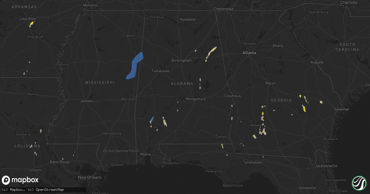
Hail Map in Alabama on May 24, 2022
Get this storm
May 24 map
$229
one time, instant access
Download today. No call, no setup
Keep the $229
Bought the map and want the full workflow? Apply the entire $229 to a subscription within 7 days. None of it is wasted.
Every map, not just this one
This buys you this map. Subscription and you get every map we run, in the markets you choose from a few cities to whole states to nationwide. Plus real-time alerts the moment a storm fires.
Contact data
Name, contact info, occupancy, even credit band for addresses in the footprint. You go from where it hit to who to call.
Become the source they trust
Unlimited branding weather history reports on demand. You already have the documented answer ready for the property owner, and you are the one who showed up with it.
Property data and RoofTrace estimates
Pull up any address you have got, its value and the exact code rules for that jurisdiction, straight from One Click Code. Then RoofTrace estimates the squares, pitch, and roof value, priced the way you price.
Storm reports in Alabama
Alabama
| Date | Description |
|---|---|
| 05/24/20224:00 AM CDT | At 900 PM CDT, a severe thunderstorm was located near Jacksonville State University, or near Jacksonville, moving northeast at 15 mph. HAZARD...60 mph wind gusts and quarter size hail. SOURCE...Radar indicated. IMPACT...Hail damage to vehicles is expected. Expect wind damage to roofs, siding, and trees. Locations impacted include... Jacksonville, Piedmont, Jacksonville State University, Knightens Crossroads and Liberty Hill. |
| 05/24/202212:10 AM CDT | Nws employee estimated at least 60 mph gusts on st. Anrdews ct on dauphin island. |
| 05/23/202210:34 PM CDT | At 334 PM CDT, a severe thunderstorm was located near Mashulaville, or 16 miles northeast of Preston, moving northeast at 40 mph. HAZARD...60 mph wind gusts. SOURCE...Radar indicated. IMPACT...Expect damage to roofs, siding, and trees. This severe thunderstorm will be near... Macon around 340 PM CDT. Brooksville around 350 PM CDT. Deerbrook around 355 PM CDT. Crawford around 400 PM CDT. Columbus and Bent Oak around 415 PM CDT.Other locations impacted by this severe thunderstorm includeShuqualak and Artesia. |
| 05/23/20229:06 PM CDT | Lots of wind blown hail. |
| 05/23/20228:32 PM CDT | At 131 PM CDT, a severe thunderstorm was located 9 miles northwest of Peterman, or 10 miles north of Monroeville, moving north at 25 mph. HAZARD...60 mph wind gusts and quarter size hail. SOURCE...Radar indicated. IMPACT...Hail damage to vehicles is expected. Expect wind damage to roofs, siding, and trees. Locations impacted include... Pine Hill, Vredenburgh and Yellow Bluff. |
| 05/23/20228:01 PM CDT | At 100 PM CDT, a severe thunderstorm was located 5 miles west of Grove Hill, moving north at 40 mph. HAZARD...60 mph wind gusts and quarter size hail. SOURCE...Radar indicated. IMPACT...Hail damage to vehicles is expected. Expect wind damage to roofs, siding, and trees. Locations impacted include... Thomasville, Grove Hill and Fulton. |
| 05/23/20227:26 PM CDT | A single tree reported down along 1565 poplar creek near missionary baptist church south of leighton. An additional tree was reported down in the same general area. |
| 05/23/20227:05 PM CDT | A couple of trees reported down along county road 157 white oak ln in hatton. |
All States Impacted by Hail Map on May 24, 2022
Cities Impacted by Hail Map on May 24, 2022
- Equality, AL
- Lott, TX
- Vienna, GA
- Byromville, GA
- Tatum, NM
- Claxton, GA
- Statesboro, GA
- Pembroke, GA
- Register, GA
- Roswell, NM
- Cottonport, LA
- Mansura, LA
- Plains, TX
- Denver City, TX
- Lovington, NM
- Albany, GA
- Amite, LA
- Lexington, TX
- Caldwell, TX
- Munford, AL
- Lorenzo, TX
- Slaton, TX
- Ransom Canyon, TX
- Ralls, TX
- Hobbs, NM
- Hensley, AR
- Little Rock, AR
- England, AR
- Scott, AR
- Paducah, TX
- Omaha, GA
- Pittsview, AL
- Junction, TX
- Vancourt, TX
- Strong, AR
- Rocksprings, TX
- Paint Rock, TX
- Tahoka, TX
- Post, TX
- Pitts, GA
- Rochelle, GA
- Baird, TX
- Weaver, AL
- Jacksonville, AL
- Anniston, AL
- Piedmont, AL
- Marble Falls, TX
- Llano, TX
- Fredericksburg, TX
- Burnet, TX
- Spicewood, TX
- Bertram, TX
- Horseshoe Bay, TX
- Round Mountain, TX
- Kingsland, TX
- Johnson City, TX
- Willow City, TX
- Bainbridge, GA
- Adrian, GA
- Soperton, GA
- Ropesville, TX
- Meadow, TX
- Brady, TX
- Menard, TX
- Barnhart, TX
- Big Lake, TX
- Mertzon, TX
- Utopia, TX
- Medina, TX
- San Angelo, TX
- Doole, TX
- Lake Arthur, NM
- Vidalia, GA
- Lyons, GA
- Oxford, AL
- Ingram, TX
- Lower Peach Tree, AL
- Thrall, TX
- Ozona, TX
- Cordele, GA
- Cobb, GA
- Hext, TX
- London, TX
- San Saba, TX
- Pine Apple, AL
- Dickens, TX
- Crosbyton, TX
- Baton Rouge, LA
- Greenwell Springs, LA
- Christoval, TX
- Eldorado, TX
- Wetumpka, AL
- Morton, TX
- Concepcion, TX
- Kellyton, AL
- Rockford, AL
- Andrews, TX
- Seminole, TX
- Uvalda, GA
- Ailey, GA
- Jonesville, LA
- Monterey, LA
- Pelham, GA
- Camilla, GA
- Manor, TX
- Elgin, TX
- Cuthbert, GA
- Monticello, FL
- Sylvester, GA
- Marianna, FL
- Cherokee, TX
- Lampasas, TX
- Bluffton, TX
- Buchanan Dam, TX
- Tow, TX
- Valley Spring, TX
- Brackettville, TX
- Elida, NM
- Eunice, NM
- Ashville, AL
- Wolfforth, TX
- Lubbock, TX
- Mountain Home, TX
- Warwick, GA
- Oakfield, GA
- Comstock, TX
- Thorndale, TX
- Asherton, TX
- Midland, TX
- Sonora, TX
- Jacksonville, GA
- McRae Helena, GA
- Washington, LA
- Palmetto, LA
- Goldthwaite, TX
- Evant, TX
- Gainestown, AL
- Uriah, AL
- George West, TX
- Tilden, TX
- Calliham, TX
- Cotulla, TX
- Fowlerton, TX
- Monroeville, AL
- Peterman, AL
- Franklin, AL
- Vredenburgh, AL
- Campbellton, FL
- Valera, TX
- Melvin, TX
- Priddy, TX
- Eola, TX
- Gustine, TX
- Stanton, TX
- Hamilton, TX
- Mullin, TX
- Santa Anna, TX
- Mereta, TX
- Gardendale, TX
- Brookesmith, TX
- Carlsbad, TX
- Early, TX
- Comanche, TX
- Big Spring, TX
- Rockwood, TX
- Sterling City, TX
- Ballinger, TX
- Rochelle, TX
- Wall, TX
- Voss, TX
- Lohn, TX
- Gouldbusk, TX
- Rowena, TX
- Coleman, TX
- Zephyr, TX
- Garden City, TX
- Goodfellow Afb, TX
- Brownwood, TX
- Eden, TX
- Talpa, TX
- Millersview, TX
- Bangs, TX
- Richland Springs, TX
- Miles, TX
- Robert Lee, TX
- Selma, AL
- Bunkie, LA
- Premont, TX
- Falfurrias, TX
- Jackson, AL
- Eagle Pass, TX
- Sabinal, TX
- Pinehurst, GA
- Mason, TX
- Castell, TX
- Art, TX
- Robstown, TX
- La Pryor, TX
- Laredo, TX
- Quemado, TX
- Del Rio, TX
- Crystal City, TX
- Fredonia, TX
- Voca, TX
- Pontotoc, TX
- Vanderpool, TX
- Leakey, TX
- Hunt, TX
- Alice, TX
- Uvalde, TX
- Carrizo Springs, TX
- Batesville, TX
- Big Wells, TX
- Barksdale, TX
- San Diego, TX
- Dryden, TX
- Doerun, GA
- Moultrie, GA
- Austin, TX
- Brinson, GA
- Bandera, TX
- Odessa, TX
- Holden, LA
- Baconton, GA
- Clyde, TX
- Banks, AR
- Hermitage, AR
- Benavides, TX
- Tarpley, TX
- Georgetown, GA
- Morris, GA
- Fort Gaines, GA
- Comfort, TX
- Center Point, TX
- Littlefield, TX
- Levelland, TX
- Seymour, TX
- Corona, NM
- Blanket, TX
- Spur, TX
- Camp Wood, TX
- Mirando City, TX
- Dripping Springs, TX
- Three Rivers, TX
- Brooksville, MS
- West Point, MS
- Crawford, MS
- Caledonia, MS
- Ethelsville, AL
- Shuqualak, MS
- Sulligent, AL
- Macon, MS
- Steens, MS
- Columbus, MS
- Millport, AL
- Vernon, AL
- Sundown, TX
- Whiteface, TX
- Snyder, TX
- Justiceburg, TX
- Aspermont, TX
- Jayton, TX
- Girard, TX
- Midkiff, TX
- Purmela, TX
- Star, TX
- Kempner, TX
- Salado, TX
- Killeen, TX
- Copperas Cove, TX
- Fort Hood, TX
- Briggs, TX
- Florence, TX
- Harker Heights, TX
- Blanco, TX
- Kerrville, TX
- Boerne, TX
- Wimberley, TX
- Hye, TX
- Harper, TX
- Stonewall, TX
- Encinal, TX
- Hondo, TX
- Floresville, TX
- La Coste, TX
- Beeville, TX
- Karnes City, TX
- Marion, TX
- Wrightsboro, TX
- San Antonio, TX
- Converse, TX
- Von Ormy, TX
- Jbsa Lackland, TX
- Rio Medina, TX
- Schertz, TX
- Westhoff, TX
- Poth, TX
- Devine, TX
- Runge, TX
- Nordheim, TX
- Nixon, TX
- Sutherland Springs, TX
- Smiley, TX
- Cost, TX
- Jbsa Ft Sam Houston, TX
- Yorktown, TX
- Leesville, TX
- Seguin, TX
- Atascosa, TX
- Hobson, TX
- Cuero, TX
- La Vernia, TX
- Gonzales, TX
- Adkins, TX
- Ecleto, TX
- D Hanis, TX
- Kenedy, TX
- Goliad, TX
- Castroville, TX
- Saint Hedwig, TX
- Gillett, TX
- Stockdale, TX
- Elmendorf, TX
- Falls City, TX
- Del Valle, TX
- La Grange, TX
- Cedar Creek, TX
- Round Top, TX
- Carmine, TX
- West Point, TX
- Fayetteville, TX
- Giddings, TX
- Bastrop, TX
- Ledbetter, TX
- Taylor, TX
- Coupland, TX
- Brenham, TX
- Pflugerville, TX
- Paige, TX
- Dime Box, TX
- Cedar Park, TX
- Round Rock, TX
- Smithville, TX
- Hutto, TX
- Lincoln, TX
- McDade, TX
- Somerville, TX
- Burton, TX
- Brookshire, TX
- Catarina, TX
- Katy, TX
- Inez, TX
- Victoria, TX
- Yoakum, TX
- Pensacola, FL
- Grove Hill, AL
- Thomasville, AL


