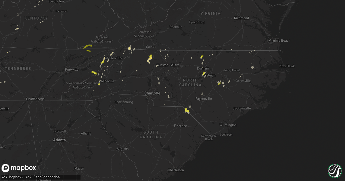
Hail Map in North Carolina on May 21, 2022
Get this storm
May 21 map
$229
one time, instant access
Download today. No call, no setup
Keep the $229
Bought the map and want the full workflow? Apply the entire $229 to a subscription within 7 days. None of it is wasted.
Every map, not just this one
This buys you this map. Subscription and you get every map we run, in the markets you choose from a few cities to whole states to nationwide. Plus real-time alerts the moment a storm fires.
Contact data
Name, contact info, occupancy, even credit band for addresses in the footprint. You go from where it hit to who to call.
Become the source they trust
Unlimited branding weather history reports on demand. You already have the documented answer ready for the property owner, and you are the one who showed up with it.
Property data and RoofTrace estimates
Pull up any address you have got, its value and the exact code rules for that jurisdiction, straight from One Click Code. Then RoofTrace estimates the squares, pitch, and roof value, priced the way you price.
Storm reports in North Carolina
North Carolina
| Date | Description |
|---|---|
| 05/21/20225:45 PM CDT | Powerlines down on the northside of roxboro. Radar estimated time. |
| 05/21/20225:09 PM CDT | Thunderstorm winds blew down one tree at the intersection of lynchburg road and lucius beasley road. |
| 05/21/20225:08 PM CDT | Thunderstorm winds blew down one tree at the intersection of sheppard mill road and pitzer road. |
| 05/21/20225:06 PM CDT | Thunderstorm winds blew down one tree at the intersection of hall road and c c camp road. |
| 05/21/20225:03 PM CDT | Thunderstorm winds blew down one tree at the intersection of flat shoals road and highway 8. |
| 05/21/20225:02 PM CDT | Thunderstorm winds blew down one tree at the intersection of king road and bro downed on horseshoe bend rd in deltaville near the deltaville library. Report via facebook. |
| 05/21/20225:02 PM CDT | Thunderstorm winds blew down one tree at the intersection of king road and brown mountain road. |
| 05/21/20225:00 PM CDT | Thunderstorm winds blew down one tree at the intersection of chilton road and mountain road. |
| 05/21/20225:00 PM CDT | Thunderstorm winds blew down one tree at the intersection of early lane and highway 268. |
| 05/21/20224:59 PM CDT | Multiple trees down near smithfield rd and i-87. Time estimated based on radar. |
| 05/21/20224:45 PM CDT | Powerlines down in the vicinity of pope rd and old salisbury rd. Radar estimated time. |
| 05/21/20224:40 PM CDT | A tree was reported down... Along with power lines down... Near the 5300 block of tobaccoville rd. Time estimated by radar. |
| 05/21/20224:34 PM CDT | Several trees down in mountain park from 534 pm to 552 pm. |
| 05/21/20224:27 PM CDT | Off airport blvd. |
| 05/21/20224:22 PM CDT | Public measured up to quarter sized hail. Time estimated by radar. |
| 05/21/20224:18 PM CDT | A tree fell down on powerlines near the intersection of n charles st and reams ave. Time estimated by radar. |
| 05/21/20223:55 PM CDT | A tree was reported down near the intersection of us 301 n and pittman rd. Time estimated by radar. |
| 05/21/20223:55 PM CDT | A tree was reported down near the intersection of us 301 n and pittman rd. Time estimated by radar. Egany. |
| 05/21/20223:55 PM CDT | Corrects previous tstm wnd dmg report from 1 wsw micro. Multiple trees down near the intersection of us 301 n and pittman rd. Time estimated by radar. |
| 05/21/20223:04 PM CDT | A tree fell down across the entire roadway. Time estimated by radar. |
| 05/21/20223:00 PM CDT | Several reports of trees and power lines down along patterson st. And hwy 152 in china grove. Time estimated from radar. |
| 05/21/20223:00 PM CDT | A tree knocked out power near the intersection of hannah pickett ave and safie 5th street. Time estimated by radar. |
| 05/21/20222:50 PM CDT | Social media report of quarter-sized hail in china grove. Time based on radar. |
| 05/21/20222:36 PM CDT | Multiple trees down near the intersection of old wire rd and sneads grove rd. Time estimated by radar. |
| 05/21/20222:33 PM CDT | Multiple trees down near the 13000 block of blues farm rd. Time estimated by radar. |
| 05/21/20221:08 PM CDT | Picture on twitter shows estimated largest hail up to quarter-sized in canton. Lots of pea to marble as well. |
| 05/21/20225:17 AM CDT | At 1015 PM EDT, a severe thunderstorm was located 5 miles southeast of Marion, moving north at 10 mph. HAZARD...60 mph wind gusts and quarter size hail. SOURCE...Radar indicated. IMPACT...Minor hail damage to vehicles is expected. Expect wind damage to trees and power lines. Locations impacted include... Marion, Lake James State Park, Lake James, Nebo, Sugar Hill, Glenwood, Fero, Dysartsville, Glen Alpine and Woodlawn. |
| 05/21/20223:18 AM CDT | At 818 PM EDT, a severe thunderstorm was located 6 miles east of Lenoir, or near Cedar Rock, and is nearly stationary. HAZARD...60 mph wind gusts and quarter size hail. SOURCE...Radar indicated. IMPACT...Minor hail damage to vehicles is expected. Expect wind damage to trees and power lines. Locations impacted include... Cedar Rock, Ellendale, Kings Creek, Little River In Alexander County and Lenoir. |
| 05/21/20221:26 AM CDT | At 626 PM EDT, a severe thunderstorm was located near Rougemont, or 10 miles southeast of Roxboro, moving north at 15 mph. HAZARD...60 mph wind gusts. SOURCE...Radar indicated. IMPACT...Expect damage to roofs, siding, and trees. Locations impacted include... Roxboro, Bethel Hill, Mayo Reservoir, Surl, Moriah and Hyco Lake. |
| 05/21/20221:16 AM CDT | At 614 PM EDT, a severe thunderstorm was located near Laurel Fork, or near Ararat, moving northeast at 15 mph. HAZARD...60 mph wind gusts and quarter size hail. SOURCE...Radar indicated. IMPACT...Hail damage to vehicles is expected. Expect wind damage to roofs, siding, and trees. Locations impacted include... Hillsville... Floyd... Indian Valley... Fancy Gap... Ararat... Willis... and Dugspur. |
| 05/21/202212:43 AM CDT | At 542 PM EDT, a severe thunderstorm was located near Scottsburg, or near South Boston, moving northeast at 30 mph. HAZARD...60 mph wind gusts and quarter size hail. SOURCE...Radar indicated. IMPACT...Hail damage to vehicles is expected. Expect wind damage to roofs, siding, and trees. Locations impacted include... South Boston... Halifax... Keysville... Charlotte Court House... Phenix... Redoak... and Clover. |
| 05/21/202212:39 AM CDT | At 539 PM EDT, a severe thunderstorm was located over King, or 7 miles east of East Bend, moving northeast at 30 mph. HAZARD...60 mph wind gusts and quarter size hail. SOURCE...Radar indicated. IMPACT...Hail damage to vehicles is expected. Expect wind damage to roofs, siding, and trees. Locations impacted include... Eden... Reidsville... Martinsville... Wentworth... Mayodan... Madison... and Pilot Mountain.This includes The following Locations The Martinsville Speedway andMartinsville Airport. |
| 05/21/202212:37 AM CDT | At 537 PM EDT, a severe thunderstorm was located 8 miles northwest of Thomasville, or 9 miles north of Lexington, moving northeast at 20 mph. HAZARD...60 mph wind gusts and penny size hail. SOURCE...Radar indicated. IMPACT...Expect damage to roofs, siding, and trees. Locations impacted include... Greensboro, Winston-Salem, High Point, Lexington, Thomasville, Kernersville, Stokesdale, Walkertown, Oak Hollow Marina and Belews Creek. |
| 05/21/202212:27 AM CDT | At 527 PM EDT, a severe thunderstorm was located 8 miles northeast of Angier, or 15 miles west of Smithfield, moving northeast at 30 mph. HAZARD...60 mph wind gusts and penny size hail. SOURCE...Radar indicated. IMPACT...Expect damage to roofs, siding, and trees. Locations impacted include... Raleigh, Garner, Clayton, Knightdale, Wendell, Emit, Coats Crossroads, Flowers and Lake Benson. |
| 05/21/202212:02 AM CDT | At 502 PM EDT, a severe thunderstorm was located near Cary, moving northeast at 10 mph. HAZARD...60 mph wind gusts and quarter size hail. SOURCE...Radar indicated. IMPACT...Hail damage to vehicles is expected. Expect wind damage to roofs, siding, and trees. Locations impacted include... Raleigh, Durham, Cary, RDU International, Apex, Morrisville, Gorman, William B Umstead State Park, Parkwood and Jordan Lake. |
| 05/21/202212:00 AM CDT | At 500 PM EDT, a severe thunderstorm was located near Roxboro, moving northeast at 15 mph. HAZARD...60 mph wind gusts and nickel size hail. SOURCE...Radar indicated. IMPACT...Expect damage to roofs, siding, and trees. Locations impacted include... Roxboro, Bethel Hill, Mayo Reservoir and Surl. |
| 05/20/202211:38 PM CDT | At 437 PM EDT, a severe thunderstorm was located near Smithfield, moving northeast at 30 mph. HAZARD...60 mph wind gusts and quarter size hail. SOURCE...Radar indicated. IMPACT...Hail damage to vehicles is expected. Expect wind damage to roofs, siding, and trees. Locations impacted include... Smithfield, Micro, Selma, Pine Level, Kenly, Lucama, Middlesex, Emit and Buckhorn Reservoir. |
| 05/20/202211:26 PM CDT | At 426 PM EDT, a severe thunderstorm was located 8 miles west of Pope AFB, or 8 miles west of Fort Bragg, moving north at 20 mph. HAZARD...60 mph wind gusts and penny size hail. SOURCE...Radar indicated. IMPACT...Expect damage to roofs, siding, and trees. Locations impacted include... Southern Pines, Fort Bragg, Aberdeen, Whispering Pines, Vass, Cameron, Olivia, Pineview, Lemon Springs and Ashley Heights. |
| 05/20/202211:20 PM CDT | At 420 PM EDT, a severe thunderstorm was located near Fremont, or 14 miles north of Goldsboro, moving northeast at 20 mph. HAZARD...60 mph wind gusts and quarter size hail. SOURCE...Radar indicated. IMPACT...Hail damage to vehicles is expected. Expect wind damage to roofs, siding, and trees. Locations impacted include... Wilson, Elm City, Fremont, Sharpsburg, Pinetops, Stantonsburg, Black Creek, Macclesfield, Saratoga and Eureka. |
| 05/20/202211:13 PM CDT | At 412 PM EDT, a severe thunderstorm was located 4 miles west of Salisbury, moving northeast at 20 mph. HAZARD...60 mph wind gusts and quarter size hail. SOURCE...Radar indicated. IMPACT...Minor hail damage to vehicles is expected. Expect wind damage to trees and power lines. Locations impacted include... Salisbury, Spencer, Cooleemee, Piedmont Research Station, Woodleaf and Mount Ulla. |
| 05/20/202210:58 PM CDT | At 358 PM EDT, a severe thunderstorm was located over Mount Rogers Summit, or near Whitetop, moving northeast at 35 mph. HAZARD...60 mph wind gusts and quarter size hail. SOURCE...Radar indicated. IMPACT...Hail damage to vehicles is expected. Expect wind damage to roofs, siding, and trees. Locations impacted include... Mountain City, Damascus, Laurel Bloomery and Konnarock. |
| 05/20/202210:47 PM CDT | At 347 PM EDT, a severe thunderstorm was located 5 miles northeast of Kannapolis, or near China Grove, moving northeast at 20 mph. HAZARD...60 mph wind gusts and quarter size hail. SOURCE...Radar indicated. IMPACT...Minor hail damage to vehicles is expected. Expect wind damage to trees and power lines. Locations impacted include... Kannapolis, Salisbury, China Grove, Spencer, Landis, Enochville, Granite Quarry, Rockwell, Faith and High Rock Lake. |
| 05/20/202210:37 PM CDT | At 336 PM EDT, a severe thunderstorm was located 10 miles east of Gatlinburg, moving northeast at 10 mph. HAZARD...60 mph wind gusts and quarter size hail. SOURCE...Radar indicated. IMPACT...Hail damage to vehicles is expected. Expect wind damage to roofs, siding, and trees. Locations impacted include... Smoky Mountains-Big Creek, Smoky Mountains-Balsam Mountain, Pittman Center, Cosby, Hartford and Great Smoky Mountains National Park.This includes Interstate 40 in Tennessee between mile markers 443 and446, and between mile markers 448 and 449, and near mile marker 451. |
| 05/20/202210:04 PM CDT | At 304 PM EDT, a severe thunderstorm was located 9 miles southwest of Hampton, or 9 miles east of Erwin, moving northeast at 10 mph. HAZARD...60 mph wind gusts and quarter size hail. SOURCE...Radar indicated. IMPACT...Hail damage to vehicles is expected. Expect wind damage to roofs, siding, and trees. Locations impacted include... Unicoi and Limestone Cove. |
| 05/20/20229:35 PM CDT | Tree down on sinclair ave in marion. |
| 05/20/20229:35 PM CDT | Trees down on bond street in marion. |
| 05/20/20228:58 PM CDT | At 158 PM EDT, a severe thunderstorm was located 8 miles east of Waynesville, or near Canton, moving northeast at 5 mph. HAZARD...60 mph wind gusts and quarter size hail. SOURCE...Radar indicated. IMPACT...Minor hail damage to vehicles is expected. Expect wind damage to trees and power lines. Locations impacted include... Canton, Clyde, Candler, Cruso and Enka. |
| 05/20/20228:36 PM CDT | At 136 PM EDT, a severe thunderstorm was located 8 miles east of Sylva, or 5 miles southwest of B.R. Parkway-Balsam Gap To Black Balsam Area, moving northeast at 10 mph. HAZARD...60 mph wind gusts and quarter size hail. SOURCE...Radar indicated. IMPACT...Minor hail damage to vehicles is expected. Expect wind damage to trees and power lines. Locations impacted include... Balsam, B.R. Parkway-Balsam Gap To Black Balsam Area, Sunburst, Cullowhee, Black Balsam Area and B.R. Parkway-Smoky Mountains To Balsam Gap. |
| 05/20/20228:30 PM CDT | At 130 PM EDT, a severe thunderstorm was located near Marshall, moving northeast at 10 mph. HAZARD...60 mph wind gusts and quarter size hail. SOURCE...Radar indicated. IMPACT...Minor hail damage to vehicles is expected. Expect wind damage to trees and power lines. Locations impacted include... Marshall, Mars Hill and Flat Creek. |
| 05/20/20228:12 PM CDT | At 112 PM EDT, a severe thunderstorm was located 10 miles southwest of Downtown Asheville, or near B.R. Parkway-Mount Pisgah To The Nc Arboretum, moving northeast at 10 mph. HAZARD...60 mph wind gusts and quarter size hail. SOURCE...Radar indicated. IMPACT...Minor hail damage to vehicles is expected. Expect wind damage to trees and power lines. Locations impacted include... Downtown Asheville, Arden, West Asheville, Woodfin, Biltmore Forest, Bent Creek, Skyland, UNC-Asheville, Enka and Avery Creek. |
All States Impacted by Hail Map on May 21, 2022
Cities Impacted by Hail Map on May 21, 2022
- Tunica, MS
- Lake Cormorant, MS
- Robinsonville, MS
- Hernando, MS
- Saint Albans, VT
- Sheldon, VT
- Swanton, VT
- Morrisville, VT
- Hyde Park, VT
- Wapakoneta, OH
- Bedford, OH
- Gates Mills, OH
- Rome, OH
- Chesterland, OH
- Orwell, OH
- Windsor, OH
- Chagrin Falls, OH
- Novelty, OH
- Macedonia, OH
- Newbury, OH
- Cleveland, OH
- Beachwood, OH
- Burton, OH
- Solon, OH
- Montville, OH
- Mentor, OH
- Willoughby, OH
- Chardon, OH
- Thompson, OH
- Huntsburg, OH
- Middlefield, OH
- Painesville, OH
- Warsaw, OH
- Columbus, OH
- Reynoldsburg, OH
- Laquey, MO
- Richland, MO
- Foster, KY
- Falmouth, KY
- Butler, KY
- Sycamore, OH
- Findlay, OH
- Carey, OH
- Upper Sandusky, OH
- Vanlue, OH
- McCutchenville, OH
- Mount Blanchard, OH
- Alvada, OH
- Arlington, OH
- New Riegel, OH
- Rock Creek, OH
- Independence, OH
- Maple Heights, OH
- Grove City, OH
- Orient, OH
- Bloomingburg, OH
- Washington Court House, OH
- Mount Sterling, OH
- London, OH
- Mount Perry, OH
- Rosebud, MO
- Gerald, MO
- Millersport, OH
- Baltimore, OH
- Central Square, NY
- Pennellville, NY
- West Monroe, NY
- Brewerton, NY
- Constantia, NY
- Saint Clair, MI
- East China, MI
- Clarks Mills, PA
- Fredonia, PA
- Greenville, PA
- Stoneboro, PA
- Conneautville, PA
- Alliance, OH
- Louisville, OH
- Ashtabula, OH
- Geneva, OH
- Austinburg, OH
- Jefferson, OH
- Parish, NY
- Clyde, OH
- Bellevue, OH
- Fresno, OH
- Errol, NH
- Canaan, VT
- Colebrook, NH
- Guildhall, VT
- Chillicothe, OH
- Circleville, OH
- Kingston, OH
- Lynn, IN
- Williamsburg, IN
- Republic, OH
- Derby Line, VT
- New Castle, IN
- Pleasantville, OH
- Russellville, OH
- Paris, KY
- Cynthiana, KY
- North Jackson, OH
- Youngstown, OH
- Lorain, OH
- Lewis, NY
- Williston, VT
- Keeseville, NY
- South Burlington, VT
- Willsboro, NY
- Shelburne, VT
- New Knoxville, OH
- Saint Marys, OH
- Forestport, NY
- Jeromesville, OH
- Mount Victory, OH
- Ridgeway, OH
- Kenton, OH
- Orleans, VT
- Almont, MI
- Flat Rock, IN
- Edinburgh, IN
- Shelbyville, IN
- Columbus, IN
- Eastlake, OH
- Derby, VT
- New Carlisle, OH
- Saint Paris, OH
- Clayton, OH
- Brookville, OH
- Dayton, OH
- North Hampton, OH
- Springfield, OH
- Englewood, OH
- Vandalia, OH
- Tipp City, OH
- Ellicottville, NY
- Franklinville, NY
- Great Valley, NY
- Pierpont, OH
- Conneaut, OH
- Kingsville, OH
- North Bloomfield, OH
- Louisville, IL
- Lake Milton, OH
- Berlin Center, OH
- Diamond, OH
- Fulton, NY
- Phoenix, NY
- Rouses Point, NY
- Centerville, IN
- Milton, IN
- Island Pond, VT
- Pittsburg, NH
- Norton, VT
- West Charleston, VT
- Averill, VT
- Andover, ME
- East Charleston, VT
- Morgan, VT
- Cuba, MO
- Atlantic, PA
- Cochranton, PA
- Meadville, PA
- Conneaut Lake, PA
- Potosi, MO
- Sullivan, MO
- House Springs, MO
- Arnold, MO
- Imperial, MO
- Fenton, MO
- High Ridge, MO
- Franklin, IN
- Trafalgar, IN
- Nineveh, IN
- Essex, NY
- West Alexandria, OH
- Sodus, NY
- Williamson, NY
- Mount Gilead, OH
- Galion, OH
- Edison, OH
- Baltic, OH
- Hillsboro, OH
- Waterford, PA
- Cambridge Springs, PA
- Germanton, NC
- Walnut Cove, NC
- Williamstown, KY
- New Wilmington, PA
- Pulaski, PA
- West Middlesex, PA
- Wirtz, VA
- Hardy, VA
- Stamping Ground, KY
- Conesville, OH
- Coshocton, OH
- Bourbon, MO
- Fincastle, VA
- Troutville, VA
- Boones Mill, VA
- Rocky Mount, VA
- O'Fallon, IL
- Belleville, IL
- Canal Winchester, OH
- Pataskala, OH
- Pickerington, OH
- Groveport, OH
- Lockbourne, OH
- Sabina, OH
- Troutdale, VA
- Sugar Grove, VA
- Burlington, KY
- Murfreesboro, NC
- Pendleton, NC
- Saint James, MO
- Saint Elmo, IL
- Troy, TN
- Hornbeak, TN
- Ridgely, TN
- Union City, TN
- Tiptonville, TN
- Obion, TN
- Williamsburg, OH
- Bethel, OH
- Frankfort, KY
- Roxboro, NC
- Timberlake, NC
- Batavia, OH
- Bahama, NC
- Imboden, AR
- Pocahontas, AR
- Greensburg, IN
- Milroy, IN
- Dover, TN
- Waverly, TN
- Hazel, KY
- Springville, TN
- Tennessee Ridge, TN
- Camden, TN
- Stewart, TN
- Mansfield, TN
- Cumberland City, TN
- Erin, TN
- Henry, TN
- Paris, TN
- Hollow Rock, TN
- New Concord, KY
- Big Sandy, TN
- Bruceton, TN
- Buchanan, TN
- Puryear, TN
- Whiteville, TN
- Iuka, IL
- Oil Trough, AR
- Pleasant Plains, AR
- Vienna, IL
- Cypress, IL
- Jonesboro, AR
- Princeton, NC
- Kenly, NC
- Selma, NC
- Canton, NC
- Waynesville, NC
- Heber Springs, AR
- McNeil, AR
- Waldo, AR
- Carlisle, AR
- Humnoke, AR
- Stuttgart, AR
- Batesville, AR
- Floral, AR
- Pulaski, TN
- Memphis, TN
- Swifton, AR
- Marshall, NC
- Louin, MS
- Cosby, TN
- Grandview, TX
- Piney Flats, TN
- Blountville, TN
- Johnson City, TN
- Kinston, AL
- Millen, GA
- Garfield, GA
- Midville, GA
- Marion, KY
- Salem, KY
- Fredonia, KY
- Burna, KY
- Eddyville, KY
- Princeton, KY
- Violet Hill, AR
- Salem, AR
- Hardy, AR
- Cherokee Village, AR
- Melbourne, AR
- Oxford, AR
- Franklin, AR
- Wiseman, AR
- Ash Flat, AR
- Glencoe, AR
- Horseshoe Bend, AR
- Brockwell, AR
- Lorena, TX
- Eva, TN
- McKenzie, TN
- Williamsville, MO
- Lewisburg, TN
- Clinton, KY
- Prospect, TN
- Lexington, NC
- Unionville, TN
- Wilburn, AR
- Saint Joe, AR
- Marshall, AR
- Oxford, NC
- Leicester, NC
- Fort Campbell, KY
- Oak Grove, KY
- Searcy, AR
- Poplar Bluff, MO
- Grandin, MO
- Ellsinore, MO
- Chuckey, TN
- Limestone, TN
- Buena Vista, TN
- Osceola, AR
- Mountain View, AR
- Pleasant Grove, AR
- Vilas, NC
- Sulphur Rock, AR
- Cord, AR
- Norman, AR
- Turbeville, SC
- Olanta, SC
- Horatio, AR
- Winthrop, AR
- Pine Bluff, AR
- McBee, SC
- Hattiesburg, MS
- Petal, MS
- Eagletown, OK
- Mena, AR
- Cabot, AR
- Cope, SC
- Anderson, AL
- Athens, AL
- Rogersville, AL
- Lester, AL
- Elkmont, AL
- Fort Mill, SC
- Kilgore, TX
- Overton, TX
- Humphrey, AR
- Aiken, SC
- Waxahachie, TX
- Hampton, AR
- Ovett, MS
- Ellisville, MS
- Hartsville, SC
- Rocky Ford, GA
- Nashville, AR
- Letohatchee, AL
- Fort Deposit, AL
- Hayneville, AL
- Springhill, LA
- West Mansfield, OH
- Mansfield, OH
- Davisburg, MI
- Shelbyville, KY
- East Carondelet, IL
- Dupo, IL
- East Saint Louis, IL
- Millstadt, IL
- Fairview Heights, IL
- Saint Louis, MO
- Petersburg, IN
- Winslow, IN
- Morehead, KY
- Carlisle, KY
- Charles City, VA
- Riner, VA
- Willis, VA
- Check, VA
- Indian Valley, VA
- Pilot, VA
- Floyd, VA
- Radford, VA
- Deerfield, OH
- Petersburg, WV
- Moorefield, WV
- Bruceville, IN
- Bicknell, IN
- Galena, MO
- Laurel Fork, VA
- Hillsville, VA
- Dickson, TN
- Burns, TN
- Danbury, NC
- Westfield, NC
- Bethel, NC
- Selmer, TN
- Ramer, TN
- Fremont, NC
- Stantonsburg, NC
- Wilson, NC
- Elkin, NC
- Roaring River, NC
- Ronda, NC
- Thurmond, NC
- State Road, NC
- North Wilkesboro, NC
- Lawrenceburg, TN
- Loretto, TN
- Leoma, TN
- Chester, SC
- Grand Junction, TN
- Michigan City, MS
- Moscow, TN
- Cordova, SC
- Texarkana, AR
- Proctor, AR
- Edmondson, AR
- Hughes, AR
- Aviston, IL
- Hot Springs Village, AR
- Lonsdale, AR
- Benton, AR
- Owensville, IN
- Princeton, IN
- Chrisney, IN
- Gentryville, IN
- Hot Springs National Park, AR
- North Tazewell, VA
- Umpire, AR
- Langley, AR
- Newhope, AR
- Jeffersonville, OH
- Wilmington, OH
- Jamestown, OH
- New Richmond, OH
- Cincinnati, OH
- Amelia, OH
- Cameron, SC
- Orangeburg, SC
- Elloree, SC
- Patriot, IN
- Rising Sun, IN
- Union, KY
- Oxford, OH
- College Corner, OH
- Somerville, OH
- Camden, OH
- Minter, AL
- Orrville, AL
- Carson, VA
- Dewitt, VA
- Dinwiddie, VA
- Saint Francisville, IL
- Lawrenceville, IL
- Sumner, IL
- Bridgeport, IL
- Claremont, IL
- Lansing, NC
- Creston, NC
- Greenfield, OH
- Leesburg, OH
- Marion, VA
- Suffolk, VA
- Sparta, KY
- Warsaw, KY
- Glencoe, KY
- Carlyle, IL
- Lawrenceburg, KY
- Locust Grove, AR
- Rosie, AR
- Sardinia, OH
- Lynchburg, OH
- Mount Orab, OH
- Elk Horn, KY
- Cecilia, KY
- Glendale, KY
- Linesville, PA
- Andover, OH
- Dorset, OH
- Drummonds, TN
- North Little Rock, AR
- Little Rock, AR
- Sunbury, OH
- Centerburg, OH
- Liberty, KY
- Success, AR
- Felicity, OH
- Ozan, AR
- Mineral Springs, AR
- Lockesburg, AR
- Columbus, AR
- Dittmer, MO
- Catawissa, MO
- Hillsboro, MO
- Pacific, MO
- Robertsville, MO
- Richwoods, MO
- Eureka, MO
- Cedar Hill, MO
- Guion, AR
- Mount Pleasant, AR
- Fulton, AR
- Ashdown, AR
- Meridian, MS
- Ore City, TX
- Blytheville, AR
- Safford, AL
- Dyer, TN
- Trenton, TN
- Martin, TN
- Ravenden Springs, AR
- Warm Springs, AR
- Goldsboro, NC
- Crawfordsville, AR
- Marion, AR
- Wakefield, VA
- Carrsville, VA
- Franklin, VA
- Zuni, VA
- Sedley, VA
- Courtland, VA
- Ivor, VA
- Hagarville, AR
- Dover, AR
- Compton, AR
- Lamar, AR
- Clarksville, AR
- Somerville, TN
- New London, NC
- Mount Pleasant, NC
- Albemarle, NC
- Dierks, AR
- Augusta, AR
- Bald Knob, AR
- Summerton, SC
- Rosston, AR
- Conway, AR
- Bigelow, AR
- Hot Springs, NC
- Stephens, AR
- Magnolia, AR
- Marked Tree, AR
- Lepanto, AR
- Jackman, ME
- Robards, KY
- Newark, AR
- Corydon, KY
- Henderson, KY
- Perryville, AR
- Roland, AR
- Paron, AR
- Jessieville, AR
- Elizabethtown, KY
- Manilla, IN
- Columbia, SC
- Tuscola, IL
- Seaman, OH
- Winchester, OH
- Georgetown, OH
- Iron City, TN
- Florence, AL
- Madisonville, KY
- Nortonville, KY
- White Plains, KY
- Graham, KY
- Earlington, KY
- Mortons Gap, KY
- Hatfield, AR
- Toomsuba, MS
- Frankfort, OH
- Nebo, KY
- Manitou, KY
- Livingston, AL
- Emelle, AL
- Princeton, WV
- South Salem, OH
- Dale, IN
- Lincoln City, IN
- Stendal, IN
- Boonville, IN
- Tennyson, IN
- Wickliffe, OH
- Rougemont, NC
- Aulander, NC
- Morgantown, IN
- Nashville, IN
- Whitetop, VA
- Mouth Of Wilson, VA
- Makanda, IL
- Cobden, IL
- Goreville, IL
- Carbondale, IL
- Hampshire, TN
- Scott City, MO
- Benton, MO
- Oran, MO
- Thebes, IL
- Chaffee, MO
- Culleoka, TN
- Thompsons Station, TN
- College Grove, TN
- Franklin, TN
- China Grove, NC
- Landis, NC
- Kannapolis, NC
- Centerville, TN
- Evansville, IN
- Blair, SC
- Hooks, TX
- Doniphan, MO
- Brecksville, OH
- Northfield, OH
- Johnson, VT
- Afton, TN
- Greeneville, TN
- Scott, AR
- Huntsville, OH
- Rushsylvania, OH
- Belle Center, OH
- Bellefontaine, OH
- Arcanum, OH
- West Milton, OH
- Laura, OH
- Ludlow Falls, OH
- Corinth, MS
- Huntsville, AR
- Berryville, AR
- Kosse, TX
- Marlin, TX
- Benton, LA
- Belcher, LA
- Como, NC
- Witter, AR
- State Line, MS
- Crestline, OH
- Tiro, OH
- Bentonia, MS
- Canton, MS
- Vaughan, MS
- Flag Pond, TN
- Fouke, AR
- West Memphis, AR
- New Haven, MI
- Macomb, MI
- New Baltimore, MI
- Jackson, TN
- Kirby, AR
- North Troy, VT
- Newport Center, VT
- Newport, VT
- Cherokee, AL
- Barton, VT
- Caseyville, IL
- Midlothian, TX
- Thornton, TX
- Hanson, KY
- Sebree, KY
- Slaughters, KY
- Hamilton, TX
- Jonesboro, TX
- Clifton, TX
- Cranfills Gap, TX
- Hico, TX
- Patton, MO
- Russia, OH
- Eaton, OH
- West Manchester, OH
- Covington, OH
- Fort Loramie, OH
- New Paris, OH
- Greenville, OH
- Pitsburg, OH
- Lewisburg, OH
- Eldorado, OH
- Richmond, IN
- Fountain City, IN
- New Madison, OH
- Palestine, OH
- Versailles, OH
- Hollansburg, OH
- Sidney, OH
- Piqua, OH
- Gettysburg, OH
- Bradford, OH
- Houston, OH
- Douglassville, TX
- Advance, MO
- Solsberry, IN
- Spencer, IN
- Tiffin, OH
- Bloomville, OH
- Saint Regis Falls, NY
- Potsdam, NY
- Bardstown, KY
- Bloomfield, KY
- Mineral Point, MO
- Valley Head, WV
- Durham, NC
- Hillsborough, NC
- Smithfield, VA
- Georgetown, KY
- Green Forest, AR
- Rushville, IN
- Finchville, KY
- Fisherville, KY
- Henrico, NC
- Valentines, VA
- Lenoir, NC
- Dongola, IL
- Buncombe, IL
- Marengo, OH
- Fulton, OH
- Ashley, OH
- Cardington, OH
- Summertown, TN
- Ethridge, TN
- Cottage Grove, TN
- Corning, AR
- Mountain Pine, AR
- King, NC
- Newberry, SC
- Scottsboro, AL
- Dyersburg, TN
- Newbern, TN
- Brickeys, AR
- Amity, AR
- Glenwood, AR
- Claudville, VA
- Mount Airy, NC
- Ararat, VA
- Pomaria, SC
- Cayce, SC
- Gaston, SC
- Hopkins, SC
- West Columbia, SC
- Maynard, AR
- Walls, MS
- Mullin, TX
- Eddy, TX
- Clayton Lake, ME
- Enosburg Falls, VT
- Berlin, NH
- Lobelville, TN
- Oakboro, NC
- Jasper, AR
- Spring Lake, NC
- Dyess, AR
- Tyronza, AR
- Goodspring, TN
- Waldron, IN
- Saint Joseph, TN
- Killen, AL
- Five Points, TN
- Muscle Shoals, AL
- Minor Hill, TN
- Lexington, AL
- Watson, OK
- Laurinburg, NC
- Gibson, NC
- McColl, SC
- Clio, SC
- Maxton, NC
- Little Rock, SC
- Horse Cave, KY
- Cave City, KY
- Tallassee, AL
- Decatur, MS
- Hickory, MS
- Enterprise, MS
- Rose Hill, MS
- Newton, MS
- Quitman, MS
- Stonewall, MS
- Pachuta, MS
- Modoc, IN
- Hagerstown, IN
- Economy, IN
- Spiceland, IN
- Knightstown, IN
- Rockport, IN
- Shady Valley, TN
- Rural Retreat, VA
- Windsor, VA
- Trimble, TN
- Kenton, TN
- Duck River, TN
- Hohenwald, TN
- Linden, TN
- Tarboro, NC
- Greenville, NC
- Salisbury, NC
- Adamsville, TN
- Crump, TN
- Ratcliff, AR
- Cardwell, MO
- Arbyrd, MO
- Columbia, TN
- Algonac, MI
- Fair Haven, MI
- Marine City, MI
- Harsens Island, MI
- London, AR
- Russellville, AR
- Delaware, AR
- Carroll, OH
- Rock Hill, SC
- Caddo Gap, AR
- Carlisle, SC
- Homer, IN
- Arlington, IN
- Morristown, IN
- Winnsboro, SC
- Richland Springs, TX
- San Saba, TX
- Marshall, TX
- Harleton, TX
- Jefferson, TX
- Highgate Center, VT
- Alburgh, VT
- Franklin, VT
- Clarksburg, OH
- New Holland, OH
- Williamsport, OH
- Newport, PA
- Millerstown, PA
- Ickesburg, PA
- Elliottsburg, PA
- Cook Sta, MO
- Steelville, MO
- Jonesborough, TN
- Telford, TN
- Lilbourn, MO
- Parma, MO
- Huntingdon, TN
- Greenbrier, AR
- Morrilton, AR
- Plumerville, AR
- Springfield, AR
- Solgohachia, AR
- Damascus, AR
- Troy, OH
- Holland, IN
- Huntingburg, IN
- Lawrenceville, VA
- Edgemont, AR
- Tumbling Shoals, AR
- Fairfield Bay, AR
- Prim, AR
- Drasco, AR
- Higden, AR
- Ida, AR
- Shirley, AR
- Concord, AR
- Greenfield, TN
- Gleason, TN
- Dresden, TN
- Mount Pleasant, TN
- Olive Hill, KY
- Maumelle, AR
- Little Rock Air Force Base, AR
- El Paso, AR
- Vilonia, AR
- Mayflower, AR
- Jacksonville, AR
- Sherwood, AR
- Spring Hill, TN
- Lewisville, IN
- Falmouth, IN
- Shelbyville, TN
- Poseyville, IN
- New Harmony, IN
- Wadesville, IN
- Mount Vernon, IN
- Cullowhee, NC
- Smithfield, NC
- Clayton, NC
- Taylorsville, KY
- Parsons, TN
- Decaturville, TN
- Munford, TN
- Millington, TN
- Saltillo, MS
- Baldwyn, MS
- New Albany, MS
- Blue Springs, MS
- Guntown, MS
- Tionesta, PA
- Marienville, PA
- Walton, KY
- Darlington, SC
- Midway, KY
- Murfreesboro, AR
- Newberry, IN
- Springville, IN
- Bloomfield, IN
- Owensburg, IN
- Scotland, IN
- Bishopville, SC
- Coldwater, MS
- Columbia, IL
- Valmeyer, IL
- De Queen, AR
- Kershaw, SC
- Texarkana, TX
- Queen City, TX
- Brownstown, IL
- Moro, AR
- Junction City, AR
- El Dorado, AR
- Connersville, IN
- Glenwood, IN
- Brownsville, IN
- Damascus, VA
- Chilhowie, VA
- Laurel Bloomery, TN
- Atlanta, TX
- Bloomburg, TX
- Bivins, TX
- Doddridge, AR
- Linden, TX
- Brownsboro, AL
- Huntsville, AL
- Owens Cross Roads, AL
- Dolphin, VA
- Rogersville, MO
- Fordland, MO
- Selma, AL
- Tyler, AL
- Freeman, VA
- Warfield, VA
- Spruce Pine, NC
- Marion, NC
- Elkton, KY
- Shell Knob, MO
- Blue Eye, MO
- Lampe, MO
- Deer, AR
- Polkton, NC
- Peachland, NC
- Charlotte, NC
- Sheridan, AR
- Redfield, AR
- Timbo, AR
- Fox, AR
- Windsor, NC
- Leesville, SC
- Batesburg, SC
- Alexander, AR
- Saratoga, AR
- New Edinburg, AR
- Neeses, SC
- Royal, AR
- Bonnerdale, AR
- Marshville, NC
- Hope, AR
- Manning, SC
- Dublin, TX
- Stephenville, TX
- Milan, GA
- Jacksonville, GA
- Rhine, GA
- Chilton, TX
- Peterman, AL
- McKenzie, AL
- Evergreen, AL
- Bainbridge, OH
- Highland, IL
- Saint Jacob, IL
- Marine, IL
- Smithland, KY
- Yorktown, VA
- Surry, VA
- Fort Eustis, VA
- Newport News, VA
- Hayes, VA
- Gloucester Point, VA
- Williamsburg, VA
- Norfork, AR
- Calico Rock, AR
- Flippin, AR
- Mountain Home, AR
- Quitman, AR
- Lynnville, TN
- Etowah, AR
- Newport, AR
- Tuckerman, AR
- Del Rio, TN
- Hartford, TN
- Newport, TN
- Portageville, MO
- Hayti, MO
- Eureka Springs, AR
- Bridgeport, AL
- Richburg, SC
- Great Falls, SC
- Pearcy, AR
- Bismarck, AR
- Whitmire, SC
- Hephzibah, GA
- Eutaw, AL
- Adrian, GA
- Soperton, GA
- Lancaster, NH
- Boonville, NY
- Port Leyden, NY
- Constableville, NY
- Lima, OH
- Bucyrus, OH
- Caledonia, OH
- Harrison Township, MI
- Ashville, OH
- Loveland, OH
- Pleasant Plain, OH
- Maineville, OH
- Ft Mitchell, KY
- Clarksville, OH
- Morrow, OH
- Latonia, KY
- Blanchester, OH
- Newport, KY
- Martinsville, OH
- Midland, OH
- Fort Thomas, KY
- Goshen, OH
- New Vienna, OH
- Milford, OH
- Maplewood, OH
- Jackson Center, OH
- Lakeview, OH
- Lewistown, OH
- Waddy, KY
- Edwardsport, IN
- California, KY
- Alexandria, KY
- Caledonia, MO
- Belleview, MO
- Belgrade, MO
- Roseland, VA
- Lovingston, VA
- Brenton, WV
- Bagdad, KY
- Munfordville, KY
- Hiwassee, VA
- Dugspur, VA
- Mount Eden, KY
- Roanoke, VA
- West Forks, ME
- Vienna, OH
- Niles, OH
- Girard, OH
- Worthington, IN
- Hymera, IN
- Shelburn, IN
- Coalmont, IN
- Coal City, IN
- Jasonville, IN
- Lewis, IN
- Freedom, IN
- Sullivan, IN
- Clay City, IN
- Mountain City, TN
- Smithville, AR
- Strawberry, AR
- Poughkeepsie, AR
- Ravenden, AR
- Black Rock, AR
- Evening Shade, AR
- Williford, AR
- McEwen, TN
- Brookport, IL
- Golconda, IL
- Plymouth, OH
- Willard, OH
- Monroeville, OH
- Attica, OH
- New Washington, OH
- Ontario, NY
- Stuart, VA
- Bethpage, TN
- Gallatin, TN
- Mammoth Spring, AR
- Liberty, IN
- Brookville, IN
- Apex, NC
- Cary, NC
- Morrisville, NC
- Pettigrew, AR
- Kansas, OK
- Delphos, OH
- Pandora, OH
- Forest, OH
- Columbus Grove, OH
- Cairo, OH
- Mount Cory, OH
- Bluffton, OH
- Jenera, OH
- Rawson, OH
- Spencerville, OH
- Ada, OH
- Mason, TN
- La Crosse, VA
- Brodnax, VA
- Williamsport, TN
- Edgemoor, SC
- Delaplaine, AR
- Hoxie, AR
- Peach Orchard, AR
- Marmaduke, AR
- Alicia, AR
- Knobel, AR
- Paragould, AR
- Bono, AR
- Walnut Ridge, AR
- Beech Grove, AR
- Piggott, AR
- Biggers, AR
- Lafe, AR
- Rector, AR
- Cash, AR
- O'Kean, AR
- Yadkinville, NC
- Mocksville, NC
- Stamps, AR
- Taylor, AR
- Fall Branch, TN
- Franklin, TX
- Cooter, MO
- Saint Francis, AR
- Gobler, MO
- Caruthersville, MO
- Holcomb, MO
- Catron, MO
- Senath, MO
- Bragg City, MO
- Wardell, MO
- Finley, TN
- Kennett, MO
- Steele, MO
- Clarkton, MO
- Campbell, MO
- Malden, MO
- Greenway, AR
- Hornersville, MO
- Gideon, MO
- Manila, AR
- Leachville, AR
- Lenox, TN
- Forsyth, GA
- Nashville, IL
- Dresden, OH
- South Boston, VA
- Yanceyville, NC
- Burlington, NC
- Byhalia, MS
- Holly Springs, MS
- Red Banks, MS
- Rutherford, TN
- Prescott, AR
- Mayfield, KY
- Lynchburg, SC
- Hickman, KY
- New Madrid, MO
- Rives, TN
- East Prairie, MO
- Marston, MO
- Seminary, MS
- Jerusalem, AR
- Cleveland, AR
- New Blaine, AR
- Witts Springs, AR
- Scranton, AR
- Atkins, AR
- Clinton, AR
- Dennard, AR
- Choctaw, AR
- Center Ridge, AR
- Pelsor, AR
- Bee Branch, AR
- Hattieville, AR
- Hector, AR
- Leslie, AR
- Tilly, AR
- Scotland, AR
- Ozone, AR
- Stanton, TN
- Beebe, AR
- Northport, AL
- Oakman, AL
- Brookwood, AL
- Quinton, AL
- Bessemer, AL
- Adger, AL
- Norwood, NC
- Waco, TX
- Jackson, AL
- Frenchmans Bayou, AR
- Arlington, TN
- Turrell, AR
- Vandervoort, AR
- Cove, AR
- Wickes, AR
- Elgin, SC
- Fairfax, SC
- Allendale, SC
- Ozark, IL
- West Harrison, IN
- New Trenton, IN
- Cedar Grove, IN
- Madison, IN
- Blackwell, MO
- Fletcher, MO
- Amherst, VA
- Alexandria, OH
- Granville, OH
- Perrysville, OH
- Butler, OH
- Mercer, PA
- Owensville, MO
- Bland, MO
- Belle, MO
- Grundy, VA
- Big Rock, VA
- Bell City, MO
- Chaplin, KY
- Nunda, NY
- Portageville, NY
- Fillmore, NY
- Dalton, NY
- Hunt, NY
- Bismarck, MO
- Irondale, MO
- Lawsonville, NC
- Kevil, KY
- Metropolis, IL
- Melber, KY
- Paducah, KY
- Hickory, KY
- Symsonia, KY
- Arlington, KY
- Bardwell, KY
- West Paducah, KY
- Fancy Farm, KY
- Cunningham, KY
- Wickliffe, KY
- La Center, KY
- Ledbetter, KY
- Barlow, KY
- Boaz, KY
- Trenton, KY
- Mount Judea, AR
- Clyde, NC
- Newburg, MO
- West College Corner, IN
- Meridian, TX
- Iredell, TX
- Waynesfield, OH
- Twin City, GA
- Palestine, TX
- Richmond, MI
- Casco, MI
- Corry, PA
- Corinth, KY
- Owenton, KY
- Jamestown, PA
- Kinsman, OH
- Milan, NH
- Miller City, IL
- Union City, PA
- Glenford, OH
- Somerset, OH
- Thornville, OH
- Matthews, MO
- Hamersville, OH
- Sharon, TN
- Grandview, IN
- Evanston, IN
- Lamar, IN
- Augusta, KY
- Vendor, AR
- Parthenon, AR
- Hasty, AR
- Western Grove, AR
- Reagan, TN
- Enville, TN
- Milledgeville, TN
- Sardis, TN
- Bath Springs, TN
- Scotts Hill, TN
- Saltillo, TN
- Pocahontas, TN
- Wilson, AR
- Joiner, AR
- Houston, AR
- England, AR
- Hensley, AR
- Comanche, TX
- Nesbit, MS
- Thomasville, AL
- Sweet Water, AL
- Doyline, LA
- Sibley, LA
- Valley Mills, TX
- Crawford, TX
- Riesel, TX
- Evant, TX
- Lometa, TX
- Purmela, TX
- Goldthwaite, TX
- Gatesville, TX
- Lampasas, TX
- Star, TX
- Denmark, SC
- Bamberg, SC
- Catherine, AL
- McGregor, TX
- Camden, AL
- Rowesville, SC
- Branchville, SC
- Caldwell, TX
- Gainesville, AL
- Epes, AL
- Dallas, TX
- Marietta, TX
- Mexia, TX
- Wortham, TX
- Mart, TX
- Axtell, TX
- Moody, TX
- Diana, TX
- May, TX
- Mount Calm, TX
- Prairie Hill, TX
- Rodessa, LA
- Ida, LA
- Lohn, TX
- Lott, TX
- Reagan, TX
- Rosebud, TX
- Maypearl, TX
- Tyler, TX
- Whitehouse, TX
- Collins, MS
- Plain Dealing, LA
- Macon, GA
- Dry Branch, GA
- Eatonton, GA
- Forest Home, AL
- McRae Helena, GA
- Woodway, TX
- Musella, GA
- Roberta, GA
- Knoxville, GA
- Leakesville, MS
- New Augusta, MS
- Richton, MS
- Bradley, AR
- Longview, TX
- Alberta, AL
- Vinegar Bend, AL
- Buckner, AR
- Italy, TX
- Mize, MS
- Seagoville, TX
- Mesquite, TX
- Bay Springs, MS
- Brooker, FL
- Gause, TX
- Sterrett, AL
- Vincent, AL
- Chelsea, AL
- Wilsonville, AL
- Columbiana, AL
- Harpersville, AL
- Lauderdale, MS
- Pine Apple, AL
- Moselle, MS
- Hosston, LA
- Spicewood, TX
- Hockley, TX
- Boerne, TX
- West, TX
- Elm Mott, TX
- Cadwell, GA
- Falls City, TX
- Smackover, AR
- Monticello, GA
- Quemado, TX
- Bertram, TX
- Burnet, TX
- Perkinston, MS
- Yulee, FL
- Moore, TX
- Devine, TX
- Charlotte, TX
- Bigfoot, TX
- Pearsall, TX
- Jourdanton, TX
- Pleasanton, TX
- McDade, TX
- Del Rio, TX
- Laughlin Afb, TX
- Brackettville, TX
- Brooksville, FL
- Leakey, TX
- Punta Gorda, FL
- Arcadia, FL
- Sonora, TX
- Lake City, FL
- Wellborn, FL
- McAlpin, FL
- Lumberton, MS
- Luling, TX
- Brady, TX
- Plant City, FL
- Gainesville, FL
- Bay Minette, AL
- Pierson, FL
- Bunnell, FL
- Seville, FL
- Comfort, TX
- Lakeland, FL
- Bartow, FL
- Fort Meade, FL
- Ehrhardt, SC
- Hubbard, TX
- Dawson, TX
- Oviedo, FL
- Hunt, TX
- Kendalia, TX
- Medina, TX
- Leesburg, FL
- Clermont, FL
- Tavares, FL
- Howey In The Hills, FL
- Astatula, FL
- Mount Dora, FL
- La Coste, TX
- San Antonio, TX
- Lytle, TX
- Somerset, TX
- Castroville, TX
- Atascosa, TX
- Hearne, TX
- Calvert, TX
- Cameron, TX
- Junction, TX
- Saint Johns, FL
- Orange City, FL
- De Leon Springs, FL
- Deland, FL
- Mountain Home, TX
- Harper, TX
- Mason, TX
- Flatonia, TX
- Lewisville, AR
- Jacksonville, FL
- Milano, TX
- Dime Box, TX
- Giddings, TX
- Green Cove Springs, FL
- Gloster, MS
- Centreville, MS
- Saint Francisville, LA
- Woodville, MS
- Eustis, FL
- Geneva, FL
- Orlando, FL
- Marble Falls, TX
- Austin, TX
- Leander, TX
- Sorrento, FL
- Saint Augustine, FL
- La Pryor, TX
- Alva, FL
- Johnson City, TX
- Blanco, TX
- Dripping Springs, TX
- Wimberley, TX
- Crystal City, TX
- Camp Wood, TX
- Bandera, TX
- Utopia, TX
- Hondo, TX
- Batesville, TX
- D Hanis, TX
- Yancey, TX
- Barksdale, TX
- Rocksprings, TX
- Manor, TX
- Kountze, TX
- Myakka City, FL
- Lodge, SC
- Harwood, TX
- Lake Butler, FL
- Jasper, FL
- Ingram, TX
- New Braunfels, TX
- McQueeney, TX
- Kingsbury, TX
- Seguin, TX
- Richland, TX
- Corsicana, TX
- Rockdale, TX
- Lincoln, TX
- Baker, LA
- Baton Rouge, LA
- Spring Branch, TX
- Tuskegee, AL
- Hardaway, AL
- Jayess, MS
- Tylertown, MS
- Live Oak, FL
- White Springs, FL
- Mico, TX
- Pipe Creek, TX
- Tarpley, TX
- Kerrville, TX
- Vanderpool, TX
- O'Brien, FL
- Mount Hermon, LA
- Franklinton, LA
- Lexington, TX
- Orange Park, FL
- Middleburg, FL
- Blum, TX
- Covington, TX
- Rio Vista, TX
- Cleburne, TX
- Penelope, TX
- Purdon, TX
- Coolidge, TX
- Abbott, TX
- Oakwood, TX
- Buffalo, TX
- Fischer, TX
- Driftwood, TX
- Eagle Pass, TX
- Cibolo, TX
- Schertz, TX
- Laredo, TX
- Bryan, TX
- Concepcion, TX
- Robstown, TX
- Corpus Christi, TX
- Mathis, TX
- Sanford, FL
- Winter Springs, FL
- Dade City, FL
- Webster, FL
- Marion, TX
- Bulverde, TX
- Beaumont, MS
- Okeechobee, FL
- Winter Garden, FL
- Polk City, FL
- Bowling Green, FL
- Dilley, TX
- Zolfo Springs, FL
- Denham Springs, LA
- Brewton, AL
- Hext, TX
- Menard, TX
- Deltona, FL
- Spring Hill, FL
- Bradley, FL
- Hampton, FL
- Starke, FL
- La Vernia, TX
- Gonzales, TX
- Walker, LA
- Wauchula, FL
- Ona, FL
- Cuero, TX
- Elgin, TX
- Palatka, FL
- Rio Medina, TX
- Hawthorne, FL
- Muldoon, TX
- Schulenburg, TX
- Ormond Beach, FL
- Daytona Beach, FL
- Mineral Ridge, OH
- Altamont, IL
- Jacksonville Beach, FL
- Pine Level, NC
- Fairfield, TX
- Troup, TX
- Bullard, TX
- Rusk, TX
- Teague, TX
- Hallsville, TX
- Tennessee Colony, TX
- Jacksonville, TX
- Tatum, TX
- Carthage, TX
- Groesbeck, TX
- Selman City, TX
- Streetman, TX
- Price, TX
- Henderson, TX
- Beckville, TX
- Bergheim, TX
- Ponca, AR
- Mulga, AL
- Lyons Falls, NY
- Mooers Forks, NY
- North Rose, NY
- Martville, NY
- Red Creek, NY
- Lyons, NY
- Newark, NY
- Walworth, NY
- Marion, NY
- Clyde, NY
- Wolcott, NY
- Sterling, NY
- Harrisburg, OH
- Hiram, OH
- Warren, OH
- Southington, OH
- Adamsville, PA
- Streetsboro, OH
- Williamsfield, OH
- Farmdale, OH
- Fowler, OH
- Aurora, OH
- Twinsburg, OH
- Garrettsville, OH
- Hartstown, PA
- Mantua, OH
- Bristolville, OH
- Cortland, OH
- West Farmington, OH
- Transfer, PA
- Burghill, OH
- Windham, OH
- Hermitage, PA
- Brookfield, OH
- Wheatland, PA
- Sharon, PA
- Sharpsville, PA
- Masury, OH
- Hubbard, OH
- Farrell, PA
- Ewing, VA
- Jonesville, VA
- Rose Hill, VA
- Cooperstown, PA
- Oil City, PA
- Spartansburg, PA
- Pleasantville, PA
- Utica, PA
- Hydetown, PA
- Townville, PA
- Titusville, PA
- Centerville, PA
- Grand Valley, PA
- Carlton, PA
- Guys Mills, PA
- Tidioute, PA
- Pittsfield, PA
- Franklin, PA
- Spring Creek, PA
- Sandy Lake, PA
- Polk, PA
- Trumann, AR
- Austin, AR
- Martinsville, IN
- Paragon, IN
- Okeana, OH
- Sneedville, TN
- Golden Gate, IL
- Grayville, IL
- Barnhill, IL
- Fairfield, IL
- Albion, IL
- Celestine, IN
- Ferdinand, IN
- Saint Meinrad, IN
- Eckerty, IN
- Leopold, IN
- Schnellville, IN
- Dubois, IN
- Santa Claus, IN
- Sulphur, IN
- Leavenworth, IN
- Grantsburg, IN
- Branchville, IN
- English, IN
- Saint Croix, IN
- Jasper, IN
- Saint Anthony, IN
- Bristow, IN
- Birdseye, IN
- Taswell, IN
- Fairfield, OH
- Oldenburg, IN
- Seven Mile, OH
- Sunman, IN
- Hamilton, OH
- Clifford, IN
- Westport, IN
- Trenton, OH
- Hartsville, IN
- Batesville, IN
- Butlerville, IN
- Laurel, IN
- Cleves, OH
- Metamora, IN
- Bath, IN
- Harrison, OH
- Hope, IN
- Middletown, OH
- Saint Paul, IN
- Taylorsville, IN
- Osgood, IN
- Boston, IN
- Leasburg, MO
- Henning, TN
- Lake City, AR
- State University, AR
- Black Oak, AR
- Monette, AR
- Portia, AR
- Harrisburg, AR
- Bassett, AR
- Powhatan, AR
- Brookland, AR
- Sidney, AR
- Keiser, AR
- Caraway, AR
- Dell, AR
- Cave City, AR
- Gilmore, AR
- Lynn, AR
- Luxora, AR
- Saffell, AR
- Burlison, TN
- Weiner, AR
- Bay, AR
- Hazen, AR
- Lonoke, AR
- Grady, AR
- Yorktown, AR
- Star City, AR
- Kingsland, AR
- Monticello, AR
- Thornton, AR
- Rison, AR
- Warren, AR
- Banks, AR
- Fordyce, AR
- Wilmar, AR
- Ivan, AR
- De Witt, AR
- Almyra, AR
- Altheimer, AR
- Wabbaseka, AR
- Rochelle, TX
- Itasca, TX


