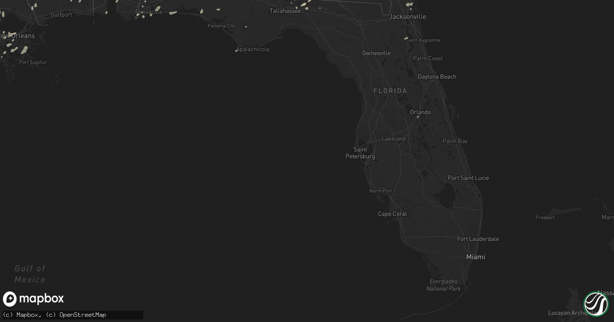
Hail Map in Florida on May 19, 2016
Get this storm
May 19 map
$229
one time, instant access
Download today. No call, no setup
Keep the $229
Bought the map and want the full workflow? Apply the entire $229 to a subscription within 7 days. None of it is wasted.
Every map, not just this one
This buys you this map. Subscription and you get every map we run, in the markets you choose from a few cities to whole states to nationwide. Plus real-time alerts the moment a storm fires.
Contact data
Name, contact info, occupancy, even credit band for addresses in the footprint. You go from where it hit to who to call.
Become the source they trust
Unlimited branding weather history reports on demand. You already have the documented answer ready for the property owner, and you are the one who showed up with it.
Property data and RoofTrace estimates
Pull up any address you have got, its value and the exact code rules for that jurisdiction, straight from One Click Code. Then RoofTrace estimates the squares, pitch, and roof value, priced the way you price.
Storm reports in Florida
Florida
| Date | Description |
|---|---|
| 05/19/20166:52 PM CDT | 911 call center reported a few trees down in flagler estates in southern st johns county. |
| 05/19/20166:50 PM CDT | 911 call center reported multiple trees down near county road 214 and county road 13 south. |
| 05/19/20163:35 PM CDT | Tree down and powerlines down near belfort and touchton roads. Time estimated from radar. |
| 05/19/20162:35 PM CDT | Wjxt relayed a damage photo via social media of a tin roof ripped off an outbuilding by strong wind gusts near boulogne. Time of damage based on radar data. |
| 05/19/20162:08 PM CDT | Delayed report of trees and limbs down on thursday resulting in a power outage in northeast jefferson county during the thursday afternoon thunderstorm. |
| 05/19/20166:45 AM CDT | Power line down at highway 65 and teresa ave |
| 05/19/20166:43 AM CDT | 58 mph gust measured at cwop site cw8103 on st george island |
| 05/19/20166:40 AM CDT | Fallen trees or limbs resulting in power outages in franklin county north of apalachicola. Reported on duke energy outage website |
| 05/19/20166:33 AM CDT | Tree down in the oak grove area |
| 05/19/20165:50 AM CDT | Tree down |
| 05/19/20165:25 AM CDT | Powerline down on roof |
| 05/19/20165:15 AM CDT | Downed power lines reported on highway 231 near transmitter road. Reported on social media |
| 05/19/20165:15 AM CDT | Tree down blocking road |
| 05/19/20164:15 AM CDT | Tree down at near intersection of stillwater road and pinelog street |
| 05/19/20163:46 AM CDT | Trees down near 25 st and redwood ave |
| 05/19/20163:40 AM CDT | Trees down across road near calhoun and sibert ave |
All States Impacted by Hail Map on May 19, 2016
Cities Impacted by Hail Map on May 19, 2016
- Hortense, GA
- Quitman, GA
- Beeville, TX
- Eastman, GA
- Abbeville, GA
- Armstrong, TX
- Tallahassee, FL
- George West, TX
- Lafayette, LA
- Broussard, LA
- Hobson, MT
- Moccasin, MT
- Gulf Breeze, FL
- San Diego, TX
- Asherton, TX
- Mission, TX
- Mcallen, TX
- Westwego, LA
- Marrero, LA
- Maurice, LA
- Linn, TX
- Larose, LA
- Picayune, MS
- Pearl River, LA
- Bainbridge, GA
- Port Barre, LA
- Breaux Bridge, LA
- Taft, TX
- Plaquemine, LA
- Cotulla, TX
- Catarina, TX
- Encinal, TX
- Stanford, MT
- Saint Marys, GA
- Eglin Afb, FL
- Sturgis, SD
- Bristol, FL
- Monticello, FL
- Kingsland, GA
- Woodbine, GA
- Freeport, FL
- Vernon, FL
- Camilla, GA
- Folkston, GA
- Hilliard, FL
- Mary Esther, FL
- Hurlburt Field, FL
- Fort Walton Beach, FL
- Gueydan, LA
- Kaplan, LA
- Pharr, TX
- San Juan, TX
- Alamo, TX
- Jeanerette, LA
- Grosse Tete, LA
- Maringouin, LA
- Coden, AL
- Lumberton, MS
- Wiggins, MS
- Loreauville, LA
- New Iberia, LA
- Saint Martinville, LA
- Theriot, LA
- Lizella, GA
- Baton Rouge, LA
- Krotz Springs, LA
- Ocilla, GA
- Three Rivers, TX
- Houma, LA
- Hammond, LA
- Ponchatoula, LA
- Orlando, FL
- Tilden, TX
- Pensacola, FL
- Lillian, AL
- Port Lavaca, TX
- Crowley, LA
- Cairo, GA
- Dublin, GA
- Montrose, GA
- Saint George, GA
- White Castle, LA
- Saint Gabriel, LA
- Angleton, TX
- Whigham, GA
- Climax, GA
- Morris, GA
- Georgetown, GA
- Clute, TX
- Freeport, TX
- Danbury, TX
- Lake Jackson, TX
- Galveston, TX
- Musella, GA
- Roundup, MT
- Lamont, FL
- Louise, TX
- Lafitte, LA
- Belle Chasse, LA
- Barataria, LA
- Greenville, FL
- Denham Springs, LA
- Chipley, FL
- Saucier, MS
- McHenry, MS
- Vacherie, LA
- Jacksonville, FL
- Morgan City, LA
- Abbeville, LA
- Waynesville, GA
- Rayne, LA
- Vancleave, MS
- Milton, FL
- Napoleonville, LA
- Carriere, MS
- Carrizo Springs, TX
- Cut Off, LA
- Hilger, MT
- Eufaula, AL
- Irwinton, GA
- Daphne, AL
- Bourg, LA
- New Orleans, LA
- Metairie, LA
- Gibson, LA
- Saint Rose, LA
- Sullivan City, TX
- La Joya, TX
- Lagrange, WY
- Laurel Hill, FL
- Mathis, TX
- Coolidge, GA
- Arnaudville, LA
- Geismar, LA
- Gonzales, LA
- Prairieville, LA
- Ama, LA
- Fort Gaines, GA
- Luling, LA
- Screven, GA
- Braithwaite, LA
- Green Cove Springs, FL
- Cantonment, FL
- Perkinston, MS
- Pelham, GA
- Scott, LA
- Donaldsonville, LA
- Belle Rose, LA
- Carville, LA
- Raymondville, TX
- Rochelle, GA
- Ocate, NM
- Yulee, FL
- Fernandina Beach, FL
- Port Saint Joe, FL
- Portland, TX
- Laredo, TX
- Marathon, TX


