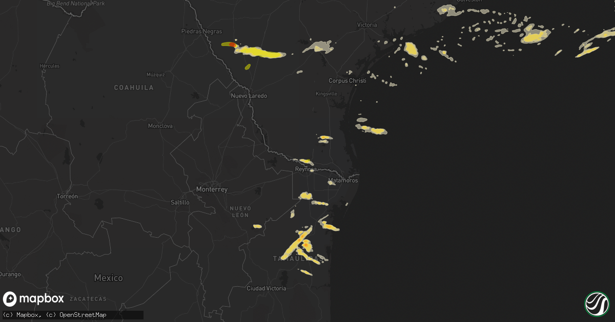
Hail Map on May 19, 2016
Get this storm
May 19 map
$229
one time, instant access
Download today. No call, no setup
Keep the $229
Bought the map and want the full workflow? Apply the entire $229 to a subscription within 7 days. None of it is wasted.
Every map, not just this one
This buys you this map. Subscription and you get every map we run, in the markets you choose from a few cities to whole states to nationwide. Plus real-time alerts the moment a storm fires.
Contact data
Name, contact info, occupancy, even credit band for addresses in the footprint. You go from where it hit to who to call.
Become the source they trust
Unlimited branding weather history reports on demand. You already have the documented answer ready for the property owner, and you are the one who showed up with it.
Property data and RoofTrace estimates
Pull up any address you have got, its value and the exact code rules for that jurisdiction, straight from One Click Code. Then RoofTrace estimates the squares, pitch, and roof value, priced the way you price.
States Impacted by Hail Map on May 19, 2016
Storm reports
South Dakota
| Date | Description |
|---|---|
| 05/18/20168:53 PM CDT | Mainly pea to penny size hail. Lasted about 30 minutes with hail accumulations of an inch or two alongside of house |
Texas
| Date | Description |
|---|---|
| 05/19/20164:28 PM CDT | Public reported quarter size hail near 29th street and nolana. |
| 05/19/20162:56 PM CDT | Tree down near northside elementary school in anglleton. |
| 05/19/20162:00 PM CDT | Trees down and power lines damaged on cr 376 and fm 1301. |
| 05/19/20162:00 PM CDT | Trees down and power lines damaged at cr 347 and cr 654b. |
| 05/19/20161:00 PM CDT | Trees down and power lines damaged on cr 376 and fm 1301. |
| 05/19/20161:00 PM CDT | Trees down and power lines damaged at cr 347 and cr 654b. |
| 05/19/201610:50 AM CDT | 7 to 10 trees down |
| 05/19/20167:06 AM CDT | A local report indicates 1.50 inch wind near 3 S CARRIZO SPRINGS |
Georgia
| Date | Description |
|---|---|
| 05/19/20164:48 PM CDT | Tree down across wiregrass road near evergreen road. |
| 05/19/20164:00 PM CDT | The call center reported a tree blocking manor millwood road. The time given was based on radar. |
| 05/19/20163:40 PM CDT | 1 tree down on emory drive |
| 05/19/20163:10 PM CDT | Three trees down on highway 80 about 1 mile northeast of knoxville |
| 05/19/20162:34 PM CDT | One tree down...taking a powerline down with it. |
Mississippi
| Date | Description |
|---|---|
| 05/19/201612:56 AM CDT | Trees down on howell tanner chapel rd near both ends. |
| 05/19/201612:55 AM CDT | Tree across the road near old mobile hwy and fred davis rd. |
| 05/19/201612:53 AM CDT | Trees down near hwy 57n and the greene county line |
| 05/19/201612:50 AM CDT | Trees down |
| 05/19/201612:48 AM CDT | Tree down on ruger rd near old riffle range rd. |
| 05/19/201612:44 AM CDT | Trees down on both basin refuge rd and basin central rd. |
| 05/19/201612:30 AM CDT | Tree down across hwy 57s at baston wade rd |
| 05/19/201612:25 AM CDT | Boats blown off trailers at academy sports on lamey bridge road in diberville. Trees also blown down on brandon james drive. Event time approximated. |
| 05/19/201612:23 AM CDT | 40 foot tree snapped and leaned against another tree behind house in d iberville behind city hall. Relayed via social media. |
| 05/19/201612:15 AM CDT | Delayed report of trees blown down on pecan drive and on nicholson avenue in long beach. Event time approximated. |
| 05/18/201611:46 PM CDT | Multiple large pecan trees snapped. Damage to chicken house and pig pen. |
Louisiana
| Date | Description |
|---|---|
| 05/18/201611:15 PM CDT | Tree on car on g street. |
| 05/18/201611:10 PM CDT | Large tree down on lakeview drive. |
| 05/18/201611:00 PM CDT | Large limbs down...wood fences blown down and minor roof damage. Location is in montgomery terrace subdivision off of highway 22. |
| 05/18/201610:30 PM CDT | Large tree down and personal weather station measured 68 mph wind gust in shenandoah area of baton rouge. |
| 05/18/201610:25 PM CDT | Power lines down near east st. John high school. Relayed via social media. |
| 05/18/201610:20 PM CDT | Trees down along 4h club rd in denham springs. Reported via social media. |
| 05/18/201610:20 PM CDT | A line of storms produced severe straight line winds near 70 mph south to north across the shenandoah area along jones creek road. Large trees were uprooted and there w |
| 05/18/201610:20 PM CDT | Trees and power lines down along hwy 308 near valentine. Time estimated from radar. |
| 05/18/201610:17 PM CDT | Trees down along hwy 61 near sorrento. |
| 05/18/201610:05 PM CDT | Damage throughout terrebonne. Power lines down in montegut. Trees down in houma. Power lines down and carport damaged in chauvin. Time estimated from radar. |
| 05/18/201610:05 PM CDT | Tree down on home off s. Peck drive in south baton rouge. Relayed via social media. |
| 05/18/201610:03 PM CDT | Trees reported down on numerous roads/highways around convent and vacherie in st. James parish. House roof blown off in st. James. Rv flipped and two others blown off j |
| 05/18/201610:02 PM CDT | Tree down through roof of house in trailer park. 10 trees down across lafourche parish. |
| 05/18/20169:45 PM CDT | Broken windows... Roof and porch damage along hwy 401/canal rd near lake veret. Time estimated from radar. |
| 05/18/20169:30 PM CDT | A line of storms tracking sw to ne along hwy 401 produced a downbusrt. The storm survey found evidence of widespread straight line wind damage near 70 mph with isolated |
| 05/18/20169:29 PM CDT | Kwbj reports power lines down on california street and posted photo of a gas station awning structure on the ground. |
| 05/18/20169:25 PM CDT | Trained spotter reports tree down on a home on cane st in bayou vista. |
| 05/18/20168:50 PM CDT | Traffic signal on pole snapped. |
| 05/18/20168:45 PM CDT | Several photos of large trees down in lafayette. |
| 05/18/20168:45 PM CDT | Katc reports 60 mph wind gust. |
| 05/18/20168:24 PM CDT | Cwop station in abbeville measured a wind gust of 70 mph. |
| 05/18/20168:19 PM CDT | Public reports 65 mph wind gust measured with personal weather station...id c2220. Trees were snapped from the gust. |
| 05/18/20168:18 PM CDT | Cwop station in abbeville measured a wind gust of 70 mph. |
| 05/18/20168:08 PM CDT | Cwop station in abbeville measured a wind gust of 59 mph. |
| 05/18/20167:56 PM CDT | Public measured an 81 mph wind gust on home weather station. Time estimated from radar. |
| 05/18/20167:47 PM CDT | Quarter sized hail reported via social media. |
Florida
| Date | Description |
|---|---|
| 05/19/20166:52 PM CDT | 911 call center reported a few trees down in flagler estates in southern st johns county. |
| 05/19/20166:50 PM CDT | 911 call center reported multiple trees down near county road 214 and county road 13 south. |
| 05/19/20163:35 PM CDT | Tree down and powerlines down near belfort and touchton roads. Time estimated from radar. |
| 05/19/20162:35 PM CDT | Wjxt relayed a damage photo via social media of a tin roof ripped off an outbuilding by strong wind gusts near boulogne. Time of damage based on radar data. |
| 05/19/20162:08 PM CDT | Delayed report of trees and limbs down on thursday resulting in a power outage in northeast jefferson county during the thursday afternoon thunderstorm. |
| 05/19/20166:45 AM CDT | Power line down at highway 65 and teresa ave |
| 05/19/20166:43 AM CDT | 58 mph gust measured at cwop site cw8103 on st george island |
| 05/19/20166:40 AM CDT | Fallen trees or limbs resulting in power outages in franklin county north of apalachicola. Reported on duke energy outage website |
| 05/19/20166:33 AM CDT | Tree down in the oak grove area |
| 05/19/20165:50 AM CDT | Tree down |
| 05/19/20165:25 AM CDT | Powerline down on roof |
| 05/19/20165:15 AM CDT | Tree down blocking road |
| 05/19/20165:15 AM CDT | Downed power lines reported on highway 231 near transmitter road. Reported on social media |
| 05/19/20164:15 AM CDT | Tree down at near intersection of stillwater road and pinelog street |
| 05/19/20163:46 AM CDT | Trees down near 25 st and redwood ave |
| 05/19/20163:40 AM CDT | Trees down across road near calhoun and sibert ave |
Utah
| Date | Description |
|---|---|
| 05/19/20166:15 PM CDT | Hat island mesonet site |
| 05/19/20166:00 PM CDT | Lakeside mountain mesonet site |
| 05/19/20165:50 PM CDT | North salt flats mesonet site. |
| 05/18/20168:42 PM CDT | Vernon raws |
| 05/18/20167:50 PM CDT | English village mesonet site |
| 05/18/20167:25 PM CDT | Camelback mountain mesonet |
| 05/18/20167:20 PM CDT | Playa station mesonet |
| 05/18/20167:00 PM CDT | Ogden peak |
Alabama
| Date | Description |
|---|---|
| 05/19/20162:42 AM CDT | Trees down on nettlesboro rd near syrene/chance |
| 05/19/20161:48 AM CDT | Trees down near 59 st and shady ln |
| 05/19/20161:44 AM CDT | Trees down across both lanes near brady rd n. And s. White ave. |
| 05/19/20161:44 AM CDT | Trees down near 59 st and shady ln |
| 05/19/20161:37 AM CDT | Tree down on south mcbride |
| 05/19/20161:30 AM CDT | National ocean service - ports observation. |
| 05/19/20161:20 AM CDT | Large tree down near dauphin island pkwy at saltaire dr. |
| 05/19/20161:20 AM CDT | Tree down on minetrail and power out at 10435 4th street |
| 05/19/20161:20 AM CDT | Gorgas at bascombe st... Tree down with powerlines |
| 05/19/20161:16 AM CDT | Trees down near emelda st and pleasant valley rd. |
| 05/19/20161:15 AM CDT | Trees down on hwy 45... 3 miles south of spice pond rd. |
| 05/19/20161:07 AM CDT | Tree down near moffett rd at campbell...near moffett rd and big creek lake...near moffett rd at shelby ln...and black water nursey rd. |
| 05/19/20161:05 AM CDT | Tree down at woddberry and briercliff |
| 05/19/201612:58 AM CDT | Power pole down near 13385 fort lake |
Cities Impacted by Hail Map on May 19, 2016
- Hortense, GA
- Quitman, GA
- Beeville, TX
- Eastman, GA
- Abbeville, GA
- Armstrong, TX
- Tallahassee, FL
- George West, TX
- Lafayette, LA
- Broussard, LA
- Hobson, MT
- Moccasin, MT
- Gulf Breeze, FL
- San Diego, TX
- Asherton, TX
- Mission, TX
- Mcallen, TX
- Westwego, LA
- Marrero, LA
- Maurice, LA
- Linn, TX
- Larose, LA
- Picayune, MS
- Pearl River, LA
- Bainbridge, GA
- Port Barre, LA
- Breaux Bridge, LA
- Taft, TX
- Plaquemine, LA
- Cotulla, TX
- Catarina, TX
- Encinal, TX
- Stanford, MT
- Saint Marys, GA
- Eglin Afb, FL
- Sturgis, SD
- Bristol, FL
- Monticello, FL
- Kingsland, GA
- Woodbine, GA
- Freeport, FL
- Vernon, FL
- Camilla, GA
- Folkston, GA
- Hilliard, FL
- Mary Esther, FL
- Hurlburt Field, FL
- Fort Walton Beach, FL
- Gueydan, LA
- Kaplan, LA
- Pharr, TX
- San Juan, TX
- Alamo, TX
- Jeanerette, LA
- Grosse Tete, LA
- Maringouin, LA
- Coden, AL
- Lumberton, MS
- Wiggins, MS
- Loreauville, LA
- New Iberia, LA
- Saint Martinville, LA
- Theriot, LA
- Lizella, GA
- Baton Rouge, LA
- Krotz Springs, LA
- Ocilla, GA
- Three Rivers, TX
- Houma, LA
- Hammond, LA
- Ponchatoula, LA
- Orlando, FL
- Tilden, TX
- Pensacola, FL
- Lillian, AL
- Port Lavaca, TX
- Crowley, LA
- Cairo, GA
- Dublin, GA
- Montrose, GA
- Saint George, GA
- White Castle, LA
- Saint Gabriel, LA
- Angleton, TX
- Whigham, GA
- Climax, GA
- Morris, GA
- Georgetown, GA
- Clute, TX
- Freeport, TX
- Danbury, TX
- Lake Jackson, TX
- Galveston, TX
- Musella, GA
- Roundup, MT
- Lamont, FL
- Louise, TX
- Lafitte, LA
- Belle Chasse, LA
- Barataria, LA
- Greenville, FL
- Denham Springs, LA
- Chipley, FL
- Saucier, MS
- McHenry, MS
- Vacherie, LA
- Jacksonville, FL
- Morgan City, LA
- Abbeville, LA
- Waynesville, GA
- Rayne, LA
- Vancleave, MS
- Milton, FL
- Napoleonville, LA
- Carriere, MS
- Carrizo Springs, TX
- Cut Off, LA
- Hilger, MT
- Eufaula, AL
- Irwinton, GA
- Daphne, AL
- Bourg, LA
- New Orleans, LA
- Metairie, LA
- Gibson, LA
- Saint Rose, LA
- Sullivan City, TX
- La Joya, TX
- Lagrange, WY
- Laurel Hill, FL
- Mathis, TX
- Coolidge, GA
- Arnaudville, LA
- Geismar, LA
- Gonzales, LA
- Prairieville, LA
- Ama, LA
- Fort Gaines, GA
- Luling, LA
- Screven, GA
- Braithwaite, LA
- Green Cove Springs, FL
- Cantonment, FL
- Perkinston, MS
- Pelham, GA
- Scott, LA
- Donaldsonville, LA
- Belle Rose, LA
- Carville, LA
- Raymondville, TX
- Rochelle, GA
- Ocate, NM
- Yulee, FL
- Fernandina Beach, FL
- Port Saint Joe, FL
- Portland, TX
- Laredo, TX
- Marathon, TX