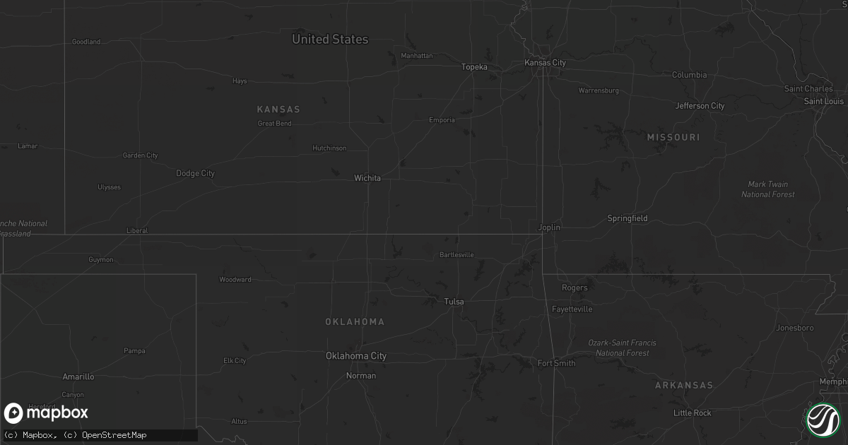
Hail Map in South Dakota on May 18, 2012
Get this storm
May 18 map
$229
one time, instant access
Download today. No call, no setup
Keep the $229
Bought the map and want the full workflow? Apply the entire $229 to a subscription within 7 days. None of it is wasted.
Every map, not just this one
This buys you this map. Subscription and you get every map we run, in the markets you choose from a few cities to whole states to nationwide. Plus real-time alerts the moment a storm fires.
Contact data
Name, contact info, occupancy, even credit band for addresses in the footprint. You go from where it hit to who to call.
Become the source they trust
Unlimited branding weather history reports on demand. You already have the documented answer ready for the property owner, and you are the one who showed up with it.
Property data and RoofTrace estimates
Pull up any address you have got, its value and the exact code rules for that jurisdiction, straight from One Click Code. Then RoofTrace estimates the squares, pitch, and roof value, priced the way you price.
Storm reports in South Dakota
South Dakota
| Date | Description |
|---|---|
| 05/18/20124:10 PM CDT | Hail covered the ground |
| 05/18/20124:00 PM CDT | Hail covered the ground |
| 05/18/20124:00 PM CDT | A local report indicates 1.25 inch wind near 2 WNW NEMO |
| 05/18/20129:30 AM CDT | Roof off barn which downed power lines at residence |
| 05/18/20121:15 AM CDT | Knocked horse fences down along property |
| 05/18/201212:45 AM CDT | Estimated 50-60 mph winds at residence with pea-sized hail |
| 05/18/201212:40 AM CDT | Large tree limbs down in yard |
| 05/17/20129:30 PM CDT | Roof off barn which downed power lines at residence |
| 05/17/20128:25 PM CDT | A local report indicates 65 MPH wind near MIDLAND |
| 05/17/20128:05 PM CDT | Accompanied with pea size hail |
| 05/17/20127:39 PM CDT | Trees uprooted...hail up to just smaller than quarters covered the ground |
| 05/17/20127:22 PM CDT | Winds estimated at 80-90 mph in town with roofs blown off two buildings...power lines also down. |
| 05/17/20127:22 PM CDT | Roof blown off hardware store in downtown...tree limbs down around town |
| 05/17/20127:02 PM CDT | Power out at home |
| 05/17/20127:02 PM CDT | Power out at home |
All States Impacted by Hail Map on May 18, 2012
Cities Impacted by Hail Map on May 18, 2012
- Johnstown, NE
- Little Falls, MN
- Cokato, MN
- Annandale, MN
- Sauk Centre, MN
- Salix, IA
- Mullen, NE
- Valentine, NE
- Butterfield, MN
- Mountain Lake, MN
- Trimont, MN
- Faulkton, SD
- Cresbard, SD
- Orient, SD
- Ipswich, SD
- Randolph, NE
- Deland, FL
- Clewiston, FL
- Hector, MN
- Fairfax, MN
- Lamberton, MN
- Brooten, MN
- Foreston, MN
- Milaca, MN
- Onamia, MN
- Howard Lake, MN
- Maple Lake, MN
- Sauk Rapids, MN
- Pompano Beach, FL
- Winnebago, NE
- Saint Cloud, MN
- Waite Park, MN
- Rice, MN
- Sartell, MN
- Mapleton, IA
- Woodland, MS
- Spicer, MN
- Casper, WY
- Powder Springs, TN
- Purdum, NE
- Deadwood, SD
- Lead, SD
- Wildwood, GA
- Belgrade, MN
- Long Valley, SD
- Harrison, NE
- Willmar, MN
- Spring Hill, TN
- Columbia, TN
- Elrosa, MN
- Long Prairie, MN
- Osakis, MN
- Natrona, WY
- Saint Cloud, FL
- Foley, MN
- Union, NE
- Trenton, GA
- Chattanooga, TN
- Midland, SD
- Interior, SD
- Kadoka, SD
- Philip, SD
- Belvidere, SD
- Wanblee, SD
- Watkins, MN
- Kimball, MN
- Litchfield, MN
- Boca Raton, FL
- Heron Lake, MN
- New London, MN
- Big Stone Gap, VA
- Elsmere, NE
- Onawa, IA
- Okeechobee, FL
- Elk Park, NC
- Newland, NC
- Highmore, SD
- Osmond, NE
- Mclean, NE
- Erhard, MN
- Thedford, NE
- Nashville, TN
- Danbury, IA
- Louisville, MS
- Rawlins, WY
- Revere, MN
- Lemoyne, NE
- Manchester, TN
- Leola, SD
- Hillman, MN
- Deer Lodge, TN
- Miami, FL
- Arthur, NE
- Comfrey, MN
- Alliance, NE
- Eagle Butte, SD
- Darfur, MN
- Dryden, VA
- Hyannis, NE
- Whitman, NE
- Washburn, TN
- Blaine, TN
- Luttrell, TN
- Rutledge, TN
- Paragonah, UT
- Parowan, UT
- Halsey, NE
- Monticello, MN
- Becker, MN
- Clear Lake, MN
- Murphy, NC
- Copperhill, TN
- Nebraska City, NE
- Homer, NE
- Macy, NE
- Sloan, IA
- Kandiyohi, MN
- Lynnville, TN
- Evansville, MN
- Oak Ridge, TN
- Casselberry, FL
- Winter Springs, FL
- Hanska, MN
- Saint James, MN
- Brule, NE
- Fairmount, ND
- Lewellen, NE
- Pulaski, TN
- Hanna, WY
- Storden, MN
- Culleoka, TN
- Nemo, SD
- Decatur, NE
- Luray, TN
- Huron, TN
- Wadena, MN
- Orange City, FL
- Debary, FL
- Chadron, NE
- Jeffers, MN
- Westbrook, MN
- Windom, MN
- Big Springs, NE
- Jamestown, TN
- Burke, SD
- Gregory, SD
- Cornersville, TN
- Cooperstown, ND
- Plainview, NE
- Creighton, NE
- Alcova, WY
- Knoxville, TN
- Wabasso, MN
- Atwater, MN
- Hay Springs, NE
- Woodbury, TN
- Bradyville, TN
- Percival, IA
- Athens, TN
- Lewisburg, TN
- Belfast, TN
- Wanda, MN
- Sanborn, MN
- Otoe, NE
- Dunbar, NE
- Nehawka, NE
- Tyndall, SD
- Beech Bluff, TN
- Missouri Valley, IA
- Carroll, NE
- International Falls, MN
- Isle, MN
- Sunbright, TN
- Soldier, IA
- Ute, IA
- Castana, IA
- Ogilvie, MN
- Glenwood, MN
- Oviedo, FL
- Jefferson, SD
- Elk Point, SD
- Buffalo, MN
- Venango, NE
- Julesburg, CO
- Sherburn, MN
- Sioux City, IA
- Hinton, IA
- Murray, NE
- Plattsmouth, NE
- Hialeah, FL
- Boulder, WY
- Bassett, NE
- Hill City, SD
- Lake Lillian, MN
- Seneca, NE
- Motley, MN
- Blue Ridge, GA
- Oshkosh, NE
- Piedmont, SD
- Bayard, NE
- Chamberlain, SD
- Seneca, SD
- Westport, SD
- Miller, SD
- Dugway, UT
- Delray Beach, FL
- Lusk, WY
- Fort Pierre, SD
- Syracuse, NE
- Sturgis, SD
- Laurel, NE
- Neola, IA
- Jeffrey City, WY
- Pawnee City, NE
- Blomkest, MN
- Tryon, NE
- Mobile, AL
- Lucedale, MS
- Whitwell, TN
- Crossville, TN
- Lander, WY
- Morganton, GA
- Blencoe, IA
- Lawrenceburg, TN
- Clarkrange, TN
- New Ulm, MN
- Fairmont, MN
- Villard, MN
- Shoshoni, WY
- Eagle Bend, MN
- Paynesville, MN
- Fort Lauderdale, FL
- Deerfield Beach, FL
- Charter Oak, IA
- Johnson, NE
- Athens, AL
- Atkinson, NE


