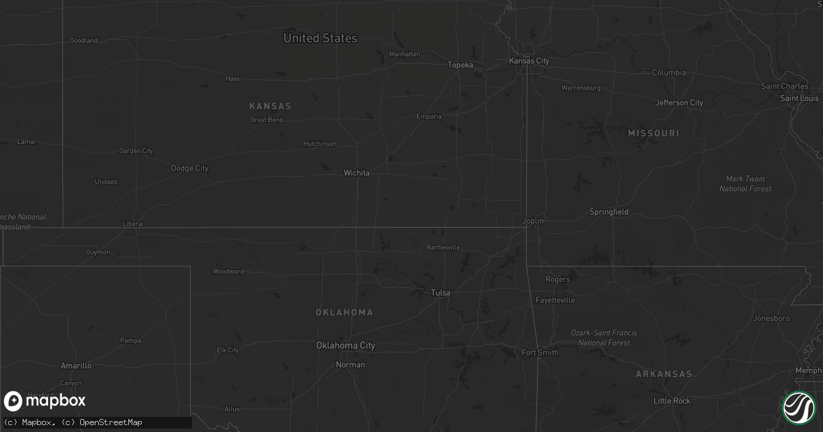
Hail Map in Minnesota on May 18, 2012
Get this storm
May 18 map
$229
one time, instant access
Download today. No call, no setup
Keep the $229
Bought the map and want the full workflow? Apply the entire $229 to a subscription within 7 days. None of it is wasted.
Every map, not just this one
This buys you this map. Subscription and you get every map we run, in the markets you choose from a few cities to whole states to nationwide. Plus real-time alerts the moment a storm fires.
Contact data
Name, contact info, occupancy, even credit band for addresses in the footprint. You go from where it hit to who to call.
Become the source they trust
Unlimited branding weather history reports on demand. You already have the documented answer ready for the property owner, and you are the one who showed up with it.
Property data and RoofTrace estimates
Pull up any address you have got, its value and the exact code rules for that jurisdiction, straight from One Click Code. Then RoofTrace estimates the squares, pitch, and roof value, priced the way you price.
Storm reports in Minnesota
Minnesota
| Date | Description |
|---|---|
| 05/18/20125:35 PM CDT | Large tree down in driveway. |
| 05/18/20125:35 PM CDT | Large tree down in driveway. |
| 05/18/20125:30 PM CDT | One energy pole down and ten spruce trees...late report. |
| 05/18/20125:19 PM CDT | Mndot station us-169 mile post 200 |
| 05/17/201211:50 PM CDT | Hail covering the ground |
| 05/17/201211:49 PM CDT | Large cottonwood trees blown down over road...late report. |
| 05/17/201211:42 PM CDT | Winds gust to near 40 mph. A couple inches of hail on the ground |
| 05/17/201211:36 PM CDT | A local report indicates 1.00 inch wind near SAUK CENTRE |
| 05/17/201211:35 PM CDT | A local report indicates 1.00 inch wind near SAUK CENTRE |
| 05/17/201211:24 PM CDT | Hail and strong winds reported together |
| 05/17/201210:55 PM CDT | Nickel to quarter size hail fell with gusty winds. Garden damage reported. |
| 05/17/201210:50 PM CDT | Six to eight inch branches in town. |
| 05/17/20129:47 PM CDT | Hail with strong wind. Power is out. |
| 05/17/20127:40 PM CDT | A local report indicates 1.00 inch wind near 5 S STORDEN |
| 05/17/20127:10 PM CDT | Beltrami county deputy reports small trees down at residence near highway two and hubbard county road 45...near grace lake. |
All States Impacted by Hail Map on May 18, 2012
Cities Impacted by Hail Map on May 18, 2012
- Johnstown, NE
- Little Falls, MN
- Cokato, MN
- Annandale, MN
- Sauk Centre, MN
- Salix, IA
- Mullen, NE
- Valentine, NE
- Butterfield, MN
- Mountain Lake, MN
- Trimont, MN
- Faulkton, SD
- Cresbard, SD
- Orient, SD
- Ipswich, SD
- Randolph, NE
- Deland, FL
- Clewiston, FL
- Hector, MN
- Fairfax, MN
- Lamberton, MN
- Brooten, MN
- Foreston, MN
- Milaca, MN
- Onamia, MN
- Howard Lake, MN
- Maple Lake, MN
- Sauk Rapids, MN
- Pompano Beach, FL
- Winnebago, NE
- Saint Cloud, MN
- Waite Park, MN
- Rice, MN
- Sartell, MN
- Mapleton, IA
- Woodland, MS
- Spicer, MN
- Casper, WY
- Powder Springs, TN
- Purdum, NE
- Deadwood, SD
- Lead, SD
- Wildwood, GA
- Belgrade, MN
- Long Valley, SD
- Harrison, NE
- Willmar, MN
- Spring Hill, TN
- Columbia, TN
- Elrosa, MN
- Long Prairie, MN
- Osakis, MN
- Natrona, WY
- Saint Cloud, FL
- Foley, MN
- Union, NE
- Trenton, GA
- Chattanooga, TN
- Midland, SD
- Interior, SD
- Kadoka, SD
- Philip, SD
- Belvidere, SD
- Wanblee, SD
- Watkins, MN
- Kimball, MN
- Litchfield, MN
- Boca Raton, FL
- Heron Lake, MN
- New London, MN
- Big Stone Gap, VA
- Elsmere, NE
- Onawa, IA
- Okeechobee, FL
- Elk Park, NC
- Newland, NC
- Highmore, SD
- Osmond, NE
- Mclean, NE
- Erhard, MN
- Thedford, NE
- Nashville, TN
- Danbury, IA
- Louisville, MS
- Rawlins, WY
- Revere, MN
- Lemoyne, NE
- Manchester, TN
- Leola, SD
- Hillman, MN
- Deer Lodge, TN
- Miami, FL
- Arthur, NE
- Comfrey, MN
- Alliance, NE
- Eagle Butte, SD
- Darfur, MN
- Dryden, VA
- Hyannis, NE
- Whitman, NE
- Washburn, TN
- Blaine, TN
- Luttrell, TN
- Rutledge, TN
- Paragonah, UT
- Parowan, UT
- Halsey, NE
- Monticello, MN
- Becker, MN
- Clear Lake, MN
- Murphy, NC
- Copperhill, TN
- Nebraska City, NE
- Homer, NE
- Macy, NE
- Sloan, IA
- Kandiyohi, MN
- Lynnville, TN
- Evansville, MN
- Oak Ridge, TN
- Casselberry, FL
- Winter Springs, FL
- Hanska, MN
- Saint James, MN
- Brule, NE
- Fairmount, ND
- Lewellen, NE
- Pulaski, TN
- Hanna, WY
- Storden, MN
- Culleoka, TN
- Nemo, SD
- Decatur, NE
- Luray, TN
- Huron, TN
- Wadena, MN
- Orange City, FL
- Debary, FL
- Chadron, NE
- Jeffers, MN
- Westbrook, MN
- Windom, MN
- Big Springs, NE
- Jamestown, TN
- Burke, SD
- Gregory, SD
- Cornersville, TN
- Cooperstown, ND
- Plainview, NE
- Creighton, NE
- Alcova, WY
- Knoxville, TN
- Wabasso, MN
- Atwater, MN
- Hay Springs, NE
- Woodbury, TN
- Bradyville, TN
- Percival, IA
- Athens, TN
- Lewisburg, TN
- Belfast, TN
- Wanda, MN
- Sanborn, MN
- Otoe, NE
- Dunbar, NE
- Nehawka, NE
- Tyndall, SD
- Beech Bluff, TN
- Missouri Valley, IA
- Carroll, NE
- International Falls, MN
- Isle, MN
- Sunbright, TN
- Soldier, IA
- Ute, IA
- Castana, IA
- Ogilvie, MN
- Glenwood, MN
- Oviedo, FL
- Jefferson, SD
- Elk Point, SD
- Buffalo, MN
- Venango, NE
- Julesburg, CO
- Sherburn, MN
- Sioux City, IA
- Hinton, IA
- Murray, NE
- Plattsmouth, NE
- Hialeah, FL
- Boulder, WY
- Bassett, NE
- Hill City, SD
- Lake Lillian, MN
- Seneca, NE
- Motley, MN
- Blue Ridge, GA
- Oshkosh, NE
- Piedmont, SD
- Bayard, NE
- Chamberlain, SD
- Seneca, SD
- Westport, SD
- Miller, SD
- Dugway, UT
- Delray Beach, FL
- Lusk, WY
- Fort Pierre, SD
- Syracuse, NE
- Sturgis, SD
- Laurel, NE
- Neola, IA
- Jeffrey City, WY
- Pawnee City, NE
- Blomkest, MN
- Tryon, NE
- Mobile, AL
- Lucedale, MS
- Whitwell, TN
- Crossville, TN
- Lander, WY
- Morganton, GA
- Blencoe, IA
- Lawrenceburg, TN
- Clarkrange, TN
- New Ulm, MN
- Fairmont, MN
- Villard, MN
- Shoshoni, WY
- Eagle Bend, MN
- Paynesville, MN
- Fort Lauderdale, FL
- Deerfield Beach, FL
- Charter Oak, IA
- Johnson, NE
- Athens, AL
- Atkinson, NE


