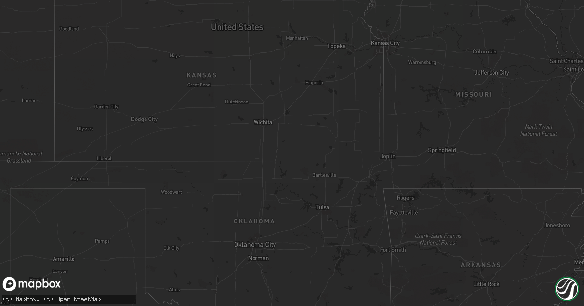
Hail Map on May 18, 2012
Get this storm
May 18 map
$229
one time, instant access
Download today. No call, no setup
Keep the $229
Bought the map and want the full workflow? Apply the entire $229 to a subscription within 7 days. None of it is wasted.
Every map, not just this one
This buys you this map. Subscription and you get every map we run, in the markets you choose from a few cities to whole states to nationwide. Plus real-time alerts the moment a storm fires.
Contact data
Name, contact info, occupancy, even credit band for addresses in the footprint. You go from where it hit to who to call.
Become the source they trust
Unlimited branding weather history reports on demand. You already have the documented answer ready for the property owner, and you are the one who showed up with it.
Property data and RoofTrace estimates
Pull up any address you have got, its value and the exact code rules for that jurisdiction, straight from One Click Code. Then RoofTrace estimates the squares, pitch, and roof value, priced the way you price.
States Impacted by Hail Map on May 18, 2012
Storm reports
Nebraska
| Date | Description |
|---|---|
| 05/18/20124:30 PM CDT | A local report indicates 1.00 inch wind near 16 N CRAWFORD |
| 05/17/20128:28 PM CDT | A local report indicates 1.00 inch wind near 9 SW ARTHUR |
Utah
| Date | Description |
|---|---|
| 05/18/201210:30 AM CDT | Flight park south sensor |
Virginia
| Date | Description |
|---|---|
| 05/18/20121:35 PM CDT | A local report indicates 1.00 inch wind near BIG STONE GAP |
Georgia
| Date | Description |
|---|---|
| 05/18/20126:19 PM CDT | Public reported nickle to quarter sized hail covering slygo road in northern dade county. Radar estimated time around 1919 edt. |
Minnesota
| Date | Description |
|---|---|
| 05/18/20125:35 PM CDT | Large tree down in driveway. |
| 05/18/20125:35 PM CDT | Large tree down in driveway. |
| 05/18/20125:30 PM CDT | One energy pole down and ten spruce trees...late report. |
| 05/18/20125:19 PM CDT | Mndot station us-169 mile post 200 |
| 05/17/201211:50 PM CDT | Hail covering the ground |
| 05/17/201211:49 PM CDT | Large cottonwood trees blown down over road...late report. |
| 05/17/201211:42 PM CDT | Winds gust to near 40 mph. A couple inches of hail on the ground |
| 05/17/201211:36 PM CDT | A local report indicates 1.00 inch wind near SAUK CENTRE |
| 05/17/201211:35 PM CDT | A local report indicates 1.00 inch wind near SAUK CENTRE |
| 05/17/201211:24 PM CDT | Hail and strong winds reported together |
| 05/17/201210:55 PM CDT | Nickel to quarter size hail fell with gusty winds. Garden damage reported. |
| 05/17/201210:50 PM CDT | Six to eight inch branches in town. |
| 05/17/20129:47 PM CDT | Hail with strong wind. Power is out. |
| 05/17/20127:40 PM CDT | A local report indicates 1.00 inch wind near 5 S STORDEN |
| 05/17/20127:10 PM CDT | Beltrami county deputy reports small trees down at residence near highway two and hubbard county road 45...near grace lake. |
Florida
| Date | Description |
|---|---|
| 05/18/20126:43 PM CDT | Quarter size hail reported near lake lowery. Time estimated by radar. |
| 05/18/20125:15 PM CDT | Dime to quarter size hail. |
| 05/18/20123:35 PM CDT | A severe thunderstorm and possible tornado snapped several trees and downed at least 6 powerline poles near the intersection of old u.s. Highway 27 and hookers point ro |
| 05/18/20121:20 PM CDT | Large tree uprooted and lightpole downed near the intersection of nw 58th street and 95th ave. |
| 05/18/20121:20 PM CDT | Large tree downed near 44th street and 113th terrace in doral. |
| 05/18/20121:20 PM CDT | An off duty nws employee reported a large tree down on northwest 58th st in doral between northwest 102 ave and northwest 107 ave. |
| 05/18/20121:20 PM CDT | An off duty nws employee reported a large tree down on northwest 58th st in doral between northwest 102 ave and northwest 107 ave. |
| 05/18/20121:20 PM CDT | Quarter size hail reported near the intersection of palmetto expressway and doral blvd. |
| 05/18/20121:17 PM CDT | At least two trees snapped near the eugenia b. Thomas school. |
| 05/18/20121:17 PM CDT | Quarter sized hail was reported near nw 41 and nw 58th streets in doral. |
| 05/18/20121:15 PM CDT | Public estimated wind gusts to 60 mph in doral. |
| 05/18/20121:15 PM CDT | Hail slightly larger than a quarter was reported near nw 41st and 107th ave at doral. |
| 05/18/20121:15 PM CDT | Hail slightly larger than a quarter was reported near nw 41st and 107th ave in doral |
| 05/18/20121:15 PM CDT | A member of the public estimated wind speeds up to 70 mph near the intersection of nw 58th street and nw 107th ave. In doral |
| 05/18/20121:15 PM CDT | Trees down and window screens blown out in balmoral estates and doral isles in doral. Winds estimated 60 to 70 mph. |
| 05/18/20121:10 PM CDT | Trees downed near the intersection of nw 64th street and nw 114th avenue. |
| 05/18/20121:10 PM CDT | Tree downed near the intersection of sw 8th street and sw 139th ave. |
| 05/18/20121:00 PM CDT | Large tree branches broken off near sw 8th street and sw 147th ave. |
Wyoming
| Date | Description |
|---|---|
| 05/18/20125:07 PM CDT | A local report indicates 63 MPH wind near 2 N GREEN MOUNTAIN |
| 05/18/20125:07 PM CDT | A local report indicates 77 MPH wind near RIVERTON |
| 05/18/20124:50 PM CDT | A local report indicates 63 MPH wind near 2 N GREEN MOUNTAIN |
| 05/18/20124:28 PM CDT | Estimated 70 mph and blowing debris around an outdoor event at a local retail store. Pea-sized hail also reported. |
| 05/18/20124:20 PM CDT | A local report indicates 77 MPH wind near RIVERTON |
| 05/18/20124:18 PM CDT | A local report indicates 59 MPH wind near 2 WSW RIVERTON |
South Dakota
| Date | Description |
|---|---|
| 05/18/20124:10 PM CDT | Hail covered the ground |
| 05/18/20124:00 PM CDT | Hail covered the ground |
| 05/18/20124:00 PM CDT | A local report indicates 1.25 inch wind near 2 WNW NEMO |
| 05/18/20129:30 AM CDT | Roof off barn which downed power lines at residence |
| 05/18/20121:15 AM CDT | Knocked horse fences down along property |
| 05/18/201212:45 AM CDT | Estimated 50-60 mph winds at residence with pea-sized hail |
| 05/18/201212:40 AM CDT | Large tree limbs down in yard |
| 05/17/20129:30 PM CDT | Roof off barn which downed power lines at residence |
| 05/17/20128:25 PM CDT | A local report indicates 65 MPH wind near MIDLAND |
| 05/17/20128:05 PM CDT | Accompanied with pea size hail |
| 05/17/20127:39 PM CDT | Trees uprooted...hail up to just smaller than quarters covered the ground |
| 05/17/20127:22 PM CDT | Roof blown off hardware store in downtown...tree limbs down around town |
| 05/17/20127:22 PM CDT | Winds estimated at 80-90 mph in town with roofs blown off two buildings...power lines also down. |
| 05/17/20127:02 PM CDT | Power out at home |
| 05/17/20127:02 PM CDT | Power out at home |
Alabama
| Date | Description |
|---|---|
| 05/18/20124:30 PM CDT | Three small pine trees uprooted or snapped and one small hardwood tree uprooted along mitchellville road. Very small section of metal roofing peeled back at one residen |
Cities Impacted by Hail Map on May 18, 2012
- Johnstown, NE
- Little Falls, MN
- Cokato, MN
- Annandale, MN
- Sauk Centre, MN
- Salix, IA
- Mullen, NE
- Valentine, NE
- Butterfield, MN
- Mountain Lake, MN
- Trimont, MN
- Faulkton, SD
- Cresbard, SD
- Orient, SD
- Ipswich, SD
- Randolph, NE
- Deland, FL
- Clewiston, FL
- Hector, MN
- Fairfax, MN
- Lamberton, MN
- Brooten, MN
- Foreston, MN
- Milaca, MN
- Onamia, MN
- Howard Lake, MN
- Maple Lake, MN
- Sauk Rapids, MN
- Pompano Beach, FL
- Winnebago, NE
- Saint Cloud, MN
- Waite Park, MN
- Rice, MN
- Sartell, MN
- Mapleton, IA
- Woodland, MS
- Spicer, MN
- Casper, WY
- Powder Springs, TN
- Purdum, NE
- Deadwood, SD
- Lead, SD
- Wildwood, GA
- Belgrade, MN
- Long Valley, SD
- Harrison, NE
- Willmar, MN
- Spring Hill, TN
- Columbia, TN
- Elrosa, MN
- Long Prairie, MN
- Osakis, MN
- Natrona, WY
- Saint Cloud, FL
- Foley, MN
- Union, NE
- Trenton, GA
- Chattanooga, TN
- Midland, SD
- Interior, SD
- Kadoka, SD
- Philip, SD
- Belvidere, SD
- Wanblee, SD
- Watkins, MN
- Kimball, MN
- Litchfield, MN
- Boca Raton, FL
- Heron Lake, MN
- New London, MN
- Big Stone Gap, VA
- Elsmere, NE
- Onawa, IA
- Okeechobee, FL
- Elk Park, NC
- Newland, NC
- Highmore, SD
- Osmond, NE
- Mclean, NE
- Erhard, MN
- Thedford, NE
- Nashville, TN
- Danbury, IA
- Louisville, MS
- Rawlins, WY
- Revere, MN
- Lemoyne, NE
- Manchester, TN
- Leola, SD
- Hillman, MN
- Deer Lodge, TN
- Miami, FL
- Arthur, NE
- Comfrey, MN
- Alliance, NE
- Eagle Butte, SD
- Darfur, MN
- Dryden, VA
- Hyannis, NE
- Whitman, NE
- Washburn, TN
- Blaine, TN
- Luttrell, TN
- Rutledge, TN
- Paragonah, UT
- Parowan, UT
- Halsey, NE
- Monticello, MN
- Becker, MN
- Clear Lake, MN
- Murphy, NC
- Copperhill, TN
- Nebraska City, NE
- Homer, NE
- Macy, NE
- Sloan, IA
- Kandiyohi, MN
- Lynnville, TN
- Evansville, MN
- Oak Ridge, TN
- Casselberry, FL
- Winter Springs, FL
- Hanska, MN
- Saint James, MN
- Brule, NE
- Fairmount, ND
- Lewellen, NE
- Pulaski, TN
- Hanna, WY
- Storden, MN
- Culleoka, TN
- Nemo, SD
- Decatur, NE
- Luray, TN
- Huron, TN
- Wadena, MN
- Orange City, FL
- Debary, FL
- Chadron, NE
- Jeffers, MN
- Westbrook, MN
- Windom, MN
- Big Springs, NE
- Jamestown, TN
- Burke, SD
- Gregory, SD
- Cornersville, TN
- Cooperstown, ND
- Plainview, NE
- Creighton, NE
- Alcova, WY
- Knoxville, TN
- Wabasso, MN
- Atwater, MN
- Hay Springs, NE
- Woodbury, TN
- Bradyville, TN
- Percival, IA
- Athens, TN
- Lewisburg, TN
- Belfast, TN
- Wanda, MN
- Sanborn, MN
- Otoe, NE
- Dunbar, NE
- Nehawka, NE
- Tyndall, SD
- Beech Bluff, TN
- Missouri Valley, IA
- Carroll, NE
- International Falls, MN
- Isle, MN
- Sunbright, TN
- Soldier, IA
- Ute, IA
- Castana, IA
- Ogilvie, MN
- Glenwood, MN
- Oviedo, FL
- Jefferson, SD
- Elk Point, SD
- Buffalo, MN
- Venango, NE
- Julesburg, CO
- Sherburn, MN
- Sioux City, IA
- Hinton, IA
- Murray, NE
- Plattsmouth, NE
- Hialeah, FL
- Boulder, WY
- Bassett, NE
- Hill City, SD
- Lake Lillian, MN
- Seneca, NE
- Motley, MN
- Blue Ridge, GA
- Oshkosh, NE
- Piedmont, SD
- Bayard, NE
- Chamberlain, SD
- Seneca, SD
- Westport, SD
- Miller, SD
- Dugway, UT
- Delray Beach, FL
- Lusk, WY
- Fort Pierre, SD
- Syracuse, NE
- Sturgis, SD
- Laurel, NE
- Neola, IA
- Jeffrey City, WY
- Pawnee City, NE
- Blomkest, MN
- Tryon, NE
- Mobile, AL
- Lucedale, MS
- Whitwell, TN
- Crossville, TN
- Lander, WY
- Morganton, GA
- Blencoe, IA
- Lawrenceburg, TN
- Clarkrange, TN
- New Ulm, MN
- Fairmont, MN
- Villard, MN
- Shoshoni, WY
- Eagle Bend, MN
- Paynesville, MN
- Fort Lauderdale, FL
- Deerfield Beach, FL
- Charter Oak, IA
- Johnson, NE
- Athens, AL
- Atkinson, NE