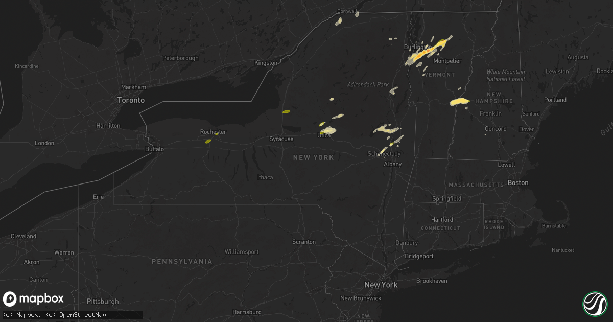
Hail Map in New York on May 17, 2025
Get this storm
May 17 map
$229
one time, instant access
Download today. No call, no setup
Keep the $229
Bought the map and want the full workflow? Apply the entire $229 to a subscription within 7 days. None of it is wasted.
Every map, not just this one
This buys you this map. Subscription and you get every map we run, in the markets you choose from a few cities to whole states to nationwide. Plus real-time alerts the moment a storm fires.
Contact data
Name, contact info, occupancy, even credit band for addresses in the footprint. You go from where it hit to who to call.
Become the source they trust
Unlimited branding weather history reports on demand. You already have the documented answer ready for the property owner, and you are the one who showed up with it.
Property data and RoofTrace estimates
Pull up any address you have got, its value and the exact code rules for that jurisdiction, straight from One Click Code. Then RoofTrace estimates the squares, pitch, and roof value, priced the way you price.
Storm reports in New York
New York
| Date | Description |
|---|---|
| 05/17/20254:54 PM CDT | Tree down on ny 22 northbound between flints crossing road and peaceful valley road. Time estimated from radar. |
| 05/17/20254:32 PM CDT | Report of a tree down near n street rd and street rd. |
| 05/17/20254:22 PM CDT | Numerous trees down around the kinderhook and valatie areas concentrated in the hemlock street and maple lake south vicinity. Time estimated from radar. Possible microb |
| 05/17/20254:20 PM CDT | Report of tree down north of greenwich on rte. 40. |
| 05/17/20254:15 PM CDT | Report of trees and wires down along rte. 40 south of greenwich. |
| 05/17/20253:45 PM CDT | Trees and wires down near the saratoga rv park. |
| 05/17/20253:25 PM CDT | Trees down along spruce lake road north of salisbury. |
| 05/17/20253:25 PM CDT | Report of trees and wires down along curtiss rd near salisbury. |
| 05/17/20252:55 PM CDT | Tree down on property. |
| 05/17/20252:55 PM CDT | Report passed from wktv in deerfield/utica. |
| 05/17/20252:48 PM CDT | Wires down. |
| 05/17/20252:42 PM CDT | A few trees down in the area along with wires and a snapped pole. |
| 05/17/20252:36 PM CDT | Corrects previous hail report from 5 w gansevoort. Report of trees and wires down on corinth mountain rd in wilton. |
| 05/17/20252:36 PM CDT | Report of trees and wires down on corinth mountain rd in wilton. |
| 05/17/20252:20 PM CDT | Report of a tree down along valentine pond rd. Time estimated from radar. |
| 05/17/20252:18 PM CDT | Ledge hill road tree on power lines |
| 05/17/20252:12 PM CDT | Trees down near intersection of turner rd and soper st. |
| 05/17/20252:00 PM CDT | Small tree down on rt 10 lewis wadhams road |
| 05/17/20251:58 PM CDT | Tree on wires in hastings... Ny. |
| 05/17/20251:55 PM CDT | Tree down on power lines. |
| 05/17/20251:41 PM CDT | Tree down on house. |
| 05/17/20251:37 PM CDT | Tree and large branches down at new york state fairgrounds from strong outflow. |
| 05/17/20251:31 PM CDT | Tree down on roof per county dispatch. |
| 05/17/20251:27 PM CDT | Wires down per county dispatch. |
| 05/17/20251:25 PM CDT | Tree uprooted and down onto a house with wires involved per county dispatch. |
| 05/17/20251:17 PM CDT | Trees and wires down on rude st. |
| 05/17/20251:17 PM CDT | Trees and wires down on hoyt road. |
| 05/17/20251:17 PM CDT | Trees and wires down on putnam rd. |
| 05/17/202512:56 PM CDT | Most hail was pea size but a few were as big as quarter size. |
| 05/17/202512:45 PM CDT | Large tree down just south of lyons. Social media report. |
| 05/17/202512:44 PM CDT | Tree and wires down on carter road south of cross road. |
| 05/17/202512:38 PM CDT | Tree blocking gurnee road near ny-31. |
| 05/17/202512:37 PM CDT | Report of tree and wires down on eastside drive in ballston lake. |
| 05/17/202512:27 PM CDT | Tree blocking most of risser road. |
| 05/17/202512:22 PM CDT | Large tree down blocking parce ave. |
| 05/17/202512:20 PM CDT | Report relayed from broadcast media of quarter size hail in glenville. Time estimated from radar. |
| 05/17/202512:12 PM CDT | Several traffic lights blown down along panorama trail. |
| 05/17/202512:10 PM CDT | Power pole broken and lines down on glazer dr. |
| 05/17/202512:10 PM CDT | Large tree down blocking the eastbound lanes of ny route 441. |
| 05/17/202512:05 PM CDT | Very large tree down on crestline dr. |
| 05/17/202511:58 AM CDT | Twitter report. Size estimated from photo. |
| 05/17/202511:54 AM CDT | A local report indicates 1.00 inch wind near Scottsville |
| 05/17/202511:52 AM CDT | Three limbs down on maiden road near ny-390. |
| 05/17/202511:36 AM CDT | Power poles and wires down. |
All States Impacted by Hail Map on May 17, 2025
Cities Impacted by Hail Map on May 17, 2025
- Thorsby, AL
- Clanton, AL
- Franklin, GA
- Grantville, GA
- Newnan, GA
- Gouverneur, NY
- Moreland, GA
- Senoia, GA
- Sharpsburg, GA
- Laurens, SC
- Luthersville, GA
- Massena, NY
- Norfolk, NY
- Brasher Falls, NY
- Zebulon, GA
- Williamson, GA
- Griffin, GA
- Barnesville, GA
- Forsyth, GA
- Norwood, NY
- Milner, GA
- Bombay, NY
- Fort Covington, NY
- Holland Patent, NY
- Rome, NY
- Remsen, NY
- Rochester, NY
- Pittsford, NY
- Scottsville, NY
- Caledonia, NY
- Rush, NY
- West Henrietta, NY
- Cold Brook, NY
- Duanesburg, NY
- Schenectady, NY
- Parish, NY
- Pulaski, NY
- Altmar, NY
- Ballston Lake, NY
- Burnt Hills, NY
- Mechanicville, NY
- Williamstown, NY
- Stittville, NY
- Ballston Spa, NY
- Round Lake, NY
- Redford, NY
- Saranac, NY
- Schuyler Falls, NY
- Saratoga Springs, NY
- Edwards, MS
- Vicksburg, MS
- Bolton, MS
- Charlotte, VT
- North Ferrisburgh, VT
- Ferrisburgh, VT
- Shelburne, VT
- Bristol, VT
- Hinesburg, VT
- New Haven, VT
- Clinton, MS
- Raymond, MS
- Jackson, MS
- South Burlington, VT
- Westport, NY
- Essex, NY
- Vergennes, VT
- Williston, VT
- Essex Junction, VT
- Cadyville, NY
- Morrisonville, NY
- Peru, NY
- Richmond, VT
- Huntington, VT
- Byram, MS
- Thendara, NY
- Eagle Bay, NY
- Jericho, VT
- Plattsburgh, NY
- Schroon Lake, NY
- Willsboro, NY
- Adirondack, NY
- Starksboro, VT
- Colchester, VT
- Lohn, TX
- Brady, TX
- Pottersville, NY
- Brant Lake, NY
- Middlebury, VT
- Rochelle, TX
- Mason, TX
- Stowe, VT
- Mullin, TX
- Goldthwaite, TX
- Morrisville, VT
- Hyde Park, VT
- Rockwood, TX
- Santa Anna, TX
- Brookesmith, TX
- Priddy, TX
- Richland Springs, TX
- Northville, NY
- Comanche, TX
- San Saba, TX
- Utica, NY
- Marcy, NY
- Whitesboro, NY
- Flora, MS
- Junction, TX
- Poland, NY
- Barneveld, NY
- Frankfort, NY
- Underhill, VT
- Cambridge, VT
- Waterbury, VT
- Porter Corners, NY
- Art, TX
- Waterbury Center, VT
- Valley Spring, TX
- Pontotoc, TX
- Greenfield Center, NY
- Newport, NY
- Corinth, NY
- Gustine, TX
- Lake Luzerne, NY
- Gansevoort, NY
- Wolcott, VT
- Hamilton, TX
- Richland, MS
- Dublin, TX
- Spearsville, LA
- Evant, TX
- Star, TX
- Marlow, OK
- Rush Springs, OK
- Pottsville, TX
- Carlton, TX
- Voca, TX
- Fredonia, TX
- Madill, OK
- Kingston, OK
- Ninnekah, OK
- Strong, AR
- Huttig, AR
- Fort Edward, NY
- Raleigh, MS
- Stephenville, TX
- Schuylerville, NY
- Chickasha, OK
- Bradley, OK
- Amber, OK
- Pioneer, LA
- Oak Grove, LA
- Lampasas, TX
- Greenwich, NY
- Tuttle, OK
- Lindsay, OK
- Gordon, TX
- Santo, TX
- Pine Hill, AL
- Alex, OK
- Bluff Dale, TX
- Purmela, TX
- Mingus, TX
- Hamburg, AR
- Jonesboro, TX
- Mustang, OK
- Oklahoma City, OK
- Newcastle, OK
- Yukon, OK
- Wheatland, OK
- Blanchard, OK
- Tolar, TX
- Lake Providence, LA
- Lipan, TX
- Woodstock, VT
- Stillwater, NY
- Iredell, TX
- Gatesville, TX
- Bethany, OK
- Maysville, OK
- Paoli, OK
- Wayne, OK
- Pauls Valley, OK
- Morgan, TX
- Meridian, TX
- Quechee, VT
- Hartland, VT
- White River Junction, VT
- Millsap, TX
- Richmond, MA
- Pittsfield, MA
- West Lebanon, NH
- North Hartland, VT
- Taftsville, VT
- Portland, AR
- Walnut Springs, TX
- Mineral Wells, TX
- Schaghticoke, NY
- Perrin, TX
- Graford, TX
- Weatherford, TX
- Whitt, TX
- Byars, OK
- Purcell, OK
- Camden, AL
- Transylvania, LA
- Thetford Center, VT
- South Strafford, VT
- Enfield, NH
- Wilder, VT
- Lebanon, NH
- Hanover, NH
- Hinsdale, MA
- Becket, MA
- Lenox, MA
- Dalton, MA
- Plainfield, NH
- Mayersville, MS
- Rolling Fork, MS
- Poolville, TX
- Jacksboro, TX
- Bridgeport, TX
- Canaan, NH
- Stratford, OK
- Vredenburgh, AL
- Etna, NH
- Lexington, OK
- Grantham, NH
- Pine Apple, AL
- Blum, TX
- Springtown, TX
- Paradise, TX
- Whitney, TX
- Caddo, OK
- Caney, OK
- Chico, TX
- Decatur, TX
- Bonita, LA
- Jones, LA
- Beatrice, AL
- Parkdale, AR
- Hillsboro, TX
- Itasca, TX
- Wanette, OK
- Kopperl, TX
- Abbott, TX
- Aquilla, TX
- Clifton, TX
- Fort Worth, TX
- Keller, TX
- Ada, OK
- Cherokee, TX
- Alvord, TX
- West, TX
- Forestburg, TX
- Roanoke, TX
- Argyle, TX
- Justin, TX
- Georgiana, AL
- Bowie, TX
- Fort Rucker, AL
- Valley Park, MS
- Sunset, TX
- Evergreen, AL
- Muenster, TX
- Saint Jo, TX
- Asher, OK
- Konawa, OK
- Denton, TX
- Ponder, TX
- Sanger, TX
- Aubrey, TX
- Valley View, TX
- Rosston, TX
- Gainesville, TX
- Montague, TX
- Era, TX
- Lindsay, TX
- Nocona, TX
- Thackerville, OK
- Burneyville, OK
- Leon, OK
- Wilmot, AR
- Newton, AL
- Ozark, AL
- Marietta, OK
- Bennett, CO
- Allen, OK
- Stonewall, OK
- Coalgate, OK
- Centrahoma, OK
- Calvin, OK
- Strasburg, CO
- Sasakwa, OK
- Whitesboro, TX
- Stuart, OK
- Collinsville, TX
- Sadler, TX
- Gordonville, TX
- Pottsboro, TX
- Mead, OK
- Wardville, OK
- Sherman, TX
- Denison, TX
- Ardmore, OK
- Lebanon, OK
- Tupelo, OK
- Lindale, TX
- Kiowa, OK
- Atoka, OK
- Pittsburg, OK
- Severy, KS
- Mill Creek, OK
- Mannsville, OK
- Tishomingo, OK
- Calera, OK
- Colbert, OK
- Hendrix, OK
- Kenefic, OK
- Athens, TX
- Stringtown, OK
- Daisy, OK
- Milburn, OK
- Weare, NH
- Okolona, AR
- Gurdon, AR
- Wapanucka, OK
- Sumner, TX
- Antlers, OK
- Yates Center, KS
- Arkadelphia, AR
- Powderly, TX
- Paris, TX
- Clayton, OK
- Sharon, OK
- Wynnewood, OK
- Blossom, TX
- Humboldt, KS
- Woodward, OK
- Detroit, TX
- Coy, AL
- Lafayette, AL
- Maud, OK
- Parker, KS
- Centerville, KS
- Bagwell, TX
- Savonburg, KS
- Elsmore, KS
- Snow, OK
- Nashoba, OK
- Mcalester, OK
- Garvin, OK
- Clarksville, TX
- Red Oak, OK
- Erie, KS
- Moran, KS
- Idabel, OK
- Heavener, OK
- Mccurtain, OK
- Garnett, KS
- Uniontown, KS
- Stark, KS
- Wewoka, OK
- Hepler, KS
- Amity, AR
- Sparkman, AR
- Seiling, OK
- Edmond, OK
- Holdenville, OK
- Neosho Falls, KS
- Guthrie, OK
- Virgil, KS
- Gridley, KS
- Westphalia, KS
- Redfield, KS
- Hartford, KS
- Burlington, KS
- Broken Bow, OK
- Le Roy, KS
- Hodgen, OK
- Fort Scott, KS
- Seminole, OK
- Wetumka, OK
- Choctaw, OK
- Newalla, OK
- Booneville, AR
- Arcadia, OK
- Bethel, OK
- Jones, OK
- Parsons, KS
- Galesburg, KS
- Honobia, OK
- Mansfield, AR
- Toronto, KS
- Luther, OK
- Iola, KS
- Colony, KS
- Saint Paul, KS
- Spencer, OK
- Mcloud, OK
- Shawnee, OK
- La Harpe, KS
- Fall River, KS
- Donaldson, AR
- Brackettville, TX
- Bismarck, AR
- Harrah, OK
- Clinton, OK
- Yale, OK
- Maramec, OK
- Malvern, AR
- Kincaid, KS
- Pawnee, OK
- Stillwater, OK
- Jennings, OK
- Glencoe, OK
- Girard, KS
- Meeker, OK
- McCune, KS
- Watonga, OK
- Thomas, OK
- Foss, OK
- Arapaho, OK
- Earlsboro, OK
- Sheldon, MO
- Cleveland, OK
- Weatherford, OK
- Geary, OK
- Fredonia, KS
- Bronson, KS
- Pittsburg, KS
- Osage, OK
- Hominy, OK
- Newkirk, OK
- Canute, OK
- Corn, OK
- Piqua, KS
- Chanute, KS
- Skiatook, OK
- Barnsdall, OK
- Hitchcock, OK
- Kingfisher, OK
- Loyal, OK
- Hennessey, OK
- Ponca City, OK
- Kaw City, OK
- Okeene, OK
- Waukomis, OK
- Pine Bluff, AR
- Grady, AR
- Carthage, AR
- Shidler, OK
- Leola, AR
- Ames, OK
- Bison, OK
- Calumet, OK
- Laredo, TX
- Walnut, KS
- Coyle, OK
- Burbank, OK
- Orlando, OK
- Mulhall, OK
- White Hall, AR
- Hydro, OK
- Perkins, OK
- Yorktown, AR
- Gould, AR
- Okarche, OK
- Moundville, MO
- Stuttgart, AR
- Milo, MO
- Ripley, OK
- Cushing, OK
- El Dorado Springs, MO
- El Reno, OK
- Gillett, AR
- Piedmont, OK
- Jerico Springs, MO
- Snow Lake, AR
- Glenpool, OK
- Bixby, OK
- Stroud, OK
- Wellston, OK
- Mounds, OK
- Duncan, MS
- Kiefer, OK
- Gunnison, MS
- Merigold, MS
- Mound Bayou, MS
- Rosedale, MS
- Chandler, OK
- Norman, OK
- Broken Arrow, OK
- Coweta, OK
- Sparks, OK
- Bristow, OK
- Kellyville, OK
- Depew, OK
- Doddsville, MS
- Shaw, MS
- Beggs, OK
- Sapulpa, OK
- Cleveland, MS
- Boyle, MS
- Prague, OK
- Paden, OK
- Ruleville, MS
- Minter City, MS
- Castle, OK
- Drew, MS
- Okemah, OK
- Schlater, MS
- Indianola, MS
- Sunflower, MS
- Okmulgee, OK
- Boley, OK
- Henryetta, OK
- Greenwood, MS
- Philipp, MS
- Council Hill, OK
- Carrollton, MS
- Moorhead, MS
- Morris, OK
- Boynton, OK
- Sidon, MS
- Weleetka, OK
- Muskogee, OK
- Coila, MS
- Oktaha, OK
- Checotah, OK
- Warner, OK
- Gore, OK
- Webbers Falls, OK
- Winona, MS
- McCarley, MS
- Dustin, OK
- Vian, OK
- Stigler, OK
- Porum, OK
- Eufaula, OK
- Hanna, OK
- Uniontown, AR
- Sallisaw, OK
- Gans, OK
- Indianola, OK
- Muldrow, OK
- Keota, OK
- Bokoshe, OK
- Spiro, OK
- Shady Point, OK
- Roland, OK
- Pocola, OK
- Alma, AR
- Van Buren, AR
- Fort Smith, AR
- Poteau, OK
- Natural Dam, AR
- Arkoma, OK
- Greenwood, AR
- Haskell, OK
- Starkville, MS
- Lavaca, AR
- Charleston, AR
- West Point, MS
- Magazine, AR
- Huntington, AR
- Whitefield, OK
- Barling, AR
- Aberdeen, MS
- Ozark, AR
- Paris, AR
- Branch, AR
- Cecil, AR
- Columbus, MS
- Ethelsville, AL
- Brookwood, AL
- Scranton, AR
- Hartman, AR
- Coal Hill, AR
- Lamar, AR
- New Blaine, AR
- Clarksville, AR
- Prue, OK
- McCalla, AL
- Vance, AL
- Reform, AL
- Millport, AL
- Knoxville, AR
- London, AR
- Delaware, AR
- Atkins, AR
- Russellville, AR
- Pottsville, AR
- Morrilton, AR
- Coker, AL
- Northport, AL
- Buhl, AL
- Dover, AR
- Bessemer, AL
- Elrod, AL
- Sperry, OK
- Gordo, AL
- Birmingham, AL
- Alabaster, AL
- Tuscaloosa, AL
- Calera, AL
- Plumerville, AR
- Hattieville, AR
- Tulsa, OK
- Helena, AL
- Pelham, AL
- Chelsea, AL
- Wilsonville, AL
- Columbiana, AL
- Greenbrier, AR
- Sylacauga, AL
- Shelby, AL
- Mount Olive, AL
- Goodwater, AL
- Weogufka, AL
- Adger, AL
- Conway, AR
- Sterrett, AL
- Owasso, OK
- Subiaco, AR
- Blue Mountain, AR
- Havana, AR
- Waldron, AR
- Ratcliff, AR
- Altus, AR
- Belleville, AR
- Dardanelle, AR
- Hector, AR
- Danville, AR
- Perryville, AR
- Briggsville, AR
- Harvey, AR
- Bluffton, AR
- Gravelly, AR
- Ola, AR
- Casa, AR
- Plainview, AR
- Rover, AR
- Springfield, AR
- Solgohachia, AR
- Adona, AR
- Vilonia, AR
- Jerusalem, AR
- Mayflower, AR
- Perry, AR
- Bigelow, AR
- Houston, AR
- Wooster, AR
- Maumelle, AR
- Roland, AR
- Paron, AR
- North Little Rock, AR
- Little Rock, AR
- Benton, AR
- Hot Springs Village, AR
- Alexander, AR
- Dolomite, AL
- Echola, AL
- West Blocton, AL
- Woodstock, AL
- Cottondale, AL
- Pleasant Grove, AL
- Fairfield, AL
- Brierfield, AL
- Montevallo, AL
- Harpersville, AL
- Childersburg, AL
- Vincent, AL
- Gardendale, AL
- Jacksonville, AR
- Sherwood, AR
- Vandiver, AL
- Leeds, AL
- Chester, AR
- Dyer, AR
- Stilwell, OK
- Mountainburg, AR
- Mulberry, AR
- Rudy, AR
- Cedarville, AR
- Hackett, AR
- Cameron, OK
- Bunch, OK
- Braggs, OK
- Midland, AR
- Hartford, AR
- Jessieville, AR
- Little Rock Air Force Base, AR
- Cabot, AR
- Ragland, AL
- Ohatchee, AL
- Ashland, AL
- Talladega, AL
- Alpine, AL
- Cropwell, AL


