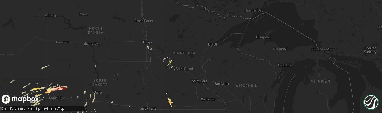
Hail Map in Minnesota on May 17, 2013
The weather event in Minnesota on May 17, 2013 includes Hail map. 12 states and 233 cities were impacted and suffered possible damage. The total estimated number of properties impacted is 0.
Want more than just the map?
Turn this storm into a full workflow.
- Owner + property data so you know who to knock
- OnDemand branded weather history reports to win the "did we even have hail?" argument
- RoofTrace estimate so reps stop guessing numbers at the door
Bought this map? Upgrade within 7 days and we'll credit the $230. (10-15 min setup call)
Hail
0
Estimated number of impacted properties by a 1.00" hail or larger3,366
Estimated number of impacted properties by a 1.75" hail or larger0
Estimated number of impacted properties by a 2.50" hail or largerStorm reports in Minnesota
Minnesota
| Date | Description |
|---|---|
| 05/17/20136:30 PM CDT | A local report indicates 1.00 inch wind near 5 NE LAKEFIELD |
| 05/17/20136:10 PM CDT | Relayed by jackson county emergency management |
| 05/17/20135:45 PM CDT | A local report indicates 2.00 inch wind near WINDOM |
| 05/17/20135:45 PM CDT | Report was in the vicinity of wilder. |
| 05/17/20135:42 PM CDT | Branches 2 inches in diameter down. |
| 05/17/20135:40 PM CDT | A local report indicates 2.00 inch wind near WINDOM |
| 05/17/20135:35 PM CDT | A local report indicates 1.00 inch wind near 3 NW WINDOM |
| 05/17/20135:30 PM CDT | Lasted until 550 pm. |
| 05/17/20135:30 PM CDT | A local report indicates 1.00 inch wind near E WINDOM |
| 05/17/20135:30 PM CDT | Lasted until 550 pm. |
| 05/17/20135:30 PM CDT | Lasted until 540 pm. |
| 05/17/20135:25 PM CDT | A local report indicates 1.00 inch wind near 4 W WINDOM |
| 05/17/20135:22 PM CDT | A local report indicates 1.50 inch wind near WINDOM |
| 05/17/20135:20 PM CDT | A local report indicates 1.25 inch wind near 1 W WINDOM |
| 05/17/20135:20 PM CDT | A local report indicates 1.75 inch wind near 3 N WINDOM |
| 05/17/20135:20 PM CDT | Lasted until 540 pm. |
| 05/17/20135:15 PM CDT | A local report indicates 1.75 inch wind near 2 NW WINDOM |
| 05/17/20135:10 PM CDT | Lasted until 522 pm. |
| 05/17/20135:08 PM CDT | A local report indicates 1.00 inch wind near 3 NW WINDOM |
| 05/17/20134:20 PM CDT | A local report indicates 1.00 inch wind near 2 E STORDEN |
| 05/17/20132:04 AM CDT | Broken windshield on truck. |
| 05/17/20131:48 AM CDT | A local report indicates 1.00 inch wind near 8 W SAUK CENTRE |
All States Impacted by Hail Map on May 17, 2013
Cities Impacted by Hail Map on May 17, 2013
- Lodgepole, NE
- Bingham Lake, MN
- Osakis, MN
- Long Prairie, MN
- Greensboro, AL
- Alliance, NE
- Chadron, NE
- Ellsworth, NE
- Bingham, NE
- Newcastle, WY
- Deadwood, SD
- Sturgis, SD
- Teague, TX
- Valentine, NE
- Whitman, NE
- Rushville, NE
- Ashby, NE
- Gordon, NE
- Hay Springs, NE
- Merriman, NE
- Lakeside, NE
- Camp Crook, SD
- Calera, AL
- Weir, MS
- Saint Francis, SD
- Mission, SD
- Italy, TX
- Milford, TX
- Moorcroft, WY
- Mallard, IA
- Curlew, IA
- Havelock, IA
- Laurens, IA
- Shelby, AL
- Sylacauga, AL
- Newbern, AL
- Marion, AL
- Uniontown, AL
- Aberdeen, MS
- Okolona, MS
- Richland Springs, TX
- Clearmont, WY
- Moorhead, MN
- Comstock, MN
- Wolverton, MN
- Cody, NE
- Breckenridge, TX
- Newcastle, TX
- Graham, TX
- South Bend, TX
- Crawford, NE
- Emmetsburg, IA
- Union Center, SD
- Enning, SD
- White Owl, SD
- Maben, MS
- Mathiston, MS
- Sauk Centre, MN
- Devils Tower, WY
- Sundance, WY
- Porcupine, SD
- Belle Fourche, SD
- Marion Junction, AL
- Selma, AL
- Fort Pierre, SD
- Okaton, SD
- Lakefield, MN
- Jackson, MN
- Jeffers, MN
- Heron Lake, MN
- Windom, MN
- Storden, MN
- Carrollton, AL
- Aliceville, AL
- Midland, SD
- Upton, WY
- Houston, MS
- Kyle, SD
- Parkers Prairie, MN
- Prairie, MS
- Gillette, WY
- Rozet, WY
- Smackover, AR
- El Dorado, AR
- Barry, TX
- Frost, TX
- Purdon, TX
- Allen, SD
- Kilgore, NE
- Nenzel, NE
- Hyannis, NE
- Mantee, MS
- Pheba, MS
- Cedarbluff, MS
- West Point, MS
- Knoxville, AL
- Akron, AL
- Moundville, AL
- Norris, SD
- Mexia, TX
- Newell, SD
- Vale, SD
- Lisco, NE
- Brandon, MN
- Wakpala, SD
- Brooten, MN
- Georgiana, AL
- Pine Apple, AL
- Olney, TX
- Holliday, TX
- San Saba, TX
- Draper, SD
- Weston, WY
- Windthorst, TX
- Loving, TX
- Ekalaka, MT
- Capitol, MT
- Hammond, MT
- Meeteetse, WY
- Whitewood, SD
- Spearfish, SD
- Saint Onge, SD
- Stewart, MS
- Kilmichael, MS
- Brierfield, AL
- Centreville, AL
- Lamberton, MN
- Revere, MN
- Thermopolis, WY
- Beulah, WY
- Aladdin, WY
- Garfield, MN
- Bryson, TX
- Faulkton, SD
- Lead, SD
- Murdo, SD
- Wortham, TX
- Ten Sleep, WY
- Glenwood, MN
- Villard, MN
- Alexandria, MN
- Kaycee, WY
- Buffalo, WY
- Philip, SD
- Tuthill, SD
- Martin, SD
- Long Valley, SD
- Randolph, AL
- Cresbard, SD
- Crookston, NE
- Thomaston, AL
- Mount Holly, AR
- Westbrook, MN
- Lawley, AL
- Eutaw, AL
- Louann, AR
- Stephens, AR
- Bessemer, AL
- Strong, AR
- Ayrshire, IA
- Quinn, SD
- Safford, AL
- Rochelle, TX
- Blooming Grove, TX
- Eupora, MS
- Eagle Bend, MN
- Miltona, MN
- Havana, ND
- Dawson, TX
- Nelson, MN
- Ruthven, IA
- White River, SD
- Walnut Grove, MN
- Columbiana, AL
- Buffalo, TX
- Midland, TX
- Evansville, MN
- Mitchell, SD
- Nisland, SD
- Pontotoc, MS
- Wood, SD
- Northville, SD
- Montevallo, AL
- Worland, WY
- Lineville, AL
- Whitney, NE
- Chamberlain, SD
- Daviston, AL
- Pine Ridge, SD
- Winona, MS
- Duck Hill, MS
- Hulett, WY
- Parmelee, SD
- Voca, TX
- Woodland, MS
- Knoxville, TN
- Oak Ridge, TN
- Randolph, MS
- Houlka, MS
- Hyattville, WY
- Minatare, NE
- Ipswich, SD
- Wilsonville, AL
- Sterrett, AL
- Harpersville, AL
- Manderson, WY
- Pukwana, SD
- Calhoun City, MS
- Hettinger, ND
- Starkville, MS
- Alabaster, AL
- Melrose, MN
- Belgrade, MN
- Maplesville, AL
- Osage, WY
- Alexander City, AL
- Vardaman, MS
- Birmingham, AL
- Pelham, AL
- York, AL
- Gordo, AL
- Talladega, AL
- Brady, TX
- French Camp, MS
- Ethel, MS
- Mount Vernon, SD
- Rutland, ND
- Oshkosh, NE
- Dalton, NE
- Sidney, NE
- Gurley, NE
- Broadwater, NE
- Hemingford, NE


