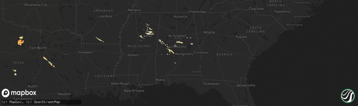
Hail Map in Alabama on May 17, 2013
The weather event in Alabama on May 17, 2013 includes Hail map. 12 states and 233 cities were impacted and suffered possible damage. The total estimated number of properties impacted is 0.
Want more than just the map?
Turn this storm into a full workflow.
- Owner + property data so you know who to knock
- OnDemand branded weather history reports to win the "did we even have hail?" argument
- RoofTrace estimate so reps stop guessing numbers at the door
Bought this map? Upgrade within 7 days and we'll credit the $230. (10-15 min setup call)
Hail
0
Estimated number of impacted properties by a 1.00" hail or larger0
Estimated number of impacted properties by a 1.75" hail or larger0
Estimated number of impacted properties by a 2.50" hail or largerStorm reports in Alabama
Alabama
| Date | Description |
|---|---|
| 05/17/20132:50 PM CDT | Sighting of tornado on boyds chapel road near interstate 65. |
| 05/17/20132:46 PM CDT | Tornado reported at fort hampton rd and clem rd. Relayed by 911/ema. |
| 05/17/20132:45 PM CDT | This very short-lived tornado was part of the same storm that produced the south athens tornado. Damage was seen in a less than 1/4 mile swath between residences along |
| 05/17/20132:38 PM CDT | Structure and tree damage on hardiman road near ardmore. Tornado possible. |
| 05/17/20132:06 PM CDT | One inch in diameter branches snapped off of trees at mcconnell cemetery. Possible tornado. |
| 05/17/20132:05 PM CDT | Trees and powerlines down along moyers road. Additional damage just northeast around steelcase inc. Possible tornado. |
| 05/17/20132:04 PM CDT | Power lines reported down. Possible tornado. |
| 05/17/20132:00 PM CDT | Tornado initially touched down along roy long rd just west of u.s. Hwy 31. Several trees were snapped/uprooted around residential property. Max winds were determined to |
| 05/16/20139:15 PM CDT | Quarter size hail reported near morgan academy on the southwest side of the city of selma. The quarter size hail fell for about 15 minutes...and hail was covering the g |
| 05/16/20139:07 PM CDT | Quarter size hail reported in selma on the western side of town. Reported through social media. |
| 05/16/20137:48 PM CDT | Quarter size hail reported near marion. |
All States Impacted by Hail Map on May 17, 2013
Cities Impacted by Hail Map on May 17, 2013
- Lodgepole, NE
- Bingham Lake, MN
- Osakis, MN
- Long Prairie, MN
- Greensboro, AL
- Alliance, NE
- Chadron, NE
- Ellsworth, NE
- Bingham, NE
- Newcastle, WY
- Deadwood, SD
- Sturgis, SD
- Teague, TX
- Valentine, NE
- Whitman, NE
- Rushville, NE
- Ashby, NE
- Gordon, NE
- Hay Springs, NE
- Merriman, NE
- Lakeside, NE
- Camp Crook, SD
- Calera, AL
- Weir, MS
- Saint Francis, SD
- Mission, SD
- Italy, TX
- Milford, TX
- Moorcroft, WY
- Mallard, IA
- Curlew, IA
- Havelock, IA
- Laurens, IA
- Shelby, AL
- Sylacauga, AL
- Newbern, AL
- Marion, AL
- Uniontown, AL
- Aberdeen, MS
- Okolona, MS
- Richland Springs, TX
- Clearmont, WY
- Moorhead, MN
- Comstock, MN
- Wolverton, MN
- Cody, NE
- Breckenridge, TX
- Newcastle, TX
- Graham, TX
- South Bend, TX
- Crawford, NE
- Emmetsburg, IA
- Union Center, SD
- Enning, SD
- White Owl, SD
- Maben, MS
- Mathiston, MS
- Sauk Centre, MN
- Devils Tower, WY
- Sundance, WY
- Porcupine, SD
- Belle Fourche, SD
- Marion Junction, AL
- Selma, AL
- Fort Pierre, SD
- Okaton, SD
- Lakefield, MN
- Jackson, MN
- Jeffers, MN
- Heron Lake, MN
- Windom, MN
- Storden, MN
- Carrollton, AL
- Aliceville, AL
- Midland, SD
- Upton, WY
- Houston, MS
- Kyle, SD
- Parkers Prairie, MN
- Prairie, MS
- Gillette, WY
- Rozet, WY
- Smackover, AR
- El Dorado, AR
- Barry, TX
- Frost, TX
- Purdon, TX
- Allen, SD
- Kilgore, NE
- Nenzel, NE
- Hyannis, NE
- Mantee, MS
- Pheba, MS
- Cedarbluff, MS
- West Point, MS
- Knoxville, AL
- Akron, AL
- Moundville, AL
- Norris, SD
- Mexia, TX
- Newell, SD
- Vale, SD
- Lisco, NE
- Brandon, MN
- Wakpala, SD
- Brooten, MN
- Georgiana, AL
- Pine Apple, AL
- Olney, TX
- Holliday, TX
- San Saba, TX
- Draper, SD
- Weston, WY
- Windthorst, TX
- Loving, TX
- Ekalaka, MT
- Capitol, MT
- Hammond, MT
- Meeteetse, WY
- Whitewood, SD
- Spearfish, SD
- Saint Onge, SD
- Stewart, MS
- Kilmichael, MS
- Brierfield, AL
- Centreville, AL
- Lamberton, MN
- Revere, MN
- Thermopolis, WY
- Beulah, WY
- Aladdin, WY
- Garfield, MN
- Bryson, TX
- Faulkton, SD
- Lead, SD
- Murdo, SD
- Wortham, TX
- Ten Sleep, WY
- Glenwood, MN
- Villard, MN
- Alexandria, MN
- Kaycee, WY
- Buffalo, WY
- Philip, SD
- Tuthill, SD
- Martin, SD
- Long Valley, SD
- Randolph, AL
- Cresbard, SD
- Crookston, NE
- Thomaston, AL
- Mount Holly, AR
- Westbrook, MN
- Lawley, AL
- Eutaw, AL
- Louann, AR
- Stephens, AR
- Bessemer, AL
- Strong, AR
- Ayrshire, IA
- Quinn, SD
- Safford, AL
- Rochelle, TX
- Blooming Grove, TX
- Eupora, MS
- Eagle Bend, MN
- Miltona, MN
- Havana, ND
- Dawson, TX
- Nelson, MN
- Ruthven, IA
- White River, SD
- Walnut Grove, MN
- Columbiana, AL
- Buffalo, TX
- Midland, TX
- Evansville, MN
- Mitchell, SD
- Nisland, SD
- Pontotoc, MS
- Wood, SD
- Northville, SD
- Montevallo, AL
- Worland, WY
- Lineville, AL
- Whitney, NE
- Chamberlain, SD
- Daviston, AL
- Pine Ridge, SD
- Winona, MS
- Duck Hill, MS
- Hulett, WY
- Parmelee, SD
- Voca, TX
- Woodland, MS
- Knoxville, TN
- Oak Ridge, TN
- Randolph, MS
- Houlka, MS
- Hyattville, WY
- Minatare, NE
- Ipswich, SD
- Wilsonville, AL
- Sterrett, AL
- Harpersville, AL
- Manderson, WY
- Pukwana, SD
- Calhoun City, MS
- Hettinger, ND
- Starkville, MS
- Alabaster, AL
- Melrose, MN
- Belgrade, MN
- Maplesville, AL
- Osage, WY
- Alexander City, AL
- Vardaman, MS
- Birmingham, AL
- Pelham, AL
- York, AL
- Gordo, AL
- Talladega, AL
- Brady, TX
- French Camp, MS
- Ethel, MS
- Mount Vernon, SD
- Rutland, ND
- Oshkosh, NE
- Dalton, NE
- Sidney, NE
- Gurley, NE
- Broadwater, NE
- Hemingford, NE


