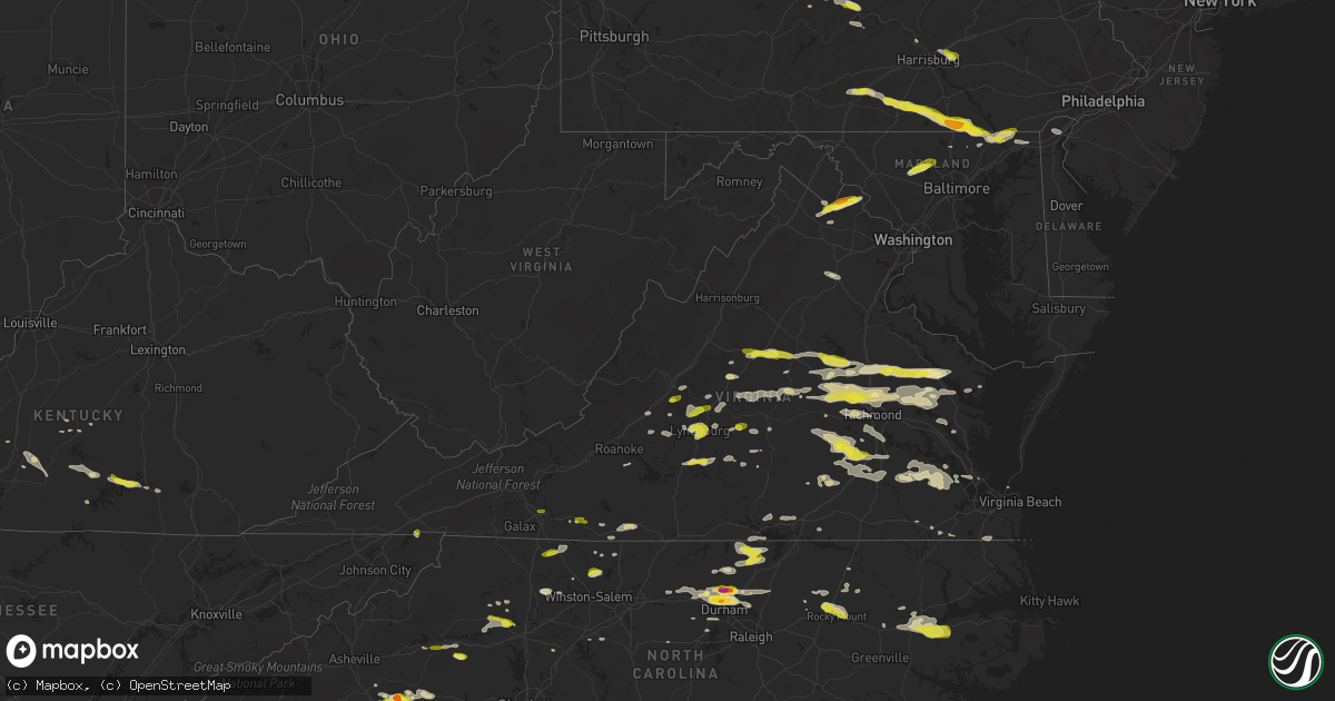
Hail Map in Virginia on May 10, 2018
Get this storm
May 10 map
$229
one time, instant access
Download today. No call, no setup
Keep the $229
Bought the map and want the full workflow? Apply the entire $229 to a subscription within 7 days. None of it is wasted.
Every map, not just this one
This buys you this map. Subscription and you get every map we run, in the markets you choose from a few cities to whole states to nationwide. Plus real-time alerts the moment a storm fires.
Contact data
Name, contact info, occupancy, even credit band for addresses in the footprint. You go from where it hit to who to call.
Become the source they trust
Unlimited branding weather history reports on demand. You already have the documented answer ready for the property owner, and you are the one who showed up with it.
Property data and RoofTrace estimates
Pull up any address you have got, its value and the exact code rules for that jurisdiction, straight from One Click Code. Then RoofTrace estimates the squares, pitch, and roof value, priced the way you price.
Storm reports in Virginia
Virginia
| Date | Description |
|---|---|
| 05/10/20186:45 PM CDT | Trees down near cartersville. |
| 05/10/20186:15 PM CDT | Dime to quarter size hail reported near the washington county... Va and sullivan county... Tn line. |
| 05/10/20185:45 PM CDT | A local report indicates 64 MPH wind near 1 SE MIDLAND |
| 05/10/20185:45 PM CDT | Tree down reported on chippokes farm road. Time estimated by radar. |
| 05/10/20185:30 PM CDT | Tree down on spring grove ave. Time estimated by radar. |
| 05/10/20185:29 PM CDT | Tree down blocking roadway in the 10400 block of old marsh road. |
| 05/10/20185:25 PM CDT | Large maple tree down. One pine tree down... 2 snapped. |
| 05/10/20185:25 PM CDT | Tree down w/vehicle accident in the city of wakefield. Tin roofing torn off outbuilding. Time estimated based on radar. |
| 05/10/20185:15 PM CDT | Power lines/poles down on haligan park road. Time estimated based on radar. |
| 05/10/20185:15 PM CDT | Two trees down on road. |
| 05/10/20185:05 PM CDT | Corrected time. Two trees down. One on a house. |
| 05/10/20185:05 PM CDT | Corrected time/location of event. Power lines/poles down on haligan park road in carson. Time estimated based on radar. |
| 05/10/20184:38 PM CDT | Tree down in the 700 block of catlett mountain road. |
| 05/10/20184:35 PM CDT | Multiple trees down. Time estimated by radar. Relayed from wfo rnk. |
| 05/10/20184:25 PM CDT | Report from social media. |
| 05/10/20184:00 PM CDT | A local report indicates 1.00 inch wind near 3 SW BEACH |
| 05/10/20183:53 PM CDT | One tree down at the 3000 block of old cluster springs road. |
| 05/10/20183:52 PM CDT | Trees down along highway 360. |
| 05/10/20183:50 PM CDT | One tree blown down at the intersection of jones ferry road and river road. |
| 05/10/20183:47 PM CDT | Trees down along newtown rd and along owns mill rd. |
| 05/10/20183:40 PM CDT | Traffic accident reported with tree down on a vehicle. |
| 05/10/20183:40 PM CDT | One large tree down... And several limbs down. |
| 05/10/20183:38 PM CDT | A local report indicates 1.00 inch wind near 1 NE LONGDALE |
| 05/10/20183:35 PM CDT | A local report indicates 1.00 inch wind near GLEN ALLEN |
| 05/10/20183:32 PM CDT | A local report indicates 1.00 inch wind near 1 N LAUREL |
| 05/10/20183:32 PM CDT | A local report indicates 1.00 inch wind near 2 NW SHORT PUMP |
| 05/10/20183:30 PM CDT | Quarter size hail north of waterford... Reported by public |
| 05/10/20183:29 PM CDT | A local report indicates 1.00 inch wind near SHORT PUMP |
| 05/10/20183:25 PM CDT | Multiple trees down. |
| 05/10/20183:25 PM CDT | Tree down reported on pagebrook drive. Time estimated by radar. |
| 05/10/20183:25 PM CDT | 2 trees and numerous large limbs blow down near ringold |
| 05/10/20183:22 PM CDT | Numerous trees down along gegory rd... Frogg level rd and route 30. |
| 05/10/20183:15 PM CDT | Quarter to ping pong ball size hail |
| 05/10/20183:10 PM CDT | Tree down reported at maidens road & huguenot trail. |
| 05/10/20183:10 PM CDT | Tree down reported on genito road. Time estimated by radar. |
| 05/10/20183:09 PM CDT | One tree down. Report from wdbj-tv. |
| 05/10/20183:03 PM CDT | Trees down near hewlett. |
| 05/10/20182:57 PM CDT | A few trees blown down on east ferry road. |
| 05/10/20182:55 PM CDT | Tree down reported at 5800 block of anderson hwy. |
| 05/10/20182:53 PM CDT | Tree down on fork rd near holland rd |
| 05/10/20182:52 PM CDT | Tree down on francisco rd near hwy 15 |
| 05/10/20182:45 PM CDT | Corrects previous tstm wnd dmg report from cartersville. Trees down near cartersville. Corrected time. |
| 05/10/20182:38 PM CDT | Four trees down on joseph martin hwy |
| 05/10/20182:35 PM CDT | Tree down on horsepasture rd and magna vista school rd |
| 05/10/20182:35 PM CDT | Tree down on cartersville rd |
| 05/10/20182:34 PM CDT | 1 tree down on east ferry road |
| 05/10/20182:34 PM CDT | Ham radio reported one inch hail on route 24. |
| 05/10/20182:30 PM CDT | Tree down in the horse pasture area. Time estimated from radar. |
| 05/10/20182:25 PM CDT | Tree down on george taylor rd and penn store rd |
| 05/10/20182:22 PM CDT | Tree down on spencer rd near ranson rd |
| 05/10/20182:20 PM CDT | Tree down on kennon road reported by sheriff's office. |
| 05/10/20182:15 PM CDT | Tree down on green springs road reported by sheriff's office. |
| 05/10/20182:07 PM CDT | A local report indicates 1.00 inch wind near MADISON HEIGHTS |
| 05/10/20181:52 PM CDT | 1 tree down partially blocking us29. |
| 05/10/20181:52 PM CDT | A local report indicates 1.00 inch wind near 3 ESE BUFFALO RIDGE |
| 05/10/20181:50 PM CDT | Hail falling at 911 dispatch center |
| 05/10/20181:47 PM CDT | Tree down on arrington rd 1 mi east of rt 29 |
| 05/10/20181:43 PM CDT | Relayed from wfo sterling. |
| 05/10/20181:42 PM CDT | Tree down near wilson rd and us rt 29 |
| 05/10/20181:40 PM CDT | Tree branch down crest hill near zachary taylor blvd. |
| 05/10/20181:33 PM CDT | A local report indicates 1.00 inch wind near 5 SSE GREENFIELD |
| 05/10/20181:20 PM CDT | A local report indicates 1.00 inch wind near 2 WNW GALAX HILLSVILLE |
| 05/10/20181:20 PM CDT | One tree down near the intersection of route 130 and ranger lane |
| 05/10/20181:12 PM CDT | Several trees down along sunset blvd extended. |
| 05/10/20181:12 PM CDT | Several trees and power lines down including one tree into a structure. |
| 05/10/201812:53 PM CDT | One tree down near the intersection of east 13th street and pine avenue |
| 05/10/201812:40 PM CDT | Tree down on pheasnt run causing gas line rupture and fire. |
| 05/10/201812:20 PM CDT | A local report indicates 1.00 inch wind near 2 WNW GALAX HILLSVILLE |
| 05/10/20181:23 AM CDT | At 623 PM EDT, a severe thunderstorm was located over Arcadia, moving southeast at 20 mph. HAZARD...60 mph wind gusts and quarter size hail. SOURCE...Radar indicated. IMPACT...Hail damage to vehicles is expected. Expect wind damage to roofs, siding, and trees. Locations impacted include... Bedford... Buchanan... Big Island... Forest... and Coleman Falls. |
| 05/10/20181:08 AM CDT | At 607 PM EDT, a severe thunderstorm was located near Carson, or 9 miles southwest of Disputanta, moving east at 40 mph. HAZARD...70 mph wind gusts and penny size hail. SOURCE...Radar indicated. IMPACT...Expect considerable tree damage. Damage is likely to mobile homes, roofs, and outbuildings. This severe thunderstorm will be near, Homeville around 620 PM EDT. Waverly around 625 PM EDT. Wakefield around 635 PM EDT. Ivor around 640 PM EDT. Zuni around 650 PM EDT. Other locations impacted by this severe thunderstorm includeVicksville, Booth Fork, Carsley, Pons, Chippokes State Park, Booker,Spring Grove, Lumberton, Ellis Fork and Dory. |
| 05/10/201812:48 AM CDT | At 547 PM EDT, severe thunderstorms were located along a line extending from 8 miles northeast of Front Royal to near Linden to 10 miles north of Sperryville, moving east at 40 mph. HAZARD...60 mph wind gusts. SOURCE...Radar indicated. IMPACT...Damaging winds will cause some trees and large branches to fall. This could injure those outdoors, as well as damage homes and vehicles. Roadways may become blocked by downed trees. Localized power outages are possible. Unsecured light objects may become projectiles. Locations impacted include... Warrenton, Bealeton, Haymarket, Sperryville, The Plains, Delaplane, Linden, Hume, Gainesville, New Baltimore, Marshall, Chester Gap, Opal, Flint Hill, Washington, Castleton, Huntly, Woolsey, Broken Hill and Hackleys Crossroads. |
| 05/10/201812:43 AM CDT | At 542 PM EDT, a severe thunderstorm was located over McKenney, moving east at 30 mph. HAZARD...60 mph wind gusts and penny size hail. SOURCE...Radar indicated. IMPACT...Expect damage to trees and powerlines. This severe thunderstorm will be near, Dewitt around 550 PM EDT. Stony Creek around 615 PM EDT. Other locations impacted by this severe thunderstorm include Burgess,Rawlings, Reams, Fields Crossroads, Warfield, Wharfs Store, Huske,Ordsburg, Center Star and Church Road. |
| 05/10/201812:26 AM CDT | At 526 PM EDT, severe thunderstorms were located along a line extending from near Stephens City to 7 miles south of Strasburg, moving east at 35 mph. HAZARD...60 mph wind gusts. SOURCE...Radar indicated. IMPACT...Damaging winds will cause some trees and large branches to fall. This could injure those outdoors, as well as damage homes and vehicles. Roadways may become blocked by downed trees. Localized power outages are possible. Unsecured light objects may become projectiles. Locations impacted include... Front Royal, Chester Gap, Arco, Howellsville, Riverton, Reliance, Karo, Glen Echo, Blue Mountain, Nineveh, Browntown, Cedarville, Buckton and Riverside. |
| 05/10/201812:19 AM CDT | At 519 PM EDT, severe thunderstorms were located along a line extending from near Millers Tavern to King And Queen Court House to Adkins Store, moving east at 45 mph. HAZARD...60 mph wind gusts and quarter size hail. SOURCE...Radar indicated. IMPACT...Minor damage to vehicles is possible. Expect wind damage to trees and powerlines. Severe thunderstorms will be near, West Point and Little Plymouth around 525 PM EDT. Church View and Shacklefords around 530 PM EDT. Jamaica and Barhamsville around 535 PM EDT. Urbanna, Toano, Saluda and Glenns around 540 PM EDT. Norge around 545 PM EDT. Gloucester Courthouse around 600 PM EDT. Other locations impacted by these severe thunderstorms includeEltham, Croaker, Bertrand, Cohoke, Rose Garden, Mattaponi, Crouch,Mascot, Cooke and Allmondsville. |
| 05/09/201811:56 PM CDT | At 456 PM EDT, severe thunderstorms were located along a line extending from near Bensley to 7 miles west of Sutherland, moving east at 40 mph. HAZARD...60 mph wind gusts and quarter size hail. SOURCE...Radar indicated. IMPACT...Minor damage to vehicles is possible. Expect wind damage to trees and powerlines. Severe thunderstorms will be near, Chester, Bellwood and Bensley around 500 PM EDT. Matoaca and Ettrick around 515 PM EDT. Petersburg and Virginia State University around 520 PM EDT. Charles City and Adkins Store around 525 PM EDT. Prince George and Ruthville around 530 PM EDT. Disputanta around 535 PM EDT. Other locations impacted by these severe thunderstorms includeWayside, Birchett Estate, Addison, Jordan Point Country Club,Petersburg National Battlefield, Pocahontas State Park, New Bohemia,Beach, Richard Bland College and Meadowville. |
| 05/09/201811:49 PM CDT | At 449 PM EDT, severe thunderstorms were located along a line extending from near Hanover to near Mechanicsville to Bensley, moving east at 40 mph. HAZARD...60 mph wind gusts and quarter size hail. SOURCE...Radar indicated. IMPACT...Minor damage to vehicles is possible. Expect wind damage to trees and powerlines. Severe thunderstorms will be near, Studley around 455 PM EDT. Tunstall around 505 PM EDT. Talleysville, Manquin and Bottoms Bridge around 510 PM EDT. Roxbury and Aylett around 515 PM EDT. New Kent and Adkins Store around 520 PM EDT. King William and Providence Forge around 525 PM EDT. Stevensville around 530 PM EDT. Other locations impacted by these severe thunderstorms includeEnfield, Mountcastle, Elko, Etna Mills, Cohoke, Sandston, Epworth,Glendale, Westwood and Rose Garden. |
| 05/09/201811:19 PM CDT | At 419 PM EDT, a severe thunderstorm was located over Chula, or near Amelia Courthouse, moving east at 45 mph. HAZARD...60 mph wind gusts and quarter size hail. SOURCE...Radar indicated. IMPACT...Minor damage to vehicles is possible. Expect wind damage to trees and powerlines. This severe thunderstorm will be near, Moseley around 430 PM EDT. Chesterfield Court House around 450 PM EDT. Chester, Bellwood and Bensley around 455 PM EDT. Other locations impacted by this severe thunderstorm includeWinterpock, Pilkinton, Giles Mill, Winterham, Pocahontas State Park,Skinquarter, Maplewood, Beach, Lodore and Truxillo. |
| 05/09/201811:18 PM CDT | At 418 PM EDT, a severe thunderstorm was located over Purcellville, or 9 miles northwest of Leesburg, moving east at 35 mph. HAZARD...Golf ball size hail and 60 mph wind gusts. SOURCE...Radar indicated. IMPACT...Expect wind damage to trees and power lines. Hail is large enough to dent and damage vehicles. Some hail damage to roofs, siding, and windows is possible. Locations impacted include... Germantown, Damascus, Ballenger Creek, Brunswick, New Market, Green Valley, Point Of Rocks, Linganore-Bartonsville, Clarksburg, Adamstown, Buckeystown, Monrovia, Barnesville, Ijamsville, Doubs, Park Mills, Dickerson, Beallsville and Tuscarora. |
| 05/09/201811:15 PM CDT | At 415 PM EDT, severe thunderstorms were located along a line extending from 6 miles west of Montpelier to near Oilville to near Moseley, moving east at 45 mph. HAZARD...70 mph wind gusts and quarter size hail. SOURCE...Radar indicated. IMPACT...Minor damage to vehicles is possible. Expect considerable tree damage. Wind damage is also likely to mobile homes, roofs, and outbuildings. Severe thunderstorms will be near, Tuckahoe and Wyndham around 420 PM EDT. Montpelier around 425 PM EDT. Glen Allen, Laurel and Lakeside around 430 PM EDT. Bon Air, University Of Richmond, Randolph Macon College and Mechanicsville around 435 PM EDT. Richmond, Ashland, Downtown Richmond, Virginia Commonwealth University, Virginia Union University, Hanover and Bensley around 440 PM EDT. Studley and East Highland Park around 445 PM EDT. Highland Springs and Mangohick around 450 PM EDT. Other locations impacted by these severe thunderstorms includeEnfield, Richmond Heights, Gum Tree, Etna Mills, Elmont, Montrose,Epworth, Richmond International, Fair Oaks and Gilman. |
| 05/09/201811:13 PM CDT | At 413 PM EDT, severe thunderstorms were located along a line extending from near Randolph Macon College to near Kings Dominion to near Milford, moving east at 35 mph. HAZARD...60 mph wind gusts and quarter size hail. SOURCE...Radar indicated. IMPACT...Minor damage to vehicles is possible. Expect wind damage to trees and powerlines. Severe thunderstorms will be near, Bowling Green around 420 PM EDT. Dawn around 425 PM EDT. Mangohick and Beulahville around 435 PM EDT. Newtown around 440 PM EDT. Loretto around 445 PM EDT. Champlain around 450 PM EDT. Saint Stephens Church and Millers Tavern around 455 PM EDT. Tappahannock around 500 PM EDT. Other locations impacted by these severe thunderstorms includeBeazley, Hustle, Elevon, Gum Tree, Penola, Epworth, Biscoe, Globe,Mount Landing and Duane Fork. |
| 05/09/201810:53 PM CDT | At 351 PM EDT, a severe thunderstorm was located near Ranson, or near Charles Town, moving east at 20 mph. HAZARD...60 mph wind gusts and quarter size hail. SOURCE...Radar indicated. IMPACT...Damaging winds will cause some trees and large branches to fall. This could injure those outdoors, as well as damage homes and vehicles. Roadways may become blocked by downed trees. Localized power outages are possible. Unsecured light objects may become projectiles. Locations impacted include... Frederick, Charles Town, Ballenger Creek, Brunswick, Ranson, Braddock Heights, Harpers Ferry, Point Of Rocks, Adamstown, Jefferson, Myersville, Lovettsville, Buckeystown, Shenandoah Junction, Rosemont, Rohrersville, Burkittsville, Gapland, Brownsville and Antietam. |
| 05/09/201810:49 PM CDT | At 349 PM EDT, severe thunderstorms were located along a line extending from near Duncan to near Fife to near Cumberland, moving east at 45 mph. HAZARD...60 mph wind gusts and quarter size hail. SOURCE...Radar indicated. IMPACT...Minor damage to vehicles is possible. Expect wind damage to trees and powerlines. Severe thunderstorms will be near, Powhatan and Ballsville around 400 PM EDT. Goochland, Gum Spring and Macon around 405 PM EDT. Oilville, Manakin and Sabot around 415 PM EDT. Wyndham around 425 PM EDT. Other locations impacted by these severe thunderstorms includeOrchid, Crozier, Rock Castle, Oak Forest, Vontay, Maidens, ThreeSquare, Irwin, Johnsons Springs and Fine Creek Mills. |
| 05/09/201810:42 PM CDT | At 342 PM EDT, a severe thunderstorm was located over Gladys, moving east at 35 mph. HAZARD...60 mph wind gusts and quarter size hail. SOURCE...Radar indicated. IMPACT...Hail damage to vehicles is expected. Expect wind damage to roofs, siding, and trees. Locations impacted include... Altavista... Phenix... Red House... Rustburg... and Pamplin City. |
| 05/09/201810:38 PM CDT | At 337 PM EDT, severe thunderstorms were located along a line extending from Toga to near Tower Hill to Concord, moving east at 35 mph. HAZARD...60 mph wind gusts and quarter size hail. SOURCE...Radar indicated. This storm has a history of producing hail the size of quarters. IMPACT...Hail damage to vehicles is expected. Expect wind damage to roofs, siding, and trees. Locations impacted include... Buckingham... Appomattox... Dillwyn... Toga... and Appomattox National Historic Park. |
| 05/09/201810:30 PM CDT | At 330 PM EDT, a severe thunderstorm was located over Bumpass, or 7 miles east of Mineral, moving east at 30 mph. HAZARD...60 mph wind gusts and quarter size hail. SOURCE...Radar indicated. IMPACT...Minor damage to vehicles is possible. Expect wind damage to trees and powerlines. This severe thunderstorm will be near, Ladysmith around 400 PM EDT. Kings Dominion around 415 PM EDT. Other locations impacted by this severe thunderstorm includeChilesburg, Golansville, Oliver, Gum Tree, Coatesville, Hewlett,Doswell, Noel, Beaverdam and Burruss Corner. |
| 05/09/201810:29 PM CDT | At 329 PM EDT, severe thunderstorms were located along a line extending from near Collinsville to Hanging Rock State Park, moving east at 30 mph. HAZARD...60 mph wind gusts and quarter size hail. SOURCE...Radar indicated. IMPACT...Hail damage to vehicles is expected. Expect wind damage to roofs, siding, and trees. Locations impacted include... Danville... Eden... Reidsville... Martinsville... and Wentworth.This includes The following Locations The Martinsville Speedway,Martinsville Airport, and Danville Airport. |
| 05/09/201810:26 PM CDT | At 325 PM EDT, severe thunderstorms were located along a line extending from 11 miles northwest of New Canton to near Centenary to near Buckingham, moving east at 35 mph. HAZARD...60 mph wind gusts and quarter size hail. SOURCE...Radar indicated. IMPACT...Minor damage to vehicles is possible. Expect wind damage to trees and powerlines. Severe thunderstorms will be near, Palmyra and Fork Union around 345 PM EDT. Columbia and Duncan around 350 PM EDT. Fife and Lakeside Village around 400 PM EDT. Cartersville around 405 PM EDT. Other locations impacted by these severe thunderstorms include Dixie,Trents Mill, Ashby, Stage Junction, Shores, Central Plains, BremoBluff, Clinton, Tamworth and Elk Hill. |
| 05/09/20189:57 PM CDT | At 256 PM EDT, severe thunderstorms were located along a line extending from near Mineral to near Palmyra, moving east at 35 mph. HAZARD...60 mph wind gusts and quarter size hail. SOURCE...Radar indicated. At around 240 pm EDT, quarter size hail was reported north of Troy. IMPACT...Minor damage to vehicles is possible. Expect wind damage to trees and powerlines. Severe thunderstorms will be near, Louisa and Mineral around 300 PM EDT. Hadensville and Bumpass around 315 PM EDT. Gum Spring around 325 PM EDT. Other locations impacted by these severe thunderstorms includeOrchid, Pendleton, Sandy Hook, Louisa Airport, Cuckoo, Caledonia,Wildwood, Dabneys, Bybee and Yanceyville. |
| 05/09/20189:46 PM CDT | At 246 PM EDT, a severe thunderstorm was located near Boonsboro, moving east at 40 mph. HAZARD...60 mph wind gusts and half dollar size hail. SOURCE...Radar indicated. IMPACT...Hail damage to vehicles is expected. Expect wind damage to roofs, siding, and trees. Locations impacted include... Bent Creek... Stonewall... Oakville... Tower Hill... and Riverville. |
| 05/09/20189:40 PM CDT | At 239 PM EDT, a severe thunderstorm was located near Falconerville, moving east at 35 mph. HAZARD...60 mph wind gusts and half dollar size hail. SOURCE...Radar indicated. IMPACT...Hail damage to vehicles is expected. Expect wind damage to roofs, siding, and trees. Locations impacted include... Buckingham... Amherst... Dillwyn... Clifford... and Gold Hill. |
| 05/09/20189:35 PM CDT | At 234 PM EDT, a severe thunderstorm was located over Dobson, moving east at 40 mph. HAZARD...60 mph wind gusts and quarter size hail. SOURCE...Radar indicated. IMPACT...Hail damage to vehicles is expected. Expect wind damage to roofs, siding, and trees. Locations impacted include... Mount Airy... Fairview... Flat Rock... Dobson... and Pilot Mountain. |
| 05/09/20189:35 PM CDT | At 234 PM EDT, severe thunderstorms were located along a line extending from 6 miles north of Schuyler to near Pleasant View, moving east at 40 mph. HAZARD...60 mph wind gusts. SOURCE...Radar indicated. IMPACT...Damaging winds will cause some trees and large branches to fall. This could injure those outdoors, as well as damage homes and vehicles. Roadways may become blocked by downed trees. Localized power outages are possible. Unsecured light objects may become projectiles. Locations impacted include... Shipman, Schuyler, Arrington, Scottsville, Esmont, Lovingston, Tye River, Damon, Allens Creek, Covesville, Rockfish, Buffalo Springs, Norwood, Glendower, Keene, Five Forks, Alberene, Gladstone, Elma and Faber. |
| 05/09/20189:33 PM CDT | At 233 PM EDT, a severe thunderstorm was located near Sperryville, or 16 miles south of Front Royal, moving east at 35 mph. HAZARD...60 mph wind gusts. SOURCE...Radar indicated. IMPACT...Damaging winds will cause some trees and large branches to fall. This could injure those outdoors, as well as damage homes and vehicles. Roadways may become blocked by downed trees. Localized power outages are possible. Unsecured light objects may become projectiles. Locations impacted include... Sperryville, Hume, Flint Hill, Washington, Hackleys Crossroads, Amissville, Fourway, Cresthill, Orlean, Five Forks, Rock Mills, Ashville and Ada. |
| 05/09/20189:22 PM CDT | At 222 PM EDT, a severe thunderstorm was located near Lake Monticello, or near Charlottesville, moving east at 40 mph. HAZARD...60 mph wind gusts and quarter size hail. SOURCE...Radar indicated. IMPACT...Minor damage to vehicles is possible. Expect wind damage to trees and powerlines. This severe thunderstorm will be near, Lake Monticello around 225 PM EDT. Troy around 235 PM EDT. Boswells Tavern around 240 PM EDT. Ferncliff around 245 PM EDT. Louisa around 255 PM EDT. Other locations impacted by this severe thunderstorm include Bybee,Yanceyville, Louisa Airport, Waldrop, Green Springs, Byrd Mill,Trevilians, Zion Crossroads, Vawter Corner and Union Mills. |
| 05/09/20189:18 PM CDT | At 218 PM EDT, a severe thunderstorm was located near Peaks Of Otter Recreation Area, moving east at 35 mph. HAZARD...60 mph wind gusts and half dollar size hail. SOURCE...Radar indicated. IMPACT...Hail damage to vehicles is expected. Expect wind damage to roofs, siding, and trees. Locations impacted include... Lynchburg... Bedford... Forest... Madison Heights... and Boonsboro.This includes The following Locations Liberty University andLynchburg Airport. |
| 05/09/20189:07 PM CDT | At 206 PM EDT, severe thunderstorms were located along a line extending from near Charlottesville to 8 miles southeast of Afton, moving east at 40 mph. HAZARD...60 mph wind gusts and quarter size hail. SOURCE...Radar indicated. IMPACT...Damaging winds will cause some trees and large branches to fall. This could injure those outdoors, as well as damage homes and vehicles. Roadways may become blocked by downed trees. Localized power outages are possible. Unsecured light objects may become projectiles. Locations impacted include... Charlottesville, Campbell, Nellysford, Scottsville, Esmont, Cobham, Cismont, North Garden, Newcomb Hall, Covesville, Boyd Tavern, Woodridge, Monticello, Keswick, Shadwell, Barracks, Greenfield, Glendower, Keene and Overton. |
| 05/09/20189:01 PM CDT | At 201 PM EDT, a severe thunderstorm was located near Alto, or 7 miles north of Forks Of Buffalo, moving east at 40 mph. HAZARD...60 mph wind gusts and quarter size hail. SOURCE...Radar indicated. IMPACT...Damaging winds will cause some trees and large branches to fall. This could injure those outdoors, as well as damage homes and vehicles. Roadways may become blocked by downed trees. Localized power outages are possible. Unsecured light objects may become projectiles. Locations impacted include... Sherando, Wintergreen, Montebello, Lyndhurst, Nellysford, Bryant, Greenfield, Jonesboro, Tyro, Afton Mountain and Massies Mill. |
| 05/09/20189:01 PM CDT | At 201 PM EDT, a severe thunderstorm was located over Arcadia, moving east at 45 mph. HAZARD...60 mph wind gusts and quarter size hail. SOURCE...Radar indicated. IMPACT...Hail damage to vehicles is expected. Expect wind damage to roofs, siding, and trees. Locations impacted include... Amherst... Buchanan... Glasgow... Forks Of Buffalo... and Clifford. |
| 05/09/20188:19 PM CDT | At 119 PM EDT, a severe thunderstorm was located near Stuarts Draft, or near Staunton, moving east at 30 mph. HAZARD...60 mph wind gusts and quarter size hail. SOURCE...Radar indicated. IMPACT...Damaging winds will cause some trees and large branches to fall. This could injure those outdoors, as well as damage homes and vehicles. Roadways may become blocked by downed trees. Localized power outages are possible. Unsecured light objects may become projectiles. Locations impacted include... Staunton, Waynesboro, Stuarts Draft, Crozet, Crimora, Sherando, Afton, Fishersville, Lyndhurst, Ivy, Greenwood, Hermitage, North Garden, Batesville, Yancey Mills, Afton Mountain and White Hall. |
All States Impacted by Hail Map on May 10, 2018
Cities Impacted by Hail Map on May 10, 2018
- Elm Creek, NE
- Maywood, NE
- Curtis, NE
- Farnam, NE
- Moorefield, NE
- Tryon, NC
- Columbus, NC
- Mill Spring, NC
- Evansville, IN
- Brady, NE
- Stapleton, NE
- Arnold, NE
- Harrisburg, NE
- Shippensburg, PA
- Biglerville, PA
- Chambersburg, PA
- Lisco, NE
- Oshkosh, NE
- Palmyra, VA
- Mayodan, NC
- Buena Vista, VA
- Lakeside, NE
- Alliance, NE
- Ashby, NE
- Ellsworth, NE
- Bingham, NE
- Lincoln, NE
- Denton, NE
- Francisco, IN
- Dale, IN
- Lynnville, IN
- Chrisney, IN
- Tennyson, IN
- Boonville, IN
- Owensville, IN
- Elberfeld, IN
- Lamar, IN
- Lincoln City, IN
- Gentryville, IN
- Oakland City, IN
- Princeton, IN
- Grandview, IN
- Haubstadt, IN
- Patoka, IN
- Fort Branch, IN
- Campbellsville, KY
- Hillsborough, NC
- Efland, NC
- Hamilton, VA
- Purcellville, VA
- Harpers Ferry, WV
- Berryville, VA
- Waterford, VA
- Paeonian Springs, VA
- Round Hill, VA
- Bluemont, VA
- Lewellen, NE
- Holyoke, CO
- Venango, NE
- Amherst, CO
- Champion, NE
- Akron, CO
- Yuma, CO
- Elsie, NE
- Paxton, NE
- Ogallala, NE
- Lemoyne, NE
- Arthur, NE
- Bahama, NC
- Durham, NC
- Ashland, VA
- Mechanicsville, VA
- Walkerton, VA
- Merriman, NE
- Gordon, NE
- Monroe, VA
- Callaway, NE
- Gothenburg, NE
- Harrisburg, PA
- Hummelstown, PA
- Hershey, PA
- Williamston, NC
- Windsor, NC
- Plymouth, NC
- Jamesville, NC
- Palmer, TN
- Dunlap, TN
- Dunnsville, VA
- Lexington, NC
- Lewiston Woodville, NC
- Henderson, KY
- Bumpass, VA
- Beaverdam, VA
- Mineral, VA
- Louisa, VA
- Gettysburg, PA
- Overton, NE
- Robersonville, NC
- Elberon, VA
- Dendron, VA
- Ivor, VA
- Wakefield, VA
- Waverly, VA
- Windsor, VA
- Spring Grove, VA
- Smithfield, VA
- Blackstone, VA
- White Haven, PA
- Freeland, PA
- Connelly Springs, NC
- Midlothian, VA
- Richmond, VA
- Henrico, VA
- Nashville, TN
- Cody, NE
- Valentine, NE
- Hershey, NE
- Bremo Bluff, VA
- Henderson, NE
- Surry, VA
- Olney, IL
- Parkersburg, IL
- West Salem, IL
- Tryon, NE
- Sutherland, NE
- Keystone, NE
- Big Springs, NE
- North Platte, NE
- Brule, NE
- Rushville, NE
- Hay Springs, NE
- Rising Sun, MD
- Conowingo, MD
- Colora, MD
- Geneva, NE
- Burlington, NC
- Mebane, NC
- Rougemont, NC
- Franklinton, NC
- Creedmoor, NC
- Butner, NC
- Stem, NC
- Wake Forest, NC
- Cedar Grove, NC
- Hurdle Mills, NC
- Moravian Falls, NC
- Grant, NE
- Ovid, CO
- Sedgwick, CO
- Russell Springs, KY
- Rocky Mount, NC
- Nashville, NC
- Battleboro, NC
- Tunnel Hill, GA
- Rocky Face, GA
- Ringgold, GA
- Reisterstown, MD
- Woodbine, MD
- Sykesville, MD
- Finksburg, MD
- Westminster, MD
- Newburgh, IN
- Reed, KY
- Mount Vernon, IN
- Spottsville, KY
- Owensboro, KY
- Wadesville, IN
- Mount Airy, NC
- Gering, NE
- Columbia, KY
- Wellfleet, NE
- Maxwell, NE
- Lynchburg, VA
- Wood River, NE
- Alda, NE
- Doniphan, NE
- Pamplin, VA
- Charlottesville, VA
- Troy, VA
- North Garden, VA
- Keswick, VA
- Red House, VA
- Brookneal, VA
- Appomattox, VA
- Haxtun, CO
- Kearney, NE
- King And Queen Court House, VA
- Oconto, NE
- Goode, VA
- Bedford, VA
- Virginia Beach, VA
- Lewistown, PA
- Yeagertown, PA
- Burnham, PA
- Huntingdon, PA
- Petersburg, PA
- Belleville, PA
- Reedsville, PA
- Hastings, NE
- Cleveland, TN
- Tappahannock, VA
- Railroad, PA
- White Hall, MD
- East Berlin, PA
- Hanover, PA
- Pylesville, MD
- Glenville, PA
- Pleasant Hall, PA
- Orrstown, PA
- Aspers, PA
- Whiteford, MD
- Delta, PA
- Airville, PA
- Nottingham, PA
- Spring Grove, PA
- Darlington, MD
- Fawn Grove, PA
- New Freedom, PA
- Thomasville, PA
- New Park, PA
- Abbottstown, PA
- Stewartstown, PA
- Glen Rock, PA
- Seven Valleys, PA
- Felton, PA
- New Oxford, PA
- Port Deposit, MD
- Shrewsbury, PA
- York Springs, PA
- Street, MD
- La Follette, TN
- Lagrange, WY
- Gibbon, NE
- Nancy, KY
- Chesterfield, VA
- Church Road, VA
- Sutherland, VA
- Amelia Court House, VA
- Manakin Sabot, VA
- Rockville, VA
- Oilville, VA
- Glen Allen, VA
- Fairfield, IL
- Johnsonville, IL
- Cisne, IL
- Geff, IL
- Ford, VA
- Petersburg, VA
- Moseley, VA
- Charles Town, WV
- Ranson, WV
- Vale, NC
- Otis, CO
- Fleming, CO
- Spencer, VA
- Ridgeway, VA
- Juniata, NE
- Trumbull, NE
- Heartwell, NE
- Minden, NE
- Kenesaw, NE
- Litchfield, NE
- Loup City, NE
- Eustis, NE
- Chapel Hill, NC
- Reliance, TN
- Elwood, NE
- Lexington, NE
- Cozad, NE
- Timberlake, NC
- Montpelier, VA
- Shacklefords, VA
- Barhamsville, VA
- Westfield, NC
- Ararat, NC
- Pilot Mountain, NC
- Kenbridge, VA
- Upperville, VA
- Edmonton, KY
- Horse Cave, KY
- Greensburg, KY
- Hardyville, KY
- Center, KY
- Saint Stephens Church, VA
- Rawlings, VA
- McKenney, VA
- Ruther Glen, VA
- Doswell, VA
- Chappell, NE
- Lodgepole, NE
- East Bend, NC
- Yadkinville, NC
- Salisbury, NC
- Julesburg, CO
- Paoli, CO
- Thaxton, VA
- Suffolk, VA
- Bridgeport, WV
- Warsaw, VA
- Hanover, VA
- Aylett, VA
- Milford, VA
- Newtown, VA
- Strang, NE
- Bruning, NE
- Carleton, NE
- Hendersonville, NC
- Port Royal, PA
- Mifflin, PA
- Harrison, TN
- Iuka, IL
- Carrboro, NC
- Farmville, VA
- Mountain Top, PA
- Gandeeville, WV
- Forest City, NC
- Ellenboro, NC
- King William, VA
- West Point, VA
- Stevensville, VA
- Fort Oglethorpe, GA
- Rossville, GA
- Warrenton, VA
- Cynthiana, IN
- Thedford, NE
- Walnut Cove, NC
- Germanton, NC
- Bullock, NC
- Henderson, NC
- Oxford, NC
- New Harmony, IN
- Poseyville, IN
- Wallace, NE
- Madrid, NE
- Chase City, VA
- South Hill, VA
- Baskerville, VA
- Boydton, VA
- Bertrand, NE
- Loomis, NE
- Gladys, VA
- Altavista, VA
- Orma, WV
- Normantown, WV
- Patrick Springs, VA
- Bassett, VA
- Whitwell, TN
- Albin, WY
- Castalia, NC
- Whitakers, NC
- Fairmont, WV
- Monteagle, TN
- Tracy City, TN
- Huntington Mills, PA
- Shickshinny, PA
- Stillwater, PA
- Boonville, NC
- Buchanan, VA
- Axtell, NE
- Axton, VA
- Martinsville, VA
- Calhoun, IL
- Bridgeport, NE
- Broadwater, NE
- Bayard, NE
- Chadron, NE
- Enfield, NC
- Mount Erie, IL
- Eddyville, NE
- State Farm, VA
- Crozier, VA
- Maidens, VA
- Genoa, CO
- Limon, CO
- Hingham, MT
- Madison Heights, VA
- Whitman, NE
- Evington, VA
- Lynch Station, VA
- Hubbell, NE
- Hampton, VA
- Albany, KY
- Stony Point, NC
- Statesville, NC
- Tobyhanna, PA
- Cresco, PA
- Powhatan, VA
- Goochland, VA
- Sandy Hook, VA
- Little Plymouth, VA
- Manquin, VA
- Gum Spring, VA
- Hyannis, NE
- Fairbury, NE
- Spencer, WV
- Rutherfordton, NC
- Chester, NE
- Hebron, NE
- Gilead, NE
- Chester, VA
- Hardy, VA
- Boones Mill, VA
- Landrum, SC
- Campobello, SC
- Saluda, NC
- Sidney, NE
- Munfordville, KY
- Milligan, NE
- Dillwyn, VA
- Alexandria, NE
- Grafton, WV
- Thornton, WV
- Dickens, NE
- Superior, NE
- Guide Rock, NE
- Charlotte Court House, VA
- Dalton, GA
- Columbia, VA
- Morgantown, WV
- North East, MD
- Elkton, MD
- Xenia, IL
- Wilmington, DE
- New Castle, DE
- Meadows Of Dan, VA
- Chatsworth, GA
- Aurora, NE
- Howardsville, VA
- Schuyler, VA
- Wingina, VA
- Buckingham, VA
- Broken Bow, NE
- Mount Airy, MD
- Kilmarnock, VA
- Angora, NE
- Monticello, KY
- Bronston, KY
- Somerset, KY
- Nebo, NC
- Morganton, NC
- Harvard, NE
- Pennsylvania Furnace, PA
- Spruce Creek, PA
- Chattanooga, TN
- Lake Harmony, PA
- Hiddenite, NC
- Monkton, MD
- Parkton, MD
- York, NE
- Waco, NE
- Burnside, KY
- Amherst, VA
- Benton, PA
- Cave City, KY
- Weatherly, PA
- Gruetli Laager, TN
- Coalmont, TN
- Roxboro, NC
- Cartersville, VA
- Arvonia, VA
- Scottsville, VA
- New Canton, VA
- Spring Hope, NC
- Taylorsville, NC
- State College, PA
- Pine Grove Mills, PA
- Muncy Valley, PA
- Gloucester, VA
- Bernardsville, NJ
- Valdese, NC
- Spindale, NC
- Bostic, NC
- New Vernon, NJ
- Green Village, NJ
- Basking Ridge, NJ
- Morristown, NJ
- Jarrettsville, MD
- Benton, TN
- Delano, TN
- Oak, NE
- Lovettsville, VA
- Boyce, VA
- Leesburg, VA
- Gildford, MT
- Griffin, IN
- Mendham, NJ
- Madison, NC
- Chickamauga, GA
- Forest, VA
- Ocoee, TN
- Afton, VA
- Big Island, VA
- Bealeton, VA
- Jeffersonton, VA
- Midland, VA
- Shickley, NE
- Concord, VA
- Dinwiddie, VA
- Carson, VA
- Halifax, PA
- Duncannon, PA
- Arrington, VA
- Gladstone, VA
- Shelton, NE
- New Kent, VA
- Water View, VA
- Mattaponi, VA
- Church View, VA
- Urbanna, VA
- Jamaica, VA
- Bruington, VA
- Abingdon, VA
- Bristol, TN
- Duff, TN
- Sequatchie, TN
- Pelham, TN
- Siler City, NC
- Chesnee, SC
- Chesapeake, VA
- Hixson, TN
- Forest Hill, MD
- Mount Carmel, IL
- Mammoth Cave, KY
- Cub Run, KY
- La Crosse, VA
- White Plains, VA
- Ebony, VA
- Brodnax, VA
- McVeytown, PA
- Granville, PA
- Hickory, NC
- Greentown, PA
- Bradfordsville, KY
- Giltner, NE
- Odessa, NE
- Grand Island, NE
- Holdrege, NE
- Funk, NE
- Courtland, VA
- Faber, VA
- Shipman, VA
- Lovingston, VA
- Prince George, VA
- Wilsons, VA
- Dewitt, VA
- Fort Lee, VA
- Disputanta, VA
- Elora, TN
- Munden, KS
- Belleville, KS
- Narka, KS
- Tobaccoville, NC
- Unityville, PA
- Ripley, WV
- Kenna, WV
- Gordonsville, VA
- Kents Store, VA
- McDonald, TN
- Apison, TN
- Ooltewah, TN
- Fort Stockton, TX
- Speedwell, TN
- Crete, NE
- Dorchester, NE
- Lookout Mountain, GA
- Wildwood, GA
- Signal Mountain, TN
- Danbury, NC
- Sandy Ridge, NC
- Halifax, NC
- Flintville, TN
- Kelso, TN
- Tellico Plains, TN
- Skipwith, VA
- Hayes Center, NE
- Buffalo Junction, VA
- Nelson, VA
- Clarksville, VA
- Prospect, VA
- Newport News, VA
- Lancaster, VA
- Raywick, KY
- Friend, NE
- Cheyenne, WY
- Phenix, VA
- Palmyra, PA
- Peach Bottom, PA
- Rockport, IN
- Richland, IN
- Glasgow, VA
- Crozet, VA
- Stuart, VA
- Hillsville, VA
- Roper, NC
- Bruceton Mills, WV
- Millville, WV
- Shenandoah Junction, WV


