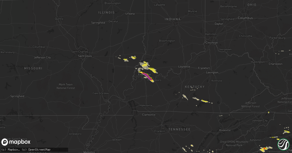
Hail Map on May 10, 2018
Get this storm
May 10 map
$229
one time, instant access
Download today. No call, no setup
Keep the $229
Bought the map and want the full workflow? Apply the entire $229 to a subscription within 7 days. None of it is wasted.
Every map, not just this one
This buys you this map. Subscription and you get every map we run, in the markets you choose from a few cities to whole states to nationwide. Plus real-time alerts the moment a storm fires.
Contact data
Name, contact info, occupancy, even credit band for addresses in the footprint. You go from where it hit to who to call.
Become the source they trust
Unlimited branding weather history reports on demand. You already have the documented answer ready for the property owner, and you are the one who showed up with it.
Property data and RoofTrace estimates
Pull up any address you have got, its value and the exact code rules for that jurisdiction, straight from One Click Code. Then RoofTrace estimates the squares, pitch, and roof value, priced the way you price.
States Impacted by Hail Map on May 10, 2018
Storm reports
New Jersey
| Date | Description |
|---|---|
| 05/10/20181:17 AM CDT | At 617 PM EDT, severe thunderstorms were located along a line extending from Bear Creek Village to near White Haven to near Hazleton, moving east at 35 mph. HAZARD...60 mph wind gusts and quarter size hail. SOURCE...Radar indicated. IMPACT...Minor damage to vehicles is possible. Wind damage to roofs, siding, trees, and power lines is possible. Locations impacted include... Mount Pocono, East Stroudsburg, Tobyhanna, Jim Thorpe, Wind Gap, Weatherly, Stormville, Werry Lake, Pocono Pines, Lake Harmony, Skytop, Tannersville, Long Pond, Kresgeville, Sun Valley, Reeders, Beltzville State Park, Saylorsburg, McMichael and Canadensis. |
South Dakota
| Date | Description |
|---|---|
| 05/09/201811:13 PM CDT | At 413 PM MDT, a severe thunderstorm was located 17 miles southeast of Gordon, moving northeast at 30 mph. HAZARD...Two inch hail. SOURCE...Radar indicated. IMPACT...People and animals outdoors will be injured. Expect damage to roofs, siding, windows, and vehicles. Locations impacted include... Merriman, Highway 61 Crossing The Niobrara River, Intersection of Highway 61 and Shadbolt Road, Eli and Intersection of Highway 20 and Irwin Road.This includes the following highways... Highway 20 between mile markers 121 and 124, and between milemarkers 129 and 152. Highway 61 between mile markers 205 and 231. |
| 05/09/201810:37 PM CDT | At 336 PM MDT, a severe thunderstorm was located near Gordon, moving northeast at 35 mph. HAZARD...Quarter size hail. SOURCE...Radar indicated. IMPACT...Damage to vehicles is expected. Locations impacted include... Gordon, Merriman, Irwin, Intersection of Highway 20 and Irwin Road, Bayonne, Shell Lake State Wildlife Management Area and Rock Hill.This includes the following highways... Highway 20 between mile markers 104 and 141. Highway 61 between mile markers 223 and 231. |
Wyoming
| Date | Description |
|---|---|
| 05/09/201810:01 PM CDT | At 301 PM MDT, a severe thunderstorm was located near Whitaker, or 19 miles north of Cheyenne, moving east at 30 mph. HAZARD...60 mph wind gusts and quarter size hail. SOURCE...Radar indicated. IMPACT...Hail damage to vehicles is expected. Expect wind damage to roofs, siding, and trees. Locations impacted include... Whitaker, Gun Barrel and Hillsdale. This includes Interstate 25 in Wyoming between mile markers 24 and36. |
| 05/09/20189:28 PM CDT | At 228 PM MDT, a severe thunderstorm was located 11 miles east of Iron Mountain, or 31 miles south of Wheatland, moving east at 25 mph. HAZARD...60 mph wind gusts. SOURCE...Radar indicated. IMPACT...Expect damage to roofs, siding, and trees. Locations impacted include... Chugwater and Slater. This includes Interstate 25 in Wyoming between mile markers 35 and59. |
North Carolina
| Date | Description |
|---|---|
| 05/10/20186:59 PM CDT | Thunderstorm winds downed a couple trees near deer run farm lane. |
| 05/10/20186:55 PM CDT | Quarter-sized hail on highway 64. |
| 05/10/20186:50 PM CDT | Many trees down in wingate and several trees down extending to marshville. A few powerlines down along the way as well. |
| 05/10/20186:49 PM CDT | Corrects previous tstm wnd dmg report from louisburg. Thunderstorm winds downed numerous trees within the community of lousiburg... Nc. |
| 05/10/20186:44 PM CDT | A local report indicates 1.00 inch wind near ROCKY MOUNT |
| 05/10/20186:42 PM CDT | Numerous trees down in pittsboro. |
| 05/10/20186:38 PM CDT | A few trees down starting in the city of monroe and extending east. |
| 05/10/20186:35 PM CDT | Tree down near the intersection of big oak church road and the intersection of nc highway 24/27. |
| 05/10/20186:20 PM CDT | Numerous trees down in siler city. |
| 05/10/20186:07 PM CDT | Numerous trees down in randolph county... Including one on the intersection of andrew hunter rd and faith rock rd. |
| 05/10/20185:49 PM CDT | Corrects previous tstm wnd dmg report from louisburg. Corrects previous tstm wnd dmg report from louisburg. Thunderstorm winds downed numerous trees within the communit |
| 05/10/20185:18 PM CDT | Ping pong size hail reported near the intersection of rose of sharon road and golden heather drive. Spotter reported hail damage to vehicles and trees. |
| 05/10/20185:16 PM CDT | Tree on a house on mitchell avenue. Tree down at jake alexander blvd and i-85. Another tree down on sunset drive. Time estimated based on radar. |
| 05/10/20185:04 PM CDT | Tree down on cedarwood st near nocarva rd. |
| 05/10/20184:58 PM CDT | Tree down near intersection of coleman road and cole farm road. |
| 05/10/20184:46 PM CDT | Multiple trees down on hicksboro road. |
| 05/10/20184:45 PM CDT | Multiple trees down along piney grove road. |
| 05/10/20184:45 PM CDT | Trees down on highway 150. |
| 05/10/20184:25 PM CDT | Golf ball size hail reported at stagville and bahama road. |
| 05/10/20184:23 PM CDT | Two trees blown down along grassy creek road near the bullock community. |
| 05/10/20184:21 PM CDT | Numerous trees down some blocking roads from near forest city to ellenboro. |
| 05/10/20184:05 PM CDT | Trees down on i-26... One on a tractor-trailer. Interstate is shut down. |
| 05/10/20183:50 PM CDT | Trees down. |
| 05/10/20183:50 PM CDT | Mostly nickel hail but some bigger. |
| 05/10/20183:35 PM CDT | Interstate 40 closed in both directions due to powerlines down at exit 111. |
| 05/10/20183:34 PM CDT | Hail fell at nc highway 89 north of walnut cove. |
| 05/10/20183:15 PM CDT | Spotter reported up to 1 inch hail north of cooksville... Nc. |
| 05/10/20183:08 PM CDT | Hail at least the size of quarters. |
| 05/10/20182:58 PM CDT | Quarter size hail at the tryon international equestrian center. |
| 05/10/20182:55 PM CDT | A school soccer team bus was hit by quarter to golf ball size hail while traveling along highway 74. |
| 05/10/20182:48 PM CDT | Power lines down in the forbush area just east of yadkinville. Per twitter. |
| 05/10/20182:42 PM CDT | Several trees blown down. |
| 05/10/20182:42 PM CDT | Quarter sized sized hail. |
| 05/10/20181:44 PM CDT | Facebook report. Time estimated from radar. |
| 05/10/20181:05 PM CDT | Nickel to quarter size hail at salem elementary school |
| 05/10/20181:05 PM CDT | Nickel to quarter size hail at salem elementary school |
| 05/10/20184:03 AM CDT | At 902 PM EDT, a severe thunderstorm was located 8 miles northwest of Hinson, or 8 miles east of Williamston, moving east at 35 mph. HAZARD...60 mph wind gusts and quarter size hail. SOURCE...Radar indicated. IMPACT...Hail damage to vehicles is expected. Expect wind damage to roofs, siding, and trees. Locations impacted include... Plymouth, Wenona, Hinson, Westover, Pleasant Grove, Scuppernong, Phelps Lake, Pungo Lake, Mackeys, Roper, Jamesville, Creswell and Dardens. |
| 05/10/20182:59 AM CDT | At 758 PM EDT, a severe thunderstorm was located near Pittsboro, moving east at 35 mph. HAZARD...60 mph wind gusts. SOURCE...Law enforcement. IMPACT...Expect damage to roofs, siding, and trees. Locations impacted include... Raleigh, Cary, Garner, Fuquay-Varina, Rdu International, Apex, Holly Springs, Morrisville, Lake Wheeler and New Hill. |
| 05/10/20182:40 AM CDT | At 739 PM EDT, a severe thunderstorm was located near Siler City, moving east at 35 mph. HAZARD...60 mph wind gusts and penny size hail. SOURCE...Radar indicated. IMPACT...Expect damage to roofs, siding, and trees. Locations impacted include... Pittsboro, Jordan Lake State Rec Area, Crosswinds Boating Center, Bynum, Seaforth Boat Dock, Crosswinds Campground, Moncure, Fearrington, Lake Jordan and Shearon Harris Reservoir. |
| 05/10/20182:35 AM CDT | At 735 PM EDT, severe thunderstorms were located along a line extending from near Dortches to near Nashville to near Bailey, moving east at 30 mph. HAZARD...60 mph wind gusts and nickel size hail. SOURCE...Radar indicated. IMPACT...Expect damage to roofs, siding, and trees. Locations impacted include... Rocky Mount, Tarboro, Nashville, Wilson, Elm City, Dortches, Bailey, Red Oak, Princeville and Sharpsburg. |
| 05/10/20182:33 AM CDT | At 733 PM EDT, a severe thunderstorm was located near Biscoe, or 7 miles northeast of Troy, moving east at 40 mph. HAZARD...60 mph wind gusts. SOURCE...Radar indicated. IMPACT...Expect damage to roofs, siding, and trees. Locations impacted include... Sanford, Carthage, Goldston, Seagrove, Broadway, Robbins, Cameron, Lemon Springs, Gum Springs and Harpers Crossroads. |
| 05/10/20182:14 AM CDT | At 713 PM EDT, a severe thunderstorm was located 10 miles northeast of Dortches, or 12 miles north of Rocky Mount, moving east at 35 mph. HAZARD...60 mph wind gusts and penny size hail. SOURCE...Radar indicated. IMPACT...Expect damage to roofs, siding, and trees. Locations impacted include... Scotland Neck, Dortches, Enfield, Whitakers, Hobgood, Glenview and Battleboro. |
| 05/10/20182:07 AM CDT | At 707 PM EDT, a severe thunderstorm was located near Asheboro, moving east at 35 mph. HAZARD...60 mph wind gusts and quarter size hail. SOURCE...Radar indicated. IMPACT...Hail damage to vehicles is expected. Expect wind damage to roofs, siding, and trees. Locations impacted include... Asheboro, Randleman, North Carolina Zoo, Siler City, Goldston, Liberty, Ramseur, Franklinville, Staley and Harpers Crossroads. |
| 05/10/20181:48 AM CDT | At 648 PM EDT, a severe thunderstorm was located near Abingdon, moving southeast at 30 mph. HAZARD...60 mph wind gusts and quarter size hail. SOURCE...Radar indicated. IMPACT...Hail damage to vehicles is expected. Expect wind damage to roofs, siding, and trees. Locations impacted include... Bristol Va, Abingdon, Mountain City, Damascus, Laurel Bloomery, Hilander Park, Harr, Shady Valley, Konnarock and Emory-Meadow View. |
| 05/10/20181:16 AM CDT | At 615 PM EDT, a severe thunderstorm was located near Franklinton, or near Louisburg, moving east at 30 mph. HAZARD...60 mph wind gusts and quarter size hail. SOURCE...Radar indicated. IMPACT...Hail damage to vehicles is expected. Expect wind damage to roofs, siding, and trees. Locations impacted include... Louisburg, Franklinton, Kittrell, Centerville and Ingleside. |
| 05/10/20181:08 AM CDT | At 608 PM EDT, a severe thunderstorm was located near Durham, moving east at 25 mph. HAZARD...60 mph wind gusts and quarter size hail. SOURCE...Radar indicated. IMPACT...Hail damage to vehicles is expected. Expect wind damage to roofs, siding, and trees. Locations impacted include... Raleigh, Durham, Hillsborough, Creedmoor, Butner, Lake Michie, Falls Lake State Rec Area, Eno River State Park, Gorman and Bahama. |
| 05/10/201812:43 AM CDT | At 541 PM EDT, a severe thunderstorm was located 11 miles south of Boydton, or 12 miles north of Henderson, moving east at 45 mph. HAZARD...60 mph wind gusts and quarter size hail. SOURCE...Radar indicated. IMPACT...Hail damage to vehicles is expected. Expect wind damage to roofs, siding, and trees. Locations impacted include... Henderson, Warrenton, Norlina, Littleton, Middleburg, Macon, Gillburg, Afton, South Henderson and Wise. |
| 05/10/201812:35 AM CDT | At 535 PM EDT, a severe thunderstorm was located near Boydton, or 16 miles south of Chase City, moving east at 40 mph. HAZARD...60 mph wind gusts and quarter size hail. SOURCE...Radar indicated. IMPACT...Minor damage to vehicles is possible. Expect wind damage to trees and powerlines. This severe thunderstorm will be near, La Crosse around 600 PM EDT. Brodnax around 605 PM EDT. Ebony around 610 PM EDT. Brunswick and Gasburg around 615 PM EDT. Other locations impacted by this severe thunderstorm includeBeechwood, Bowens Corner, Finchley, John H Kerr Dam, White Plains,Meredithville, Skipwith, Forksville, Rogers Corner and Richardson. |
| 05/10/201812:18 AM CDT | At 517 PM EDT, severe thunderstorms were located along a line extending from near Hitesburg to 8 miles southeast of Virgilina to 10 miles east of Roxboro, moving east at 40 mph. HAZARD...60 mph wind gusts and quarter size hail. SOURCE...Radar indicated. IMPACT...Hail damage to vehicles is expected. Expect wind damage to roofs, siding, and trees. Locations impacted include... Henderson, Oxford, Stovall, Middleburg, Gillburg, Steele Creek Marina & Campground, Kerr Lake, South Henderson, Dabney and Tungsten. |
| 05/10/201812:15 AM CDT | At 514 PM EDT, a severe thunderstorm was located 4 miles east of Statesville, moving east at 30 mph. HAZARD...60 mph wind gusts and quarter size hail. SOURCE...Radar indicated. IMPACT...Minor hail damage to vehicles is expected. Expect wind damage to trees and power lines. Locations impacted include... Salisbury, Statesville, Mocksville, Spencer, Granite Quarry, Rockwell, Cooleemee, Cleveland, Faith and Harmony. |
| 05/10/201812:12 AM CDT | At 512 PM EDT, a severe thunderstorm was located 6 miles south of Columbus, or near Landrum, moving southeast at 20 mph. HAZARD...60 mph wind gusts and quarter size hail. SOURCE...Radar indicated. IMPACT...Minor hail damage to vehicles is expected. Expect wind damage to trees and power lines. Locations impacted include... Boiling Springs SC, Landrum, Inman, Tryon, Campobello, Lake Bowen, USC Upstate, Gowensville, Fingerville and Saluda. |
| 05/10/201812:05 AM CDT | At 505 PM EDT, a severe thunderstorm was located near Rougemont, or 10 miles northeast of Hillsborough, moving east at 25 mph. HAZARD...60 mph wind gusts and quarter size hail. SOURCE...Radar indicated. IMPACT...Hail damage to vehicles is expected. Expect wind damage to roofs, siding, and trees. Locations impacted include... Oxford, Creedmoor, Butner, Rougemont, Stem, Lake Michie, Lake Butner, Moriah, Eno River State Park and Bahama. |
| 05/09/201811:34 PM CDT | At 434 PM EDT, a severe thunderstorm was located over Pine Hall, moving northeast at 45 mph. HAZARD...60 mph wind gusts and quarter size hail. SOURCE...Radar indicated. IMPACT...Hail damage to vehicles is expected. Expect wind damage to roofs, siding, and trees. Locations impacted include... Reidsville... Wentworth... Mayodan... Madison... and Walnut Cove. |
| 05/09/201811:31 PM CDT | At 430 PM EDT, a severe thunderstorm was located 5 miles east of Taylorsville, or near Stony Point, moving east at 20 mph. HAZARD...60 mph wind gusts and quarter size hail. SOURCE...Radar indicated. IMPACT...Minor hail damage to vehicles is expected. Expect wind damage to trees and power lines. Locations impacted include... Statesville, Taylorsville, Stony Point, Harmony, Love Valley, Hiddenite, Turnersburg, Olin, Vashti and Millersville. |
| 05/09/201811:27 PM CDT | At 426 PM EDT, severe thunderstorms were located along a line extending from Elmo to near Burlington, moving east at 65 mph. HAZARD...60 mph wind gusts and quarter size hail. SOURCE...Radar indicated. IMPACT...Hail damage to vehicles is expected. Expect wind damage to roofs, siding, and trees. Locations impacted include... Danville... Reidsville... South Boston... Yanceyville... and Bethel.This includes The following Location Danville Airport. |
| 05/09/201810:58 PM CDT | At 358 PM EDT, a severe thunderstorm was located 7 miles east of Columbus, moving east at 25 mph. HAZARD...60 mph wind gusts and quarter size hail. SOURCE...Radar indicated. IMPACT...Minor hail damage to vehicles is expected. Expect wind damage to trees and power lines. Locations impacted include... Forest City, Rutherfordton, Columbus, Spindale, Landrum, Tryon, Chesnee, Campobello, Lake Bowen and Mill Spring. |
| 05/09/201810:55 PM CDT | At 354 PM EDT, a severe thunderstorm was located 12 miles southeast of Morganton, or 7 miles east of South Mountains State Park, moving east at 25 mph. HAZARD...60 mph wind gusts and quarter size hail. SOURCE...Radar indicated. IMPACT...Minor hail damage to vehicles is expected. Expect wind damage to trees and power lines. Locations impacted include... Hickory, Newton, Lincolnton, Conover, Longview, Valdese, Maiden, Icard, Hildebran and Connelly Springs. |
| 05/09/20189:58 PM CDT | At 258 PM EDT, a severe thunderstorm was located near Maple Springs, moving east at 45 mph. HAZARD...60 mph wind gusts and quarter size hail. SOURCE...Radar indicated. IMPACT...Hail damage to vehicles is expected. Expect wind damage to roofs, siding, and trees. Locations impacted include... North Wilkesboro... Elkin... Wilkesboro... Yadkinville... and Jonesville. |
| 05/09/20189:15 PM CDT | At 215 PM EDT, a severe thunderstorm was located 8 miles northeast of Columbus, moving east at 25 mph. HAZARD...60 mph wind gusts and quarter size hail. SOURCE...Radar indicated. IMPACT...Minor hail damage to vehicles is expected. Expect wind damage to trees and power lines. Locations impacted include... Forest City, Rutherfordton, Spindale, Ellenboro, Bostic, Green Hill, Mill Spring, Henrietta, Harris and Lake Adger. |
| 05/09/20188:22 PM CDT | Trees down on long ridge road and highway 64. Time estimated by radar. |
| 05/09/20188:15 PM CDT | A local report indicates 1.00 inch wind near 4 S PLYMOUTH |
| 05/09/20188:10 PM CDT | Nickel to quarter size hail. |
| 05/09/20188:03 PM CDT | Tree down on cleveland road near intersection with short journey road. |
| 05/09/20187:53 PM CDT | Thunderstorm winds downed numerous trees within the community of lousiburg... Nc. |
| 05/09/20187:30 PM CDT | Swift creek fd is responding to a large tree down at lake wheeler rd. And inwood rd. |
| 05/09/20187:25 PM CDT | One tree down on jones franklin rd... Approximately half a mile from i-440. |
| 05/09/20187:01 PM CDT | Tree down on intersection of willett rd and peach orchard rd. |
West Virginia
| Date | Description |
|---|---|
| 05/10/20182:53 PM CDT | Up to quarter size hail |
| 05/10/20181:50 PM CDT | Trees down in the bruceton mills area. Time estimated by radar. |
| 05/10/20181:44 PM CDT | A local report indicates 1.00 inch wind near HEBRON |
| 05/10/20181:39 PM CDT | A local report indicates 1.00 inch wind near COOPERS ROCK |
| 05/09/201810:58 PM CDT | At 358 PM EDT, a severe thunderstorm was located near Berryville, or 11 miles southeast of Millwood Pike, moving east at 25 mph. HAZARD...60 mph wind gusts and quarter size hail. SOURCE...Radar indicated. IMPACT...Damaging winds will cause some trees and large branches to fall. This could injure those outdoors, as well as damage homes and vehicles. Roadways may become blocked by downed trees. Localized power outages are possible. Unsecured light objects may become projectiles. Locations impacted include... Purcellville, Round Hill, Bluemont, Hillsboro, Saint Louis, Millwood, Philomont, Lincoln and Briggs. |
| 05/09/201810:00 PM CDT | At 300 PM EDT, a severe thunderstorm was located 7 miles southwest of Arnoldsburg, or 10 miles southeast of Spencer, moving east at 30 mph. HAZARD...60 mph wind gusts and quarter size hail. SOURCE...Radar indicated. IMPACT...Hail damage to vehicles is expected. Expect wind damage to roofs, siding, and trees. Locations impacted include... Arnoldsburg, Millstone, Orma, Nicut, Chloe and Tariff. |
| 05/09/20189:53 PM CDT | At 252 PM EDT, a severe thunderstorm was located over Arnoldsburg, or 8 miles south of Grantsville, moving east at 30 mph. HAZARD...60 mph wind gusts and quarter size hail. SOURCE...Radar indicated. IMPACT...Hail damage to vehicles is expected. Expect wind damage to roofs, siding, and trees. Locations impacted include... Arnoldsburg, Cedar Creek State Park, Shock, Millstone, Stumptown and Normantown. |
| 05/09/20189:45 PM CDT | At 245 PM EDT, a severe thunderstorm was located near Grafton, moving east at 30 mph. HAZARD...60 mph wind gusts and quarter size hail. SOURCE...Radar indicated. IMPACT...Hail damage to vehicles is expected. Expect wind damage to roofs, siding, and trees. Locations impacted include... Grafton and Thornton. |
| 05/09/20189:42 PM CDT | At 242 PM EDT, a severe thunderstorm was located near Winfield, or near Grafton, moving east at 25 mph. HAZARD...Wind gusts to 60 mph and quarter-size hail. SOURCE...Radar. IMPACT...Minor hail damage to vehicles is possible. Expect wind damage to trees and power lines, resulting in some power outages. Locations impacted include... Kingwood... Rowlesburg... Winfield... Newburg... Reedsville... Albright... Tunnelton... Gladesville... Fellowsville... Browns Chapel... Valley Falls... Israel...This includes Interstate 79 in West Virginia near mile marker 140. |
| 05/09/20189:40 PM CDT | At 240 PM EDT, a severe thunderstorm was located 7 miles south of Spencer, moving east at 30 mph. HAZARD...60 mph wind gusts and quarter size hail. SOURCE...Radar indicated. IMPACT...Hail damage to vehicles is expected. Expect wind damage to roofs, siding, and trees. Locations impacted include... Arnoldsburg, Millstone, Orma, Looneyville, Tariff, Nicut, Chloe and Gandeeville. |
| 05/09/20189:10 PM CDT | At 210 PM EDT, a severe thunderstorm was located near West Union, or 11 miles northeast of Harrisville, moving east at 30 mph. HAZARD...60 mph wind gusts and quarter size hail. SOURCE...Radar indicated. IMPACT...Hail damage to vehicles is expected. Expect wind damage to roofs, siding, and trees. Locations impacted include... West Union, New Milton, Smithburg, Greenwood and Blandville. This includes Route 50 in West Virginia between mile markers 44 and64. |
South Carolina
| Date | Description |
|---|---|
| 05/10/20185:20 PM CDT | Several trees down mainly in the southern part of spartanburg county from near woodruff to glenn springs. Also a few powerlines down. |
| 05/10/20185:00 PM CDT | Tree down on a house. Time estimated by radar. |
| 05/10/20184:05 PM CDT | Trees down on i-26. One on a tractor trailer. Interstate shut down. |
| 05/10/20182:49 AM CDT | At 749 PM EDT, a severe thunderstorm was located 7 miles east of Monroe, or near Marshville, moving east at 35 mph. HAZARD...60 mph wind gusts and quarter size hail. SOURCE...Radar indicated. IMPACT...Minor hail damage to vehicles is expected. Expect wind damage to trees and power lines. Locations impacted include... Monroe, Unionville, Wingate, Marshville, Lake Park, Sturdivants, Trinity, Hemby Bridge, Mineral Springs and Wesley Chapel. |
| 05/10/20182:01 AM CDT | At 701 PM EDT, a severe thunderstorm was located 10 miles southwest of Union, or 4 miles west of Rose Hill State Park, moving east at 35 mph. HAZARD...60 mph wind gusts and quarter size hail. SOURCE...Radar indicated. IMPACT...Minor hail damage to vehicles is expected. Expect wind damage to trees and power lines. Locations impacted include... Rose Hill State Park, Cross Keys, Cross Anchor, Sedalia, Enoree, Carlisle and Buffalo. |
| 05/10/201812:24 AM CDT | At 523 PM EDT, a severe thunderstorm was located 10 miles north of Easley, or 5 miles southwest of Slater-Marietta, moving southeast at 20 mph. HAZARD...60 mph wind gusts and quarter size hail. SOURCE...Radar indicated. IMPACT...Minor hail damage to vehicles is expected. Expect wind damage to trees and power lines. Locations impacted include... Taylors, Travelers Rest, Slater-Marietta, Paris Mountain State Park, Lake Robinson, Cherrydale Point, Furman University, Pumpkintown, Dacusville and Berea. |
| 05/10/201812:19 AM CDT | At 519 PM EDT, a severe thunderstorm was located 6 miles southeast of Forest City, or 4 miles southwest of Ellenboro, moving southeast at 20 mph. HAZARD...60 mph wind gusts and quarter size hail. SOURCE...Radar indicated. IMPACT...Minor hail damage to vehicles is expected. Expect wind damage to trees and power lines. Locations impacted include... Shelby, Gaffney, Forest City, Boiling Springs NC, Cowpens, Mayo, Chesnee, Patterson Springs, Ellenboro and Lattimore. |
| 05/09/201811:46 PM CDT | At 445 PM EDT, a severe thunderstorm was located 5 miles northwest of Columbus, moving east at 30 mph. HAZARD...60 mph wind gusts and quarter size hail. SOURCE...Radar indicated. IMPACT...Minor hail damage to vehicles is expected. Expect wind damage to trees and power lines. Locations impacted include... Rutherfordton, Columbus, Spindale, Saluda, Green Hill, Mill Spring, Green Creek, Lake Adger, Forest City and Tryon. |
| 05/09/201810:13 PM CDT | At 312 PM EDT, a severe thunderstorm was located 4 miles northeast of Columbus, moving east at 10 mph. HAZARD...60 mph wind gusts and quarter size hail. SOURCE...Radar indicated. IMPACT...Minor hail damage to vehicles is expected. Expect wind damage to trees and power lines. Locations impacted include... Columbus, Mill Spring, Green Creek, Lake Adger, Fingerville, Forest City, Spindale and Rutherfordton. |
| 05/09/20189:52 PM CDT | At 251 PM EDT, a severe thunderstorm was located near Columbus, moving east at 10 mph. HAZARD...60 mph wind gusts and quarter size hail. SOURCE...Radar indicated. IMPACT...Minor hail damage to vehicles is expected. Expect wind damage to trees and power lines. Locations impacted include... Columbus, Mill Spring, Green Creek and Lake Adger. |
Tennessee
| Date | Description |
|---|---|
| 05/10/20182:30 PM CDT | Thunderstorm outflow winds caused damage to the roof of a sunroom and to a carport. A number of trees in the area were also downed. |
| 05/10/20181:30 PM CDT | Trees & power lines down at main st. & 14th ave. |
| 05/10/20181:30 PM CDT | Trees & power lines down at homer layne rd. & hwy 150 |
| 05/10/20181:30 PM CDT | Large tree down blocking 50th ave. N |
| 05/10/20182:59 AM CDT | At 758 PM EDT, a severe thunderstorm was located over Tusculum, or near Greeneville, moving southeast at 20 mph. HAZARD...60 mph wind gusts and quarter size hail. SOURCE...Radar indicated. IMPACT...Hail damage to vehicles is expected. Expect wind damage to roofs, siding, and trees. Locations impacted include... Greeneville, Tusculum, Camp Creek, Davy Crockett Birthplace, Chucky and Rocky Fork. |
| 05/09/20187:20 PM CDT | Dime to quarter size hail |
Pennsylvania
| Date | Description |
|---|---|
| 05/10/20185:54 PM CDT | Photo indicates hail up to quarter size fell in the nottingham area. Time approximated by radar. |
| 05/10/20185:15 PM CDT | Penny to quarter size hail. |
| 05/10/20185:09 PM CDT | Widespread penny-sized hail with a few quarter and ping pong ball-sized stones mixed in. |
| 05/10/20185:08 PM CDT | A local report indicates 1.00 inch wind near 2 N HERSHEY |
| 05/10/20185:08 PM CDT | Numerous trees reported down in the stewartstown area. |
| 05/10/20185:07 PM CDT | Local fire chief notified 911 center of several reports of trees and wires down from the shrewsbury area eastward into hopewell township and the stewartstown area. |
| 05/10/20185:05 PM CDT | Tree down on structure. Wires down. |
| 05/10/20185:00 PM CDT | Trees down blocking seiling farm road |
| 05/10/20185:00 PM CDT | A local report indicates 63 MPH wind near 1 E SHREWSBURY |
| 05/10/20184:55 PM CDT | A local report indicates 1.00 inch wind near STEWARTSTOWN |
| 05/10/20184:53 PM CDT | A local report indicates 1.00 inch wind near SHREWSBURY |
| 05/10/20184:50 PM CDT | Tree down on lockville rd exeter township |
| 05/10/20184:48 PM CDT | Wires down. |
| 05/10/20184:25 PM CDT | Trees reported down. |
| 05/10/20184:23 PM CDT | Nickel to quarter size hail. |
| 05/10/20184:20 PM CDT | Trees and wires down on amity road |
| 05/10/20183:27 PM CDT | Trees and wires down on butcher shop road. |
| 05/10/20183:24 PM CDT | Trees and wires down on cuba mills road. |
| 05/10/20183:17 PM CDT | Wires reported down. |
| 05/10/20183:15 PM CDT | Tree on an unoccupied vehicle on sandy lane. |
| 05/10/20182:20 PM CDT | Trees down |
| 05/10/20181:14 AM CDT | At 613 PM EDT, a severe thunderstorm was located over Campbelltown, moving east at 35 mph. HAZARD...60 mph wind gusts and quarter size hail. SOURCE...Radar indicated. IMPACT...Hail damage to vehicles is possible. Expect wind damage to trees and power lines. Locations impacted include... Akron, Cornwall, Hummelstown, Mount Joy, New Holland, Manheim, Hershey, Ephrata, East Petersburg and Palmyra.This includes The Pennsylvania Turnpike from mile markers 249 to 295. |
| 05/10/201812:45 AM CDT | At 544 PM EDT, severe thunderstorms were located along a line extending from Scranton to near Huntington Mills, moving southeast at 45 mph. HAZARD...60 mph wind gusts and quarter size hail. SOURCE...Radar indicated. IMPACT...Hail damage to vehicles is expected. Expect wind damage to roofs, siding, and trees. Severe thunderstorms will be near... Scranton, Dunmore and Old Forge around 550 PM EDT. Moscow around 555 PM EDT. Conyngham, Sterling and Lehigh around 605 PM EDT. Hazleton, West Hazleton and Angels around 610 PM EDT. Freeland, Drifton and Woodside-Drifton around 615 PM EDT. |
| 05/09/201811:56 PM CDT | At 454 PM EDT, severe thunderstorms were located along a line extending from near Meiserville to near New Buffalo to Newport to near Ickesburg, moving east at 40 mph. HAZARD...70 mph wind gusts and nickel size hail. SOURCE...Radar indicated. IMPACT...Expect considerable tree damage. Damage is likely to mobile homes, roofs, and outbuildings. Locations impacted include... Palmyra, Linglestown, Colonial Park, Hershey, Harrisburg, Harper Tavern, Skyline View, Lykens, Millersburg and New Buffalo.This includes the following Interstates... Interstate 78 from mile markers 0 to 4. Interstate 81 from mile markers 71 to 96. |
| 05/09/201811:37 PM CDT | At 437 PM EDT, severe thunderstorms were located along a line extending from Kratzerville to near Mount Pleasant Mills to near Mexico to near Honey Grove, moving east at 45 mph. HAZARD...60 mph wind gusts and nickel size hail. SOURCE...Radar indicated. IMPACT...Expect damage to trees and power lines. Locations impacted include... Northumberland, Sunbury, Shamokin, Kulpmont, Mount Carmel, Selinsgrove, Mcalisterville, Ickesburg, Shamokin Dam and Kratzerville. |
| 05/09/201811:12 PM CDT | At 412 PM EDT, a severe thunderstorm was located over Shippensburg, moving east at 25 mph. HAZARD...60 mph wind gusts and quarter size hail or larger. SOURCE...Radar indicated. IMPACT...Hail damage to vehicles is possible. Expect wind damage to trees and power lines. Locations impacted include... Shippensburg, Boiling Springs, Walnut Bottom, Hampton, Lake Meade, East Berlin, Pine Grove Furnace, Mount Holly Springs, Aspers and York Springs.This includes Interstate 81 from mile markers 22 to 40. |
| 05/09/201811:04 PM CDT | At 404 PM EDT, a severe thunderstorm was located near Belleville, moving east southeast at 30 mph. HAZARD...60 mph wind gusts and penny size hail. SOURCE...Radar indicated. IMPACT...Expect damage to trees and power lines. This severe thunderstorm will be near, Lewistown, Highland Park, Juniata Terrace, Burnham and Yeagertown around 410 PM EDT. Alfarata around 420 PM EDT. Walnut and Spruce Hill around 430 PM EDT. Mexico around 440 PM EDT.Other locations impacted by this severe thunderstorm includeMifflintown, Port Royal, Maitland, Barrville, Thompsontown, EastSalem and Mifflin. |
| 05/09/201810:03 PM CDT | At 303 PM EDT, a severe thunderstorm was located over Derry, or near Latrobe, moving east at 40 mph. HAZARD...Wind gusts to 60 mph and quarter-size hail. SOURCE...Radar. IMPACT...Minor hail damage to vehicles is possible. Expect wind damage to trees and power lines, resulting in some power outages. Locations impacted include... Latrobe... McChesneytown-Loyalhanna... Blairsville... Derry... Black Lick... New Florence... Seward... Bolivar... |
Illinois
| Date | Description |
|---|---|
| 05/10/20186:45 PM CDT | Late report. Trees knocked down. |
| 05/10/20181:35 AM CDT | At 635 PM CDT, a severe thunderstorm was located over Parkersburg, or 11 miles south of Olney, moving east at 10 mph. HAZARD...60 mph wind gusts and quarter size hail. SOURCE...Radar indicated. IMPACT...Hail damage to vehicles is expected. Expect wind damage to roofs, siding, and trees. Locations impacted include... Lancaster and West Salem. |
| 05/10/20181:33 AM CDT | At 633 PM CDT, a severe thunderstorm was located over Parkersburg, or 10 miles south of Olney, moving east at 15 mph. HAZARD...60 mph wind gusts and quarter size hail. SOURCE...Radar indicated. IMPACT...Hail damage to vehicles is expected. Expect wind damage to roofs, siding, and trees. Locations impacted include... Parkersburg, Calhoun, Berryville, Helena and Mount Carmel Airport. |
| 05/09/201811:14 PM CDT | At 414 PM CDT, a severe thunderstorm was located near New Harmony, or 15 miles northeast of Carmi, moving east at 20 mph. HAZARD...60 mph wind gusts and quarter size hail. SOURCE...Radar indicated. IMPACT...Hail damage to vehicles is expected. Expect wind damage to roofs, siding, and trees. Locations impacted include... Owensville, Poseyville, Cynthiana and Griffin. |
Virginia
| Date | Description |
|---|---|
| 05/10/20186:45 PM CDT | Trees down near cartersville. |
| 05/10/20186:15 PM CDT | Dime to quarter size hail reported near the washington county... Va and sullivan county... Tn line. |
| 05/10/20185:45 PM CDT | A local report indicates 64 MPH wind near 1 SE MIDLAND |
| 05/10/20185:45 PM CDT | Tree down reported on chippokes farm road. Time estimated by radar. |
| 05/10/20185:30 PM CDT | Tree down on spring grove ave. Time estimated by radar. |
| 05/10/20185:29 PM CDT | Tree down blocking roadway in the 10400 block of old marsh road. |
| 05/10/20185:25 PM CDT | Tree down w/vehicle accident in the city of wakefield. Tin roofing torn off outbuilding. Time estimated based on radar. |
| 05/10/20185:25 PM CDT | Large maple tree down. One pine tree down... 2 snapped. |
| 05/10/20185:15 PM CDT | Two trees down on road. |
| 05/10/20185:15 PM CDT | Power lines/poles down on haligan park road. Time estimated based on radar. |
| 05/10/20185:05 PM CDT | Corrected time. Two trees down. One on a house. |
| 05/10/20185:05 PM CDT | Corrected time/location of event. Power lines/poles down on haligan park road in carson. Time estimated based on radar. |
| 05/10/20184:38 PM CDT | Tree down in the 700 block of catlett mountain road. |
| 05/10/20184:35 PM CDT | Multiple trees down. Time estimated by radar. Relayed from wfo rnk. |
| 05/10/20184:25 PM CDT | Report from social media. |
| 05/10/20184:00 PM CDT | A local report indicates 1.00 inch wind near 3 SW BEACH |
| 05/10/20183:53 PM CDT | One tree down at the 3000 block of old cluster springs road. |
| 05/10/20183:52 PM CDT | Trees down along highway 360. |
| 05/10/20183:50 PM CDT | One tree blown down at the intersection of jones ferry road and river road. |
| 05/10/20183:47 PM CDT | Trees down along newtown rd and along owns mill rd. |
| 05/10/20183:40 PM CDT | One large tree down... And several limbs down. |
| 05/10/20183:40 PM CDT | Traffic accident reported with tree down on a vehicle. |
| 05/10/20183:38 PM CDT | A local report indicates 1.00 inch wind near 1 NE LONGDALE |
| 05/10/20183:35 PM CDT | A local report indicates 1.00 inch wind near GLEN ALLEN |
| 05/10/20183:32 PM CDT | A local report indicates 1.00 inch wind near 1 N LAUREL |
| 05/10/20183:32 PM CDT | A local report indicates 1.00 inch wind near 2 NW SHORT PUMP |
| 05/10/20183:30 PM CDT | Quarter size hail north of waterford... Reported by public |
| 05/10/20183:29 PM CDT | A local report indicates 1.00 inch wind near SHORT PUMP |
| 05/10/20183:25 PM CDT | Multiple trees down. |
| 05/10/20183:25 PM CDT | 2 trees and numerous large limbs blow down near ringold |
| 05/10/20183:25 PM CDT | Tree down reported on pagebrook drive. Time estimated by radar. |
| 05/10/20183:22 PM CDT | Numerous trees down along gegory rd... Frogg level rd and route 30. |
| 05/10/20183:15 PM CDT | Quarter to ping pong ball size hail |
| 05/10/20183:10 PM CDT | Tree down reported on genito road. Time estimated by radar. |
| 05/10/20183:10 PM CDT | Tree down reported at maidens road & huguenot trail. |
| 05/10/20183:09 PM CDT | One tree down. Report from wdbj-tv. |
| 05/10/20183:03 PM CDT | Trees down near hewlett. |
| 05/10/20182:57 PM CDT | A few trees blown down on east ferry road. |
| 05/10/20182:55 PM CDT | Tree down reported at 5800 block of anderson hwy. |
| 05/10/20182:53 PM CDT | Tree down on fork rd near holland rd |
| 05/10/20182:52 PM CDT | Tree down on francisco rd near hwy 15 |
| 05/10/20182:45 PM CDT | Corrects previous tstm wnd dmg report from cartersville. Trees down near cartersville. Corrected time. |
| 05/10/20182:38 PM CDT | Four trees down on joseph martin hwy |
| 05/10/20182:35 PM CDT | Tree down on horsepasture rd and magna vista school rd |
| 05/10/20182:35 PM CDT | Tree down on cartersville rd |
| 05/10/20182:34 PM CDT | Ham radio reported one inch hail on route 24. |
| 05/10/20182:34 PM CDT | 1 tree down on east ferry road |
| 05/10/20182:30 PM CDT | Tree down in the horse pasture area. Time estimated from radar. |
| 05/10/20182:25 PM CDT | Tree down on george taylor rd and penn store rd |
| 05/10/20182:22 PM CDT | Tree down on spencer rd near ranson rd |
| 05/10/20182:20 PM CDT | Tree down on kennon road reported by sheriff's office. |
| 05/10/20182:15 PM CDT | Tree down on green springs road reported by sheriff's office. |
| 05/10/20182:07 PM CDT | A local report indicates 1.00 inch wind near MADISON HEIGHTS |
| 05/10/20181:52 PM CDT | 1 tree down partially blocking us29. |
| 05/10/20181:52 PM CDT | A local report indicates 1.00 inch wind near 3 ESE BUFFALO RIDGE |
| 05/10/20181:50 PM CDT | Hail falling at 911 dispatch center |
| 05/10/20181:47 PM CDT | Tree down on arrington rd 1 mi east of rt 29 |
| 05/10/20181:43 PM CDT | Relayed from wfo sterling. |
| 05/10/20181:42 PM CDT | Tree down near wilson rd and us rt 29 |
| 05/10/20181:40 PM CDT | Tree branch down crest hill near zachary taylor blvd. |
| 05/10/20181:33 PM CDT | A local report indicates 1.00 inch wind near 5 SSE GREENFIELD |
| 05/10/20181:20 PM CDT | A local report indicates 1.00 inch wind near 2 WNW GALAX HILLSVILLE |
| 05/10/20181:20 PM CDT | One tree down near the intersection of route 130 and ranger lane |
| 05/10/20181:12 PM CDT | Several trees and power lines down including one tree into a structure. |
| 05/10/20181:12 PM CDT | Several trees down along sunset blvd extended. |
| 05/10/201812:53 PM CDT | One tree down near the intersection of east 13th street and pine avenue |
| 05/10/201812:40 PM CDT | Tree down on pheasnt run causing gas line rupture and fire. |
| 05/10/201812:20 PM CDT | A local report indicates 1.00 inch wind near 2 WNW GALAX HILLSVILLE |
| 05/10/20181:23 AM CDT | At 623 PM EDT, a severe thunderstorm was located over Arcadia, moving southeast at 20 mph. HAZARD...60 mph wind gusts and quarter size hail. SOURCE...Radar indicated. IMPACT...Hail damage to vehicles is expected. Expect wind damage to roofs, siding, and trees. Locations impacted include... Bedford... Buchanan... Big Island... Forest... and Coleman Falls. |
| 05/10/20181:08 AM CDT | At 607 PM EDT, a severe thunderstorm was located near Carson, or 9 miles southwest of Disputanta, moving east at 40 mph. HAZARD...70 mph wind gusts and penny size hail. SOURCE...Radar indicated. IMPACT...Expect considerable tree damage. Damage is likely to mobile homes, roofs, and outbuildings. This severe thunderstorm will be near, Homeville around 620 PM EDT. Waverly around 625 PM EDT. Wakefield around 635 PM EDT. Ivor around 640 PM EDT. Zuni around 650 PM EDT. Other locations impacted by this severe thunderstorm includeVicksville, Booth Fork, Carsley, Pons, Chippokes State Park, Booker,Spring Grove, Lumberton, Ellis Fork and Dory. |
| 05/10/201812:48 AM CDT | At 547 PM EDT, severe thunderstorms were located along a line extending from 8 miles northeast of Front Royal to near Linden to 10 miles north of Sperryville, moving east at 40 mph. HAZARD...60 mph wind gusts. SOURCE...Radar indicated. IMPACT...Damaging winds will cause some trees and large branches to fall. This could injure those outdoors, as well as damage homes and vehicles. Roadways may become blocked by downed trees. Localized power outages are possible. Unsecured light objects may become projectiles. Locations impacted include... Warrenton, Bealeton, Haymarket, Sperryville, The Plains, Delaplane, Linden, Hume, Gainesville, New Baltimore, Marshall, Chester Gap, Opal, Flint Hill, Washington, Castleton, Huntly, Woolsey, Broken Hill and Hackleys Crossroads. |
| 05/10/201812:43 AM CDT | At 542 PM EDT, a severe thunderstorm was located over McKenney, moving east at 30 mph. HAZARD...60 mph wind gusts and penny size hail. SOURCE...Radar indicated. IMPACT...Expect damage to trees and powerlines. This severe thunderstorm will be near, Dewitt around 550 PM EDT. Stony Creek around 615 PM EDT. Other locations impacted by this severe thunderstorm include Burgess,Rawlings, Reams, Fields Crossroads, Warfield, Wharfs Store, Huske,Ordsburg, Center Star and Church Road. |
| 05/10/201812:26 AM CDT | At 526 PM EDT, severe thunderstorms were located along a line extending from near Stephens City to 7 miles south of Strasburg, moving east at 35 mph. HAZARD...60 mph wind gusts. SOURCE...Radar indicated. IMPACT...Damaging winds will cause some trees and large branches to fall. This could injure those outdoors, as well as damage homes and vehicles. Roadways may become blocked by downed trees. Localized power outages are possible. Unsecured light objects may become projectiles. Locations impacted include... Front Royal, Chester Gap, Arco, Howellsville, Riverton, Reliance, Karo, Glen Echo, Blue Mountain, Nineveh, Browntown, Cedarville, Buckton and Riverside. |
| 05/10/201812:19 AM CDT | At 519 PM EDT, severe thunderstorms were located along a line extending from near Millers Tavern to King And Queen Court House to Adkins Store, moving east at 45 mph. HAZARD...60 mph wind gusts and quarter size hail. SOURCE...Radar indicated. IMPACT...Minor damage to vehicles is possible. Expect wind damage to trees and powerlines. Severe thunderstorms will be near, West Point and Little Plymouth around 525 PM EDT. Church View and Shacklefords around 530 PM EDT. Jamaica and Barhamsville around 535 PM EDT. Urbanna, Toano, Saluda and Glenns around 540 PM EDT. Norge around 545 PM EDT. Gloucester Courthouse around 600 PM EDT. Other locations impacted by these severe thunderstorms includeEltham, Croaker, Bertrand, Cohoke, Rose Garden, Mattaponi, Crouch,Mascot, Cooke and Allmondsville. |
| 05/09/201811:56 PM CDT | At 456 PM EDT, severe thunderstorms were located along a line extending from near Bensley to 7 miles west of Sutherland, moving east at 40 mph. HAZARD...60 mph wind gusts and quarter size hail. SOURCE...Radar indicated. IMPACT...Minor damage to vehicles is possible. Expect wind damage to trees and powerlines. Severe thunderstorms will be near, Chester, Bellwood and Bensley around 500 PM EDT. Matoaca and Ettrick around 515 PM EDT. Petersburg and Virginia State University around 520 PM EDT. Charles City and Adkins Store around 525 PM EDT. Prince George and Ruthville around 530 PM EDT. Disputanta around 535 PM EDT. Other locations impacted by these severe thunderstorms includeWayside, Birchett Estate, Addison, Jordan Point Country Club,Petersburg National Battlefield, Pocahontas State Park, New Bohemia,Beach, Richard Bland College and Meadowville. |
| 05/09/201811:49 PM CDT | At 449 PM EDT, severe thunderstorms were located along a line extending from near Hanover to near Mechanicsville to Bensley, moving east at 40 mph. HAZARD...60 mph wind gusts and quarter size hail. SOURCE...Radar indicated. IMPACT...Minor damage to vehicles is possible. Expect wind damage to trees and powerlines. Severe thunderstorms will be near, Studley around 455 PM EDT. Tunstall around 505 PM EDT. Talleysville, Manquin and Bottoms Bridge around 510 PM EDT. Roxbury and Aylett around 515 PM EDT. New Kent and Adkins Store around 520 PM EDT. King William and Providence Forge around 525 PM EDT. Stevensville around 530 PM EDT. Other locations impacted by these severe thunderstorms includeEnfield, Mountcastle, Elko, Etna Mills, Cohoke, Sandston, Epworth,Glendale, Westwood and Rose Garden. |
| 05/09/201811:19 PM CDT | At 419 PM EDT, a severe thunderstorm was located over Chula, or near Amelia Courthouse, moving east at 45 mph. HAZARD...60 mph wind gusts and quarter size hail. SOURCE...Radar indicated. IMPACT...Minor damage to vehicles is possible. Expect wind damage to trees and powerlines. This severe thunderstorm will be near, Moseley around 430 PM EDT. Chesterfield Court House around 450 PM EDT. Chester, Bellwood and Bensley around 455 PM EDT. Other locations impacted by this severe thunderstorm includeWinterpock, Pilkinton, Giles Mill, Winterham, Pocahontas State Park,Skinquarter, Maplewood, Beach, Lodore and Truxillo. |
| 05/09/201811:18 PM CDT | At 418 PM EDT, a severe thunderstorm was located over Purcellville, or 9 miles northwest of Leesburg, moving east at 35 mph. HAZARD...Golf ball size hail and 60 mph wind gusts. SOURCE...Radar indicated. IMPACT...Expect wind damage to trees and power lines. Hail is large enough to dent and damage vehicles. Some hail damage to roofs, siding, and windows is possible. Locations impacted include... Germantown, Damascus, Ballenger Creek, Brunswick, New Market, Green Valley, Point Of Rocks, Linganore-Bartonsville, Clarksburg, Adamstown, Buckeystown, Monrovia, Barnesville, Ijamsville, Doubs, Park Mills, Dickerson, Beallsville and Tuscarora. |
| 05/09/201811:15 PM CDT | At 415 PM EDT, severe thunderstorms were located along a line extending from 6 miles west of Montpelier to near Oilville to near Moseley, moving east at 45 mph. HAZARD...70 mph wind gusts and quarter size hail. SOURCE...Radar indicated. IMPACT...Minor damage to vehicles is possible. Expect considerable tree damage. Wind damage is also likely to mobile homes, roofs, and outbuildings. Severe thunderstorms will be near, Tuckahoe and Wyndham around 420 PM EDT. Montpelier around 425 PM EDT. Glen Allen, Laurel and Lakeside around 430 PM EDT. Bon Air, University Of Richmond, Randolph Macon College and Mechanicsville around 435 PM EDT. Richmond, Ashland, Downtown Richmond, Virginia Commonwealth University, Virginia Union University, Hanover and Bensley around 440 PM EDT. Studley and East Highland Park around 445 PM EDT. Highland Springs and Mangohick around 450 PM EDT. Other locations impacted by these severe thunderstorms includeEnfield, Richmond Heights, Gum Tree, Etna Mills, Elmont, Montrose,Epworth, Richmond International, Fair Oaks and Gilman. |
| 05/09/201811:13 PM CDT | At 413 PM EDT, severe thunderstorms were located along a line extending from near Randolph Macon College to near Kings Dominion to near Milford, moving east at 35 mph. HAZARD...60 mph wind gusts and quarter size hail. SOURCE...Radar indicated. IMPACT...Minor damage to vehicles is possible. Expect wind damage to trees and powerlines. Severe thunderstorms will be near, Bowling Green around 420 PM EDT. Dawn around 425 PM EDT. Mangohick and Beulahville around 435 PM EDT. Newtown around 440 PM EDT. Loretto around 445 PM EDT. Champlain around 450 PM EDT. Saint Stephens Church and Millers Tavern around 455 PM EDT. Tappahannock around 500 PM EDT. Other locations impacted by these severe thunderstorms includeBeazley, Hustle, Elevon, Gum Tree, Penola, Epworth, Biscoe, Globe,Mount Landing and Duane Fork. |
| 05/09/201810:53 PM CDT | At 351 PM EDT, a severe thunderstorm was located near Ranson, or near Charles Town, moving east at 20 mph. HAZARD...60 mph wind gusts and quarter size hail. SOURCE...Radar indicated. IMPACT...Damaging winds will cause some trees and large branches to fall. This could injure those outdoors, as well as damage homes and vehicles. Roadways may become blocked by downed trees. Localized power outages are possible. Unsecured light objects may become projectiles. Locations impacted include... Frederick, Charles Town, Ballenger Creek, Brunswick, Ranson, Braddock Heights, Harpers Ferry, Point Of Rocks, Adamstown, Jefferson, Myersville, Lovettsville, Buckeystown, Shenandoah Junction, Rosemont, Rohrersville, Burkittsville, Gapland, Brownsville and Antietam. |
| 05/09/201810:49 PM CDT | At 349 PM EDT, severe thunderstorms were located along a line extending from near Duncan to near Fife to near Cumberland, moving east at 45 mph. HAZARD...60 mph wind gusts and quarter size hail. SOURCE...Radar indicated. IMPACT...Minor damage to vehicles is possible. Expect wind damage to trees and powerlines. Severe thunderstorms will be near, Powhatan and Ballsville around 400 PM EDT. Goochland, Gum Spring and Macon around 405 PM EDT. Oilville, Manakin and Sabot around 415 PM EDT. Wyndham around 425 PM EDT. Other locations impacted by these severe thunderstorms includeOrchid, Crozier, Rock Castle, Oak Forest, Vontay, Maidens, ThreeSquare, Irwin, Johnsons Springs and Fine Creek Mills. |
| 05/09/201810:42 PM CDT | At 342 PM EDT, a severe thunderstorm was located over Gladys, moving east at 35 mph. HAZARD...60 mph wind gusts and quarter size hail. SOURCE...Radar indicated. IMPACT...Hail damage to vehicles is expected. Expect wind damage to roofs, siding, and trees. Locations impacted include... Altavista... Phenix... Red House... Rustburg... and Pamplin City. |
| 05/09/201810:38 PM CDT | At 337 PM EDT, severe thunderstorms were located along a line extending from Toga to near Tower Hill to Concord, moving east at 35 mph. HAZARD...60 mph wind gusts and quarter size hail. SOURCE...Radar indicated. This storm has a history of producing hail the size of quarters. IMPACT...Hail damage to vehicles is expected. Expect wind damage to roofs, siding, and trees. Locations impacted include... Buckingham... Appomattox... Dillwyn... Toga... and Appomattox National Historic Park. |
| 05/09/201810:30 PM CDT | At 330 PM EDT, a severe thunderstorm was located over Bumpass, or 7 miles east of Mineral, moving east at 30 mph. HAZARD...60 mph wind gusts and quarter size hail. SOURCE...Radar indicated. IMPACT...Minor damage to vehicles is possible. Expect wind damage to trees and powerlines. This severe thunderstorm will be near, Ladysmith around 400 PM EDT. Kings Dominion around 415 PM EDT. Other locations impacted by this severe thunderstorm includeChilesburg, Golansville, Oliver, Gum Tree, Coatesville, Hewlett,Doswell, Noel, Beaverdam and Burruss Corner. |
| 05/09/201810:29 PM CDT | At 329 PM EDT, severe thunderstorms were located along a line extending from near Collinsville to Hanging Rock State Park, moving east at 30 mph. HAZARD...60 mph wind gusts and quarter size hail. SOURCE...Radar indicated. IMPACT...Hail damage to vehicles is expected. Expect wind damage to roofs, siding, and trees. Locations impacted include... Danville... Eden... Reidsville... Martinsville... and Wentworth.This includes The following Locations The Martinsville Speedway,Martinsville Airport, and Danville Airport. |
| 05/09/201810:26 PM CDT | At 325 PM EDT, severe thunderstorms were located along a line extending from 11 miles northwest of New Canton to near Centenary to near Buckingham, moving east at 35 mph. HAZARD...60 mph wind gusts and quarter size hail. SOURCE...Radar indicated. IMPACT...Minor damage to vehicles is possible. Expect wind damage to trees and powerlines. Severe thunderstorms will be near, Palmyra and Fork Union around 345 PM EDT. Columbia and Duncan around 350 PM EDT. Fife and Lakeside Village around 400 PM EDT. Cartersville around 405 PM EDT. Other locations impacted by these severe thunderstorms include Dixie,Trents Mill, Ashby, Stage Junction, Shores, Central Plains, BremoBluff, Clinton, Tamworth and Elk Hill. |
| 05/09/20189:57 PM CDT | At 256 PM EDT, severe thunderstorms were located along a line extending from near Mineral to near Palmyra, moving east at 35 mph. HAZARD...60 mph wind gusts and quarter size hail. SOURCE...Radar indicated. At around 240 pm EDT, quarter size hail was reported north of Troy. IMPACT...Minor damage to vehicles is possible. Expect wind damage to trees and powerlines. Severe thunderstorms will be near, Louisa and Mineral around 300 PM EDT. Hadensville and Bumpass around 315 PM EDT. Gum Spring around 325 PM EDT. Other locations impacted by these severe thunderstorms includeOrchid, Pendleton, Sandy Hook, Louisa Airport, Cuckoo, Caledonia,Wildwood, Dabneys, Bybee and Yanceyville. |
| 05/09/20189:46 PM CDT | At 246 PM EDT, a severe thunderstorm was located near Boonsboro, moving east at 40 mph. HAZARD...60 mph wind gusts and half dollar size hail. SOURCE...Radar indicated. IMPACT...Hail damage to vehicles is expected. Expect wind damage to roofs, siding, and trees. Locations impacted include... Bent Creek... Stonewall... Oakville... Tower Hill... and Riverville. |
| 05/09/20189:40 PM CDT | At 239 PM EDT, a severe thunderstorm was located near Falconerville, moving east at 35 mph. HAZARD...60 mph wind gusts and half dollar size hail. SOURCE...Radar indicated. IMPACT...Hail damage to vehicles is expected. Expect wind damage to roofs, siding, and trees. Locations impacted include... Buckingham... Amherst... Dillwyn... Clifford... and Gold Hill. |
| 05/09/20189:35 PM CDT | At 234 PM EDT, severe thunderstorms were located along a line extending from 6 miles north of Schuyler to near Pleasant View, moving east at 40 mph. HAZARD...60 mph wind gusts. SOURCE...Radar indicated. IMPACT...Damaging winds will cause some trees and large branches to fall. This could injure those outdoors, as well as damage homes and vehicles. Roadways may become blocked by downed trees. Localized power outages are possible. Unsecured light objects may become projectiles. Locations impacted include... Shipman, Schuyler, Arrington, Scottsville, Esmont, Lovingston, Tye River, Damon, Allens Creek, Covesville, Rockfish, Buffalo Springs, Norwood, Glendower, Keene, Five Forks, Alberene, Gladstone, Elma and Faber. |
| 05/09/20189:35 PM CDT | At 234 PM EDT, a severe thunderstorm was located over Dobson, moving east at 40 mph. HAZARD...60 mph wind gusts and quarter size hail. SOURCE...Radar indicated. IMPACT...Hail damage to vehicles is expected. Expect wind damage to roofs, siding, and trees. Locations impacted include... Mount Airy... Fairview... Flat Rock... Dobson... and Pilot Mountain. |
| 05/09/20189:33 PM CDT | At 233 PM EDT, a severe thunderstorm was located near Sperryville, or 16 miles south of Front Royal, moving east at 35 mph. HAZARD...60 mph wind gusts. SOURCE...Radar indicated. IMPACT...Damaging winds will cause some trees and large branches to fall. This could injure those outdoors, as well as damage homes and vehicles. Roadways may become blocked by downed trees. Localized power outages are possible. Unsecured light objects may become projectiles. Locations impacted include... Sperryville, Hume, Flint Hill, Washington, Hackleys Crossroads, Amissville, Fourway, Cresthill, Orlean, Five Forks, Rock Mills, Ashville and Ada. |
| 05/09/20189:22 PM CDT | At 222 PM EDT, a severe thunderstorm was located near Lake Monticello, or near Charlottesville, moving east at 40 mph. HAZARD...60 mph wind gusts and quarter size hail. SOURCE...Radar indicated. IMPACT...Minor damage to vehicles is possible. Expect wind damage to trees and powerlines. This severe thunderstorm will be near, Lake Monticello around 225 PM EDT. Troy around 235 PM EDT. Boswells Tavern around 240 PM EDT. Ferncliff around 245 PM EDT. Louisa around 255 PM EDT. Other locations impacted by this severe thunderstorm include Bybee,Yanceyville, Louisa Airport, Waldrop, Green Springs, Byrd Mill,Trevilians, Zion Crossroads, Vawter Corner and Union Mills. |
| 05/09/20189:18 PM CDT | At 218 PM EDT, a severe thunderstorm was located near Peaks Of Otter Recreation Area, moving east at 35 mph. HAZARD...60 mph wind gusts and half dollar size hail. SOURCE...Radar indicated. IMPACT...Hail damage to vehicles is expected. Expect wind damage to roofs, siding, and trees. Locations impacted include... Lynchburg... Bedford... Forest... Madison Heights... and Boonsboro.This includes The following Locations Liberty University andLynchburg Airport. |
| 05/09/20189:07 PM CDT | At 206 PM EDT, severe thunderstorms were located along a line extending from near Charlottesville to 8 miles southeast of Afton, moving east at 40 mph. HAZARD...60 mph wind gusts and quarter size hail. SOURCE...Radar indicated. IMPACT...Damaging winds will cause some trees and large branches to fall. This could injure those outdoors, as well as damage homes and vehicles. Roadways may become blocked by downed trees. Localized power outages are possible. Unsecured light objects may become projectiles. Locations impacted include... Charlottesville, Campbell, Nellysford, Scottsville, Esmont, Cobham, Cismont, North Garden, Newcomb Hall, Covesville, Boyd Tavern, Woodridge, Monticello, Keswick, Shadwell, Barracks, Greenfield, Glendower, Keene and Overton. |
| 05/09/20189:01 PM CDT | At 201 PM EDT, a severe thunderstorm was located near Alto, or 7 miles north of Forks Of Buffalo, moving east at 40 mph. HAZARD...60 mph wind gusts and quarter size hail. SOURCE...Radar indicated. IMPACT...Damaging winds will cause some trees and large branches to fall. This could injure those outdoors, as well as damage homes and vehicles. Roadways may become blocked by downed trees. Localized power outages are possible. Unsecured light objects may become projectiles. Locations impacted include... Sherando, Wintergreen, Montebello, Lyndhurst, Nellysford, Bryant, Greenfield, Jonesboro, Tyro, Afton Mountain and Massies Mill. |
| 05/09/20189:01 PM CDT | At 201 PM EDT, a severe thunderstorm was located over Arcadia, moving east at 45 mph. HAZARD...60 mph wind gusts and quarter size hail. SOURCE...Radar indicated. IMPACT...Hail damage to vehicles is expected. Expect wind damage to roofs, siding, and trees. Locations impacted include... Amherst... Buchanan... Glasgow... Forks Of Buffalo... and Clifford. |
| 05/09/20188:19 PM CDT | At 119 PM EDT, a severe thunderstorm was located near Stuarts Draft, or near Staunton, moving east at 30 mph. HAZARD...60 mph wind gusts and quarter size hail. SOURCE...Radar indicated. IMPACT...Damaging winds will cause some trees and large branches to fall. This could injure those outdoors, as well as damage homes and vehicles. Roadways may become blocked by downed trees. Localized power outages are possible. Unsecured light objects may become projectiles. Locations impacted include... Staunton, Waynesboro, Stuarts Draft, Crozet, Crimora, Sherando, Afton, Fishersville, Lyndhurst, Ivy, Greenwood, Hermitage, North Garden, Batesville, Yancey Mills, Afton Mountain and White Hall. |
Kentucky
| Date | Description |
|---|---|
| 05/10/20186:49 PM CDT | Wind gusts measured. |
| 05/10/20186:48 PM CDT | Metal roof blown off of spectrum building on northwest side of town. Wind gust speed unknown. |
| 05/10/20186:42 PM CDT | Winds estimated. Marble size hail reported with storm. |
| 05/10/20186:17 PM CDT | Late report. Barn destroyed. Time of event is based on radar. |
| 05/10/20181:10 PM CDT | Em reported two trees down. 1 one on shucks creek road and the other in central park in ashland. Pea-sized hail was also reported in the cell. |
| 05/10/20186:38 AM CDT | At 1137 PM EDT, a severe thunderstorm was located over Naomi, or 11 miles north of Monticello, moving east at 30 mph. HAZARD...60 mph wind gusts and quarter size hail. SOURCE...Radar indicated. IMPACT...Hail damage to vehicles is expected. Expect wind damage to roofs, siding, and trees. Locations impacted include... Monticello, Burnside, Naomi, Sloans Valley, Alpine, Gregory, Bronston, Quinton, Betsey, Ritner, Delta, Frazer, Tateville, Denney, Kidder, Mill Springs, Faubush, General Burnside S.P., Steubenville and Trimble. |
| 05/10/20182:22 AM CDT | At 722 PM CDT, a severe thunderstorm was located near Folsomville, or 8 miles east of Boonville, moving southeast at 20 mph. HAZARD...70 mph wind gusts and ping pong ball size hail. SOURCE...Radar indicated. IMPACT...People and animals outdoors will be injured. Expect hail damage to roofs, siding, windows, and vehicles. Expect considerable tree damage. Wind damage is also likely to mobile homes, roofs, and outbuildings. Locations impacted include... Grandview, Holiday World, Chrisney, Tennyson and Gentryville. |
| 05/10/201812:35 AM CDT | At 535 PM CDT, a severe thunderstorm was located near Evansville, moving southeast at 15 mph. Numerous reports of quarter to ping pong ball sized hail have been recieved with this storm in Evansville. HAZARD...Ping pong ball size hail and 60 mph wind gusts. SOURCE...Trained weather spotters. IMPACT...People and animals outdoors will be injured. Expect hail damage to roofs, siding, windows, and vehicles. Expect wind damage to roofs, siding, and trees. Locations impacted include... Evansville, Newburgh, Stanley, Eureka and Hebbardsville. |
| 05/10/201812:00 AM CDT | At 459 PM CDT, a severe thunderstorm was located over Kasson, or moving into northwestern Evansville, moving east at 25 mph. HAZARD...60 mph wind gusts and half dollar size hail. SOURCE...Radar indicated. IMPACT...Hail damage to vehicles is expected. Expect wind damage to roofs, siding, and trees. Locations impacted include... Evansville, Newburgh, Chandler, Melody Hill, Darmstadt and Kasson. |
| 05/09/201811:44 PM CDT | At 444 PM CDT, a severe thunderstorm was located over Blairsville, or 11 miles northeast of Mount Vernon, moving east at 25 mph. HAZARD...60 mph wind gusts and quarter size hail. SOURCE...Radar indicated. IMPACT...Hail damage to vehicles is expected. Expect wind damage to roofs, siding, and trees. Locations impacted include... Evansville, Darmstadt, Blairsville and Kasson. |
| 05/09/201811:03 PM CDT | Quarter sized hail on slate branch road south of somerset. Reported via social media. |
New York
| Date | Description |
|---|---|
| 05/10/20183:50 PM CDT | Tree and large tree limbs down on sunnyside road. |
| 05/10/20183:56 AM CDT | At 856 PM EDT, a severe thunderstorm was located over Chatham, or over Summit, moving east at 30 mph. HAZARD...60 mph wind gusts and quarter size hail. SOURCE...Radar indicated. IMPACT...Minor hail damage to vehicles is possible. Expect wind damage to trees and power lines. This severe thunderstorm will be near... Millburn around 905 PM EDT. Orange and Union around 910 PM EDT. Elizabeth around 915 PM EDT. Newark and Harrison around 920 PM EDT. Bayonne and Kearny around 925 PM EDT. Jersey City and Secaucus around 930 PM EDT. Hoboken and Union City around 935 PM EDT. |
| 05/10/20181:22 AM CDT | At 622 PM EDT, a severe thunderstorm was located near Blooming Grove, or 17 miles northeast of Mount Pocono, moving east at 25 mph. HAZARD...60 mph wind gusts and quarter size hail. SOURCE...Radar indicated. IMPACT...Hail damage to vehicles is expected. Expect wind damage to roofs, siding, and trees. This severe thunderstorm will be near... Pecks Pond around 630 PM EDT. Greeley around 645 PM EDT. Milford around 705 PM EDT. Port Jervis, Matamoras and Millrift around 715 PM EDT. |
| 05/10/201812:03 AM CDT | At 503 PM EDT, a severe thunderstorm was located over Berne, or 15 miles east of Cobleskill, moving east at 40 mph. HAZARD...60 mph wind gusts. SOURCE...Radar indicated. IMPACT...Expect damage to roofs, siding, and trees. This severe thunderstorm will be near... Westerlo and Altamont around 515 PM EDT. Voorheesville around 520 PM EDT. Guilderland and Feura Bush around 525 PM EDT. Albany, Delmar and Ravena around 530 PM EDT. Selkirk around 535 PM EDT.Other locations impacted by this severe thunderstorm include BleeckerStadium, Clarksville, East Berne, Shoefelt Corners, West Berne, SpawnHollow, Dormansville, Beckers Corners, Karlsfeld and Knox. |
| 05/09/201811:29 PM CDT | At 428 PM EDT, a severe thunderstorm was located near Richmondville, or 7 miles west of Cobleskill, moving east at 45 mph. HAZARD...60 mph wind gusts. SOURCE...Radar indicated. IMPACT...Expect damage to roofs, siding, and trees. This severe thunderstorm will be near... Cobleskill around 440 PM EDT. Middleburgh, Schoharie and Central Bridge around 450 PM EDT.Other locations impacted by this severe thunderstorm include ZehCorners, Beekman Corners, West Richmondville, Seward, Old CentralBridge, Lawyersville, Huntersland, Warnerville, Sharon and Carlisle. |
Montana
| Date | Description |
|---|---|
| 05/10/20181:00 AM CDT | At 559 PM MDT, a severe thunderstorm was located 14 miles north of Beaver Creek, or 17 miles northwest of Havre, moving east at 30 mph. HAZARD...Quarter size hail. SOURCE...Radar indicated. IMPACT...Damage to vehicles and agriculture is expected. This severe thunderstorm will remain over mainly rural areas of northeastern Hill County. |
| 05/10/201812:12 AM CDT | At 511 PM MDT, a severe thunderstorm was located 17 miles north of Gildford, or 32 miles northwest of Havre, moving east at 25 mph. HAZARD...Half dollar size hail. SOURCE...Radar indicated. IMPACT...Damage to vehicles and agriculture is expected. This severe thunderstorm will remain over mainly rural areas of north central Hill County. |
| 05/09/201811:35 PM CDT | At 434 PM MDT, a severe thunderstorm was located 23 miles northwest of Gildford, or 32 miles northeast of Chester, moving east at 15 mph. HAZARD...Quarter size hail. SOURCE...Radar indicated. IMPACT...Damage to vehicles is expected. Locations impacted include... Simpson. |
| 05/09/20187:45 PM CDT | Trained spotter estimated a wind gust of 60-70 mph north of havre. Wind gust was likely caused by a downdraft from a weakening thunderstorm. Pea size hail was reported |
Colorado
| Date | Description |
|---|---|
| 05/10/20186:10 PM CDT | A local report indicates 1.25 inch wind near 6 S JULESBURG |
| 05/10/20185:17 AM CDT | At 1017 PM MDT, a severe thunderstorm was located 5 miles south of Big Springs, moving northeast at 30 mph. HAZARD...60 mph wind gusts and half dollar size hail. SOURCE...Radar indicated. IMPACT...Hail damage to vehicles is expected. Expect wind damage to roofs, siding, and trees. This severe thunderstorm will remain over mainly rural areas of northeastern Sedgwick County. |
| 05/10/20181:43 AM CDT | At 641 PM MDT, a severe thunderstorm was located 13 miles northeast of Arickaree School, or 17 miles southwest of Yuma, moving east at 20 mph. HAZARD...60 mph wind gusts and half dollar size hail. SOURCE...Radar indicated. IMPACT...Hail damage to vehicles is expected. Expect wind damage to roofs, siding, and trees. Frequent cloud-to-ground lightning is also accompanying this storm. Locations impacted include... Abarr and Heartstrong. |
| 05/10/201812:42 AM CDT | At 542 PM MDT, a severe thunderstorm was located near Elba, or 20 miles south of Akron, moving northeast at 40 mph. HAZARD...60 mph wind gusts and half dollar size hail. SOURCE...Radar indicated. IMPACT...Hail damage to vehicles is expected. Expect wind damage to roofs, siding, and trees. Locations impacted include... Anton and Elba. |
| 05/10/201812:38 AM CDT | At 538 PM MDT, a severe thunderstorm was located 5 miles northeast of Limon, moving northeast at 20 mph. HAZARD...60 mph wind gusts and half dollar size hail. SOURCE...Radar indicated. IMPACT...Hail damage to vehicles is expected. Expect wind damage to roofs, siding, and trees. Locations impacted include... Limon, Arriba and Genoa. |
| 05/10/201812:25 AM CDT | At 524 PM MDT, a severe thunderstorm was located 6 miles southwest of St Petersburg, or 20 miles southeast of Sterling, moving northeast at 35 mph. HAZARD...60 mph wind gusts and half dollar size hail. SOURCE...Radar indicated. IMPACT...Hail damage to vehicles is expected. Expect wind damage to roofs, siding, and trees. Locations impacted include... Haxtun, Highland Center and St Petersburg. |
| 05/09/20188:07 PM CDT | A local report indicates 1.50 inch wind near N HOLYOKE |
| 05/09/20188:02 PM CDT | A local report indicates 1.00 inch wind near 1 SE HOLYOKE |
| 05/09/20187:30 PM CDT | A local report indicates 1.00 inch wind near 6 SSE WAGES |
Maryland
| Date | Description |
|---|---|
| 05/10/20185:40 PM CDT | A local report indicates 1.00 inch wind near WHITEFORD |
| 05/10/20184:33 PM CDT | A local report indicates 1.00 inch wind near 2 WNW GAMBER |
| 05/10/20181:51 AM CDT | At 651 PM EDT, a severe thunderstorm was located over Rising Sun, or 11 miles north of Havre De Grace, moving east at 30 mph. HAZARD...60 mph wind gusts and quarter size hail. SOURCE...Radar indicated. IMPACT...Minor damage to vehicles is possible. Wind damage to roofs, siding, trees, and power lines is possible. Locations impacted include... Elkton, Calvert, Oxford, North East, West Grove, Rising Sun, Charlestown, Glen Roy, Zion, Blake, Barksdale, West Nottingham, Octoraro, Mount Vernon, Fair Hill, Glen Westover, Bay View, Lombard, Richardsmere and Woodlawn. |
| 05/10/20181:37 AM CDT | At 636 PM EDT, a severe thunderstorm was located near Delta, or 15 miles northwest of Aberdeen, moving east at 30 mph. HAZARD...Ping pong ball size hail and 60 mph wind gusts. SOURCE...Radar indicated. IMPACT...Damaging winds will cause some trees and large branches to fall. This could injure those outdoors, as well as damage homes and vehicles. Roadways may become blocked by downed trees. Localized power outages are possible. Unsecured light objects may become projectiles. Locations impacted include... Aberdeen, Havre De Grace, Aberdeen Proving Ground, Bel Air North, Jarrettsville, Pylesville, Darlington, Cardiff, Churchville, Carsins, Scarboro, Chrome Hill, Street, Rocks, Hickory and Whiteford. |
| 05/10/20181:24 AM CDT | At 623 PM EDT, severe thunderstorms were located along a line extending from near Warrenton to 9 miles west of Bealeton to 7 miles northwest of Culpeper, moving southeast at 35 mph. HAZARD...60 mph wind gusts. SOURCE...Radar indicated. IMPACT...Damaging winds will cause some trees and large branches to fall. This could injure those outdoors, as well as damage homes and vehicles. Roadways may become blocked by downed trees. Localized power outages are possible. Unsecured light objects may become projectiles. Locations impacted include... Stafford, Fredericksburg, Culpeper, Warrenton, Quantico, Aquia Creek, Potomac Creek, Triangle, Dumfries, Bealeton, Massaponax, Spotsylvania, Cherry Hill, Falmouth, Opal, Remington, Catlett, Calverton, Midland and Brandy Station. |
| 05/10/201812:45 AM CDT | At 543 PM EDT, a severe thunderstorm was located over Glen Rock, moving east at 35 mph. HAZARD...60 mph wind gusts and quarter size hail. SOURCE...Radar indicated. IMPACT...Hail damage to vehicles is possible. Expect wind damage to trees and power lines. Locations impacted include... Dallastown, Red Lion, Spry, Brogue, Cross Roads, Sunnyburn, Shrewsbury, Glen Rock, Railroad and Jacobus.This includes Interstate 83 from mile markers 0 to 15. |
| 05/10/201812:45 AM CDT | At 545 PM EDT, a severe thunderstorm was located near Codorus, or near Spry, moving east at 25 mph. HAZARD...60 mph wind gusts and quarter size hail. SOURCE...Radar indicated. IMPACT...Damaging winds will cause some trees and large branches to fall. This could injure those outdoors, as well as damage homes and vehicles. Roadways may become blocked by downed trees. Localized power outages are possible. Unsecured light objects may become projectiles. Locations impacted include... Havre De Grace, Pylesville, Darlington, Cardiff, Norrisville, Street, Rocks, Scarboro and Whiteford. |
| 05/10/201812:17 AM CDT | At 517 PM EDT, a severe thunderstorm was located near Mount Airy, or 9 miles northeast of Damascus, moving east at 30 mph. HAZARD...60 mph wind gusts and quarter size hail. SOURCE...Radar indicated. IMPACT...Damaging winds will cause some trees and large branches to fall. This could injure those outdoors, as well as damage homes and vehicles. Roadways may become blocked by downed trees. Localized power outages are possible. Unsecured light objects may become projectiles. Locations impacted include... Baltimore, Pikesville, Cockeysville, Westminster, Ellicott City, Towson, Catonsville, Woodlawn, Randallstown, Parkville, Owings Mills, Eldersburg, Carney, Milford Mill, Reisterstown, Lochearn, Mays Chapel, Timonium, Mount Airy and Hampstead. |
| 05/10/201812:11 AM CDT | At 510 PM EDT, a severe thunderstorm was located over Hampton, moving east at 25 mph. HAZARD...60 mph wind gusts and quarter size hail. SOURCE...Radar indicated. IMPACT...Hail damage to vehicles is possible. Expect wind damage to trees and power lines. Locations impacted include... Hanover, York, Parkville, Spry, Weigelstown, West York, York Airport, Spring Grove, New Oxford and Lake Meade.This includes Interstate 83 from mile markers 10 to 18. |
| 05/09/201811:55 PM CDT | At 455 PM EDT, a severe thunderstorm was located over Millers Tavern, or near Tappahannock, moving east at 35 mph. HAZARD...60 mph wind gusts and quarter size hail. SOURCE...Radar indicated. IMPACT...Minor damage to vehicles is possible. Expect wind damage to trees and powerlines. This severe thunderstorm will be near, Tappahannock around 505 PM EDT. Dunnsville around 510 PM EDT. Warsaw and Center Cross around 515 PM EDT. Sharps around 520 PM EDT. Farnham and Haynesville around 525 PM EDT. Robley and Morattico around 530 PM EDT. Heathsville around 540 PM EDT. Lancaster around 545 PM EDT. Other locations impacted by this severe thunderstorm includeLottsburg, Regina, Avalon, Brook Vale, Upright, Nuttsville,Reedville, Belle Isle State Park, Biscoe and Edwardsville. |
| 05/09/201811:10 PM CDT | At 409 PM EDT, a severe thunderstorm was located over Bluemont, or 9 miles south of Charles Town, moving east at 25 mph. HAZARD...Tennis ball size hail and 60 mph wind gusts. SOURCE...Radar indicated. IMPACT...Expect wind damage to trees and power lines. Hail is large enough to dent and damage vehicles. Some hail damage to roofs, siding, and windows is possible. Locations impacted include... Purcellville, Brunswick, Lovettsville, Hillsboro, Paeonian Springs, Waterford, Neersville, Lucketts and Taylorstown. |
| 05/09/20189:32 PM CDT | At 232 PM EDT, a severe thunderstorm was located 7 miles northeast of Brookhaven, or 9 miles east of Morgantown, moving east at 20 mph. HAZARD...Wind gusts to 60 mph and quarter-size hail. SOURCE...Radar. IMPACT...Minor hail damage to vehicles is possible. Expect wind damage to trees and power lines, resulting in some power outages. Locations impacted include... Friendsville... Brookhaven... Markleysburg... Brandonville... Bruceton Mills... Valley Point... Laurel Run... Selbysport... Hazelton... Cranesville... Clifton Mills... Cheat Lake...This includes the following highways... Interstate 68 in Maryland between mile markers 1 and 5. Interstate 68 in West Virginia between mile markers 9 and 32. |
Indiana
| Date | Description |
|---|---|
| 05/10/20186:34 PM CDT | Mping report |
| 05/10/20186:25 PM CDT | Multiple reports of quarter size hail. |
| 05/10/20186:00 PM CDT | Late report. Tree damage reported between santa claus and dale. |
| 05/10/20185:47 PM CDT | Ping pong ball size hail reported in town. |
| 05/10/20185:43 PM CDT | Quarter size hail falling near angel mounds on southeast side of town. |
| 05/10/20185:37 PM CDT | Quarter size hail reported. |
| 05/10/20185:34 PM CDT | Quarter size hail reported at intersection of oak hill and capital blvd. |
| 05/10/20185:24 PM CDT | Quarter size hail reported. Several windshields damaged or shattered from previous hail and current hail falling. Event occurring on west side of town. |
| 05/10/20185:19 PM CDT | Winds estimated 70 mph on north side of town. Ping pong ball size hail reported with this storm. |
| 05/10/20185:19 PM CDT | Ping pong ball size hail reported on north side of town. |
| 05/10/20185:16 PM CDT | Quarter size hail reported on the northeast side of town. |
| 05/10/20185:15 PM CDT | Hail the size of hen eggs falling near the downtown area. Strong winds associated with this storm. |
| 05/10/20187:29 AM CDT | At 1229 AM EDT, a severe thunderstorm was located 9 miles northwest of New Castle, or 11 miles southeast of Anderson, moving east at 60 mph. HAZARD...60 mph wind gusts and quarter size hail. SOURCE...Radar indicated. IMPACT...Hail damage to vehicles is expected. Expect wind damage to roofs, siding, and trees. Locations impacted include... Muncie, New Castle, Winchester, Albany, Yorktown, Chesterfield, Daleville, Parker City, Farmland, Lynn, Selma, Kennard, Sulphur Springs, Mooreland, Mount Summit, Losantville, Modoc, Cadiz, Springport and Greensboro.This includes Interstate 69 between mile markers 231 and 235. |
| 05/10/20181:58 AM CDT | At 657 PM CDT, severe thunderstorms were located along a line extending from near Princeton to near Lynnville, moving east at 15 mph. HAZARD...60 mph wind gusts and quarter size hail. SOURCE...Radar indicated. IMPACT...Hail damage to vehicles is expected. Expect wind damage to roofs, siding, and trees. Locations impacted include... Oakland City, Dale, Lynnville, Winslow, Holiday World, Folsomville, Francisco, Somerville, Tennyson, Gentryville, Spurgeon and Mackey. |
| 05/10/20181:54 AM CDT | At 653 PM CDT, a severe thunderstorm was located over southern Owensboro, moving southeast at 20 mph. Reports of wind damage and hail have been received in Owensboro. HAZARD...70 mph wind gusts and ping pong ball size hail. SOURCE...Trained weather spotters. IMPACT...People and animals outdoors will be injured. Expect hail damage to roofs, siding, windows, and vehicles. Expect considerable tree damage. Wind damage is also likely to mobile homes, roofs, and outbuildings. Locations impacted include... Owensboro, Whitesville, Masonville, Moseleyville and Pleasant Ridge. |
| 05/10/20181:27 AM CDT | At 627 PM CDT, a severe thunderstorm was located near Fort Branch, moving east at 20 mph. Spotters reported quarter sized hail in Princeton at 625 pm. This storm is capable of ping pong ball sized hail. HAZARD...70 mph wind gusts and ping pong ball size hail. SOURCE...Trained weather spotters. IMPACT...People and animals outdoors will be injured. Expect hail damage to roofs, siding, windows, and vehicles. Expect considerable tree damage. Wind damage is also likely to mobile homes, roofs, and outbuildings. Locations impacted include... Princeton, Oakland City, Princeton In Gibson County, Lynnville, Francisco, Somerville, Spurgeon and Mackey. |
| 05/10/20181:08 AM CDT | At 607 PM CDT, a severe thunderstorm was located near Stanley, or 7 miles southeast of Newburgh, moving southeast at 20 mph. HAZARD...Two inch hail and 70 mph wind gusts. SOURCE...Radar indicated. IMPACT...People and animals outdoors will be injured. Expect hail damage to roofs, siding, windows, and vehicles. Expect considerable tree damage. Wind damage is also likely to mobile homes, roofs, and outbuildings. Locations impacted include... Owensboro, Masonville and Stanley. |
| 05/10/201812:52 AM CDT | At 552 PM CDT, a severe thunderstorm was located over Owensville, or near Fort Branch, moving east at 20 mph. HAZARD...60 mph wind gusts and quarter size hail. SOURCE...Radar indicated. IMPACT...Hail damage to vehicles is expected. Expect wind damage to roofs, siding, and trees. Locations impacted include... Princeton, Fort Branch, Oakland City, Princeton In Gibson County, Owensville, Francisco, Somerville and Mackey. |
| 05/10/201812:19 AM CDT | At 519 PM CDT, a severe thunderstorm was located near Lynnville, or 9 miles north of Boonville, moving east at 35 mph. HAZARD...60 mph wind gusts and half dollar size hail. SOURCE...Radar indicated. IMPACT...Hail damage to vehicles is expected. Expect wind damage to roofs, siding, and trees. Locations impacted include... Dale, Lynnville, Holiday World, Folsomville, Tennyson and Gentryville. |
| 05/09/20187:35 PM CDT | Tree damage reported in the community. Small hail occurred with the storm. |
Alabama
| Date | Description |
|---|---|
| 05/10/20185:05 PM CDT | Tree down on brown street in cedar bluff. Winds estimated 40-50 mph per radar. |
| 05/10/20185:03 PM CDT | Tree down on country road 166. Winds estimated 40-50 mph per radar. |
| 05/10/20185:03 PM CDT | Updated report. Tree down on highway 68 near county road 107 and riverside lane. Another tree down on powerlines on county road 104. Tree also down on county road 91. W |
Nebraska
| Date | Description |
|---|---|
| 05/10/20186:35 PM CDT | A local report indicates 1.25 inch wind near 17 S CODY |
| 05/10/20186:32 PM CDT | A local report indicates 1.00 inch wind near 19 N ELLSWORTH |
| 05/10/20186:30 PM CDT | Two large trees down. One fell on a pickup truck... Another is blocking the road. |
| 05/10/20186:17 PM CDT | Reports of irrigation pivot overturned... Metal roof torn from a building. Also at about 1710l we recieved a report of a truck blow over in alden about 4 miles to the s |
| 05/10/20186:13 PM CDT | Public reported a semi blow over due to strong tstm winds |
| 05/10/20186:13 PM CDT | A local report indicates 1.25 inch wind near 16 SW CODY |
| 05/10/20186:13 PM CDT | A local report indicates 1.00 inch wind near 2 E GORDON |
| 05/10/20186:10 PM CDT | Golf ball size hail and 40 to 50 mph winds. |
| 05/10/20186:08 PM CDT | Delayed report |
| 05/10/20186:00 PM CDT | Reported along hwy 385 |
| 05/10/20186:00 PM CDT | Estimated to have been 50 to 60 mph. |
| 05/10/20185:58 PM CDT | A local report indicates 64 MPH wind near CRESCENT LAKE NWR |
| 05/10/20185:50 PM CDT | Report via social media. |
| 05/10/20185:40 PM CDT | A local report indicates 1.50 inch wind near 17 E HARRISBURG |
| 05/10/20185:11 PM CDT | A local report indicates 1.00 inch wind near 22 SE GORDON |
| 05/10/20184:50 PM CDT | Report via social media. |
| 05/10/20184:40 PM CDT | A local report indicates 1.75 inch wind near 6 E GORDON |
| 05/10/20186:59 AM CDT | At 1159 PM CDT, severe thunderstorms were located along a line extending from near Comstock to 9 miles northeast of Sumner, moving east at 40 mph. HAZARD...60 mph wind gusts. SOURCE...Radar indicated. IMPACT...Expect damage to roofs, siding, and trees. Locations impacted include... Ansley, Mason City, Comstock, Westerville, Buckeye, Block Hill Basin, Arcadia Diversion Dam State Wildlife Management Area, Burr Oak, Gavin Siding, Wescott, Cumro and Intersection of Highway 183 and Cumro Road.This includes the following highways... Highway 183 between mile markers 73 and 100. Highway 2 between mile markers 289 and 307. Highway 92 between mile markers 300 and 308. |
| 05/10/20186:44 AM CDT | At 1143 PM CDT, severe thunderstorms were located along a line extending from Litchfield to near Overton to 7 miles southwest of Eustis, moving east at 20 mph. HAZARD...70 mph wind gusts. SOURCE...Trained weather spotters and automated weather observing equipment . IMPACT...Expect considerable tree damage. Damage is likely to mobile homes, roofs, and outbuildings. Locations impacted include... Kearney, Lexington, Cozad, Ravenna, Loup City, Elm Creek, Bertrand, Elwood, Overton, Odessa, Pleasanton, Litchfield, Amherst, Sumner, Ashton, Riverdale, Miller, Rockville, Eddyville and Hazard.This includes Interstate 80 between mile markers 214 and 281. |
| 05/10/20186:25 AM CDT | At 1124 PM CDT, severe thunderstorms were located along a line extending from 6 miles southeast of Ravenna to near Elm Creek, moving east at 45 mph. HAZARD...70 mph wind gusts. SOURCE...Radar indicated. IMPACT...Expect considerable tree damage. Damage is likely to mobile homes, roofs, and outbuildings. Locations impacted include... Curtis, Brady, Eustis, Maxwell, Moorefield, Maywood, Cottonwood Canyon State Wildlife Management Area, Hansen Memorial Reserve State Wildlife Management Area, Jeffrey Canyon State Wildlife Management Area, Vroman and Dancing Leaf Earth Lodge.This includes the following highways... Interstate 80 in Nebraska between mile markers 187 and 207. Highway 83 between mile markers 40 and 48. |
| 05/10/20186:13 AM CDT | At 1112 PM CDT, severe thunderstorms were located along a line extending from 6 miles north of Eddyville to near Cozad to 8 miles northeast of Wellfleet, moving east at 45 mph. HAZARD...70 mph wind gusts and nickel size hail. SOURCE...Radar indicated. IMPACT...Expect considerable tree damage. Damage is likely to mobile homes, roofs, and outbuildings. Locations impacted include... Lexington, Cozad, Gothenburg, Overton, Sumner, Eddyville, Willow Island and Farnam.This includes Interstate 80 between mile markers 209 and 249. |
| 05/10/20186:01 AM CDT | At 1100 PM CDT, severe thunderstorms were located along a line extending from near Pleasanton to near Johnson Lake, moving east at 45 mph. HAZARD...70 mph wind gusts. SOURCE...Radar indicated. IMPACT...Expect considerable tree damage. Damage is likely to mobile homes, roofs, and outbuildings. Locations impacted include... Brady, Maxwell, Wellfleet, Lake Maloney State Recreation Area, Keith, Cottonwood Canyon State Wildlife Management Area, Hansen Memorial Reserve State Wildlife Management Area and Jeffrey Canyon State Wildlife Management Area.This includes the following highways... Interstate 80 in Nebraska between mile markers 184 and 207. Highway 83 between mile markers 52 and 78. |
| 05/10/20185:58 AM CDT | At 1057 PM CDT, severe thunderstorms were located along a line extending from near Taylor to near Berwyn to near Oconto, moving east at 25 mph. HAZARD...70 mph wind gusts and penny size hail. SOURCE...Radar indicated. IMPACT...Expect considerable tree damage. Damage is likely to mobile homes, roofs, and outbuildings. Locations impacted include... Broken Bow, Callaway, Sargent, Ansley, Merna, Mason City, Oconto, Comstock, Berwyn, Weissert, Westerville, Lillian, Walworth, Lodi, Buckeye, Round Valley, Arcadia Diversion Dam State Wildlife Management Area, Burr Oak, Gavin Siding and Wescott.This includes the following highways... Highway 183 between mile markers 73 and 121. Highway 2 between mile markers 266 and 307. Highway 92 between mile markers 270 and 308. |
| 05/10/20185:57 AM CDT | At 1056 PM CDT, severe thunderstorms were located along a line extending from near Burwell to 6 miles northeast of Ansley to 11 miles east of Oconto to 6 miles west of Eddyville, moving east at 50 mph. HAZARD...60 mph wind gusts. SOURCE...Trained weather spotters and automated observing equipment IMPACT...Expect damage to roofs, siding, and trees. Locations impacted include... Ord, Ravenna, Loup City, Pleasanton, Arcadia, North Loup, Litchfield, Ashton, Miller, Rockville, Hazard, Elyria, Fort Hartsuff State Park and Sherman Reservoir Dam. |
| 05/10/20185:30 AM CDT | At 1030 PM MDT, a severe thunderstorm was located near Brule, or 8 miles southeast of Big Springs, moving northeast at 30 mph. HAZARD...Quarter size hail. SOURCE...Radar indicated. IMPACT...Damage to vehicles is expected. Locations impacted include... Ogallala, Brule, Keystone, Roscoe and Kingsley Dam. This includes the following highways... Highway 61 between mile markers 78 and 102. Highway 92 between mile markers 136 and 138. Interstate 80 in Nebraska between mile markers 112 and 139. |
| 05/10/20185:17 AM CDT | At 1016 PM CDT, severe thunderstorms were located along a line extending from near Callaway to 11 miles northeast of Brady to 11 miles south of Maxwell, moving east at 45 mph. HAZARD...60 mph wind gusts. SOURCE...Trained weather spotters. IMPACT...Expect damage to roofs, siding, and trees. Locations impacted include... Cozad, Gothenburg, Sumner, Eddyville and Willow Island. This storm has a history of wind gusts to over 60 mph across portions of Lincoln County.This includes Interstate 80 between mile markers 209 and 227. |
| 05/10/20185:13 AM CDT | At 1012 PM CDT/912 PM MDT/, severe thunderstorms were located along a line extending from 8 miles southeast of Sutherland Reservoir State Recreation Area to near Wallace, moving east at 25 mph. HAZARD...70 mph wind gusts and quarter size hail. SOURCE...Radar indicated. IMPACT...Hail damage to vehicles is expected. Expect considerable tree damage. Wind damage is also likely to mobile homes, roofs, and outbuildings. Locations impacted include... Wallace, Dickens, Grainton and Somerset. |
| 05/10/20185:09 AM CDT | At 1008 PM CDT, severe thunderstorms were located along a line extending from near Oconto to near Moorefield, moving east at 45 mph. HAZARD...70 mph wind gusts and penny size hail. SOURCE...Radar indicated. IMPACT...Expect considerable tree damage. Damage is likely to mobile homes, roofs, and outbuildings. Locations impacted include... Brady, Wellfleet, Hansen Memorial Reserve State Wildlife Management Area, Jeffrey Canyon State Wildlife Management Area and Vroman.This includes the following highways... Interstate 80 in Nebraska between mile markers 198 and 208. Highway 83 between mile markers 52 and 69. |
| 05/10/20185:05 AM CDT | At 1005 PM CDT, severe thunderstorms were located along a line extending from 8 miles north of Anselmo to 14 miles northeast of Brady, moving east at 20 mph. HAZARD...60 mph wind gusts and penny size hail. SOURCE...Radar indicated. IMPACT...Expect damage to roofs, siding, and trees. Locations impacted include... Broken Bow, Arnold, Callaway, Sargent, Ansley, Merna, Mason City, Oconto, Anselmo, Comstock, Berwyn, Victoria Springs State Recreation Area, Weissert, Westerville, Lillian, Milburn, Walworth, Lodi, Buckeye and Finchville.This includes the following highways... Highway 183 between mile markers 73 and 121. Highway 2 between mile markers 246 and 307. Highway 92 between mile markers 246 and 308. |
| 05/10/20184:41 AM CDT | At 940 PM CDT, severe thunderstorms were located along a line extending from 8 miles south of Gandy to near Lake Maloney State Recreation Area, moving northeast at 40 mph. HAZARD...60 mph wind gusts and penny size hail. SOURCE...Radar indicated. IMPACT...Expect damage to roofs, siding, and trees. Locations impacted include... North Platte, Hershey, Brady, Maxwell, Lake Maloney State Recreation Area, North Platte Airport, Keith, Cottonwood Canyon State Wildlife Management Area and Birdwood.This includes the following highways... Highway 97 between mile markers 1 and 14. Interstate 80 in Nebraska between mile markers 165 and 197. Highway 83 between mile markers 70 and 103. |
| 05/10/20184:28 AM CDT | At 928 PM CDT/828 PM MDT/, a severe thunderstorm was located near Elsie, or 13 miles east of Grant, moving east at 25 mph. HAZARD...Ping pong ball size hail and 60 mph wind gusts. SOURCE...Radar indicated. IMPACT...People and animals outdoors will be injured. Expect hail damage to roofs, siding, windows, and vehicles. Expect wind damage to roofs, siding, and trees. Locations impacted include... Wallace, Elsie and Grainton. |
| 05/10/20183:47 AM CDT | At 847 PM CDT/747 PM MDT/, severe thunderstorms were located along a line extending from 10 miles north of Seneca to near Thedford to 14 miles north of Ringgold, moving east at 55 mph. HAZARD...70 mph wind gusts. SOURCE...Radar indicated. IMPACT...Expect considerable tree damage. Damage is likely to mobile homes, roofs, and outbuildings. Locations impacted include... Thedford, Halsey, Gandy, Logan, Highway 83 crossing The Dismal River, Tarboz Lake, Shanklin Bluff, Hoagland, Brown Lake, Norway, Giant Hill and Natwick.This includes the following highways... Highway 2 between mile markers 198 and 227. Highway 92 between mile markers 242 and 245. Highway 83 between mile markers 113 and 161. |
| 05/10/20183:29 AM CDT | At 829 PM CDT/729 PM MDT/, a severe thunderstorm was located 7 miles south of Paxton, or 17 miles southeast of Ogallala, moving east at 25 mph. HAZARD...Ping pong ball size hail and 60 mph wind gusts. SOURCE...Radar indicated. IMPACT...People and animals outdoors will be injured. Expect hail damage to roofs, siding, windows, and vehicles. Expect wind damage to roofs, siding, and trees. Locations impacted include... Sutherland, Hershey, Paxton, Sutherland Reservoir State Recreation Area, Sarben, Coker, O'Fallons and Nevens.This includes Interstate 80 in Nebraska between mile markers 139 and169. |
| 05/10/20183:16 AM CDT | At 816 PM CDT/716 PM MDT/, severe thunderstorms were located along a line extending from 10 miles southwest of Mullen to 22 miles southeast of Whitman to 20 miles northeast of Arthur, moving southeast at 50 mph. HAZARD...60 mph wind gusts. SOURCE...Radar indicated. IMPACT...Expect damage to roofs, siding, and trees. Locations impacted include... Tryon, Ringgold, Sand Beach Lake, Highway 97 crossing the Dismal River, Big Lamunyon Flats, Hecla, East Cody Lake and Shimmons Lake.This includes the following highways... Highway 2 between mile markers 171 and 179. Highway 92 between mile markers 191 and 223. Highway 97 between mile markers 18 and 65. |
| 05/10/20183:00 AM CDT | A local report indicates 1.00 inch wind near 1 SSE KEARNEY |
| 05/10/20182:42 AM CDT | At 741 PM MDT, a severe thunderstorm was located over Grant, moving northeast at 20 mph. HAZARD...60 mph wind gusts and half dollar size hail. SOURCE...Radar indicated. IMPACT...Hail damage to vehicles is expected. Expect wind damage to roofs, siding, and trees. This severe thunderstorm will be near, Madrid around 805 PM MDT. Other locations impacted by this severe thunderstorm include WildHorse Spring.This includes Highway 61 between mile markers 56 and 74. |
| 05/10/20182:32 AM CDT | At 732 PM MDT, a severe thunderstorm was located 6 miles west of Amherst, or 6 miles north of Holyoke, moving northeast at 30 mph. HAZARD...Ping pong ball size hail and 60 mph wind gusts. SOURCE...Radar indicated. IMPACT...People and animals outdoors will be injured. Expect hail damage to roofs, siding, windows, and vehicles. Expect wind damage to roofs, siding, and trees. Locations impacted include... Holyoke, Paoli, Amherst and Pleasant Valley. |
| 05/10/20182:17 AM CDT | Dimes... Nickels a few quarter sized. |
| 05/10/20182:11 AM CDT | At 711 PM CDT/611 PM MDT/, a severe thunderstorm was located over Merritt Reservoir, or 23 miles southwest of Valentine, moving east at 25 mph. HAZARD...Half dollar size hail. SOURCE...Radar indicated. IMPACT...Damage to vehicles is expected. Locations impacted include... Valentine National Wildlife Refuge, Merritt Reservoir, Big Alkali Lake State Wildlife Management Area and Schlagel Creek State Wildlife Management Area.This includes the following highways... Highway 20 near mile marker 210. Highway 97 between mile markers 106 and 124. Highway 83 between mile markers 185 and 202. |
| 05/10/20182:05 AM CDT | A local report indicates 1.75 inch wind near 8 NW HERSHEY |
| 05/10/20182:05 AM CDT | At 705 PM MDT, a severe thunderstorm was located 9 miles east of Venango, or 11 miles southwest of Grant, moving northeast at 35 mph. HAZARD...Ping pong ball size hail and 60 mph wind gusts. SOURCE...Radar indicated. IMPACT...People and animals outdoors will be injured. Expect hail damage to roofs, siding, windows, and vehicles. Expect wind damage to roofs, siding, and trees. This severe thunderstorm will be near, Grant around 725 PM MDT. Madrid around 740 PM MDT. Elsie around 745 PM MDT. Other locations impacted by this severe thunderstorm include Brandonand Wild Horse Spring.This includes Highway 61 between mile markers 51 and 76. |
| 05/10/20182:04 AM CDT | Pea size hail was also occurring. |
| 05/10/20181:58 AM CDT | At 658 PM MDT, a severe thunderstorm was located near Lewellen, or 12 miles east of Oshkosh, moving east at 30 mph. HAZARD...Golf ball size hail and 70 mph wind gusts. SOURCE...Radar indicated. IMPACT...People and animals outdoors will be injured. Expect hail damage to roofs, siding, windows, and vehicles. Expect considerable tree damage. Wind damage is also likely to mobile homes, roofs, and outbuildings. Locations impacted include... Arthur, Lewellen, Lemoyne, Ash Hollow State Historical Park, Ruthon, Haythorn Lake, Belmar, Clear Creek State Wildlife Management Area, Bluewater Battlefield State Historical Park, McKeag and Otter Creek Campground.This includes the following highways... Highway 61 between mile markers 101 and 126. Highway 92 between mile markers 115 and 132, and between milemarkers 165 and 172. |
| 05/10/20181:56 AM CDT | A local report indicates 63 MPH wind near 3 S GENEVA |
| 05/10/20181:54 AM CDT | York awos. |
| 05/10/20181:54 AM CDT | Corrects previous tstm wnd gst report from 3 sse bradshaw. |
| 05/10/20181:52 AM CDT | A local report indicates 62 MPH wind near 1 W MILLIGAN |
| 05/10/20181:51 AM CDT | A local report indicates 60 MPH wind near 4 NE SHICKLEY |
| 05/10/20181:44 AM CDT | A local report indicates 65 MPH wind near 3 NW SHICKLEY |
| 05/10/20181:42 AM CDT | At 642 PM MDT, a severe thunderstorm was located near Brule, or 7 miles southwest of Ogallala, moving northeast at 20 mph. HAZARD...Golf ball size hail and 60 mph wind gusts. SOURCE...Radar indicated. IMPACT...People and animals outdoors will be injured. Expect hail damage to roofs, siding, windows, and vehicles. Expect wind damage to roofs, siding, and trees. This severe thunderstorm will be near, Ogallala around 705 PM MDT. Roscoe around 715 PM MDT. Keystone around 725 PM MDT. Other locations impacted by this severe thunderstorm includeBroganville.This includes the following highways... Highway 61 between mile markers 73 and 95. Interstate 80 in Nebraska between mile markers 117 and 143. |
| 05/10/20181:35 AM CDT | Delayed report. Peak gust of 58 mph per 20-minute obs. |
| 05/10/20181:32 AM CDT | At 632 PM MDT, a severe thunderstorm was located 9 miles southeast of Highland Center, or 11 miles southwest of Holyoke, moving east at 30 mph. HAZARD...Ping pong ball size hail and 60 mph wind gusts. SOURCE...Radar indicated. IMPACT...People and animals outdoors will be injured. Expect hail damage to roofs, siding, windows, and vehicles. Expect wind damage to roofs, siding, and trees. Locations impacted include... Holyoke and Pleasant Valley. |
| 05/10/20181:30 AM CDT | A local report indicates 60 MPH wind near AURORA |
| 05/10/20181:29 AM CDT | At 628 PM CDT/528 PM MDT/, a severe thunderstorm was located 9 miles east of Medicine Lake, or 38 miles west of Valentine, moving east at 30 mph. HAZARD...Two inch hail. SOURCE...Radar indicated. IMPACT...People and animals outdoors will be injured. Expect damage to roofs, siding, windows, and vehicles. Locations impacted include... Merritt Reservoir, Schoolhouse Lake, Steer Creek Campground and Anderson Bridge State Wildlife Management Area.This includes Highway 97 between mile markers 107 and 121. |
| 05/10/20181:27 AM CDT | At 626 PM MDT, a severe thunderstorm was located 17 miles southeast of Crescent Lake National Wildlife Refuge, or 19 miles northeast of Oshkosh, moving northeast at 40 mph. HAZARD...70 mph wind gusts and ping pong ball size hail. SOURCE...Radar indicated. IMPACT...People and animals outdoors will be injured. Expect hail damage to roofs, siding, windows, and vehicles. Expect considerable tree damage. Wind damage is also likely to mobile homes, roofs, and outbuildings. this severe thunderstorm will remain over mainly rural areas of northern Arthur...southwestern Grant and east central Garden Counties, including the following locations: Jensen Lake, Green Lake, Rackett, Bourquim Hill, Lena, Sand Puddin Lake, Three Mile Lake, Velma, Spring Valley Lake and Calora.This includes the following highways... Highway 61 between mile markers 126 and 155. Highway 92 between mile markers 165 and 168. |
| 05/10/20181:22 AM CDT | Corrects previous report from 4 ese inland. |
| 05/10/20181:20 AM CDT | A local report indicates 70 MPH wind near 3 W CLAY CENTER |
| 05/10/20181:20 AM CDT | Corrects previous report from 4 sw harvard. Mesonet station nb029... 4 sw harvard. |
| 05/10/20181:15 AM CDT | Six power poles were blown down on highway 6 between road h and road k. |
| 05/10/20181:13 AM CDT | Reports of at least two large trees down in central city along with damage to several smaller trees. |
| 05/10/20181:12 AM CDT | A local report indicates 62 MPH wind near 2 W GLENVIL |
| 05/10/20181:09 AM CDT | At 609 PM MDT, a severe thunderstorm was located 9 miles west of Oshkosh, moving east at 35 mph. HAZARD...Golf ball size hail and 70 mph wind gusts. SOURCE...Radar indicated. IMPACT...People and animals outdoors will be injured. Expect hail damage to roofs, siding, windows, and vehicles. Expect considerable tree damage. Wind damage is also likely to mobile homes, roofs, and outbuildings. This severe thunderstorm will be near, Oshkosh around 625 PM MDT. Lewellen around 640 PM MDT. Other locations impacted by this severe thunderstorm include AshHollow State Historical Park, Bluewater Battlefield State HistoricalPark, Windlass Hill and Intersection of Highway 27 and 9 Mile Road.This includes Highway 92 between mile markers 115 and 118. |
| 05/10/20181:07 AM CDT | Delayed report of estimated 55-65 mph gusts with zero visibility in blowing dust. Relayed by em. |
| 05/10/20181:07 AM CDT | Corrected to reflect a measured not estimated gust. |
| 05/10/20181:05 AM CDT | Corrects time of previous report for 1 ese doniphan. |
| 05/10/20181:02 AM CDT | Corrected again to reflect the actual peak gust speed of 64 mph at gri. |
| 05/10/20181:02 AM CDT | Pivot end blown over. Time estimated from radar. |
| 05/10/20181:01 AM CDT | A local report indicates 71 MPH wind near HASTINGS AIRPORT |
| 05/10/20181:00 AM CDT | A local report indicates 2.50 inch wind near 4 N OGALLALA |
| 05/10/20181:00 AM CDT | Peak gust measured on davis weather station. |
| 05/10/20181:00 AM CDT | A local report indicates 70 MPH wind near 1 NW HASTINGS |
| 05/10/20181:00 AM CDT | At 600 PM MDT, a severe thunderstorm was located near Brule, or 8 miles southeast of Big Springs, moving northeast at 20 mph. HAZARD...Golf ball size hail. SOURCE...Radar indicated. IMPACT...People and animals outdoors will be injured. Expect damage to roofs, siding, windows, and vehicles. This severe thunderstorm will be near, Brule around 615 PM MDT. Ogallala around 645 PM MDT. Other locations impacted by this severe thunderstorm include Megeath.This includes the following highways... Highway 61 between mile markers 73 and 92. Interstate 80 in Nebraska between mile markers 110 and 132. |
| 05/10/201812:59 AM CDT | This was the actual peak northwesterly gust of the event at hsi. |
| 05/10/201812:59 AM CDT | Corrects previous tstm wnd gst report from 3 ssw hastings. Zero visibility from blowing dust. |
| 05/10/201812:57 AM CDT | A local report indicates 60 MPH wind near 2 N HASTINGS |
| 05/10/201812:56 AM CDT | At 555 PM MDT, a severe thunderstorm was located 8 miles east of Ellsworth, or 38 miles east of Alliance, moving northeast at 25 mph. HAZARD...Two inch hail. SOURCE...Radar indicated. IMPACT...People and animals outdoors will be injured. Expect damage to roofs, siding, windows, and vehicles. Locations impacted include... Ashby, Watson Lake, Bingham, Duluth, Dipping Vat Meadow, Finnegan Lake, Intersection of Highway 61 and Survey Valley Road and Mother Lake.This includes the following highways... Highway 2 between mile markers 123 and 143, and between mile markers153 and 157. Highway 61 between mile markers 160 and 186. |
| 05/10/201812:55 AM CDT | Grand island asos. |
| 05/10/201812:50 AM CDT | A local report indicates 2.00 inch wind near 4 N OGALLALA |
| 05/10/201812:45 AM CDT | A local report indicates 70 MPH wind near HOLSTEIN |
| 05/10/201812:41 AM CDT | At 540 PM MDT, a severe thunderstorm was located 15 miles northeast of The Intersection Of Highway 385 And 92, or 22 miles south of Alliance, moving northeast at 30 mph. HAZARD...Golf ball size hail and 70 mph wind gusts. SOURCE...Radar indicated. IMPACT...People and animals outdoors will be injured. Expect hail damage to roofs, siding, windows, and vehicles. Expect considerable tree damage. Wind damage is also likely to mobile homes, roofs, and outbuildings. This severe thunderstorm will remain over mainly rural areas of southeastern Box Butte and northeastern Morrill Counties. |
| 05/10/201812:40 AM CDT | Corrects previous report from 2 nne norman. Unofficial peak gust from a personal weather station. |
| 05/10/201812:40 AM CDT | At 540 PM MDT, severe thunderstorms were located along a line extending from 13 miles east of Angora to 11 miles west of Crescent Lake National Wildlife Refuge to near Lisco, moving northeast at 35 mph. HAZARD...Golf ball size hail and 70 mph wind gusts. SOURCE...Radar indicated. IMPACT...People and animals outdoors will be injured. Expect hail damage to roofs, siding, windows, and vehicles. Expect considerable tree damage. Wind damage is also likely to mobile homes, roofs, and outbuildings. Locations impacted include... Lisco, Crescent Lake National Wildlife Refuge, Rackett, Dogtown Flats, Deer Lake, Britton Lake, Wild Horse Flats, Richardson Lake, Miles Lake, Mumper, Bourquim Hill, Herman Lake, Jerry Lake, Adams Flats, Sugar Loaf Hill and Tralnor Lake. |
| 05/10/201812:33 AM CDT | A local report indicates 78 MPH wind near 2 NNE NORMAN |
| 05/10/201812:22 AM CDT | At 521 PM MDT, a severe thunderstorm was located 9 miles east of Ellsworth, or 39 miles east of Alliance, moving north at 55 mph. HAZARD...Golf ball size hail and 70 mph wind gusts. SOURCE...Radar indicated. IMPACT...People and animals outdoors will be injured. Expect hail damage to roofs, siding, windows, and vehicles. Expect considerable tree damage. Wind damage is also likely to mobile homes, roofs, and outbuildings. Locations impacted include... Watson Lake, Bingham, Round Lake, Big Hill, Dipping Vat Meadow, Morgan Lake, Billys Lake, Wolf Hill, Finnegan Lake, Kennedy Lake, Intersection of Highway 61 and Survey Valley Road and Mother Lake.This includes the following highways... Highway 2 between mile markers 119 and 135. Highway 61 between mile markers 175 and 195. |
| 05/10/201812:21 AM CDT | A local report indicates 1.00 inch wind near 2 W KEARNEY |
| 05/10/201812:20 AM CDT | Corrects previous report from 5 ne axtell. Nebraska mesonet station. |
| 05/10/201812:20 AM CDT | Corrects previous report from minden. Multiple social media pictures of downed branches in minden. Time estimated from radar. |
| 05/10/201812:16 AM CDT | Unofficial gust from personal weather station. |
| 05/10/201812:10 AM CDT | Corrects previous report from mesonet station up018. |
| 05/10/201812:09 AM CDT | Kearney awos. |
| 05/10/201812:08 AM CDT | At 508 PM MDT, a severe thunderstorm was located over Gordon, moving east at 15 mph. HAZARD...Golf ball size hail. SOURCE...Radar indicated. IMPACT...People and animals outdoors will be injured. Expect damage to roofs, siding, windows, and vehicles. Locations impacted include... Gordon, Irwin, Intersection of Highway 20 and Irwin Road, Bayonne, Rock Hill and Intersection of Highway 27 and Mills Road.This includes Highway 20 between mile markers 101 and 131. |
| 05/10/201812:06 AM CDT | A local report indicates 64 MPH wind near 3 ESE KEARNEY |
| 05/10/201812:02 AM CDT | A local report indicates 61 MPH wind near 7 N FUNK |
| 05/10/201812:00 AM CDT | Corrected spelling error in previous comment. Peak gust obtained from dialing voice line in between standard 20-minute obs. |
| 05/10/201812:00 AM CDT | Corrects previous report from 4 nne holdrege. Nebraska mesonet station. |
| 05/10/201812:00 AM CDT | A local report indicates 65 MPH wind near 5 N HOLDREGE |
| 05/09/201811:58 PM CDT | At 458 PM MDT, a severe thunderstorm was located 10 miles north of Antioch, or 17 miles northeast of Alliance, moving east at 35 mph. HAZARD...Tennis ball size hail. SOURCE...Radar indicated. IMPACT...People and animals outdoors will be injured. Expect damage to roofs, siding, windows, and vehicles. Locations impacted include... Snow Lake, Watson Lake, Wickson Lake, Diamond Lake, Wolf Hill, Krause Lake, Argo Hill and Kennedy Lake.This includes Highway 250 between mile markers 4 and 21. |
| 05/09/201811:57 PM CDT | At 456 PM MDT, a severe thunderstorm was located near Crescent Lake National Wildlife Refuge, or 27 miles north of Oshkosh, moving northeast at 45 mph. HAZARD...Golf ball size hail and 70 mph wind gusts. SOURCE...Radar indicated. IMPACT...People and animals outdoors will be injured. Expect hail damage to roofs, siding, windows, and vehicles. Expect considerable tree damage. Wind damage is also likely to mobile homes, roofs, and outbuildings. Locations impacted include... Ellsworth, Hyannis, Ashby, Crescent Lake National Wildlife Refuge, Patterson Lake, Swede Lake, Deer Lake, Britton Lake, Kincaid Lake, Kennedy Lake, Wild Horse Flats, Snow Lake, Mumper, Bingham, Lakeside, Herman Lake, Dominick Lake, Jerry Lake and Adams Flats.This includes the following highways... Highway 250 between mile markers 1 and 8. Highway 2 between mile markers 107 and 146. Highway 61 near mile marker 159. |
| 05/09/201811:55 PM CDT | A local report indicates 60 MPH wind near LOUP CITY |
| 05/09/201811:50 PM CDT | At 449 PM MDT, a severe thunderstorm was located 10 miles west of Medicine Lake, or 29 miles east of Gordon, moving northeast at 25 mph. HAZARD...Tennis ball size hail. SOURCE...Radar indicated. IMPACT...People and animals outdoors will be injured. Expect damage to roofs, siding, windows, and vehicles. Locations impacted include... Cody, Medicine Lake, Indian Hill, Intersection of Highway 61 and Shadbolt Road, Schoolhouse Lake and Highway 61 crossing the Snake River.This includes the following highways... Highway 20 between mile markers 151 and 158. Highway 61 between mile markers 197 and 211. |
| 05/09/201811:48 PM CDT | At 448 PM MDT, a severe thunderstorm was located over Redington, or 25 miles southeast of Scottsbluff, moving east at 40 mph. HAZARD...60 mph wind gusts and quarter size hail. SOURCE...Radar indicated. IMPACT...Hail damage to vehicles is expected. Expect wind damage to roofs, siding, and trees. Locations impacted include... Bridgeport, Northport, The Intersection Of Highway 385 And 92, Chimney Rock State Park, Court House And Jail Rocks, Bridgeport State Recreation Area, Redington, South Bayard Junction and Broadwater. |
| 05/09/201811:41 PM CDT | At 438 PM MDT, a severe thunderstorm was located 8 miles west of Oshkosh, moving northeast at 35 mph. HAZARD...Golf ball size hail and 60 mph wind gusts. SOURCE...Radar indicated. IMPACT...People and animals outdoors will be injured. Expect hail damage to roofs, siding, windows, and vehicles. Expect wind damage to roofs, siding, and trees. Locations impacted include... Oshkosh, Lewellen, Ash Hollow State Historical Park, Bluewater Battlefield State Historical Park, Windlass Hill and Intersection of Highway 27 and 9 Mile Road.This includes Highway 92 between mile markers 115 and 118. |
| 05/09/201811:41 PM CDT | At 440 PM MDT, a severe thunderstorm was located 6 miles south of Ovid, or 10 miles southwest of Julesburg, moving northeast at 30 mph. HAZARD...60 mph wind gusts and half dollar size hail. SOURCE...Radar indicated. IMPACT...Hail damage to vehicles is expected. Expect wind damage to roofs, siding, and trees. Locations impacted include... Julesburg and Ovid. |
| 05/09/201811:35 PM CDT | Corrects previous report from lexington airport. Peak gust at lxn per 20-minute obs. |
| 05/09/201811:29 PM CDT | A local report indicates 62 MPH wind near 4 SE MILLER |
| 05/09/201811:28 PM CDT | At 428 PM MDT, a severe thunderstorm was located 8 miles northeast of Wild Horse Butte, or 19 miles north of Alliance, moving northeast at 30 mph. HAZARD...Half dollar size hail. SOURCE...Radar indicated. IMPACT...Damage to vehicles is expected. Locations impacted include... Diamond Lake, Smith Lake State Wildlife Management Area, Argo Hill and Krause Lake.This includes Highway 250 between mile markers 16 and 37. |
| 05/09/201811:25 PM CDT | At 425 PM MDT, a severe thunderstorm was located near Lisco, or 11 miles west of Oshkosh, moving northeast at 45 mph. HAZARD...Ping pong ball size hail and 60 mph wind gusts. SOURCE...Radar indicated. IMPACT...People and animals outdoors will be injured. Expect hail damage to roofs, siding, windows, and vehicles. Expect wind damage to roofs, siding, and trees. Locations impacted include... Lisco, Crescent Lake National Wildlife Refuge, Richardson Lake, Mumper, Rackett, Dogtown Flats, Adams Flats and Sugar Loaf Hill. |
| 05/09/201811:18 PM CDT | At 418 PM MDT, a severe thunderstorm was located 7 miles north of Wild Horse Butte, or 18 miles north of Alliance, moving northeast at 25 mph. HAZARD...60 mph wind gusts and quarter size hail. SOURCE...Radar indicated. IMPACT...Hail damage to vehicles is expected. Expect wind damage to roofs, siding, and trees. Locations impacted include... Alliance, Wild Horse Butte and Berea. |
| 05/09/201811:15 PM CDT | Lexington awos. |
| 05/09/201811:01 PM CDT | A local report indicates 60 MPH wind near ANSLEY |
| 05/09/201811:00 PM CDT | A local report indicates 62 MPH wind near 2 NW GOTHENBURG |
| 05/09/201810:52 PM CDT | Outflow from storms to the east |
| 05/09/201810:35 PM CDT | A local report indicates 60 MPH wind near 8 SW CALLAWAY |
| 05/09/201810:34 PM CDT | At 333 PM MDT, a severe thunderstorm was located 18 miles south of Gordon, moving northeast at 35 mph. HAZARD...Half dollar size hail. SOURCE...Radar indicated. IMPACT...Damage to vehicles is expected. Locations impacted include... Merriman, Highway 61 Crossing The Niobrara River, Intersection of Highway 61 and Shadbolt Road, Rock Hill, Morgan Lake and Billys Lake.This includes the following highways... Highway 20 between mile markers 135 and 137. Highway 61 between mile markers 203 and 227. |
| 05/09/201810:32 PM CDT | A local report indicates 60 MPH wind near 6 N COZAD |
| 05/09/201810:28 PM CDT | A local report indicates 62 MPH wind near BROKEN BOW |
| 05/09/201810:10 PM CDT | A local report indicates 65 MPH wind near 10 SE NORTH PLATTE |
| 05/09/201810:09 PM CDT | Delayed report via social media. Public reported 90 mph gust on home weather station. |
| 05/09/201810:01 PM CDT | A local report indicates 58 MPH wind near 4 S NORTH PLATTE |
| 05/09/20189:48 PM CDT | Lee bird field asos still gusting 56kts |
| 05/09/20189:39 PM CDT | Klbf asos peak wind gust |
| 05/09/20188:58 PM CDT | Public report of a landspout tornado. |
| 05/09/20188:47 PM CDT | A local report indicates 1.75 inch wind near GRANT |
| 05/09/20188:42 PM CDT | A local report indicates 1.00 inch wind near GRANT |
| 05/09/20188:40 PM CDT | A local report indicates 1.75 inch wind near 7 S PAXTON |
| 05/09/20188:27 PM CDT | A local report indicates 1.25 inch wind near 6 S ROSCOE |
| 05/09/20188:24 PM CDT | A local report indicates 70 MPH wind near 8 S MULLEN |
| 05/09/20188:22 PM CDT | A local report indicates 70 MPH wind near 2 S MULLEN |
| 05/09/20188:07 PM CDT | A local report indicates 1.00 inch wind near 8 N ARTHUR |
| 05/09/20188:00 PM CDT | Time estimated from radar |
| 05/09/20187:59 PM CDT | A local report indicates 1.50 inch wind near LEWELLEN |
| 05/09/20187:48 PM CDT | A local report indicates 2.00 inch wind near 3 NW LEWELLEN |
| 05/09/20187:40 PM CDT | Estimated time of 640pm mdt or 740pm cdt. Had quarter size hail and lots of marble size hail. |
| 05/09/20187:02 PM CDT | A local report indicates 1.75 inch wind near 12 NE OSHKOSH |
Cities Impacted by Hail Map on May 10, 2018
- Elm Creek, NE
- Maywood, NE
- Curtis, NE
- Farnam, NE
- Moorefield, NE
- Tryon, NC
- Columbus, NC
- Mill Spring, NC
- Evansville, IN
- Brady, NE
- Stapleton, NE
- Arnold, NE
- Harrisburg, NE
- Shippensburg, PA
- Biglerville, PA
- Chambersburg, PA
- Lisco, NE
- Oshkosh, NE
- Palmyra, VA
- Mayodan, NC
- Buena Vista, VA
- Lakeside, NE
- Alliance, NE
- Ashby, NE
- Ellsworth, NE
- Bingham, NE
- Lincoln, NE
- Denton, NE
- Francisco, IN
- Dale, IN
- Lynnville, IN
- Chrisney, IN
- Tennyson, IN
- Boonville, IN
- Owensville, IN
- Elberfeld, IN
- Lamar, IN
- Lincoln City, IN
- Gentryville, IN
- Oakland City, IN
- Princeton, IN
- Grandview, IN
- Haubstadt, IN
- Patoka, IN
- Fort Branch, IN
- Campbellsville, KY
- Hillsborough, NC
- Efland, NC
- Hamilton, VA
- Purcellville, VA
- Harpers Ferry, WV
- Berryville, VA
- Waterford, VA
- Paeonian Springs, VA
- Round Hill, VA
- Bluemont, VA
- Lewellen, NE
- Holyoke, CO
- Venango, NE
- Amherst, CO
- Champion, NE
- Akron, CO
- Yuma, CO
- Elsie, NE
- Paxton, NE
- Ogallala, NE
- Lemoyne, NE
- Arthur, NE
- Bahama, NC
- Durham, NC
- Ashland, VA
- Mechanicsville, VA
- Walkerton, VA
- Merriman, NE
- Gordon, NE
- Monroe, VA
- Callaway, NE
- Gothenburg, NE
- Harrisburg, PA
- Hummelstown, PA
- Hershey, PA
- Williamston, NC
- Windsor, NC
- Plymouth, NC
- Jamesville, NC
- Palmer, TN
- Dunlap, TN
- Dunnsville, VA
- Lexington, NC
- Lewiston Woodville, NC
- Henderson, KY
- Bumpass, VA
- Beaverdam, VA
- Mineral, VA
- Louisa, VA
- Gettysburg, PA
- Overton, NE
- Robersonville, NC
- Elberon, VA
- Dendron, VA
- Ivor, VA
- Wakefield, VA
- Waverly, VA
- Windsor, VA
- Spring Grove, VA
- Smithfield, VA
- Blackstone, VA
- White Haven, PA
- Freeland, PA
- Connelly Springs, NC
- Midlothian, VA
- Richmond, VA
- Henrico, VA
- Nashville, TN
- Cody, NE
- Valentine, NE
- Hershey, NE
- Bremo Bluff, VA
- Henderson, NE
- Surry, VA
- Olney, IL
- Parkersburg, IL
- West Salem, IL
- Tryon, NE
- Sutherland, NE
- Keystone, NE
- Big Springs, NE
- North Platte, NE
- Brule, NE
- Rushville, NE
- Hay Springs, NE
- Rising Sun, MD
- Conowingo, MD
- Colora, MD
- Geneva, NE
- Burlington, NC
- Mebane, NC
- Rougemont, NC
- Franklinton, NC
- Creedmoor, NC
- Butner, NC
- Stem, NC
- Wake Forest, NC
- Cedar Grove, NC
- Hurdle Mills, NC
- Moravian Falls, NC
- Grant, NE
- Ovid, CO
- Sedgwick, CO
- Russell Springs, KY
- Rocky Mount, NC
- Nashville, NC
- Battleboro, NC
- Tunnel Hill, GA
- Rocky Face, GA
- Ringgold, GA
- Reisterstown, MD
- Woodbine, MD
- Sykesville, MD
- Finksburg, MD
- Westminster, MD
- Newburgh, IN
- Reed, KY
- Mount Vernon, IN
- Spottsville, KY
- Owensboro, KY
- Wadesville, IN
- Mount Airy, NC
- Gering, NE
- Columbia, KY
- Wellfleet, NE
- Maxwell, NE
- Lynchburg, VA
- Wood River, NE
- Alda, NE
- Doniphan, NE
- Pamplin, VA
- Charlottesville, VA
- Troy, VA
- North Garden, VA
- Keswick, VA
- Red House, VA
- Brookneal, VA
- Appomattox, VA
- Haxtun, CO
- Kearney, NE
- King And Queen Court House, VA
- Oconto, NE
- Goode, VA
- Bedford, VA
- Virginia Beach, VA
- Lewistown, PA
- Yeagertown, PA
- Burnham, PA
- Huntingdon, PA
- Petersburg, PA
- Belleville, PA
- Reedsville, PA
- Hastings, NE
- Cleveland, TN
- Tappahannock, VA
- Railroad, PA
- White Hall, MD
- East Berlin, PA
- Hanover, PA
- Pylesville, MD
- Glenville, PA
- Pleasant Hall, PA
- Orrstown, PA
- Aspers, PA
- Whiteford, MD
- Delta, PA
- Airville, PA
- Nottingham, PA
- Spring Grove, PA
- Darlington, MD
- Fawn Grove, PA
- New Freedom, PA
- Thomasville, PA
- New Park, PA
- Abbottstown, PA
- Stewartstown, PA
- Glen Rock, PA
- Seven Valleys, PA
- Felton, PA
- New Oxford, PA
- Port Deposit, MD
- Shrewsbury, PA
- York Springs, PA
- Street, MD
- La Follette, TN
- Lagrange, WY
- Gibbon, NE
- Nancy, KY
- Chesterfield, VA
- Church Road, VA
- Sutherland, VA
- Amelia Court House, VA
- Manakin Sabot, VA
- Rockville, VA
- Oilville, VA
- Glen Allen, VA
- Fairfield, IL
- Johnsonville, IL
- Cisne, IL
- Geff, IL
- Ford, VA
- Petersburg, VA
- Moseley, VA
- Charles Town, WV
- Ranson, WV
- Vale, NC
- Otis, CO
- Fleming, CO
- Spencer, VA
- Ridgeway, VA
- Juniata, NE
- Trumbull, NE
- Heartwell, NE
- Minden, NE
- Kenesaw, NE
- Litchfield, NE
- Loup City, NE
- Eustis, NE
- Chapel Hill, NC
- Reliance, TN
- Elwood, NE
- Lexington, NE
- Cozad, NE
- Timberlake, NC
- Montpelier, VA
- Shacklefords, VA
- Barhamsville, VA
- Westfield, NC
- Ararat, NC
- Pilot Mountain, NC
- Kenbridge, VA
- Upperville, VA
- Edmonton, KY
- Horse Cave, KY
- Greensburg, KY
- Hardyville, KY
- Center, KY
- Saint Stephens Church, VA
- Rawlings, VA
- McKenney, VA
- Ruther Glen, VA
- Doswell, VA
- Chappell, NE
- Lodgepole, NE
- East Bend, NC
- Yadkinville, NC
- Salisbury, NC
- Julesburg, CO
- Paoli, CO
- Thaxton, VA
- Suffolk, VA
- Bridgeport, WV
- Warsaw, VA
- Hanover, VA
- Aylett, VA
- Milford, VA
- Newtown, VA
- Strang, NE
- Bruning, NE
- Carleton, NE
- Hendersonville, NC
- Port Royal, PA
- Mifflin, PA
- Harrison, TN
- Iuka, IL
- Carrboro, NC
- Farmville, VA
- Mountain Top, PA
- Gandeeville, WV
- Forest City, NC
- Ellenboro, NC
- King William, VA
- West Point, VA
- Stevensville, VA
- Fort Oglethorpe, GA
- Rossville, GA
- Warrenton, VA
- Cynthiana, IN
- Thedford, NE
- Walnut Cove, NC
- Germanton, NC
- Bullock, NC
- Henderson, NC
- Oxford, NC
- New Harmony, IN
- Poseyville, IN
- Wallace, NE
- Madrid, NE
- Chase City, VA
- South Hill, VA
- Baskerville, VA
- Boydton, VA
- Bertrand, NE
- Loomis, NE
- Gladys, VA
- Altavista, VA
- Orma, WV
- Normantown, WV
- Patrick Springs, VA
- Bassett, VA
- Whitwell, TN
- Albin, WY
- Castalia, NC
- Whitakers, NC
- Fairmont, WV
- Monteagle, TN
- Tracy City, TN
- Huntington Mills, PA
- Shickshinny, PA
- Stillwater, PA
- Boonville, NC
- Buchanan, VA
- Axtell, NE
- Axton, VA
- Martinsville, VA
- Calhoun, IL
- Bridgeport, NE
- Broadwater, NE
- Bayard, NE
- Chadron, NE
- Enfield, NC
- Mount Erie, IL
- Eddyville, NE
- State Farm, VA
- Crozier, VA
- Maidens, VA
- Genoa, CO
- Limon, CO
- Hingham, MT
- Madison Heights, VA
- Whitman, NE
- Evington, VA
- Lynch Station, VA
- Hubbell, NE
- Hampton, VA
- Albany, KY
- Stony Point, NC
- Statesville, NC
- Tobyhanna, PA
- Cresco, PA
- Powhatan, VA
- Goochland, VA
- Sandy Hook, VA
- Little Plymouth, VA
- Manquin, VA
- Gum Spring, VA
- Hyannis, NE
- Fairbury, NE
- Spencer, WV
- Rutherfordton, NC
- Chester, NE
- Hebron, NE
- Gilead, NE
- Chester, VA
- Hardy, VA
- Boones Mill, VA
- Landrum, SC
- Campobello, SC
- Saluda, NC
- Sidney, NE
- Munfordville, KY
- Milligan, NE
- Dillwyn, VA
- Alexandria, NE
- Grafton, WV
- Thornton, WV
- Dickens, NE
- Superior, NE
- Guide Rock, NE
- Charlotte Court House, VA
- Dalton, GA
- Columbia, VA
- Morgantown, WV
- North East, MD
- Elkton, MD
- Xenia, IL
- Wilmington, DE
- New Castle, DE
- Meadows Of Dan, VA
- Chatsworth, GA
- Aurora, NE
- Howardsville, VA
- Schuyler, VA
- Wingina, VA
- Buckingham, VA
- Broken Bow, NE
- Mount Airy, MD
- Kilmarnock, VA
- Angora, NE
- Monticello, KY
- Bronston, KY
- Somerset, KY
- Nebo, NC
- Morganton, NC
- Harvard, NE
- Pennsylvania Furnace, PA
- Spruce Creek, PA
- Chattanooga, TN
- Lake Harmony, PA
- Hiddenite, NC
- Monkton, MD
- Parkton, MD
- York, NE
- Waco, NE
- Burnside, KY
- Amherst, VA
- Benton, PA
- Cave City, KY
- Weatherly, PA
- Gruetli Laager, TN
- Coalmont, TN
- Roxboro, NC
- Cartersville, VA
- Arvonia, VA
- Scottsville, VA
- New Canton, VA
- Spring Hope, NC
- Taylorsville, NC
- State College, PA
- Pine Grove Mills, PA
- Muncy Valley, PA
- Gloucester, VA
- Bernardsville, NJ
- Valdese, NC
- Spindale, NC
- Bostic, NC
- New Vernon, NJ
- Green Village, NJ
- Basking Ridge, NJ
- Morristown, NJ
- Jarrettsville, MD
- Benton, TN
- Delano, TN
- Oak, NE
- Lovettsville, VA
- Boyce, VA
- Leesburg, VA
- Gildford, MT
- Griffin, IN
- Mendham, NJ
- Madison, NC
- Chickamauga, GA
- Forest, VA
- Ocoee, TN
- Afton, VA
- Big Island, VA
- Bealeton, VA
- Jeffersonton, VA
- Midland, VA
- Shickley, NE
- Concord, VA
- Dinwiddie, VA
- Carson, VA
- Halifax, PA
- Duncannon, PA
- Arrington, VA
- Gladstone, VA
- Shelton, NE
- New Kent, VA
- Water View, VA
- Mattaponi, VA
- Church View, VA
- Urbanna, VA
- Jamaica, VA
- Bruington, VA
- Abingdon, VA
- Bristol, TN
- Duff, TN
- Sequatchie, TN
- Pelham, TN
- Siler City, NC
- Chesnee, SC
- Chesapeake, VA
- Hixson, TN
- Forest Hill, MD
- Mount Carmel, IL
- Mammoth Cave, KY
- Cub Run, KY
- La Crosse, VA
- White Plains, VA
- Ebony, VA
- Brodnax, VA
- McVeytown, PA
- Granville, PA
- Hickory, NC
- Greentown, PA
- Bradfordsville, KY
- Giltner, NE
- Odessa, NE
- Grand Island, NE
- Holdrege, NE
- Funk, NE
- Courtland, VA
- Faber, VA
- Shipman, VA
- Lovingston, VA
- Prince George, VA
- Wilsons, VA
- Dewitt, VA
- Fort Lee, VA
- Disputanta, VA
- Elora, TN
- Munden, KS
- Belleville, KS
- Narka, KS
- Tobaccoville, NC
- Unityville, PA
- Ripley, WV
- Kenna, WV
- Gordonsville, VA
- Kents Store, VA
- McDonald, TN
- Apison, TN
- Ooltewah, TN
- Fort Stockton, TX
- Speedwell, TN
- Crete, NE
- Dorchester, NE
- Lookout Mountain, GA
- Wildwood, GA
- Signal Mountain, TN
- Danbury, NC
- Sandy Ridge, NC
- Halifax, NC
- Flintville, TN
- Kelso, TN
- Tellico Plains, TN
- Skipwith, VA
- Hayes Center, NE
- Buffalo Junction, VA
- Nelson, VA
- Clarksville, VA
- Prospect, VA
- Newport News, VA
- Lancaster, VA
- Raywick, KY
- Friend, NE
- Cheyenne, WY
- Phenix, VA
- Palmyra, PA
- Peach Bottom, PA
- Rockport, IN
- Richland, IN
- Glasgow, VA
- Crozet, VA
- Stuart, VA
- Hillsville, VA
- Roper, NC
- Bruceton Mills, WV
- Millville, WV
- Shenandoah Junction, WV