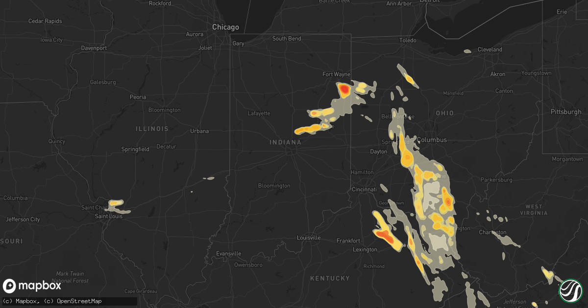
Hail Map in North Carolina on May 10, 2011
Get this storm
May 10 map
$229
one time, instant access
Download today. No call, no setup
Keep the $229
Bought the map and want the full workflow? Apply the entire $229 to a subscription within 7 days. None of it is wasted.
Every map, not just this one
This buys you this map. Subscription and you get every map we run, in the markets you choose from a few cities to whole states to nationwide. Plus real-time alerts the moment a storm fires.
Contact data
Name, contact info, occupancy, even credit band for addresses in the footprint. You go from where it hit to who to call.
Become the source they trust
Unlimited branding weather history reports on demand. You already have the documented answer ready for the property owner, and you are the one who showed up with it.
Property data and RoofTrace estimates
Pull up any address you have got, its value and the exact code rules for that jurisdiction, straight from One Click Code. Then RoofTrace estimates the squares, pitch, and roof value, priced the way you price.
Storm reports in North Carolina
North Carolina
| Date | Description |
|---|---|
| 05/10/20116:58 PM CDT | Nickel to quarter size hail fell. |
| 05/10/20116:30 PM CDT | A local report indicates 1.75 inch wind near 6 NNW WHITEVILLE |
| 05/10/20116:29 PM CDT | Pea to quarter size hail near peacock rd and bill hooks rd n-nw of whiteville. |
| 05/10/20116:27 PM CDT | Ground covered in golfball size hail in western prong near 701 n and peacock rd. |
| 05/10/20115:26 PM CDT | A local report indicates 1.25 inch wind near FAIRMONT |
| 05/10/20115:25 PM CDT | A local report indicates 1.50 inch wind near 4 NNW FAIRMONT |
| 05/10/20114:52 PM CDT | Hail fell for about 20 minutes...but reached half dollar sized at around 552 pm. Wind was nearly calm during storm. |
| 05/10/20114:40 PM CDT | A local report indicates 1.00 inch wind near 3 SW CASAR |
| 05/10/20114:33 PM CDT | A local report indicates 1.00 inch wind near 3 NW SUNSET BEACH |
| 05/10/20114:10 PM CDT | A local report indicates 1.75 inch wind near GLEN ALPINE |
| 05/10/20114:01 PM CDT | Salem community |
| 05/10/20114:00 PM CDT | Salem community |
| 05/10/20113:56 PM CDT | Time estimated |
| 05/10/20113:56 PM CDT | A local report indicates 1.00 inch wind near MORGANTON |
| 05/10/20113:55 PM CDT | Hail covered the ground. Very little rain. |
| 05/10/20113:55 PM CDT | A local report indicates 1.00 inch wind near 3 S NAKINA |
| 05/10/20113:42 PM CDT | Time estimated |
| 05/10/201110:55 AM CDT | A report of golf ball sized hail somewhere in mooresville. Exact location is vague. |
| 05/10/201110:55 AM CDT | Tree down on a house. |
| 05/10/201110:43 AM CDT | Multiple trees down in downtown valdese...snapped off waist high. |
| 05/10/20111:07 AM CDT | At least two trees down along highway 207 at the state line. |
| 05/10/201112:15 AM CDT | Numerous trees down. |
| 05/09/201111:55 PM CDT | Public reports a metal arborg blown over by the wind in the 500 block of marsh road. |
| 05/09/201111:36 PM CDT | Numerous reports of golf ball to egg sized hail in the university area northeast of charlotte. |
| 05/09/201111:35 PM CDT | The spotter is located about 1 mile south of crowders mountain. |
| 05/09/201111:35 PM CDT | Trees and large limbs down in the crowders mountain area. |
| 05/09/201111:32 PM CDT | 12 inch diameter tree down at the intersection of university city blvd and chancellor park drive. |
| 05/09/201111:18 PM CDT | Hail up to quarter sized fell for about five minutes. |
| 05/09/201111:14 PM CDT | 36 inch diameter tree down on college farm road. |
| 05/09/201111:12 PM CDT | High tension towers twisted. |
| 05/09/201111:04 PM CDT | *** 2 fatal *** tree struck two people in yard. |
| 05/09/201110:57 PM CDT | Large branches broken. |
| 05/09/201110:55 PM CDT | A report of golf ball sized hail somewhere in mooresville. Exact location is vague. |
| 05/09/201110:55 PM CDT | Tree down on a house. |
| 05/09/201110:55 PM CDT | Trees down. |
| 05/09/201110:52 PM CDT | Tree down on nc highway 18. |
| 05/09/201110:51 PM CDT | 10 inch diameter trees down near the intersection of hw-18 and sugar loaf road. |
| 05/09/201110:51 PM CDT | Trees down. |
| 05/09/201110:49 PM CDT | Madison county comms reports 2 trees down on puncheon fork road. |
| 05/09/201110:43 PM CDT | Multiple trees down in downtown valdese...snapped off waist high. |
| 05/09/201110:42 PM CDT | One tree down on hw-208 in the laurel area. |
| 05/09/201110:41 PM CDT | Roof collapsed. |
| 05/09/201110:32 PM CDT | Multiple trees down in the roadway along abington road near angel lane. One of the trees is on a house. |
| 05/09/201110:28 PM CDT | Several trees down resulting in power outages in the area. |
| 05/09/201110:08 PM CDT | Tree in the roadway on red bud lane. County comms also reports numerous trees down in other parts of the county. |
| 05/09/201110:00 PM CDT | Trees down |
| 05/09/20119:57 PM CDT | Tree in the roadway on birchfield creek road. County comms also reports numerous trees down in other parts of the county. |
| 05/09/20119:55 PM CDT | Tree in the roadway on hw-19e. County also reports numerous other trees down in the county. |
| 05/09/20118:49 PM CDT | A local report indicates 1.75 inch wind near CAROLINA BEACH |
| 05/09/20118:48 PM CDT | A local report indicates 1.75 inch wind near W KURE BEACH |
| 05/09/20118:48 PM CDT | A local report indicates 1.75 inch wind near 1 WSW CAROLINA BEACH |
| 05/09/20118:35 PM CDT | Wway staff reported ping pong ball size hail |
| 05/09/20118:34 PM CDT | A local report indicates 1.75 inch wind near 1 ENE BOILING SPRING LA |
| 05/09/20118:30 PM CDT | Media viewer reports of quarter to golfball size near boiling spring lakes |
| 05/09/20118:27 PM CDT | A local report indicates 1.25 inch wind near 4 SE WINNABOW |
| 05/09/20118:18 PM CDT | A local report indicates 1.00 inch wind near 2 S WINNABOW |
All States Impacted by Hail Map on May 10, 2011
Cities Impacted by Hail Map on May 10, 2011
- Pease, MN
- Princeton, MN
- Foreston, MN
- Milaca, MN
- Berne, IN
- Ossian, IN
- Bluffton, IN
- Decatur, IN
- Monroe, IN
- Stone Lake, WI
- Hayward, WI
- Marine On Saint Croix, MN
- Hugo, MN
- Forest Lake, MN
- Scandia, MN
- Pamplico, SC
- Wabeno, WI
- White Lake, WI
- Concord, NC
- Charlotte, NC
- Huntersville, NC
- Harrisburg, NC
- Orrum, NC
- Fairmont, NC
- Hopkins, SC
- Columbia, SC
- Keystone, IN
- Andrews, SC
- Georgetown, SC
- Little River, SC
- Longs, SC
- Conway, SC
- Myrtle Beach, SC
- North Myrtle Beach, SC
- Loris, SC
- South Charleston, OH
- Thelma, KY
- Londonderry, OH
- Stoutsville, OH
- Greenfield, OH
- West Portsmouth, OH
- Williamsport, KY
- Salt Lick, KY
- Brooksville, KY
- Tollesboro, KY
- Circleville, OH
- Salyersville, KY
- Waverly, OH
- Mount Olivet, KY
- Tomahawk, KY
- Pilgrim, KY
- Wilsondale, WV
- Clarksburg, OH
- Adams, KY
- Coalton, OH
- Garrison, KY
- Sandy Hook, KY
- Patriot, OH
- River, KY
- Isonville, KY
- South Webster, OH
- Wallingford, KY
- Georgetown, OH
- Ulysses, KY
- Boons Camp, KY
- East Liberty, OH
- West Jefferson, OH
- Bloomingburg, OH
- Friendship, OH
- Latham, OH
- McArthur, OH
- New Holland, OH
- Morehead, KY
- Martha, KY
- Oil Springs, KY
- Warfield, KY
- Mayslick, KY
- Laurelville, OH
- Elkfork, KY
- Plain City, OH
- Clearfield, KY
- Cable, OH
- Lucasville, OH
- Aberdeen, OH
- Crum, WV
- Russellville, OH
- Blaine, KY
- Oak Hill, OH
- Beaver, OH
- Ironton, OH
- South Bloomingville, OH
- Royalton, KY
- Jackson, OH
- North Lewisburg, OH
- Inez, KY
- Sabina, OH
- Willow Wood, OH
- Russell, KY
- Emerson, KY
- Rushsylvania, OH
- Jamestown, OH
- Wellston, OH
- Prestonsburg, KY
- West Van Lear, KY
- Ceredo, WV
- Vanceburg, KY
- Belle Center, OH
- Mingo, OH
- Manchester, OH
- Huntsville, OH
- Prichard, WV
- Lowmansville, KY
- West Liberty, KY
- Rush, KY
- Mize, KY
- Campton, KY
- Flatwoods, KY
- Wellington, KY
- Urbana, OH
- Ripley, OH
- Wheelersburg, OH
- Chesapeake, OH
- Bellefontaine, OH
- Clayhole, KY
- Pedro, OH
- Vest, KY
- East Point, KY
- Blue Creek, OH
- Wittensville, KY
- Augusta, KY
- Kingston, OH
- West Union, OH
- London, OH
- Springfield, OH
- Dover, KY
- Genoa, WV
- Van Lear, KY
- Russells Point, OH
- Auxier, KY
- Ashland, KY
- Hitchins, KY
- Worthington, KY
- Debord, KY
- Kermit, WV
- New Carlisle, OH
- Washington Court House, OH
- Hagerhill, KY
- Franklin Furnace, OH
- West Liberty, OH
- Frankfort, OH
- Blue River, KY
- South Salem, OH
- Ray, OH
- Tremont City, OH
- Waterloo, OH
- Mount Sterling, OH
- Denton, KY
- Catlettsburg, KY
- Saint Paris, OH
- Minford, OH
- Flatgap, KY
- Jeffersonville, OH
- Olive Hill, KY
- Grayson, KY
- Cedarville, OH
- Huntington, WV
- Quincy, KY
- Catawba, OH
- Stambaugh, KY
- Thurman, OH
- Hamersville, OH
- Lavalette, WV
- Tutor Key, KY
- Fort Gay, WV
- Mechanicsburg, OH
- Wayne, WV
- Cannel City, KY
- Argillite, KY
- Louisa, KY
- Hillsboro, OH
- Adelphi, OH
- Rousseau, KY
- Kitts Hill, OH
- South Shore, KY
- Lakeview, OH
- Zanesfield, OH
- Staffordsville, KY
- Piketon, OH
- Portsmouth, OH
- Flemingsburg, KY
- Ezel, KY
- South Point, OH
- Hazel Green, KY
- Ewing, KY
- McDermott, OH
- South Solon, OH
- Lewistown, OH
- Kenova, WV
- Peebles, OH
- South Portsmouth, KY
- Paintsville, KY
- Yellow Springs, OH
- Vancleve, KY
- Chillicothe, OH
- South Vienna, OH
- West Mansfield, OH
- Jackson, KY
- Dunlow, WV
- Williamsport, OH
- Greenup, KY
- Germantown, KY
- Meally, KY
- Rarden, OH
- Bainbridge, OH
- Sitka, KY
- Stout, OH
- Richmond Dale, OH
- De Graff, OH
- Keaton, KY
- Maysville, KY
- Otway, OH
- Charleston, WV
- Kimberly, WV
- Mount Carbon, WV
- Kanawha Falls, WV
- Hugheston, WV
- Pond Gap, WV
- Hico, WV
- Belva, WV
- Cedar Grove, WV
- Glasgow, WV
- Lansing, WV
- Ansted, WV
- Handley, WV
- Fayetteville, WV
- Smithers, WV
- Gallagher, WV
- East Bank, WV
- Mammoth, WV
- Montgomery, WV
- Victor, WV
- Drybranch, WV
- London, WV
- Belle, WV
- Pratt, WV
- Hansford, WV
- Powellton, WV
- Gauley Bridge, WV
- Blount, WV
- Moorefield, KY
- Falmouth, KY
- Sharpsburg, KY
- Mount Sterling, KY
- Cynthiana, KY
- Millersburg, KY
- Paris, KY
- Olympia, KY
- Owingsville, KY
- Foster, KY
- Carlisle, KY
- Oak Park, MN
- Lugoff, SC
- Mooresville, NC
- Charleston, SC
- Mount Pleasant, SC
- Sullivans Island, SC
- Saint Croix Falls, WI
- Grantsburg, WI
- North Branch, MN
- Harris, MN
- Aynor, SC
- Galivants Ferry, SC
- Nichols, SC
- Foley, MN
- Effingham, SC
- Lake City, SC
- Johnsonville, SC
- Florence, SC
- Hemingway, SC
- Dugspur, VA
- Laurel Fork, VA
- Hillsville, VA
- Summitville, IN
- Fowlerton, IN
- Jonesboro, IN
- Fairmount, IN
- Chanhassen, MN
- Eden Prairie, MN
- Chaska, MN
- Clarkton, NC
- Whiteville, NC
- Bladenboro, NC
- Alton, IL
- Hartford, IL
- Moro, IL
- Wood River, IL
- West Alton, MO
- East Alton, IL
- South Roxana, IL
- Roxana, IL
- Saint Louis, MO
- Cottage Hills, IL
- Bethalto, IL
- Edwardsville, IL
- Southport, NC
- Bolivia, NC
- Kure Beach, NC
- Winnabow, NC
- Evergreen, NC
- Hallsboro, NC
- Perryton, TX
- Cicero, IN
- Noblesville, IN
- Arcadia, IN
- Frankton, IN
- Anderson, IN
- Simpsonville, SC
- Fountain Inn, SC
- Greenville, SC
- Van Wert, OH
- Travelers Rest, SC
- Mullins, SC
- Gresham, SC
- Marion, SC
- Green Sea, SC
- Fair Bluff, NC
- Jamestown, SC
- Arcadia, OH
- Alvada, OH
- Findlay, OH
- Vanlue, OH
- Carey, OH
- Mount Blanchard, OH
- Pulaski, VA
- Dublin, VA
- Claudville, VA
- Willis, VA
- Ararat, VA
- Masterson, TX
- Batavia, OH
- Goshen, OH
- Williamsburg, OH
- Gaston, IN
- Matthews, IN
- Eaton, IN
- Dunkirk, IN
- Upland, IN
- Hartford City, IN
- Gas City, IN
- Pennville, IN
- Montpelier, IN
- Muncie, IN
- Rock, KS
- Winfield, KS
- Awendaw, SC
- Isle Of Palms, SC
- Daleville, IN
- Yorktown, IN
- Alexandria, IN
- Trego, WI
- Spooner, WI
- Paint Bank, VA
- Troutville, VA
- New Castle, VA
- Liberty, WV
- Quail, TX
- Hedley, TX
- Atlanta, IN
- Rush City, MN
- Stanchfield, MN
- Braham, MN
- Cambridge, MN
- Pender, NE
- Wisner, NE
- Bancroft, NE
- Maria Stein, OH
- Saint Henry, OH
- Minnetonka, MN
- Hopkins, MN
- Minneapolis, MN
- Shakopee, MN
- Seagraves, TX
- Hamer, SC
- Rowland, NC
- Anoka, MN
- Elk River, MN
- Isanti, MN
- Saint Francis, MN
- Valdese, NC
- Connelly Springs, NC
- Drexel, NC
- Lawndale, NC
- Hickory, NC
- Morganton, NC
- Vale, NC
- Hildebran, NC
- Raymond, OH
- Marysville, OH
- Davidson, NC
- Siren, WI
- Webster, WI
- Saint Michael, MN
- Monticello, MN
- Albertville, MN
- Rogers, MN
- Yorkshire, OH
- Houston, OH
- Fort Loramie, OH
- McClellanville, SC
- Nesmith, SC
- Scranton, SC
- Shelby, NC
- Union Mills, NC
- Ellenboro, NC
- Forest City, NC
- Chesnee, SC
- Nebo, NC
- Mooresboro, NC
- Spindale, NC
- Bostic, NC
- Marion, NC
- Rutherfordton, NC
- Gaffney, SC
- Casar, NC
- Duncan, SC
- Wellford, SC
- Startex, SC
- Greer, SC
- Lyman, SC
- Plains, TX
- Squaw Lake, MN
- Northome, MN
- Radford, VA
- Harrod, OH
- Ada, OH
- Alger, OH
- Mora, MN
- Lorenzo, TX
- Floydada, TX
- Petersburg, TX
- Idalou, TX
- Silverton, TX
- Kress, TX
- Lockney, TX
- Happy, TX
- Tulia, TX
- Hope, KY
- Means, KY
- Taylors, SC
- Bowlus, MN
- Royalton, MN
- Pine City, MN
- Grasston, MN
- Quemado, TX
- Oakwood, VA
- Richlands, VA
- Bandy, VA
- Whitewood, VA
- Grundy, VA
- Cedar Bluff, VA
- Raven, VA
- Pilgrims Knob, VA
- Pounding Mill, VA
- Jewell Ridge, VA
- Springbrook, WI
- Frederic, WI
- Shell Lake, WI
- Ely, MN
- Union, WV
- Sinks Grove, WV
- Gap Mills, WV
- Secondcreekx, WV
- Excelsior, MN
- Saint Paul, MN
- Redkey, IN
- Ridgeville, IN
- Albany, IN
- Ronceverte, WV
- Waiteville, WV
- Pelican Lake, WI
- Rhinelander, WI
- Indian Valley, VA
- Fancy Gap, VA
- Meadows Of Dan, VA
- Mount Airy, NC
- Lumberton, NC
- Tabor City, NC
- Troutman, NC
- Dalbo, MN
- Sauk Rapids, MN
- Dieterich, IL
- Wheeler, IL
- Hi Hat, KY
- Raven, KY
- Jeremiah, KY
- Roxana, KY
- Beaver, KY
- Virgie, KY
- Millstone, KY
- McDowell, KY
- Thornton, KY
- Littcarr, KY
- Premium, KY
- Langley, KY
- Kite, KY
- Vicco, KY
- Grethel, KY
- Hindman, KY
- Ermine, KY
- Melvin, KY
- Whitesburg, KY
- Hueysville, KY
- Minnie, KY
- Topmost, KY
- Isom, KY
- Drift, KY
- Redfox, KY
- Mallie, KY
- Pine Top, KY
- Garrett, KY
- Pippa Passes, KY
- Bevinsville, KY
- Deane, KY
- Weeksbury, KY
- Wayland, KY
- Wheelwright, KY
- Blackey, KY
- Bypro, KY
- Mousie, KY
- Dema, KY
- Leburn, KY
- Garner, KY
- Lackey, KY
- Gunlock, KY
- Eastern, KY
- Booker, TX
- Balko, OK
- Dillon, SC
- Crivitz, WI
- Athelstane, WI
- Wausaukee, WI
- Walton, WV
- Clendenin, WV
- Amma, WV
- Hiwassee, VA
- Blooming Prairie, MN
- Ellendale, MN
- Riner, VA
- Christiansburg, VA
- Kings Mountain, NC
- Clover, SC
- Gastonia, NC
- Mount Ulla, NC
- China Grove, NC
- Cleveland, NC
- Ohio City, OH
- Middle Point, OH
- Campobello, SC
- Inman, SC
- Landrum, SC
- Greeneville, TN
- Chuckey, TN
- Afton, TN
- Monroe, NC
- Midland, NC
- Statesville, NC
- Kannapolis, NC
- Matthews, NC
- Cornelius, NC
- Indian Trail, NC
- Pineville, NC
- Saint Germain, WI
- Lac Du Flambeau, WI
- Minocqua, WI
- Woodruff, WI
- Boulder Junction, WI
- Sayner, WI
- Ogilvie, MN
- Eastover, SC
- Maxton, NC
- Frenchburg, KY
- Luck, WI
- Cushing, WI
- Lake View, SC
- Van Buren, OH
- Bloomdale, OH
- Wharton, OH
- McComb, OH
- Upper Sandusky, OH
- Custar, OH
- Cygnet, OH
- North Baltimore, OH
- Saint Matthews, SC
- Cameron, SC
- Hanahan, SC
- North Charleston, SC
- Goose Creek, SC
- Ladson, SC
- Advent, WV
- Kenna, WV
- Southside, WV
- Leon, WV
- Nakina, NC
- Spencerville, OH
- Lima, OH
- Loop, TX
- Brownfield, TX
- Claude, TX
- Beckley, WV
- Artie, WV
- Whitesville, WV
- Clear Creek, WV
- Eskdale, WV
- Iron River, MI
- Watersmeet, MI
- Crystal Falls, MI
- Trout Creek, MI
- Calabash, NC
- Sunset Beach, NC
- Vansant, VA
- Lebanon, VA
- Fedscreek, KY
- Rowe, VA
- Kimper, KY
- Hurley, VA
- Davenport, VA
- Cleveland, VA
- Phelps, KY
- Steele, KY
- Big Rock, VA
- Haysi, VA
- Bee, VA
- Honaker, VA
- Lubbock, TX
- Wolfforth, TX
- Given, WV
- Rockford, OH
- Hertel, WI
- Glen Carbon, IL
- Granite City, IL
- Highland, IL
- Saint Jacob, IL
- Maryville, IL
- Collinsville, IL
- Florissant, MO
- Troy, IL
- Wellington, TX
- Shamrock, TX
- Babbitt, MN
- Hereford, TX
- Church Hill, TN
- Duffield, VA
- Eidson, TN
- Surgoinsville, TN
- Gate City, VA
- Blacksburg, SC
- Grover, NC
- Greenup, IL
- Casey, IL
- Hardy, KY
- Belfry, KY
- Pinsonfork, KY
- Ransom, KY
- Canada, KY
- Stone, KY
- Huddy, KY
- Forest Hills, KY
- McAndrews, KY
- Center City, MN
- Buffalo, MN
- Sarona, WI
- Lindstrom, MN
- Grandy, MN
- Cedar, MN
- Stacy, MN
- Bethel, MN
- Heath Springs, SC
- Lancaster, SC
- Bruce Crossing, MI
- Ada, OK
- Woolwine, VA
- Pineville, SC
- Bonneau, SC
- Moncks Corner, SC
- Tahoka, TX
- Meadow, TX
- Gruver, TX
- Groom, TX
- Coward, SC
- Lane, SC
- Longwood, NC
- Timmonsville, SC
- Fork, SC
- Cordesville, SC
- Leland, NC
- Huger, SC
- Salters, SC
- Lake Waccamaw, NC
- Bolton, NC
- Murrells Inlet, SC
- Ocean Isle Beach, NC
- Chadbourn, NC
- Charleston Afb, SC
- Ridgeville, SC
- Folly Beach, SC
- Supply, NC
- Summerville, SC
- Ash, NC
- Cerro Gordo, NC
- Clarendon, NC
- Cades, SC
- Kingstree, SC
- Pembroke, NC
- Floyd, VA
- Catawba, VA
- Hillman, MN
- Bock, MN
- Clear Lake, MN
- Pierz, MN
- Rice, MN
- Saint Cloud, MN
- Lena, WI
- Suring, WI
- Gillett, WI
- Oconto Falls, WI
- Webbville, KY
- Gadsden, SC
- Elgin, SC
- Winnsboro, SC
- Ridgeway, SC
- Blythewood, SC
- Lovington, NM
- Hobbs, NM
- Morton, TX
- Whiteface, TX
- Littlefield, TX
- Levelland, TX
- Denver City, TX
- Seminole, TX
- Monroeville, IN
- Swayzee, IN
- Fort Wayne, IN
- Hoagland, IN
- Farmland, IN
- Venedocia, OH
- Cloverdale, OH
- Parker City, IN
- Fort Jennings, OH
- Selma, IN
- Willshire, OH
- Delphos, OH
- Craigville, IN
- Poneto, IN
- Marion, IN
- Convoy, OH
- Lapel, IN
- Portland, IN
- Bryant, IN
- Mendon, OH
- Geneva, IN
- Wren, OH
- Petroleum, IN
- Fort Recovery, OH
- Celina, OH
- Chassell, MI
- Wellston, OK
- Coyle, OK
- Meridian, OK
- Perkins, OK
- Cramerton, NC
- Lowell, NC
- Belmont, NC
- Ravenel, SC
- Sheffield Lake, OH
- Lorain, OH
- Cherryville, NC
- Stinnett, TX
- White Deer, TX
- Borger, TX
- Panhandle, TX
- Elkview, WV
- Bluffton, OH
- Jenera, OH
- Dola, OH
- Kenton, OH
- Dunkirk, OH
- Forest, OH
- Mauldin, SC
- Gray Court, SC
- Prior Lake, MN
- Wayzata, MN
- New Prague, MN
- Savage, MN
- Jordan, MN
- Martinsville, IL


