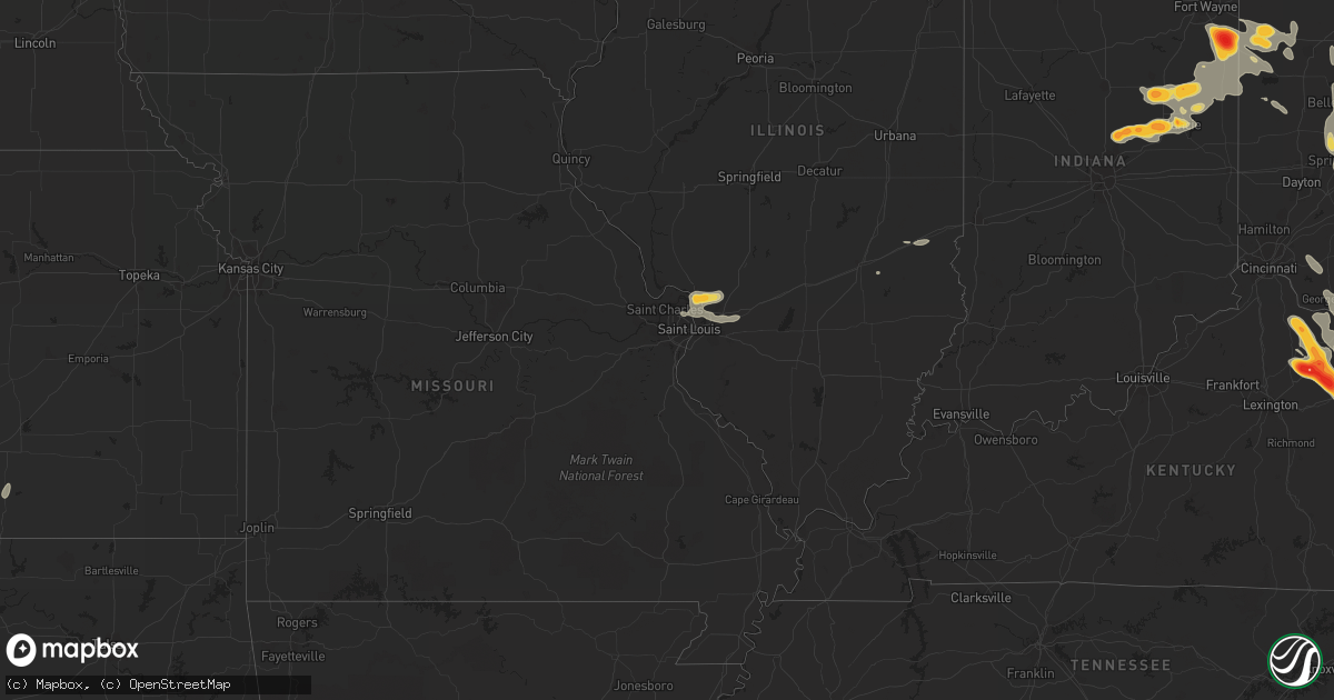
Hail Map on May 10, 2011
Get this storm
May 10 map
$229
one time, instant access
Download today. No call, no setup
Keep the $229
Bought the map and want the full workflow? Apply the entire $229 to a subscription within 7 days. None of it is wasted.
Every map, not just this one
This buys you this map. Subscription and you get every map we run, in the markets you choose from a few cities to whole states to nationwide. Plus real-time alerts the moment a storm fires.
Contact data
Name, contact info, occupancy, even credit band for addresses in the footprint. You go from where it hit to who to call.
Become the source they trust
Unlimited branding weather history reports on demand. You already have the documented answer ready for the property owner, and you are the one who showed up with it.
Property data and RoofTrace estimates
Pull up any address you have got, its value and the exact code rules for that jurisdiction, straight from One Click Code. Then RoofTrace estimates the squares, pitch, and roof value, priced the way you price.
States Impacted by Hail Map on May 10, 2011
Storm reports
Kansas
| Date | Description |
|---|---|
| 05/10/20116:40 AM CDT | A telephone pole was blown down in lakin. |
New Mexico
| Date | Description |
|---|---|
| 05/10/20113:07 AM CDT | Quarter size hail reported on the north side of hobbs. |
| 05/10/20113:00 AM CDT | Pea to quarter size hail reported to be about one half inch deep on the ground. |
North Carolina
| Date | Description |
|---|---|
| 05/10/20116:58 PM CDT | Nickel to quarter size hail fell. |
| 05/10/20116:30 PM CDT | A local report indicates 1.75 inch wind near 6 NNW WHITEVILLE |
| 05/10/20116:29 PM CDT | Pea to quarter size hail near peacock rd and bill hooks rd n-nw of whiteville. |
| 05/10/20116:27 PM CDT | Ground covered in golfball size hail in western prong near 701 n and peacock rd. |
| 05/10/20115:26 PM CDT | A local report indicates 1.25 inch wind near FAIRMONT |
| 05/10/20115:25 PM CDT | A local report indicates 1.50 inch wind near 4 NNW FAIRMONT |
| 05/10/20114:52 PM CDT | Hail fell for about 20 minutes...but reached half dollar sized at around 552 pm. Wind was nearly calm during storm. |
| 05/10/20114:40 PM CDT | A local report indicates 1.00 inch wind near 3 SW CASAR |
| 05/10/20114:33 PM CDT | A local report indicates 1.00 inch wind near 3 NW SUNSET BEACH |
| 05/10/20114:10 PM CDT | A local report indicates 1.75 inch wind near GLEN ALPINE |
| 05/10/20114:01 PM CDT | Salem community |
| 05/10/20114:00 PM CDT | Salem community |
| 05/10/20113:56 PM CDT | A local report indicates 1.00 inch wind near MORGANTON |
| 05/10/20113:56 PM CDT | Time estimated |
| 05/10/20113:55 PM CDT | Hail covered the ground. Very little rain. |
| 05/10/20113:55 PM CDT | A local report indicates 1.00 inch wind near 3 S NAKINA |
| 05/10/20113:42 PM CDT | Time estimated |
| 05/10/201110:55 AM CDT | Tree down on a house. |
| 05/10/201110:55 AM CDT | A report of golf ball sized hail somewhere in mooresville. Exact location is vague. |
| 05/10/201110:43 AM CDT | Multiple trees down in downtown valdese...snapped off waist high. |
| 05/10/20111:07 AM CDT | At least two trees down along highway 207 at the state line. |
| 05/10/201112:15 AM CDT | Numerous trees down. |
| 05/09/201111:55 PM CDT | Public reports a metal arborg blown over by the wind in the 500 block of marsh road. |
| 05/09/201111:36 PM CDT | Numerous reports of golf ball to egg sized hail in the university area northeast of charlotte. |
| 05/09/201111:35 PM CDT | Trees and large limbs down in the crowders mountain area. |
| 05/09/201111:35 PM CDT | The spotter is located about 1 mile south of crowders mountain. |
| 05/09/201111:32 PM CDT | 12 inch diameter tree down at the intersection of university city blvd and chancellor park drive. |
| 05/09/201111:18 PM CDT | Hail up to quarter sized fell for about five minutes. |
| 05/09/201111:14 PM CDT | 36 inch diameter tree down on college farm road. |
| 05/09/201111:12 PM CDT | High tension towers twisted. |
| 05/09/201111:04 PM CDT | *** 2 fatal *** tree struck two people in yard. |
| 05/09/201110:57 PM CDT | Large branches broken. |
| 05/09/201110:55 PM CDT | Trees down. |
| 05/09/201110:55 PM CDT | Tree down on a house. |
| 05/09/201110:55 PM CDT | A report of golf ball sized hail somewhere in mooresville. Exact location is vague. |
| 05/09/201110:52 PM CDT | Tree down on nc highway 18. |
| 05/09/201110:51 PM CDT | 10 inch diameter trees down near the intersection of hw-18 and sugar loaf road. |
| 05/09/201110:51 PM CDT | Trees down. |
| 05/09/201110:49 PM CDT | Madison county comms reports 2 trees down on puncheon fork road. |
| 05/09/201110:43 PM CDT | Multiple trees down in downtown valdese...snapped off waist high. |
| 05/09/201110:42 PM CDT | One tree down on hw-208 in the laurel area. |
| 05/09/201110:41 PM CDT | Roof collapsed. |
| 05/09/201110:32 PM CDT | Multiple trees down in the roadway along abington road near angel lane. One of the trees is on a house. |
| 05/09/201110:28 PM CDT | Several trees down resulting in power outages in the area. |
| 05/09/201110:08 PM CDT | Tree in the roadway on red bud lane. County comms also reports numerous trees down in other parts of the county. |
| 05/09/201110:00 PM CDT | Trees down |
| 05/09/20119:57 PM CDT | Tree in the roadway on birchfield creek road. County comms also reports numerous trees down in other parts of the county. |
| 05/09/20119:55 PM CDT | Tree in the roadway on hw-19e. County also reports numerous other trees down in the county. |
| 05/09/20118:49 PM CDT | A local report indicates 1.75 inch wind near CAROLINA BEACH |
| 05/09/20118:48 PM CDT | A local report indicates 1.75 inch wind near 1 WSW CAROLINA BEACH |
| 05/09/20118:48 PM CDT | A local report indicates 1.75 inch wind near W KURE BEACH |
| 05/09/20118:35 PM CDT | Wway staff reported ping pong ball size hail |
| 05/09/20118:34 PM CDT | A local report indicates 1.75 inch wind near 1 ENE BOILING SPRING LA |
| 05/09/20118:30 PM CDT | Media viewer reports of quarter to golfball size near boiling spring lakes |
| 05/09/20118:27 PM CDT | A local report indicates 1.25 inch wind near 4 SE WINNABOW |
| 05/09/20118:18 PM CDT | A local report indicates 1.00 inch wind near 2 S WINNABOW |
Minnesota
| Date | Description |
|---|---|
| 05/10/20116:44 PM CDT | A local report indicates 1.25 inch wind near ST JOSEPH |
| 05/10/20116:43 PM CDT | A local report indicates 1.75 inch wind near 1 N ST JOSEPH |
| 05/10/20116:38 PM CDT | A local report indicates 1.25 inch wind near 1 S BOWLUS |
| 05/10/20116:30 PM CDT | A local report indicates 1.00 inch wind near 1 ESE ST JOSEPH |
| 05/09/201111:39 PM CDT | Delayed report. Mostly small hail but a few minutes of some quarter size hail. Nearly constant lightning. On moose lake. |
| 05/09/201110:50 PM CDT | A local report indicates 1.50 inch wind near 2 NE NORTH BRANCH |
| 05/09/20119:15 PM CDT | A local report indicates 2.00 inch wind near 2 E PEASE |
| 05/09/20119:04 PM CDT | A local report indicates 1.00 inch wind near 3 NE ELK RIVER |
| 05/09/20119:00 PM CDT | A local report indicates 1.75 inch wind near ST FRANCIS |
| 05/09/20118:50 PM CDT | Target field |
| 05/09/20118:40 PM CDT | A local report indicates 1.75 inch wind near ST LOUIS PARK |
| 05/09/20118:39 PM CDT | A local report indicates 2.00 inch wind near 1 NW MINNEAPOLIS |
| 05/09/20118:37 PM CDT | At intersection of 100th st and 125th ave. |
| 05/09/20118:35 PM CDT | A local report indicates 2.00 inch wind near 3 SSW FOREST LAKE |
| 05/09/20118:35 PM CDT | Broadway and interstate 94 |
| 05/09/20118:35 PM CDT | A local report indicates 1.75 inch wind near 2 N ST LOUIS PARK |
| 05/09/20118:34 PM CDT | A local report indicates 2.00 inch wind near 4 SSW FORESTON |
| 05/09/20118:33 PM CDT | Broadway and interstate 94 |
| 05/09/20118:30 PM CDT | A local report indicates 2.50 inch wind near ST LOUIS PARK |
| 05/09/20118:29 PM CDT | Reported at corner of franklin and lyndale. |
| 05/09/20118:28 PM CDT | At intersection of 394 and louisiana ave. |
| 05/09/20118:28 PM CDT | A local report indicates 1.75 inch wind near 5 WSW MINNEAPOLIS |
| 05/09/20118:25 PM CDT | A local report indicates 1.00 inch wind near ELK RIVER |
| 05/09/20118:24 PM CDT | A local report indicates 1.75 inch wind near ELK RIVER |
| 05/09/20118:21 PM CDT | A local report indicates 2.00 inch wind near OAK PARK |
| 05/09/20118:19 PM CDT | A local report indicates 2.75 inch wind near ALBERTVILLE |
| 05/09/20118:15 PM CDT | A local report indicates 2.00 inch wind near 3 NE EDEN PRAIRIE |
| 05/09/20118:15 PM CDT | A local report indicates 2.00 inch wind near ALBERTVILLE |
| 05/09/20118:15 PM CDT | A local report indicates 1.75 inch wind near EDINA |
| 05/09/20118:13 PM CDT | A local report indicates 1.00 inch wind near EDEN PRAIRIE |
| 05/09/20118:10 PM CDT | A local report indicates 1.00 inch wind near EDINA |
| 05/09/20118:10 PM CDT | A local report indicates 1.00 inch wind near 2 W ELK RIVER |
| 05/09/20118:08 PM CDT | A local report indicates 1.00 inch wind near EDINA |
| 05/09/20118:05 PM CDT | A local report indicates 1.25 inch wind near 1 SSW EDEN PRAIRIE |
| 05/09/20118:03 PM CDT | A local report indicates 1.75 inch wind near 1 ENE EDEN PRAIRIE |
| 05/09/20118:03 PM CDT | A local report indicates 1.25 inch wind near EDINA |
| 05/09/20117:59 PM CDT | Debris visible cr 118 and cr 35 |
| 05/09/20117:58 PM CDT | A local report indicates 2.00 inch wind near RONNEBY |
| 05/09/20117:58 PM CDT | A local report indicates 1.00 inch wind near ST MICHAEL |
| 05/09/20117:58 PM CDT | Time estimated. Roof of a home damaged on 42nd st ne. |
| 05/09/20117:58 PM CDT | A local report indicates 1.00 inch wind near 5 WSW EDEN PRAIRIE |
| 05/09/20117:55 PM CDT | A local report indicates 1.00 inch wind near EDEN PRAIRIE |
| 05/09/20117:54 PM CDT | An nws storm survey assessed an ef-1 tornado with maximum winds near 90 mph tracked for approximately three miles to the northeast ending one mile west of st. Michael. |
| 05/09/20117:48 PM CDT | At weather office |
| 05/09/20117:43 PM CDT | A local report indicates 1.75 inch wind near CHASKA |
| 05/09/20117:43 PM CDT | A local report indicates 1.75 inch wind near 3 W ST MICHAEL |
| 05/09/20117:43 PM CDT | A local report indicates 1.00 inch wind near 1 SSW FOLEY |
| 05/09/20117:43 PM CDT | A local report indicates 1.00 inch wind near FOLEY |
| 05/09/20117:41 PM CDT | A local report indicates 1.00 inch wind near WAITE PARK |
| 05/09/20117:40 PM CDT | A local report indicates 1.00 inch wind near CHASKA |
| 05/09/20117:37 PM CDT | A local report indicates 1.00 inch wind near 1 WNW FOLEY |
| 05/09/20117:20 PM CDT | A local report indicates 1.00 inch wind near BUFFALO |
| 05/09/20117:13 PM CDT | A local report indicates 1.00 inch wind near 1 ENE ELLENDALE |
Ohio
| Date | Description |
|---|---|
| 05/10/20116:42 PM CDT | Tree reported down near eifort |
| 05/10/20116:04 PM CDT | A local report indicates 1.00 inch wind near 4 NW OAK HILL |
| 05/10/20115:35 PM CDT | A local report indicates 1.50 inch wind near 4 ENE SOUTH WEBSTER |
| 05/10/20115:32 PM CDT | A local report indicates 1.00 inch wind near SOUTH POINT |
| 05/10/20115:22 PM CDT | A local report indicates 2.00 inch wind near OAK HILL |
| 05/10/20115:20 PM CDT | A local report indicates 1.00 inch wind near OAK HILL |
| 05/10/20115:09 PM CDT | Quarter sized reported at the 911 center. |
| 05/10/20114:55 PM CDT | A local report indicates 1.00 inch wind near 1 SE CAVETT |
| 05/10/20114:40 PM CDT | A local report indicates 1.75 inch wind near 3 S VAN WERT |
| 05/10/20114:35 PM CDT | A local report indicates 1.25 inch wind near SOUTH POINT |
| 05/10/20114:32 PM CDT | A local report indicates 1.00 inch wind near SOUTH POINT |
| 05/10/20114:30 PM CDT | A local report indicates 1.25 inch wind near SOUTH POINT |
| 05/10/20114:12 PM CDT | A local report indicates 1.00 inch wind near SHEFFIELD LAKE |
| 05/10/20114:05 PM CDT | A local report indicates 1.00 inch wind near JACKSON |
| 05/10/20113:44 PM CDT | A local report indicates 1.25 inch wind near NORTH FORK VILLAGE |
| 05/10/20113:42 PM CDT | Marble to golf ball size hail nr intersection sr 50 and sr 28 |
| 05/10/20113:37 PM CDT | A local report indicates 1.50 inch wind near 2 ENE KNOCKEMSTIFF |
| 05/10/20113:30 PM CDT | Most hail nickel size...but largest stones were 1 inch. |
| 05/10/20113:28 PM CDT | A local report indicates 1.00 inch wind near FRANKFORT |
| 05/10/20113:20 PM CDT | Trees down along sr 52 in portsmouth and west portsmouth |
| 05/10/20119:03 AM CDT | A local report indicates 1.00 inch wind near UPPER SANDUSKY |
| 05/10/20118:34 AM CDT | A local report indicates 1.00 inch wind near 3 SW CAREY |
| 05/10/20118:28 AM CDT | A local report indicates 2.00 inch wind near VANLUE |
| 05/10/20118:25 AM CDT | 1 1/2 in - 1 3/4 in hail |
| 05/10/20118:20 AM CDT | Hail measured one inch to one and a quarter inch. |
| 05/10/20117:53 AM CDT | A local report indicates 1.00 inch wind near VAN BUREN |
| 05/10/20112:58 AM CDT | A local report indicates 1.00 inch wind near MCMORRAN |
| 05/10/20112:08 AM CDT | A local report indicates 1.25 inch wind near SABINA |
| 05/10/201112:59 AM CDT | A local report indicates 1.00 inch wind near 5 SE SPRINGFIELD |
| 05/10/201112:40 AM CDT | A local report indicates 1.75 inch wind near 5 WNW SOUTH CHARLESTON |
| 05/10/201112:25 AM CDT | Kings creek area. |
| 05/10/201112:24 AM CDT | Pea to quarter sized hail south of county line road. |
| 05/10/201112:20 AM CDT | A local report indicates 1.00 inch wind near WASHINGTON COURT HOUSE |
| 05/09/201111:48 PM CDT | A local report indicates 1.25 inch wind near SOUTH CHARLESTON |
| 05/09/201111:28 PM CDT | A local report indicates 1.75 inch wind near BLUE CREEK |
| 05/09/201111:07 PM CDT | A local report indicates 1.00 inch wind near PEEBLES |
| 05/09/201110:25 PM CDT | A local report indicates 1.75 inch wind near 5 NW BAINBRIDGE |
| 05/09/201110:17 PM CDT | A local report indicates 1.75 inch wind near 1 E JEFFERSONVILLE |
| 05/09/20119:13 PM CDT | Estimated time. |
Indiana
| Date | Description |
|---|---|
| 05/10/20114:14 PM CDT | 2.5 inch hail at us 224 and cr 300 w |
| 05/10/20114:12 PM CDT | A local report indicates 1.50 inch wind near DECATUR |
| 05/10/20114:10 PM CDT | Reported at 28th street and us 224 in decatur |
| 05/10/20114:01 PM CDT | A local report indicates 1.75 inch wind near PREBLE |
| 05/10/20113:22 PM CDT | A local report indicates 1.00 inch wind near GENEVA |
| 05/10/20113:11 PM CDT | A local report indicates 1.00 inch wind near ALBANY |
| 05/10/20112:48 PM CDT | Hail ongoing. |
| 05/10/20112:45 PM CDT | A local report indicates 1.00 inch wind near PENNVILLE |
| 05/10/20112:22 PM CDT | There was some denting of cars and minor leaf shredding...time estimated from radar |
| 05/10/20112:22 PM CDT | A local report indicates 1.00 inch wind near 1 W HARTFORD CITY |
| 05/10/20112:16 PM CDT | A local report indicates 1.00 inch wind near DUNKIRK |
| 05/10/20112:15 PM CDT | A local report indicates 1.00 inch wind near HARTFORD CITY |
| 05/10/20111:58 PM CDT | A local report indicates 1.75 inch wind near FAIRMOUNT |
| 05/10/20111:55 PM CDT | On the ball state campus. |
| 05/10/20111:53 PM CDT | A local report indicates 1.75 inch wind near 3 S GAS CITY |
| 05/10/20111:50 PM CDT | A local report indicates 1.00 inch wind near 7 NNE ANDERSON |
| 05/10/20111:50 PM CDT | Northwest side of muncie...0.5 miles nw of ball state campus. |
| 05/10/20111:45 PM CDT | Quarter size hail covering ground. |
| 05/10/20111:40 PM CDT | Fell for five minutes..covering ground. |
| 05/10/20111:30 PM CDT | 1 n prosperity...lots of hail covering ground. |
| 05/10/20111:15 PM CDT | At 10 n and 900 w. |
| 05/10/20111:15 PM CDT | A local report indicates 1.75 inch wind near 3 S ALEXANDRIA |
| 05/10/20111:13 PM CDT | In perkinsville. |
| 05/10/20111:11 PM CDT | Half dollar to golf ball size hail. |
| 05/10/20111:06 PM CDT | 2 ese perkinsville. |
| 05/10/20111:04 PM CDT | A local report indicates 1.75 inch wind near 6 SW ELWOOD |
| 05/10/20111:02 PM CDT | Golf ball sized hail covering the ground...near 246th st and brehm rd. |
| 05/10/201112:49 PM CDT | A local report indicates 1.75 inch wind near CICERO |
| 05/10/201112:46 PM CDT | A local report indicates 1.50 inch wind near 1 N CICERO |
Illinois
| Date | Description |
|---|---|
| 05/10/201112:34 PM CDT | A local report indicates 1.00 inch wind near BETHALTO |
| 05/10/201112:27 PM CDT | On north side of alton |
| 05/10/201112:25 PM CDT | Hail up to the size of a quarter. |
| 05/10/201112:08 PM CDT | Report from martinsville high school |
| 05/10/201112:03 PM CDT | Dime to quarter size hail |
| 05/10/201112:02 PM CDT | A local report indicates 1.00 inch wind near 4 N CASEY |
Michigan
| Date | Description |
|---|---|
| 05/10/20113:30 AM CDT | Lasted for about 7 minutes until 337 am central. Tapered off to pea sized hail at that time. |
| 05/10/20112:24 AM CDT | Multiple local reports of estimated quarter sized hail between bruce crossing and trout creek. Time estimated from radar. |
Tennessee
| Date | Description |
|---|---|
| 05/09/201110:30 PM CDT | Few trees down. |
| 05/09/201110:15 PM CDT | One tree down on hwy 66. |
| 05/09/201110:15 PM CDT | One tree down along 11w. |
| 05/09/201110:15 PM CDT | One tree down. |
| 05/09/201110:00 PM CDT | 1 tree down. |
| 05/09/20119:50 PM CDT | 1 tree down. |
| 05/09/20119:50 PM CDT | Numerous trees and power lines down. |
| 05/09/20119:40 PM CDT | Trees and power lines down county wide. |
| 05/09/20119:40 PM CDT | Several trees down. |
Texas
| Date | Description |
|---|---|
| 05/10/20119:27 AM CDT | A local report indicates 1.00 inch wind near QUEMADO |
| 05/10/20116:24 AM CDT | A local report indicates 60 MPH wind near BORGER |
| 05/10/20115:30 AM CDT | A local report indicates 1.75 inch wind near 6 S PERRYTON |
| 05/10/20115:10 AM CDT | Hail dented vehicle near university and 82nd st |
| 05/10/20115:10 AM CDT | Mostly pea to half inch...but one hail dent noticed on car at kamc studios. |
| 05/10/20114:30 AM CDT | Penny to quarter size hail in seagraves. |
| 05/10/20112:30 AM CDT | Old live trees blown down and 1 to 1.5 inch tree limbs blown down on the south and southwest side of amarillo. The tree limb damage was pretty widespread throughout tow |
| 05/10/20112:28 AM CDT | About a half dozen power liines and poles down in amarillo. Also...some minor wind damage along interstate 27. |
| 05/10/20112:05 AM CDT | A local report indicates 60 MPH wind near 1 E AMARILLO |
| 05/10/20111:50 AM CDT | Lawn furniture also being blown around along with reduced visibilities from blowing dust. |
| 05/10/20111:15 AM CDT | A local report indicates 59 MPH wind near 2 NE FRIONA |
Wisconsin
| Date | Description |
|---|---|
| 05/10/20113:22 AM CDT | 1/2 to 1 inch hail |
| 05/10/20113:05 AM CDT | A local report indicates 1.00 inch wind near RHINELANDER |
| 05/10/201112:40 AM CDT | Delayed report. Time estimated from radar |
| 05/10/201112:10 AM CDT | A local report indicates 2.75 inch wind near 2 N SPOONER |
| 05/09/201111:37 PM CDT | Hail size has increased. Reported at government center on north side of siren. |
| 05/09/201111:30 PM CDT | Delayed report. Mostly pea and dime size hail lasted for 30 min. Some quarter size hail. Storm rainfall total 1.50 in. |
West Virginia
| Date | Description |
|---|---|
| 05/10/20116:50 PM CDT | Quarter to golf ball sized hail has been reported on i-64 through huntington. |
| 05/10/20116:00 PM CDT | One tree down |
| 05/10/20116:00 PM CDT | Public reported 20 to 30 min of hail just under golf ball size on sweet springs valley road. |
| 05/10/20115:14 PM CDT | Enough to shovel near sandstone. |
| 05/10/20115:08 PM CDT | A local report indicates 1.00 inch wind near HUGHESTON |
| 05/10/20114:28 PM CDT | A local report indicates 1.00 inch wind near CHARLESTON |
Virginia
| Date | Description |
|---|---|
| 05/10/20116:30 PM CDT | Trees down. |
| 05/10/20116:24 PM CDT | Quarter size hail |
| 05/10/20116:22 PM CDT | A local report indicates 1.00 inch wind near VINTON |
| 05/10/20116:18 PM CDT | 1 inch hail is falling in downtown roanoke. |
| 05/10/20116:10 PM CDT | A local report indicates 1.00 inch wind near CEDAR BLUFF |
| 05/10/20116:10 PM CDT | A local report indicates 1.00 inch wind near RICHLANDS |
| 05/10/20115:55 PM CDT | Quarter size hail at exit 101 on interstate 81. Time estimated from radar. |
| 05/10/20115:51 PM CDT | A local report indicates 1.00 inch wind near DUBLIN |
| 05/10/20115:48 PM CDT | A local report indicates 1.75 inch wind near DUBLIN |
| 05/10/20115:48 PM CDT | A local report indicates 1.00 inch wind near 2 SE DUBLIN |
| 05/10/20115:42 PM CDT | Half dollar size hail reported by spotter on walnut street. |
| 05/10/20114:45 PM CDT | 1 inch hail fell along willis gap road. |
| 05/10/20114:25 PM CDT | Hail at least 1 inch in diameter is falling along danville pike. |
| 05/10/20114:20 PM CDT | 1.5 to 2 inch hail is falling on nester school road in the community of dugspur. |
| 05/10/20113:10 AM CDT | Several trees down on oakwood drive and also on pine hill rd in bristol va. |
| 05/09/20119:45 PM CDT | Several trees down. |
| 05/09/20119:45 PM CDT | One tree down in olinger. |
| 05/09/20119:30 PM CDT | Several trees down. |
| 05/09/20119:30 PM CDT | Several trees down. |
| 05/09/20119:30 PM CDT | Several trees down. |
| 05/09/20119:25 PM CDT | Several trees down. |
| 05/09/20119:10 PM CDT | Several trees down. |
| 05/09/20119:10 PM CDT | Couple trees down. |
| 05/09/20119:00 PM CDT | Trees and power lines down county wide. |
| 05/09/20118:31 PM CDT | 911 center reports trees and power poles lines down throughout the county and power outages countywide. |
| 05/09/20118:30 PM CDT | 911 center reports trees and power poles lines down across roads throughout the county. |
Nebraska
| Date | Description |
|---|---|
| 05/10/20111:55 AM CDT | Delayed report of damaging thunderstorm winds that ripped off a large soffit from front porch to garage. Shingles blown off roof and rain gutter torn off by wind damage |
| 05/10/20111:54 AM CDT | Wind gust of 63 mph was recorded at ogallala airport. |
| 05/10/20111:07 AM CDT | A local report indicates 1.00 inch wind near 2 SW PENDER |
South Carolina
| Date | Description |
|---|---|
| 05/10/20116:55 PM CDT | A local report indicates 1.75 inch wind near 1 S ANDREWS |
| 05/10/20116:55 PM CDT | A local report indicates 1.00 inch wind near FOUNTAIN INN |
| 05/10/20116:45 PM CDT | There were several reports in this area of golf ball sized hail in the five forks area down to simpsonville. Hail started at 732 pm at this specific location and contin |
| 05/10/20116:45 PM CDT | A local report indicates 2.00 inch wind near 4 E MAULDIN |
| 05/10/20116:42 PM CDT | A local report indicates 1.75 inch wind near 5 ENE MAULDIN |
| 05/10/20116:40 PM CDT | A local report indicates 1.50 inch wind near 4 ENE MAULDIN |
| 05/10/20116:38 PM CDT | A local report indicates 1.00 inch wind near NESMITH |
| 05/10/20116:37 PM CDT | A local report indicates 1.75 inch wind near 3 E MAULDIN |
| 05/10/20116:32 PM CDT | A local report indicates 1.25 inch wind near 4 E MAULDIN |
| 05/10/20116:30 PM CDT | A local report indicates 2.50 inch wind near ANDREWS |
| 05/10/20116:29 PM CDT | Baseball size hail damaging vehicles in the area. |
| 05/10/20116:27 PM CDT | One inch hail |
| 05/10/20116:25 PM CDT | Cocorahs observer reports half dollar sized hail with shredded leaves and dents in their car. |
| 05/10/20116:20 PM CDT | A local report indicates 1.00 inch wind near 5 SW GREER |
| 05/10/20116:16 PM CDT | Golf ball hail at the boiling springs fire dept |
| 05/10/20116:14 PM CDT | A local report indicates 1.50 inch wind near 3 SSE NICHOLS |
| 05/10/20116:00 PM CDT | Largest hail was the size of a quarter. Shredded leaves. |
| 05/10/20116:00 PM CDT | A local report indicates 1.00 inch wind near 7 E CAMPOBELLO |
| 05/10/20116:00 PM CDT | Baseball size hail damaged dozens of cars in the community of woodcreek. |
| 05/10/20116:00 PM CDT | Cocorahs observer reports quarter to ping pong ball sized hail. |
| 05/10/20115:58 PM CDT | Nickel to golfball size hail in downtown conway |
| 05/10/20115:57 PM CDT | Media viewer report softball size hail at the walmart in conway |
| 05/10/20115:55 PM CDT | Hail fell at wade hampton and watson roads. |
| 05/10/20115:55 PM CDT | Golfball to baseball size hail |
| 05/10/20115:55 PM CDT | Wmbf viewer reports baseball size hail in north conway |
| 05/10/20115:50 PM CDT | Hail up to half dollar size at the waffle house. Fell from 650 to 711 pm. |
| 05/10/20115:47 PM CDT | Intersection of sandy flat rd and lynn rd |
| 05/10/20115:40 PM CDT | Hail covered the ground |
| 05/10/20115:40 PM CDT | Hail covering the ground. The hail lasted from 640 pm edt until 647 pm edt |
| 05/10/20115:40 PM CDT | A local report indicates 1.00 inch wind near 2 NE NESMITH |
| 05/10/20115:40 PM CDT | The large hail fell from 640 pm edt until 645 pm edt... And covered the ground. The hail caused damage to vehicles and homes near highway 501. |
| 05/10/20115:40 PM CDT | Off duty nws employee reports numerous dents in vehicles...lots of leaf debris...and several branches down from the hail. |
| 05/10/20115:35 PM CDT | Hail covering the ground. |
| 05/10/20115:33 PM CDT | Hail fell from 633 pm to 645 pm |
| 05/10/20115:30 PM CDT | A local report indicates 1.75 inch wind near JOHNSONVILLE |
| 05/10/20115:30 PM CDT | A local report indicates 1.00 inch wind near 6 E GRESHAM |
| 05/10/20115:27 PM CDT | A local report indicates 1.00 inch wind near 4 W JOHNSONVILLE |
| 05/10/20115:25 PM CDT | Cocorahs observer reports half dollar sized hail with shredded leaves and dents in their car. |
| 05/10/20115:25 PM CDT | Softball size hail over hannah broke a car window |
| 05/10/20115:05 PM CDT | A local report indicates 1.75 inch wind near PAMPLICO |
| 05/10/20114:56 PM CDT | A local report indicates 1.75 inch wind near PAMPLICO |
| 05/10/20114:55 PM CDT | Baseball size hail covering the ground. |
| 05/10/20114:50 PM CDT | Golfball to tennis ball size hail. Hail tore the gutters off the house and damaged a car. |
| 05/10/20114:34 PM CDT | A local report indicates 1.75 inch wind near NORTH MYRTLE BEACH |
| 05/10/20114:33 PM CDT | A local report indicates 1.00 inch wind near 4 NE EVERGREEN |
| 05/10/20114:29 PM CDT | Ping pong size hail on hwy 90 near the intersection of hwy 31. |
| 05/10/20114:26 PM CDT | A local report indicates 1.25 inch wind near LONGS |
| 05/10/20114:24 PM CDT | A local report indicates 1.00 inch wind near LITTLE RIVER |
| 05/10/20114:21 PM CDT | Nickel to quarter size hail. |
| 05/10/20114:15 PM CDT | A local report indicates 1.00 inch wind near LONGS |
| 05/10/20112:56 AM CDT | Ping pong ball size hail reported along the highway 78 highway 52 connector. |
| 05/10/20112:44 AM CDT | Time estimated based off radar |
| 05/10/20112:40 AM CDT | Powerpoll down blocking mccrae drive. |
| 05/10/20112:39 AM CDT | Tree down on n hazard street |
| 05/10/20112:39 AM CDT | Field of wheat about 2 ft high flattened. Time estimated based off radar. |
| 05/10/20112:25 AM CDT | A local report indicates 1.00 inch wind near 2 SSE BONNEAU |
| 05/10/20112:25 AM CDT | Time estimated based off radar |
| 05/10/20112:20 AM CDT | Large tree down blocking mudville road. |
| 05/10/20112:10 AM CDT | Sheriff reports trees down between summerton and manning on alex harvin road and also on hwy 261 west of manning. |
| 05/10/20112:08 AM CDT | Highway patrol reported trees down near the intersection of hwys 301 and 47 near elloree. |
| 05/10/20112:07 AM CDT | Time estimated based off radar |
| 05/10/20112:05 AM CDT | Trees down on mcgirt swamp rd. |
| 05/10/20112:02 AM CDT | Tree down along sc hwy 341 7 miles west of johnsonville. Time estimated based off radar. |
| 05/10/20111:53 AM CDT | Time estimated based off radar. |
| 05/10/20111:53 AM CDT | Time estimated based off radar |
| 05/10/20111:40 AM CDT | Sheriff reported trees down at hwy 378 and 261 and also along hwy 261 to wedgefield. |
| 05/10/20111:39 AM CDT | Tree down at 3600 south hill road. Time estimated based off radar. |
| 05/10/20111:23 AM CDT | Power pole blown down by the hospital. |
| 05/10/20111:20 AM CDT | Sheriff reported trees down in southeast richland county in the eastover area. |
| 05/10/20111:14 AM CDT | Shaw meteorologist reported 1 inch hail on hwy 378 just east of columbia. |
| 05/10/20111:12 AM CDT | Dispatch reported trees down from blythewood to dentsville. |
| 05/10/20111:10 AM CDT | Sheriff reported trees and powerlines down from elgin to lugoff/camden to bethune. |
| 05/10/20111:06 AM CDT | Sheriff reoprted powerlines down in luggoff and large hail of unknown size. |
| 05/10/20111:03 AM CDT | Hail was measured and reported by public near the sw corner of ft jackson off leesburg rd about 2 miles east of i-77 |
| 05/10/20111:03 AM CDT | Public reported large branches down in northeast columbia. |
| 05/10/201112:45 AM CDT | Sheriff reported trees down across northern kershaw county. |
| 05/10/201112:45 AM CDT | Public reported trees down in pomeria. |
| 05/10/201112:40 AM CDT | Em reports trees and powerlines down in heath springs. |
| 05/10/201112:39 AM CDT | Em reports trees down in northern fairfield county from white oak to mitford. |
| 05/10/201112:39 AM CDT | Em reported trees down across northern fairfield county from white oak to mitford. |
| 05/10/201112:35 AM CDT | Em reports trees and powerlines down in heath springs. |
| 05/10/201112:30 AM CDT | Sheriff reported trees down in the van wyck area. |
| 05/10/201112:30 AM CDT | Sheriff reported trees down in the van wyck area. |
| 05/10/201112:14 AM CDT | Public reported trees down in whitmire. |
| 05/10/201112:04 AM CDT | Large branches down. |
| 05/09/201111:58 PM CDT | Pk wnd 34054/0458 |
| 05/09/201111:53 PM CDT | Numerous trees down on lake wylie road near the lake. |
| 05/09/201111:50 PM CDT | Numerous trees down across the roadway near the intersection of evergreen road and riverfront road. |
| 05/09/201111:42 PM CDT | Jonesville fire department reports first strong gust hit in this area along the spartanburg highway at 1242 am blowing down trees. There were other locations around jon |
| 05/09/201111:40 PM CDT | Tree across the roadway at grandview road and hw-161. |
| 05/09/201111:40 PM CDT | Trees across the roadway at whitworth road and hw-161. |
| 05/09/201111:35 PM CDT | Numerous trees down from highway 18 at the state border with north carolina down to the ninety nine islands power plant. A resident in blacksburg had a large tree on hi |
| 05/09/201111:32 PM CDT | Trees down on powerlines at hw-18 and i-85. |
| 05/09/201111:27 PM CDT | Tree down on highway 5 at youngs grove rd. |
| 05/09/201111:27 PM CDT | Tree down on a house on front street. |
| 05/09/201111:25 PM CDT | Large branches broken. |
| 05/09/201111:23 PM CDT | Multiple trees and powerlines down near the intersection of bridges road and hw-5. |
| 05/09/201111:22 PM CDT | Tree down. |
| 05/09/20119:43 PM CDT | Isle of palms fire dept number 1 receiving golf ball size hail. |
| 05/09/20119:41 PM CDT | Public report of golf ball size hail from wild dunes. |
| 05/09/20118:52 PM CDT | Golf ball size hail. Time estimated via radar. |
| 05/09/20118:18 PM CDT | Report of golf ball to softball size hail along st. Delight rd |
| 05/09/20118:08 PM CDT | Quarter size hail occurred along highway 501 east southeast of andrews. |
| 05/09/20117:54 PM CDT | Golf ball size hail reported on us-17n between awendaw and mcclellanville. |
| 05/09/20117:43 PM CDT | Golf ball size hail has been falling for a few minutes. |
| 05/09/20117:36 PM CDT | A local report indicates 1.00 inch wind near NESMITH |
| 05/09/20117:35 PM CDT | Quarter size hail reported at the exxon station in rhems. |
| 05/09/20117:27 PM CDT | Hail fell for 7 minutes. Covered the ground. |
| 05/09/20117:05 PM CDT | Hw-14 quick stop rerported hail up to the size of quarters. |
Kentucky
| Date | Description |
|---|---|
| 05/10/20116:29 PM CDT | 4 to 5 foot tree uprooted and utility pole blown down in mount caramel. They also had a rotating wall cloud pass over the house. |
| 05/10/20116:12 PM CDT | A local report indicates 1.00 inch wind near MAYSVILLE |
| 05/10/20114:34 PM CDT | A local report indicates 1.25 inch wind near ASHLAND |
| 05/10/20114:32 PM CDT | A local report indicates 1.00 inch wind near ASHLAND |
| 05/10/20114:20 PM CDT | A local report indicates 1.00 inch wind near ASHLAND |
| 05/10/20114:16 PM CDT | Hail started out as pea sized and increased to quarter sized. |
| 05/10/20113:52 PM CDT | Quarter to golf ball sized hail reported. |
| 05/10/20113:49 PM CDT | A local report indicates 1.00 inch wind near ASHLAND |
| 05/10/20113:45 PM CDT | Hail occurred between 445 and 510 pm. Hail ranged in size from pea to quarter. |
| 05/10/20113:40 PM CDT | Trees down throughout the county. |
| 05/10/20113:33 PM CDT | A local report indicates 1.75 inch wind near 5 N CARLISLE |
| 05/10/20113:24 PM CDT | Reports of golf ball sized hail outside of argillite... Ky. |
| 05/10/20113:22 PM CDT | A local report indicates 1.00 inch wind near 5 N CARLISLE |
| 05/10/20113:22 PM CDT | Post office reports quarter sized hail on site... With patrons reporting golf ball sized in the area. |
| 05/10/20113:15 PM CDT | A local report indicates 1.00 inch wind near PRESTON |
| 05/10/20113:15 PM CDT | Hail occurred between 410 and 420 pm. |
| 05/10/20113:12 PM CDT | A local report indicates 1.00 inch wind near 4 SSW MOUNT OLIVET |
| 05/10/20113:06 PM CDT | A local report indicates 1.00 inch wind near STEPSTONE |
| 05/10/20113:06 PM CDT | A local report indicates 1.00 inch wind near PRESTON |
| 05/10/20112:45 PM CDT | A trained spotter witnessed golfball to baseball size hail in sharpsburg. The hail caused damage to cars in the area including broken windshields. |
| 05/10/20112:43 PM CDT | Hail caused dents in car. |
| 05/10/20112:35 PM CDT | A local report indicates 1.75 inch wind near NEAVE |
| 05/10/20112:31 PM CDT | A local report indicates 2.75 inch wind near CARLISLE |
| 05/10/20112:30 PM CDT | Many dented cars and broken windows |
| 05/10/20112:18 PM CDT | A local report indicates 1.75 inch wind near MILLERSBURG |
| 05/10/20112:15 PM CDT | A local report indicates 1.75 inch wind near 1 SE PIQUA |
| 05/10/20112:05 PM CDT | A local report indicates 1.00 inch wind near MILLERSBURG |
| 05/10/20112:03 PM CDT | A local report indicates 2.75 inch wind near MILLERSBURG |
| 05/10/20111:30 AM CDT | Quarter size hail was reported by law enforcement officers who were on a foot pursuit in the paintsville area. The hail also dented cars in the area. |
| 05/10/20111:22 AM CDT | A local report indicates 1.25 inch wind near 1 W PAINTSVILLE |
| 05/10/20111:18 AM CDT | A tree was blown down in sitka or about a mile west of galen. |
| 05/10/201112:00 AM CDT | A local report indicates 1.00 inch wind near GARRISON |
| 05/09/201111:34 PM CDT | Trees down on power poles and lines across north fork rd. |
| 05/09/20119:20 PM CDT | Quarter size hail was reported. |
| 05/09/20118:35 PM CDT | A local report indicates 1.75 inch wind near CANEY |
| 05/09/20118:32 PM CDT | A local report indicates 1.25 inch wind near 1 E MIZE |
| 05/09/20118:27 PM CDT | A local report indicates 1.00 inch wind near STACY FORK |
| 05/09/20118:22 PM CDT | Golf ball size hail caused damage to an automobile and a tow behind camper. |
| 05/09/20118:17 PM CDT | Roof blown of nichols apothecary and in the middle of the road. |
| 05/09/20118:16 PM CDT | Roof blown of nichols apothecary and in the middle of the road. |
| 05/09/20118:15 PM CDT | Tree across road at hambley ave. |
| 05/09/20118:15 PM CDT | A tree was blown down in langley between 915 and 920 pm. |
| 05/09/20118:14 PM CDT | Trees down on power lines on little card road. |
| 05/09/20118:13 PM CDT | Tree landed on collin street in collin. |
| 05/09/20118:00 PM CDT | Trees blown down across zebulon highway and privacy fence blown down. |
| 05/09/20118:00 PM CDT | Trees blown down on zebulon highway between double kwik and velocity. |
| 05/09/20118:00 PM CDT | Tree fell on vehicle near post office at edna on hwy 460. Driver injured. |
| 05/09/20117:36 PM CDT | A local report indicates 1.75 inch wind near CLEARFIELD |
| 05/09/20117:30 PM CDT | A local report indicates 1.00 inch wind near MOREHEAD |
| 05/09/20117:27 PM CDT | A local report indicates 1.00 inch wind near CRANSTON |
| 05/09/20117:27 PM CDT | A local report indicates 1.75 inch wind near HILDA |
| 05/09/20117:25 PM CDT | The fire chief reported that quarter size hail was falling in cranston off ky 377. |
| 05/09/20117:05 PM CDT | Numerous trees down |
| 05/09/20117:05 PM CDT | Numerous trees down |
Cities Impacted by Hail Map on May 10, 2011
- Pease, MN
- Princeton, MN
- Foreston, MN
- Milaca, MN
- Berne, IN
- Ossian, IN
- Bluffton, IN
- Decatur, IN
- Monroe, IN
- Stone Lake, WI
- Hayward, WI
- Marine On Saint Croix, MN
- Hugo, MN
- Forest Lake, MN
- Scandia, MN
- Pamplico, SC
- Wabeno, WI
- White Lake, WI
- Concord, NC
- Charlotte, NC
- Huntersville, NC
- Harrisburg, NC
- Orrum, NC
- Fairmont, NC
- Hopkins, SC
- Columbia, SC
- Keystone, IN
- Andrews, SC
- Georgetown, SC
- Little River, SC
- Longs, SC
- Conway, SC
- Myrtle Beach, SC
- North Myrtle Beach, SC
- Loris, SC
- South Charleston, OH
- Thelma, KY
- Londonderry, OH
- Stoutsville, OH
- Greenfield, OH
- West Portsmouth, OH
- Williamsport, KY
- Salt Lick, KY
- Brooksville, KY
- Tollesboro, KY
- Circleville, OH
- Salyersville, KY
- Waverly, OH
- Mount Olivet, KY
- Tomahawk, KY
- Pilgrim, KY
- Wilsondale, WV
- Clarksburg, OH
- Adams, KY
- Coalton, OH
- Garrison, KY
- Sandy Hook, KY
- Patriot, OH
- River, KY
- Isonville, KY
- South Webster, OH
- Wallingford, KY
- Georgetown, OH
- Ulysses, KY
- Boons Camp, KY
- East Liberty, OH
- West Jefferson, OH
- Bloomingburg, OH
- Friendship, OH
- Latham, OH
- McArthur, OH
- New Holland, OH
- Morehead, KY
- Martha, KY
- Oil Springs, KY
- Warfield, KY
- Mayslick, KY
- Laurelville, OH
- Elkfork, KY
- Plain City, OH
- Clearfield, KY
- Cable, OH
- Lucasville, OH
- Aberdeen, OH
- Crum, WV
- Russellville, OH
- Blaine, KY
- Oak Hill, OH
- Beaver, OH
- Ironton, OH
- South Bloomingville, OH
- Royalton, KY
- Jackson, OH
- North Lewisburg, OH
- Inez, KY
- Sabina, OH
- Willow Wood, OH
- Russell, KY
- Emerson, KY
- Rushsylvania, OH
- Jamestown, OH
- Wellston, OH
- Prestonsburg, KY
- West Van Lear, KY
- Ceredo, WV
- Vanceburg, KY
- Belle Center, OH
- Mingo, OH
- Manchester, OH
- Huntsville, OH
- Prichard, WV
- Lowmansville, KY
- West Liberty, KY
- Rush, KY
- Mize, KY
- Campton, KY
- Flatwoods, KY
- Wellington, KY
- Urbana, OH
- Ripley, OH
- Wheelersburg, OH
- Chesapeake, OH
- Bellefontaine, OH
- Clayhole, KY
- Pedro, OH
- Vest, KY
- East Point, KY
- Blue Creek, OH
- Wittensville, KY
- Augusta, KY
- Kingston, OH
- West Union, OH
- London, OH
- Springfield, OH
- Dover, KY
- Genoa, WV
- Van Lear, KY
- Russells Point, OH
- Auxier, KY
- Ashland, KY
- Hitchins, KY
- Worthington, KY
- Debord, KY
- Kermit, WV
- New Carlisle, OH
- Washington Court House, OH
- Hagerhill, KY
- Franklin Furnace, OH
- West Liberty, OH
- Frankfort, OH
- Blue River, KY
- South Salem, OH
- Ray, OH
- Tremont City, OH
- Waterloo, OH
- Mount Sterling, OH
- Denton, KY
- Catlettsburg, KY
- Saint Paris, OH
- Minford, OH
- Flatgap, KY
- Jeffersonville, OH
- Olive Hill, KY
- Grayson, KY
- Cedarville, OH
- Huntington, WV
- Quincy, KY
- Catawba, OH
- Stambaugh, KY
- Thurman, OH
- Hamersville, OH
- Lavalette, WV
- Tutor Key, KY
- Fort Gay, WV
- Mechanicsburg, OH
- Wayne, WV
- Cannel City, KY
- Argillite, KY
- Louisa, KY
- Hillsboro, OH
- Adelphi, OH
- Rousseau, KY
- Kitts Hill, OH
- South Shore, KY
- Lakeview, OH
- Zanesfield, OH
- Staffordsville, KY
- Piketon, OH
- Portsmouth, OH
- Flemingsburg, KY
- Ezel, KY
- South Point, OH
- Hazel Green, KY
- Ewing, KY
- McDermott, OH
- South Solon, OH
- Lewistown, OH
- Kenova, WV
- Peebles, OH
- South Portsmouth, KY
- Paintsville, KY
- Yellow Springs, OH
- Vancleve, KY
- Chillicothe, OH
- South Vienna, OH
- West Mansfield, OH
- Jackson, KY
- Dunlow, WV
- Williamsport, OH
- Greenup, KY
- Germantown, KY
- Meally, KY
- Rarden, OH
- Bainbridge, OH
- Sitka, KY
- Stout, OH
- Richmond Dale, OH
- De Graff, OH
- Keaton, KY
- Maysville, KY
- Otway, OH
- Charleston, WV
- Kimberly, WV
- Mount Carbon, WV
- Kanawha Falls, WV
- Hugheston, WV
- Pond Gap, WV
- Hico, WV
- Belva, WV
- Cedar Grove, WV
- Glasgow, WV
- Lansing, WV
- Ansted, WV
- Handley, WV
- Fayetteville, WV
- Smithers, WV
- Gallagher, WV
- East Bank, WV
- Mammoth, WV
- Montgomery, WV
- Victor, WV
- Drybranch, WV
- London, WV
- Belle, WV
- Pratt, WV
- Hansford, WV
- Powellton, WV
- Gauley Bridge, WV
- Blount, WV
- Moorefield, KY
- Falmouth, KY
- Sharpsburg, KY
- Mount Sterling, KY
- Cynthiana, KY
- Millersburg, KY
- Paris, KY
- Olympia, KY
- Owingsville, KY
- Foster, KY
- Carlisle, KY
- Oak Park, MN
- Lugoff, SC
- Mooresville, NC
- Charleston, SC
- Mount Pleasant, SC
- Sullivans Island, SC
- Saint Croix Falls, WI
- Grantsburg, WI
- North Branch, MN
- Harris, MN
- Aynor, SC
- Galivants Ferry, SC
- Nichols, SC
- Foley, MN
- Effingham, SC
- Lake City, SC
- Johnsonville, SC
- Florence, SC
- Hemingway, SC
- Dugspur, VA
- Laurel Fork, VA
- Hillsville, VA
- Summitville, IN
- Fowlerton, IN
- Jonesboro, IN
- Fairmount, IN
- Chanhassen, MN
- Eden Prairie, MN
- Chaska, MN
- Clarkton, NC
- Whiteville, NC
- Bladenboro, NC
- Alton, IL
- Hartford, IL
- Moro, IL
- Wood River, IL
- West Alton, MO
- East Alton, IL
- South Roxana, IL
- Roxana, IL
- Saint Louis, MO
- Cottage Hills, IL
- Bethalto, IL
- Edwardsville, IL
- Southport, NC
- Bolivia, NC
- Kure Beach, NC
- Winnabow, NC
- Evergreen, NC
- Hallsboro, NC
- Perryton, TX
- Cicero, IN
- Noblesville, IN
- Arcadia, IN
- Frankton, IN
- Anderson, IN
- Simpsonville, SC
- Fountain Inn, SC
- Greenville, SC
- Van Wert, OH
- Travelers Rest, SC
- Mullins, SC
- Gresham, SC
- Marion, SC
- Green Sea, SC
- Fair Bluff, NC
- Jamestown, SC
- Arcadia, OH
- Alvada, OH
- Findlay, OH
- Vanlue, OH
- Carey, OH
- Mount Blanchard, OH
- Pulaski, VA
- Dublin, VA
- Claudville, VA
- Willis, VA
- Ararat, VA
- Masterson, TX
- Batavia, OH
- Goshen, OH
- Williamsburg, OH
- Gaston, IN
- Matthews, IN
- Eaton, IN
- Dunkirk, IN
- Upland, IN
- Hartford City, IN
- Gas City, IN
- Pennville, IN
- Montpelier, IN
- Muncie, IN
- Rock, KS
- Winfield, KS
- Awendaw, SC
- Isle Of Palms, SC
- Daleville, IN
- Yorktown, IN
- Alexandria, IN
- Trego, WI
- Spooner, WI
- Paint Bank, VA
- Troutville, VA
- New Castle, VA
- Liberty, WV
- Quail, TX
- Hedley, TX
- Atlanta, IN
- Rush City, MN
- Stanchfield, MN
- Braham, MN
- Cambridge, MN
- Pender, NE
- Wisner, NE
- Bancroft, NE
- Maria Stein, OH
- Saint Henry, OH
- Minnetonka, MN
- Hopkins, MN
- Minneapolis, MN
- Shakopee, MN
- Seagraves, TX
- Hamer, SC
- Rowland, NC
- Anoka, MN
- Elk River, MN
- Isanti, MN
- Saint Francis, MN
- Valdese, NC
- Connelly Springs, NC
- Drexel, NC
- Lawndale, NC
- Hickory, NC
- Morganton, NC
- Vale, NC
- Hildebran, NC
- Raymond, OH
- Marysville, OH
- Davidson, NC
- Siren, WI
- Webster, WI
- Saint Michael, MN
- Monticello, MN
- Albertville, MN
- Rogers, MN
- Yorkshire, OH
- Houston, OH
- Fort Loramie, OH
- McClellanville, SC
- Nesmith, SC
- Scranton, SC
- Shelby, NC
- Union Mills, NC
- Ellenboro, NC
- Forest City, NC
- Chesnee, SC
- Nebo, NC
- Mooresboro, NC
- Spindale, NC
- Bostic, NC
- Marion, NC
- Rutherfordton, NC
- Gaffney, SC
- Casar, NC
- Duncan, SC
- Wellford, SC
- Startex, SC
- Greer, SC
- Lyman, SC
- Plains, TX
- Squaw Lake, MN
- Northome, MN
- Radford, VA
- Harrod, OH
- Ada, OH
- Alger, OH
- Mora, MN
- Lorenzo, TX
- Floydada, TX
- Petersburg, TX
- Idalou, TX
- Silverton, TX
- Kress, TX
- Lockney, TX
- Happy, TX
- Tulia, TX
- Hope, KY
- Means, KY
- Taylors, SC
- Bowlus, MN
- Royalton, MN
- Pine City, MN
- Grasston, MN
- Quemado, TX
- Oakwood, VA
- Richlands, VA
- Bandy, VA
- Whitewood, VA
- Grundy, VA
- Cedar Bluff, VA
- Raven, VA
- Pilgrims Knob, VA
- Pounding Mill, VA
- Jewell Ridge, VA
- Springbrook, WI
- Frederic, WI
- Shell Lake, WI
- Ely, MN
- Union, WV
- Sinks Grove, WV
- Gap Mills, WV
- Secondcreekx, WV
- Excelsior, MN
- Saint Paul, MN
- Redkey, IN
- Ridgeville, IN
- Albany, IN
- Ronceverte, WV
- Waiteville, WV
- Pelican Lake, WI
- Rhinelander, WI
- Indian Valley, VA
- Fancy Gap, VA
- Meadows Of Dan, VA
- Mount Airy, NC
- Lumberton, NC
- Tabor City, NC
- Troutman, NC
- Dalbo, MN
- Sauk Rapids, MN
- Dieterich, IL
- Wheeler, IL
- Hi Hat, KY
- Raven, KY
- Jeremiah, KY
- Roxana, KY
- Beaver, KY
- Virgie, KY
- Millstone, KY
- McDowell, KY
- Thornton, KY
- Littcarr, KY
- Premium, KY
- Langley, KY
- Kite, KY
- Vicco, KY
- Grethel, KY
- Hindman, KY
- Ermine, KY
- Melvin, KY
- Whitesburg, KY
- Hueysville, KY
- Minnie, KY
- Topmost, KY
- Isom, KY
- Drift, KY
- Redfox, KY
- Mallie, KY
- Pine Top, KY
- Garrett, KY
- Pippa Passes, KY
- Bevinsville, KY
- Deane, KY
- Weeksbury, KY
- Wayland, KY
- Wheelwright, KY
- Blackey, KY
- Bypro, KY
- Mousie, KY
- Dema, KY
- Leburn, KY
- Garner, KY
- Lackey, KY
- Gunlock, KY
- Eastern, KY
- Booker, TX
- Balko, OK
- Dillon, SC
- Crivitz, WI
- Athelstane, WI
- Wausaukee, WI
- Walton, WV
- Clendenin, WV
- Amma, WV
- Hiwassee, VA
- Blooming Prairie, MN
- Ellendale, MN
- Riner, VA
- Christiansburg, VA
- Kings Mountain, NC
- Clover, SC
- Gastonia, NC
- Mount Ulla, NC
- China Grove, NC
- Cleveland, NC
- Ohio City, OH
- Middle Point, OH
- Campobello, SC
- Inman, SC
- Landrum, SC
- Greeneville, TN
- Chuckey, TN
- Afton, TN
- Monroe, NC
- Midland, NC
- Statesville, NC
- Kannapolis, NC
- Matthews, NC
- Cornelius, NC
- Indian Trail, NC
- Pineville, NC
- Saint Germain, WI
- Lac Du Flambeau, WI
- Minocqua, WI
- Woodruff, WI
- Boulder Junction, WI
- Sayner, WI
- Ogilvie, MN
- Eastover, SC
- Maxton, NC
- Frenchburg, KY
- Luck, WI
- Cushing, WI
- Lake View, SC
- Van Buren, OH
- Bloomdale, OH
- Wharton, OH
- McComb, OH
- Upper Sandusky, OH
- Custar, OH
- Cygnet, OH
- North Baltimore, OH
- Saint Matthews, SC
- Cameron, SC
- Hanahan, SC
- North Charleston, SC
- Goose Creek, SC
- Ladson, SC
- Advent, WV
- Kenna, WV
- Southside, WV
- Leon, WV
- Nakina, NC
- Spencerville, OH
- Lima, OH
- Loop, TX
- Brownfield, TX
- Claude, TX
- Beckley, WV
- Artie, WV
- Whitesville, WV
- Clear Creek, WV
- Eskdale, WV
- Iron River, MI
- Watersmeet, MI
- Crystal Falls, MI
- Trout Creek, MI
- Calabash, NC
- Sunset Beach, NC
- Vansant, VA
- Lebanon, VA
- Fedscreek, KY
- Rowe, VA
- Kimper, KY
- Hurley, VA
- Davenport, VA
- Cleveland, VA
- Phelps, KY
- Steele, KY
- Big Rock, VA
- Haysi, VA
- Bee, VA
- Honaker, VA
- Lubbock, TX
- Wolfforth, TX
- Given, WV
- Rockford, OH
- Hertel, WI
- Glen Carbon, IL
- Granite City, IL
- Highland, IL
- Saint Jacob, IL
- Maryville, IL
- Collinsville, IL
- Florissant, MO
- Troy, IL
- Wellington, TX
- Shamrock, TX
- Babbitt, MN
- Hereford, TX
- Church Hill, TN
- Duffield, VA
- Eidson, TN
- Surgoinsville, TN
- Gate City, VA
- Blacksburg, SC
- Grover, NC
- Greenup, IL
- Casey, IL
- Hardy, KY
- Belfry, KY
- Pinsonfork, KY
- Ransom, KY
- Canada, KY
- Stone, KY
- Huddy, KY
- Forest Hills, KY
- McAndrews, KY
- Center City, MN
- Buffalo, MN
- Sarona, WI
- Lindstrom, MN
- Grandy, MN
- Cedar, MN
- Stacy, MN
- Bethel, MN
- Heath Springs, SC
- Lancaster, SC
- Bruce Crossing, MI
- Ada, OK
- Woolwine, VA
- Pineville, SC
- Bonneau, SC
- Moncks Corner, SC
- Tahoka, TX
- Meadow, TX
- Gruver, TX
- Groom, TX
- Coward, SC
- Lane, SC
- Longwood, NC
- Timmonsville, SC
- Fork, SC
- Cordesville, SC
- Leland, NC
- Huger, SC
- Salters, SC
- Lake Waccamaw, NC
- Bolton, NC
- Murrells Inlet, SC
- Ocean Isle Beach, NC
- Chadbourn, NC
- Charleston Afb, SC
- Ridgeville, SC
- Folly Beach, SC
- Supply, NC
- Summerville, SC
- Ash, NC
- Cerro Gordo, NC
- Clarendon, NC
- Cades, SC
- Kingstree, SC
- Pembroke, NC
- Floyd, VA
- Catawba, VA
- Hillman, MN
- Bock, MN
- Clear Lake, MN
- Pierz, MN
- Rice, MN
- Saint Cloud, MN
- Lena, WI
- Suring, WI
- Gillett, WI
- Oconto Falls, WI
- Webbville, KY
- Gadsden, SC
- Elgin, SC
- Winnsboro, SC
- Ridgeway, SC
- Blythewood, SC
- Lovington, NM
- Hobbs, NM
- Morton, TX
- Whiteface, TX
- Littlefield, TX
- Levelland, TX
- Denver City, TX
- Seminole, TX
- Monroeville, IN
- Swayzee, IN
- Fort Wayne, IN
- Hoagland, IN
- Farmland, IN
- Venedocia, OH
- Cloverdale, OH
- Parker City, IN
- Fort Jennings, OH
- Selma, IN
- Willshire, OH
- Delphos, OH
- Craigville, IN
- Poneto, IN
- Marion, IN
- Convoy, OH
- Lapel, IN
- Portland, IN
- Bryant, IN
- Mendon, OH
- Geneva, IN
- Wren, OH
- Petroleum, IN
- Fort Recovery, OH
- Celina, OH
- Chassell, MI
- Wellston, OK
- Coyle, OK
- Meridian, OK
- Perkins, OK
- Cramerton, NC
- Lowell, NC
- Belmont, NC
- Ravenel, SC
- Sheffield Lake, OH
- Lorain, OH
- Cherryville, NC
- Stinnett, TX
- White Deer, TX
- Borger, TX
- Panhandle, TX
- Elkview, WV
- Bluffton, OH
- Jenera, OH
- Dola, OH
- Kenton, OH
- Dunkirk, OH
- Forest, OH
- Mauldin, SC
- Gray Court, SC
- Prior Lake, MN
- Wayzata, MN
- New Prague, MN
- Savage, MN
- Jordan, MN
- Martinsville, IL