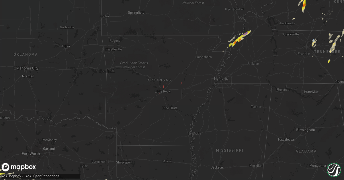
Hail Map in Arkansas on May 2, 2019
Get this storm
May 2 map
$229
one time, instant access
Download today. No call, no setup
Keep the $229
Bought the map and want the full workflow? Apply the entire $229 to a subscription within 7 days. None of it is wasted.
Every map, not just this one
This buys you this map. Subscription and you get every map we run, in the markets you choose from a few cities to whole states to nationwide. Plus real-time alerts the moment a storm fires.
Contact data
Name, contact info, occupancy, even credit band for addresses in the footprint. You go from where it hit to who to call.
Become the source they trust
Unlimited branding weather history reports on demand. You already have the documented answer ready for the property owner, and you are the one who showed up with it.
Property data and RoofTrace estimates
Pull up any address you have got, its value and the exact code rules for that jurisdiction, straight from One Click Code. Then RoofTrace estimates the squares, pitch, and roof value, priced the way you price.
Storm reports in Arkansas
Arkansas
| Date | Description |
|---|---|
| 05/02/20195:10 PM CDT | Large tree uprooted on moody street in gosnell. |
| 05/02/20195:02 PM CDT | Brief tornado reported near gosnell. |
| 05/02/20194:47 PM CDT | Possible tornado damage to a home on greene road 402. |
| 05/02/20194:29 PM CDT | Emergency manager reported tornado near knob... Ar. |
| 05/02/20193:15 PM CDT | Damage to a baseball field in the town of mccrory. Radar data are inconclusive as to whether this was due to a tornado. Time estimated from radar. |
| 05/02/20192:57 PM CDT | Broadcast media viewer sent picture of tornado near hwy 33 southeast of augusta. Time and location estimated from radar. |
| 05/02/20192:45 PM CDT | Tornado reported on highway 226. |
| 05/02/20192:23 PM CDT | Multiple reports via social media... Including video... Show a tornado in progress west of des arc. Time and location estimated from radar. |
| 05/02/20191:52 PM CDT | House reported to be damaged. |
| 05/02/20191:46 PM CDT | Trees topped and blown down near the intersection of hwy 89 and hwy 5 near cabot. Possible tornado... Time estimated from radar. |
| 05/02/20191:42 PM CDT | Damage was reported off interstate 30 in little rock. A tree was reported down blocking part of frontage road near exit 130. |
| 05/02/20191:35 PM CDT | This weak tornado moved from ne to sw. Tree limbs were snapped with a few trees uprooted along faulkner gap road. A small shed was also destroyed. |
| 05/02/20191:33 PM CDT | There was damage to a house from a fallen tree. |
| 05/02/20191:33 PM CDT | Public reports building damage near the town of furlow. Possible tornado. Time and location estimated from radar. |
| 05/02/20191:28 PM CDT | Roof damage was reported along with downed trees and damage to an rv. |
| 05/02/20191:26 PM CDT | Trees were either uprooted or tree limbs snapped along this tornato path. Survey results conclude damage was consistent with an ef0 tornado. |
| 05/02/20191:24 PM CDT | Trees reported to be blown down. |
| 05/02/20191:20 PM CDT | A tree was down on a shed at batesville pike and jacksonville cato rd. At gibson. |
| 05/02/20191:15 PM CDT | Numerous trees down along portions of kellogg acres road near gibson from a likely tornado. Reported via media... Time estimated from radar. |
| 05/02/201912:55 PM CDT | A garage door was blown in... And some roofing material was removed from a business at 10601 otter creek blvd. In mabelvale. Estimate thunderstorm winds of 60 to 70 mph |
| 05/02/201912:52 PM CDT | A metal shed was damaged along with 8 to 10 trees reported down at otter creek and mabelvale west. |
| 05/02/201912:44 PM CDT | Roof damage to storage buildings along w 65th street in little rock. Time and location estimated from radar. |
| 05/02/201912:39 PM CDT | The survey team has confirmed a tornado near the i-430/i-30 interchange. Preliminary damage survey results indicate an ef1 tornado. More details to come later once the |
| 05/01/20198:07 PM CDT | At 107 PM CDT, a severe thunderstorm was located near Protho Junction, or near North Little Rock, moving north at 25 mph. HAZARD...70 mph wind gusts. SOURCE...Radar indicated. IMPACT...Expect considerable tree damage. Damage is likely to mobile homes, roofs, and outbuildings. Locations impacted include... Little Rock... North Little Rock... Conway... Sherwood... Jacksonville... Cabot... Downtown Little Rock... North Little Rock Airport... Little Rock AFB... Ward... Vilonia... Wrightsville... Austin in Lonoke County... Argenta... Keo... Old Austin... Parnell... Gravel Ridge... Meto... Toltec Mounds State Park...This includes the following highways... Interstate 30 between mile markers 138 and 142. Interstate 40 between mile markers 150 and 169. Interstate 530 near mile marker 1. Interstate 630 near mile marker 1. Interstate 440 between mile markers 1 and 14. US Highway 67 between mile markers 1 and 24. |
All States Impacted by Hail Map on May 2, 2019
Cities Impacted by Hail Map on May 2, 2019
- Murfreesboro, TN
- Pollok, TX
- Baird, TX
- Union, KY
- Verona, KY
- Warsaw, KY
- Walton, KY
- Patriot, IN
- Cisco, TX
- Comstock, TX
- Del Rio, TX
- Valley Mills, TX
- Bloomington Springs, TN
- Smiths Grove, KY
- Park City, KY
- Boonville, IN
- Tennyson, IN
- Chrisney, IN
- Ridgely, TN
- Lebanon, TN
- Mount Juliet, TN
- Eastland, TX
- Fort Stockton, TX
- Hartford, KY
- Beaver Dam, KY
- Eden, TX
- Dryden, TX
- Carbon, TX
- Anson, TX
- Milano, TX
- Dickerson, MD
- Germantown, MD
- Poolesville, MD
- Great Falls, VA
- Leesburg, VA
- Potomac, MD
- Ashburn, VA
- Sterling, VA
- Barbourville, KY
- Rockholds, KY
- Wadesville, IN
- May, TX
- Sidney, TX
- Cynthiana, KY
- Cleburne, TX
- New Harmony, IN
- Poseyville, IN
- Richland, IN
- Buffalo Valley, TN
- Silver Point, TN
- Baxter, TN
- Coleman, TX
- Winters, TX
- Talpa, TX
- Valera, TX
- Ballinger, TX
- Russell Springs, KY
- Jamestown, KY
- Carlton, TX
- Dublin, TX
- Ordway, CO
- Brackettville, TX
- Troy, TN
- Whitesville, KY
- Utica, KY
- Fredericksburg, TX
- Morgantown, KY
- Brownsville, KY
- Iraan, TX
- Sheffield, TX
- Big Wells, TX
- Huntsville, TX
- Cameron, TX
- Comanche, TX
- Blanket, TX
- Hornbeak, TN
- De Leon, TX
- Smithville, TN
- Laredo, TX
- Mirando City, TX
- Gatesville, TX
- Lawn, TX
- Goldsboro, TX
- Lynchburg, VA
- Madison Heights, VA
- Abilene, TX
- Parkers Lake, KY
- Corbin, KY
- Bedias, TX
- Beattyville, KY
- Jackson, KY
- Gallatin, TN
- Christoval, TX
- Eldorado, TX
- Rising Star, TX
- Gainesboro, TN
- Owensville, IN
- Philpot, KY
- Rochester, KY
- Drakesboro, KY
- Livermore, KY
- Fordsville, KY
- Hawesville, KY
- Reynolds Station, KY
- Olaton, KY
- Centertown, KY
- Celina, TN
- Allons, TN
- Burkesville, KY
- Elkton, KY
- Cave City, KY
- Corydon, KY
- Henderson, KY
- Hickman, KY
- Rocky Mount, VA
- Santa Anna, TX
- Boone, CO
- Olney Springs, CO
- Princeton, IN
- Fort Branch, IN
- Scottsville, KY
- Adolphus, KY
- Blackwell, TX
- Weinert, TX
- Elmwood, TN
- Gordonsville, VA
- Goldthwaite, TX
- Hillsboro, TX
- Whitney, TX
- Riesel, TX
- Waco, TX
- Timpson, TX
- Hearne, TX
- Ovalo, TX
- Glen Rose, TX
- Bryan, TX
- Crawford, TX
- Hendersonville, TN
- Sonora, TX
- Natchitoches, LA
- Oilton, TX
- San Ygnacio, TX
- Bruni, TX
- Zapata, TX
- Hebbronville, TX
- Aldie, VA
- Middleburg, VA
- The Plains, VA
- Junction, TX
- Moran, TX
- Clyde, TX
- Albany, TX
- Mount Vernon, IN
- Cross Plains, TX
- Iola, TX
- Mcminnville, TN
- Morrison, TN
- Red Boiling Springs, TN
- Whitleyville, TN
- Pleasant Shade, TN
- Lafayette, TN
- Gorman, TX
- Menard, TX
- Fulton, KY
- Wingo, KY
- Hayti, MO
- Tiptonville, TN
- Clinton, KY
- Caruthersville, MO
- Union City, TN
- Stephenville, TX
- Stanton, KY
- Rockdale, TX
- Hardyville, KY
- Horse Cave, KY
- Brady, TX
- Comfort, TX
- Kerrville, TX
- San Saba, TX
- McGregor, TX
- London, TX
- Mason, TX
- Hico, TX
- Malone, TX
- Calvert, TX
- Sylvester, TX
- Francisco, IN
- Petersburg, IN
- Otwell, IN
- Velpen, IN
- Jasper, IN
- Winslow, IN
- Nolan, TX
- Walnut Springs, TX
- Iredell, TX
- Meridian, TX
- Lexington, TX
- Frenchburg, KY
- Haubstadt, IN
- Cotulla, TX
- Nacogdoches, TX
- Lancaster, TN
- Granville, TN
- Dowelltown, TN
- Hilham, TN
- Buffalo, TX
- Temple Hills, MD
- Merkel, TX
- Hawley, TX
- Gray, KY
- Cookeville, TN
- Novice, TX
- Voss, TX
- Davidsonville, MD
- Annapolis, MD
- Crownsville, MD
- Gambrills, MD
- Bedford, VA
- Montvale, VA
- Clifton, TX
- Sweetwater, TX
- Trent, TX
- Steele, MO
- Harper, TX
- Cushing, TX
- Concord, VA
- Glasgow, KY
- Garrison, TX
- Vancourt, TX
- Portageville, MO
- Ranger, TX
- College Station, TX
- Woodbine, KY
- Evansville, IN
- Cynthiana, IN
- Laughlin Afb, TX
- Cedar Bluff, VA
- Sparta, TN
- Melvin, TX
- Marquez, TX
- Williamstown, KY
- Carmi, IL
- Hopkinsville, KY
- Monticello, KY
- Brownwood, TX
- Blytheville, AR
- Rochelle, TX
- Richland Springs, TX
- Oglesby, TX
- Haskell, TX
- Carthage, TN
- Ravenna, KY
- Clay City, KY
- Evant, TX
- Purmela, TX
- Washington, DC
- Burtonsville, MD
- Laurel, MD
- Gause, TX
- Thrall, TX
- Elgin, TX
- Foster, KY
- Brooksville, KY
- Patoka, IN
- Mount Carmel, IL
- Desdemona, TX
- Horse Branch, KY
- Little Rock, AR
- Mabelvale, AR
- Sherwood, AR
- Jacksonville, AR
- Cabot, AR
- Des Arc, AR
- Dillwyn, VA
- New Canton, VA
- Arvonia, VA
- Kensington, MD
- Herndon, VA
- Gaithersburg, MD
- Rockville, MD
- Reston, VA
- Bethesda, MD


