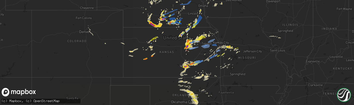
Hail Map in Kansas on April 29, 2022
The weather event in Kansas on April 29, 2022 includes Hail, Wind, and Tornado maps. 8 states and 592 cities were impacted and suffered possible damage. The total estimated number of properties impacted is 138,227.
Want more than just the map?
Turn this storm into a full workflow.
- Owner + property data so you know who to knock
- OnDemand branded weather history reports to win the "did we even have hail?" argument
- RoofTrace estimate so reps stop guessing numbers at the door
Bought this map? Upgrade within 7 days and we'll credit the $230. (10-15 min setup call)
Hail
Wind
Tornado
138,227
Estimated number of impacted properties by a 1.00" hail or larger76,000
Estimated number of impacted properties by a 1.75" hail or larger1,850
Estimated number of impacted properties by a 2.50" hail or largerStorm reports in Kansas
Kansas
| Date | Description |
|---|---|
| 04/29/20226:59 PM CDT | A local report indicates 1.75 inch wind near ABILENE |
| 04/29/20226:59 PM CDT | A local report indicates 71 MPH wind near 6 WSW BELOIT |
| 04/29/20226:59 PM CDT | A local report indicates 84 MPH wind near 7 E TIPTON |
| 04/29/20226:53 PM CDT | Asos station khlc hill city. |
| 04/29/20226:53 PM CDT | A local report indicates 1.75 inch wind near 3 NE ABILENE |
| 04/29/20226:51 PM CDT | A local report indicates 1.00 inch wind near ABILENE |
| 04/29/20226:48 PM CDT | A local report indicates 1.75 inch wind near ABILENE |
| 04/29/20226:46 PM CDT | A local report indicates 69 MPH wind near 3 N TIPTON |
| 04/29/20226:45 PM CDT | A local report indicates 4.00 inch wind near ENTERPRISE |
| 04/29/20226:40 PM CDT | Public reports brief touchdown just outside of washington at 640pm. |
| 04/29/20226:31 PM CDT | Spotter reported tornado north of carlton. |
| 04/29/20226:29 PM CDT | Also reports a funnel cloud. |
| 04/29/20226:23 PM CDT | A local report indicates 1.50 inch wind near 8 NNW MOONLIGHT |
| 04/29/20226:15 PM CDT | A local report indicates 61 MPH wind near SMITH CENTER AIRPORT |
| 04/29/20226:13 PM CDT | A local report indicates 1.75 inch wind near 5 NW MOONLIGHT |
| 04/29/20226:11 PM CDT | Asos station khlc hill city. |
| 04/29/20226:05 PM CDT | Via graham county dispatch. Penny to quarter sized hail accumulating on roads and in ditches. Zero visibility reported due to heavy rain and hail. |
| 04/29/20226:00 PM CDT | A local report indicates 66 MPH wind near 1 W LOGAN |
| 04/29/20225:57 PM CDT | Mesonet station up856 0.8 e yocemento |
| 04/29/20225:55 PM CDT | A local report indicates 58 MPH wind near 1 NNW OSBORNE |
| 04/29/20225:54 PM CDT | A local report indicates 2.00 inch wind near CONCORDIA |
| 04/29/20225:51 PM CDT | Spotter reports quarter to half-dollar sized hail just on the western side of abilene city limits. |
| 04/29/20225:51 PM CDT | Asos station kcnk concordia. |
| 04/29/20225:45 PM CDT | Mesonet station k5wky 1 ssw wakeeney. |
| 04/29/20225:45 PM CDT | Estimated by nws employee along outflow surge. |
| 04/29/20225:38 PM CDT | A local report indicates 1.00 inch wind near 6 W WOODBINE |
| 04/29/20225:35 PM CDT | Mesonet station k5sct 1 ese scott state lake. |
| 04/29/20225:10 PM CDT | Social media report. |
| 04/29/20225:01 PM CDT | A local report indicates 59 MPH wind near PLAINVILLE |
| 04/29/20225:00 PM CDT | Mini dust storms when winds came through. |
| 04/29/20224:59 PM CDT | Asos station krsl russell municipal airport. |
| 04/29/20224:30 PM CDT | Mesonet station k5wkr 2 nw victoria. |
| 04/29/20223:31 PM CDT | A local report indicates 1.00 inch wind near 12 S NESS CITY |
| 04/29/20229:23 AM CDT | Delayed report of quarter sized hail. |
| 04/29/20226:43 AM CDT | At 1143 PM CDT, severe thunderstorms were located along a line extending from 6 miles south of Hardy to 3 miles southeast of Ponca City to 4 miles southwest of Red Rock to 4 miles west of Orlando, moving east at 40 mph. HAZARD...60 mph wind gusts and quarter size hail. SOURCE...Radar indicated. IMPACT...Hail damage to vehicles is expected. Expect wind damage to roofs, siding, and trees. Locations impacted include... Stillwater, Ponca City, Perry, Morrison, Glencoe, Kaw City, Red Rock, Marland, Orlando, Lake Carl Blackwell, Kaw Lake, Lake Mcmurtry, Hardy, Sooner Lake, Ingalls and Ceres. |
| 04/29/20226:39 AM CDT | At 1139 PM CDT, severe thunderstorms were located along a line extending from 7 miles northeast of Longton to 5 miles northeast of Hardy, moving east at 40 mph. HAZARD...60 mph wind gusts and penny size hail. SOURCE...Radar indicated. IMPACT...Expect damage to roofs, siding, and trees. Locations impacted include... Independence, Neodesha, Caney, Sedan, Cedar Vale, Longton, Elk City, Peru, Chautauqua, Elk Falls, Havana, Elgin, Bolton, Sycamore, Niotaze, Buxton, Elk City Lake, Elk City State Park, Hale and Independence Airport. |
| 04/29/20226:30 AM CDT | At 1130 PM CDT, severe thunderstorms were located along a line extending from 3 miles northeast of Hardy to 5 miles west of Red Rock, moving east at 50 mph. HAZARD...60 mph wind gusts and half dollar size hail. SOURCE...Radar indicated. IMPACT...Hail damage to vehicles is expected. Expect wind damage to roofs, siding, and trees. Locations in or near the path include... Pawhuska... Pawnee... Fairfax... Shidler... Wynona... Ralston... Burbank... Blackburn... Maramec... Skedee... Grainola... Foraker... Bigheart... Pearsonia... Hulah... Sunset Lake... Osage Hills State Park... Webb City... Wah Sha She State Park... Apperson... |
| 04/29/20226:03 AM CDT | At 1103 PM CDT, a severe thunderstorm was located near Burden, or 11 miles east of Winfield, moving east at 45 mph. HAZARD...60 mph wind gusts and nickel size hail. SOURCE...Radar indicated. IMPACT...Expect damage to roofs, siding, and trees. Locations impacted include... Arkansas City, Winfield, Sedan, Howard, Cedar Vale, Burden, Moline, Longton, Dexter, Grenola, Atlanta, Geuda Springs, Elk Falls, Elgin, Cambridge, Maple City, Winfield City Lake and Strother Field Airport.This includes Interstate 35 near Mile Marker 1. |
| 04/29/20225:59 AM CDT | At 1058 PM CDT, severe thunderstorms were located along a line extending from near Braman to near Breckenridge, moving east at 45 mph. The most severe storm was located near Lamont. HAZARD...Ping pong ball size hail and 60 mph wind gusts. SOURCE...Radar indicated. IMPACT...People and animals outdoors will be injured. Expect hail damage to roofs, siding, windows, and vehicles. Expect wind damage to roofs, siding, and trees. Locations impacted include... Ponca City, Blackwell, Tonkawa, Newkirk, Garber, Billings, Lamont, Kaw City, Red Rock, Breckenridge, Marland, Braman, Hunter, Deer Creek, Kildare, Chilocco, Kaw Lake, Hardy and Nardin. |
| 04/29/20225:34 AM CDT | At 1032 PM CDT, a severe thunderstorm was located 9 miles north of Toronto, or 9 miles northwest of Yates Center, moving east at 45 mph. HAZARD...60 mph wind gusts and quarter size hail. SOURCE...Radar indicated. IMPACT...Hail damage to vehicles is expected. Expect wind damage to roofs, siding, and trees. Locations impacted include... Iola, Humboldt, Yates Center, La Harpe, Gas, Moran, Toronto, Neosho Falls, Mildred, Bassett, Toronto Lake, Batesville, Rose, Cross Timbers State Park, Iola Airport and Piqua. |
| 04/29/20225:25 AM CDT | At 1024 PM CDT, severe thunderstorms were located along a line extending from 9 miles north of Latham to near Belle Plaine, moving east at 50 mph. HAZARD...60 mph wind gusts and quarter size hail. SOURCE...Radar indicated. IMPACT...Hail damage to vehicles is expected. Expect wind damage to roofs, siding, and trees. Locations impacted include... Mulvane, Rose Hill, Douglass, Belle Plaine, Udall, Leon, Howard, Moline, Severy, Grenola, Atlanta, Fall River, Latham, Elk Falls, Rock, Climax, Fall River State Park, Beaumont, Winfield City Lake and Fall River Lake.This includes Interstate 35 between Mile Markers 25 and 33. |
| 04/29/20225:22 AM CDT | At 1022 PM CDT, severe thunderstorms were located along a line extending from 5 miles northwest of Renfrow to 5 miles southeast of Wakita, moving east at 50 mph. Additional storms are likely to develop along this line. HAZARD...60 mph wind gusts and quarter size hail. SOURCE...Radar indicated. IMPACT...Hail damage to vehicles is expected. Expect wind damage to roofs, siding, and trees. Locations impacted include... Blackwell, Tonkawa, Medford, Newkirk, Lamont, Braman, Deer Creek, Jefferson, Renfrow, Chilocco, Nardin, Blackwell Lake and Peckham. |
| 04/29/20225:18 AM CDT | At 1017 PM CDT, a severe thunderstorm was located 4 miles west of Colony, moving northeast at 40 mph. HAZARD...Ping pong ball size hail and 60 mph wind gusts. SOURCE...Radar indicated. IMPACT...People and animals outdoors will be injured. Expect hail damage to roofs, siding, windows, and vehicles. Expect wind damage to roofs, siding, and trees. Locations impacted include... Garnett, Colony, Kincaid and Lone Elm. |
| 04/29/20225:16 AM CDT | At 1016 PM CDT, severe thunderstorms were located along a line extending from near Haysville to 5 miles south of Wakita, moving east at 50 mph. HAZARD...60 mph wind gusts and half dollar size hail. SOURCE...Radar indicated. IMPACT...Hail damage to vehicles is expected. Expect wind damage to roofs, siding, and trees. Locations impacted include... Arkansas City, Winfield, Wellington, Caldwell, Oxford, Burden, South Haven, Geuda Springs, Mayfield, Hunnewell, Perth, Riverdale, Strother Field Airport and Wellington Airport.This includes Interstate 35 between Mile Markers 1 and 26. |
| 04/29/20225:02 AM CDT | At 1002 PM CDT, a severe thunderstorm was located near Mulvane, moving southeast at 25 mph. HAZARD...60 mph wind gusts and quarter size hail. SOURCE...Radar indicated. IMPACT...Hail damage to vehicles is expected. Expect wind damage to roofs, siding, and trees. Locations impacted include... Derby, Mulvane, Rose Hill, Douglass, Belle Plaine, Udall, Atlanta, Rock, Winfield City Lake and Riverdale.This includes Interstate 35 between Mile Markers 24 and 37. |
| 04/29/20224:54 AM CDT | At 954 PM CDT, a severe thunderstorm was located 9 miles northwest of Eureka, moving east at 25 mph. HAZARD...Ping pong ball size hail and 60 mph wind gusts. SOURCE...Radar indicated. IMPACT...People and animals outdoors will be injured. Expect hail damage to roofs, siding, windows, and vehicles. Expect wind damage to roofs, siding, and trees. Locations impacted include... Eureka, Madison, Hamilton, Rosalia, Climax, Virgil, Eureka City Lake, Beaumont, Thrall, Eureka Airport and Piedmont. |
| 04/29/20224:47 AM CDT | At 947 PM CDT, severe thunderstorms were located along a line extending from 3 miles northeast of Winchester to 4 miles southwest of Oskaloosa to 3 miles south of Williamstown to 4 miles southwest of Globe, moving east at 55 mph. HAZARD...60 mph wind gusts and penny size hail. SOURCE...Radar indicated. IMPACT...Expect damage to roofs, siding, and trees. Locations impacted include... Topeka, Lawrence, Baldwin City, Carbondale, Valley Falls, Oskaloosa, Tecumseh, Eudora, Richland, Overbrook, Perry, McLouth, Meriden, Scranton, Ozawkie, Nortonville, Lecompton, Clinton, Winchester and Lone Star.This includes Kansas Turnpike between mile markers 170 and 205. |
| 04/29/20224:43 AM CDT | At 941 PM CDT, a severe thunderstorm was located 4 miles northeast of Le Roy, moving northeast at 55 mph. HAZARD...Ping pong ball size hail and 60 mph wind gusts. SOURCE...Radar indicated. IMPACT...People and animals outdoors will be injured. Expect hail damage to roofs, siding, windows, and vehicles. Expect wind damage to roofs, siding, and trees. Locations impacted include... Garnett, Richmond, Greeley, Lane, Westphalia and Le Roy. |
| 04/29/20224:36 AM CDT | At 936 PM CDT, a severe thunderstorm was located near East Wichita, or near Andover, moving east at 30 mph. HAZARD...Two inch hail and 60 mph wind gusts. SOURCE...Trained weather spotters. IMPACT...People and animals outdoors will be injured. Expect hail damage to roofs, siding, windows, and vehicles. Expect wind damage to roofs, siding, and trees. Locations impacted include... Wichita, Derby, El Dorado, Andover, Haysville, Augusta, Bel Aire, Rose Hill, Towanda, Benton, Leon, Eastborough, Latham, East Wichita, Northeast Wichita, Mcconnell Air Force Base, South Wichita, Santa Fe Lake, El Dorado State Park and Augusta Municipal Airport.This includes the following highways... Interstate 135 between Mile Markers 0 and 8. Interstate 35 between Mile Markers 38 and 80. |
| 04/29/20224:24 AM CDT | At 923 PM CDT, severe thunderstorms were located along a line extending from near White Cloud to near Denton to near Nortonville, moving east at 35 mph. HAZARD...60 mph wind gusts and quarter size hail. SOURCE...Radar indicated. IMPACT...Hail damage to vehicles is expected. Expect wind damage to roofs, siding, and trees. Locations impacted include... St. Joseph, Atchison, Savannah, Wathena, Elwood, Highland, Troy, Country Club Villa, Country Club, Oregon, Agency, Amazonia, Rushville, Lancaster, Forest City, Fillmore, Lewis And Clark Village, Doniphan, Barnard and De Kalb.This includes the following highways... Interstate 29 between mile markers 31 and 79. Interstate 229 between mile markers 0 and 14. |
| 04/29/20224:24 AM CDT | At 923 PM CDT, severe thunderstorms were located along a line extending from 4 miles northeast of Rossville to near Auburn to near Harveyville, moving east at 40 mph. HAZARD...60 mph wind gusts and nickel size hail. SOURCE...Radar indicated. IMPACT...Expect damage to roofs, siding, and trees. Locations impacted include... Topeka, Carbondale, Valley Falls, Rossville, Tecumseh, Richland, Silver Lake, Auburn, Overbrook, Burlingame, Perry, Meriden, Scranton, Hoyt, Ozawkie, Lecompton, Willard, Pauline, Perry Lake and Grantville.This includes the following highways... Interstate 70 between mile markers 347 and 355. Kansas Turnpike between mile markers 155 and 193. |
| 04/29/20224:15 AM CDT | At 915 PM CDT, a severe thunderstorm was located near Towanda, moving east at 35 mph. HAZARD...70 mph wind gusts and quarter size hail. SOURCE...Radar indicated. IMPACT...Hail damage to vehicles is expected. Expect considerable tree damage. Wind damage is also likely to mobile homes, roofs, and outbuildings. Locations impacted include... Wichita, Derby, El Dorado, Andover, Haysville, Augusta, Bel Aire, Rose Hill, Towanda, Benton, Downtown Wichita, Kechi, Eastborough, Eisenhower National Airport, Northeast Wichita, East Wichita, Mcconnell Air Force Base, South Wichita, Santa Fe Lake and Jabara Airport.This includes the following highways... Interstate 135 between Mile Markers 0 and 11. Interstate 35 between Mile Markers 39 and 79. |
| 04/29/20224:02 AM CDT | At 902 PM CDT, a severe thunderstorm was located near Ottawa, moving northeast at 45 mph. HAZARD...60 mph wind gusts and quarter size hail. SOURCE...Radar indicated. IMPACT...Hail damage to vehicles is expected. Expect wind damage to roofs, siding, and trees. Locations impacted include... Southeastern Lawrence, Ottawa, Baldwin City, Eudora, Wellsville, Centropolis, Pomona, Williamsburg, Quenemo, Princeton, Pleasant Grove, Vinland and Globe.This includes Interstate 35 between mile markers 171 and 198. |
| 04/29/20223:57 AM CDT | At 857 PM CDT, severe thunderstorms were located along a line extending from near Paxico to 5 miles northwest of Bushong, moving east at 50 mph. HAZARD...60 mph wind gusts and quarter size hail. SOURCE...Radar indicated. IMPACT...Hail damage to vehicles is expected. Expect wind damage to roofs, siding, and trees. Locations impacted include... Topeka, Alma, Eskridge, Dover, Silver Lake, Auburn, Burlingame, Maple Hill, McFarland, Harveyville, Paxico, Willard, Pauline and Keene.This includes the following highways... Interstate 70 between mile markers 323 and 355. Kansas Turnpike between mile markers 155 and 181. |
| 04/29/20223:53 AM CDT | At 852 PM CDT, severe thunderstorms were located along a line extending from 7 miles southeast of Burdick to Potwin, moving southeast at 30 mph. HAZARD...60 mph wind gusts and quarter size hail. SOURCE...Radar indicated. IMPACT...Hail damage to vehicles is expected. Expect wind damage to roofs, siding, and trees. Locations impacted include... Cottonwood Falls, Whitewater, Strong City, Florence, Potwin, Elbing, Burns, Cassoday, Bazaar, Elmdale, Matfield Green, Cedar Point, Hymer, Wonsevu, Tallgrass Prairie, Saffordville and Tallgrass Prairie Preserve.This includes Interstate 35 between Mile Markers 81 and 105. |
| 04/29/20223:48 AM CDT | At 848 PM CDT, severe thunderstorms were located along a line extending from near Soldier to near Circleville to near Holton, moving northeast at 50 mph. HAZARD...60 mph wind gusts and quarter size hail. SOURCE...Radar indicated. IMPACT...Hail damage to vehicles is expected. Expect wind damage to roofs, siding, and trees. Locations impacted include... Holton, Sabetha, Horton, Wetmore, Fairview, Whiting, Circleville, Corning, Netawaka, Soldier, Goff, Powhattan, Kickapoo Reservation and Woodlawn. |
| 04/29/20223:45 AM CDT | At 845 PM CDT, severe thunderstorms were located along a line extending from near Reserve to near Willis to near Potawatomi Reservation, moving northeast at 35 mph. HAZARD...60 mph wind gusts and quarter size hail. SOURCE...Radar indicated. IMPACT...Hail damage to vehicles is expected. Expect wind damage to roofs, siding, and trees. Locations impacted include... Atchison, Mound City, Highland, Troy, Oregon, Effingham, Maitland, Lancaster, Forest City, Craig, White Cloud, Muscotah, Denton, Big Lake, Severance, Farmington, Huron, Leona, Fortescue and Bigelow.This includes Interstate 29 between mile markers 67 and 93. |
| 04/29/20223:44 AM CDT | At 843 PM CDT, severe thunderstorms were located along a line extending from 7 miles southwest of Whitewater to near West Wichita, moving east at 40 mph. HAZARD...60 mph wind gusts and quarter size hail. SOURCE...Radar indicated. IMPACT...Hail damage to vehicles is expected. Expect wind damage to roofs, siding, and trees. Locations impacted include... Wichita, Andover, Park City, Valley Center, Bel Aire, Goddard, Maize, Sedgwick, Colwich, Benton, Downtown Wichita, Kechi, Andale, Eastborough, West Wichita, East Wichita, Eisenhower National Airport, Northeast Wichita, Mcconnell Air Force Base and Jabara Airport.This includes the following highways... Interstate 135 between Mile Markers 2 and 22. Interstate 35 between Mile Markers 44 and 55. |
| 04/29/20223:38 AM CDT | At 838 PM CDT, severe thunderstorms were located along a line extending from near St. Marys to 4 miles north of McFarland to 7 miles north of Volland, moving east at 20 mph. HAZARD...60 mph wind gusts and quarter size hail. SOURCE...Radar indicated. IMPACT...Hail damage to vehicles is expected. Expect wind damage to roofs, siding, and trees. Locations impacted include... Southeastern Manhattan, Wamego, Ogden, St. George, Belvue and Louisville. |
| 04/29/20223:36 AM CDT | At 836 PM CDT, a severe thunderstorm was located near Newton, moving east at 40 mph. HAZARD...60 mph wind gusts. SOURCE...Radar indicated. IMPACT...Expect damage to roofs, siding, and trees. Locations impacted include... Newton, North Newton, Sedgwick, Peabody, Whitewater, Florence, Walton, Elbing, Cedar Point and Newton Airport.This includes Interstate 135 between Mile Markers 23 and 34. |
| 04/29/20223:32 AM CDT | At 832 PM CDT, a severe thunderstorm was located over Marion, moving northeast at 55 mph. HAZARD...60 mph wind gusts and quarter size hail. SOURCE...Radar indicated. IMPACT...Hail damage to vehicles is expected. Expect wind damage to roofs, siding, and trees. Locations impacted include... Marion, Lincolnville, Lost Springs, Hymer, Pilsen and Marion Lake. |
| 04/29/20223:28 AM CDT | At 828 PM CDT, a severe thunderstorm was located 11 miles west of Eureka, moving northeast at 45 mph. HAZARD...60 mph wind gusts and half dollar size hail. SOURCE...Radar indicated. IMPACT...Hail damage to vehicles is expected. Expect wind damage to roofs, siding, and trees. Locations impacted include... Eureka, Hamilton, Virgil, Eureka City Lake, Thrall and Eureka Airport. |
| 04/29/20223:27 AM CDT | At 827 PM CDT, severe thunderstorms were located along a line extending from 8 miles south of Havensville to 3 miles south of Emmett to near Paxico, moving east at 50 mph. HAZARD...60 mph wind gusts and quarter size hail. SOURCE...Radar indicated. IMPACT...Hail damage to vehicles is expected. Expect wind damage to roofs, siding, and trees. Locations impacted include... Topeka, Holton, Valley Falls, Rossville, Alma, Tecumseh, St. Marys, Richland, Dover, Silver Lake, Meriden, Hoyt, Ozawkie, Nortonville, Maple Hill, Mayetta, McFarland, Paxico, Emmett and Denison.This includes the following highways... Interstate 70 between mile markers 329 and 355. Kansas Turnpike between mile markers 171 and 191. |
| 04/29/20223:24 AM CDT | At 823 PM CDT, severe thunderstorms were located along a line extending from 3 miles southwest of St. George to 4 miles south of Herington, moving east at 40 mph. HAZARD...70 mph wind gusts and half dollar size hail. SOURCE...Radar indicated. IMPACT...Hail damage to vehicles is expected. Expect considerable tree damage. Wind damage is also likely to mobile homes, roofs, and outbuildings. Locations impacted include... Herington, Council Grove, Alma, White City, Alta Vista, Dwight, McFarland, Paxico, Wilsey, Parkerville, Dunlap, Latimer, Council Grove Lake, Volland and Burdick.This includes Interstate 70 between mile markers 304 and 339. |
| 04/29/20223:21 AM CDT | At 820 PM CDT, a severe thunderstorm was located 6 miles south of Cottonwood Falls, moving northeast at 35 mph. HAZARD...60 mph wind gusts and quarter size hail. SOURCE...Radar indicated. IMPACT...Hail damage to vehicles is expected. Expect wind damage to roofs, siding, and trees. Locations impacted include... Cottonwood Falls, Strong City, Bazaar, Elmdale, Saffordville, Tallgrass Prairie and Tallgrass Prairie Preserve.This includes Interstate 35 between Mile Markers 106 and 115. |
| 04/29/20223:14 AM CDT | At 814 PM CDT, severe thunderstorms were located along a line extending from near Sabetha to near Wetmore to 5 miles south of Circleville, moving northeast at 25 mph. HAZARD...60 mph wind gusts and nickel size hail. SOURCE...Radar indicated. IMPACT...Expect damage to roofs, siding, and trees. Locations impacted include... Holton, Sabetha, Horton, Wetmore, Fairview, Morrill, Whiting, Circleville, Netawaka, Soldier, Goff, Powhattan, Oneida, Hamlin, Kickapoo Reservation and Woodlawn. |
| 04/29/20223:07 AM CDT | At 807 PM CDT, a severe thunderstorm was located over Andover, moving northeast at 20 mph. HAZARD...60 mph wind gusts and half dollar size hail. SOURCE...Radar indicated. IMPACT...Hail damage to vehicles is expected. Expect wind damage to roofs, siding, and trees. Locations impacted include... Wichita, El Dorado, Andover, Augusta, Rose Hill, Towanda, Benton, Eastborough, East Wichita, Santa Fe Lake, El Dorado State Park, Augusta Municipal Airport, El Dorado Airport and El Dorado Lake.This includes Interstate 35 between Mile Markers 49 and 82. |
| 04/29/20223:06 AM CDT | At 806 PM CDT, severe thunderstorms were located along a line extending from near Westmoreland to St. George to 9 miles south of Manhattan, moving east at 25 mph. HAZARD...Ping pong ball size hail and 60 mph wind gusts. SOURCE...Radar indicated. IMPACT...People and animals outdoors will be injured. Expect hail damage to roofs, siding, windows, and vehicles. Expect wind damage to roofs, siding, and trees. Locations impacted include... Wamego, Alma, Westmoreland, St. George, McFarland, Paxico, Belvue and Louisville.This includes Interstate 70 between mile markers 312 and 333. |
| 04/29/20223:02 AM CDT | At 802 PM CDT, severe thunderstorms were located along a line extending from 5 miles northeast of Chapman to 4 miles northwest of Tampa, moving east at 25 mph. HAZARD...70 mph wind gusts and ping pong ball size hail. SOURCE...Trained weather spotters. At 800 PM trained spotters reported ping pong ball size hail 2 miles south of Chapman. IMPACT...People and animals outdoors will be injured. Expect hail damage to roofs, siding, windows, and vehicles. Expect considerable tree damage. Wind damage is also likely to mobile homes, roofs, and outbuildings. Locations impacted include... Junction City, Herington, Grandview Plaza, Chapman, Hope, Woodbine and Latimer.This includes Interstate 70 between mile markers 284 and 314. |
| 04/29/20222:44 AM CDT | At 744 PM CDT, a severe thunderstorm was located 7 miles south of St. George, moving northeast at 30 mph. HAZARD...Ping pong ball size hail and 60 mph wind gusts. SOURCE...Trained weather spotters. IMPACT...People and animals outdoors will be injured. Expect hail damage to roofs, siding, windows, and vehicles. Expect wind damage to roofs, siding, and trees. Locations impacted include... Wamego, St. Marys, St. George, Belvue, Emmett, Louisville and Delia.This includes Interstate 70 between mile markers 316 and 326. |
| 04/29/20222:41 AM CDT | At 740 PM CDT, severe thunderstorms were located along a line extending from near Keats to near Enterprise, moving east at 35 mph. HAZARD...Two inch hail and 70 mph wind gusts. SOURCE...Trained weather spotters. At 733 PM trained spotters reported two inch hail 6 miles northwest of Junction City near Milford Lake. IMPACT...People and animals outdoors will be injured. Expect hail damage to roofs, siding, windows, and vehicles. Expect considerable tree damage. Wind damage is also likely to mobile homes, roofs, and outbuildings. Locations impacted include... Manhattan, Junction City, Ogden, Milford, Milford Lake and Keats. This includes Interstate 70 between mile markers 303 and 314. |
| 04/29/20222:39 AM CDT | At 739 PM CDT, severe thunderstorms were located along a line extending from 4 miles west of Corning to near Havensville to 6 miles west of Emmett, moving northeast at 25 mph. HAZARD...60 mph wind gusts and nickel size hail. SOURCE...Radar indicated. IMPACT...Expect damage to roofs, siding, and trees. Locations impacted include... Sabetha, Seneca, Onaga, Centralia, Wetmore, Circleville, Corning, Soldier, Havensville, Goff, Oneida, Baileyville and Woodlawn. |
| 04/29/20222:34 AM CDT | At 734 PM CDT, a severe thunderstorm was located 6 miles southeast of Wymore, or 16 miles north of Marysville, moving northeast at 35 mph. HAZARD...60 mph wind gusts and half dollar size hail. SOURCE...Radar indicated. IMPACT...Hail damage to vehicles is expected. Expect wind damage to roofs, siding, and trees. This severe thunderstorm will remain over mainly rural areas of southwestern Johnson, western Pawnee and southeastern Gage Counties, including the following locations... Liberty, Barneston, Burchard, Virginia, Rockford State Recreation Area and Lewiston. |
| 04/29/20222:32 AM CDT | At 732 PM CDT, a severe thunderstorm was located over Eastborough, or near Bel Aire, moving northeast at 45 mph. HAZARD...60 mph wind gusts and quarter size hail. SOURCE...Radar indicated. IMPACT...Hail damage to vehicles is expected. Expect wind damage to roofs, siding, and trees. Locations impacted include... Wichita, Derby, Andover, Bel Aire, Towanda, Benton, Downtown Wichita, Kechi, Eastborough, East Wichita, Northeast Wichita, Mcconnell Air Force Base, South Wichita, Oaklawn and Jabara Airport.This includes the following highways... Interstate 135 between Mile Markers 0 and 11. Interstate 35 between Mile Markers 42 and 60. |
| 04/29/20222:29 AM CDT | At 729 PM CDT, a severe thunderstorm was located near Potwin, or 7 miles northeast of Whitewater, moving northeast at 45 mph. HAZARD...60 mph wind gusts and quarter size hail. SOURCE...Radar indicated. IMPACT...Hail damage to vehicles is expected. Expect wind damage to roofs, siding, and trees. Locations impacted include... Potwin and Burns. |
| 04/29/20222:23 AM CDT | At 723 PM CDT, a severe thunderstorm was located over Florence, moving northeast at 45 mph. HAZARD...60 mph wind gusts and quarter size hail. SOURCE...Radar indicated. IMPACT...Hail damage to vehicles is expected. Expect wind damage to roofs, siding, and trees. Locations impacted include... Cottonwood Falls, Strong City, Florence, Elmdale, Cedar Point, Hymer, Tallgrass Prairie and Tallgrass Prairie Preserve. |
| 04/29/20222:23 AM CDT | At 723 PM CDT, severe thunderstorms were located along a line extending from 4 miles north of Chapman to 5 miles southwest of Enterprise, moving southeast at 35 mph. HAZARD...Ping pong ball size hail and 60 mph wind gusts. SOURCE...Radar indicated. IMPACT...People and animals outdoors will be injured. Expect hail damage to roofs, siding, windows, and vehicles. Expect wind damage to roofs, siding, and trees. Locations impacted include... Junction City, Abilene, Grandview Plaza, Chapman, Enterprise, Woodbine and Moonlight.This includes Interstate 70 between mile markers 274 and 307. |
| 04/29/20222:15 AM CDT | At 715 PM CDT, a severe thunderstorm was located 9 miles southeast of Ogden, moving northeast at 35 mph. HAZARD...Ping pong ball size hail and 60 mph wind gusts. SOURCE...Radar indicated. IMPACT...People and animals outdoors will be injured. Expect hail damage to roofs, siding, windows, and vehicles. Expect wind damage to roofs, siding, and trees. Locations impacted include... Manhattan, Wamego, St. George and Louisville. This includes Interstate 70 between mile markers 308 and 321. |
| 04/29/20222:09 AM CDT | At 709 PM CDT, a severe thunderstorm was located near Washington, moving northeast at 40 mph. HAZARD...60 mph wind gusts and quarter size hail. SOURCE...Radar indicated. IMPACT...Hail damage to vehicles is expected. Expect wind damage to roofs, siding, and trees. Locations impacted include... Washington and Morrowville. |
| 04/29/20222:09 AM CDT | At 708 PM CDT, severe thunderstorms were located along a line extending from near Edgar to near Byron, moving northeast at 45 mph. HAZARD...Ping pong ball size hail and 60 mph wind gusts. SOURCE...Radar indicated. IMPACT...People and animals outdoors will be injured. Expect hail damage to roofs, siding, windows, and vehicles. Expect wind damage to roofs, siding, and trees. Severe thunderstorms will be near... Chester around 715 PM CDT. Shickley around 720 PM CDT. Hebron around 725 PM CDT.Other locations in the path of these severe thunderstorms includeGrafton, Geneva, Gilead, Fairmont, Alexandria and Exeter. |
| 04/29/20222:08 AM CDT | At 707 PM CDT, severe thunderstorms were located along a line extending from near Green to 3 miles southeast of Talmage, moving east at 30 mph. HAZARD...70 mph wind gusts and ping pong ball size hail. SOURCE...Radar indicated. IMPACT...People and animals outdoors will be injured. Expect hail damage to roofs, siding, windows, and vehicles. Expect considerable tree damage. Wind damage is also likely to mobile homes, roofs, and outbuildings. Locations impacted include... Junction City, Clay Center, Wakefield, Riley, Milford, Leonardville and Milford Lake. |
| 04/29/20222:00 AM CDT | At 700 PM CDT, a severe thunderstorm was located 6 miles west of Whitewater, moving northeast at 40 mph. HAZARD...60 mph wind gusts and half dollar size hail. SOURCE...Radar indicated. IMPACT...Hail damage to vehicles is expected. Expect wind damage to roofs, siding, and trees. Locations impacted include... Newton, Park City, Peabody, Whitewater, Potwin, Elbing and Newton Airport.This includes Interstate 135 between Mile Markers 19 and 29. |
| 04/29/20222:00 AM CDT | At 659 PM CDT, a severe thunderstorm was located near Westmoreland, moving northeast at 35 mph. HAZARD...60 mph wind gusts and quarter size hail. SOURCE...Radar indicated. IMPACT...Hail damage to vehicles is expected. Expect wind damage to roofs, siding, and trees. Locations impacted include... Blue Rapids, Westmoreland, Blaine, Frankfort, Onaga, Waterville, Olsburg, Randolph, Wheaton, Tuttle Creek Lake and Lillis. |
| 04/29/20221:55 AM CDT | At 654 PM CDT, severe thunderstorms were located along a line extending from 5 miles northwest of Linn to near Palmer to 4 miles northwest of Green, moving east at 30 mph. HAZARD...60 mph wind gusts and quarter size hail. SOURCE...Radar indicated. IMPACT...Hail damage to vehicles is expected. Expect wind damage to roofs, siding, and trees. Locations impacted include... Linn, Greenleaf, Barnes, Green and Palmer. |
| 04/29/20221:43 AM CDT | At 642 PM CDT, severe thunderstorms were located along a line extending from near Bladen to Esbon, moving northeast at 35 mph. This warning replaces the previous warning for this location. HAZARD...Ping pong ball size hail and 60 mph wind gusts. SOURCE...Radar indicated. IMPACT...People and animals outdoors will be injured. Expect hail damage to roofs, siding, windows, and vehicles. Expect wind damage to roofs, siding, and trees. Severe thunderstorms will be near... Bladen around 650 PM CDT. Burr Oak around 655 PM CDT. Rosemont around 700 PM CDT.Other locations in the path of these severe thunderstorms includeLawrence, Superior, Webber, Bostwick and Lovewell State Park. |
| 04/29/20221:26 AM CDT | At 625 PM CDT, a severe thunderstorm was located near Morrowville, moving northeast at 25 mph. HAZARD...Golf ball size hail and 60 mph wind gusts. SOURCE...Radar indicated. IMPACT...People and animals outdoors will be injured. Expect hail damage to roofs, siding, windows, and vehicles. Expect wind damage to roofs, siding, and trees. Locations impacted include... Morrowville and Hollenberg. |
| 04/29/20221:25 AM CDT | At 624 PM CDT, a severe thunderstorm was located 7 miles north of Moonlight, moving northeast at 25 mph. HAZARD...Ping pong ball size hail and 60 mph wind gusts. SOURCE...Radar indicated. IMPACT...People and animals outdoors will be injured. Expect hail damage to roofs, siding, windows, and vehicles. Expect wind damage to roofs, siding, and trees. Locations impacted include... Clay Center, Chapman, Wakefield, Riley, Milford, Leonardville, Green, Milford Lake and Moonlight.This includes Interstate 70 between mile markers 280 and 290. |
| 04/29/20221:20 AM CDT | At 619 PM CDT, severe thunderstorms were located along a line extending from 4 miles east of Morland to Nicodemus to 4 miles northeast of Zurich, moving northeast at 50 mph. HAZARD...70 mph wind gusts and penny size hail. SOURCE...Mesonet. At 611 pm CDT... A 59 mph wind gust was reported at Hill City Airport. IMPACT...Expect considerable tree damage. Damage is likely to mobile homes, roofs, and outbuildings. Locations impacted include... Edmond. |
| 04/29/20221:12 AM CDT | At 612 PM CDT, a severe thunderstorm was located near Palco, or 18 miles northeast of Ogallah, moving northeast at 35 mph. HAZARD...60 mph wind gusts and half dollar size hail. SOURCE...Radar indicated. IMPACT...Hail damage to vehicles is expected. Expect wind damage to roofs, siding, and trees. This severe thunderstorm will be near... Zurich around 620 PM CDT.Other locations in the path of this severe thunderstorm includeStockton and Woodston. |
| 04/29/20221:09 AM CDT | At 609 PM CDT, a severe thunderstorm was located near Diller, or 14 miles southwest of Beatrice, moving northeast at 45 mph. HAZARD...60 mph wind gusts and half dollar size hail. SOURCE...Radar indicated. IMPACT...Hail damage to vehicles is expected. Expect wind damage to roofs, siding, and trees. This severe thunderstorm will be near... Plymouth around 620 PM CDT.Other locations in the path of this severe thunderstorm includeBeatrice, De Witt, Pickrell, Clatonia and Cortland. |
| 04/29/20221:08 AM CDT | At 608 PM CDT, a severe thunderstorm was located 5 miles south of Carlton, moving northeast at 45 mph. HAZARD...Ping pong ball size hail and 60 mph wind gusts. SOURCE...Radar indicated. IMPACT...People and animals outdoors will be injured. Expect hail damage to roofs, siding, windows, and vehicles. Expect wind damage to roofs, siding, and trees. Locations impacted include... Abilene, Enterprise and Carlton. This includes Interstate 70 between mile markers 271 and 275. |
| 04/29/20221:06 AM CDT | At 606 PM CDT, a severe thunderstorm was located over Byron, or 16 miles north of Belleville, moving north at 40 mph. HAZARD...Ping pong ball size hail and 60 mph wind gusts. SOURCE...Radar indicated. IMPACT...People and animals outdoors will be injured. Expect hail damage to roofs, siding, windows, and vehicles. Expect wind damage to roofs, siding, and trees. This severe thunderstorm will be near... Deshler and Ruskin around 615 PM CDT. Hebron around 620 PM CDT.Other locations in the path of this severe thunderstorm includeBelvidere, Carleton, Bruning, Shickley and Strang. |
| 04/29/202212:59 AM CDT | At 558 PM CDT, a severe thunderstorm was located 4 miles southeast of Chapman, moving northeast at 40 mph. HAZARD...60 mph wind gusts and half dollar size hail. SOURCE...Radar indicated. IMPACT...Hail damage to vehicles is expected. Expect wind damage to roofs, siding, and trees. Locations impacted include... Southwestern Manhattan, Junction City, Ogden, Grandview Plaza, Chapman, Milford and Milford Lake.This includes Interstate 70 between mile markers 287 and 305. |
| 04/29/202212:58 AM CDT | At 556 PM CDT, a severe thunderstorm was located 6 miles east of Concordia, moving northeast at 25 mph. HAZARD...Two inch hail and 60 mph wind gusts. SOURCE...Public. At 5:55pm, golf ball size hail and 60mph winds were reported in Concordia. IMPACT...People and animals outdoors will be injured. Expect hail damage to roofs, siding, windows, and vehicles. Expect wind damage to roofs, siding, and trees. Locations impacted include... Concordia, Belleville, Clyde, Cuba and Agenda. |
| 04/29/202212:54 AM CDT | At 553 PM CDT, severe thunderstorms were located along a line extending from near Hildreth to Franklin to near Kensington, moving east at 25 mph. HAZARD...Ping pong ball size hail and 60 mph wind gusts. SOURCE...Radar indicated. At 5:45 PM 60 mph wind was reported along the gust front in northern Phillips County. Large hail is possible with the thunderstorms. IMPACT...People and animals outdoors will be injured. Expect hail damage to roofs, siding, windows, and vehicles. Expect wind damage to roofs, siding, and trees. Severe thunderstorms will be near... Upland around 605 PM CDT.Other locations in the path of these severe thunderstorms includeSmith Center, Riverton, Bellaire, Inavale, Red Cloud, Lebanon andCowles. |
| 04/29/202212:54 AM CDT | At 553 PM CDT, a severe thunderstorm was located near Abilene, moving north at 35 mph. HAZARD...Half dollar size hail. SOURCE...Trained weather spotters. At 550 PM CDT trained spotters reported half dollar size hail on the west side of Abilene. IMPACT...Damage to vehicles is expected. Locations impacted include... Abilene, Wakefield, Moonlight and Talmage. This includes Interstate 70 between mile markers 272 and 280. |
| 04/29/202212:49 AM CDT | At 549 PM CDT, severe thunderstorms were located along a line extending from near Ogallah to 7 miles north of Voda to 5 miles north of Grainfield, moving northeast at 55 mph. HAZARD...60 mph wind gusts and penny size hail. SOURCE...Radar indicated. IMPACT...Expect damage to roofs, siding, and trees. Locations impacted include... Morland, Bogue, Nicodemus and Hill City.This includes Interstate 70 in Kansas between mile markers 89 and113. |
| 04/29/202212:39 AM CDT | At 539 PM CDT, severe thunderstorms were located along a line extending from Collyer to near Trego Center to McCracken, moving northeast at 40 mph. HAZARD...60 mph wind gusts and nickel size hail. SOURCE...Radar indicated. IMPACT...Expect damage to roofs, siding, and trees. Severe thunderstorms will be near... Ogallah around 545 PM CDT. Wakeeney and Riga around 550 PM CDT. Ellis and Liebenthal around 555 PM CDT.Other locations in the path of these severe thunderstorms includeSchoenchen, Antonino, Munjor, Toulon, Victoria and Walker. |
| 04/29/202212:33 AM CDT | At 532 PM CDT, a severe thunderstorm was located 4 miles east of Concordia, moving north at 35 mph. HAZARD...60 mph wind gusts and quarter size hail. SOURCE...Radar indicated. IMPACT...Hail damage to vehicles is expected. Expect wind damage to roofs, siding, and trees. Locations impacted include... Concordia, Norway, Agenda and Aurora. |
| 04/29/202212:11 AM CDT | At 511 PM CDT, a severe thunderstorm was located 5 miles northwest of Tampa, moving northeast at 45 mph. HAZARD...60 mph wind gusts and half dollar size hail. SOURCE...Radar indicated. IMPACT...Hail damage to vehicles is expected. Expect wind damage to roofs, siding, and trees. Locations impacted include... Hope, Woodbine and Carlton. |
| 04/29/202212:00 AM CDT | At 500 PM CDT, a severe thunderstorm was located 5 miles south of Stamford, or 20 miles northeast of Norton, moving southeast at 25 mph. HAZARD...60 mph wind gusts and quarter size hail. SOURCE...Radar indicated. IMPACT...Hail damage to vehicles is expected. Expect wind damage to roofs, siding, and trees. This severe thunderstorm will remain over mainly rural areas of northeastern Norton County. |
| 04/28/202211:41 PM CDT | At 441 PM CDT, a severe thunderstorm was located over Hollinger, or 21 miles north of Norton, moving east at 15 mph. HAZARD...Two inch hail and 60 mph wind gusts. SOURCE...Radar indicated. IMPACT...People and animals outdoors will be injured. Expect hail damage to roofs, siding, windows, and vehicles. Expect wind damage to roofs, siding, and trees. Locations impacted include... Stamford and Orleans. |
| 04/28/202211:16 PM CDT | At 416 AM CDT, a severe thunderstorm was located 6 miles south of Wakefield, moving northeast at 40 mph. HAZARD...Half dollar size hail. SOURCE...Radar indicated. IMPACT...Damage to vehicles is expected. Locations impacted include... Junction City, Chapman, Wakefield, Riley, Milford, Milford Lake and Keats.This includes Interstate 70 between mile markers 285 and 292. |
| 04/28/202210:52 PM CDT | At 352 AM CDT, a severe thunderstorm was located 6 miles west of Dexter, or 10 miles southeast of Winfield, moving northeast at 25 mph. HAZARD...Quarter size hail. SOURCE...Radar indicated. IMPACT...Damage to vehicles is expected. Locations impacted include... Burden, Dexter, Cambridge and Winfield City Lake. |
| 04/28/202210:45 PM CDT | Mesonet station k5ok7 i-70 - east oakley interchange. |
| 04/28/202210:45 PM CDT | Mesonet s |
| 04/28/202210:28 PM CDT | A local report indicates 65 MPH wind near 7 NNW LONE ELM |
| 04/28/202210:14 PM CDT | At 314 AM CDT, a severe thunderstorm was located 7 miles south of Glen Elder, or 13 miles southwest of Beloit, moving north at 20 mph. HAZARD...Quarter size hail. SOURCE...Radar indicated. IMPACT...Damage to vehicles is expected. Locations impacted include... Cawker City and Glen Elder. |
| 04/28/202210:13 PM CDT | At 313 PM CDT, a severe thunderstorm was located 11 miles south of Ness City, moving east at 25 mph. HAZARD...60 mph wind gusts and quarter size hail. SOURCE...Radar indicated. IMPACT...Hail damage to vehicles is expected. Expect wind damage to roofs, siding, and trees. Locations impacted include... Gray. |
| 04/28/202210:11 PM CDT | At 310 AM CDT, a severe thunderstorm was located over Oxford, moving northeast at 25 mph. HAZARD...Quarter size hail. SOURCE...Radar indicated. IMPACT...Damage to vehicles is expected. Locations impacted include... Oxford, Udall and Rock. |
| 04/28/202210:10 PM CDT | Tree downed by thunderstorm. |
| 04/28/202210:09 PM CDT | At 309 PM CDT, a severe thunderstorm was located near Kalvesta, moving east at 25 mph. HAZARD...60 mph wind gusts and quarter size hail. SOURCE...Radar indicated. IMPACT...Hail damage to vehicles is expected. Expect wind damage to roofs, siding, and trees. This severe thunderstorm will be near... Kalvesta around 320 PM CDT. |
| 04/28/202210:08 PM CDT | Large tree down on home. Report via social media. |
| 04/28/202210:00 PM CDT | Power lines downed. |
| 04/28/20229:55 PM CDT | Delayed report. Several three inch diameter tree limbs snapped. Winds were estimated to be at least 60 mph. |
| 04/28/20229:53 PM CDT | At 253 AM CDT, a severe thunderstorm was located near Andale, or near Colwich, moving northeast at 30 mph. HAZARD...Quarter size hail. SOURCE...Radar indicated. IMPACT...Damage to vehicles is expected. Locations impacted include... Newton, Park City, Valley Center, Maize, Halstead, Sedgwick, Colwich, Burrton, Mount Hope, Andale and Bentley.This includes Interstate 135 between Mile Markers 16 and 31. |
| 04/28/20229:53 PM CDT | Asos station kgld goodland. |
| 04/28/20229:48 PM CDT | Delayed report. |
| 04/28/20229:48 PM CDT | A local report indicates 70 MPH wind near 2 WNW PERRY |
| 04/28/20229:41 PM CDT | At 240 AM CDT, a severe thunderstorm was located over Glade, or over Phillipsburg, moving north at 25 mph. HAZARD...Quarter size hail. SOURCE...Radar indicated. IMPACT...Damage to vehicles is expected. This severe thunderstorm will be near... Phillipsburg around 245 AM CDT. |
| 04/28/20229:37 PM CDT | Delayed report. |
| 04/28/20229:35 PM CDT | A local report indicates a tornado near 5 ENE ROSALIA |
| 04/28/20229:35 PM CDT | Delayed report. Received via mping. |
| 04/28/20229:34 PM CDT | A local report indicates 1.75 inch wind near 1 SSE ANDOVER |
| 04/28/20229:33 PM CDT | A local report indicates 2.00 inch wind near 2 S EAST WICHITA |
| 04/28/20229:32 PM CDT | A local report indicates 1.00 inch wind near 1 W LE ROY |
| 04/28/20229:30 PM CDT | Asos station kfoe topeka forbes. |
| 04/28/20229:30 PM CDT | Delayed report. Semi truck flipped over on the kansas turnpike. Time estimated from radar. |
| 04/28/20229:29 PM CDT | Wind driven hail. |
| 04/28/20229:29 PM CDT | Delayed report. |
| 04/28/20229:28 PM CDT | Delayed reports...tree limbs down. |
| 04/28/20229:27 PM CDT | Reports of multi-vortex... Wedge. |
| 04/28/20229:24 PM CDT | At 224 PM MDT/324 PM CDT/, a severe thunderstorm was located 15 miles southwest of Leoti, moving east at 35 mph. HAZARD...60 mph wind gusts and quarter size hail. SOURCE...Radar indicated. IMPACT...Hail damage to vehicles is expected. Expect wind damage to roofs, siding, and trees. This severe thunderstorm will remain over mainly rural areas of southwestern Wichita and southeastern Greeley Counties, including the following locations... Lydia. |
| 04/28/20229:20 PM CDT | Delayed report. Received via mping. |
| 04/28/20229:19 PM CDT | Wind driven hail at nws office. |
| 04/28/20229:18 PM CDT | Delayed report - a large tree |
| 04/28/20229:10 PM CDT | Power poles damage... Possible rotation location. |
| 04/28/20229:07 PM CDT | House destoryed... Possibly be a tornado. No injuries were reported. |
| 04/28/20229:03 PM CDT | Delayed report. Received via mping. |
| 04/28/20229:01 PM CDT | A local report indicates 1.75 inch wind near 2 W ROSALIA |
| 04/28/20229:01 PM CDT | Public citizen reported wind gusts of 65 to 70 mph in eastborough near the wsu campus. |
| 04/28/20228:53 PM CDT | Jackson county emergency manager reported a tornado on the ground at highway 75 and 166th road. |
| 04/28/20228:50 PM CDT | Delayed report of tennis ball sized hail near el dorado lake sent via facebook. Time is approximated from radar. |
| 04/28/20228:47 PM CDT | Em coordinator reports power poles snapped in half. Time estimated from radar. |
| 04/28/20228:47 PM CDT | Tornado just sw of town. |
| 04/28/20228:27 PM CDT | Reports of tree damage and power lines down. Time estimated based on radar. |
| 04/28/20228:20 PM CDT | Spotter was in augusta looking west at the tornado and the tornado had just crossed highway 400 to the north. |
| 04/28/20228:19 PM CDT | Brief touchdown. |
| 04/28/20228:16 PM CDT | Partial rooftop damage to a residential home. Possibly caused by a tornado. |
| 04/28/20228:14 PM CDT | Damage to hangars at the airport. Possibly caused by a tornado. |
| 04/28/20228:12 PM CDT | Damage to a residential home... Tree tops twisted. Possibly caused by a tornado. |
| 04/28/20228:10 PM CDT | Damage to railroad signs... Railroad signs impaled into trees. Possibly caused by a tornado. |
| 04/28/20228:10 PM CDT | Railroad signs damaged and impaled into trees. Possibly caused by a tornado. |
| 04/28/20228:09 PM CDT | A local report indicates a tornado near 1 S WAMEGO |
| 04/28/20228:08 PM CDT | Delayed report... Photo on social media of debris. |
| 04/28/20228:07 PM CDT | Power poles knocked down. |
| 04/28/20228:06 PM CDT | Two houses damaged just south of 800 and union road... Possibly by a tornado. Time estimated from radar. |
| 04/28/20228:04 PM CDT | A local report indicates a tornado near 1 NW HILLSBORO |
| 04/28/20228:03 PM CDT | A local report indicates a tornado near 2 SW LEHIGH |
| 04/28/20228:03 PM CDT | A local report indicates a tornado near 3 SSE DURHAM |
| 04/28/20228:00 PM CDT | A local report indicates a tornado near 7 SE CARLTON |
| 04/28/20228:00 PM CDT | A local report indicates 1.50 inch wind near 2 S CHAPMAN |
| 04/28/20227:57 PM CDT | A local report indicates a tornado near 4 N TAMPA |
| 04/28/20227:55 PM CDT | Ongoing landspout tornado. |
| 04/28/20227:55 PM CDT | A local report indicates 1.00 inch wind near ANDOVER |
| 04/28/20227:54 PM CDT | A local report indicates 59 MPH wind near CAWKER CITY |
| 04/28/20227:48 PM CDT | A local report indicates 67 MPH wind near 1 NNE OSBORNE |
| 04/28/20227:47 PM CDT | A local report indicates 1.25 inch wind near EAST WICHITA |
| 04/28/20227:42 PM CDT | A local report indicates 70 MPH wind near 6 NW JUNCTION CITY |
| 04/28/20227:33 PM CDT | A local report indicates 2.00 inch wind near 6 NW JUNCTION CITY |
| 04/28/20227:30 PM CDT | A local report indicates 66 MPH wind near 4 WSW BELOIT |
| 04/28/20227:26 PM CDT | A local report indicates 58 MPH wind near 2 N GLEN ELDER |
| 04/28/20227:25 PM CDT | Mesonet station k5wkr 2 nw victoria. |
| 04/28/20227:25 PM CDT | Mesonet station up853 walker |
| 04/28/20227:21 PM CDT | A local report indicates 66 MPH wind near 6 WSW BELOIT |
| 04/28/20227:20 PM CDT | A local report indicates 62 MPH wind near 9 NE VICTOR |
| 04/28/20227:20 PM CDT | A local report indicates 1.50 inch wind near 6 NNE CHAPMAN |
| 04/28/20227:20 PM CDT | Mesonet station k5wkr 2 nw victoria. |
| 04/28/20227:20 PM CDT | Delayed report. |
| 04/28/20227:17 PM CDT | A local report indicates 2.75 inch wind near 4 NNE ENTERPRISE |
| 04/28/20227:17 PM CDT | A local report indicates 2.75 inch wind near 4 NNE CHAPMAN |
| 04/28/20227:11 PM CDT | Awos station khys hays regional airport awos site. |
| 04/28/20227:10 PM CDT | Report via social media of a large tree down in beloit. Tree appears to be live. Diameter of the tree is unknown. |
| 04/28/20227:10 PM CDT | A local report indicates 64 MPH wind near 9 ENE VICTOR |
| 04/28/20227:10 PM CDT | Corrects previous tstm wnd dmg report from 1 ssw beloit. Report via social media of a large tree down in beloit. Tree appears to be live. Diameter of the tree was at le |
| 04/28/20227:08 PM CDT | A local report indicates 70 MPH wind near 9 ENE VICTOR |
| 04/28/20227:07 PM CDT | Report from mping: 3-inch tree limbs broken; power poles broken. |
| 04/28/20227:05 PM CDT | Report from mping: ping pong ball |
| 04/28/20227:03 PM CDT | A local report indicates 79 MPH wind near 4 WSW BELOIT |
| 04/28/20227:03 PM CDT | A local report indicates 1.00 inch wind near 1 NNW CHAPMAN |
| 04/28/20227:00 PM CDT | Mesonet station ew5822 clay center. |
| 04/28/20227:00 PM CDT | Delayed report from facebook. |
All States Impacted by Hail Map on April 29, 2022
Cities Impacted by Hail Map on April 29, 2022
- Elwood, NE
- Cozad, NE
- Lexington, NE
- Odessa, MO
- Wilcox, NE
- Minden, NE
- Axtell, NE
- Hildreth, NE
- Stillwater, OK
- Ripley, OK
- Agra, OK
- Cushing, OK
- Stroud, OK
- Yale, OK
- Guide Rock, NE
- Funk, NE
- Holbrook, NE
- Paola, KS
- Depew, OK
- Holden, MO
- Centerview, MO
- Kingsville, MO
- Greenwood, MO
- Bates City, MO
- Peculiar, MO
- Belton, MO
- Warrensburg, MO
- Lone Jack, MO
- Pleasant Hill, MO
- Kansas City, MO
- Raymore, MO
- Lees Summit, MO
- Shelby, NE
- Lewis, IA
- Genoa, NE
- Orleans, NE
- Arapahoe, NE
- Beaver City, NE
- Republican City, NE
- Bloomington, NE
- Alma, NE
- Eustis, NE
- Stamford, NE
- Edison, NE
- Oxford, NE
- Phillipsburg, KS
- Naponee, NE
- Cambridge, NE
- Ottawa, KS
- Princeton, KS
- Sedan, KS
- Elk City, KS
- Covington, OK
- Pleasanton, NE
- Riverdale, NE
- Gibbon, NE
- Ravenna, NE
- Kearney, NE
- Onaga, KS
- Earling, IA
- Dunlap, IA
- Murdock, NE
- Louisville, NE
- Athol, KS
- Cedar, KS
- Kensington, KS
- Gaylord, KS
- Kirwin, KS
- Lancaster, KS
- Everest, KS
- Morrison, OK
- Wichita, KS
- Glencoe, OK
- Concordia, KS
- Appleton City, MO
- Rockville, MO
- Dearing, KS
- Caney, KS
- Wann, OK
- Coffeyville, KS
- Independence, KS
- Ransom, KS
- Green Ridge, MO
- Lincoln, MO
- Cole Camp, MO
- Ionia, MO
- Edgar, NE
- Butler, MO
- Adrian, MO
- El Dorado, KS
- Le Roy, KS
- Neosho Falls, KS
- Colony, KS
- Morrowville, KS
- Washington, KS
- Haddam, KS
- Beatrice, NE
- Lamont, OK
- Eureka, KS
- Bristow, OK
- Deshler, NE
- Oak, NE
- Davenport, NE
- Blue Hill, NE
- Glenvil, NE
- Fairfield, NE
- Lawrence, NE
- Deweese, NE
- Nelson, NE
- Leoti, KS
- Derby, KS
- Campbell, NE
- Pawnee, OK
- Harlan, IA
- Walnut, IA
- Elk Horn, IA
- Kimballton, IA
- Irwin, IA
- Audubon, IA
- Hastings, NE
- Olathe, KS
- Spring Hill, KS
- Prague, OK
- Paden, OK
- Sparks, OK
- Mcconnell Afb, KS
- Hill City, KS
- Collyer, KS
- Morland, KS
- Quinter, KS
- Wakeeney, KS
- Bladen, NE
- Rosalia, KS
- Leon, KS
- Humansville, MO
- Stockton, MO
- Ruskin, NE
- Hettick, IL
- Fullerton, NE
- Pawhuska, OK
- Cimarron, KS
- Holdrege, NE
- Jansen, NE
- Rising City, NE
- Surprise, NE
- Stromsburg, NE
- Osceola, NE
- Gresham, NE
- Ulysses, NE
- White City, KS
- Okemah, OK
- Clifton, KS
- Palmer, KS
- Coweta, OK
- Broken Arrow, OK
- Clay Center, NE
- Sutton, NE
- Harrisonville, MO
- Garden City, MO
- Juniata, NE
- Kenesaw, NE
- Soldier, KS
- Holton, KS
- Abilene, KS
- Woodbine, KS
- Enterprise, KS
- Chapman, KS
- Wakefield, KS
- Junction City, KS
- Cedar Creek, NE
- Springfield, NE
- Weeping Water, NE
- Hendley, NE
- Long Island, KS
- Westmoreland, KS
- Saint George, KS
- Valley Center, KS
- Scott City, KS
- Havensville, KS
- Wamego, KS
- Casey, IA
- Fontanelle, IA
- Greenfield, IA
- Enid, OK
- Kremlin, OK
- Hunter, OK
- Defiance, IA
- Elmwood, NE
- Carleton, NE
- Ness City, KS
- Jetmore, KS
- Arcadia, KS
- Bronaugh, MO
- Liberal, MO
- Agenda, KS
- Clyde, KS
- Aurora, KS
- Belleville, KS
- McCool Junction, NE
- Fairmont, NE
- Jerico Springs, MO
- Lamar, MO
- Avoca, NE
- Anselmo, NE
- Merna, NE
- Ayr, NE
- Tecumseh, NE
- Denver, CO
- Bazine, KS
- Endicott, NE
- Commerce City, CO
- Brighton, CO
- Whitewater, KS
- Wellington, KS
- Belle Plaine, KS
- Ogallah, KS
- Utica, KS
- Augusta, KS
- Douglass, KS
- Kansas City, KS
- Garnett, KS
- Haysville, KS
- Clearwater, KS
- Andover, KS
- Rose Hill, KS
- Blue Springs, NE
- Wymore, NE
- Havana, KS
- Niotaze, KS
- Fort Riley, KS
- Hope, KS
- Gypsum, KS
- Riley, KS
- Milford, KS
- Wagoner, OK
- Atchison, KS
- Fontana, KS
- Windsor, MO
- Sedalia, MO
- Knob Noster, MO
- La Monte, MO
- Chilhowee, MO
- S Coffeyville, OK
- Linn, KS
- Columbus, NE
- Shawnee, OK
- Drumright, OK
- Chandler, OK
- Perry, OK
- Tryon, OK
- Perkins, OK
- Manley, NE
- Superior, NE
- Hardy, NE
- Byron, NE
- Republic, KS
- Wetmore, KS
- Circleville, KS
- Netawaka, KS
- Hillsboro, KS
- Valley Falls, KS
- Effingham, KS
- Muscotah, KS
- Wilburton, OK
- Peru, KS
- Salix, IA
- Manhattan, KS
- Belvue, KS
- Doniphan, NE
- Wood River, NE
- Unadilla, NE
- Palmyra, NE
- Westerville, NE
- Ansley, NE
- Hillview, IL
- White Hall, IL
- Mayfield, KS
- Lenapah, OK
- Delaware, OK
- Benton, KS
- Arapahoe, CO
- Boley, OK
- Castle, OK
- Seminole, OK
- Palco, KS
- Plainville, KS
- Bridgewater, IA
- Oakley, KS
- Tribune, KS
- Winona, KS
- Nevada, MO
- Heartwell, NE
- Brady, NE
- Watkins, CO
- Aurora, CO
- Overland Park, KS
- Stilwell, KS
- Wewoka, OK
- Douglas, OK
- Diller, NE
- Fairbury, NE
- Bucyrus, KS
- Red Rock, OK
- Atlantic, IA
- Griswold, IA
- Manilla, IA
- Hiawatha, KS
- Saint Joseph, MO
- Ponca City, OK
- Blackwell, OK
- Tonkawa, OK
- Osceola, MO
- Shelby, IA
- Peck, KS
- Sedgwick, KS
- Maize, KS
- Mulvane, KS
- Towanda, KS
- Newton, KS
- Milan, KS
- Kechi, KS
- South Haven, KS
- Caldwell, KS
- Broken Bow, NE
- Greenfield, IL
- Palmyra, IL
- Pearl, IL
- Emmett, KS
- Moline, KS
- Cedar Vale, KS
- Tampa, KS
- Copan, OK
- Welda, KS
- Earlsboro, OK
- Bennett, CO
- Callaway, NE
- Clay Center, KS
- Talmage, KS
- Longford, KS
- Herington, KS
- Roodhouse, IL
- Pomona, KS
- Richmond, KS
- Westphalia, KS
- Brownell, KS
- Comstock, NE
- Ord, NE
- Shidler, OK
- Garber, OK
- Billings, OK
- Dadeville, MO
- Aldrich, MO
- Maxwell, NE
- Saint Libory, NE
- Grand Island, NE
- Chapman, NE
- Columbus, KS
- Milo, MO
- Sheldon, MO
- Weskan, KS
- Burlington, CO
- Sargent, NE
- Burwell, NE
- Hepler, KS
- Farlington, KS
- Mound Valley, KS
- Altamont, KS
- Medford, OK
- Edna, KS
- Lakin, KS
- Pleasanton, KS
- Decatur, NE
- Tekamah, NE
- Yates Center, KS
- Parker, KS
- La Cygne, KS
- Holstein, NE
- Fort Lupton, CO
- Adams, NE
- Sterling, NE
- Lewiston, NE
- Virginia, NE
- Filley, NE
- Crab Orchard, NE
- Kingsley, IA
- Liberty, KS
- Burchard, NE
- Orlando, OK
- Cumberland, IA
- Wiota, IA
- Goodland, KS
- Boelus, NE
- Rockville, NE
- Benedict, NE
- Chetopa, KS
- Henderson, NE
- Bradshaw, NE
- Shelton, NE
- Dighton, KS
- North Fort Myers, FL
- Punta Gorda, FL
- Hugo, CO
- Dwight, KS
- Alta Vista, KS
- Gove, KS
- Neola, IA
- McClelland, IA
- Minden, IA
- Osawatomie, KS
- Wetumka, OK
- Oketo, KS
- Cairo, NE
- Lane, KS
- Rantoul, KS
- Marshall, OK
- Lucien, OK
- Solomon, KS
- Paxico, KS
- Saint Marys, KS
- Delia, KS
- Alma, KS
- Goff, KS
- Greenwich, KS
- Deer Creek, OK
- Ramona, KS
- Lost Springs, KS
- Fort Gibson, OK
- Mora, MO
- Smithton, MO
- Oak Grove, MO
- Grain Valley, MO
- Burns, KS
- Hamilton, KS
- Piedmont, KS
- Virgil, KS
- Saint Edward, NE
- York, NE
- Grafton, NE
- Fort Myers, FL
- Courtland, KS
- Odell, NE
- Mindenmines, MO
- Chautauqua, KS
- Nebo, IL
- Grandview, MO
- Greeley, KS
- Pickrell, NE
- Lebo, KS
- Guthrie, OK
- Geneva, NE
- Grenola, KS
- Elyria, NE
- El Dorado Springs, MO
- Arnold, NE
- Morganville, KS
- Piqua, KS
- Mcalester, OK
- Horton, KS
- Vail, IA
- Denison, IA
- Glasco, KS
- Williamsburg, KS
- Hartshorne, OK
- Pond Creek, OK
- Cummings, KS
- Farnam, NE
- Tyro, KS
- Dewey, OK
- Dexter, KS
- Goddard, KS
- Riverton, IA
- Hamburg, IA
- Damar, KS
- Scotia, NE
- Nehawka, NE
- Indianola, OK
- Lowry City, MO
- Herman, NE
- Arlington, NE
- Craig, NE
- North Platte, NE
- Hoxie, KS
- Palmer, NE
- Marysville, KS
- Hanover, KS
- Barneston, NE
- Bremen, KS
- Liberty, NE
- Leonardville, KS
- Carney, OK
- Meeker, OK
- Davenport, OK
- Amoret, MO
- Pleasant Hill, IL
- Maple City, KS
- Stockton, KS
- Healy, KS
- Potwin, KS
- Hancock, IA
- Avoca, IA
- Panama, IA
- Bogue, KS
- Wellston, OK
- Amsterdam, MO
- Archie, MO
- Persia, IA
- Logan, IA
- Mayetta, KS
- Mahaska, KS
- Hollenberg, KS
- Porter, OK
- Hornick, IA
- Bronson, IA
- Moville, IA
- Tulsa, OK
- Owasso, OK
- Clarkson, NE
- Mound City, KS
- Centerville, KS
- Woodbine, IA
- Portsmouth, IA
- Sloan, IA
- Sergeant Bluff, IA
- Strasburg, CO
- Geuda Springs, KS
- Red Oak, OK
- Ingalls, KS
- Alda, NE
- Phillips, NE
- Marquette, NE
- Harvard, NE
- Inland, NE
- Roseland, NE
- Trumbull, NE
- Giltner, NE
- Hebron, NE
- Red Cloud, NE
- Shickley, NE
- Ong, NE
- Strang, NE
- Syracuse, NE
- Murray, NE
- Union, NE
- Cook, NE
- Brock, NE
- Lorton, NE
- Dunbar, NE
- Plattsmouth, NE
- Otoe, NE
- Steinauer, NE
- Talmage, NE
- Burr, NE
- Nebraska City, NE
- Schuyler, NE
- Silver Creek, NE
- Dodge, NE
- Linwood, NE
- Rogers, NE
- North Bend, NE
- David City, NE
- Bellwood, NE
- Ogden, KS
- Council Grove, KS
- Harveyville, KS
- Berryton, KS
- Burlingame, KS
- Scranton, KS
- Lecompton, KS
- Eskridge, KS
- Tecumseh, KS
- Wakarusa, KS
- Auburn, KS
- Topeka, KS
- Carbondale, KS
- Overbrook, KS
- Easton, KS
- Leavenworth, KS
- Tonganoxie, KS
- Oskaloosa, KS
- Grantville, KS
- Ozawkie, KS
- Meriden, KS
- McLouth, KS
- Perry, KS
- Bonner Springs, KS
- De Soto, KS
- Lawrence, KS
- Eudora, KS
- Linwood, KS
- Louisburg, KS
- Cleveland, MO
- Hughesville, MO


