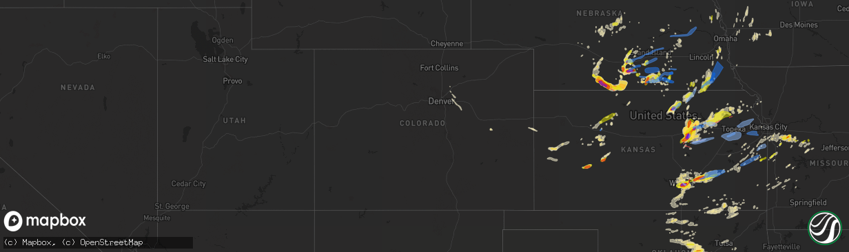
Hail Map in Colorado on April 29, 2022
The weather event in Colorado on April 29, 2022 includes Hail, Wind, and Tornado maps. 8 states and 592 cities were impacted and suffered possible damage. The total estimated number of properties impacted is 0.
Want more than just the map?
Turn this storm into a full workflow.
- Owner + property data so you know who to knock
- OnDemand branded weather history reports to win the "did we even have hail?" argument
- RoofTrace estimate so reps stop guessing numbers at the door
Bought this map? Upgrade within 7 days and we'll credit the $230. (10-15 min setup call)
Hail
Wind
Tornado
0
Estimated number of impacted properties by a 1.00" hail or larger0
Estimated number of impacted properties by a 1.75" hail or larger0
Estimated number of impacted properties by a 2.50" hail or largerStorm reports in Colorado
Colorado
| Date | Description |
|---|---|
| 04/29/20222:12 PM CDT | Report from mping: 1-inch tree limbs broken; shingles blown off. |
| 04/29/20227:43 AM CDT | At 1242 PM MDT, a severe thunderstorm was located 8 miles northwest of Boyero, or 23 miles southeast of Limon, moving southeast at 25 mph. HAZARD...60 mph wind gusts and quarter size hail. SOURCE...Radar indicated. IMPACT...Expect damage to roofs, siding, and trees. Hail damage to vehicles is expected. This severe thunderstorm will be near... Boyero around 100 PM MDT. |
| 04/28/20228:34 PM CDT | Mesonet site just north of yuma. |
| 04/28/20228:21 PM CDT | At 121 PM MDT, a severe thunderstorm was located 12 miles north of Simla, or 22 miles west of Limon, moving southeast at 30 mph. HAZARD...60 mph wind gusts. SOURCE...Radar indicated. IMPACT...Expect damage to roofs, siding, and trees. Locations impacted include... Matheson. |
All States Impacted by Hail Map on April 29, 2022
Cities Impacted by Hail Map on April 29, 2022
- Elwood, NE
- Cozad, NE
- Lexington, NE
- Odessa, MO
- Wilcox, NE
- Minden, NE
- Axtell, NE
- Hildreth, NE
- Stillwater, OK
- Ripley, OK
- Agra, OK
- Cushing, OK
- Stroud, OK
- Yale, OK
- Guide Rock, NE
- Funk, NE
- Holbrook, NE
- Paola, KS
- Depew, OK
- Holden, MO
- Centerview, MO
- Kingsville, MO
- Greenwood, MO
- Bates City, MO
- Peculiar, MO
- Belton, MO
- Warrensburg, MO
- Lone Jack, MO
- Pleasant Hill, MO
- Kansas City, MO
- Raymore, MO
- Lees Summit, MO
- Shelby, NE
- Lewis, IA
- Genoa, NE
- Orleans, NE
- Arapahoe, NE
- Beaver City, NE
- Republican City, NE
- Bloomington, NE
- Alma, NE
- Eustis, NE
- Stamford, NE
- Edison, NE
- Oxford, NE
- Phillipsburg, KS
- Naponee, NE
- Cambridge, NE
- Ottawa, KS
- Princeton, KS
- Sedan, KS
- Elk City, KS
- Covington, OK
- Pleasanton, NE
- Riverdale, NE
- Gibbon, NE
- Ravenna, NE
- Kearney, NE
- Onaga, KS
- Earling, IA
- Dunlap, IA
- Murdock, NE
- Louisville, NE
- Athol, KS
- Cedar, KS
- Kensington, KS
- Gaylord, KS
- Kirwin, KS
- Lancaster, KS
- Everest, KS
- Morrison, OK
- Wichita, KS
- Glencoe, OK
- Concordia, KS
- Appleton City, MO
- Rockville, MO
- Dearing, KS
- Caney, KS
- Wann, OK
- Coffeyville, KS
- Independence, KS
- Ransom, KS
- Green Ridge, MO
- Lincoln, MO
- Cole Camp, MO
- Ionia, MO
- Edgar, NE
- Butler, MO
- Adrian, MO
- El Dorado, KS
- Le Roy, KS
- Neosho Falls, KS
- Colony, KS
- Morrowville, KS
- Washington, KS
- Haddam, KS
- Beatrice, NE
- Lamont, OK
- Eureka, KS
- Bristow, OK
- Deshler, NE
- Oak, NE
- Davenport, NE
- Blue Hill, NE
- Glenvil, NE
- Fairfield, NE
- Lawrence, NE
- Deweese, NE
- Nelson, NE
- Leoti, KS
- Derby, KS
- Campbell, NE
- Pawnee, OK
- Harlan, IA
- Walnut, IA
- Elk Horn, IA
- Kimballton, IA
- Irwin, IA
- Audubon, IA
- Hastings, NE
- Olathe, KS
- Spring Hill, KS
- Prague, OK
- Paden, OK
- Sparks, OK
- Mcconnell Afb, KS
- Hill City, KS
- Collyer, KS
- Morland, KS
- Quinter, KS
- Wakeeney, KS
- Bladen, NE
- Rosalia, KS
- Leon, KS
- Humansville, MO
- Stockton, MO
- Ruskin, NE
- Hettick, IL
- Fullerton, NE
- Pawhuska, OK
- Cimarron, KS
- Holdrege, NE
- Jansen, NE
- Rising City, NE
- Surprise, NE
- Stromsburg, NE
- Osceola, NE
- Gresham, NE
- Ulysses, NE
- White City, KS
- Okemah, OK
- Clifton, KS
- Palmer, KS
- Coweta, OK
- Broken Arrow, OK
- Clay Center, NE
- Sutton, NE
- Harrisonville, MO
- Garden City, MO
- Juniata, NE
- Kenesaw, NE
- Soldier, KS
- Holton, KS
- Abilene, KS
- Woodbine, KS
- Enterprise, KS
- Chapman, KS
- Wakefield, KS
- Junction City, KS
- Cedar Creek, NE
- Springfield, NE
- Weeping Water, NE
- Hendley, NE
- Long Island, KS
- Westmoreland, KS
- Saint George, KS
- Valley Center, KS
- Scott City, KS
- Havensville, KS
- Wamego, KS
- Casey, IA
- Fontanelle, IA
- Greenfield, IA
- Enid, OK
- Kremlin, OK
- Hunter, OK
- Defiance, IA
- Elmwood, NE
- Carleton, NE
- Ness City, KS
- Jetmore, KS
- Arcadia, KS
- Bronaugh, MO
- Liberal, MO
- Agenda, KS
- Clyde, KS
- Aurora, KS
- Belleville, KS
- McCool Junction, NE
- Fairmont, NE
- Jerico Springs, MO
- Lamar, MO
- Avoca, NE
- Anselmo, NE
- Merna, NE
- Ayr, NE
- Tecumseh, NE
- Denver, CO
- Bazine, KS
- Endicott, NE
- Commerce City, CO
- Brighton, CO
- Whitewater, KS
- Wellington, KS
- Belle Plaine, KS
- Ogallah, KS
- Utica, KS
- Augusta, KS
- Douglass, KS
- Kansas City, KS
- Garnett, KS
- Haysville, KS
- Clearwater, KS
- Andover, KS
- Rose Hill, KS
- Blue Springs, NE
- Wymore, NE
- Havana, KS
- Niotaze, KS
- Fort Riley, KS
- Hope, KS
- Gypsum, KS
- Riley, KS
- Milford, KS
- Wagoner, OK
- Atchison, KS
- Fontana, KS
- Windsor, MO
- Sedalia, MO
- Knob Noster, MO
- La Monte, MO
- Chilhowee, MO
- S Coffeyville, OK
- Linn, KS
- Columbus, NE
- Shawnee, OK
- Drumright, OK
- Chandler, OK
- Perry, OK
- Tryon, OK
- Perkins, OK
- Manley, NE
- Superior, NE
- Hardy, NE
- Byron, NE
- Republic, KS
- Wetmore, KS
- Circleville, KS
- Netawaka, KS
- Hillsboro, KS
- Valley Falls, KS
- Effingham, KS
- Muscotah, KS
- Wilburton, OK
- Peru, KS
- Salix, IA
- Manhattan, KS
- Belvue, KS
- Doniphan, NE
- Wood River, NE
- Unadilla, NE
- Palmyra, NE
- Westerville, NE
- Ansley, NE
- Hillview, IL
- White Hall, IL
- Mayfield, KS
- Lenapah, OK
- Delaware, OK
- Benton, KS
- Arapahoe, CO
- Boley, OK
- Castle, OK
- Seminole, OK
- Palco, KS
- Plainville, KS
- Bridgewater, IA
- Oakley, KS
- Tribune, KS
- Winona, KS
- Nevada, MO
- Heartwell, NE
- Brady, NE
- Watkins, CO
- Aurora, CO
- Overland Park, KS
- Stilwell, KS
- Wewoka, OK
- Douglas, OK
- Diller, NE
- Fairbury, NE
- Bucyrus, KS
- Red Rock, OK
- Atlantic, IA
- Griswold, IA
- Manilla, IA
- Hiawatha, KS
- Saint Joseph, MO
- Ponca City, OK
- Blackwell, OK
- Tonkawa, OK
- Osceola, MO
- Shelby, IA
- Peck, KS
- Sedgwick, KS
- Maize, KS
- Mulvane, KS
- Towanda, KS
- Newton, KS
- Milan, KS
- Kechi, KS
- South Haven, KS
- Caldwell, KS
- Broken Bow, NE
- Greenfield, IL
- Palmyra, IL
- Pearl, IL
- Emmett, KS
- Moline, KS
- Cedar Vale, KS
- Tampa, KS
- Copan, OK
- Welda, KS
- Earlsboro, OK
- Bennett, CO
- Callaway, NE
- Clay Center, KS
- Talmage, KS
- Longford, KS
- Herington, KS
- Roodhouse, IL
- Pomona, KS
- Richmond, KS
- Westphalia, KS
- Brownell, KS
- Comstock, NE
- Ord, NE
- Shidler, OK
- Garber, OK
- Billings, OK
- Dadeville, MO
- Aldrich, MO
- Maxwell, NE
- Saint Libory, NE
- Grand Island, NE
- Chapman, NE
- Columbus, KS
- Milo, MO
- Sheldon, MO
- Weskan, KS
- Burlington, CO
- Sargent, NE
- Burwell, NE
- Hepler, KS
- Farlington, KS
- Mound Valley, KS
- Altamont, KS
- Medford, OK
- Edna, KS
- Lakin, KS
- Pleasanton, KS
- Decatur, NE
- Tekamah, NE
- Yates Center, KS
- Parker, KS
- La Cygne, KS
- Holstein, NE
- Fort Lupton, CO
- Adams, NE
- Sterling, NE
- Lewiston, NE
- Virginia, NE
- Filley, NE
- Crab Orchard, NE
- Kingsley, IA
- Liberty, KS
- Burchard, NE
- Orlando, OK
- Cumberland, IA
- Wiota, IA
- Goodland, KS
- Boelus, NE
- Rockville, NE
- Benedict, NE
- Chetopa, KS
- Henderson, NE
- Bradshaw, NE
- Shelton, NE
- Dighton, KS
- North Fort Myers, FL
- Punta Gorda, FL
- Hugo, CO
- Dwight, KS
- Alta Vista, KS
- Gove, KS
- Neola, IA
- McClelland, IA
- Minden, IA
- Osawatomie, KS
- Wetumka, OK
- Oketo, KS
- Cairo, NE
- Lane, KS
- Rantoul, KS
- Marshall, OK
- Lucien, OK
- Solomon, KS
- Paxico, KS
- Saint Marys, KS
- Delia, KS
- Alma, KS
- Goff, KS
- Greenwich, KS
- Deer Creek, OK
- Ramona, KS
- Lost Springs, KS
- Fort Gibson, OK
- Mora, MO
- Smithton, MO
- Oak Grove, MO
- Grain Valley, MO
- Burns, KS
- Hamilton, KS
- Piedmont, KS
- Virgil, KS
- Saint Edward, NE
- York, NE
- Grafton, NE
- Fort Myers, FL
- Courtland, KS
- Odell, NE
- Mindenmines, MO
- Chautauqua, KS
- Nebo, IL
- Grandview, MO
- Greeley, KS
- Pickrell, NE
- Lebo, KS
- Guthrie, OK
- Geneva, NE
- Grenola, KS
- Elyria, NE
- El Dorado Springs, MO
- Arnold, NE
- Morganville, KS
- Piqua, KS
- Mcalester, OK
- Horton, KS
- Vail, IA
- Denison, IA
- Glasco, KS
- Williamsburg, KS
- Hartshorne, OK
- Pond Creek, OK
- Cummings, KS
- Farnam, NE
- Tyro, KS
- Dewey, OK
- Dexter, KS
- Goddard, KS
- Riverton, IA
- Hamburg, IA
- Damar, KS
- Scotia, NE
- Nehawka, NE
- Indianola, OK
- Lowry City, MO
- Herman, NE
- Arlington, NE
- Craig, NE
- North Platte, NE
- Hoxie, KS
- Palmer, NE
- Marysville, KS
- Hanover, KS
- Barneston, NE
- Bremen, KS
- Liberty, NE
- Leonardville, KS
- Carney, OK
- Meeker, OK
- Davenport, OK
- Amoret, MO
- Pleasant Hill, IL
- Maple City, KS
- Stockton, KS
- Healy, KS
- Potwin, KS
- Hancock, IA
- Avoca, IA
- Panama, IA
- Bogue, KS
- Wellston, OK
- Amsterdam, MO
- Archie, MO
- Persia, IA
- Logan, IA
- Mayetta, KS
- Mahaska, KS
- Hollenberg, KS
- Porter, OK
- Hornick, IA
- Bronson, IA
- Moville, IA
- Tulsa, OK
- Owasso, OK
- Clarkson, NE
- Mound City, KS
- Centerville, KS
- Woodbine, IA
- Portsmouth, IA
- Sloan, IA
- Sergeant Bluff, IA
- Strasburg, CO
- Geuda Springs, KS
- Red Oak, OK
- Ingalls, KS
- Alda, NE
- Phillips, NE
- Marquette, NE
- Harvard, NE
- Inland, NE
- Roseland, NE
- Trumbull, NE
- Giltner, NE
- Hebron, NE
- Red Cloud, NE
- Shickley, NE
- Ong, NE
- Strang, NE
- Syracuse, NE
- Murray, NE
- Union, NE
- Cook, NE
- Brock, NE
- Lorton, NE
- Dunbar, NE
- Plattsmouth, NE
- Otoe, NE
- Steinauer, NE
- Talmage, NE
- Burr, NE
- Nebraska City, NE
- Schuyler, NE
- Silver Creek, NE
- Dodge, NE
- Linwood, NE
- Rogers, NE
- North Bend, NE
- David City, NE
- Bellwood, NE
- Ogden, KS
- Council Grove, KS
- Harveyville, KS
- Berryton, KS
- Burlingame, KS
- Scranton, KS
- Lecompton, KS
- Eskridge, KS
- Tecumseh, KS
- Wakarusa, KS
- Auburn, KS
- Topeka, KS
- Carbondale, KS
- Overbrook, KS
- Easton, KS
- Leavenworth, KS
- Tonganoxie, KS
- Oskaloosa, KS
- Grantville, KS
- Ozawkie, KS
- Meriden, KS
- McLouth, KS
- Perry, KS
- Bonner Springs, KS
- De Soto, KS
- Lawrence, KS
- Eudora, KS
- Linwood, KS
- Louisburg, KS
- Cleveland, MO
- Hughesville, MO


