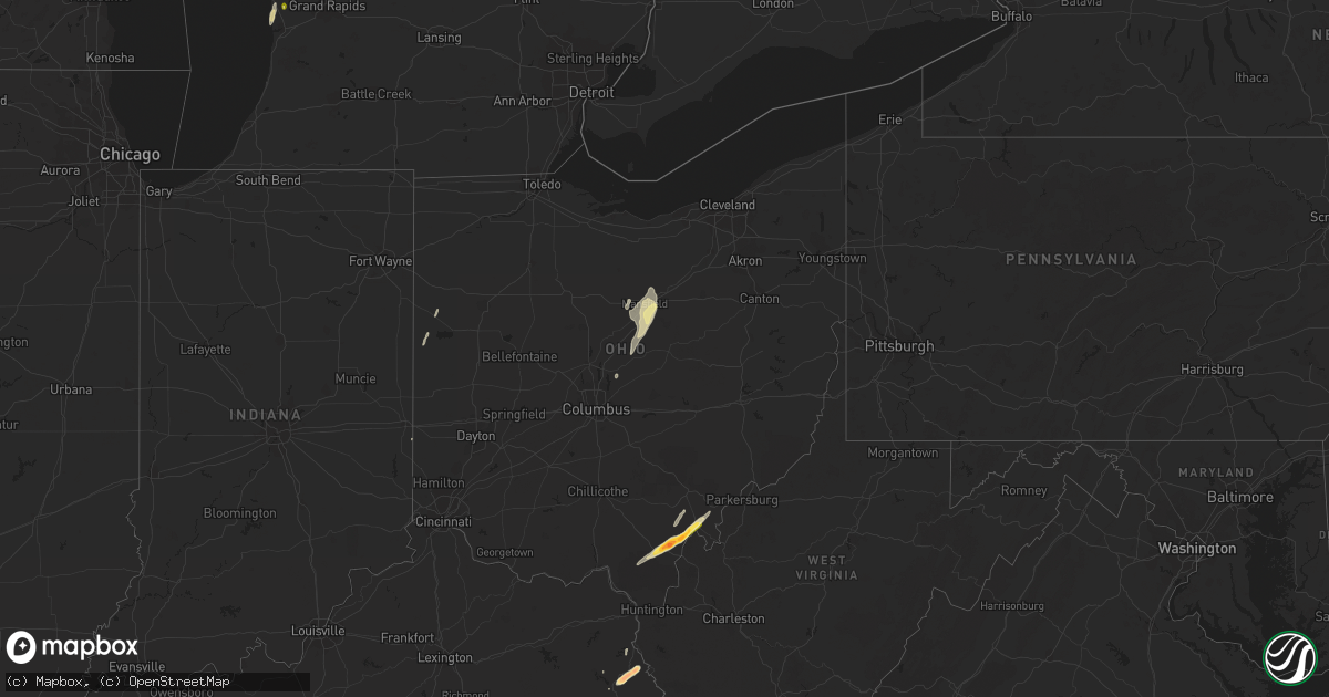
Hail Map in Ohio on April 29, 2014
Get this storm
April 29 map
$229
one time, instant access
Download today. No call, no setup
Keep the $229
Bought the map and want the full workflow? Apply the entire $229 to a subscription within 7 days. None of it is wasted.
Every map, not just this one
This buys you this map. Subscription and you get every map we run, in the markets you choose from a few cities to whole states to nationwide. Plus real-time alerts the moment a storm fires.
Contact data
Name, contact info, occupancy, even credit band for addresses in the footprint. You go from where it hit to who to call.
Become the source they trust
Unlimited branding weather history reports on demand. You already have the documented answer ready for the property owner, and you are the one who showed up with it.
Property data and RoofTrace estimates
Pull up any address you have got, its value and the exact code rules for that jurisdiction, straight from One Click Code. Then RoofTrace estimates the squares, pitch, and roof value, priced the way you price.
Storm reports in Ohio
Ohio
| Date | Description |
|---|---|
| 04/29/20146:58 PM CDT | Trees downed |
| 04/29/20146:45 PM CDT | Gutter torn off building by thunderstorm winds |
| 04/29/20146:29 PM CDT | A tree was downed on church street in millageville. |
| 04/29/20146:23 PM CDT | A tree was downed and damage occurred to a well due to thunderstorm winds. |
| 04/29/20146:15 PM CDT | Barn destroyed on miami trace rd. |
| 04/29/20146:13 PM CDT | Measured on home weather station. Tree and limbs downed. Greenhouse damaged. |
| 04/29/20146:04 PM CDT | Barn heavily damaged |
| 04/29/20146:00 PM CDT | A couple of tree limbs were downed due to thudnerstorm winds. |
| 04/29/20145:47 PM CDT | Several power poles were downed due to thudnerstorm winds. |
| 04/29/20145:43 PM CDT | A tree was reported down in a street in pleasant ridge. |
| 04/29/20145:39 PM CDT | Trees and wires were reported down in bethel due to thunderstorm winds. |
| 04/29/20145:38 PM CDT | A tree was downed on a car and clipped a house near water street and spice street. |
| 04/29/20145:34 PM CDT | A tree was reported down on a roof in east walnut hills. |
| 04/28/20149:04 PM CDT | Quarter size hail observed |
| 04/28/20148:58 PM CDT | Reported by 911 dispatcher. |
| 04/28/20148:52 PM CDT | Web report with photo. Fell along oxyer rd off st rt 554. Timed from radar. |
| 04/28/20148:50 PM CDT | 1 inch hail estimated. Wind gusts estimated at 60 mph. |
| 04/28/20148:46 PM CDT | At least one inch hail in kerr ohio |
| 04/28/20148:40 PM CDT | Web report with photo. Fell along bullaville rd. |
| 04/28/20148:22 PM CDT | A local report indicates 1.00 inch wind near PERRYSVILLE |
| 04/28/20148:10 PM CDT | Trailer collapsed near mock road...some people could be trapped. |
| 04/28/20148:10 PM CDT | Winds up to 50 mph. |
| 04/28/20148:10 PM CDT | Some trees down. |
| 04/28/20148:07 PM CDT | A local report indicates 61 MPH wind near MANSFIELD |
| 04/28/20148:05 PM CDT | Some trees down. |
| 04/28/20148:00 PM CDT | A local report indicates 1.00 inch wind near 5 E BUCYRUS |
| 04/28/20148:00 PM CDT | A local report indicates 60 MPH wind near 5 E BUCYRUS |
| 04/28/20148:00 PM CDT | *** 1 inj *** mobile home flipped. A possible inury. |
| 04/28/20147:50 PM CDT | Roof off a barn. |
| 04/28/20147:45 PM CDT | A tree and a large limb down. |
| 04/28/20147:40 PM CDT | Some trees down. |
| 04/28/20147:30 PM CDT | Many trees down across the county. |
| 04/28/20147:30 PM CDT | A few trees downed in the area |
| 04/28/20147:21 PM CDT | A roof was blown off of a structure in delaware due to thunderstorm winds. |
| 04/28/20147:17 PM CDT | A local report indicates 61 MPH wind near KDLZ DELAWARE APT |
| 04/28/20147:12 PM CDT | A local report indicates 60 MPH wind near 4 NW WESTERVILLE |
| 04/28/20147:06 PM CDT | A local report indicates 61 MPH wind near KOSU OSU AIRPORT |
| 04/28/20147:04 PM CDT | A local report indicates 75 MPH wind near 2 SSW HILLIARD |
| 04/28/20147:03 PM CDT | Downed tree limbs and power lines blocked the roadway near brand and coffman |
| 04/28/20147:00 PM CDT | Time estimated |
All States Impacted by Hail Map on April 29, 2014
Cities Impacted by Hail Map on April 29, 2014
- Millbrook, AL
- Prattville, AL
- Wetumpka, AL
- Lowndesboro, AL
- Coosada, AL
- Montgomery, AL
- Fredericktown, OH
- Mansfield, OH
- Lucas, OH
- Bellville, OH
- Wilson, NC
- Remus, MI
- Six Lakes, MI
- Lakeview, MI
- Blanchard, MI
- Camden, AL
- Bidwell, OH
- Gallipolis, OH
- Monticello, MS
- Prentiss, MS
- Sontag, MS
- Silver Creek, MS
- Trufant, MI
- Coral, MI
- Howard City, MI
- Cedar Springs, MI
- Pierson, MI
- Sand Lake, MI
- East Palatka, FL
- Palatka, FL
- Hayneville, AL
- Eclectic, AL
- Kenly, NC
- Kent City, MI
- Sparta, MI
- Live Oak, FL
- White Springs, FL
- Roseboro, NC
- Autryville, NC
- Salemburg, NC
- Lena, MS
- Walnut Grove, MS
- Carthage, MS
- Philadelphia, MS
- Scotland Neck, NC
- Farmville, NC
- Fountain, NC
- Amite, LA
- Roseland, LA
- Black Creek, NC
- Lucama, NC
- Elm City, NC
- Jacksonville, FL
- Bogue Chitto, MS
- Brookhaven, MS
- Aberdeen, MS
- Coleman, MI
- Mendon, OH
- Rockford, OH
- Florala, AL
- Sanderson, FL
- Louisa, KY
- Ulysses, KY
- River, KY
- Polk City, FL
- Clermont, FL
- Groveland, FL
- Cheshire, OH
- Dudley, NC
- Beatrice, AL
- Franklin, AL
- Pine Apple, AL
- Vredenburgh, AL
- Dillon, SC
- Hamer, SC
- Walstonburg, NC
- Greenville, NC
- Hookerton, NC
- Okolona, MS
- Beaumont, MS
- New Augusta, MS
- Tutor Key, KY
- Lowmansville, KY
- Paintsville, KY
- Tomahawk, KY
- Logan, AL
- Cullman, AL
- Crane Hill, AL
- Conklin, MI
- Casnovia, MI
- Lake City, FL
- Macclesfield, NC
- Stantonsburg, NC
- Fremont, NC
- Middleport, OH
- Vinton, OH
- Coden, AL
- Cove City, NC
- Trenton, NC
- Mount Pleasant, MI
- Clare, MI
- Rosebush, MI
- Sims, NC
- Grant, MI
- Thurman, OH
- Long Bottom, OH
- Pomeroy, OH
- Rio Grande, OH
- Patriot, OH
- Oak Hill, OH
- Farwell, MI
- Lake, MI
- Parkton, NC
- Wade, NC
- Hope Mills, NC
- Fayetteville, NC
- Butler, OH
- Spring Hope, NC
- Bailey, NC
- Ocala, FL
- Lake Panasoffkee, FL
- Sandgap, KY
- McKee, KY
- Saucier, MS
- Vancleave, MS
- Raeford, NC
- Kingsland, GA
- Pinconning, MI
- Rhodes, MI
- Bentley, MI
- Halifax, NC
- Enfield, NC
- Amory, MS
- Smithville, MS
- Rockford, MI
- Newaygo, MI
- Comstock Park, MI
- Morley, MI
- Mecosta, MI
- Edmore, MI
- Weidman, MI
- Stanwood, MI
- Red Springs, NC
- Pinetops, NC
- Saint Marys, GA
- Yulee, FL
- Richmond, IN
- Snow Hill, NC
- La Grange, NC
- Reddick, FL
- Williston, FL
- Micanopy, FL
- Tyler, AL
- Kentwood, LA
- Greensburg, LA
- Lake Wales, FL
- Smithfield, NC
- Clayton, NC
- Kissimmee, FL
- Plant City, FL
- Valrico, FL
- Riverview, FL
- Dover, FL
- Lithia, FL
- Frostproof, FL
- Stedman, NC
- Holland, MI
- West Olive, MI
- Mount Vernon, KY
- Linwood, MI
- Tuscumbia, AL
- Wiggins, MS
- Perkinston, MS
- Zellwood, FL
- Apopka, FL
- Hawthorne, FL
- Albany, OH
- Rutland, OH
- Langsville, OH
- Fernandina Beach, FL
- Rich Square, NC
- Perry, FL
- Coopersville, MI
- Satsuma, FL
- San Mateo, FL
- Hastings, FL
- Bunnell, FL
- Interlachen, FL
- Slaughter, LA
- Zachary, LA
- Pikeville, NC
- Thelma, KY
- Moultrie, GA
- Doerun, GA
- Beaverton, MI
- Dunn, NC
- Inez, KY
- Williamsport, KY
- Rowland, NC
- Pembroke, NC
- Lumberton, NC
- Hagerhill, KY
- Glen Saint Mary, FL
- Macclenny, FL
- Rocky Mount, NC
- Grand Bay, AL
- Bayou La Batre, AL
- Dade City, FL
- Hilliard, FL
- Callahan, FL
- Lucedale, MS
- Somerset, KY
- Princeton, NC
- Clinton, NC
- Pass Christian, MS
- Bay Saint Louis, MS
- Waveland, MS
- Tallahassee, FL
- Monticello, FL
- Starke, FL
- Lawtey, FL
- Lake Butler, FL
- Oviedo, FL
- New Brockton, AL
- Brooksville, FL
- Windermere, FL
- Winter Garden, FL
- Poplarville, MS
- Grand Haven, MI
- Pine Top, KY
- Mallie, KY
- Crescent City, FL
- Cherokee, AL
- Florence, AL
- Zebulon, NC
- Louisburg, NC
- Grifton, NC
- Indian Lake Estates, FL
- Coldwater, OH
- Celina, OH
- Fort Recovery, OH
- Diberville, MS
- Biloxi, MS
- Vanceboro, NC
- Elba, AL
- Reedsville, OH
- Mason, WV
- Racine, OH
- Fairmont, NC
- Theodore, AL
- Mobile, AL
- New Smyrna Beach, FL
- Linden, NC
- Fort Bragg, NC
- Lumber Bridge, NC
- Godwin, NC
- Galion, OH
- Melrose, FL
- Gladwin, MI
- Tarboro, NC
- Georgetown, FL
- Kawkawlin, MI
- Mount Olive, NC
- Goldsboro, NC
- Kinston, NC
- Seven Springs, NC
- McHenry, MS
- Pine Hill, AL
- Minter, AL
- Coy, AL
- Pomona Park, FL
- Lillington, NC
- Bunnlevel, NC
- Erwin, NC
- Morrison, TN
- Newton Grove, NC
- Benson, NC
- Gulfport, MS
- Sunbury, OH
- Thomaston, AL
- Catherine, AL
- Greenwell Springs, LA
- Four Oaks, NC
- Collins, MS
- Smithdale, MS
- Coolville, OH
- Mount Vernon, OH
- Ashland, OH
- Shiloh, OH
- Flatgap, KY
- Marne, MI
- Grand Rapids, MI
- Saint George, GA
- Seville, FL
- Pierson, FL
- Midland, MI
- Hope, MI
- Selma, NC
- Middlesex, NC
- Florahome, FL
- Saraland, AL
- Dover, NC
- Orlando, KY
- Livingston, KY
- West Columbia, WV


