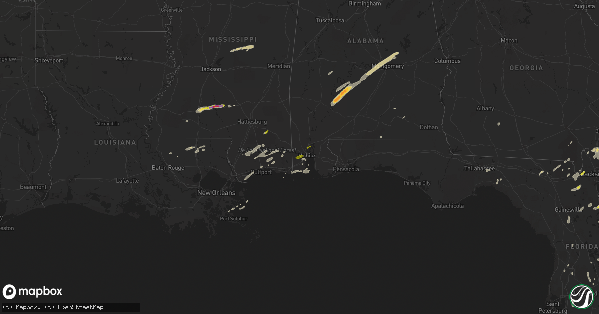
Hail Map on April 29, 2014
Get this storm
April 29 map
$229
one time, instant access
Download today. No call, no setup
Keep the $229
Bought the map and want the full workflow? Apply the entire $229 to a subscription within 7 days. None of it is wasted.
Every map, not just this one
This buys you this map. Subscription and you get every map we run, in the markets you choose from a few cities to whole states to nationwide. Plus real-time alerts the moment a storm fires.
Contact data
Name, contact info, occupancy, even credit band for addresses in the footprint. You go from where it hit to who to call.
Become the source they trust
Unlimited branding weather history reports on demand. You already have the documented answer ready for the property owner, and you are the one who showed up with it.
Property data and RoofTrace estimates
Pull up any address you have got, its value and the exact code rules for that jurisdiction, straight from One Click Code. Then RoofTrace estimates the squares, pitch, and roof value, priced the way you price.
States Impacted by Hail Map on April 29, 2014
Storm reports
Ohio
| Date | Description |
|---|---|
| 04/29/20146:58 PM CDT | Trees downed |
| 04/29/20146:45 PM CDT | Gutter torn off building by thunderstorm winds |
| 04/29/20146:29 PM CDT | A tree was downed on church street in millageville. |
| 04/29/20146:23 PM CDT | A tree was downed and damage occurred to a well due to thunderstorm winds. |
| 04/29/20146:15 PM CDT | Barn destroyed on miami trace rd. |
| 04/29/20146:13 PM CDT | Measured on home weather station. Tree and limbs downed. Greenhouse damaged. |
| 04/29/20146:04 PM CDT | Barn heavily damaged |
| 04/29/20146:00 PM CDT | A couple of tree limbs were downed due to thudnerstorm winds. |
| 04/29/20145:47 PM CDT | Several power poles were downed due to thudnerstorm winds. |
| 04/29/20145:43 PM CDT | A tree was reported down in a street in pleasant ridge. |
| 04/29/20145:39 PM CDT | Trees and wires were reported down in bethel due to thunderstorm winds. |
| 04/29/20145:38 PM CDT | A tree was downed on a car and clipped a house near water street and spice street. |
| 04/29/20145:34 PM CDT | A tree was reported down on a roof in east walnut hills. |
| 04/28/20149:04 PM CDT | Quarter size hail observed |
| 04/28/20148:58 PM CDT | Reported by 911 dispatcher. |
| 04/28/20148:52 PM CDT | Web report with photo. Fell along oxyer rd off st rt 554. Timed from radar. |
| 04/28/20148:50 PM CDT | 1 inch hail estimated. Wind gusts estimated at 60 mph. |
| 04/28/20148:46 PM CDT | At least one inch hail in kerr ohio |
| 04/28/20148:40 PM CDT | Web report with photo. Fell along bullaville rd. |
| 04/28/20148:22 PM CDT | A local report indicates 1.00 inch wind near PERRYSVILLE |
| 04/28/20148:10 PM CDT | Some trees down. |
| 04/28/20148:10 PM CDT | Winds up to 50 mph. |
| 04/28/20148:10 PM CDT | Trailer collapsed near mock road...some people could be trapped. |
| 04/28/20148:07 PM CDT | A local report indicates 61 MPH wind near MANSFIELD |
| 04/28/20148:05 PM CDT | Some trees down. |
| 04/28/20148:00 PM CDT | *** 1 inj *** mobile home flipped. A possible inury. |
| 04/28/20148:00 PM CDT | A local report indicates 1.00 inch wind near 5 E BUCYRUS |
| 04/28/20148:00 PM CDT | A local report indicates 60 MPH wind near 5 E BUCYRUS |
| 04/28/20147:50 PM CDT | Roof off a barn. |
| 04/28/20147:45 PM CDT | A tree and a large limb down. |
| 04/28/20147:40 PM CDT | Some trees down. |
| 04/28/20147:30 PM CDT | Many trees down across the county. |
| 04/28/20147:30 PM CDT | A few trees downed in the area |
| 04/28/20147:21 PM CDT | A roof was blown off of a structure in delaware due to thunderstorm winds. |
| 04/28/20147:17 PM CDT | A local report indicates 61 MPH wind near KDLZ DELAWARE APT |
| 04/28/20147:12 PM CDT | A local report indicates 60 MPH wind near 4 NW WESTERVILLE |
| 04/28/20147:06 PM CDT | A local report indicates 61 MPH wind near KOSU OSU AIRPORT |
| 04/28/20147:04 PM CDT | A local report indicates 75 MPH wind near 2 SSW HILLIARD |
| 04/28/20147:03 PM CDT | Downed tree limbs and power lines blocked the roadway near brand and coffman |
| 04/28/20147:00 PM CDT | Time estimated |
Georgia
| Date | Description |
|---|---|
| 04/29/20147:40 AM CDT | 1 tree uprooted and blocked a road. 1 power line downed. 1 cable line downed. |
| 04/29/20147:25 AM CDT | Trees down across county. Time estimated by radar. |
| 04/29/20142:58 AM CDT | Building collapsed at martin recycling company in donalsonville. |
| 04/29/20142:55 AM CDT | Tree across the road at highway 91 and river road. |
Alabama
| Date | Description |
|---|---|
| 04/29/20146:35 PM CDT | Multiple trees were knocked down on brownsferry road at near the four way stop at mooresville road. |
| 04/29/20146:35 PM CDT | Trees were knocked down and damage to outbuildings in the area at browns ferry road at gray road. |
| 04/29/20143:50 AM CDT | Quarter size hail in cotton lakes subdivision. |
| 04/29/20143:40 AM CDT | Quarter size hail. |
| 04/28/20149:09 PM CDT | Quarter sized hail at the oakland fire department. |
Mississippi
| Date | Description |
|---|---|
| 04/29/20145:30 PM CDT | A local report indicates 1.00 inch wind near SILVER CREEK |
| 04/29/20145:05 PM CDT | Reported in the new zion area |
| 04/29/20144:59 PM CDT | Occurring on us 84 at the fair river community |
| 04/29/20144:05 PM CDT | The roof of a porch was blown some 200 ft where it damaged a power line and power pole. Skirting on a mobile home was also thrown. This occurred along hwy 427 about 0.5 |
Indiana
| Date | Description |
|---|---|
| 04/29/20145:06 PM CDT | Trees and power lines were downed in the eastern portions of warsaw county. Two of these trees were located along ambrose road off of highway 42. |
North Carolina
| Date | Description |
|---|---|
| 04/29/20146:49 PM CDT | Fire dept reported tornado on the ground near shine. |
| 04/29/20146:41 PM CDT | Spotter reports tornado on the ground east of autryville... Report unconfirmed at this time |
| 04/29/20146:35 PM CDT | A local report indicates 1.00 inch wind near SALEMBURG |
| 04/29/20146:33 PM CDT | Quarter size hail |
| 04/29/20145:20 PM CDT | Tornado touchdown on mooring road. Roof blown off a residence. Numerous downed trees. Many other reports of minor structural damage and downed trees in this general are |
| 04/29/20144:56 PM CDT | County 911 reports debris blown across old wilson road. |
| 04/29/20144:35 PM CDT | A local report indicates 1.00 inch wind near 4 NNW HOPE MILLS |
| 04/29/20144:22 PM CDT | A local report indicates 60 MPH wind near FARMVILLE |
| 04/29/20144:20 PM CDT | Quarter size hail reported in farmville. |
| 04/29/20143:52 PM CDT | Quarter size hail at east langley road and bridgersville road |
| 04/29/20143:26 PM CDT | Golf ball size hail at tarboro st and glendale st |
| 04/29/20143:13 PM CDT | Golf ball size hail at the 911 center |
| 04/29/20143:12 PM CDT | Quarter to half dollar size hail covering the ground at tarboro st and glendale st |
| 04/29/20143:11 PM CDT | Golf ball size hail at hwy 117 |
| 04/29/20142:56 PM CDT | Damage to homes at hancock and john nunnery road |
| 04/29/20142:26 PM CDT | 2 trees down across the road at hwy 27 e and hwy 421 |
| 04/29/20142:26 PM CDT | 2 trees down across road at hwy 27e and hwy 421 near buies creek |
| 04/29/20141:26 PM CDT | Tornado observed while driving south on hwy-70 |
| 04/29/20141:25 PM CDT | Tornado briefly touched down in field between hwy-70 and cove city |
| 04/29/20141:10 PM CDT | A local report indicates 1.75 inch wind near 2 SSW COVE CITY |
| 04/28/20147:10 PM CDT | Possible tornado touchdown near intersection of juniper and church roads. Damage included a single-wide with significant damage and several out buildings destroyed. |
| 04/28/20147:04 PM CDT | Tornado reported on the ground near honeycutt road near salemburg... Report 3rd hand from scanner via skywarn |
Florida
| Date | Description |
|---|---|
| 04/29/20145:30 PM CDT | A few tree limbs reported down in st augustine. Time estimated from radar imagery. |
| 04/29/20145:30 PM CDT | A few tree limbs reported down in st augustine. Time estimated from radar imagery. |
| 04/29/20145:00 PM CDT | Two manufactured homes...1 major damage with roof peeled off substantially and carport destroyed...1 minor with partial roof peeled and carport damage...small shed dama |
| 04/29/20143:00 PM CDT | The 911 center reported around 500 feet of powerlines downed due to thunderstorm winds. |
| 04/29/20142:30 PM CDT | Photos of hail on first coast news website. Size of hail estimated from photo of hail in subjects hand. |
| 04/29/20149:10 AM CDT | A few trees down in northern and eastern leon county. A couple down on power lines. |
| 04/29/20143:00 AM CDT | Barn blown down near altha. Reported by public on the wdhn news facebook page |
| 04/29/20142:49 AM CDT | Numerous trees snapped in half near the intersection of highway 231 and county road 162 east. |
| 04/29/20142:47 AM CDT | One house completely destoryed at the intersection of 77 and tri county road. Another home on tri county road with roof damage. |
| 04/29/20142:30 AM CDT | Numerous trees down across the county |
| 04/29/20141:55 AM CDT | Numerous trees snapped in half near the intersection of highway 231 and county road 162 east. Corrected time of event. |
| 04/29/20141:52 AM CDT | A second tornado was confirmed in jackson county fl starting along highway 231 southeast of campbellton with a few trees blown over and snapped. There was evidence of s |
| 04/29/20141:47 AM CDT | One house completely destoryed at the intersection of 77 and tri county road. Another home on tri county road with roof damage. Corrected time of event. |
| 04/29/20141:44 AM CDT | This tornado touched down a half mile or so east ofhighway 77 south of graceville. Damage was mostly to trees. However...several homes were damaged. One was severely da |
| 04/29/20141:28 AM CDT | Several trees down in the county |
| 04/29/20141:20 AM CDT | Tree fell on a house on owens community road near vernon. |
| 04/29/20141:00 AM CDT | Tree down on bay grove road. |
| 04/29/201412:45 AM CDT | Spotter estimated wind gust of 60 mph. |
| 04/29/201412:30 AM CDT | Tree down on main street and davis street. Power lines down on graham ave |
| 04/29/201412:30 AM CDT | Spotter estimated gusts of 60 to 70 mph in the de funiak springs area with dime size hail. |
| 04/28/201411:53 PM CDT | Tree down on house on long road. No injuries. |
| 04/28/201411:05 PM CDT | Tree down on house on long road. No injuries. Corrected time of event. |
| 04/28/201410:15 PM CDT | Large trees down and a roof was ripped off a house at duke airfield just south of crestview. |
West Virginia
| Date | Description |
|---|---|
| 04/29/20142:25 PM CDT | Numerous tress down along toms creek rd. Timed from radar. |
Illinois
| Date | Description |
|---|---|
| 04/29/201411:20 AM CDT | Brief touch down. No damages reported. |
Kentucky
| Date | Description |
|---|---|
| 04/29/20145:25 PM CDT | A local report indicates 60 MPH wind near FLORENCE |
| 04/29/20144:46 PM CDT | Trees downed |
| 04/29/20144:40 PM CDT | Dispatch reports a couple of trees down near the henry...owen county border on lead mine road |
| 04/29/20144:31 PM CDT | Dispatch reports several trees down across the eastern and northern portions of shelby county |
| 04/29/20144:26 PM CDT | Broadcast media relayed report of damage to sky lights on home in shelbyville |
| 04/29/20144:20 PM CDT | Picture on facebook of tree down in downtown shelbyville |
| 04/29/20143:52 PM CDT | Picture on twitter via broadcast media of a large portion of a tree knocked over in bloomfield |
| 04/29/20142:27 PM CDT | Web report...picture of approximately 3 inch hail. |
| 04/28/20148:52 PM CDT | This is a public report via twitter. |
| 04/28/20148:29 PM CDT | Quarter size hail observed in grayson |
| 04/28/20148:25 PM CDT | This is a public report via twitter. |
| 04/28/20148:15 PM CDT | Nickel to quarter sized hail reported in blackey. |
| 04/28/20147:53 PM CDT | The time of the event is estimated from radar. |
| 04/28/20147:30 PM CDT | A local report indicates 1.00 inch wind near 1 S MOUNT VERNON |
Colorado
| Date | Description |
|---|---|
| 04/29/201411:27 AM CDT | A local report indicates 58 MPH wind near 11 E PARKER |
Michigan
| Date | Description |
|---|---|
| 04/29/20145:49 PM CDT | Two trees uprooted at magrudder and isabella/m-20 |
| 04/29/20145:48 PM CDT | Trailer flipped on side off of south magrudder rd. |
| 04/29/20145:20 PM CDT | Hail duration 13 minutes |
| 04/29/20144:58 PM CDT | A local report indicates 1.00 inch wind near BLANCHARD |
| 04/29/20144:56 PM CDT | Hail the size of a half dollar fell for 11 minutes. |
| 04/29/20144:50 PM CDT | A local report indicates 1.25 inch wind near 3 SE BLANCHARD |
| 04/29/20144:42 PM CDT | A local report indicates 1.00 inch wind near 2 WSW MECOSTA |
| 04/29/20144:42 PM CDT | A local report indicates 1.00 inch wind near SIX LAKES |
| 04/29/20144:40 PM CDT | Photo sent to fox 17 from public. Courtesy of fox 17 live blog. Time is estimated by radar |
| 04/29/20144:40 PM CDT | Picture sent in to local broadcast media. Courtesy of fox 17. Time estimated by radar. |
| 04/29/20144:35 PM CDT | Hail photo sent to local broadcast media blog. Courtesy of fox 17 |
| 04/29/20144:28 PM CDT | A local report indicates 1.50 inch wind near 3 NNE LANGSTON |
| 04/29/20144:18 PM CDT | Ham radio operator forwarded photos of a snapped tree that had a diameter of 6 inches. Tree damage was isolated amongst several other smaller branches. Time estimated b |
| 04/29/20143:55 PM CDT | Received photos from the public. Time estimated by radar. |
| 04/29/20143:49 PM CDT | Relayed report from the south end of sparta |
| 04/29/20141:50 PM CDT | Traveler southbound us31 between m45 and stanton reports up to quarter-size hail. Time estimated from radar. |
| 04/28/20149:34 PM CDT | Trees downed at colwood and east cass city roads |
| 04/28/20149:26 PM CDT | Trees down at gun club road and weeden road |
| 04/28/20149:06 PM CDT | Large tree downed and blocking haines road west of grosbeck |
| 04/28/20148:35 PM CDT | A local report indicates 58 MPH wind near 4 E FENTON |
| 04/28/20148:23 PM CDT | Wires downed on mobile home causing it to catch fire |
| 04/28/20148:21 PM CDT | Tree reported down on a car at davista and orchard near duck lake |
| 04/28/20148:08 PM CDT | Powerlines reported downed at nine mile and beck roads. Also dime sized hail reported |
| 04/28/20148:05 PM CDT | Tree blown down at 8 mile and griswold roads |
| 04/28/20148:00 PM CDT | 3 foot tree limb fell on 2 cars at the dexter dental office. |
| 04/28/20148:00 PM CDT | 2 foot tree limbs down at mast rd and n territorial rd. |
Cities Impacted by Hail Map on April 29, 2014
- Millbrook, AL
- Prattville, AL
- Wetumpka, AL
- Lowndesboro, AL
- Coosada, AL
- Montgomery, AL
- Fredericktown, OH
- Mansfield, OH
- Lucas, OH
- Bellville, OH
- Wilson, NC
- Remus, MI
- Six Lakes, MI
- Lakeview, MI
- Blanchard, MI
- Camden, AL
- Bidwell, OH
- Gallipolis, OH
- Monticello, MS
- Prentiss, MS
- Sontag, MS
- Silver Creek, MS
- Trufant, MI
- Coral, MI
- Howard City, MI
- Cedar Springs, MI
- Pierson, MI
- Sand Lake, MI
- East Palatka, FL
- Palatka, FL
- Hayneville, AL
- Eclectic, AL
- Kenly, NC
- Kent City, MI
- Sparta, MI
- Live Oak, FL
- White Springs, FL
- Roseboro, NC
- Autryville, NC
- Salemburg, NC
- Lena, MS
- Walnut Grove, MS
- Carthage, MS
- Philadelphia, MS
- Scotland Neck, NC
- Farmville, NC
- Fountain, NC
- Amite, LA
- Roseland, LA
- Black Creek, NC
- Lucama, NC
- Elm City, NC
- Jacksonville, FL
- Bogue Chitto, MS
- Brookhaven, MS
- Aberdeen, MS
- Coleman, MI
- Mendon, OH
- Rockford, OH
- Florala, AL
- Sanderson, FL
- Louisa, KY
- Ulysses, KY
- River, KY
- Polk City, FL
- Clermont, FL
- Groveland, FL
- Cheshire, OH
- Dudley, NC
- Beatrice, AL
- Franklin, AL
- Pine Apple, AL
- Vredenburgh, AL
- Dillon, SC
- Hamer, SC
- Walstonburg, NC
- Greenville, NC
- Hookerton, NC
- Okolona, MS
- Beaumont, MS
- New Augusta, MS
- Tutor Key, KY
- Lowmansville, KY
- Paintsville, KY
- Tomahawk, KY
- Logan, AL
- Cullman, AL
- Crane Hill, AL
- Conklin, MI
- Casnovia, MI
- Lake City, FL
- Macclesfield, NC
- Stantonsburg, NC
- Fremont, NC
- Middleport, OH
- Vinton, OH
- Coden, AL
- Cove City, NC
- Trenton, NC
- Mount Pleasant, MI
- Clare, MI
- Rosebush, MI
- Sims, NC
- Grant, MI
- Thurman, OH
- Long Bottom, OH
- Pomeroy, OH
- Rio Grande, OH
- Patriot, OH
- Oak Hill, OH
- Farwell, MI
- Lake, MI
- Parkton, NC
- Wade, NC
- Hope Mills, NC
- Fayetteville, NC
- Butler, OH
- Spring Hope, NC
- Bailey, NC
- Ocala, FL
- Lake Panasoffkee, FL
- Sandgap, KY
- McKee, KY
- Saucier, MS
- Vancleave, MS
- Raeford, NC
- Kingsland, GA
- Pinconning, MI
- Rhodes, MI
- Bentley, MI
- Halifax, NC
- Enfield, NC
- Amory, MS
- Smithville, MS
- Rockford, MI
- Newaygo, MI
- Comstock Park, MI
- Morley, MI
- Mecosta, MI
- Edmore, MI
- Weidman, MI
- Stanwood, MI
- Red Springs, NC
- Pinetops, NC
- Saint Marys, GA
- Yulee, FL
- Richmond, IN
- Snow Hill, NC
- La Grange, NC
- Reddick, FL
- Williston, FL
- Micanopy, FL
- Tyler, AL
- Kentwood, LA
- Greensburg, LA
- Lake Wales, FL
- Smithfield, NC
- Clayton, NC
- Kissimmee, FL
- Plant City, FL
- Valrico, FL
- Riverview, FL
- Dover, FL
- Lithia, FL
- Frostproof, FL
- Stedman, NC
- Holland, MI
- West Olive, MI
- Mount Vernon, KY
- Linwood, MI
- Tuscumbia, AL
- Wiggins, MS
- Perkinston, MS
- Zellwood, FL
- Apopka, FL
- Hawthorne, FL
- Albany, OH
- Rutland, OH
- Langsville, OH
- Fernandina Beach, FL
- Rich Square, NC
- Perry, FL
- Coopersville, MI
- Satsuma, FL
- San Mateo, FL
- Hastings, FL
- Bunnell, FL
- Interlachen, FL
- Slaughter, LA
- Zachary, LA
- Pikeville, NC
- Thelma, KY
- Moultrie, GA
- Doerun, GA
- Beaverton, MI
- Dunn, NC
- Inez, KY
- Williamsport, KY
- Rowland, NC
- Pembroke, NC
- Lumberton, NC
- Hagerhill, KY
- Glen Saint Mary, FL
- Macclenny, FL
- Rocky Mount, NC
- Grand Bay, AL
- Bayou La Batre, AL
- Dade City, FL
- Hilliard, FL
- Callahan, FL
- Lucedale, MS
- Somerset, KY
- Princeton, NC
- Clinton, NC
- Pass Christian, MS
- Bay Saint Louis, MS
- Waveland, MS
- Tallahassee, FL
- Monticello, FL
- Starke, FL
- Lawtey, FL
- Lake Butler, FL
- Oviedo, FL
- New Brockton, AL
- Brooksville, FL
- Windermere, FL
- Winter Garden, FL
- Poplarville, MS
- Grand Haven, MI
- Pine Top, KY
- Mallie, KY
- Crescent City, FL
- Cherokee, AL
- Florence, AL
- Zebulon, NC
- Louisburg, NC
- Grifton, NC
- Indian Lake Estates, FL
- Coldwater, OH
- Celina, OH
- Fort Recovery, OH
- Diberville, MS
- Biloxi, MS
- Vanceboro, NC
- Elba, AL
- Reedsville, OH
- Mason, WV
- Racine, OH
- Fairmont, NC
- Theodore, AL
- Mobile, AL
- New Smyrna Beach, FL
- Linden, NC
- Fort Bragg, NC
- Lumber Bridge, NC
- Godwin, NC
- Galion, OH
- Melrose, FL
- Gladwin, MI
- Tarboro, NC
- Georgetown, FL
- Kawkawlin, MI
- Mount Olive, NC
- Goldsboro, NC
- Kinston, NC
- Seven Springs, NC
- McHenry, MS
- Pine Hill, AL
- Minter, AL
- Coy, AL
- Pomona Park, FL
- Lillington, NC
- Bunnlevel, NC
- Erwin, NC
- Morrison, TN
- Newton Grove, NC
- Benson, NC
- Gulfport, MS
- Sunbury, OH
- Thomaston, AL
- Catherine, AL
- Greenwell Springs, LA
- Four Oaks, NC
- Collins, MS
- Smithdale, MS
- Coolville, OH
- Mount Vernon, OH
- Ashland, OH
- Shiloh, OH
- Flatgap, KY
- Marne, MI
- Grand Rapids, MI
- Saint George, GA
- Seville, FL
- Pierson, FL
- Midland, MI
- Hope, MI
- Selma, NC
- Middlesex, NC
- Florahome, FL
- Saraland, AL
- Dover, NC
- Orlando, KY
- Livingston, KY
- West Columbia, WV