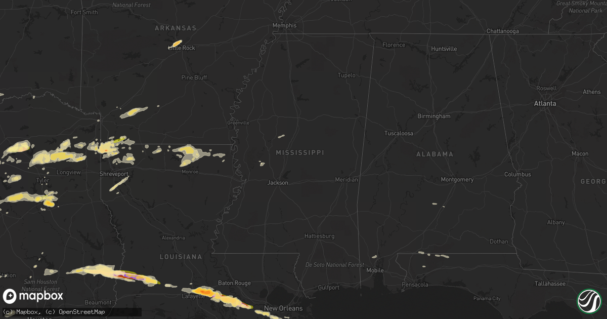
Hail Map in Mississippi on April 24, 2015
Get this storm
April 24 map
$229
one time, instant access
Download today. No call, no setup
Keep the $229
Bought the map and want the full workflow? Apply the entire $229 to a subscription within 7 days. None of it is wasted.
Every map, not just this one
This buys you this map. Subscription and you get every map we run, in the markets you choose from a few cities to whole states to nationwide. Plus real-time alerts the moment a storm fires.
Contact data
Name, contact info, occupancy, even credit band for addresses in the footprint. You go from where it hit to who to call.
Become the source they trust
Unlimited branding weather history reports on demand. You already have the documented answer ready for the property owner, and you are the one who showed up with it.
Property data and RoofTrace estimates
Pull up any address you have got, its value and the exact code rules for that jurisdiction, straight from One Click Code. Then RoofTrace estimates the squares, pitch, and roof value, priced the way you price.
Storm reports in Mississippi
Mississippi
| Date | Description |
|---|---|
| 04/24/20153:50 AM CDT | Tree fell on a home and car located at intersection of hwys 503 and 504. No injuries. Time estimated. |
| 04/24/20153:15 AM CDT | Scattered power lines down |
| 04/24/20153:10 AM CDT | Tree down on highway 495 |
| 04/24/20153:10 AM CDT | Nws damage survey found an ef0 tornado with max winds of 75mph...max width of 50yds and path length of 0.9 miles. This tornado began along little-rock rd... Causing a nar (ja |
| 04/24/20152:54 AM CDT | Trees downed across the road along co rd 448 between co rd 525 and ms hwy 19 |
| 04/24/20152:51 AM CDT | Tornado began near the intersection of cr 248/cr 347 and tracked ene through the beatline community crossing ms highway 19 at bethsaida and ended along cr 450. The roof |
| 04/24/20152:50 AM CDT | Trees downed along co rd 347 near co rd 444 |
| 04/24/20152:49 AM CDT | Trees downed along ms hwy 15 |
| 04/24/20152:47 AM CDT | Trees and powerlines down at a few locations in union |
| 04/24/20152:46 AM CDT | Trees downed across ms hwy 485 near co rd 361...causing a multivehicle accident |
| 04/24/20152:30 AM CDT | Trees downed along ms hwy 488. Possible tornado. |
| 04/24/20152:28 AM CDT | Tree downed across ms hwy 35 near twin city |
| 04/24/20152:28 AM CDT | Nws damage survey found an ef1 tornado with max winds of 110mph...max width of 500yds and path length of 3.5 miles. The tornado started just west of hwy 35... Snapping se (ja |
| 04/24/20152:25 AM CDT | Numerous trees down across highway 35 just north of walnut grove |
| 04/24/20152:25 AM CDT | Scattered trees down across northern scott county |
| 04/24/20152:20 AM CDT | Nws damage survey found an ef0 tornado with maximum winds of 75mph...maximum width of 50yds and path length of 0.9 miles. Several trees were snapped and uprooted in a n |
| 04/24/20152:18 AM CDT | Fallen tree crushed camper and car. Wind speed estimated around 60 mph. |
| 04/24/20152:17 AM CDT | Debris in road on ms hwy 25 at ms hwy 13. Possible tornado |
| 04/24/20152:17 AM CDT | Nws damage survey found an ef1 tornado with maximum winds of 105mph...maximum width of 300yds and path length of 2.5 miles. This tornado started just west of highway 25 |
| 04/24/20151:58 AM CDT | Nws damage survey found an ef1 tornado with maximum winds of 95mph...maximum width of 75yds and path length of 1.7 miles. This tornado snapped and uprooted a number of |
| 04/24/20151:58 AM CDT | Tree downed across the natchez trace near milepost 173 |
| 04/24/20151:52 AM CDT | Several shingles blown off a home on the east city of canton |
| 04/24/20151:50 AM CDT | Trees uprooted |
| 04/24/20151:50 AM CDT | A tree fell on a home on w academy st |
| 04/24/20151:47 AM CDT | Observed by private weather station near gluckstadt |
| 04/24/20151:45 AM CDT | Several trees downed in the lake caroline area |
| 04/24/20151:30 AM CDT | Siding damage to a home and a gutter torn off a shop building. |
| 04/24/20151:25 AM CDT | Tree fell on a house on patterson rd. Time estimated. |
| 04/24/20151:15 AM CDT | Several trees downed in satartia and east along highway 433. |
| 04/24/20151:10 AM CDT | Multiple trees downed |
| 04/24/201512:48 AM CDT | Measured on roof of stationary storm chase vehicle |
| 04/24/201512:30 AM CDT | Tree downed along ms hwy 8 near the grenada tallahatchie county line. |
| 04/23/201511:46 PM CDT | Trees were uprooted |
| 04/23/201511:30 PM CDT | Trees were downed and grain silos were damaged |
All States Impacted by Hail Map on April 24, 2015
Cities Impacted by Hail Map on April 24, 2015
- Cotulla, TX
- Tilden, TX
- Fowlerton, TX
- Waldo, KS
- Natoma, KS
- Russell, KS
- Plainville, KS
- Gorham, KS
- Hays, KS
- Bunker Hill, KS
- Catharine, KS
- Victoria, KS
- Lucas, KS
- Luray, KS
- Paradise, KS
- Donaldsonville, LA
- Plaquemine, LA
- Carencro, LA
- Lafayette, LA
- Saint James, LA
- Belle Rose, LA
- Breaux Bridge, LA
- Saint Martinville, LA
- Pierre Part, LA
- Arnaudville, LA
- White Castle, LA
- Grosse Tete, LA
- Gove, KS
- Singer, LA
- Kirbyville, TX
- Bassett, NE
- Wilson, KS
- Lincoln, KS
- Ellsworth, KS
- Dorrance, KS
- Ellis, KS
- Sylvan Grove, KS
- Bowie, TX
- Sunset, TX
- Chico, TX
- Smiley, TX
- Gillett, TX
- Cuero, TX
- Westhoff, TX
- Corsica, SD
- Tyler, TX
- Winona, TX
- Utica, KS
- Arlington, TX
- Grand Prairie, TX
- Stephenville, TX
- Gorman, TX
- Carbon, TX
- Dublin, TX
- De Leon, TX
- Brewster, NE
- Taylor, NE
- Floresville, TX
- Elmendorf, TX
- Poteet, TX
- Somerset, TX
- Von Ormy, TX
- San Antonio, TX
- Ransom, KS
- Wakeeney, KS
- Wortham, TX
- Whitehouse, TX
- Palestine, TX
- Athens, TX
- Purdon, TX
- Jacksonville, TX
- Dawson, TX
- Mount Calm, TX
- Axtell, TX
- Hubbard, TX
- Troup, TX
- Montalba, TX
- Streetman, TX
- Richland, TX
- Henderson, TX
- Bullard, TX
- Malakoff, TX
- Fairfield, TX
- Larue, TX
- Rusk, TX
- Tennessee Colony, TX
- Kerens, TX
- Coolidge, TX
- Mexia, TX
- Penelope, TX
- Frankston, TX
- Pawnee City, NE
- Axtell, KS
- Burchard, NE
- Lyford, TX
- Spearsville, LA
- Castroville, TX
- Robert Lee, TX
- Bronte, TX
- Miles, TX
- Paint Rock, TX
- Rowena, TX
- San Angelo, TX
- Mereta, TX
- Laredo, TX
- Fred, TX
- Merryville, LA
- Spurger, TX
- Newton, TX
- Hillister, TX
- Call, TX
- Warren, TX
- Bon Wier, TX
- Woodville, TX
- Santa Anna, TX
- Collyer, KS
- Hico, TX
- Venus, TX
- Saint Francis, KS
- Midlothian, TX
- Alvarado, TX
- Mansfield, TX
- Mitchell, SD
- Bridgewater, SD
- Waxahachie, TX
- Red Oak, TX
- Dunning, NE
- Purdum, NE
- Quinter, KS
- Weatherford, TX
- Granbury, TX
- Tribune, KS
- Barry, TX
- Bluff Dale, TX
- Tolar, TX
- Charlotte, TX
- Bigfoot, TX
- Kit Carson, CO
- Brookshire, TX
- Yorktown, TX
- Glen Rose, TX
- Desdemona, TX
- Comanche, TX
- Huntsville, TX
- Ida, LA
- Vivian, LA
- Hosston, LA
- Palco, KS
- Stockton, KS
- Logan, KS
- Phillipsburg, KS
- Van, TX
- Grand Saline, TX
- Baker, FL
- Flatonia, TX
- Muldoon, TX
- Kinder, LA
- Reeves, LA
- Dallas, TX
- Addison, TX
- Carrollton, TX
- Como, TX
- Yantis, TX
- Colton, SD
- Humboldt, SD
- Hartford, SD
- Great Bend, KS
- Cotton Valley, LA
- Minden, LA
- Benton, LA
- Haughton, LA
- La Feria, TX
- San Benito, TX
- Burwell, NE
- Devine, TX
- Lytle, TX
- Natalia, TX
- Hondo, TX
- Winters, TX
- Scott City, KS
- Parkston, SD
- Dilley, TX
- Pearsall, TX
- Batesville, TX
- Crystal City, TX
- Helotes, TX
- Brady, NE
- Maxwell, NE
- Stapleton, NE
- Coldspring, TX
- Goldsboro, TX
- Ovalo, TX
- Wingate, TX
- Novice, TX
- Cross Plains, TX
- Lawn, TX
- Baird, TX
- Rising Star, TX
- Cisco, TX
- Clyde, TX
- Pleasanton, TX
- Uvalde, TX
- Maumelle, AR
- Sabinal, TX
- Spivey, KS
- Zenda, KS
- Little Rock, AR
- North Little Rock, AR
- Opelousas, LA
- Sunset, LA
- Armour, SD
- Big Lake, TX
- Sterling City, TX
- Garden City, TX
- Plain Dealing, LA
- Bradley, AR
- Kingsbury, TX
- Eagle Pass, TX
- Quemado, TX
- Ogallah, KS
- Grinnell, KS
- Mineola, TX
- Quitman, TX
- Winnsboro, TX
- Beverly, KS
- Tescott, KS
- Minneapolis, KS
- May, TX
- Burkett, TX
- Coleman, TX
- Brownwood, TX
- La Pryor, TX
- Weslaco, TX
- Hawkins, TX
- Jefferson, TX
- Harleton, TX
- Daingerfield, TX
- Avinger, TX
- Ore City, TX
- Omaha, TX
- Gilmer, TX
- Big Sandy, TX
- Pittsburg, TX
- Diana, TX
- Knippa, TX
- Brackettville, TX
- Eustace, TX
- Santa Rosa, TX
- Burlington, CO
- Fedora, SD
- Mingus, TX
- Ranger, TX
- Marion, LA
- Bastrop, LA
- Ogallala, NE
- Mabank, TX
- Longville, LA
- Ragley, LA
- Dequincy, LA
- Menno, SD
- Scotland, SD
- Olivet, SD
- Kaycee, WY
- Bivins, TX
- Kingston, OK
- Hendrix, OK
- Durant, OK
- Colbert, OK
- Calera, OK
- Mead, OK
- Branch, LA
- Rayne, LA
- Plattenville, LA
- Napoleonville, LA
- Convent, LA
- Vacherie, LA
- Jeanerette, LA
- Scott, LA
- Church Point, LA
- Palmer, TX
- Lancaster, TX
- Ferris, TX
- Rio Medina, TX
- D Hanis, TX
- Kingman, KS
- Quinlan, TX
- Lone Oak, TX
- Point, TX
- Linn, KS
- Calliham, TX
- Lexington, MS
- Italy, TX
- Bentonia, MS
- Canova, SD
- Salem, SD
- Morganville, KS
- Clifton, KS
- Clyde, KS
- New Waverly, TX
- Hope, AR
- Fulton, SD
- Brashear, TX
- Cumby, TX
- Emory, TX
- Sulphur Springs, TX
- Marienthal, KS
- Leoti, KS
- Ennis, TX
- Park, KS
- McDonald, KS
- Burns, KS
- Laurel Hill, FL
- Shreveport, LA
- Gloster, LA
- Frierson, LA
- Stonewall, LA
- Elm Grove, LA
- Summerfield, LA
- Taylor, AR
- Yazoo City, MS
- Mercedes, TX
- Wichita, KS
- Joshua, TX
- Talpa, TX
- Keene, TX
- Cedar Hill, TX
- Crowley, TX
- Nemo, TX
- Cleburne, TX
- Burleson, TX
- Godley, TX
- Rainbow, TX
- Cresson, TX
- Fort Worth, TX
- Basile, LA
- Jennings, LA
- Eastland, TX
- Bonita, LA
- Aledo, TX
- Clay Center, KS
- Hoxie, KS
- Keatchie, LA
- Grand Cane, LA
- Stockville, NE
- Ballinger, TX
- Des Allemands, LA
- Ama, LA
- Sterlington, LA
- Christoval, TX
- Farmerville, LA
- Monroe, LA
- Downsville, LA
- Paradis, LA
- Hahnville, LA
- Thibodaux, LA
- Edgard, LA
- Boutte, LA
- Haynesville, LA
- Ben Wheeler, TX
- Canton, TX
- Linden, TX
- Rodessa, LA
- Gilliam, LA
- Belcher, LA
- Doddridge, AR
- Lipan, TX
- New Braunfels, TX
- McQueeney, TX
- Seguin, TX
- Marion, TX
- Norris, SD
- Long Valley, SD
- Asherton, TX
- Bernice, LA
- Lafitte, LA
- Port Sulphur, LA
- Braithwaite, LA
- Belle Chasse, LA
- Atlanta, TX
- Jbsa Lackland, TX
- Norton, TX
- Wessington Springs, SD
- Tryon, NE
- Greenleaf, KS
- Whitesboro, TX
- Letcher, SD
- Longford, KS
- Wakefield, KS
- Mount Vernon, SD
- Artesian, SD
- Sharon Springs, KS
- Weskan, KS
- Vancourt, TX
- Converse, TX
- Jbsa Randolph, TX
- Universal City, TX
- College Station, TX
- Katy, TX
- Jourdanton, TX
- Marietta, TX
- Naples, TX
- Morland, KS
- Pioneer, LA
- Hutchinson, KS
- Pretty Prairie, KS
- Wills Point, TX
- Atascosa, TX
- La Coste, TX
- Stockdale, TX
- Falls City, TX
- La Vernia, TX
- Mico, TX
- Yancey, TX
- Livingston, TX
- Jasper, TX
- Ethan, SD
- Nashville, KS
- Prescott, AR
- Rosston, AR
- Idalia, CO
- Fruitvale, TX
- Edgewood, TX
- Canistota, SD
- Carrizo Springs, TX
- North Platte, NE
- Itasca, TX
- Melvin, TX
- Luling, TX
- Anselmo, NE
- Hughes Springs, TX
- Donna, TX
- Greenville, AL
- Emmet, AR
- Trinity, TX
- Yoakum, TX
- Stratton, CO
- Eldorado, TX
- Larned, KS
- Texarkana, TX
- Nash, TX
- Camden, AR
- Astoria, SD
- Sealy, TX
- Bennington, KS
- Brookville, KS
- Homer, LA
- Winfred, SD
- Terrell, TX
- Lisbon, LA
- Grainfield, KS
- Jennings, KS
- Plankinton, SD
- Arnold, NE
- Emery, SD
- Macksville, KS
- Marysville, KS
- Brewton, AL
- Jay, FL
- St John, KS
- Eunice, LA
- Iota, LA
- Fulton, AR
- Palmer, KS
- Lone Star, TX
- Forreston, TX
- Milford, TX
- Pottsboro, TX
- Bokchito, OK
- Cartwright, OK
- Denison, TX
- Catarina, TX
- Carlsbad, TX
- Del Rio, TX
- Raymondville, TX
- Claflin, KS
- Oakley, KS
- Washington, KS
- Henrietta, TX
- Aurora, KS
- Mer Rouge, LA
- Kaufman, TX
- Goodfellow Afb, TX
- Corsicana, TX
- Rice, TX
- Alexandria, SD
- Childress, TX
- Marrero, LA
- Barataria, LA
- Cunningham, KS
- Harlingen, TX
- Steinauer, NE
- Culbertson, NE
- La Grange, TX
- Oberlin, KS
- Waller, TX
- Forest Home, AL
- Wray, CO
- Brady, TX
- Jacksboro, TX
- Moore, TX
- Sutherland Springs, TX
- Cibolo, TX
- Poth, TX
- Schertz, TX
- Jbsa Ft Sam Houston, TX
- Milton, FL
- Lewisville, AR
- Lewis, KS
- Moorefield, NE
- Arthur City, TX
- Powderly, TX
- Laneville, TX
- Reklaw, TX
- Thedford, NE
- Springhill, LA
- Oil City, LA
- Shongaloo, LA
- Emerson, AR
- Pointblank, TX
- Sarepta, LA
- Santo, TX
- Haven, KS
- Satartia, MS
- Bangs, TX
- Mansfield, LA
- Amelia, NE
- Barnes, KS
- Hanover, KS
- Table Rock, NE
- Bloomburg, TX
- Wellfleet, NE
- Lindale, TX
- Axis, AL
- Saraland, AL
- Chunchula, AL
- Millsap, TX
- Chidester, AR
- Buckner, AR
- Kemp, TX
- Roanoke, TX
- Oak Grove, LA
- Woonsocket, SD
- Anderson, TX
- Scurry, TX
- Fayetteville, TX
- Ellinger, TX
- Brandt, SD
- Lillian, TX
- Kosse, TX
- Doyline, LA
- Shepherd, MT
- Broadview, MT
- Gordon, TX
- Miltonvale, KS
- Delphos, KS
- Atwood, KS
- Dimock, SD
- Humboldt, NE
- Waelder, TX
- Schulenburg, TX
- Duncanville, TX
- Freeman, SD
- Long Pine, NE
- Elton, LA


