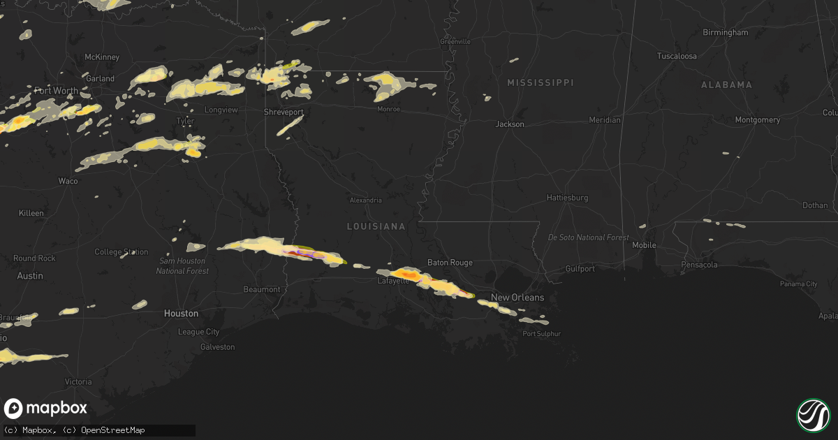
Hail Map in Louisiana on April 24, 2015
Get this storm
April 24 map
$229
one time, instant access
Download today. No call, no setup
Keep the $229
Bought the map and want the full workflow? Apply the entire $229 to a subscription within 7 days. None of it is wasted.
Every map, not just this one
This buys you this map. Subscription and you get every map we run, in the markets you choose from a few cities to whole states to nationwide. Plus real-time alerts the moment a storm fires.
Contact data
Name, contact info, occupancy, even credit band for addresses in the footprint. You go from where it hit to who to call.
Become the source they trust
Unlimited branding weather history reports on demand. You already have the documented answer ready for the property owner, and you are the one who showed up with it.
Property data and RoofTrace estimates
Pull up any address you have got, its value and the exact code rules for that jurisdiction, straight from One Click Code. Then RoofTrace estimates the squares, pitch, and roof value, priced the way you price.
Storm reports in Louisiana
Louisiana
| Date | Description |
|---|---|
| 04/24/20156:15 PM CDT | Trees and powerlines down in paradis and luling. |
| 04/24/20154:37 PM CDT | Several reports from witnesses of a brief tornado touch down. Unsure if damage to 7 trailers was directly related to tornado as images suggest more straightline wind da |
| 04/24/20154:25 PM CDT | Trees down in bayou pigeon and bayou sorrel. Trailer overturned in bayou pigeon area. |
| 04/24/20154:25 PM CDT | Also wind gusts 50 mph. Damage to autos. |
| 04/24/20154:10 PM CDT | Golf ball size hail reported by co-op observer at bayou sorrel lock. Time estimated. |
| 04/24/20153:40 PM CDT | Several public photos of tennis ball to baseball sized hail in catahoula |
| 04/24/20153:37 PM CDT | Public posted photo of baseball sized hail in breaux bridge and parks area |
| 04/24/20153:30 PM CDT | State police reports two overturned 18 wheelers on interstate 10 near milepost 108 |
| 04/24/20153:25 PM CDT | Trained spotter reports estimated 65 mph wind gusts and half dollar size hail |
| 04/24/20153:15 PM CDT | Video of quarter sized hail in breaux bridge |
| 04/24/20151:30 PM CDT | Public reported trees and power lines down |
| 04/24/20151:20 PM CDT | Media shared photo of downed tree in reeves. Time estimated from radar. |
| 04/24/20151:09 PM CDT | Photos of a power pole snapped on 171. Time estimated from radar. |
| 04/24/20151:00 PM CDT | Nws employee reports trees and power lines down along clark rd off of hwy 12. Time estimated from radar. |
| 04/24/20151:00 PM CDT | Public shared photo of several large branches down on hwy 110 between singer and longville. Time estimated from radar. |
| 04/24/201512:56 PM CDT | Emergency manager reports trees down between fields and ragley. Time estimated from radar. |
| 04/24/201512:45 PM CDT | Media relayed report of estimated quarter sized hail in singer |
| 04/24/201512:35 AM CDT | Downed utility lines and snapped utility poles in east carroll parish |
| 04/24/201512:29 AM CDT | Power lines down along hwy 134 |
| 04/24/201512:20 AM CDT | Tree downed across la hwy 17 |
| 04/24/201512:18 AM CDT | Trees and utility poles downed around west carroll parish |
| 04/24/201512:00 AM CDT | A tree and a power line down in mer rouge |
| 04/23/201511:55 PM CDT | Tree down across hwy 593 near collinston |
| 04/23/201511:52 PM CDT | Several trees downed across morehouse parish |
| 04/23/201511:49 PM CDT | A couple trees down |
| 04/23/201511:48 PM CDT | Tree damage occurred three to four miles south of beekman. The most significant damage was along state highway 593 where several large hardwood trees were snapped and u |
| 04/23/201511:10 PM CDT | Trees down... Snapped and uprooted |
| 04/23/201510:40 PM CDT | An ef1 tornado began 7 ese of haynesville and ended 9 wsw of junction city. Damage consisted mainally of uprooted and snapped trees. |
| 04/23/201510:32 PM CDT | Trees down |
| 04/23/201510:30 PM CDT | Power lines down |
| 04/23/201510:30 PM CDT | Power lines down...nickel size hail covering the ground |
| 04/23/201510:03 PM CDT | Tree down on power lines. |
| 04/23/20159:55 PM CDT | Power lines down |
| 04/23/20159:50 PM CDT | Busted out 3 windows of a house |
All States Impacted by Hail Map on April 24, 2015
Cities Impacted by Hail Map on April 24, 2015
- Cotulla, TX
- Tilden, TX
- Fowlerton, TX
- Waldo, KS
- Natoma, KS
- Russell, KS
- Plainville, KS
- Gorham, KS
- Hays, KS
- Bunker Hill, KS
- Catharine, KS
- Victoria, KS
- Lucas, KS
- Luray, KS
- Paradise, KS
- Donaldsonville, LA
- Plaquemine, LA
- Carencro, LA
- Lafayette, LA
- Saint James, LA
- Belle Rose, LA
- Breaux Bridge, LA
- Saint Martinville, LA
- Pierre Part, LA
- Arnaudville, LA
- White Castle, LA
- Grosse Tete, LA
- Gove, KS
- Singer, LA
- Kirbyville, TX
- Bassett, NE
- Wilson, KS
- Lincoln, KS
- Ellsworth, KS
- Dorrance, KS
- Ellis, KS
- Sylvan Grove, KS
- Bowie, TX
- Sunset, TX
- Chico, TX
- Smiley, TX
- Gillett, TX
- Cuero, TX
- Westhoff, TX
- Corsica, SD
- Tyler, TX
- Winona, TX
- Utica, KS
- Arlington, TX
- Grand Prairie, TX
- Stephenville, TX
- Gorman, TX
- Carbon, TX
- Dublin, TX
- De Leon, TX
- Brewster, NE
- Taylor, NE
- Floresville, TX
- Elmendorf, TX
- Poteet, TX
- Somerset, TX
- Von Ormy, TX
- San Antonio, TX
- Ransom, KS
- Wakeeney, KS
- Wortham, TX
- Whitehouse, TX
- Palestine, TX
- Athens, TX
- Purdon, TX
- Jacksonville, TX
- Dawson, TX
- Mount Calm, TX
- Axtell, TX
- Hubbard, TX
- Troup, TX
- Montalba, TX
- Streetman, TX
- Richland, TX
- Henderson, TX
- Bullard, TX
- Malakoff, TX
- Fairfield, TX
- Larue, TX
- Rusk, TX
- Tennessee Colony, TX
- Kerens, TX
- Coolidge, TX
- Mexia, TX
- Penelope, TX
- Frankston, TX
- Pawnee City, NE
- Axtell, KS
- Burchard, NE
- Lyford, TX
- Spearsville, LA
- Castroville, TX
- Robert Lee, TX
- Bronte, TX
- Miles, TX
- Paint Rock, TX
- Rowena, TX
- San Angelo, TX
- Mereta, TX
- Laredo, TX
- Fred, TX
- Merryville, LA
- Spurger, TX
- Newton, TX
- Hillister, TX
- Call, TX
- Warren, TX
- Bon Wier, TX
- Woodville, TX
- Santa Anna, TX
- Collyer, KS
- Hico, TX
- Venus, TX
- Saint Francis, KS
- Midlothian, TX
- Alvarado, TX
- Mansfield, TX
- Mitchell, SD
- Bridgewater, SD
- Waxahachie, TX
- Red Oak, TX
- Dunning, NE
- Purdum, NE
- Quinter, KS
- Weatherford, TX
- Granbury, TX
- Tribune, KS
- Barry, TX
- Bluff Dale, TX
- Tolar, TX
- Charlotte, TX
- Bigfoot, TX
- Kit Carson, CO
- Brookshire, TX
- Yorktown, TX
- Glen Rose, TX
- Desdemona, TX
- Comanche, TX
- Huntsville, TX
- Ida, LA
- Vivian, LA
- Hosston, LA
- Palco, KS
- Stockton, KS
- Logan, KS
- Phillipsburg, KS
- Van, TX
- Grand Saline, TX
- Baker, FL
- Flatonia, TX
- Muldoon, TX
- Kinder, LA
- Reeves, LA
- Dallas, TX
- Addison, TX
- Carrollton, TX
- Como, TX
- Yantis, TX
- Colton, SD
- Humboldt, SD
- Hartford, SD
- Great Bend, KS
- Cotton Valley, LA
- Minden, LA
- Benton, LA
- Haughton, LA
- La Feria, TX
- San Benito, TX
- Burwell, NE
- Devine, TX
- Lytle, TX
- Natalia, TX
- Hondo, TX
- Winters, TX
- Scott City, KS
- Parkston, SD
- Dilley, TX
- Pearsall, TX
- Batesville, TX
- Crystal City, TX
- Helotes, TX
- Brady, NE
- Maxwell, NE
- Stapleton, NE
- Coldspring, TX
- Goldsboro, TX
- Ovalo, TX
- Wingate, TX
- Novice, TX
- Cross Plains, TX
- Lawn, TX
- Baird, TX
- Rising Star, TX
- Cisco, TX
- Clyde, TX
- Pleasanton, TX
- Uvalde, TX
- Maumelle, AR
- Sabinal, TX
- Spivey, KS
- Zenda, KS
- Little Rock, AR
- North Little Rock, AR
- Opelousas, LA
- Sunset, LA
- Armour, SD
- Big Lake, TX
- Sterling City, TX
- Garden City, TX
- Plain Dealing, LA
- Bradley, AR
- Kingsbury, TX
- Eagle Pass, TX
- Quemado, TX
- Ogallah, KS
- Grinnell, KS
- Mineola, TX
- Quitman, TX
- Winnsboro, TX
- Beverly, KS
- Tescott, KS
- Minneapolis, KS
- May, TX
- Burkett, TX
- Coleman, TX
- Brownwood, TX
- La Pryor, TX
- Weslaco, TX
- Hawkins, TX
- Jefferson, TX
- Harleton, TX
- Daingerfield, TX
- Avinger, TX
- Ore City, TX
- Omaha, TX
- Gilmer, TX
- Big Sandy, TX
- Pittsburg, TX
- Diana, TX
- Knippa, TX
- Brackettville, TX
- Eustace, TX
- Santa Rosa, TX
- Burlington, CO
- Fedora, SD
- Mingus, TX
- Ranger, TX
- Marion, LA
- Bastrop, LA
- Ogallala, NE
- Mabank, TX
- Longville, LA
- Ragley, LA
- Dequincy, LA
- Menno, SD
- Scotland, SD
- Olivet, SD
- Kaycee, WY
- Bivins, TX
- Kingston, OK
- Hendrix, OK
- Durant, OK
- Colbert, OK
- Calera, OK
- Mead, OK
- Branch, LA
- Rayne, LA
- Plattenville, LA
- Napoleonville, LA
- Convent, LA
- Vacherie, LA
- Jeanerette, LA
- Scott, LA
- Church Point, LA
- Palmer, TX
- Lancaster, TX
- Ferris, TX
- Rio Medina, TX
- D Hanis, TX
- Kingman, KS
- Quinlan, TX
- Lone Oak, TX
- Point, TX
- Linn, KS
- Calliham, TX
- Lexington, MS
- Italy, TX
- Bentonia, MS
- Canova, SD
- Salem, SD
- Morganville, KS
- Clifton, KS
- Clyde, KS
- New Waverly, TX
- Hope, AR
- Fulton, SD
- Brashear, TX
- Cumby, TX
- Emory, TX
- Sulphur Springs, TX
- Marienthal, KS
- Leoti, KS
- Ennis, TX
- Park, KS
- McDonald, KS
- Burns, KS
- Laurel Hill, FL
- Shreveport, LA
- Gloster, LA
- Frierson, LA
- Stonewall, LA
- Elm Grove, LA
- Summerfield, LA
- Taylor, AR
- Yazoo City, MS
- Mercedes, TX
- Wichita, KS
- Joshua, TX
- Talpa, TX
- Keene, TX
- Cedar Hill, TX
- Crowley, TX
- Nemo, TX
- Cleburne, TX
- Burleson, TX
- Godley, TX
- Rainbow, TX
- Cresson, TX
- Fort Worth, TX
- Basile, LA
- Jennings, LA
- Eastland, TX
- Bonita, LA
- Aledo, TX
- Clay Center, KS
- Hoxie, KS
- Keatchie, LA
- Grand Cane, LA
- Stockville, NE
- Ballinger, TX
- Des Allemands, LA
- Ama, LA
- Sterlington, LA
- Christoval, TX
- Farmerville, LA
- Monroe, LA
- Downsville, LA
- Paradis, LA
- Hahnville, LA
- Thibodaux, LA
- Edgard, LA
- Boutte, LA
- Haynesville, LA
- Ben Wheeler, TX
- Canton, TX
- Linden, TX
- Rodessa, LA
- Gilliam, LA
- Belcher, LA
- Doddridge, AR
- Lipan, TX
- New Braunfels, TX
- McQueeney, TX
- Seguin, TX
- Marion, TX
- Norris, SD
- Long Valley, SD
- Asherton, TX
- Bernice, LA
- Lafitte, LA
- Port Sulphur, LA
- Braithwaite, LA
- Belle Chasse, LA
- Atlanta, TX
- Jbsa Lackland, TX
- Norton, TX
- Wessington Springs, SD
- Tryon, NE
- Greenleaf, KS
- Whitesboro, TX
- Letcher, SD
- Longford, KS
- Wakefield, KS
- Mount Vernon, SD
- Artesian, SD
- Sharon Springs, KS
- Weskan, KS
- Vancourt, TX
- Converse, TX
- Jbsa Randolph, TX
- Universal City, TX
- College Station, TX
- Katy, TX
- Jourdanton, TX
- Marietta, TX
- Naples, TX
- Morland, KS
- Pioneer, LA
- Hutchinson, KS
- Pretty Prairie, KS
- Wills Point, TX
- Atascosa, TX
- La Coste, TX
- Stockdale, TX
- Falls City, TX
- La Vernia, TX
- Mico, TX
- Yancey, TX
- Livingston, TX
- Jasper, TX
- Ethan, SD
- Nashville, KS
- Prescott, AR
- Rosston, AR
- Idalia, CO
- Fruitvale, TX
- Edgewood, TX
- Canistota, SD
- Carrizo Springs, TX
- North Platte, NE
- Itasca, TX
- Melvin, TX
- Luling, TX
- Anselmo, NE
- Hughes Springs, TX
- Donna, TX
- Greenville, AL
- Emmet, AR
- Trinity, TX
- Yoakum, TX
- Stratton, CO
- Eldorado, TX
- Larned, KS
- Texarkana, TX
- Nash, TX
- Camden, AR
- Astoria, SD
- Sealy, TX
- Bennington, KS
- Brookville, KS
- Homer, LA
- Winfred, SD
- Terrell, TX
- Lisbon, LA
- Grainfield, KS
- Jennings, KS
- Plankinton, SD
- Arnold, NE
- Emery, SD
- Macksville, KS
- Marysville, KS
- Brewton, AL
- Jay, FL
- St John, KS
- Eunice, LA
- Iota, LA
- Fulton, AR
- Palmer, KS
- Lone Star, TX
- Forreston, TX
- Milford, TX
- Pottsboro, TX
- Bokchito, OK
- Cartwright, OK
- Denison, TX
- Catarina, TX
- Carlsbad, TX
- Del Rio, TX
- Raymondville, TX
- Claflin, KS
- Oakley, KS
- Washington, KS
- Henrietta, TX
- Aurora, KS
- Mer Rouge, LA
- Kaufman, TX
- Goodfellow Afb, TX
- Corsicana, TX
- Rice, TX
- Alexandria, SD
- Childress, TX
- Marrero, LA
- Barataria, LA
- Cunningham, KS
- Harlingen, TX
- Steinauer, NE
- Culbertson, NE
- La Grange, TX
- Oberlin, KS
- Waller, TX
- Forest Home, AL
- Wray, CO
- Brady, TX
- Jacksboro, TX
- Moore, TX
- Sutherland Springs, TX
- Cibolo, TX
- Poth, TX
- Schertz, TX
- Jbsa Ft Sam Houston, TX
- Milton, FL
- Lewisville, AR
- Lewis, KS
- Moorefield, NE
- Arthur City, TX
- Powderly, TX
- Laneville, TX
- Reklaw, TX
- Thedford, NE
- Springhill, LA
- Oil City, LA
- Shongaloo, LA
- Emerson, AR
- Pointblank, TX
- Sarepta, LA
- Santo, TX
- Haven, KS
- Satartia, MS
- Bangs, TX
- Mansfield, LA
- Amelia, NE
- Barnes, KS
- Hanover, KS
- Table Rock, NE
- Bloomburg, TX
- Wellfleet, NE
- Lindale, TX
- Axis, AL
- Saraland, AL
- Chunchula, AL
- Millsap, TX
- Chidester, AR
- Buckner, AR
- Kemp, TX
- Roanoke, TX
- Oak Grove, LA
- Woonsocket, SD
- Anderson, TX
- Scurry, TX
- Fayetteville, TX
- Ellinger, TX
- Brandt, SD
- Lillian, TX
- Kosse, TX
- Doyline, LA
- Shepherd, MT
- Broadview, MT
- Gordon, TX
- Miltonvale, KS
- Delphos, KS
- Atwood, KS
- Dimock, SD
- Humboldt, NE
- Waelder, TX
- Schulenburg, TX
- Duncanville, TX
- Freeman, SD
- Long Pine, NE
- Elton, LA


