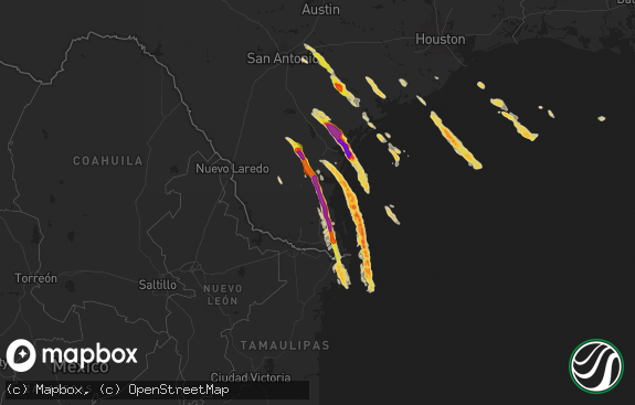
Hail Map in Mission, TX on April 20, 2012
The weather event in Mission, TX on April 20, 2012 includes Hail map. 4 states and 207 cities were impacted and suffered possible damage. The total estimated number of properties impacted is 0.

Hail
0
Estimated number of impacted properties by a 1.00" hail or larger0
Estimated number of impacted properties by a 1.75" hail or larger0
Estimated number of impacted properties by a 2.50" hail or largerStorm reports in Mission, TX
Mission, TX
| Date | Description |
|---|---|
| 04/20/20126:25 PM CDT | Quarter size hail near chimmey park |
| 04/20/20126:05 PM CDT | Skywarn spotter reports quarter size on shary road in mission |
| 04/20/20126:01 PM CDT | Public reports large hail in alton just north of mission mile 5 reports numerous broken car windshields |
| 04/20/20125:59 PM CDT | Quarter sized hail reported on w 40th street. |
| 04/20/20125:56 PM CDT | A local report indicates 1.00 inch wind near PALMVIEW |
| 04/20/20125:38 PM CDT | Golf ball sized hail reported at shary and 3 mile road. |
| 04/20/20125:36 PM CDT | Softball sized hail reported at taylor and 5 mile road. |
| 04/20/20125:30 PM CDT | Reports of 60 mph wind gusts and golf ball sized hail at stuart and 21st. |
| 04/20/20125:30 PM CDT | Reports of 60 mph wind gusts and golf ball sized hail at stuart and 21st. |
| 04/20/20125:29 PM CDT | Quarter size to golf ball size reports in palmhurst area. |
| 04/20/20125:27 PM CDT | Golfball sized hail reported in mission north of 107. |
| 04/20/20125:26 PM CDT | Golf ball size hail reported in alton near intersection of 5 mile road and conway. |
| 04/20/20125:25 PM CDT | Public reports baseball size hail in mission near palm drive and 5 mile wind est. To 50 mph |
All States Impacted by Hail Map on April 20, 2012
All Cities Impacted by Hail Map on April 20, 2012
- Fort Meade, FL
- Orlando, FL
- Kissimmee, FL
- Saint Cloud, FL
- Armstrong, TX
- Webster, FL
- Concepcion, TX
- Cleveland, TX
- Pharr, TX
- Penitas, TX
- San Juan, TX
- La Joya, TX
- Mcallen, TX
- Hidalgo, TX
- Mission, TX
- Edinburg, TX
- Linn, TX
- Delmita, TX
- Encino, TX
- Raymondville, TX
- Olmito, TX
- Grulla, TX
- Hargill, TX
- Lyford, TX
- Los Fresnos, TX
- San Benito, TX
- Falfurrias, TX
- Harlingen, TX
- San Perlita, TX
- Rio Grande City, TX
- Garciasville, TX
- Alamo, TX
- Brownsville, TX
- Hebbronville, TX
- Donna, TX
- Rio Hondo, TX
- Santa Elena, TX
- Hazlehurst, MS
- Pattison, MS
- Fayette, MS
- Union Church, MS
- Hermanville, MS
- Cuero, TX
- Westhoff, TX
- Sebring, FL
- La Marque, TX
- Texas City, TX
- Hitchcock, TX
- Lufkin, TX
- Alice, TX
- Bishop, TX
- Robstown, TX
- Huntsville, TX
- East Bernard, TX
- Beasley, TX
- Premont, TX
- Nacogdoches, TX
- Clermont, FL
- Davenport, FL
- Corpus Christi, TX
- Portland, TX
- Port Aransas, TX
- Taft, TX
- Sinton, TX
- Alto, TX
- Pasadena, TX
- Houston, TX
- Dale, TX
- Rosanky, TX
- Kingsville, TX
- Riviera, TX
- Kenedy, TX
- Beaumont, TX
- China, TX
- Grapeland, TX
- Wells, TX
- Boyce, LA
- Huntington, TX
- Rosharon, TX
- Osteen, FL
- Debary, FL
- Lake Helen, FL
- Deltona, FL
- Deland, FL
- Orange City, FL
- El Campo, TX
- Hallettsville, TX
- Yoakum, TX
- Douglass, TX
- Sealy, TX
- Cat Spring, TX
- Sarita, TX
- Livingston, TX
- Geneva, FL
- Mims, FL
- Kenansville, FL
- Astor, FL
- Pierson, FL
- Karnack, TX
- Jefferson, TX
- Combes, TX
- Sebastian, TX
- Winter Garden, FL
- Polk City, FL
- Hallsville, TX
- Rosenberg, TX
- Carthage, TX
- Louise, TX
- Flatonia, TX
- Waelder, TX
- Fort Pierce, FL
- Zavalla, TX
- Fischer, TX
- San Marcos, TX
- Wimberley, TX
- Apple Springs, TX
- Miami, FL
- Lakeland, FL
- Victoria, TX
- Altoona, FL
- Kennard, TX
- Crockett, TX
- Lake Mary, FL
- Longwood, FL
- Etoile, TX
- Zolfo Springs, FL
- Anahuac, TX
- Bartow, FL
- Lorida, FL
- Sanford, FL
- New Smyrna Beach, FL
- Seguin, TX
- Damon, TX
- Santa Fe, TX
- Dickinson, TX
- Lake Placid, FL
- Beckville, TX
- Bedias, TX
- Ganado, TX
- Tatum, TX
- Columbus, TX
- New Ulm, TX
- Seville, FL
- Missouri City, TX
- Chireno, TX
- Christmas, FL
- Montgomery, TX
- Vero Beach, FL
- Smiley, TX
- Broaddus, TX
- Runge, TX
- De Berry, TX
- Labelle, FL
- Zellwood, FL
- Mount Dora, FL
- Apopka, FL
- Sorrento, FL
- Channelview, TX
- Hollywood, FL
- Richmond, TX
- Port Lavaca, TX
- Corrigan, TX
- Trinity, TX
- Brenham, TX
- Montverde, FL
- Hempstead, TX
- Baytown, TX
- Highlands, TX
- Katy, TX
- Brookshire, TX
- Leesburg, FL
- Henderson, TX
- Tavares, FL
- San Augustine, TX
- San Isidro, TX
- Groveland, FL
- Three Rivers, TX
- Seadrift, TX
- Sugar Land, TX
- Center, TX
- Hockley, TX
- Paris, TX
- Canyon Lake, TX
- Sebastian, FL
- Marshall, TX
- Garwood, TX
- Bellville, TX
- Willis, TX
- Conroe, TX
- Ingleside, TX
- Edna, TX
- Santa Rosa, TX
- Edcouch, TX
- Sullivan City, TX
- Groveton, TX
- Tilden, TX
- Colmesneil, TX
- Chester, TX
- Waller, TX
- Oakhurst, TX
- Pointblank, TX
- Gillett, TX
- Paisley, FL
- Fort Lauderdale, FL
- Alleyton, TX
- Bleiblerville, TX
- Realitos, TX


