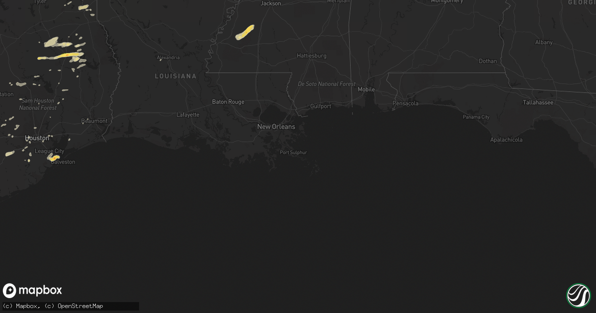
Hail Map in Florida on April 20, 2012
Get this storm
April 20 map
$229
one time, instant access
Download today. No call, no setup
Keep the $229
Bought the map and want the full workflow? Apply the entire $229 to a subscription within 7 days. None of it is wasted.
Every map, not just this one
This buys you this map. Subscription and you get every map we run, in the markets you choose from a few cities to whole states to nationwide. Plus real-time alerts the moment a storm fires.
Contact data
Name, contact info, occupancy, even credit band for addresses in the footprint. You go from where it hit to who to call.
Become the source they trust
Unlimited branding weather history reports on demand. You already have the documented answer ready for the property owner, and you are the one who showed up with it.
Property data and RoofTrace estimates
Pull up any address you have got, its value and the exact code rules for that jurisdiction, straight from One Click Code. Then RoofTrace estimates the squares, pitch, and roof value, priced the way you price.
Storm reports in Florida
Florida
| Date | Description |
|---|---|
| 04/20/20125:41 PM CDT | Kmlb asos pk wnd 04050/2241z. |
| 04/20/20125:31 PM CDT | Nickel to quarter hail. Rain 1 to 1.50 inches in a half hour. |
| 04/20/20125:26 PM CDT | 1 mile nw of sanlando springs gust from davis pro. Penny to dime size hail. 5.23 inches of rain. |
| 04/20/20124:45 PM CDT | Public reported golf ball sized hail. |
| 04/20/20124:36 PM CDT | Two trees down in lakewood park. |
| 04/20/20124:36 PM CDT | Skywarn spotter reported dime to quarter size hail near intersection of ocala ave. And kings highway in lakewood park. |
| 04/20/20124:35 PM CDT | Pin tree fell on home fort smith blvd. Time estimated from radar. |
| 04/20/20124:17 PM CDT | Radar analysis and information from emergency management indicates straight-line winds from a severe thunderstorm produced wind damage along highway 40...just east of h |
| 04/20/20123:45 PM CDT | Nickel to quarter size hail near intersection of irlo bronson memorial highway and narcoossee road in saint cloud. |
| 04/20/20123:45 PM CDT | Based on damage photos from emergency management and news media...radar analysis...and information from an eyewitness...the localized wind event in tequesta has been cl |
| 04/20/20123:10 PM CDT | Ham radio operator reported pea to quarter size hail near intersection of south orange blossom trail and wetherbee rd. |
| 04/20/20122:15 PM CDT | Lake louisa state park ranger relayed report from camper of ping pong ball sized hail. |
All States Impacted by Hail Map on April 20, 2012
Cities Impacted by Hail Map on April 20, 2012
- Fort Meade, FL
- Orlando, FL
- Kissimmee, FL
- Saint Cloud, FL
- Armstrong, TX
- Webster, FL
- Concepcion, TX
- Cleveland, TX
- Pharr, TX
- Penitas, TX
- San Juan, TX
- La Joya, TX
- Mcallen, TX
- Hidalgo, TX
- Mission, TX
- Edinburg, TX
- Linn, TX
- Delmita, TX
- Encino, TX
- Raymondville, TX
- Olmito, TX
- Grulla, TX
- Hargill, TX
- Lyford, TX
- Los Fresnos, TX
- San Benito, TX
- Falfurrias, TX
- Harlingen, TX
- San Perlita, TX
- Rio Grande City, TX
- Garciasville, TX
- Alamo, TX
- Brownsville, TX
- Hebbronville, TX
- Donna, TX
- Rio Hondo, TX
- Santa Elena, TX
- Hazlehurst, MS
- Pattison, MS
- Fayette, MS
- Union Church, MS
- Hermanville, MS
- Cuero, TX
- Westhoff, TX
- Sebring, FL
- La Marque, TX
- Texas City, TX
- Hitchcock, TX
- Lufkin, TX
- Alice, TX
- Bishop, TX
- Robstown, TX
- Huntsville, TX
- East Bernard, TX
- Beasley, TX
- Premont, TX
- Nacogdoches, TX
- Clermont, FL
- Davenport, FL
- Corpus Christi, TX
- Portland, TX
- Port Aransas, TX
- Taft, TX
- Sinton, TX
- Alto, TX
- Pasadena, TX
- Houston, TX
- Dale, TX
- Rosanky, TX
- Kingsville, TX
- Riviera, TX
- Kenedy, TX
- Beaumont, TX
- China, TX
- Grapeland, TX
- Wells, TX
- Boyce, LA
- Huntington, TX
- Rosharon, TX
- Osteen, FL
- Debary, FL
- Lake Helen, FL
- Deltona, FL
- Deland, FL
- Orange City, FL
- El Campo, TX
- Hallettsville, TX
- Yoakum, TX
- Douglass, TX
- Sealy, TX
- Cat Spring, TX
- Sarita, TX
- Livingston, TX
- Geneva, FL
- Mims, FL
- Kenansville, FL
- Astor, FL
- Pierson, FL
- Karnack, TX
- Jefferson, TX
- Combes, TX
- Sebastian, TX
- Winter Garden, FL
- Polk City, FL
- Hallsville, TX
- Rosenberg, TX
- Carthage, TX
- Louise, TX
- Flatonia, TX
- Waelder, TX
- Fort Pierce, FL
- Zavalla, TX
- Fischer, TX
- San Marcos, TX
- Wimberley, TX
- Apple Springs, TX
- Miami, FL
- Lakeland, FL
- Victoria, TX
- Altoona, FL
- Kennard, TX
- Crockett, TX
- Lake Mary, FL
- Longwood, FL
- Etoile, TX
- Zolfo Springs, FL
- Anahuac, TX
- Bartow, FL
- Lorida, FL
- Sanford, FL
- New Smyrna Beach, FL
- Seguin, TX
- Damon, TX
- Santa Fe, TX
- Dickinson, TX
- Lake Placid, FL
- Beckville, TX
- Bedias, TX
- Ganado, TX
- Tatum, TX
- Columbus, TX
- New Ulm, TX
- Seville, FL
- Missouri City, TX
- Chireno, TX
- Christmas, FL
- Montgomery, TX
- Vero Beach, FL
- Smiley, TX
- Broaddus, TX
- Runge, TX
- De Berry, TX
- Labelle, FL
- Zellwood, FL
- Mount Dora, FL
- Apopka, FL
- Sorrento, FL
- Channelview, TX
- Hollywood, FL
- Richmond, TX
- Port Lavaca, TX
- Corrigan, TX
- Trinity, TX
- Brenham, TX
- Montverde, FL
- Hempstead, TX
- Baytown, TX
- Highlands, TX
- Katy, TX
- Brookshire, TX
- Leesburg, FL
- Henderson, TX
- Tavares, FL
- San Augustine, TX
- San Isidro, TX
- Groveland, FL
- Three Rivers, TX
- Seadrift, TX
- Sugar Land, TX
- Center, TX
- Hockley, TX
- Paris, TX
- Canyon Lake, TX
- Sebastian, FL
- Marshall, TX
- Garwood, TX
- Bellville, TX
- Willis, TX
- Conroe, TX
- Ingleside, TX
- Edna, TX
- Santa Rosa, TX
- Edcouch, TX
- Sullivan City, TX
- Groveton, TX
- Tilden, TX
- Colmesneil, TX
- Chester, TX
- Waller, TX
- Oakhurst, TX
- Pointblank, TX
- Gillett, TX
- Paisley, FL
- Fort Lauderdale, FL
- Alleyton, TX
- Bleiblerville, TX
- Realitos, TX


