Hail Map in Texas on April 20, 2012
Get this storm
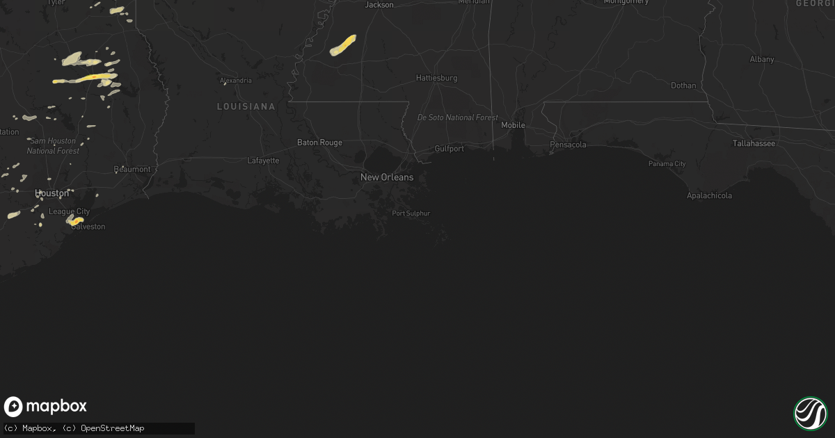
April 20 map
$229
one time, instant access
Download today. No call, no setup
Keep the $229
Bought the map and want the full workflow? Apply the entire $229 to a subscription within 7 days. None of it is wasted.
Every map, not just this one
This buys you this map. Subscription and you get every map we run, in the markets you choose from a few cities to whole states to nationwide. Plus real-time alerts the moment a storm fires.
Contact data
Name, contact info, occupancy, even credit band for addresses in the footprint. You go from where it hit to who to call.
Become the source they trust
Unlimited branding weather history reports on demand. You already have the documented answer ready for the property owner, and you are the one who showed up with it.
Property data and RoofTrace estimates
Pull up any address you have got, its value and the exact code rules for that jurisdiction, straight from One Click Code. Then RoofTrace estimates the squares, pitch, and roof value, priced the way you price.
Storm reports in Texas
Texas
| Date | Description |
|---|---|
| 04/20/20126:48 PM CDT | Quarter sized hail and wind gusts of at least 50 mph. |
| 04/20/20126:45 PM CDT | Quarter size reported near the treasure hills area of harlingen. |
| 04/20/20126:44 PM CDT | Quarter sized hail reported near harlingen high school. |
| 04/20/20126:35 PM CDT | Report of funnel and touch down southwest of highway 77 in harlingen. Resident at intersection of rangerville road and cr 800 reported split tree blown across road and |
| 04/20/20126:25 PM CDT | Quarter size hail near chimmey park |
| 04/20/20126:10 PM CDT | Golfball size hail reported on highway 77 near lyford. |
| 04/20/20126:08 PM CDT | Quarter sized hail reported at conway. |
| 04/20/20126:05 PM CDT | Skywarn spotter reports quarter size on shary road in mission |
| 04/20/20126:01 PM CDT | Public reports large hail in alton just north of mission mile 5 reports numerous broken car windshields |
| 04/20/20125:59 PM CDT | Quarter sized hail reported on w 40th street. |
| 04/20/20125:56 PM CDT | A local report indicates 1.00 inch wind near PALMVIEW |
| 04/20/20125:54 PM CDT | Large hail reported at military hwy and 281. |
| 04/20/20125:52 PM CDT | Reported all over town. Location of this report at eoc on s. 7th street. Duration of hail two minutes. |
| 04/20/20125:50 PM CDT | Softball sized hail reported at mcallen high school. |
| 04/20/20125:50 PM CDT | Public reports golf ball size hail in south pharr |
| 04/20/20125:45 PM CDT | Brief touchdown and lift up. No damage reported. |
| 04/20/20125:45 PM CDT | Public reports of baseball size hail on 2500 jasmine |
| 04/20/20125:45 PM CDT | Edinburg police department reports golfball size hail fell in edinburg between 530 and 6 pm cdt at the intersection of closner and canton. |
| 04/20/20125:39 PM CDT | Skywarn spotters report golf to baseball size hail on ware rd and quarter size on 23rd and 5 mile |
| 04/20/20125:38 PM CDT | Golf ball sized hail reported at shary and 3 mile road. |
| 04/20/20125:36 PM CDT | 3 trees were reported blown down on roadways in the evadale area. Time is estimated. |
| 04/20/20125:36 PM CDT | Softball sized hail reported at taylor and 5 mile road. |
| 04/20/20125:34 PM CDT | Public reported dime to baseball size hail at nolana and 23rd. |
| 04/20/20125:32 PM CDT | Golf ball sized hail reported at 4 mile and ware. |
| 04/20/20125:31 PM CDT | Golfball size hail reported near the intersection of bicentenial and nolana. |
| 04/20/20125:30 PM CDT | Reports of 60 mph wind gusts and golf ball sized hail at stuart and 21st. |
| 04/20/20125:30 PM CDT | Reports of 60 mph wind gusts and golf ball sized hail at stuart and 21st. |
| 04/20/20125:29 PM CDT | Quarter size to golf ball size reports in palmhurst area. |
| 04/20/20125:27 PM CDT | Quarter size hail reported near the intersection of trenton and 10 street. |
| 04/20/20125:27 PM CDT | Golfball sized hail reported in mission north of 107. |
| 04/20/20125:26 PM CDT | Began at 526 pm continued through at least 536 pm. |
| 04/20/20125:26 PM CDT | Golf ball size hail reported in alton near intersection of 5 mile road and conway. |
| 04/20/20125:25 PM CDT | Public reports baseball size hail in mission near palm drive and 5 mile wind est. To 50 mph |
| 04/20/20125:20 PM CDT | Hidalgo county sheriffs office reports quarter to golfball size hail fell in the vicinity of mccook. |
| 04/20/20125:03 PM CDT | Quarter size hail now falling at mustang island state park |
| 04/20/20124:55 PM CDT | Damaged windshields and power outages. |
| 04/20/20124:45 PM CDT | 78 mph wind gust recorded at moody gardens. |
| 04/20/20124:42 PM CDT | Em office reported quarter size hail in ricardo area. |
| 04/20/20124:36 PM CDT | Nws co-op observer reports quarter size hail and wind gust to 50 to 60 mph near san isidro |
| 04/20/20124:32 PM CDT | Golfball sized hail in la marque at the public works department. |
| 04/20/20124:31 PM CDT | Quarter sized hail on highway 6 and fm 2004. |
| 04/20/20124:30 PM CDT | Quarter sized hail in hitchcock at the police and fire stations. |
| 04/20/20124:30 PM CDT | Brooks county sheriffs office reports quarter size hail fell in encino. |
| 04/20/20124:27 PM CDT | A local report indicates 1.00 inch wind near INGLESIDE |
| 04/20/20124:20 PM CDT | Us postal service in santa elena reported quarter sized hail. |
| 04/20/20123:55 PM CDT | Public reported quarter size hail. |
| 04/20/20123:45 PM CDT | Quarter sized hail in houston heights. |
| 04/20/20123:40 PM CDT | Strong winds gusting to 58 mph last 10 minutes. |
| 04/20/20123:39 PM CDT | Quarter sized hail in damon over northwest brazoria county. |
| 04/20/20123:39 PM CDT | Strong winds gusting to 58 mph at bellaire boulevard and chimney rock. |
| 04/20/20123:35 PM CDT | Large limbs down east of the galleria. |
| 04/20/20123:30 PM CDT | Power poles down along highway 290...2 powerpoles down on the northwest freeway...multiple trees down. |
| 04/20/20123:30 PM CDT | Numerous trees down all over the county. Time frame is 330 to 500 pm. |
| 04/20/20123:00 PM CDT | Quarter sized hail at fm 75 and fm 1696. |
| 04/20/20122:52 PM CDT | Convenience store near chalk hill reports nickel to quarter-sized hail. |
| 04/20/20121:55 PM CDT | Hail up to quarter size. |
| 04/20/20121:45 PM CDT | Dime to quarter size hail... Covering the parking lot. |
| 04/20/20121:43 PM CDT | Boat launch on lake sam rayburn reports quarter-sized hail. |
| 04/20/20121:01 PM CDT | Hail the size up to quarter... Winds 40 to 50 mph and one inch of rainfall. |
| 04/20/201212:03 PM CDT | A local report indicates 1.75 inch wind near LUFKIN |
| 04/20/201212:01 PM CDT | A local report indicates 1.25 inch wind near LUFKIN |
| 04/20/201211:45 AM CDT | A local report indicates 1.00 inch wind near 4 S NACOGDOCHES |
| 04/20/20127:10 AM CDT | A local report indicates 1.00 inch wind near UNCERTAIN |
| 04/19/20127:10 PM CDT | Mostly nickel sized but several stones of quarter sized embedded. |
| 04/19/20127:00 PM CDT | Intersection of southmost and international blvd. Nickel to quarter size stones. |
All States Impacted by Hail Map on April 20, 2012
Cities Impacted by Hail Map on April 20, 2012
- Fort Meade, FL
- Orlando, FL
- Kissimmee, FL
- Saint Cloud, FL
- Armstrong, TX
- Webster, FL
- Concepcion, TX
- Cleveland, TX
- Pharr, TX
- Penitas, TX
- San Juan, TX
- La Joya, TX
- Mcallen, TX
- Hidalgo, TX
- Mission, TX
- Edinburg, TX
- Linn, TX
- Delmita, TX
- Encino, TX
- Raymondville, TX
- Olmito, TX
- Grulla, TX
- Hargill, TX
- Lyford, TX
- Los Fresnos, TX
- San Benito, TX
- Falfurrias, TX
- Harlingen, TX
- San Perlita, TX
- Rio Grande City, TX
- Garciasville, TX
- Alamo, TX
- Brownsville, TX
- Hebbronville, TX
- Donna, TX
- Rio Hondo, TX
- Santa Elena, TX
- Hazlehurst, MS
- Pattison, MS
- Fayette, MS
- Union Church, MS
- Hermanville, MS
- Cuero, TX
- Westhoff, TX
- Sebring, FL
- La Marque, TX
- Texas City, TX
- Hitchcock, TX
- Lufkin, TX
- Alice, TX
- Bishop, TX
- Robstown, TX
- Huntsville, TX
- East Bernard, TX
- Beasley, TX
- Premont, TX
- Nacogdoches, TX
- Clermont, FL
- Davenport, FL
- Corpus Christi, TX
- Portland, TX
- Port Aransas, TX
- Taft, TX
- Sinton, TX
- Alto, TX
- Pasadena, TX
- Houston, TX
- Dale, TX
- Rosanky, TX
- Kingsville, TX
- Riviera, TX
- Kenedy, TX
- Beaumont, TX
- China, TX
- Grapeland, TX
- Wells, TX
- Boyce, LA
- Huntington, TX
- Rosharon, TX
- Osteen, FL
- Debary, FL
- Lake Helen, FL
- Deltona, FL
- Deland, FL
- Orange City, FL
- El Campo, TX
- Hallettsville, TX
- Yoakum, TX
- Douglass, TX
- Sealy, TX
- Cat Spring, TX
- Sarita, TX
- Livingston, TX
- Geneva, FL
- Mims, FL
- Kenansville, FL
- Astor, FL
- Pierson, FL
- Karnack, TX
- Jefferson, TX
- Combes, TX
- Sebastian, TX
- Winter Garden, FL
- Polk City, FL
- Hallsville, TX
- Rosenberg, TX
- Carthage, TX
- Louise, TX
- Flatonia, TX
- Waelder, TX
- Fort Pierce, FL
- Zavalla, TX
- Fischer, TX
- San Marcos, TX
- Wimberley, TX
- Apple Springs, TX
- Miami, FL
- Lakeland, FL
- Victoria, TX
- Altoona, FL
- Kennard, TX
- Crockett, TX
- Lake Mary, FL
- Longwood, FL
- Etoile, TX
- Zolfo Springs, FL
- Anahuac, TX
- Bartow, FL
- Lorida, FL
- Sanford, FL
- New Smyrna Beach, FL
- Seguin, TX
- Damon, TX
- Santa Fe, TX
- Dickinson, TX
- Lake Placid, FL
- Beckville, TX
- Bedias, TX
- Ganado, TX
- Tatum, TX
- Columbus, TX
- New Ulm, TX
- Seville, FL
- Missouri City, TX
- Chireno, TX
- Christmas, FL
- Montgomery, TX
- Vero Beach, FL
- Smiley, TX
- Broaddus, TX
- Runge, TX
- De Berry, TX
- Labelle, FL
- Zellwood, FL
- Mount Dora, FL
- Apopka, FL
- Sorrento, FL
- Channelview, TX
- Hollywood, FL
- Richmond, TX
- Port Lavaca, TX
- Corrigan, TX
- Trinity, TX
- Brenham, TX
- Montverde, FL
- Hempstead, TX
- Baytown, TX
- Highlands, TX
- Katy, TX
- Brookshire, TX
- Leesburg, FL
- Henderson, TX
- Tavares, FL
- San Augustine, TX
- San Isidro, TX
- Groveland, FL
- Three Rivers, TX
- Seadrift, TX
- Sugar Land, TX
- Center, TX
- Hockley, TX
- Paris, TX
- Canyon Lake, TX
- Sebastian, FL
- Marshall, TX
- Garwood, TX
- Bellville, TX
- Willis, TX
- Conroe, TX
- Ingleside, TX
- Edna, TX
- Santa Rosa, TX
- Edcouch, TX
- Sullivan City, TX
- Groveton, TX
- Tilden, TX
- Colmesneil, TX
- Chester, TX
- Waller, TX
- Oakhurst, TX
- Pointblank, TX
- Gillett, TX
- Paisley, FL
- Fort Lauderdale, FL
- Alleyton, TX
- Bleiblerville, TX
- Realitos, TX


